Some villages sit so far from busy highways that the modern world seems to arrive slowly, if it arrives at all. This list travels from the bottom of the Grand Canyon to a volcanic crater in the Pacific, from Himalayan highlands to the end of a Patagonian road.
Some places have no roads at all. Others sit on mountainsides where old towers, mud-brick homes, and wooden houses still shape daily life.
A few are easier to reach than they used to be, yet they keep the traditions that made them special. If you love maps, mountains, islands, and stories about how people adapt to hard places, this collection gives you seventeen new spots to save.
Some are open to visitors with a little planning, and others ask for real patience on the journey. Read on and pick the one that pulls at you most.
Supai, Arizona, USA
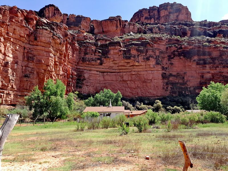
No paved road reaches this village at the bottom of the Grand Canyon. Supai is the home of the Havasupai Tribe, and it is one of the most isolated communities in the United States.
Vehicles stop at Hualapai Hilltop. From there, visitors generally go in on foot by trail, while limited helicopter service may also operate.
Planning comes first here. All tourists need advance reservations and permits from the Havasupai Tribe, so showing up without them is not an option.
Check the official Havasupai Reservations site before you pick dates.
As of August 31, 2026, the Tribe confirmed that Havasupai was open and its trails were passable. That is good news, but conditions can change, so recheck close to your trip.
The isolation is a big part of what makes the area extraordinary. Getting there takes effort, and the strict rules help protect both the community and the canyon around it.
Ittoqqortoormiit, Greenland
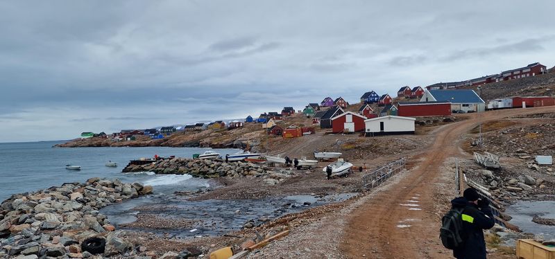
There are remote Arctic settlements, and then there is Ittoqqortoormiit. Visit Greenland describes it as the most isolated town in Greenland, set beside the huge Scoresby Sund fjord system and near Northeast Greenland National Park.
The trip shows how far away it is. Travelers typically fly from Iceland to Nerlerit Inaat, then continue about 40 kilometers by helicopter, boat, or snowmobile, depending on the season.
Once you arrive, colorful houses stand against wide stretches of rock, snow, ice, and water. The contrast makes the town easy to recognize in photos.
Local tour operators still offer hiking, kayaking, dog sledding, fishing, and other Arctic experiences. That means a visit can be built around the season you choose.
For anyone who wants a true edge-of-the-map trip, this is a strong candidate. Just plan the travel legs carefully, since each one depends on weather and season.
Adamstown, Pitcairn Island

Only dozens of people live in Adamstown, yet it is technically the capital of the Pitcairn Islands. That makes it feel more like a tiny village at the edge of the Pacific.
There is no airport. Most visitors arrive aboard the island’s passenger supply ship, or by cruise ship or private yacht.
Pitcairn’s tourism department is currently accepting passenger-ship bookings through 2027, which confirms the island remains open to visitors. Booking well ahead is a smart move for a trip like this.
The village has a post office, general store, museum, public hall, church, government offices, medical facilities, and locally operated homestays. Everything a small community needs sits close together.
Few inhabited places leave you feeling farther from the rest of humanity. If you like the idea of a trip where the journey is half the story, this island belongs on your map.
Inverie, Scotland
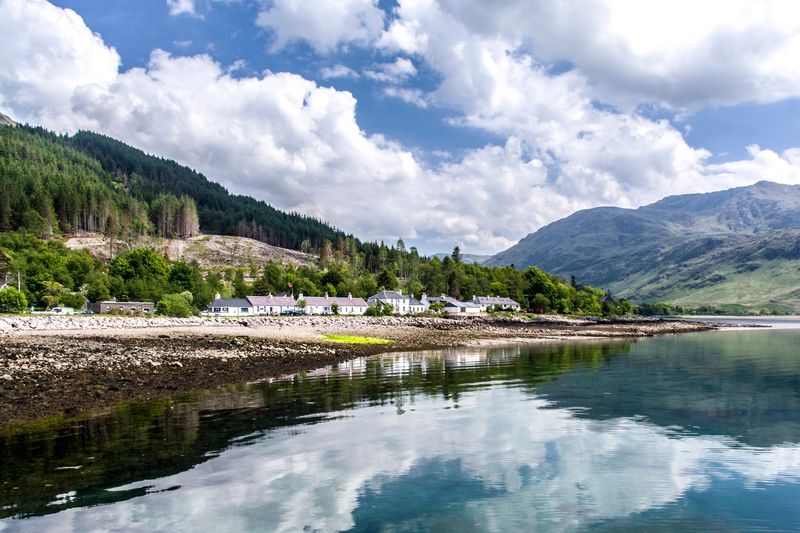
Scotland hardly seems like the obvious place to search for a roadless village, but Inverie proves otherwise. It sits on the Knoydart Peninsula in the Highlands.
Inverie has no road connection to the rest of Britain’s road network. VisitScotland describes it as Knoydart’s only settlement and notes that the remote village can be reached only by boat or on foot.
That means crossing Loch Nevis by water or making a serious overland trek through the mountains. Neither choice is a quick errand, so give yourself time.
Without ordinary road traffic, the setting stands out even more. Sea lochs and rugged peaks surround the village on every side.
Inverie feels far more isolated than its spot on a map might suggest. It is a good pick for hikers and boat lovers who want Highland scenery without a line of cars.
Gásadalur, Faroe Islands
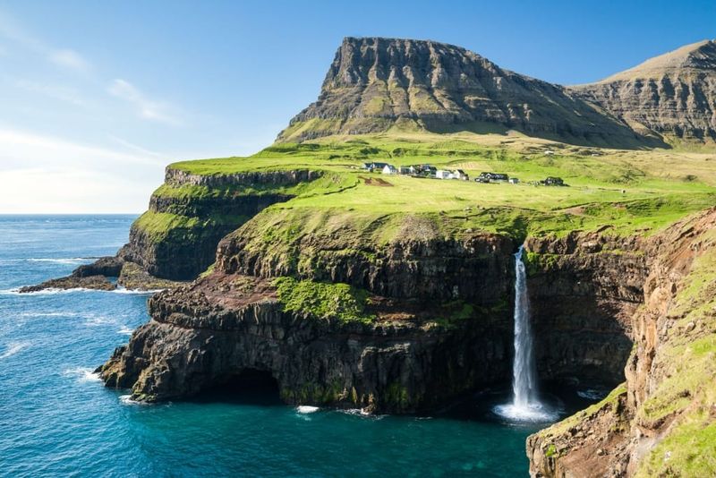
Until a road tunnel opened in 2004, the mail here was carried over a mountain. Gásadalur was once one of the most isolated settlements in the Faroe Islands, and villagers relied on a mountain path to reach their neighbors.
The post arrived over that route several times a week. It is a small detail that shows how cut off daily life used to be.
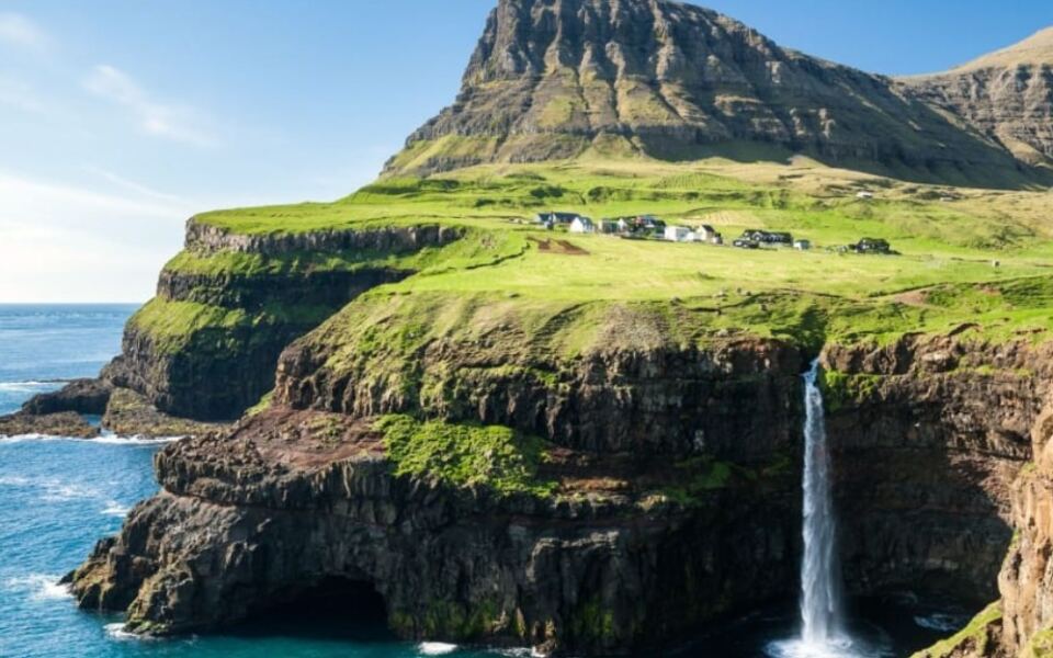
Getting here is easier today, but the scenery has lost none of its drama. Mountains rise behind the settlement while the famous Múlafossur waterfall drops from the cliffs toward the ocean.
Visitors can also find a local café, a small guesthouse, and a souvenir shop. That gives you a few simple options for a stop.
The village proves that better access does not necessarily erase a sense of isolation. The place still feels tucked against the edge of the sea.
Ushguli, Georgia
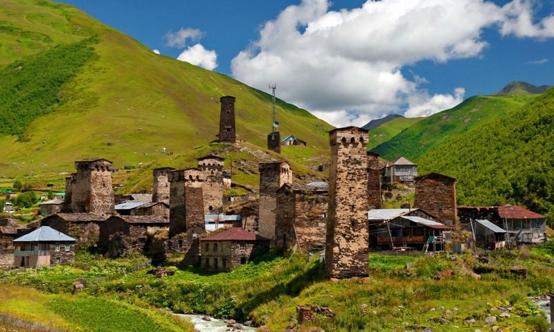
At roughly 2,200 meters above sea level, Ushguli sits among the highest year-round communities in Europe’s mountain ranges. It is not a single settlement but a community made up of several small villages high in Georgia’s Caucasus Mountains.
Medieval Svan towers and traditional mountain architecture helped make Upper Svaneti a UNESCO World Heritage Site. Centuries of geographic isolation are part of the reason the landscape has stayed so well preserved.
Access can still be challenging. The road toward Lentekhi is generally usable only during warmer months, because snow can close it for much of the year.
Plan your timing around the season, and check road conditions before you go. Summer is the easier window for most travelers.
With Shkhara rising nearby, Ushguli still feels like a settlement positioned at the very end of the mountains.
Laya, Bhutan
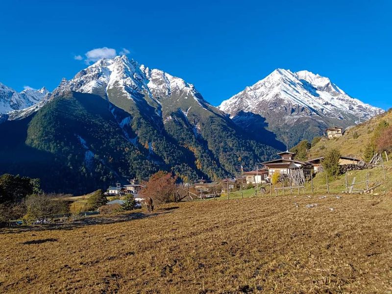
Every October 23 and 24, Laya hosts Bhutan’s Royal Highland Festival. The event celebrates the culture, animals, traditions, and resilience of the country’s highland communities.
Expect yaks, horses, mastiffs, cultural performances, and traditional competitions. It is a chance to see mountain life presented by the people who live it.
Reaching Laya takes travelers high into the Himalayas, where life has developed under conditions very different from those in the lower valleys. The community sits at approximately 4,000 meters above sea level in Gasa District.
Highland traditions remain strong here, which is a big reason the festival has a home in this village. The altitude and mountain isolation also mean that simply arriving is part of the experience.
If you are thinking about a visit, build in time to adjust to the height. Rushing does not suit a place like this.
Kibber, Himachal Pradesh, India
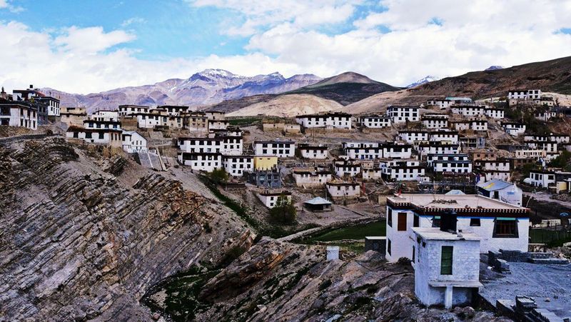
At about 4,205 meters, Kibber ranks among the highest permanently inhabited villages in India’s stark Spiti Valley. The air is thin, and the landscape is dry and open.
The village serves as a base for high-altitude trekking. It also sits near Kibber Wildlife Sanctuary, a vast protected landscape known for species including ibex, blue sheep, Himalayan wolves, and snow leopards.
Himachal Pradesh Tourism notes that the region’s extreme altitude and remoteness can leave it isolated for roughly half the year. That is a useful fact when you pick your travel dates.
First-time visitors to northern India often picture green Himalayan slopes. Kibber looks quite different, closer to the Tibetan Plateau.
Bring patience for the altitude and flexibility for the weather. Both will help you enjoy a place that runs on its own terms.
Manang, Nepal
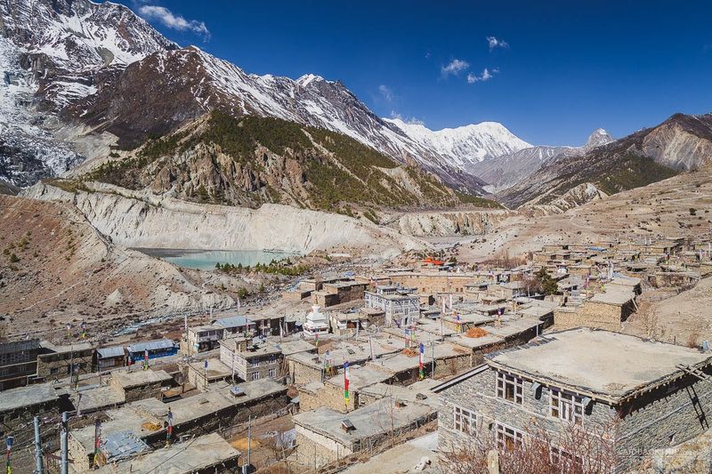
Trekkers heading up the Annapurna Circuit reach Manang after the landscape has already started to change. The route leads into a high-altitude region that looks very different from the lower valleys.
The Nepal Tourism Board describes Manang as a string of seven villages forming the upper section of the circuit. The terrain becomes dry, rocky, and almost Tibetan in appearance, with enormous mountains surrounding the communities.
Winters can be extremely cold and snowy. Trekking infrastructure includes lodges and teahouses along established routes, which makes multi-day walks easier to organize.
Manang’s isolation is no longer absolute. Still, its altitude and Himalayan setting make everyday life here feel very far removed from Nepal’s major cities.
If you are planning a trek, pick your season with care. Weather shapes almost everything about a journey through this part of Nepal.
Wae Rebo, Flores, Indonesia
Some places protect their magic by making the last stretch a walk. Wae Rebo may be one of the best examples.
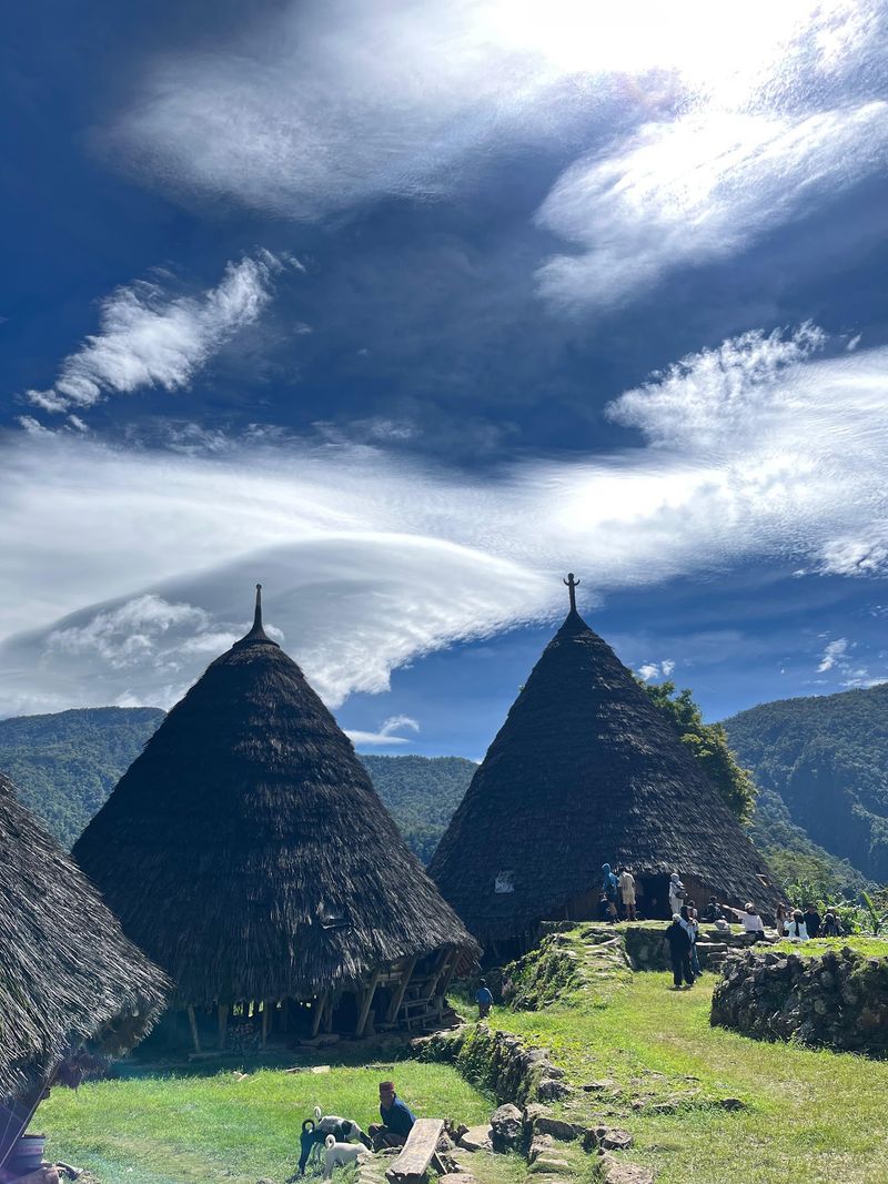
This traditional Manggarai settlement sits roughly 1,100 meters above sea level amid mountains and tropical forest on Flores. Indonesia’s official tourism site says visitors traditionally reach it after several hours of walking from Denge.
The village is famous for its towering conical Mbaru Niang houses. In 2012, it received recognition in UNESCO’s Asia-Pacific Heritage Awards for community-led restoration of its traditional architecture.
That restoration work was led by the community itself, which gives the recognition extra meaning.
Wae Rebo continues to welcome travelers interested in local culture and ecotourism. Comfortable walking shoes and a respectful attitude are the best things to pack.
Aogashima, Japan
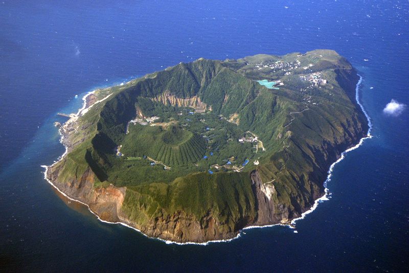
Picture living inside a volcanic crater on an island hundreds of kilometers from Tokyo. That is essentially Aogashima.
The island sits about 358 kilometers south of Tokyo in the Pacific Ocean. It contains a smaller volcanic cone inside its larger crater, which gives the landscape a layered look.
Tokyo’s official tourism organization describes Aogashima as the most remote island in the Izu archipelago and notes that tourism remains relatively limited. That keeps the island quiet.
Visitors come for hiking, stargazing, volcanic scenery, camping, and even a sauna heated using geothermal energy. It is a mix of outdoor activities and a very unusual bit of local energy use.
Few places make Japan’s huge modern cities feel quite as distant. Pack for an island trip and expect the weather to set the schedule.
Shirakawa-go, Japan
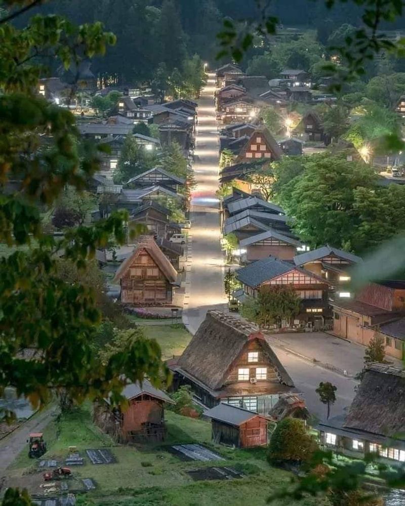
Shirakawa-go is more famous than many places on this list, but its history is rooted in genuine geographic isolation. Mountains shaped how people lived here for centuries.
The villages in Gifu Prefecture became known for steeply pitched gassho-zukuri farmhouses. The design was built to withstand huge winter snowfall.
The area, together with neighboring Gokayama, became a UNESCO World Heritage Site in 1995. Some of the homes are not simply reconstructed museum buildings.
Some remain private residences, while others operate as museums and traditional guesthouses.
Direct buses now make visiting easier. Even so, the landscape still shows how mountain communities adapted to long, difficult winters.
If you go, remember that people live in many of these homes. Respecting private property keeps the village welcoming for everyone.
Iruya, Argentina
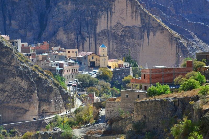
The road to Iruya is part of the reason this tiny mountain community sticks in the memory. Argentina’s official tourism site describes a journey of roughly three hours from Humahuaca along a winding gravel mountain road.
The village is in Salta Province at about 2,780 meters above sea level. It sits dramatically against steep mountain slopes.
Inside the settlement are adobe houses, cobbled streets, and churches. Local traditions have been shaped by centuries of interaction between Indigenous and Hispanic cultures.
Hiking trails also connect Iruya with even smaller communities such as San Isidro. That gives walkers a way to explore beyond the main streets.
Give yourself time for the drive and do not rush it. The trip up is a big part of what makes Iruya stand out.
Caleta Tortel, Chile
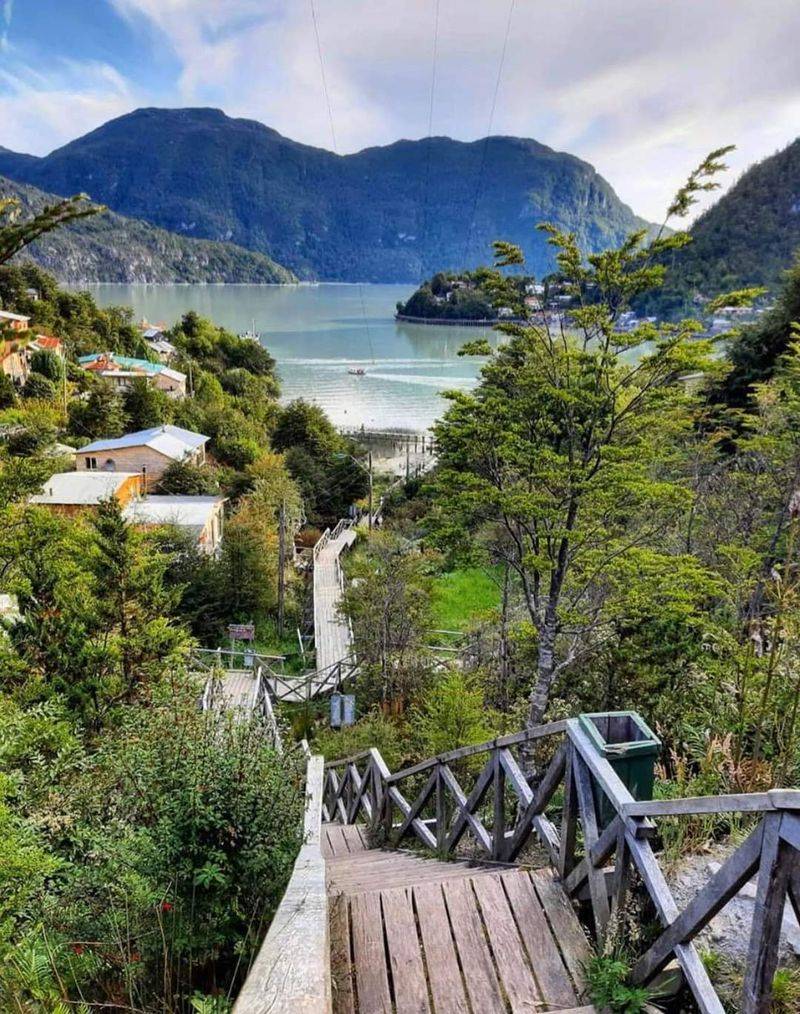
Streets are optional in Caleta Tortel. Much of the settlement is connected by roughly seven kilometers of wooden walkways made from Guaitecas cypress.
The village lies far south in Chilean Patagonia. Chile’s official tourism agency describes Tortel as one of the isolated communities near the southern end of the Carretera Austral.
Reaching it from Balmaceda involves about ten hours of overland travel through Patagonia. That is a full day on the road, so plan your stops and fuel.
Between the boardwalks, forests, rivers, mountains, and fjords, the village looks built into the landscape rather than imposed upon it. Walking is the main way to get around.
Bring shoes with good grip, since wood can be slick in wet weather. Patagonia does not always keep its skies dry.
Villa O’Higgins, Chile
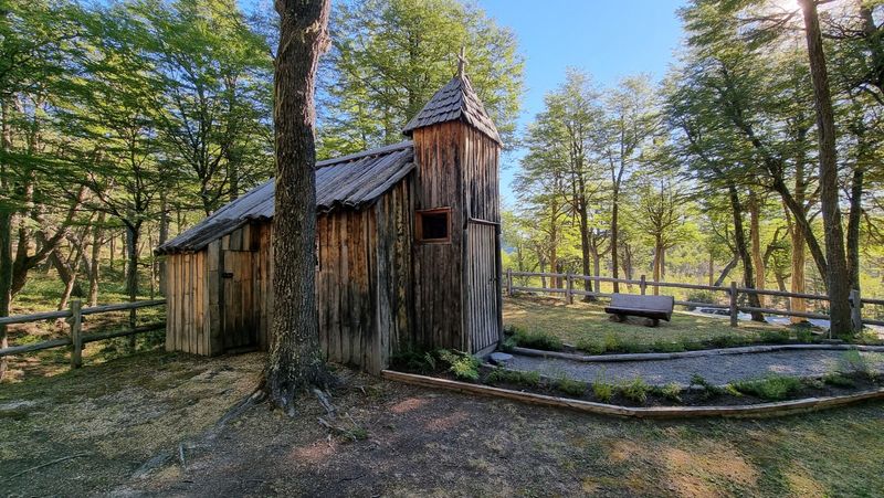
Keep following the Carretera Austral far enough and the road simply runs out. That is the story at Villa O’Higgins.
This small Patagonian settlement marks the southern end of Chile’s Route 7. From Balmaceda, Chile Travel estimates the overland journey at around 12 hours, including long gravel sections and a ferry crossing.
Despite the isolation, visitors can find accommodation. The town works as a base for hiking and boat excursions toward the massive O’Higgins Glacier and the Southern Patagonian Ice Field.
Few road trips offer such a literal sense of reaching the end of the road. It makes a fitting finish for anyone who has driven the full route.
Build extra time into the schedule for gravel roads and the ferry. Slow travel suits this corner of Chile.
Taquile, Peru
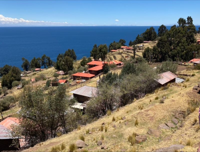
Taquile rises from Lake Titicaca, where isolation has helped preserve a living Andean culture. The island is a strong example of how tradition can carry on at high altitude.
Peru’s official tourism organization actively promotes overnight stays with communities on Taquile and neighboring islands. Visitors can learn about farming, cooking, textile traditions, local rituals, and daily life within community-based tourism programs.
Staying overnight changes the visit. Rather than simply passing through for photographs, travelers get a chance to understand how people have adapted to life on a high-altitude island.
Those traditions have been passed down through generations. Textiles in particular are a big part of the story here.
If you go, join a community program and follow local guidance. That keeps the benefits of tourism close to the people who live on the island.
Misfat Al Abriyeen, Oman
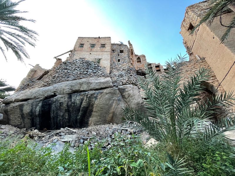
Remoteness looks different in Oman. Misfat Al Abriyeen is built into a dramatic mountainside, and its old buildings climb the slope in tight layers.
The village is known for traditional mud-brick buildings, narrow passages, terraced agriculture, and mountain scenery. Walking through it feels like following the shape of the hill.
In recent years, residents have restored some older houses as boutique accommodations. That allows tourism to support preservation rather than simply replacing the historic settlement.
The Oman Observer reported in a September 2026 update that the village continues attracting travelers interested in hiking and traditional Omani life.
It is a strong example of an old community finding a way to remain alive rather than becoming an empty heritage site. Go with respect for the homes and gardens that people still use every day.
Share this story