Montana is the kind of place that makes you stop mid-step and just stare. The state holds some of the most dramatic mountain scenery in the entire country, from ancient glaciers and turquoise alpine lakes to sweeping ridgelines that stretch as far as the eye can see. Glacier National Park alone could keep a hiker busy for years, but Montana’s best trails extend well beyond its famous borders. Whether you have a full day to burn or just a couple of hours, there is a hike here that will leave you reaching for your camera every few minutes.
The trails on this list range from family-friendly strolls to challenging summit pushes, but they all share one thing in common: the views are absolutely worth every step. Get your boots laced up, pack some snacks, and prepare to be seriously impressed by what Montana has waiting for you.
1. Hidden Lake Overlook Trail, West Glacier, Montana
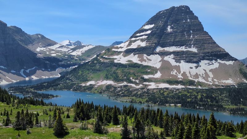
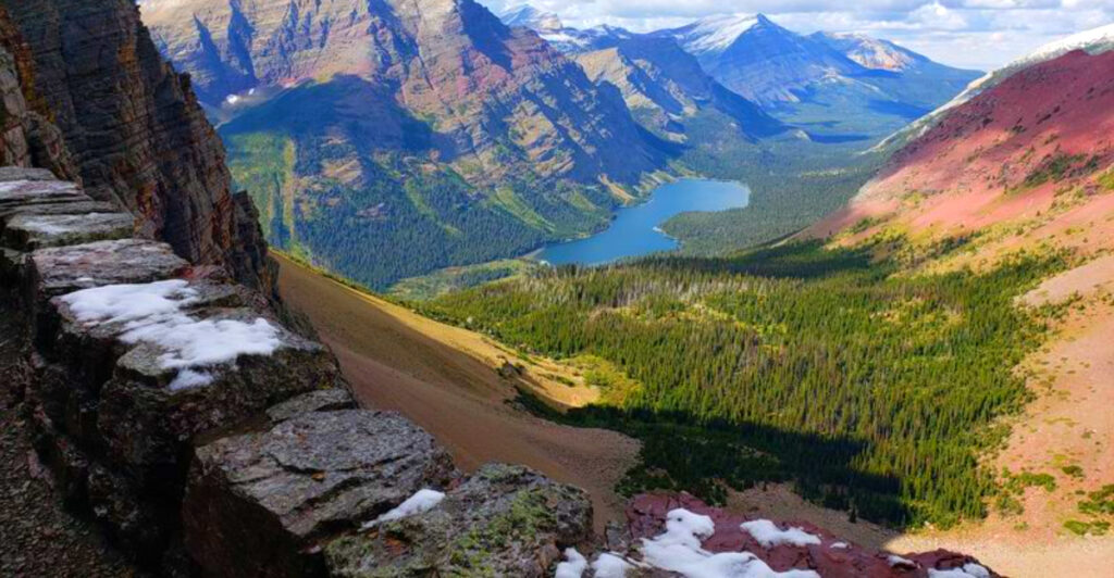
One of the most rewarding short hikes in the American West starts right at the Logan Pass Visitor Center, which means you barely need to drive anywhere before the scenery becomes jaw-dropping. The Hidden Lake Overlook Trail climbs through alpine meadows on a raised boardwalk designed to protect the fragile plant life beneath your feet.
The boardwalk approach is not just practical; it gives the whole experience a slightly cinematic quality as you rise above the meadow with peaks surrounding you on all sides. At the overlook, Hidden Lake appears below Bearhat Mountain in a shade of blue-green that looks almost too vivid to be real.
Summer brings colorful wildflowers and frequent wildlife sightings, including mountain goats that roam the rocky slopes with casual confidence. The round trip is short enough for most fitness levels, yet the payoff rivals hikes three times as long. Arrive early to avoid the crowds that this popular viewpoint naturally attracts.
2. Avalanche Lake Trail, West Glacier, Montana
Before the trail even gets going, it hands you something remarkable: a boardwalk loop through a cathedral of old-growth western hemlock and red cedar trees, some of which have been standing for over five centuries and reach heights of 100 feet. This opening section, called the Trail of the Cedars, is one of the most unique forest walks in all of Glacier National Park.
Beyond the boardwalk, the path follows Avalanche Creek through a narrow gorge where turquoise water tumbles over sculpted rock formations. Several overlooks provide clear views into the gorge below, rewarding hikers well before the main destination comes into view.
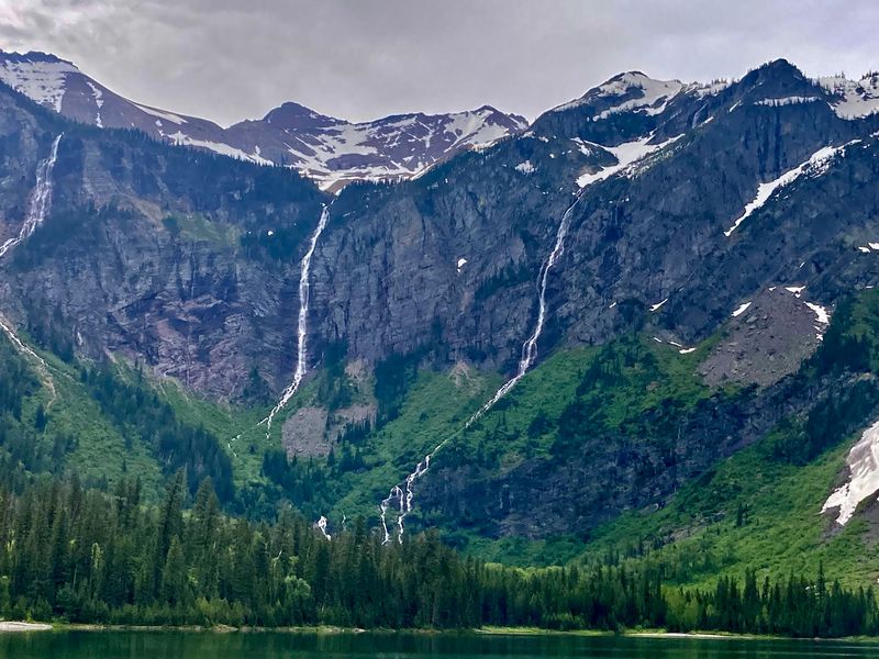
The lake itself sits inside a natural amphitheater of steep cliffs, with multiple waterfalls pouring down the walls from above. The round trip covers 4.6 to 6 miles with 500 to 757 feet of elevation gain, making it a solid moderate hike. Bearhat Mountain and Heavens Peak dominate the skyline from the far end of the lake.
3. Grinnell Glacier Trail, Babb, Montana
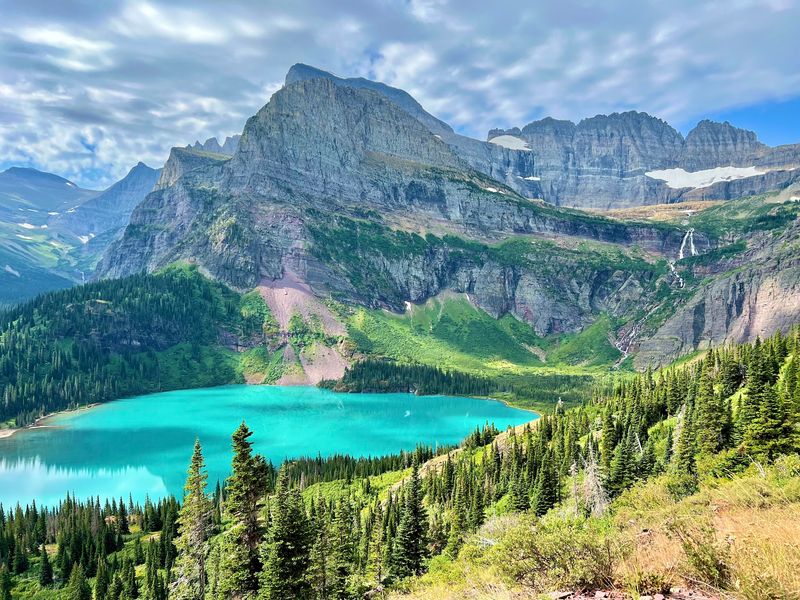
Turquoise lakes, cascading waterfalls, and a living glacier waiting at the end of the trail: the Grinnell Glacier hike checks an impressive number of boxes for a single day out. Starting from the Many Glacier area, this route is widely considered one of the finest day hikes in Montana and earns that reputation with every mile.
The scenery escalates steadily as you climb, with each new viewpoint outdoing the last. Glacially carved valleys open up below, while the surrounding peaks grow more imposing the higher you go. The upper section crosses alpine meadows where wildflowers bloom in summer against a backdrop of raw, exposed rock.
Grinnell Glacier itself has shrunk significantly over recent decades, making each visit feel like a meaningful one. The hike is demanding and covers several miles with real elevation gain, so solid footwear and plenty of water are essential. Hikers who make the full journey consistently rank it among the most memorable experiences Montana has to offer.
4. Iceberg Lake Trail, Babb, Montana
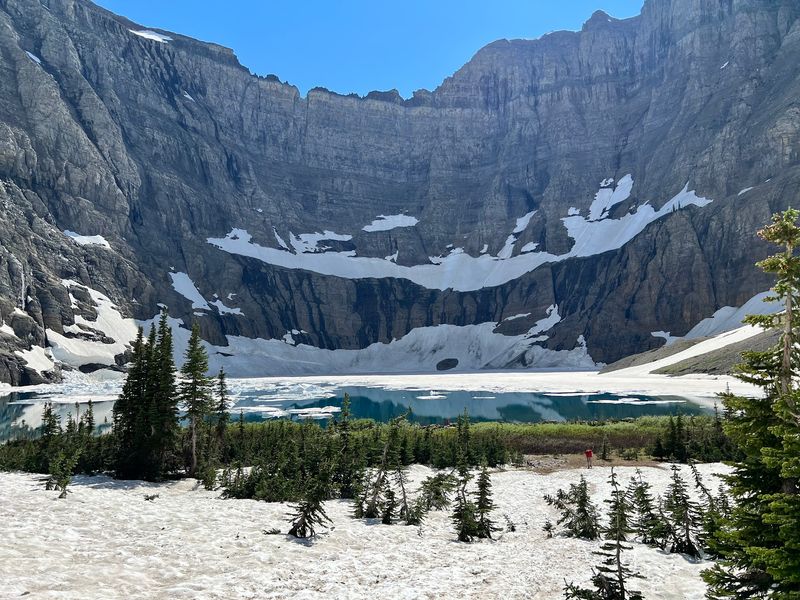
Floating ice in the middle of summer sounds like a geography trick question, but Iceberg Lake makes it a reality. Tucked into a shadowed cirque beneath Mount Wilbur, this striking aquamarine lake holds chunks of ice on its surface well into July and sometimes August, because the surrounding cliffs block enough sunlight to keep things cold long after the rest of the park has warmed up.
The trail starts behind the Swiftcurrent Motor Inn and covers roughly 9.4 to 10.1 miles round trip with 1,200 to 1,500 feet of elevation gain. The steepest section comes early, within the first half-mile, after which the grade becomes more manageable as the path winds through meadows and open terrain.
This area is designated prime grizzly bear habitat, so carrying bear spray and making noise on the trail are not optional suggestions. Bighorn sheep, mountain goats, moose, and deer are also regularly spotted. An early start is strongly recommended, both for parking and for experiencing the trail before the afternoon crowds arrive.
5. Ptarmigan Tunnel Trail, Babb, Montana
Hiking through an actual tunnel carved into a mountain is not something most trail guides can promise, but this one delivers exactly that. The Ptarmigan Tunnel was constructed by the Civilian Conservation Corps in 1930, originally to allow horse and tourist traffic between different areas of Glacier National Park. Heavy steel doors were added in 1975 and the tunnel stays open roughly from mid-July through October 1, depending on snow.
Getting there requires effort: the round trip covers 10.6 to 11 miles with roughly 2,300 to 2,420 feet of elevation gain. The route climbs through meadows, aspen groves, spruce forests, and subalpine terrain before reaching the tunnel entrance at about 7,200 feet.
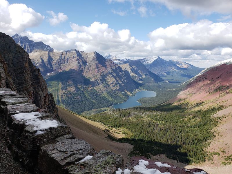
The south side looks out over the Many Glacier Valley with views of Mount Grinnell and Swiftcurrent Mountain. Emerging on the north side reveals the Belly River Valley far below, with Elizabeth Lake nestled at the base of cliffs that drop roughly 1,400 feet. Wildlife in this area includes moose, mountain goats, bighorn sheep, and grizzly bears, so bear spray is essential.
6. Beehive Basin Trail, Big Sky, Montana
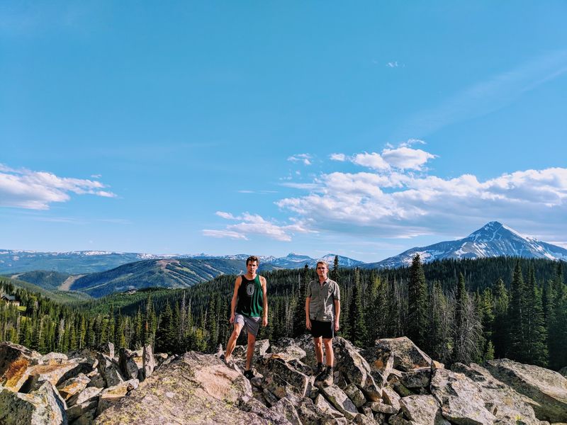
Just outside Big Sky, a trail quietly climbs into one of the most photogenic alpine basins in southwest Montana, and not nearly enough people know about it yet. The Beehive Basin Trail covers 6 to 7.2 miles round trip with 1,152 to 1,725 feet of elevation gain, reaching elevations above 9,000 feet before delivering hikers to a crystal-clear alpine lake inside a U-shaped glacial cirque.
The route winds through evergreen forests and open meadows that erupt with lupine, paintbrush, and balsamroot in late June and July. Small stream crossings and views of the surrounding terrain keep the journey interesting long before the lake comes into view. Lone Peak dominates the horizon from the basin, providing a dramatic frame for the destination.
Autumn is equally worth the trip, when the meadows shift to golden tones and the crowds thin out noticeably. Elk, moose, black bears, and grizzly bears all inhabit the area, making bear spray a smart addition to your pack. Weekend parking fills fast in summer, so plan for an early morning start.
7. Sacagawea Peak Trail, Bozeman, Montana
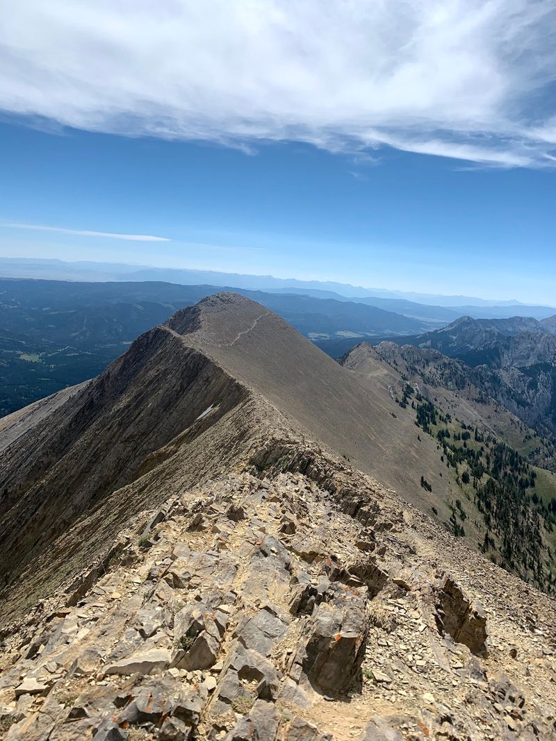
At 9,665 feet, Sacagawea Peak holds the title of highest point in the Bridger Range, and the views from the top make it very clear why that matters. Starting from the Fairy Lake Campground trailhead, the route is about 4 to 4.5 miles round trip, but it earns its moderate-to-difficult rating with a punishing 1,800 to 2,000 feet of elevation gain packed into a short distance.
The trail climbs through dense forest before breaking above the treeline into open alpine meadows and rocky slopes. A glacial cirque sits near the upper portion of the route, where exposed rock formations tell a clear story of how these mountains were shaped over thousands of years.
From the summit, the Crazy Mountains, Tobacco Root Mountains, Gallatin Range, Spanish Peaks, and the sprawling Gallatin Valley all spread out in a full 360-degree panorama. Mountain goats are a common sight near the top. Snowfields can persist into mid-July, and the access road to Fairy Lake Campground can be rough, so a high-clearance vehicle is worth considering.
8. Ousel Falls Trail, Big Sky, Montana
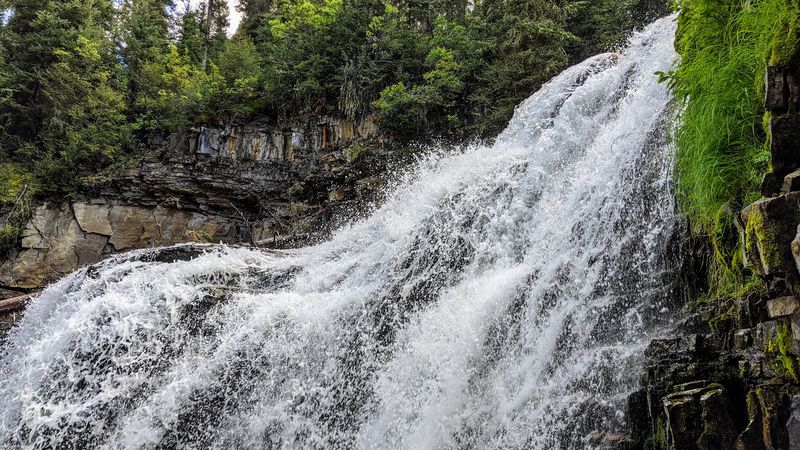
Not every great Montana hike demands an all-day commitment or a brutal elevation gain. The Ousel Falls Trail covers just 1.6 to 1.8 miles round trip and sits only two miles south of Big Sky Town Center, making it one of the most accessible scenic payoffs in the entire region. The trail descends gently into the South Fork ravine through a mixed evergreen forest.
Multiple sturdy bridges cross the South Fork of the West Fork of the Gallatin River along the way, each offering a slightly different view of the rushing water below. Interpretive signs explain the local ecology, including information about the American Dipper, the aquatic songbird the falls are named after, which can be spotted foraging in the river year-round.
The destination is a 100-foot waterfall that can be viewed from its base, its top, and several rocky overlooks. Spring snowmelt pushes the falls to their most powerful, while winter transforms the cascade into massive blue icicles. Dogs are welcome on leash, and the park includes picnic areas for a post-hike break.
9. Pine Creek Falls Trail, Livingston, Montana
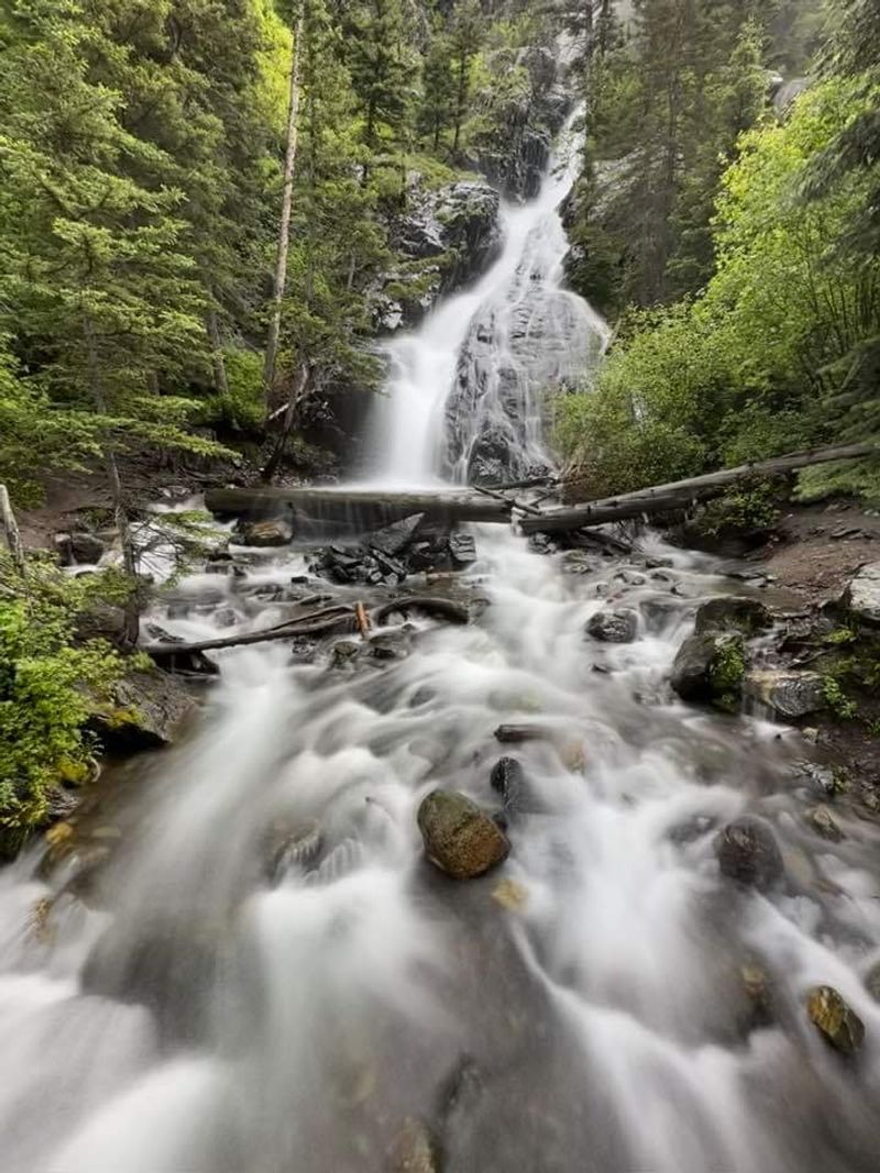
Paradise Valley lives up to its name in a big way along the Pine Creek Falls Trail, a scenic route just outside Livingston that packs a lot of beauty into a relatively short distance. The out-and-back hike covers about 2.4 to 2.5 miles round trip and is rated easy to moderate, making it a solid choice for families and hikers who want rewarding scenery without a grueling climb.
The path moves through a thick coniferous forest, following Pine Creek through a picturesque canyon. Multiple bridges cross the creek and its tributaries along the way, keeping the journey varied and visually interesting before the main attraction appears.
Pine Creek Falls drops 100 feet in a graceful multi-tiered cascade over limestone cliffs into clear pools below. The Absaroka Mountains, including Black Mountain at 10,941 feet, frame the background and add real scale to the surrounding landscape. For hikers wanting more, the trail continues another four miles past the falls to Pine Creek Lake, though that extension involves significantly more elevation gain. Bear spray is advisable throughout.
10. Mount Sentinel M Trail, Missoula, Montana
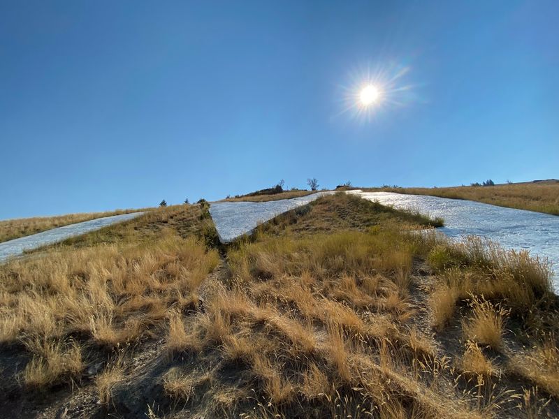
Missoula has a skyline feature that most cities would envy: a giant white letter M painted on the hillside above town, visible from nearly everywhere in the valley. The M Trail starts right at the University of Montana campus, which means there is essentially zero excuse not to hike it if you are anywhere near downtown. The round trip to the M covers 1.18 to 1.5 miles, while the full summit adds up to about 3.1 to 3.6 miles total.
Eleven to thirteen switchbacks carry hikers up a steep slope, gaining 620 to 646 feet of elevation by the time the concrete M comes into view. The M has been a Missoula landmark since 1908, originally built from rocks by Forestry Club members before being upgraded to more durable materials over the years.
From the M, the entire Missoula Valley spreads out below, with the Clark Fork River winding through it and the Bitterroot and Rattlesnake Mountains visible in the distance. Continuing to the true summit adds another 1,250 feet of gain and expands the views even further, revealing ancient waterlines on Mount Jumbo left by Glacial Lake Missoula.
11. Holland Falls National Recreation Trail, Condon, Montana
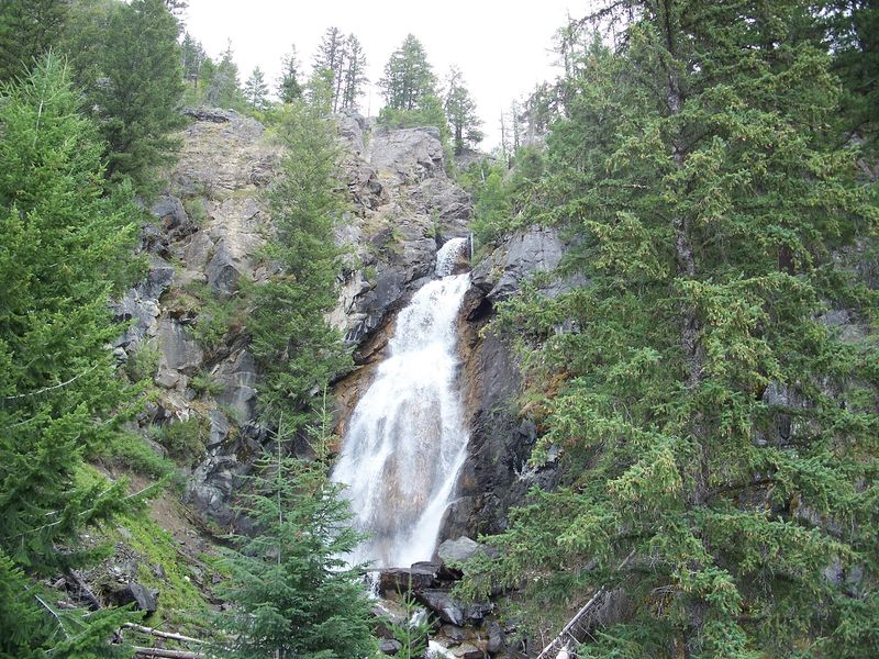
Holland Lake is already a scenic destination on its own, but the trail that leads away from its shoreline and into the Flathead National Forest delivers something even better waiting at the end. The Holland Falls National Recreation Trail, officially designated as Trail 416, covers 3 to 3.3 miles round trip with a gradual 326 to 750 feet of elevation gain, making it one of western Montana’s most accessible rewarding hikes.
The path begins past the Holland Lake Campground and follows the 416-acre lake’s shoreline before climbing steadily through forests of Ponderosa pine, Douglas fir, and tamarack. Views over the lake toward the Mission Mountains open up as you gain elevation, providing a strong preview of what the surrounding landscape has to offer.
Holland Falls arrives as a multi-tiered cascade with a main drop of roughly 50 feet over rocky ledges. Spring snowmelt brings the falls to their most dramatic flow, though they run consistently throughout the season. The terrain near the base gets rocky, so sturdy footwear is recommended. Bears are active in the area, and carrying bear spray is a sensible precaution for any visitor.
Share this story