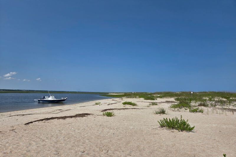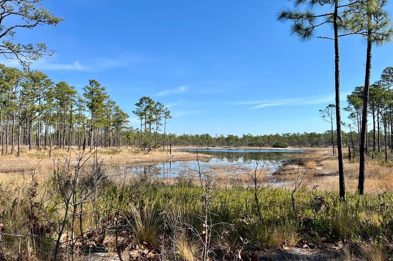
Tucked onto Ocracoke Island, Springer’s Point Nature Preserve holds one of the quieter coastal walks on the North Carolina coast. A roughly 0.8-mile trail threads through ancient live oaks, salt marsh, and wet grasslands before opening onto a sandy beach along Pamlico Sound.
The preserve is protected, undeveloped, and genuinely worth the trip, though it rewards visitors who come prepared and understand what they are actually walking toward.
A Soundside Beach at the End of a Short Ocracoke Trail
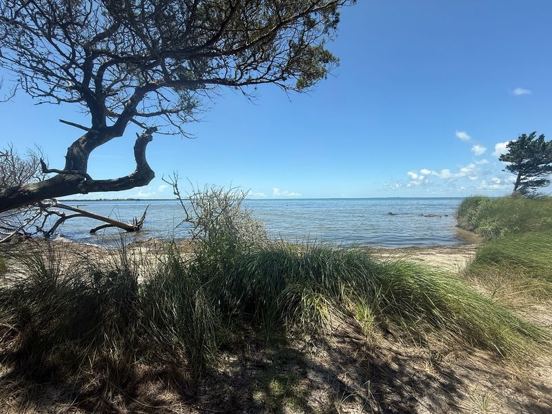
Springer’s Point Nature Preserve on Ocracoke Island is the kind of place that earns its reputation through understatement. The NC Coastal Land Trust describes the preserve as a site where ancient live oaks and winding trails lead to a sandy beach on Pamlico Sound, overlooking the historic waters of Teach’s Hole.
The endpoint is a soundside beach, not an Atlantic Ocean beach, and that distinction matters for anyone planning the trip.
The trail measures about 0.8 mile one way. Visit Ocracoke confirms that distance, which puts the round trip at roughly 1.6 miles on the preserve trail alone, before accounting for any walking from wherever visitors leave their vehicles.
The article premise of “one mile” is close, but using the accurate figure helps readers plan their time and energy honestly.
The route moves through maritime forest, salt marsh, and wet grasslands before the tree cover gives way and the sound comes into view. Sources describe the trail as leading through coastal habitats and opening onto the beach, though they stop short of claiming the water stays completely invisible until the final footstep.
The transition from shaded forest to open water feels like a genuine reveal, atmospheric and unhurried, but the experience is better described as a gradual coastal unfolding than a sudden dramatic surprise.
Springer’s Point is protected, tranquil, and undeveloped. Calling it undiscovered would not be accurate since it is a known Ocracoke attraction with public access, but it consistently offers a quieter alternative to the island’s busier spots.
The preserve’s soundside setting, its mix of habitats, and the short trail length together make it one of the more rewarding short walks available on the Outer Banks.
Plan for Access Before You Start the Trail

Finding the trailhead requires a little orientation first. Springer’s Point sits near the Ocracoke Lighthouse and Loop Road, placing it within walking or biking distance of the village for most visitors staying nearby.
The proximity to the lighthouse makes it easy to combine with other Ocracoke stops, but getting to the entrance on foot or by bike is not just a suggestion. The NC Coastal Land Trust states clearly that there is no vehicle or golf-cart parking at the preserve trailhead, and the land manager asks that improperly parked vehicles be moved immediately.
For visitors who are not within easy walking distance of the entrance, the local tourism office points to limited nearby parking options. The Ocracoke Assembly of God Church and spots farther down Lighthouse Road are referenced as possibilities, though availability is not guaranteed and conditions can vary by season.
Anyone counting on those spots should build in extra time and consider arriving early on busier days.
Biking to the preserve entrance is a practical option that many visitors use, and Ocracoke’s flat terrain makes it manageable for most riders. Once at the trailhead, however, the preserve permits foot traffic only.
Bicycles must be left outside before entering, and the trails themselves are designated for walking. There are no exceptions posted for short side trips or quick rides to the water.
The access arrangement shapes the visit more than most people expect. Visitors who arrive by ferry and rent bikes for the day will find the setup straightforward, while those arriving by car will need to factor in the walk from wherever they park.
Either way, understanding the access limits before leaving for the preserve saves frustration at the trailhead and keeps the visit focused on the walk itself.
The Route Moves Through Forest, Marsh, and Wet Grassland
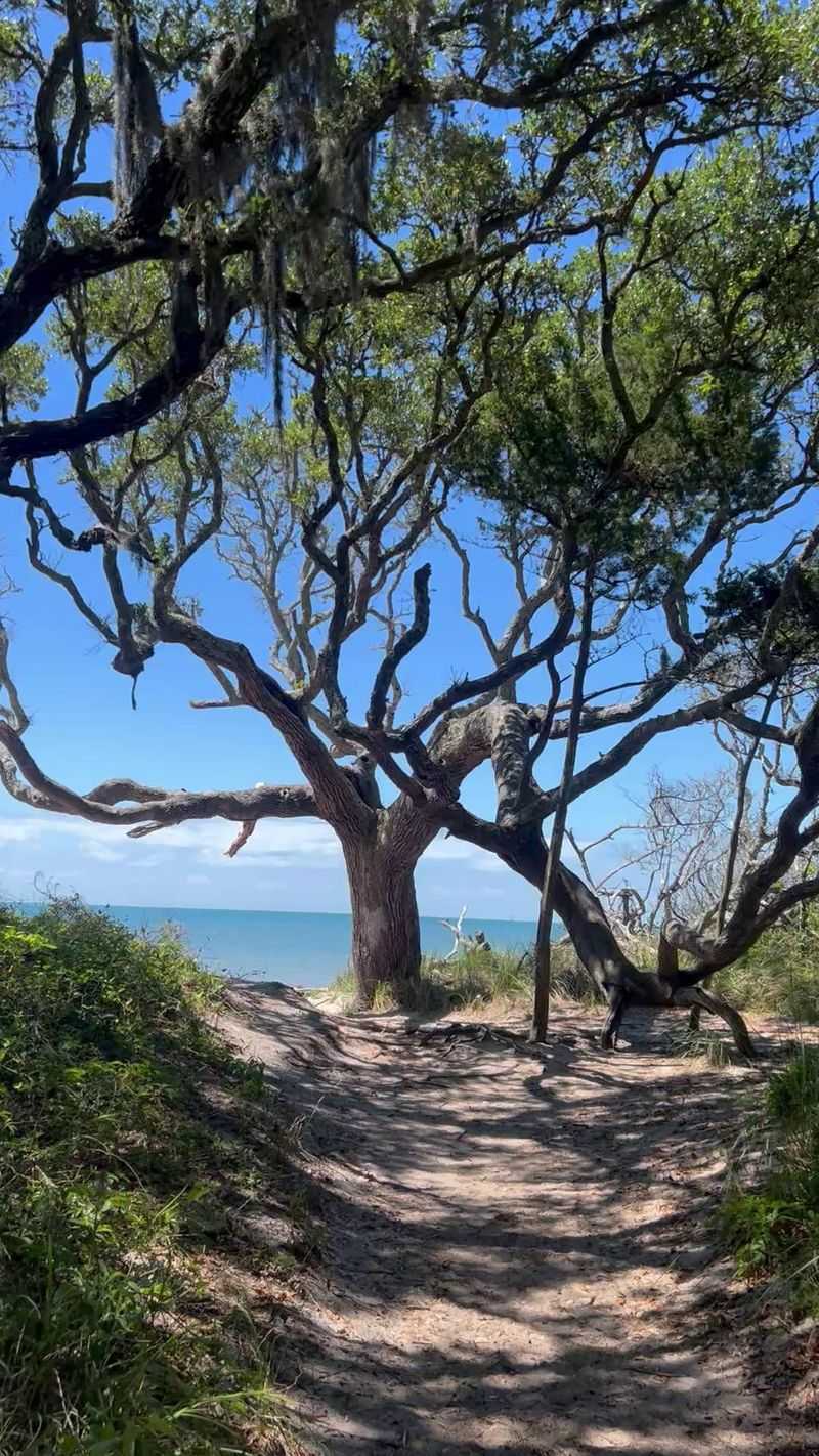
Walking into Springer’s Point feels immediately different from most coastal approaches. The trail enters a canopy of ancient live oaks whose branches arch low and wide, filtering light in ways that make the path feel older and quieter than the distance would suggest.
The NC Coastal Land Trust documents these trees alongside loblolly pines and red cedars as defining features of the preserve’s maritime forest, and all three species are visible along the roughly 0.8-mile route.
The forest canopy does not hold the entire way. As the trail progresses, the vegetation shifts and opens into sections of salt marsh and wet grasslands that give the walk a different texture and light.
These transitions are not dramatic switchbacks or steep descents. They unfold gradually, one habitat blending into the next, so the walker moves through what feels like a series of distinct rooms connected by a single path.
Birds are a reliable presence throughout the route, and butterflies appear in the warmer months when the preserve’s grasses and shrubby edges are most active. The authoritative sources for Springer’s Point emphasize these wildlife elements rather than any notable wildflower display, so visitors should set their expectations around the forest and marsh character rather than a garden-style bloom.
The trail is described as narrow and rugged in sections, which is worth taking seriously rather than treating as a disclaimer. Wet grassland stretches can leave the path soft or uneven underfoot, especially after rain.
The canopy shade that makes the forest walk pleasant also means some sections stay damp longer than exposed ground would. The combination of varied terrain and shifting habitats is exactly what makes the walk interesting, but it also means the 0.8-mile distance feels more purposeful than a simple flat stroll.
The Trail Opens onto Pamlico Sound
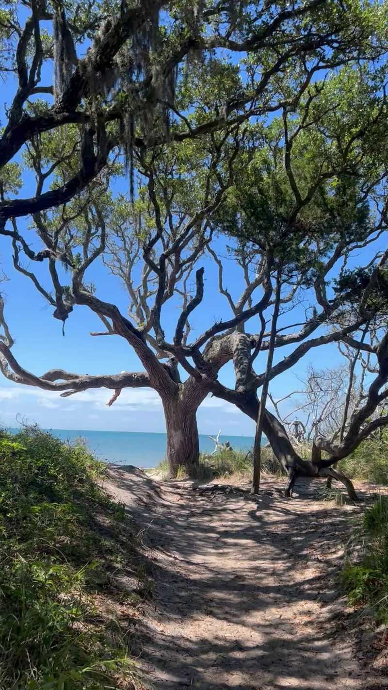
Coming out of the tree line at Springer’s Point, the shift is immediate. The shade drops away, the sky opens up, and a sandy beach along Pamlico Sound stretches out toward Teach’s Hole, the historic channel named for the pirate Blackbeard.
The NC Coastal Land Trust describes this endpoint as a place where visitors can take in the protected and undeveloped soundside landscape, and that framing is accurate. There are no concession stands, no umbrellas for rent, and no structures interrupting the view across the water.
The beach itself is sandy and accessible, but Visit Ocracoke notes that the preserve places swimming entirely at visitors’ own risk. The Coastal Land Trust specifically warns about shoreline hazards, and the soundside setting does not automatically make the water safe.
Pamlico Sound can have currents, drop-offs, and conditions that vary without obvious warning. The beach is a place to pause, sit, and look outward rather than a dependable spot to swim.
Springer’s Point is not the same experience as Ocracoke’s Atlantic beach, which lies on the island’s ocean-facing side and is managed separately under Cape Hatteras National Seashore. The soundside setting at Springer’s Point is calmer in character, with views across the sound rather than open-ocean surf, but that difference in feel does not change the need for caution near the water.
For most visitors, the endpoint rewards the walk simply by existing. The preserved shoreline, the absence of development, and the historical weight of looking out at Teach’s Hole give the spot a texture that a more accessible beach could not replicate.
Sitting on the sand after 0.8 miles through live-oak forest and marsh is its own kind of payoff, separate from any question of swimming.
Pack for Insects, Sun, and Uneven Ground

Closed-toe shoes are the single most important gear choice for Springer’s Point. The trail includes narrow, rugged sections and wet grassland terrain where sandals or flip-flops create real footing problems.
The NC Coastal Land Trust specifically warns visitors about biting insects, poisonous plants, narrow rugged trails, and shoreline hazards, and those warnings reflect actual conditions rather than legal boilerplate.
Insect repellent is worth applying before entering the trailhead, not after the first bite. The maritime forest and marsh habitat that makes the walk interesting is also exactly the kind of environment where mosquitoes and biting flies concentrate, particularly in warmer months.
The Ocracoke tourism office recommends insect repellent for visits during the warmer season, and the preserve’s own language reinforces that advice.
Sun protection matters more at the trail’s endpoint than along the forested route. The live-oak canopy provides genuine shade for much of the 0.8-mile walk, but the soundside beach is fully exposed.
Sunscreen, a hat, and sunglasses should be packed even when the forest section feels cool and overcast.
Carry enough water for the full round trip of roughly 1.6 miles plus any walking from parking. There are no water sources or facilities inside the preserve, and the combination of warm weather, humidity, and uneven terrain can make the distance feel longer than the number suggests.
On hours: the Coastal Land Trust page currently lists the preserve as open 8 a.m. to sunset Tuesday through Sunday and closed Mondays in one section, while a separate rules section on the same page says “8am to sunset daily.” That conflict has not been resolved in the available sources, so verify the current schedule directly with the preserve or the Coastal Land Trust immediately before your visit to avoid arriving on a closed day.
Follow the Preserve’s Rules at the Water’s Edge
Springer’s Point operates under a clear set of conduct rules, and they apply from the trailhead to the waterline. The NC Coastal Land Trust prohibits camping, fires, smoking, alcohol, and the removal of plants or wildlife anywhere within the preserve.
Visitors must stay on designated trails at all times, meaning shortcuts through the marsh or stepping off the path for a better photograph are not permitted.
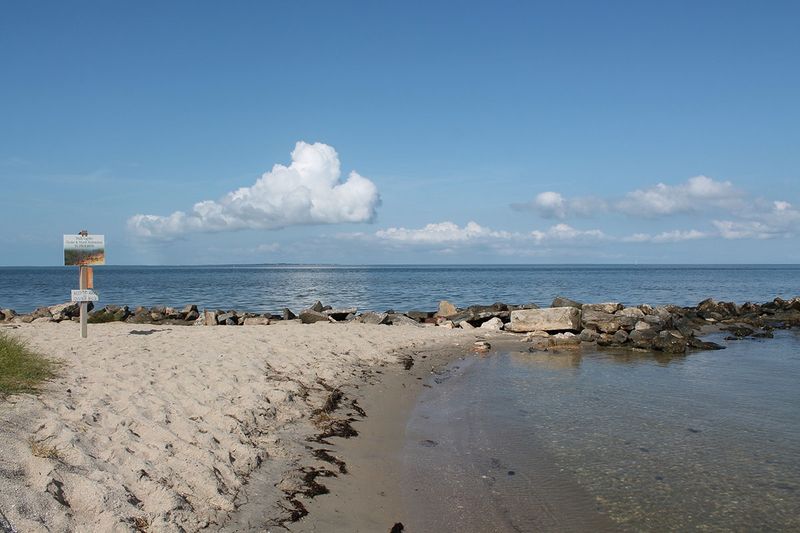
At the beach, the rules extend to the shoreline structures. The preserve specifically instructs visitors to stay off the rock jetty, shoreline rocks, and oyster-shell sill.
These features can be slippery, unstable, or sharp underfoot, and the preserve’s warning reflects genuine hazard rather than excessive caution. The sandy beach itself is where visitors are meant to stop and take in the view.
Dogs are welcome on the trail but must remain on a leash throughout the visit. Owners are responsible for cleaning up after their animals, and that requirement applies along the trail and at the beach.
The preserve does not post waste bag stations, so bringing your own supplies is the practical approach.
Swimming at Springer’s Point is at your own risk on Pamlico Sound, which carries its own set of conditions. Ocracoke’s Atlantic-facing beach is a separate experience managed under Cape Hatteras National Seashore.
The National Park Service notes that Ocracoke’s ocean beaches can have rough surf and rip currents, and advises checking conditions before entering the water and using lifeguarded areas when they are available.
For anyone swimming at the Atlantic beach rather than the preserve, the National Weather Service advises never swimming alone, staying near lifeguards, and knowing what to do if caught in a rip current: stay calm, swim parallel to shore until free of the current, then angle back toward the beach, and signal for help if needed. These are habits worth building before any coastal swim, not just on unfamiliar beaches.
What Springer’s Point Actually Promises
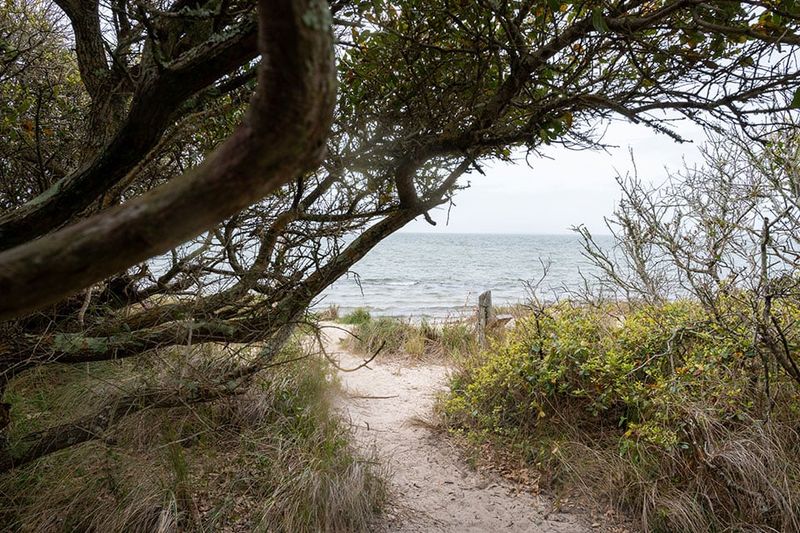
Springer’s Point Nature Preserve delivers a short, protected walk through live-oak forest and coastal marsh that ends at a sandy beach on Pamlico Sound. The NC Coastal Land Trust’s preserve page frames the site accurately: ancient trees, winding trails, and a soundside beach that feels removed from the more developed parts of Ocracoke Island.
Plan for roughly 1.6 miles round trip on the preserve trail, plus whatever distance separates your parking spot from the trailhead. Visit Ocracoke’s listing puts the one-way trail at 0.8 mile, which is the most specific published figure available.
The total outing is short enough for most fitness levels but long enough to feel like a real walk through genuinely varied habitat.
Visitors should expect a soundside preserve experience, not an Atlantic swimming beach. The water at the endpoint is on Pamlico Sound, the views look out toward Teach’s Hole, and the shoreline is undeveloped and protected.
The gradual transition from shaded maritime forest to open water is the actual reward here, a coastal unfolding that takes the length of a trail to earn rather than a hidden ocean waiting behind a single last tree.
Share this story