Somewhere north of where the pavement ends in North Carolina, the road simply disappears into sand, and the Outer Banks reveals a side most visitors never see. The beach itself becomes the highway, stretching toward the Virginia line through dunes, open shoreline, and protected coastal habitat where free-roaming horses might cross your path.
It is the kind of outing that trades highway noise for the sound of waves and salt-tinged wind, and it rewards the people who show up prepared. If you have ever wanted a coastal drive that feels genuinely off the beaten path, this four-wheel-drive beach corridor north of Corolla is worth understanding before you go.
Where Paved NC 12 Gives Way to Sand
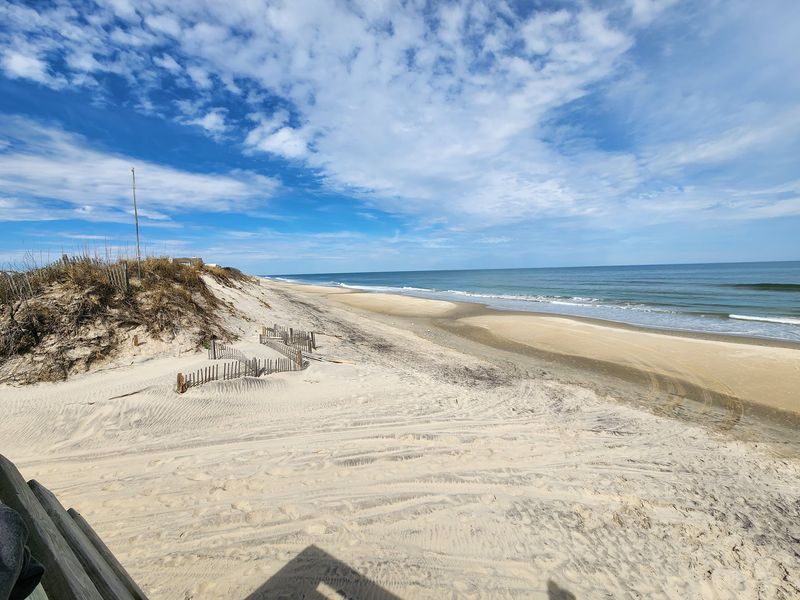
Paved NC 12 carries you north through Corolla with the easy confidence of any ordinary coastal highway, and then, without much fanfare, it simply stops. At that point, the beach takes over as the only route forward toward Swan Beach and Carova, communities that have no paved road connection to the outside world.
The transition happens at a sand ramp, and from there you are on a public vehicular beach-access corridor, not a marked scenic highway with guardrails and mileage signs.
According to the U.S. Fish and Wildlife Service, the first tract of the Currituck National Wildlife Refuge begins roughly three-quarters of a mile north of where the pavement ends, so the shift from ordinary roadway to protected coastal land happens quickly.
The refuge itself has no buildings or visitor facilities, meaning the landscape stays open and largely uninterrupted.
Separating these three zones helps set realistic expectations. The paved NC 12 approach brings you to the starting point.
The Currituck Banks protected area and the northern four-wheel-drive beach corridor are what follow. Currituck tourism materials describe the northern beach area as spanning more than 20 miles, but the experience is a beach drive, not entry onto a formal coastal highway with a fixed distance marker at each end.
The Beach Leads, While the Soundside Habitat Adds Depth
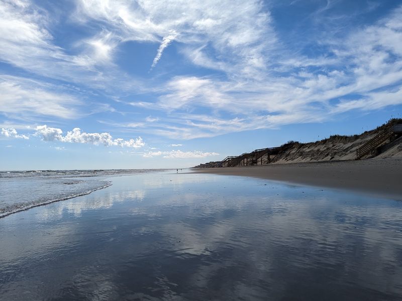
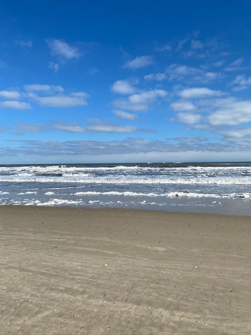
Most of the driving happens right on the beach, with the Atlantic on one side and a wall of dunes on the other. That is the core of the experience: open shoreline, salt air, and the particular stillness that comes when conventional road infrastructure disappears behind you.
The ocean view is consistent, but the landscape around it carries more variety than a first glance suggests.
The Currituck Banks Reserve contains ocean beach, dunes, grasslands, shrub thickets, maritime forest, freshwater and brackish marshes, tidal flats, and subtidal habitat along the Currituck Sound. A sound overlook and boardwalk are available south of the four-wheel-drive beach access, offering a quieter spot to take in the soundside scenery that you will not see from the beach itself.
Marsh and Currituck Sound views are most strongly associated with those protected soundside areas and reserve habitats rather than with the vehicle route. Expect the drive to feel expansive and coastal rather than marsh-lined.
The sensory richness comes from layers: the smell of brine, the texture of wind-sculpted dunes, the hush of maritime forest just beyond the ridge, and the occasional flash of shorebird movement at the water’s edge.
Wild Horses Reward Patience, Not Pursuit
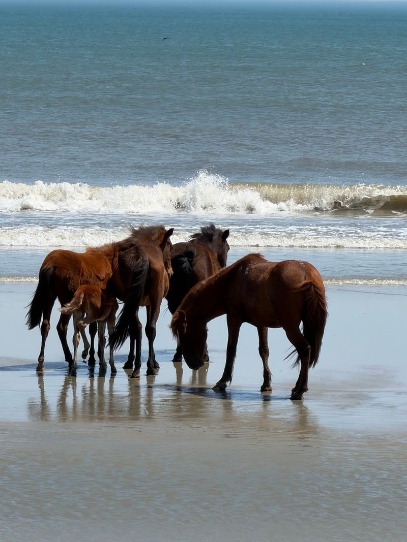
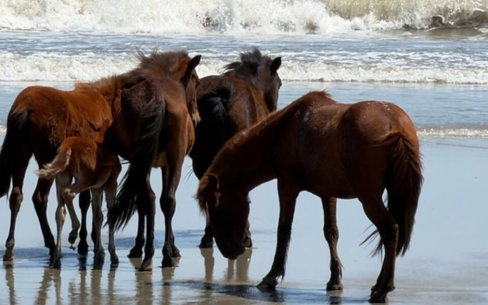
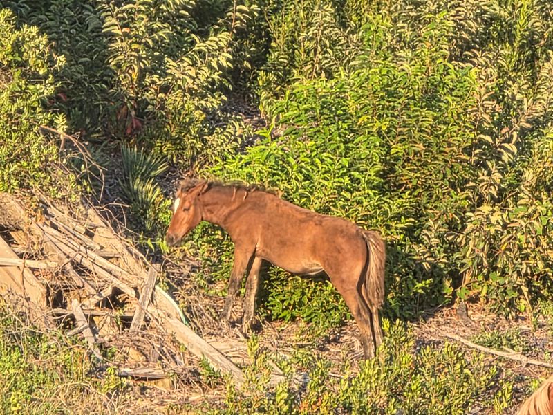
Spotting a Banker horse moving through the dunes or grazing near the shoreline is one of those travel moments that stays with you. The horses are free-roaming, undomesticated, and genuinely wild, which means they appear on their own schedule and in their own chosen habitat.
They move between the shoreline, dunes, maritime forest, grasslands, and marsh areas, so a sighting could happen almost anywhere along the corridor or not at all.
North Carolina has designated the Colonial Spanish Mustang as the state’s official horse, a recognition tied to the Corolla herd’s long coastal presence. Genetic research supports Colonial Spanish ancestry for these horses, while explanations involving shipwrecks, abandoned expeditions, or early settlements remain historical hypotheses rather than a confirmed single origin story.
Rules in the Currituck Banks area prohibit intentionally coming within 50 feet of a wild horse, and federal refuge rules prohibit approaching or feeding them altogether. The Corolla Wild Horse Fund is clear that human food can harm them, so resist any impulse to offer a snack.
Watch quietly, keep your distance, and let them move on their own terms.
What the 25-Mile Figure Actually Measures
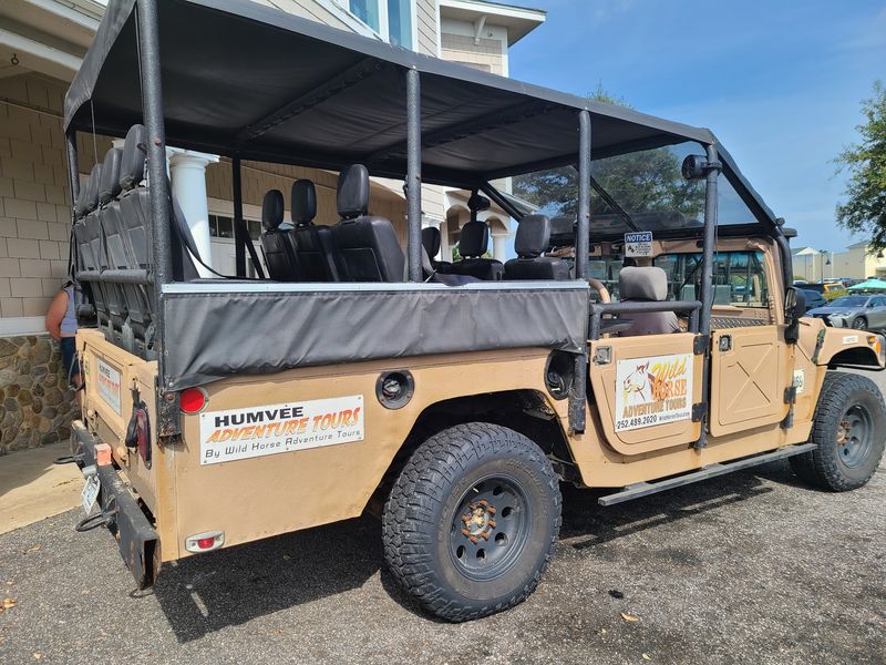
The number 25 miles shows up often in connection with this route, and it deserves a candid explanation before you plan your trip around it. That figure comes primarily from guided wild-horse tour descriptions, where operators advertise approximately two-hour excursions covering roughly 20 to 30 miles of combined beach driving, backcountry roads, and out-and-back travel.
Operators like Corolla Jeep Adventures and See Corolla Wild Horses describe their tours that way, but those are operator descriptions of route coverage, not a government measurement of a single one-way road.
Authoritative accounts from the U.S. Fish and Wildlife Service place the physical beach corridor from the end of paved NC 12 toward the Virginia line at roughly 11 miles, while Currituck tourism materials describe a broader northern beach area exceeding 20 miles.
Thinking of this as a four-wheel-drive beach drive or a guided excursion is more accurate than picturing a measured 25-mile coastal highway. The distance you cover depends on where you turn around, how far a tour operator travels, and whether the route includes roads behind the dunes.
Plan for an adventure with a flexible range, not a fixed mileage post at each end.
Four-Wheel Drive and Shared Space Define the Route
Four-wheel drive is not a suggestion here. Both Currituck County and the U.S.
Fish and Wildlife Service require it, and county beach-driving rules are explicit that vehicles without four-wheel drive should not attempt the beach. Your vehicle also needs to be properly registered, licensed, and insured before you head onto the sand.
A rental vehicle can work, but only if it has genuine four-wheel-drive capability and your rental agreement specifically authorizes beach driving. Two-wheel-drive vehicles, AWD-only models, and low-clearance cars are not suitable, regardless of how capable they feel on pavement.
Currituck visitor guidance echoes that point, and ignoring it can leave you stuck in soft sand far from any help.
The beach is a public vehicular access corridor, not a private or traffic-free road. Residents, visitors, tour vehicles, emergency responders, pedestrians, horses, and wildlife all share it.
Traffic-use profiles of the Currituck Banks area confirm that summer use in particular can be busy. The posted speed limit is 35 mph on the open beach, dropping to 15 mph within 300 feet of any person.
Treat it like a shared road because that is exactly what it is.
Prepare the Vehicle Before Entering the Sand
Preparation starts before the wheels ever touch sand. Airing down your tires in a legal location is one of the most important steps, and Currituck County beach-driving guidance lists air stations at Historic Corolla Park where you can handle that task.
The county’s published tire-pressure materials reference different PSI values depending on vehicle type, so rather than following one universal number, check current county guidance, your vehicle manufacturer’s recommendations, and your rental company’s rules if applicable.
Engage four-wheel drive at the ramp before you reach the soft sand, not after you are already stuck. Keep your speed slow and steady, avoid sharp turns, and stay in established tracks where the sand is firmer.
Fuel matters more than many visitors expect: there are no gas stations in the four-wheel-drive area, and the refuge has no buildings or visitor facilities of any kind. Start with a full tank.
Bring enough water for everyone in your vehicle, along with any supplies you might need for the day. Conditions along the corridor can shift with the tides, and Currituck County has warned that storms, erosion, and high tides can narrow or block sections.
Checking county updates before you leave home takes five minutes and can save you a very long, frustrating turnaround. Visitor FAQ guidance reinforces that conditions change and that preparation is not optional on this route.
Understand the Current Beach-Parking Rules
Driving through the corridor and parking on the beach are two different things under current county rules, and the distinction matters for planning. For 2026, Currituck County requires visitor beach-parking permits during the season running from the second Saturday in May through the last Saturday in September.
The county’s permit-season announcement confirms that visitor permits are capped at 300 per week, so availability is limited during peak summer travel.
The permit requirement applies specifically to parking on the beach strand, not to passing through the area. Even with a valid permit, county beach-driving rules prohibit parking within the first 1.5 miles north of the four-wheel-drive ramp.
Drivers must also keep the beach’s active traffic lanes clear at all times and remove any unattended items before nightfall.
Treat these as time-specific rules that could change before your visit. Permit seasons, weekly caps, and access conditions are subject to revision, so checking the county’s official beach-parking page before you book travel is the safest approach.
A quick review of current rules takes far less time than arriving to find your plans blocked by a regulation that shifted since you last checked.
Choose a Guided Tour When You Lack the Right Setup
Not every visitor arrives with an authorized, beach-capable four-wheel-drive vehicle, and that is a completely reasonable situation. Guided tours exist precisely for this scenario, and they offer a practical, comfortable introduction to the corridor without requiring you to navigate sand ramps, tire pressure, or county permit logistics on your own.
Operators such as Corolla Jeep Adventures, Wild Horse Corolla, and See Corolla Wild Horses commonly advertise roughly two-hour trips covering about 20 to 30 miles of beach and backcountry travel. Those distances reflect each operator’s combined route coverage and are not an official road measurement.
A knowledgeable guide who tracks the herd’s habits and habitat use may improve your odds of a sighting, but no tour can guarantee the horses will appear.
The wildlife rules apply equally on a guided tour. Federal refuge rules prohibit approaching or feeding the horses regardless of whether you are in a private vehicle or a tour truck, and Currituck’s wild-horse adventure guidance is consistent on that point.
The horses remain wild, and keeping your distance is part of the experience, not an inconvenience.
The Real Payoff Is Quiet Coastal Access
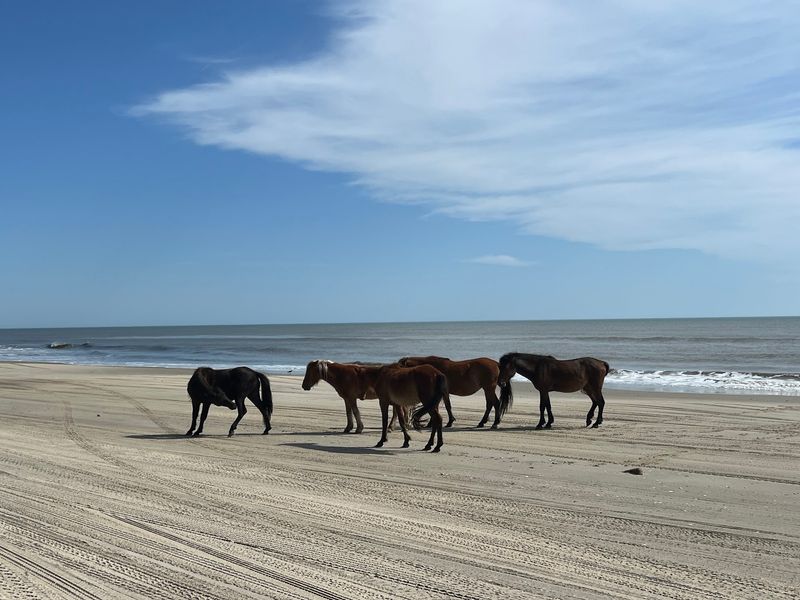
Strip away the round numbers and the traffic-free promises, and what remains is genuinely worth the trip. The northern Outer Banks corridor offers open shoreline, salt air, and a sense of coastal remoteness that most paved roads simply cannot deliver.
Traffic exists, but it feels lighter and less conventional than anything on NC 12, and the absence of gas stations and visitor facilities keeps the experience honest.
The distance you cover depends on your vehicle, your turn-around point, and whether you are driving independently or riding with a tour operator whose combined route may reach 20 to 30 miles. Soundside marsh and Currituck Sound views reward those who explore protected reserve habitats, while the beach corridor itself delivers dunes, open sky, and the possibility of horses.
Check current county conditions and permit rules before you leave, then choose your approach: an authorized, capable four-wheel-drive vehicle for an independent run, or a guided tour for a simpler first look. Either way, the sand and the salt air are the real destination.
Share this story