Asia’s monsoon season gets a bad reputation for ruining travel plans, but the truth is that rain transforms this continent into something genuinely spectacular. Waterfalls surge to full power, rice terraces fill with mirror-like water, ancient forests drip with moss, and mountain valleys disappear into rolling clouds.
From the wettest town on Earth to a misty island in southern Japan, the destinations on this list show a completely different side of Asia that dry-season travelers rarely get to see. Whether you are chasing dramatic scenery, lush greenery, or simply a quieter crowd at a beautiful place, these 13 destinations make a strong case for packing your rain jacket and heading out anyway.
Sohra, Meghalaya, India
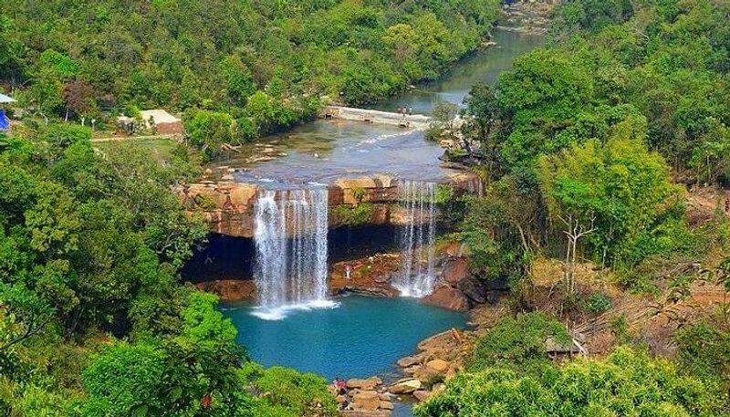
Sohra holds a record that most travelers have heard about but few have actually witnessed firsthand. Historically known as Cherrapunji, this town in Meghalaya is one of the wettest places on the planet, and the monsoon season from June through September is when that reputation becomes visible in every direction.
Nohkalikai Falls is the region’s centerpiece, dropping dramatically from a plateau into a vivid green pool far below. Dainthlen Falls, Nohsngithiang Falls, and several cave systems add more reasons to stay longer than a single afternoon.
The surrounding hills produce an almost theatrical landscape, with fog rolling across cliffs and waterfalls appearing through cloud cover. Sohra sits about 55 kilometers from Shillong and is reachable by shared taxis and tourist vehicles.
Expect slippery walking paths, sudden downpours, and waterfalls running at their absolute strongest. Living root bridges nearby are a bonus worth adding to the itinerary.
Kaas Plateau, Maharashtra, India
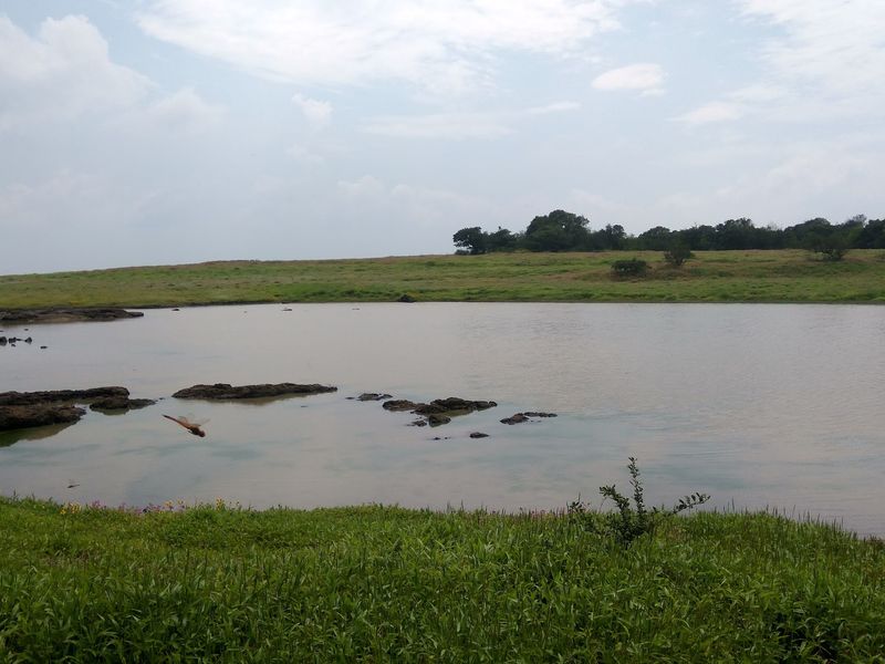
Every year, the Western Ghats pull off something remarkable. As the rainy season winds into late August, Kaas Plateau transforms into a sweeping carpet of wildflowers that spreads across the elevated landscape near Satara in Maharashtra.
Rain feeds the shallow soils and seasonal wetlands here, supporting hundreds of plant species that bloom in waves from late August into early October. Maharashtra Tourism continues to feature Kaas as one of the state’s signature monsoon experiences, and the plateau’s ecological sensitivity means visitor numbers are controlled.
Advance booking is strongly recommended during peak flowering season.
Nearby Kaas Lake and Thoseghar Waterfalls make it easy to extend the visit into a broader exploration of monsoon Maharashtra. Waterproof footwear is genuinely useful, since trails become slick after heavy rain.
The plateau sits roughly 25 kilometers from Satara, making it a manageable day trip for travelers already exploring the region’s rainy-season scenery.
Munnar, Kerala, India
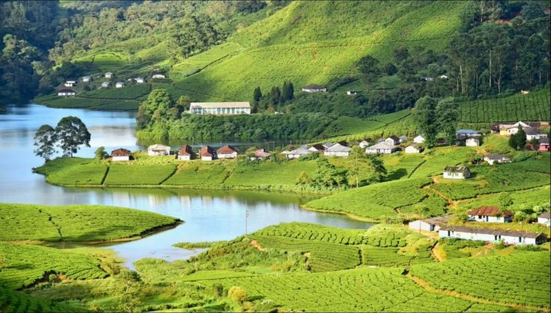
Tea and rain are a natural combination, and Munnar makes that pairing look extraordinary. The rolling tea estates of the Western Ghats in Kerala are already one of southern India’s most recognizable landscapes, but heavy rainfall pushes the green to a depth and richness that photographs struggle to capture accurately.
Streams fill quickly, waterfalls strengthen, and clouds sweep through valleys between the plantation-covered ridges. India’s official tourism portal lists Mattupetty Dam, Eravikulam National Park, Top Station, and surrounding nature areas as part of a complete Munnar visit.
Photo Point delivers broad views across plantations and wooded slopes, while higher viewpoints can vanish into cloud one moment and open dramatically the next. The combination of cultivated fields and rugged mountain terrain gives Munnar a visual character unlike the tropical lowlands of Kerala.
Roads are the main way to explore, but travelers should allow extra time during heavy rain and follow local guidance about conditions.
Ratchaprapha Dam and Khao Sok, Surat Thani, Thailand
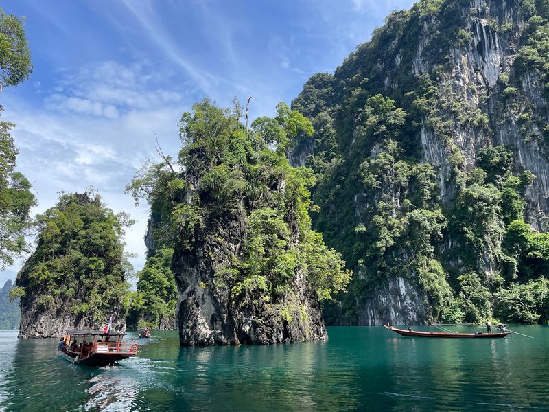
Thailand’s tourism authority does not tell travelers to avoid the wet season entirely. In fact, Ratchaprapha Dam and Khao Sok National Park are specifically recommended for their rainy-season scenery, and the landscape here genuinely earns that endorsement.
The reservoir, commonly called Cheow Lan Lake, sits surrounded by enormous limestone formations that rise almost vertically from emerald-colored water. Rain adds low clouds and mist around the karst peaks, giving the lake a layered, atmospheric quality that changes throughout the day.
Boat trips reveal forested islands, narrow channels, and floating accommodations spread across a vast expanse of water.
Khao Sok’s tropical vegetation becomes exceptionally lush during this period, with jungle trails and wildlife at their most active. Conditions can shift quickly, so boat excursions and hikes may need adjustment during storms.
Travelers willing to accept unpredictable weather find one of Thailand’s most dramatic and memorable natural environments waiting for them here.
Mu Cang Chai, Yen Bai, Vietnam
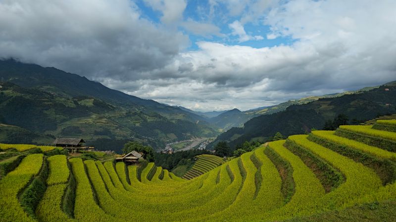
The rice terraces of Mu Cang Chai were not built quickly. Generations of farmers carved more than 2,000 hectares of terraces into steep mountain slopes in Yen Bai Province, creating one of Vietnam’s most extraordinary agricultural landscapes.
Rain is central to the scenery here. During the water-pouring period, farmers guide rainwater into the terraces, turning the stepped hillsides into giant reflective surfaces that catch clouds and changing light.
Vietnam Tourism notes that the rainy season runs roughly from April through October, with deep green fields in summer giving way to golden paddies around September and October.
Khau Pha Pass and Mam Xoi Hill provide the area’s best-known viewpoints, where the scale of the terraced landscape becomes clear from above. Mo Waterfall gains considerable volume following seasonal rain, adding another reason to explore beyond the main viewpoints.
Roads into the region can be narrow and winding, so planning travel times carefully makes the journey smoother.
Jatiluwih Rice Terraces, Bali, Indonesia
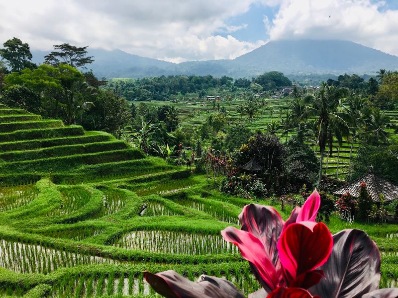
Bali’s beaches attract most of the attention, but the island’s interior tells a completely different story when tropical rain keeps the countryside saturated and deeply green. Jatiluwih in Tabanan is among Bali’s most expansive agricultural regions, with terraces stretching across broad hillsides beneath the island’s central mountains.
The terraces connect directly to Bali’s traditional subak irrigation system, which distributes water across the rice-growing landscape in a method recognized by UNESCO. During wet periods, flooded paddies reflect the shifting sky while low clouds settle over the mountain ridges above.
Narrow roads and walking paths let visitors explore different elevations and viewpoints rather than simply stopping at a single overlook.
The surrounding countryside includes forests and waterfalls, with Yeh Hoo Waterfall adding to the appeal when Bali’s vegetation is at its greenest. Indonesia’s official tourism site continues to promote Jatiluwih and its walking routes, making it one of the more accessible interior destinations for travelers looking beyond the coast.
Batad Rice Terraces, Ifugao, Philippines
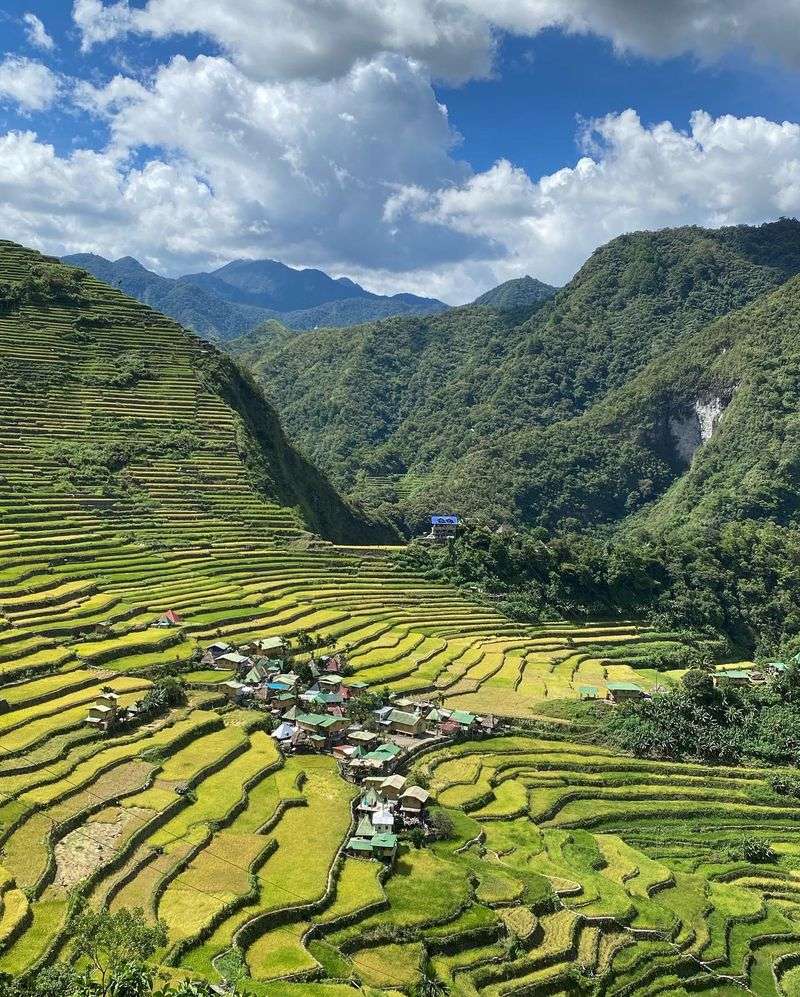
Few agricultural landscapes in Asia match the sheer drama of Batad. The terraces form a natural amphitheater around a mountain village in Ifugao, and they are part of the UNESCO-listed Rice Terraces of the Philippine Cordilleras, a recognition that reflects just how significant these structures are culturally and historically.
Getting here requires walking. Paths weave between stone and earth terraces maintained by generations of Ifugao farmers, and that effort is part of what makes the experience different from a roadside viewpoint.
Wet-season moisture intensifies the green color of the paddies and surrounding mountains, producing the layered landscape the Cordillera highlands are known for.
The tradeoff is terrain. Rain turns stone steps and narrow terrace paths slick, so proper footwear and a local guide are especially useful during wet conditions.
The Philippine tourism department continues to feature Batad as one of Ifugao’s major visitor destinations, and the effort required to reach it tends to keep the atmosphere refreshingly uncrowded.
Yakushima, Kagoshima Prefecture, Japan
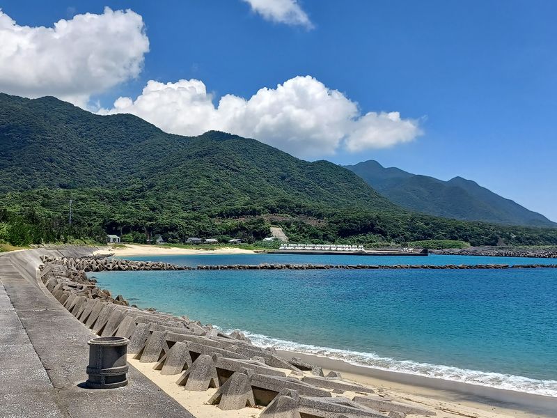
Not every monsoon landscape involves rice terraces or waterfalls. Yakushima, a mountainous island south of Kyushu in Kagoshima Prefecture, receives some of Japan’s highest annual rainfall, and that moisture supports forests that feel genuinely ancient in a way that is difficult to describe until you are standing inside one.
Yakusugi Land provides relatively accessible trails and boardwalks through forests containing yakusugi cedars more than 1,000 years old. Shiratani Unsuikyo Ravine offers another classic landscape where moss covers rocks, roots, and fallen trees beneath a thick overhead canopy.
Japan’s National Parks website specifically tells visitors to expect possible showers because of the island’s extreme rainfall levels.
Rain is not an interruption here. It is part of the ecosystem that created these forests.
Ferries and flights connect Yakushima with major cities in Kyushu, although severe weather can temporarily affect transportation schedules. Packing proper rain gear and waterproof trail shoes makes a significant practical difference on the island’s forest paths.
Alishan National Forest Recreation Area, Taiwan
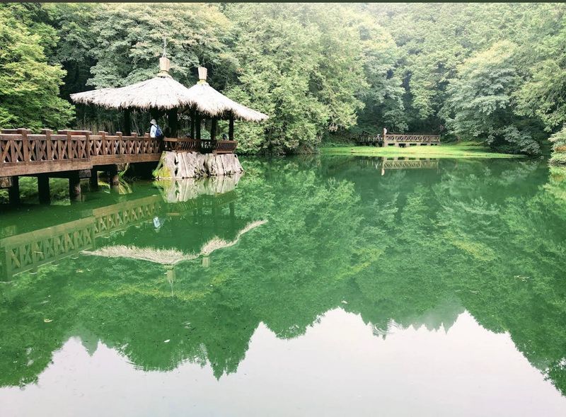
The numbers at Alishan are striking. Taiwan’s Tourism Administration reports annual rainfall reaching roughly 4,000 millimeters, along with more than 200 rainy days and around 244 foggy days in an average year.
That is not a place that merely gets wet occasionally. It is a landscape built around moisture.
Dense forests wrap around mountain slopes, mist moves between enormous trees, and clouds frequently fill the valleys below the viewpoints. The monsoon period generally runs from May through September, which is when the atmosphere becomes particularly dramatic.
Alishan National Forest Recreation Area is currently listed as open, with forest trails, viewpoints, visitor facilities, and transportation connections available to travelers.
The famous sea of clouds is never guaranteed on any given morning, but shifting weather during the rainy season can make the scenery more dynamic as valleys disappear and reappear beneath moving fog. Layering up for cooler temperatures at elevation is worth remembering even during summer months.
Cameron Highlands, Pahang, Malaysia
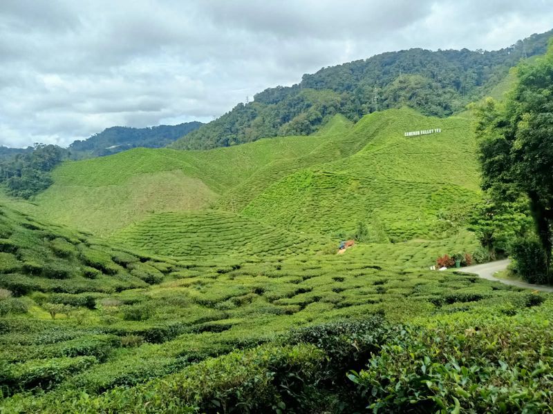
Cameron Highlands operates at a different pace and altitude than most of Malaysia. Rolling tea plantations, tropical mountain vegetation, farms, and misty forest sit at elevations much higher than the coastal cities, and rain deepens the green of every surface it touches.
The Mossy Forest near Mount Brinchang is particularly suited to wet conditions. Trees, branches, and rocks are covered in thick moss, while clouds frequently drift directly through the forest canopy.
Tourism Malaysia describes the atmosphere as misty, cloud-filled, and almost otherworldly, which is one of the more accurate tourism descriptions you will come across.
Nearby tea plantations add broad geometric patterns to the landscape, contrasting sharply with the untamed forest just above. Travelers should expect muddy paths and changing visibility when rain arrives, but those same conditions produce the saturated greenery and hanging mist that make Cameron Highlands so photogenic.
The region is an established destination with accommodation and transport options at multiple price points.
Sera Ella, Matale District, Sri Lanka
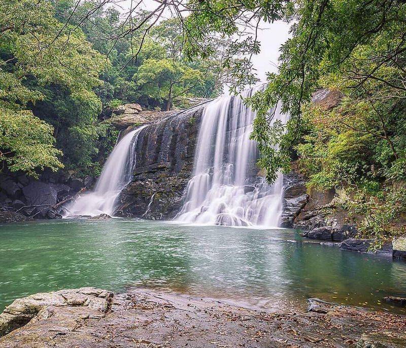
Sri Lanka has no shortage of waterfalls, but Sera Ella stands out for what happens when monsoon rain arrives in full force. Sri Lanka Tourism notes that the waterfall flows throughout the year but becomes particularly impressive during monsoonal periods, and the difference between seasons is visible in both the volume and the energy of the water.
Water falls across a broad rock face surrounded by dense vegetation, forming a curtain-like cascade that spreads wide rather than plunging in a single narrow column. One distinctive feature is a cave behind the falling water, which gives visitors a different perspective on the landscape and adds an element rarely found at other waterfalls in the region.
The surrounding highland countryside includes forests, mountains, and grassland that frequently become wrapped in mist. Travelers exploring this part of Sri Lanka’s central interior can combine Sera Ella with other nearby attractions.
As with any waterfall during monsoon, approaching fast-moving water after heavy rainfall should always be avoided.
Pokhara, Nepal
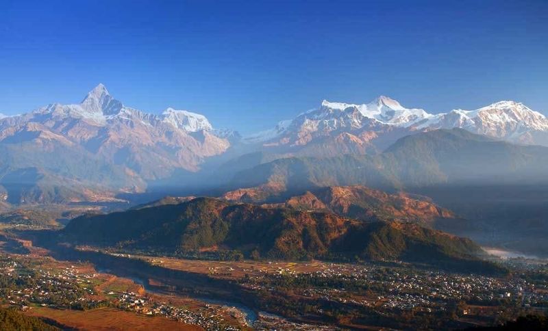
Pokhara during the dry season is famous for its Himalayan panoramas, but the monsoon version of this city offers something harder to find elsewhere. Nepal’s official tourism board highlights Phewa, Rupa, and Begnas lakes as well as the Seti River and Devi’s Fall as the area’s main draws, and several of these become considerably more impressive when rain is feeding them.
Hills turn deep green, waterfalls gain serious volume, and storm clouds move dramatically across Phewa Lake in ways that feel almost cinematic. Devi’s Fall is especially striking when large amounts of water push through its narrow rock channel with force.
Travelers focused primarily on uninterrupted Annapurna views may prefer a clearer season, since monsoon clouds regularly obscure the peaks. Those drawn to water, lush greenery, and a moodier side of the Himalayan foothills can find summer genuinely rewarding.
Trekking conditions should always be checked locally after sustained rainfall before heading out on any trail.
Punakha Valley, Bhutan
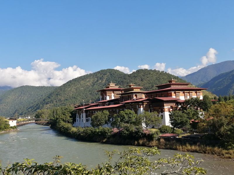
Bhutan’s reputation for careful, low-volume tourism means even the popular destinations feel relatively unhurried, and Punakha Valley during the summer monsoon is a genuinely rewarding combination of scenery and calm. The country’s official tourism portal notes that June through August brings lush landscapes, stronger waterfalls, flourishing rice fields, and rain that typically arrives in shorter bursts than travelers expect.
The valley is nourished by the Pho Chhu and Mo Chhu rivers, and the enormous Punakha Dzong sits near their confluence in one of Bhutan’s most visually dramatic settings. Walks through the surrounding countryside reveal rice paddies in intense shades of green, with the fortress providing a strong visual anchor across the river landscape.
Punakha Suspension Bridge offers broad views over the river valley and the forested ridges rising on either side. Summer visitors should be prepared for wet rural paths and occasional changes to outdoor plans, but the monsoon transformation of this valley is well worth the flexibility required.
Share this story