Some of the world’s most visited destinations sit surprisingly close to active volcanoes. From the beaches of Bali to the streets of Naples, millions of tourists walk, hike, and sightsee near geological forces that scientists watch around the clock.
That combination of natural spectacle and real-world risk makes these places unlike anywhere else on earth. Whether you are planning a trip or just curious about the planet’s most dramatic landscapes, this list covers 17 active volcanoes that share space with some of the busiest tourist regions in the world.
Kilauea, Hawaii, United States
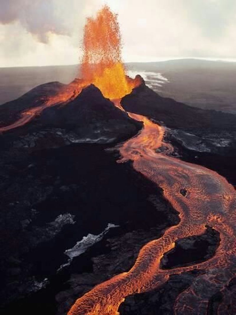
Hawaii Volcanoes National Park on the Big Island draws hundreds of thousands of visitors each year, and Kilauea is the main reason many of them make the trip. Sitting at the park’s heart, this volcano has been one of the most continuously active on the planet for decades.
Its summit caldera, Halemaumau, has seen intermittent eruptive activity since December 2024. The USGS maintained a WATCH alert level as recently as September 2026, which means conditions can shift quickly.
Visitors can still explore the park’s trails, lava tube systems like Thurston Lava Tube, and overlooks that frame the crater. Chain of Craters Road offers one of the more dramatic scenic drives in the national park system.
Always check the USGS Hawaiian Volcano Observatory site before visiting, since access near active vents changes depending on current eruptive conditions.
Mauna Loa, Hawaii, United States
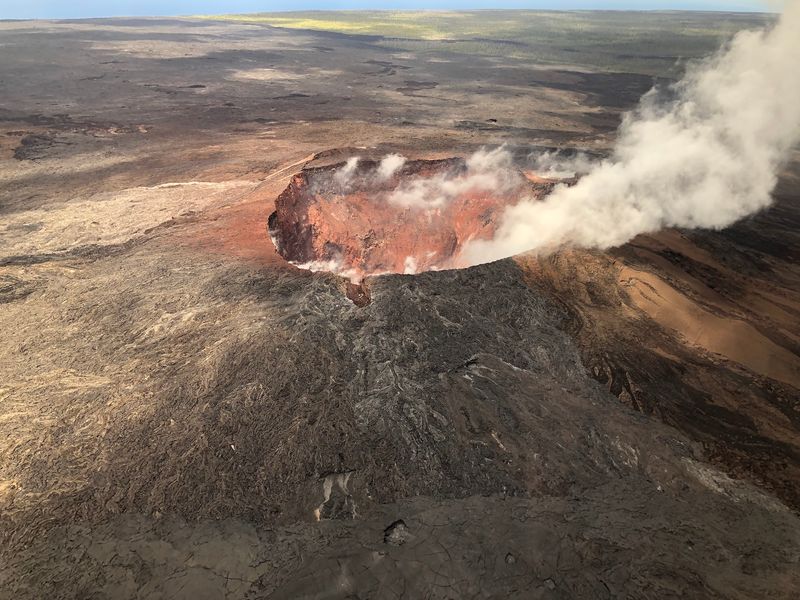
Mauna Loa holds a record that no other volcano on earth can claim: it is the largest active volcano in the world by volume and surface area. Sharing the Big Island with Kilauea, it rises over 13,600 feet above sea level while extending far below the ocean surface.
Its most recent eruption happened in November and December 2022, the first time it had erupted in 38 years. The USGS listed it at NORMAL status in September 2026, but monitoring across its summit and rift zones never stops.
Mauna Loa Road inside Hawaii Volcanoes National Park gives visitors access to trailheads and overlooks across its broad slopes. The summit trail is a serious undertaking requiring permits and proper preparation.
For most visitors, the drive and roadside viewpoints offer a genuine sense of just how massive this mountain really is.
Mount Vesuvius, Naples, Italy
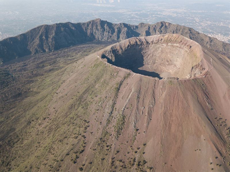
Standing above one of Italy’s most famous cities, Vesuvius is the volcano that buried Pompeii and Herculaneum under ash and pyroclastic material in 79 AD. That event turned it into one of the most studied volcanoes in history, and the ruins it created are now among Europe’s top archaeological attractions.
The volcano last erupted in 1944, but it remains classified as active. Millions of people live within the surrounding Campania region, making it one of the most densely populated volcanic zones anywhere in the world.
Visitors can hike to the crater rim on a well-maintained trail from the car park near the summit. The views over Naples and the Bay of Naples are genuinely impressive.
Combining a visit to Vesuvius with a day at Pompeii or Herculaneum makes for one of the most historically layered day trips in all of Italy.
Campi Flegrei, Naples and Pozzuoli, Italy
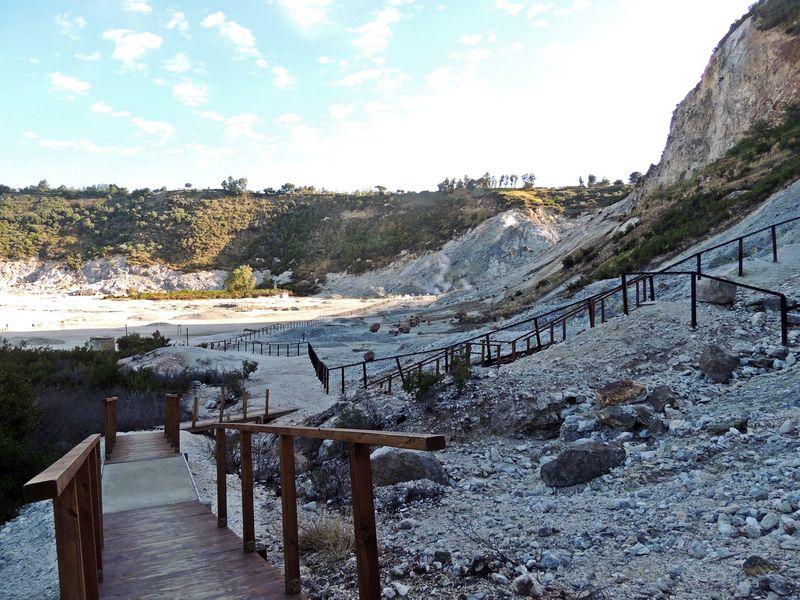
Unlike the classic cone shape most people picture when they think of a volcano, Campi Flegrei is a vast supervolcanic caldera stretching across a wide area west of central Naples. Parts of the city itself, along with the town of Pozzuoli, sit directly within the caldera system.
Its last eruption created Monte Nuovo in 1538, but the system has never gone quiet. A phenomenon called bradyseism, or slow ground movement caused by underground volcanic pressure, has caused measurable uplift and increased earthquake activity in recent years, drawing significant scientific attention.
The Solfatara crater near Pozzuoli is the most accessible point for visitors, featuring steaming fumaroles and sulfurous vents. The Phlegraean Fields Archaeological Park also sits within the caldera, offering Roman-era ruins in a genuinely unusual geological setting.
Monitoring of Campi Flegrei remains intensive because of how many people live across the area.
Mount Etna, Sicily, Italy
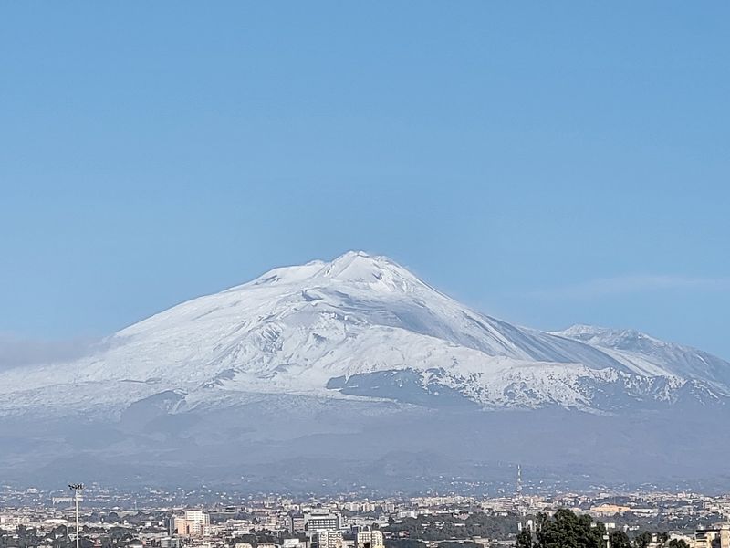
Etna is Europe’s tallest and most active volcano, and it sits in plain view above Catania and the surrounding towns of eastern Sicily. Its eruptions are frequent, often producing lava flows, ash clouds, and spectacular nighttime glow that locals have lived alongside for thousands of years.
Italy’s National Institute of Geophysics and Volcanology was still recording thermal activity around Etna’s summit craters as recently as September 2026. Despite that, Etna is also one of Sicily’s biggest tourism draws, with cable car access and guided hiking routes that take visitors partway up the volcano.
The Etna DOC wine region sits on the volcano’s fertile slopes, where vineyards produce wines that have attracted serious international attention. Towns like Zafferana Etnea and Nicolosi serve as good base points for excursions.
Etna manages the rare combination of genuine geological hazard and genuine tourist destination better than almost any volcano on this list.
Stromboli, Aeolian Islands, Italy
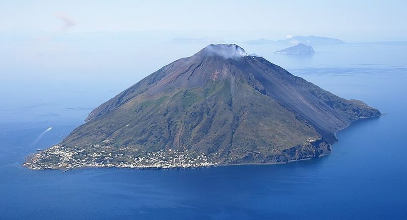
For centuries, sailors crossing the Tyrrhenian Sea used Stromboli’s glow as a natural lighthouse. The volcano produces small explosions so regularly that volcanologists actually named a type of eruption style after it: Strombolian activity, characterized by frequent mild blasts that throw glowing material into the air.
Eruptive activity was continuing during August 2026, which is not unusual for this island. Stromboli sits in the Aeolian Islands north of Sicily, and reaching it requires a ferry or hydrofoil from ports like Milazzo or Lipari.
Guided nighttime hikes to the summit observation area are the main draw for visitors, with the views of active eruptions against a dark sky being a genuinely rare travel experience. Access to the summit zone requires booking a licensed guide.
The small village at the base of the volcano has a handful of accommodations and restaurants, giving the island a quiet, end-of-the-road character that feels very different from mainland Italy.
Mount Fuji, Fuji Five Lakes, Japan
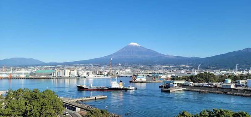
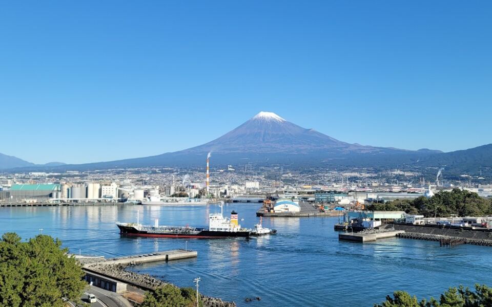
Japan’s most photographed mountain is technically an active stratovolcano that last erupted in 1707-1708, an event known as the Hoei eruption that deposited ash over Edo, the city now called Tokyo. The fact that millions of people visit the Fuji Five Lakes region every year without thinking much about that history says something about how normalized its presence has become.
Despite its current quiet status, Fuji is monitored continuously by Japan’s Meteorological Agency. The surrounding Fuji Five Lakes area, including Kawaguchiko and Yamanakako, offers some of the most recognizable views of the mountain and supports a large tourism economy built around those sightlines.
The official climbing season runs from early July through early September, with hundreds of thousands of hikers attempting the summit each year. In recent years, authorities have introduced crowd management measures on popular trails, including access fees and barriers, to manage the sheer volume of visitors the mountain attracts.
Sakurajima, Kagoshima, Japan
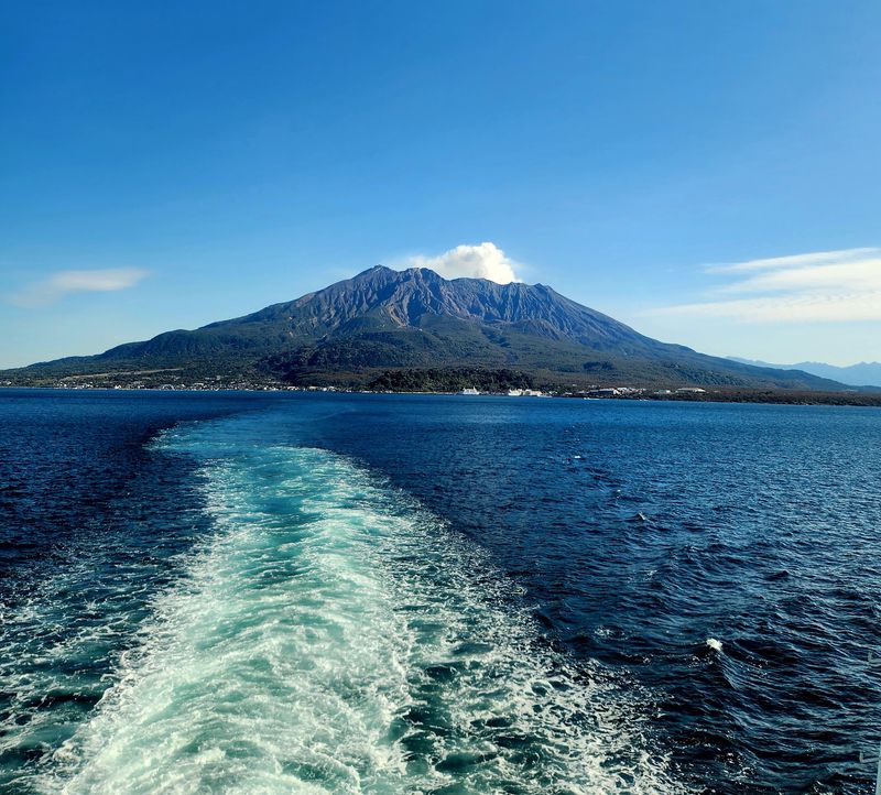
Kagoshima is sometimes called the Naples of Japan, partly because of its setting on a bay and partly because it shares its skyline with an active volcano. Sakurajima sits directly across Kagoshima Bay from the city center, close enough that residents regularly deal with volcanic ash on their cars and streets.
The volcano recorded numerous eruptive events during 2026, and Japan’s alert level remained at 3 during early September, with restrictions in place near the active craters. That level of activity has been relatively normal for Sakurajima over recent decades.
A short ferry ride from Kagoshima’s city port brings visitors to the island, where a 33-kilometer loop road circles the volcano. Lava fields from a major 1914 eruption are visible from the road and have since connected what was once an island to the Osumi Peninsula.
Yunohira Observatory provides one of the better viewpoints of the active crater from a safe distance.
Mount Aso, Kumamoto Prefecture, Japan
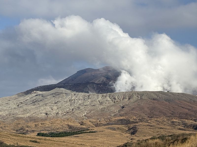
The Aso caldera is one of the largest calderas in the world, stretching roughly 25 kilometers from east to west across central Kyushu. Inside that enormous depression sits an active volcanic complex, with Nakadake being the most consistently active of its central cones.
Authorities maintained Alert Level 2 restrictions immediately around the Nakadake crater in September 2026, meaning access to the crater rim itself was limited. That situation is not unusual for Aso, where access conditions change depending on gas emissions and eruptive behavior.
The broader caldera is home to towns, farmland, hot spring resorts, and grasslands that make it one of Kyushu’s most appealing regions to explore. The Kusasenri plateau, Daikanbo viewpoint, and the Aso Volcano Museum are all accessible even when crater access is restricted.
Kumamoto City, which was significantly affected by major earthquakes in 2016, sits just west of the caldera and serves as the main gateway for most visitors.
Mount Merapi, Yogyakarta, Indonesia
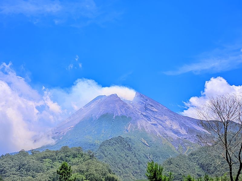
North of Yogyakarta, one of Indonesia’s most important cultural cities, Merapi rises sharply above the surrounding landscape. It is considered one of the most active and dangerous volcanoes in Indonesia, with a long history of significant eruptions including major events in 1930 and 2010.
Eruptive activity was continuing in September 2026, with lava avalanches descending parts of the volcano and an Alert Level 3 remaining in effect. That level restricts access within a defined danger radius around the summit.
Despite the ongoing activity, Yogyakarta remains a thriving tourism destination. Prambanan temple complex and Borobudur, the world’s largest Buddhist monument, are both within reach of the city and draw large visitor numbers year-round.
Jeep tours to view Merapi’s slopes and past lava fields from the 2010 eruption have become popular excursions. The Museum Sisa Hartaku, which preserves remnants from the 2010 event, gives visitors a sobering look at what the volcano is capable of.
Mount Agung, Bali, Indonesia
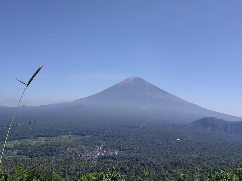
Bali’s reputation rests on its temples, rice terraces, and beach resorts, but the island’s highest point is an active stratovolcano that the Balinese consider deeply sacred. Pura Besakih, known as Bali’s Mother Temple, sits on Agung’s slopes and is one of the island’s most important religious sites.
Agung produced its most recent reported eruptive activity in 2022, following a major period of renewed activity that began in 2017 after decades of quiet. The 2017-2019 period saw significant ash eruptions and prompted large-scale evacuations.
For most visitors to Bali, Agung forms a dramatic backdrop rather than a destination in itself. Guided summit hikes are available during quieter periods, departing in the early morning hours to reach the crater rim at sunrise.
The views on a clear day extend across Bali and toward Lombok and Rinjani to the east. Checking current alert levels before booking any summit trek is strongly recommended.
Mount Batur, Bali, Indonesia
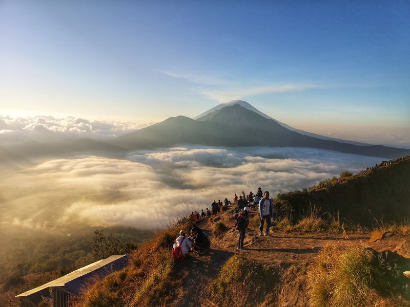
Sunrise hikes up Mount Batur are one of Bali’s most popular adventure activities, and for good reason. The view from the crater rim at dawn, looking out over the caldera lake and the surrounding landscape, is one of the more striking natural scenes the island offers.
Batur is historically active, with its most recent confirmed eruption listed by the Smithsonian Global Volcanism Program in 2000. The caldera itself is enormous, roughly 13 kilometers wide, and Lake Batur sits within it alongside the more recently formed volcanic cone that hikers climb today.
The Kintamani area along the caldera rim has been a Bali tourism hub for decades, with restaurants and viewpoints overlooking the entire volcanic complex. The hike to the summit typically takes two to three hours from the trailhead and is generally manageable for reasonably fit visitors.
Local guides are required for the trek, and bookings through registered operators are straightforward to arrange from most Bali accommodation.
Taal Volcano, Tagaytay, Philippines
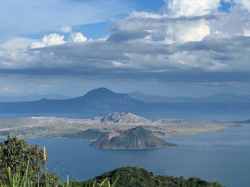
From the ridge at Tagaytay, roughly 60 kilometers south of Manila, the view of Taal Volcano sitting inside its lake is one of the most unusual volcanic landscapes in Southeast Asia. The setup is layered: a lake inside a volcanic island inside a larger lake inside a caldera.
It is genuinely hard to find a comparable scene anywhere else.
Taal remained active in 2026 and produced minor phreatic eruptions in May of that year. Taal Volcano Island itself is classified as a Permanent Danger Zone by Philippine authorities, meaning unrestricted tourist access to the island is not permitted.
The Tagaytay ridge offers plenty of ways to enjoy the view without entering the restricted zone. Restaurants and viewpoint areas along the ridge have made the area a popular day trip from Manila for years.
PHIVOLCS, the Philippine Institute of Volcanology and Seismology, publishes regular bulletins that clearly indicate current access conditions for anyone planning a visit to the area.
Mayon Volcano, Legazpi, Philippines
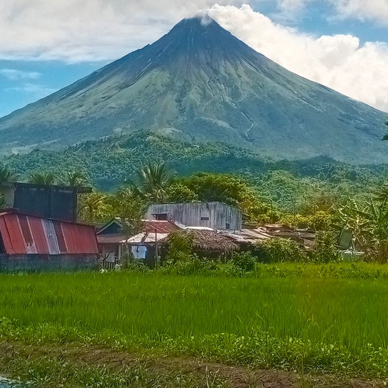
Mayon’s near-perfect cone shape has made it one of the most photographed volcanoes in Asia. Rising above the Bicol region near Legazpi City, it is often described as the most symmetrical stratovolcano in the world, a claim that holds up when you see it from the surrounding rice fields and coastal plains.
It is also the Philippines’ most active volcano. Eruptive activity continued during 2026, and while the alert level was lowered from 3 to 2 in August, the permanent danger zone around the volcano remained off limits to the public.
Legazpi City serves as the main base for visitors, with viewpoints at Cagsawa Ruins offering a particularly striking composition: the partially buried old church ruins in the foreground and Mayon rising sharply behind. The ruins themselves are a reminder of Mayon’s 1814 eruption, which buried the town of Cagsawa.
It is a history that the landscape still makes very easy to read.
Popocatepetl, Mexico City and Puebla, Mexico
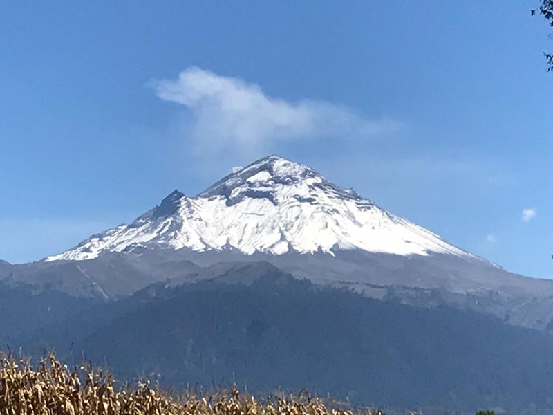
Locals around Mexico City and Puebla have a nickname for Popocatepetl: El Popo. At nearly 5,500 meters, it is the second highest peak in Mexico and one of the most active volcanoes in North America, sitting between two of the country’s most populated urban areas.
The volcano remained active during 2026, with monitoring agencies recording regular gas, steam, and occasional ash emissions. Its summit area is not open for climbing because of the volcanic danger zone, which is a firm restriction rather than a guideline.
From Puebla’s historic center, which is a UNESCO World Heritage Site, Popocatepetl is often visible on clear mornings above the city’s colonial rooftops. The nearby town of Amecameca serves as a gateway for closer views, and the Paso de Cortes saddle between Popocatepetl and the dormant Iztaccihuatl offers an accessible high-altitude viewpoint.
The pairing of colonial history and active volcanic geology in this region is genuinely unlike anywhere else in Mexico.
Poas Volcano, Costa Rica
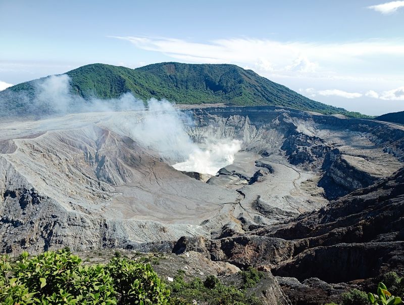
Costa Rica packs an extraordinary amount of volcanic geology into a small country, and Poas is one of its most accessible examples. Located within Poas Volcano National Park in the central highlands, it sits roughly 37 kilometers north of Alajuela and within easy reach of the San Jose region.
Small eruptions were continuing during August and early September 2026, including events that produced ash and ballistic material around the crater. Because of that, visitor access to the crater overlook depends entirely on current safety conditions set by Costa Rican authorities.
When access is open, visitors can walk a short paved trail from the park entrance to a viewpoint directly above the crater, which holds one of the world’s largest and most acidic crater lakes. The surrounding cloud forest is home to wildlife including resplendent quetzals, making the park worthwhile even on days when crater access is restricted.
Reservations and timed entry slots are required, and conditions should always be checked through OVSICORI, Costa Rica’s official volcanic monitoring agency, before visiting.
Cotopaxi, Quito Region, Ecuador
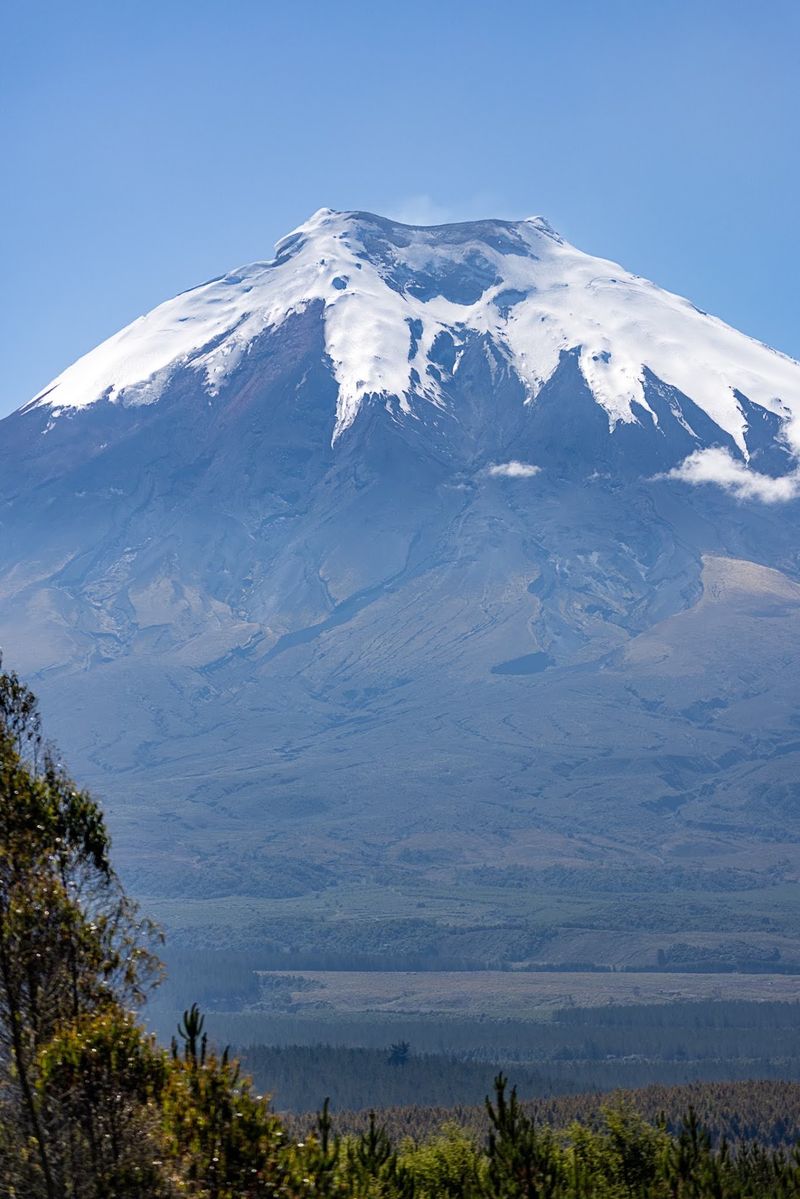
At roughly 5,897 meters, Cotopaxi is one of the highest active volcanoes in the world and one of the most recognizable peaks in South America. Its glacier-covered, nearly symmetrical cone is visible from Quito on clear days, rising above the Avenue of the Volcanoes that runs through Ecuador’s highland corridor.
Ecuador’s monitoring agency listed Cotopaxi at its lowest alert level in June 2026, but its eruptive history, including significant activity in 2015, means it stays under continuous observation. The volcano sits within Cotopaxi National Park, which covers a large area of high-altitude paramo habitat south of Quito.
A paved road inside the park leads to a parking area at around 4,600 meters, making it one of the more accessible high-altitude volcanic environments in the Andes without requiring technical climbing skills. From there, a steep trail reaches the Jose Rivas refuge at about 4,800 meters.
The park also supports wildlife including Andean condors, wild horses, and deer across its open grassland landscape.
Share this story