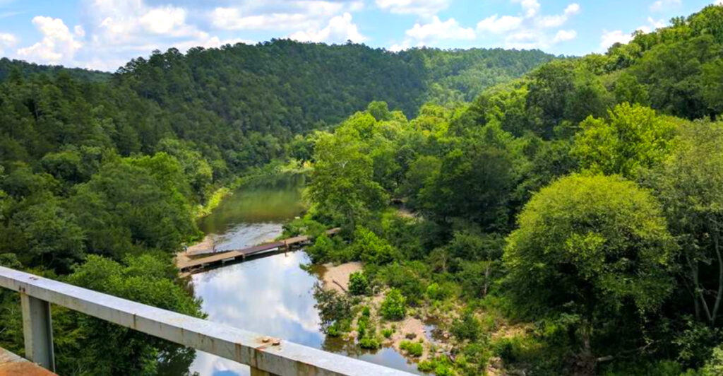
Class V whitewater, steep mountain terrain, ancient rock formations, nearly 20 miles of backcountry trails, and primitive riverside campsites make this southwestern Arkansas park one of the state’s wildest outdoor escapes. At its heart is the Cossatot River, whose name comes from a French phrase translated as “crushed head” or “skull crusher” – a fitting description for a waterway famous for powerful rapids and technical drops.
The biggest spectacle arrives at Cossatot Falls, where the river drops roughly 33 feet in only one-third of a mile. Class IV to V rapids with names like Washing Machine and Devil’s Hollow Falls challenge experienced paddlers, while hikers and spectators can experience the drama safely from shore. Away from the whitewater, visitors find clear swimming holes, rare wildlife, rugged trails, fishing, and primitive camping beneath remarkably dark mountain skies.
Here’s why Cossatot River State Park-Natural Area has become one of Arkansas’ most unforgettable destinations for hikers, paddlers, campers, and travelers searching for a genuinely wild escape.
Finding the Park: Location, Address, and First Impressions
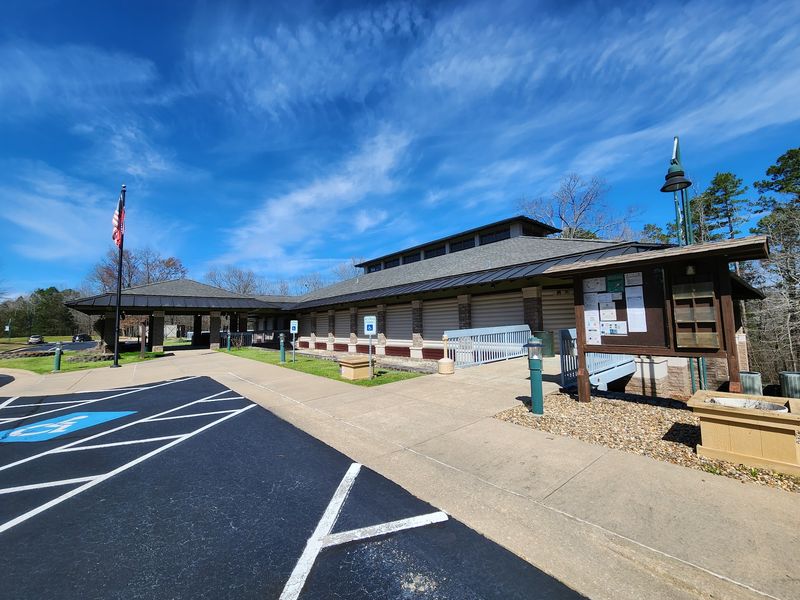
The moment you turn off the main highway and catch your first glimpse of the Ouachita Mountains rising through the tree line, you already sense that this place is different. Cossatot River State Park-Natural Area sits at 1980 US-278, Wickes, AR 71973, straddling the borders of Polk and Howard counties in southwestern Arkansas.
The visitor center is right where US Highway 278 crosses the Cossatot River, making it easy to spot from the road. The building is modern, well-maintained, and staffed with genuinely helpful rangers who seem to love talking about the park.
The surrounding landscape greets you with dense hardwood forest, rocky ridgelines, and the distant sound of moving water. Cell service fades quickly once you leave the main road, so arriving with a downloaded map and printed directions is a smart move. The park is open daily from 8 AM to 5 PM, and the phone number is 870-385-2201 if you need to check conditions before making the drive.
The Name That Tells the Whole Story
Not many rivers come with a built-in warning label, but the Cossatot does. The name is an anglicized version of the French phrase “casse-tete,” which translates directly to “crushed head” or “skull crusher.” Early French explorers did not choose that name casually.
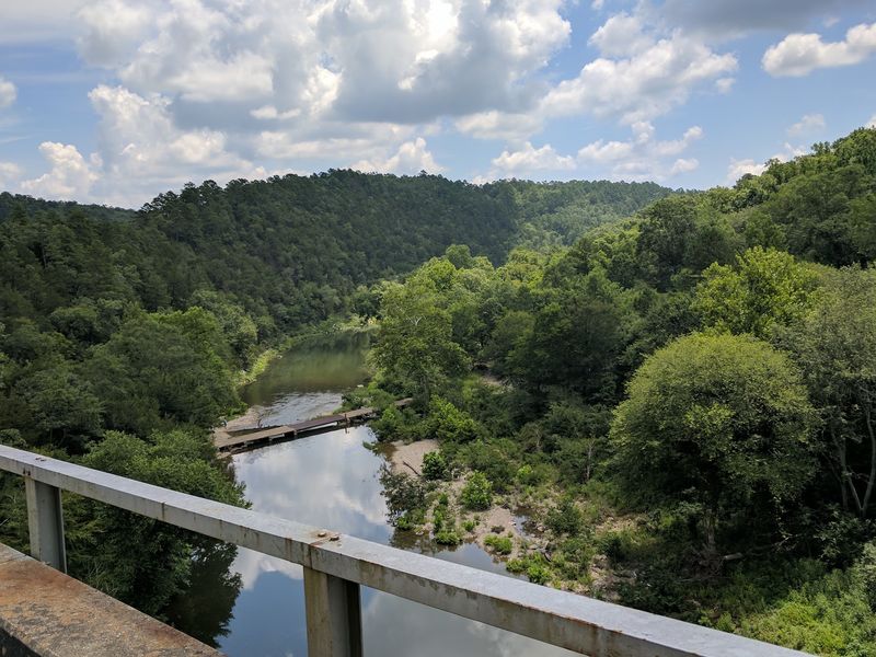
The river earned it through sheer force, carving through the Ouachita Mountains with a relentless energy that makes even experienced paddlers pause before putting in. It holds dual designations as both an Arkansas Natural and Scenic River and a National Wild and Scenic River, protecting roughly 12.5 miles of its most dramatic corridor.
Those designations are not honorary titles. They reflect a genuine commitment to keeping this waterway free from development and degradation. The result is a river that still behaves exactly as it always has, unpredictable, powerful, and breathtakingly clear when the rains hold off. That combination of raw character and protected status makes the Cossatot genuinely one of a kind in the entire mid-South region.
The Geology Beneath Your Boots
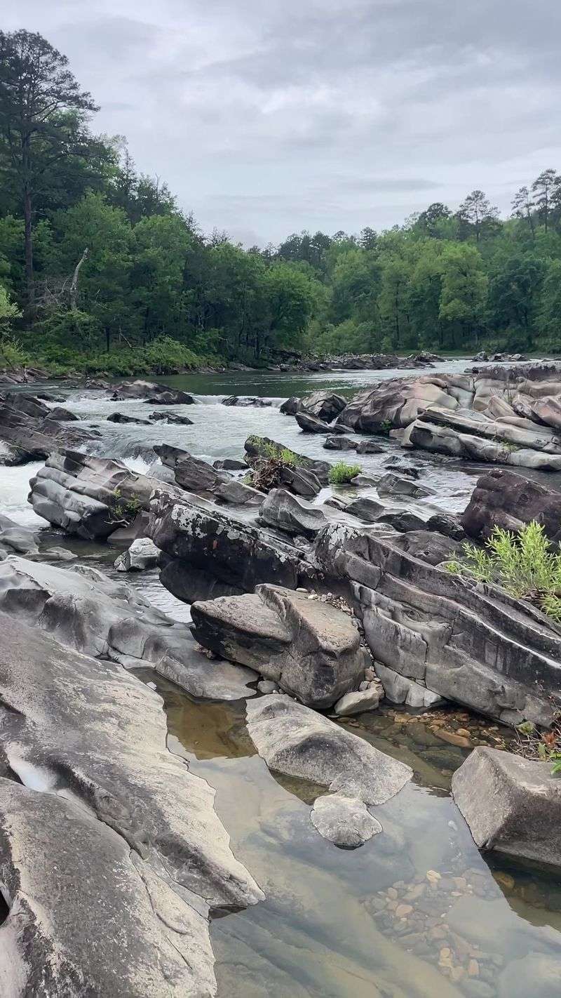
Few state parks in Arkansas offer such a vivid geology lesson underfoot. The bedrock here is primarily Stanley Shale, composed of hard quartzite, sandstone, and siliceous shales dating back to the late Mississippian and early Pennsylvanian periods, roughly 300 million years ago.
What makes the scenery so visually striking is that these rock layers are not flat. The Ouachita Orogeny, an ancient mountain-building event, compressed and tilted the sedimentary formations dramatically, creating those distinctive angled strata you see jutting out of the riverbanks and canyon walls.
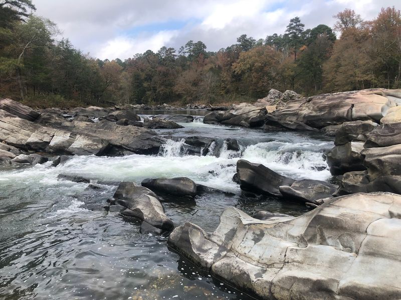
At Cossatot Falls, the tilted sandstone layers are almost theatrical in their presentation, stacked at steep angles as the river pours over and between them. The substrate throughout the river channel is mostly bedrock, rubble, and enormous boulders, which is exactly what creates the technical rapids that draw expert paddlers from across the country. Standing on those ancient rocks, you can almost feel the weight of geological time pressing up through the soles of your boots.
Cossatot Falls: The Crown Jewel of the Whitewater
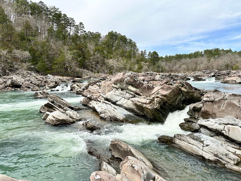
Cossatot Falls is the section of river that gives the park its legendary reputation, and nothing quite prepares you for seeing it in person during high water. The river drops approximately 33 feet in elevation within a third of a mile, crashing over a series of back-to-back ledges with the kind of relentless intensity that makes your pulse jump just watching from the bank.
The rapid sequence includes drops with names like Washing Machine and Devil’s Hollow Falls, each one presenting a distinct challenge requiring precise maneuvering. The overall run through the falls section is rated Class IV to V, strictly reserved for highly experienced paddlers who understand river hydraulics and carry proper safety gear.
For non-paddlers, the falls are still absolutely worth visiting. A rocky, gravel road leads down to the area, and from the bank you can watch the water perform its full spectacle without ever getting wet. The roar alone is something worth hearing, a low, continuous thunder that reverberates through the canyon walls and settles somewhere deep in your chest.
Rapids With Names That Mean Business
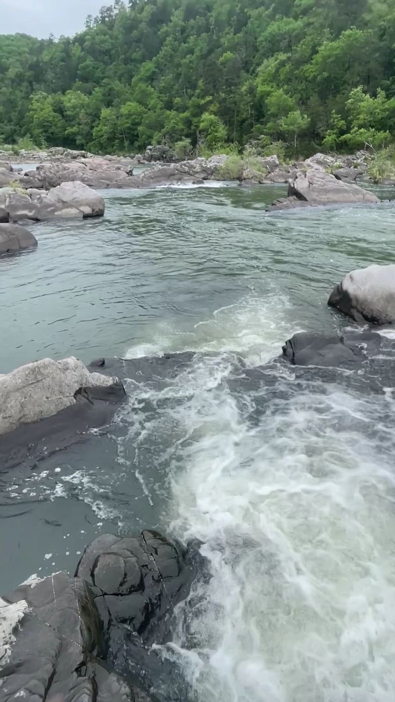
Beyond the falls, the Cossatot River offers a full menu of named rapids that read like a highlight reel of technical paddling. Zigzag, the Esses, B.M.F., Whiplash, Shoulderbone, Deer Camp Rapid, and Devil’s Hollow Rapid each present their own distinct personality and challenge level.
The variety keeps even seasoned paddlers on their toes, because no two drops behave the same way. Some require precise ferry angles, others demand aggressive forward strokes through powerful hydraulics, and a few reward patience and careful scouting before committing to the line.
The overall run through the main whitewater corridor covers around 12.5 miles of river, with rapids ranging from Class III all the way up to Class V depending on water levels. The park does not offer equipment rentals or shuttle services, so paddlers need to organize their own logistics well in advance. That self-sufficiency requirement adds another layer to the adventure, making a successful run feel genuinely earned rather than handed to you on a guided platter.
When to Visit for the Best Whitewater
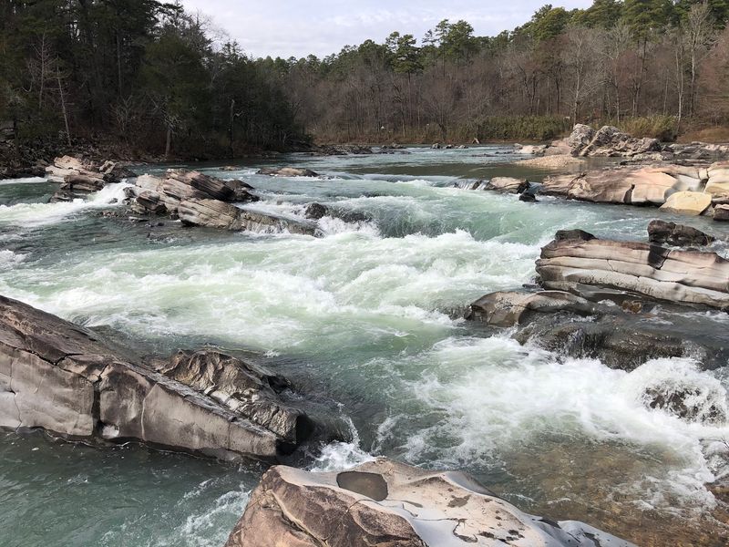
Timing a visit to the Cossatot for whitewater is less about picking a month off a calendar and more about watching the sky. The river is entirely rainfall-dependent, meaning its character can shift from a gentle float to a roaring Class V torrent within hours of a significant storm.
The prime window for serious paddling typically runs from late autumn through early spring, when the watershed receives the most consistent precipitation. Winter and early spring storms can push water levels into the ideal range for tackling the bigger rapids, and the cooler temperatures keep the crowds manageable.
During summer and dry spells, the river drops considerably, scaling back to Class II or III in some sections and opening up opportunities for swimming, snorkeling, and casual floating between the pools. Checking real-time river gauge data through the U.S. Geological Survey before heading out is genuinely essential, not just helpful. Arriving to find the river too low for paddling or dangerously high for safe travel are equally frustrating outcomes that a quick data check can easily prevent.
Trails That Take You Deep Into the Ouachitas
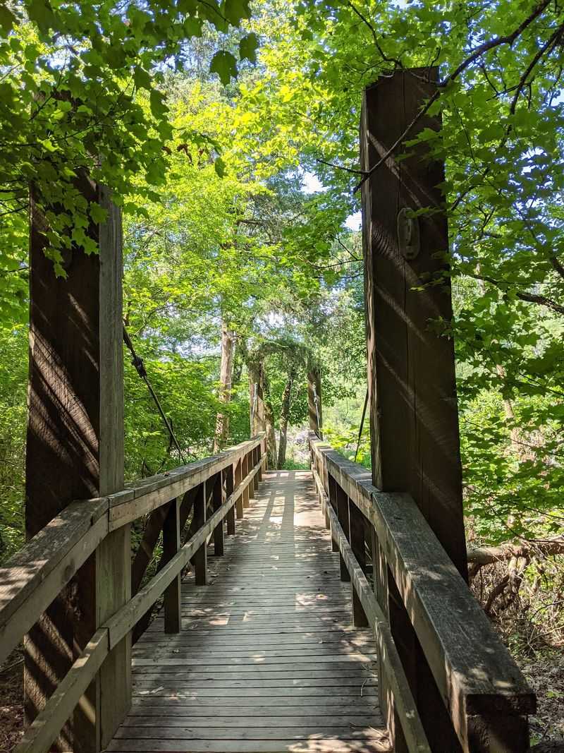
The park’s trail network stretches nearly 20 miles through some of the most rugged and rewarding terrain in southwestern Arkansas. The flagship route is the River Corridor Trail, a 12.5 to 14 mile path that runs alongside the Cossatot through the heart of the canyon, crossing numbered bridges and passing a series of waterfalls and wildflower-covered glades along the way.
The Harris Creek Trail offers a more manageable 3.5-mile loop that moves through dry shale pits, mature shortleaf pine forests, and hardwood stands before delivering a panoramic overlook of the river far below. Hikers regularly spot white-tailed deer and armadillos along this route, and the trail is well-marked enough to follow confidently without a guide.
For shorter outings, the 0.75-mile Brushy Creek Nature Trail and the 0.5-mile Waterleaf Interpretive Trail provide accessible options for families or visitors with limited mobility. The interpretive trail includes educational signage and partial ADA accessibility, making it a genuinely welcoming entry point into the park’s natural story. Good waterproof footwear is strongly recommended on every route here.
Primitive Camping Under a Mountain Sky
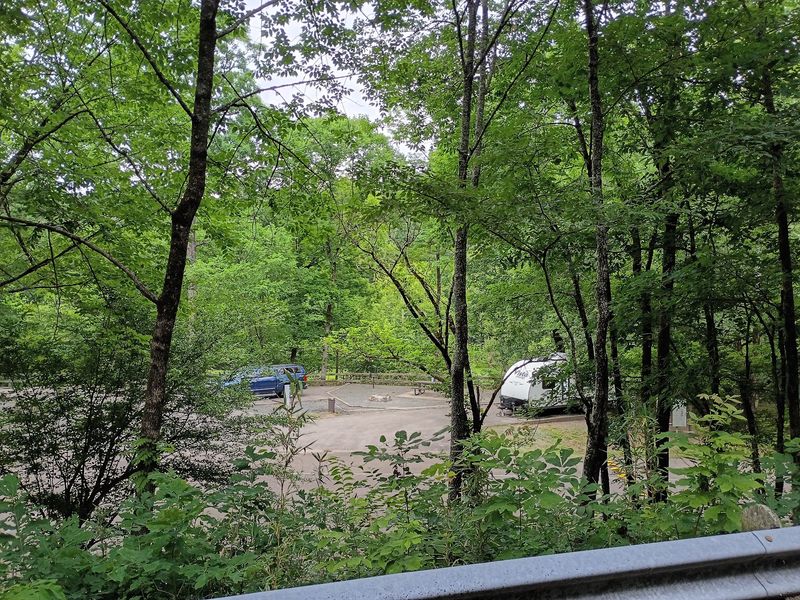
Camping at this park is a genuinely rustic experience, and that is precisely its appeal. All sites are primitive, meaning no electrical hookups, no water connections, and no RV facilities. What you get instead is a tent site steps from the river, complete silence after dark, and a sky full of stars unobstructed by light pollution.
The Cossatot Falls Area has six to seven sites clustered near the rapids, putting you close enough to fall asleep to the sound of moving water. The Sandbar Area offers seven to fifteen spots with a slightly different riverside atmosphere, while the Ed Banks Area provides one or two quieter sites for those seeking extra solitude.
Groups can reserve the River Ridge Group Camp, which includes a pavilion, fire pit, grill, vault restrooms, and river access. Potable water is not available anywhere in the camping areas, so packing in all your drinking water is non-negotiable. Raccoons are active at night, and securing your food before sleeping is a lesson most campers only need to learn once.
The Visitor Center: More Than Just a Map Stop
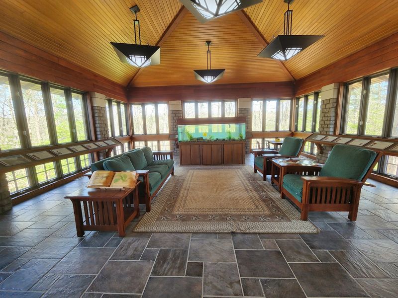
Built in 2004 and positioned right where US-278 crosses the river, the visitor center here is a surprisingly rich destination on its own. The building houses a large exhibit gallery covering the park’s geology, plant life, animal inhabitants, and human history, presented in a way that holds the attention of both kids and adults.
Two classroom and laboratory rooms host interpretive programs throughout the year, led by park staff who clearly enjoy their subject matter. The wildlife observation room is a quiet highlight, offering a discreet vantage point for watching local fauna without disturbing them. Photographers tend to linger there longer than anywhere else in the building.
The gift shop carries park-themed merchandise and Arkansas-focused items, though prices lean toward the premium end. Clean restrooms, a playground adjacent to the building, and a helpful front desk staffed with rangers who answer questions thoroughly round out the experience. The center is an ideal first stop before heading deeper into the park, especially for first-time visitors who want context before hitting the trails or the water.
Rare Wildlife and Plants Found Nowhere Else
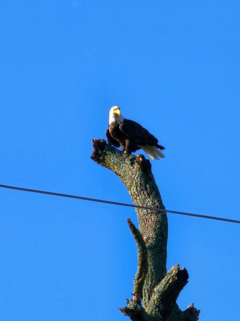
The protected status of this river corridor has created a refuge for species that struggle to survive anywhere development has taken hold. The leopard darter and the Ouachita Mountain shiner are two fish species found almost exclusively in the southern Ouachitas, and both depend on the clean, fast-moving water that the Cossatot provides.
Their presence in these waters is a reliable indicator of exceptional water quality, which says a great deal about how well the park has been managed since its establishment in 1988. Above the waterline, the forest supports white-tailed deer, wild turkeys, and occasional black bears that move through the backcountry quietly enough that most hikers never realize they are nearby.
Botanists and wildflower enthusiasts will find the spring season particularly rewarding. Browne’s waterleaf, a plant with a limited range in the Ouachitas, blooms along the interpretive trail in April and May, drawing visitors who make the trip specifically to see it. The combination of rare aquatic species, forest mammals, and endemic plants makes this park a genuine biodiversity hotspot tucked into a corner of Arkansas most people have never visited.
The History Behind the Park’s Creation
The story of how this park came to exist is worth knowing, because it almost did not happen. Much of the land along the upper Cossatot was owned by the Weyerhaeuser Corporation, a forestry products company, and the idea of creating a protected natural area here first surfaced in 1974 after the Arkansas Environmental Preservation Commission was formed.
Negotiations with Weyerhaeuser began in 1975, but the company had legitimate concerns about whether state agencies could manage such a heavily used and dynamically challenging recreation area. Progress stalled for nearly a decade until the Arkansas Department of Parks and Tourism joined the effort in 1984, proposing a joint management model that finally addressed those concerns.
The Nature Conservancy stepped in to acquire and hold the land in trust while state funding was secured. On November 19, 1987, Governor Bill Clinton announced the acquisition, and the park officially entered the state system on February 19, 1988. A later donation of 160 acres from Arkla Gas Company expanded its footprint further. That long road to protection makes every hike and every river run here feel like something worth celebrating.
Share this story