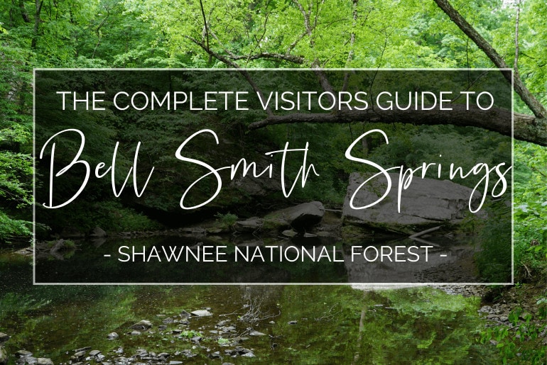
Bell Smith Springs is one of our favorite places to visit in Shawnee National Forest. With its cascading bluffs, cliff jumping, 8 miles worth of trails and so much more it’s not hard to see why so many other people like it as well!
In this complete guide to Bell Smith Springs, we’re going to cover everything you need to know for your visit. We’ll cover the best places to park, where to camp, the best hikes and so much more.
We’ve also provided links on Google Maps to most of the main features in Bell Smith Springs to make it super easy to find exactly what you’re looking for!

Must-See Things at Bell Smith Springs
Natural Bridge
Natural Bridge is without a doubt a must-see stop at Bell Smith Springs. As you might have guessed, it’s a natural bridge This natural formation is made entirely out of rock, it’s 125 feet long and 30 feet high. It’s also the largest natural bridge formation in Shawnee National Forest.
You can get to Natural Bridge on the yellow trail which is also known as the “Natural Bridge Trail”.
Here it is marked on Google Maps for you. For more information check out the Bell Smith Springs Trails section below.

Devil’s Backbone
Devil’s Backbone is another must-see stop when you visit Bell Smith Springs. There are a ton of really cool rock formations in Bell Smith Springs, but Devil’s Backbone is pretty unique.
It’s two really large triangle-shaped boulders that come out of a pool of water. They’re in line with each other and so when you look at them from the side they look like the spine of some giant creature coming out of the pool!
Devil’s Backbone is on the White Trail and it’s relatively close to the turnaround loop.
Here it is marked on Google Maps for you. For more information check out the Bell Smith Springs Trails section below.
Civilian Conservation Corps Stairs
If you park at the main parking area for Bell Smith Springs then you’re only a short walk away from these iconic stairs. They’re made from local stone and were hand-laid by members of the Civilian Conservation Corps in the early 1930s.
In response to The Great Depression, President Roosevelt created the New Deal. It created jobs in a lot of different ways, but one of them was creating and then funding the Civilian Conservation Corps. The CCC worked on projects that improved access to many of our country’s parks and conservation areas so that more people could enjoy them.
These stairs were one of those projects and now almost 100 years later we’re still enjoying the work that the CCC did.
Check out the map below for the exact location of the stairs.
Planning a trip to Shawnee National Forest? We’ve got some detailed guides to help you plan an unforgettable trip!
Bell Smith Springs Map
Getting to Bell Smith Springs
Bell Smith Springs is located in Shawnee National Forest in Southern Illinois. The closest town is Eddyville, IL which is about 15 minutes away. Harrisburg and Vienna are the two closest larger towns.
They are also the only places to get gas in the area and it will take you about an hour round trip to get to Bell Smith Springs and back. We recommend making sure you have plenty of gas before leaving town.
Harrisburg, IL to Bell Smith Springs (21 Miles – 30 Minutes)
Head South out of Harrisburg on State Road 145 for 14 miles then turn right on Water Tower Road. Follow that for 2.5 miles. Then take a right on Ozark Rd. In just over a mile you’ll take a Left onto Bell Smith Springs Road which will lead you straight to the main parking lot.
Vienna, IL to Bell Smith Springs (24 Miles – 37 Minutes)
Head North out of Vienna on State Road 45 for 12 miles. Take a Right on Ozark road and go another 8 miles until you reach Bell Smith Springs Road. Take a Right and that will take you right to the main parking lot.
Parking Near Bell Smith Springs
Parking in Bell Smith Springs is only allowed in designated parking areas. We have never had an issue finding a parking spot, but on popular weekends it can get a little crowded!
We’ve listed out all of the places you’re allowed to park so that you can spend more time swimming and hiking and less time driving in circles looking for a place to park!
1st Main Parking Area
On Bell Smith Springs Rd past Redbud Campground is the first main parking area. There is space for quite a few cars, but since this is the main parking area it, generally speaking, fills up the quickest. You can see its exact location on the map above.
2nd Main Parking Area
If you come to the first parking area and there aren’t any spaces left don’t despair just yet! If you keep driving past that first parking area down to the turn-around loop you find some additional parking down there. Check out the map above to see its exact location.
You’re not allowed to park in the grass around the turnaround loop, so make sure you’re still parking in a designated parking spot.
Redbud Campground
If both of the main parking areas are full then head back up Bell Smith Springs Rd to the Redbud Campground. If you’re camping then you can just park at your campsite, but if you’re not there are still about 4 parking spots right by the main gate.
Unfortunately, you can’t park in the campground unless you’re going to be camping there. I’ve marked the parking area in front of the campground on the map above.
Hunting Branch Trail Head
If the campground is also full there is one last place you can check! The Hunting Branch Trailhead has parking but is a little further away. Keep heading back down Bell Smith Springs part towards Ozark Rd and there will be a road that goes off to the left.
At the end of that road is the Hunting Branch Trail Head and you’ll find some additional parking there. You can hike the White trail as well as the Red trail from there. This parking area and the trailhead are also marked on the map above.
The Best Time to Visit Bell Smith Springs

The Bell Smith Springs trail system is open year-round which makes it a great place to visit any time you want to get out in nature for a little bit!
The Redbud campground however is only open from March 15th until December 15th.
Most people visit Bell Smith Springs in the summer and fall months since swimming, cliff jumping and hiking are the most popular things to do.
If we’re planning on camping then we like to visit Bell Smith Springs in the Spring because it’s not quite as hot which makes it nicer for sleeping in a tent.
If we aren’t planning on camping then we like to go later in summer. The weather is a bit warmer but that makes jumping into the nice cool water that much more refreshing!
If at all possible try to visit Bell Smith Springs during the week, especially if you’re planning on camping. It’s a super popular area to visit in Shawnee National Forest and so most of the year it gets pretty packed on the weekends.
The campground is first-come-first-served and you can’t make reservations, so keep that in mind if you plan to come camping on a popular weekend.
Bell Smith Springs Cliff Jumping
There are so many wonderful things to do at Bell Smith Springs, but cliff jumping is certainly one that you won’t want to miss!
We love all of the great hiking trails that Bell Smith Springs has to offer, but nothing really beats that feeling of jumping off a boulder or a tree into that cool blue water when you’re soaked in sweat from hiking all morning!
There are a few different areas with deeper pools that are great for swimming and jumping. The Devil’s Backbone area of the white trail is one of our favorites. It’s relatively close to either one of the main parking areas.
Here it is marked on Google Maps for you.
The biggest thing to remember with cliff jumping is safety! I cannot stress this enough, please be safe and keep an eye on children as well.
Here are a few good rules to follow whenever you’re cliff jumping.
- Always check the water depth before jumping into any pool (Even if you have jumped there before – water levels change)
- Look for fallen trees and rocks that may be hidden under the water
- Watch your step, rocks that are good for jumping are often wet from other jumpers
- NEVER dive head first
- Do not allow children to jump unattended
Bell Smith Springs Camping
The Redbud Campground will be your best option for Bell Smith Springs camping. The campground is located right on Bell Smith Springs Rd and you’ll drive right past it if you’re going to either one of the main two parking areas.
Redbud Campground is open from March 15th until December 15th. The campground is $10 per night for up to 8 people per site. We really like camping at the Redbud Campground because the sites are nice and spread out.
Unfortunately, there are no full hook-up RV sites and most of the sites are better for smaller campers or tent camping.
There are vault toilets, but no flushing toilets or showers so be prepared for more primitive-style camping.
There is drinking water available at the campground. As you come into the campground there is a hand pump located between the first two sites on the right side of the road.
If tent camping isn’t really your thing there are plenty of great rental cabins. We wrote an article about some of our favorite cabins in the area so be sure to check those out!
Bell Smith Springs Trails
Bell Smith Springs has 8 miles of interconnected trails that will take you all through this beautiful section of Shawnee National Forest. There are four official marked trails and we’ve detailed them all out for you here.
Several of the trails are known by different names. To make things easy for you we’ve also included links to AllTrails so you can read reviews for each of the trails and even follow a guided GPS if you would like.
Most of the trails in Bell Smith Springs are very well marked and so as long as you’re paying attention, getting lost normally isn’t an issue.
If you would like an overview of all the trails in the area, here is the USDA Bell Smith Springs Trail map.
Please note that the Bell Smith Springs trails are for hiking use only. No equestrian use is allowed.
Hill Branch Trail (Mill Branch Trail)
- Blazes – Red
- Trailhead – Hunting Branch Trailhead
- Distance – 1.6 Miles
- Difficulty – Moderate
- View on AllTrails
This beautiful hike takes most people less than an hour to complete. It’s a loop that goes down one side of Hill Branch Springs before crossing the creek and coming back along the other side.
It takes you past an old grist mill site along the creek and while it’s not as popular as some of the other trails in Bell Smith Springs it’s an awesome hike and a great option if you’re visiting on a weekend and you’re looking for a trail that won’t be quite as crowded.
The White Loop
- Blazes – White
- Trailhead – Either Main Parking Area or Hunting Branch Trailhead
- Distance – Approximately 1.2 Miles
- Difficulty – Moderate
- View on AllTrails
The White trail connects all three of the other trails together and so it’s a great place to start no matter what you would like to see! It will take you to the Civilian Conservation Corps stairs, Devil’s Backbone, the Jumping Spring, and Bay Creek.
On the USDA Bell Smith Springs trail map, the White Loop is actually marked in black and not listed as its own trail. The AllTrails map helps a little because they have the main section of the trail listed, but not all of the smaller sections and the places where it connects to the other trails.
I would recommend looking at both of them to get a better understanding of what all you can see on the White Loop.


Natural Bridge Trail (The Yellow Trail)
- Blazes – Yellow
- Trailhead – Bell Smith Springs Main Parking Area
- Distance – 0.9 Miles
- Difficulty – Easy
- View on AllTrails
The Natural Bridge trail will take you to the Natural Bridge, but you’ll also make a stop at the scenic overlook and you’ll go down the Civilian Conservation Corps stairs.
You’ll hike along Bay Creek for a little while and the entire loop can be done in less than 45 minutes or so. It’s also a great area of Bell Smith Springs for bird watching so keep an eye out and you might spot some of Illinois’ most beautiful bird species.
If you would like to see Natural Bridge but you don’t have time for the entire hike you can take a shortcut. Right after you cross the creek the trail will split going to the left or the right. If you keep going straight back towards the bluff you will see Natural Bridge from below.
And if you would like to see the top of the bridge follow the trail off to the right. You will see some stone steps and then some metal rung stairs where you can climb straight up to the top.
Sentry Bluff Trail (Eagle Trail, Eagle Lookout Trail, The Blue Trail)
- Blazes – Blue
- Trailhead – Bell Smith Springs Main Parking area or Redbud Campground Entrance
- Distance – 2.7 Miles
- Difficulty – Moderate
- View on AllTrails
This trail goes by many different names, but regardless of what name you want to call it, it’s an absolutely beautiful trail! It takes you much further down Bay Creek than the Natural Bridge trail and if you follow the whole loop all the way around it will even take you past Boulder Falls.
Plan more than an hour if you’re going to hike all of the Blue Trail. It’s also a good idea to bring some shoes that you don’t mind getting wet because you’ll need to cross the creek a few times.
It’s also a good idea to consider the weather if you’re going to hike the Blue Trail. The Bay Creek water level changes quite a lot and so if it’s been raining recently it’s not uncommon for the water to be higher than most hiking boots. The trail also takes you through several areas that have lots of smooth rocks and so they can get very slippery if they’re wet or covered in ice or snow.
Rules and Safety
Bell Smith Springs is one of the most beautiful areas of Shawnee National Forest and a must-see stop for anyone visiting the area! But being mindful of a few things while you visit will not only help keep the area beautiful for the next visitor but also help keep you safe in the process!
Remember to please follow Leave No Trace principles whenever you’re out enjoying nature.
Here is a shortlist of the official rules for visiting Bell Smith Springs.
Rules
- No Glass allowed in Bell Smith Springs Area
- Bell Smith Springs is open 6:00am – 10:00pm
- No camping outside of Redbud campground
- Pets must be on a leash at all times
- Foot traffic only (No horses)
- Parking is only allowed in designated parking areas
- Enforced by US Forest Service, Illinois Conservation Police, Pope County Sheriff’s Department
Accidents can happen easily out in nature so here are a few basic tips to help keep you safe while you visit this beautiful park!
Safety
- Hunting is allowed out in the general use area so be careful during hunting season
- Copperhead snakes are present in the area
- Poison ivy is extremely common in Bell Smith Springs so be mindful on the trails
- Some hiking areas are extremely slippery so watch your step on smooth rocks
- The jumping area can be dangerous and deaths have occurred (please read the jumping safety tips above)
- Most gas stations are about 20 miles away so make sure you have plenty of gas before you go
Things to Do Near Bell Smith Springs
You could easily spend several days at Bell Smith Springs and if you have the time we definitely recommend camping at least one night at the Redbud Campground so that you’ll have at least two days to explore everything that Bell Smith Springs has to offer!
If you want to see some other things in the area, below are just a couple of our favorite spots in Shawnee National Forest that are very close to Bell Smith Springs.

Burden Falls
Burden Falls is only about a ten-minute drive from Bell Smith Springs and so it’s an easy stop to add in! It’s a short 1.2 mile out and back hike but the waterfall is actually very close to the parking area. We like stopping here for a snack or a picnic since it’s super easy to get to and nice to sit by.

Jackson Falls
We are huge fans of waterfalls and so it shouldn’t come as much of a shock that our second recommendation would be another waterfall!
Jackson Falls is actually a little closer to Bell Smith Springs than Burden Falls, but because you have to go all the way around Ozark Rd it will take you closer to 25 minutes to get there from Bell Smith Springs.
When you arrive at the falls you will be on top of the waterfall and it’s a beautiful view down over the valley. Getting down to the bottom is possible but not easy. Check out our article for more tips about hiking at Jackson Falls.
Jackson Falls is also super popular for rock climbing and so there are designated anchor points all around the waterfall for rock climbing. Obviously, DO NOT attempt this unless you are an experienced rock climber and have the proper safety equipment.
Now Go Enjoy Bell Smith Springs!
So there you have it, everything you need to know about visiting Bell Smith Springs. We have been several times and always look forward to our next opportunity to go back.
The Bell Smith Springs Recreation Area has so many amazing rock formations and buffs, and cool places for swimming packed into one area we’re sure it’s going to become one of your favorite places to visit in Shawnee National Forest as well.
We hope this article about visiting Bell Smith Springs helps you plan your trip. We would love to connect with you! You can learn more about us here or read more of our recent blog posts here. Also, follow us on Instagram (@UnearthTheVoyage) and Facebook to see what we are up to next!


