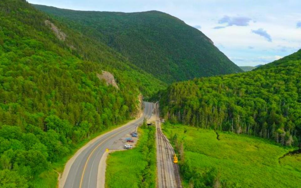
There is a place in New Hampshire where granite cliffs rise so steeply on both sides of the road that the sky above you shrinks to a narrow ribbon of blue. The mountains here do not ease you in gently.
They announce themselves all at once, and the effect is genuinely jaw-dropping. A single road threads through this ancient pass, and along the way you get cascading waterfalls visible right from your car window, forests that turn into a blaze of color every fall, and trails that lead to some of the most rewarding summit views in all of New England.
What makes this place even more fascinating is the human story woven into the landscape, a tale of a family, a landslide, and a house that survived when its owners did not. Keep reading, because this mountain pass has far more layers than its dramatic first impression suggests.
Where the Notch Begins: Location and First Impressions
Crawford Notch State Park sits at 1464 US-302, Hart’s Location, NH 03812, tucked deep in the White Mountains of New Hampshire. The park covers approximately 5,775 acres and is open 24 hours a day, every day of the year, which means you can catch it at sunrise, at dusk, or even under a full winter moon.
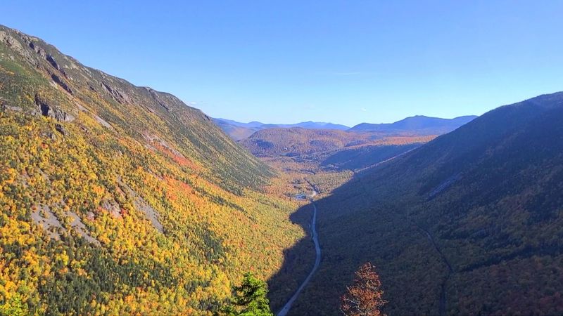
The moment you turn onto Route 302 and the cliffs begin to close in around you, the scale of this place hits differently than any photograph prepares you for. Granite walls rise hundreds of feet on either side, and the road narrows as the valley tightens around it.
The park sits within the broader White Mountain region, making it a natural anchor point for exploring some of the most spectacular terrain in the northeastern United States. You can reach it from North Conway to the south or from Twin Mountain to the north, and both approaches deliver their own brand of scenery.
How This Pass Got Its Name
Back in 1771, a hunter named Timothy Nash was tracking a moose through the White Mountains when he stumbled upon a dramatic gap in the ridgeline that nobody had formally documented before. That accidental discovery opened up a route through terrain that had previously blocked travel between the coast and the interior of New Hampshire.
The Crawford family took that discovery and built something lasting from it. Abel Crawford and his son Ethan Allen became the first permanent settlers in the notch, establishing inns for travelers and blazing trails up into the surrounding peaks.
In 1819, they created the Crawford Path, which is widely considered the oldest continuously maintained hiking trail in the United States.
The family’s legacy is so deeply embedded in the landscape that the notch itself carries their name. Their entrepreneurial spirit turned a rugged mountain gap into a destination, and that tradition of welcoming visitors has never really stopped since those early inn-keeping days.
The Willey House Story That Still Sends Chills
In August 1826, a catastrophic landslide roared down the mountainside above a small homestead in the notch. The Willey family, sensing danger, fled their house and headed for what they believed was a safer location nearby.
The slide split around the house itself and left it completely intact, but the family was not so fortunate.
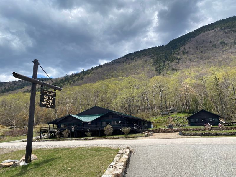
The Willey House still stands today as a historical site within the park, and it draws visitors who want to see the spot where one of New England’s most haunting pioneer stories unfolded. Interpretive displays near the site explain the events of that night and give context to the landscape around it.
Standing in front of that modest structure and looking up at the steep slope above, you get a visceral sense of how exposed early settlers were to the raw power of these mountains. The site is free to visit and sits right along Route 302, making it an easy and genuinely moving stop on any drive through the notch.
Driving Route 302: A Scenic Road That Does Not Disappoint
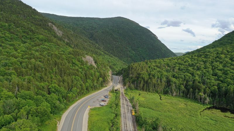
Route 302 through Crawford Notch is recognized as part of the Presidential Range Tour National Scenic Byway, and that designation is not just a formality. The road winds past sheer cliff faces, broad mountain views, and roadside waterfalls that appear almost without warning as you round each bend.
Many people who have driven this route suggest heading from east to west to catch the most dramatic perspective of the notch opening up ahead of you. That said, the westbound approach from Twin Mountain has its own appeal, as you descend into the valley and the cliffs rise progressively on either side.
Pull-offs are scattered along the route for the major viewpoints and trailheads, but planning ahead with a map is genuinely useful here. Some of the most striking roadside views have no formal parking area, so knowing in advance where you want to stop makes the drive far more enjoyable.
The Conway Scenic Railroad also passes through, and spotting the train against the fall foliage is a bonus worth watching for.
Arethusa Falls and the Waterfall Network That Runs Through the Park
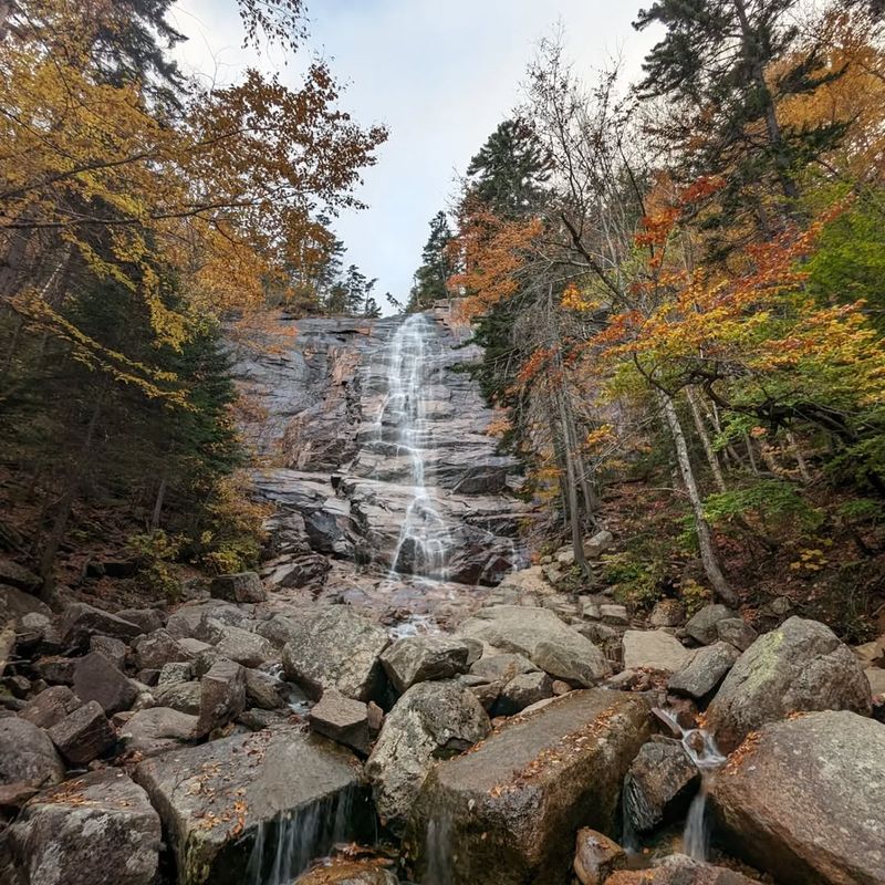
New Hampshire’s tallest single-drop waterfall lives inside this park. Arethusa Falls drops approximately 200 feet down a granite face, and the hike to reach it covers about 1.5 miles one way through forest that feels genuinely wild.
After a good rain or during spring snowmelt, the volume of water coming over that ledge is something you feel in your chest.
Ripley Falls offers a different experience, dropping about 100 feet and sitting closer to the road on a shorter trail. Silver Cascade is the most accessible of the bunch, visible directly from Route 302 without leaving your car, though stopping to stand near it is worth the few extra minutes.
Venture onto the Bemis Brook Trail and you will find Bemis Falls and Coliseum Falls waiting along a path that feels like it was designed to reward the curious. Each waterfall in this park has its own character, its own sound, and its own best season, making multiple visits feel like discovering entirely different places each time.
Trails for Every Type of Hiker, From Strollers to Summit Seekers
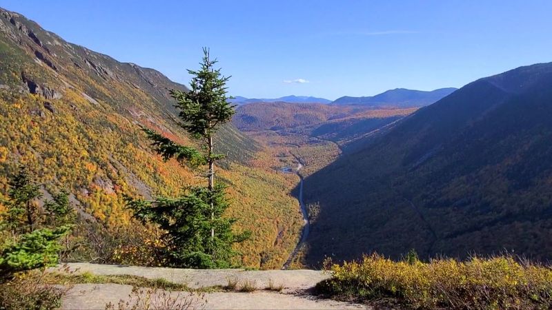
Mount Willard is the trail that earns the most enthusiastic recommendations from families visiting the park. The hike covers about 3 miles round trip with manageable elevation gain, and the payoff at the top is a full panoramic view looking straight down into the notch.
It is the kind of summit view that makes you feel like you have earned something real without requiring technical climbing skills.
For hikers looking to push harder, Mount Webster, Mount Jackson, and Mount Crawford all offer steeper climbs with sweeping alpine vistas that open up above the treeline. The Frankenstein Cliff Trail is another option that delivers serious elevation and rewarding perspectives of the valley below.
Shorter loops like the Pond Loop Trail and the Willey House Falls Trail give visitors who prefer a gentler pace a chance to experience the forest without committing to a full mountain climb. Sturdy footwear and plenty of water are non-negotiable on any of these routes, since trail conditions can shift quickly and services within the park are limited.
Wildlife Sightings That Make Every Visit Feel Unpredictable
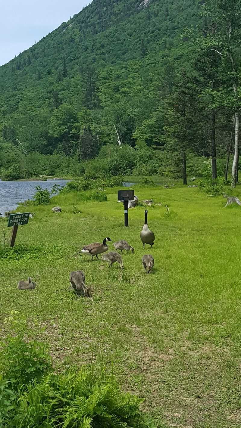
The forests and river corridors of Crawford Notch create habitat that supports an impressive range of wildlife. Moose sightings are not guaranteed, but they happen often enough that keeping your eyes on the tree line along the Saco River corridor is always worthwhile.
White-tailed deer are a more frequent presence, particularly in the early morning hours when the park is quieter.
Black bears inhabit the surrounding mountains, and while encounters are rare, the park’s remote character means you are genuinely in their territory. Beavers work the waterways, and porcupines occasionally appear along trailsides in a way that catches hikers completely off guard.
Birdwatchers find the park especially rewarding during migration seasons. Bald eagles, red-tailed hawks, and various owl species use the ridgelines and river valleys as travel corridors.
Dawn and dusk are consistently the best windows for wildlife activity, so arriving early or staying into the evening hours dramatically increases your chances of a memorable encounter beyond just the scenery.
The Geology Behind the Cliffs: What Ice Age Forces Left Behind
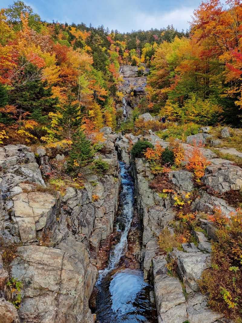
The word “notch” is a distinctly Northern New England term for a deep, narrow valley carved through a mountain range. Crawford Notch is a textbook example, shaped primarily by glacial activity during the last Ice Age when massive sheets of ice ground through the landscape and left behind the steep, U-shaped valley visible today.
The granite cliffs that define the notch walls are not just dramatic backdrops. They are remnants of some of the oldest rock formations in the region, sculpted over millions of years and then exposed by glacial erosion.
The Saco River, which originates from Saco Lake near the top of the notch, has continued that carving work on a smaller scale ever since.
Old-growth forest patches survive in protected corners of the park, particularly along the Dry River drainage and sections of the Webster Cliff Trail. Trees over 150 years old grow in these areas, with bark textures and canopy structures that feel unmistakably ancient compared to the second-growth forests found across most of New England.
Fall Foliage Season: When the Notch Puts on Its Best Show
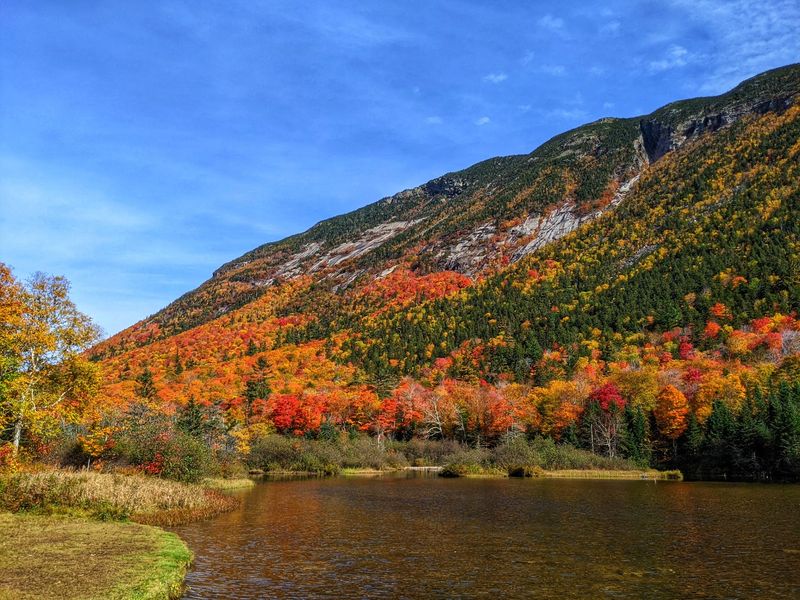
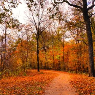
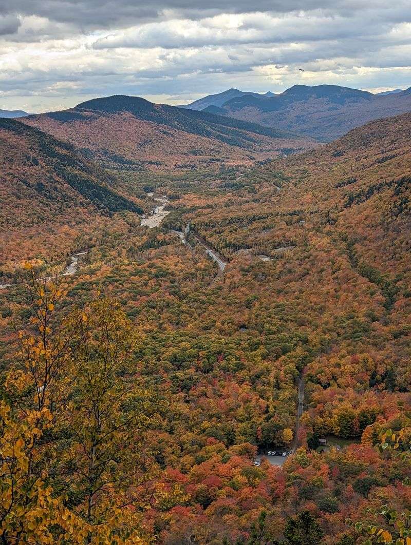
Peak foliage in Crawford Notch typically arrives between late September and mid-October, and the effect of those colors pressed between granite cliff walls is genuinely hard to overstate. The reds, oranges, and golds fill the valley from the road level all the way up to the ridgelines, creating a layered panorama that photographers and painters return to year after year.
The Conway Scenic Railroad runs through the notch during foliage season, and watching a vintage train roll through a corridor of blazing autumn color while granite peaks loom above is one of those experiences that earns its own category of memorable. Arriving early on weekends during peak weeks is essential, as parking areas fill quickly and the crowds along Route 302 can slow the scenic drive considerably.
Hiking during foliage season adds another dimension to any trail in the park. The color changes at different elevations, so a single hike from valley floor to summit passes through multiple stages of the seasonal transformation, each one distinct from the last.
Camping at Dry River: Sleeping in the Heart of the Notch
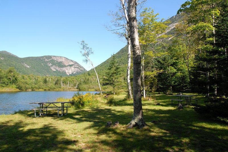
The Dry River Campground offers 36 wooded sites tucked into the core of the park, and the sound of the river running nearby is the kind of white noise that makes sleeping outdoors feel effortless. Sites can accommodate RVs and trailers up to 40 feet in length, and flush toilets and showers are available during the main season, which typically runs from late May to late October.
Primitive camping is permitted during the shoulder seasons in early spring and late fall, weather permitting, which opens up the park to visitors who prefer a quieter, less crowded experience. The campground serves as an excellent base for day hikes, waterfall visits, and wildlife watching without requiring a long drive back to a hotel each evening.
Campfire evenings here come with a bonus that urban campgrounds simply cannot match: the night sky above Crawford Notch is exceptionally clear. The park’s remote location away from major city light pollution makes stargazing a legitimate activity, and on a clear autumn night, the Milky Way is visible with the naked eye.
Practical Tips for Getting the Most Out of Your Visit
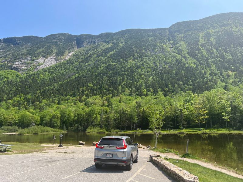
Cell service inside the notch is unreliable regardless of your carrier. Downloading offline maps before you leave and writing down the park phone number, (603) 374-2272, are small preparations that prevent big frustrations once you are in the valley.
The park’s website through nhstateparks.org carries current information on trail closures and seasonal facility availability.
Dogs are welcome in designated areas of the park as long as they stay on a leash and owners clean up after them. The Willey House itself does not permit dogs inside, so plan accordingly if you are traveling with a pet.
Restrooms are available at several wayside areas along Route 302, though not at every trailhead.
New Hampshire acquired most of the land for Crawford Notch State Park in 1913, specifically to protect the scenery from the widespread logging that was stripping other parts of the White Mountains at the time. That conservation decision is the reason the cliffs, forests, and waterfalls remain as intact as they are today, and arriving with that history in mind makes the whole landscape feel even more worth protecting.
Share this story