Some of my favorite Oregon memories started with a wrong turn and a hunch that something special waited at the end of a bumpy road. This one began with gravel dust, no phone signal, and a growing feeling I might be lost for good.
Then the trees appeared, so tall and so old that I forgot about the drive entirely. If you love the hidden corners of Oregon that most travelers never find, this forest belongs on your list.
A Pocket of Ancient Forest West of Salem
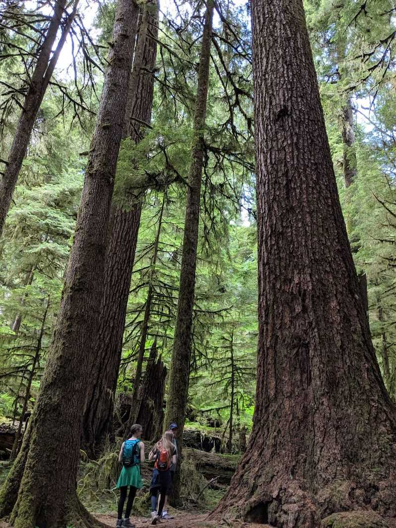
Tucked deep in the Oregon Coast Range, about an hour and a half beyond the small town of Falls City, sits one of the state’s quietest treasures. Valley of the Giants Outstanding Natural Area is a nature preserve managed by the Bureau of Land Management.
Visitors often call it a timber treasure hidden west of Salem, and that description fits. The protected area covers roughly 51 acres of old growth forest, a small island of towering Douglas fir and hemlock surrounded by working timberland.
Small does not mean forgettable, though. Inside this pocket, the trees rise like living skyscrapers, the air feels cool and damp, and rushing water sings below the trail.
One hiker described it as Oregon’s off-the-beaten-path jewel, and plenty of others agree. For anyone who craves a place that feels untouched and far from the usual weekend crowds, this valley delivers that rare sense of discovery.
Echoes of Valsetz and a Vanished Lake
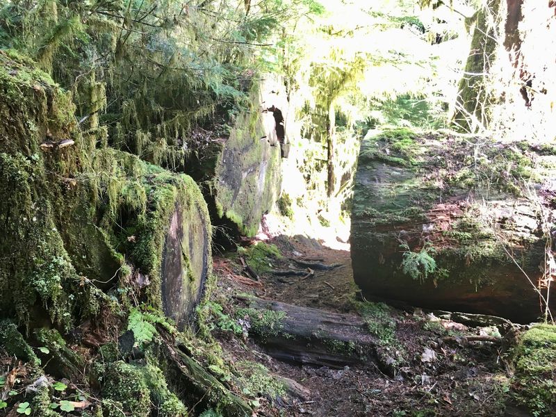
History hides along the road to the giants. On the way in, drivers pass through Valsetz, an open area where an old foundation filled with boulders still sits beside the gravel.
Long ago, this spot held a company town and a lake. One curious visitor only made sense of the landscape after studying 1974 USGS quad maps at home, which still showed the old lake bed and the town.
Newer maps leave those landmarks out, so the history feels almost secret now.
Logging shaped everything around here. The region is a checkerboard of private and public land, and you will cross back and forth between them repeatedly.
Many hikers mention feeling a little wistful, imagining the whole Coast Range once looked like this valley. That contrast makes the surviving grove feel even more precious, like a window into what the forest used to be before saws arrived.
Why Your Map App Will Lead You Astray
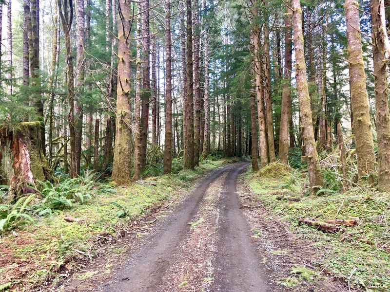
Here is the honest truth: do not follow Google. Nearly every visitor repeats that warning, and for good reason.
The app tends to send people toward a road that clearly states there is no access to the valley.
The only reliable route starts in Falls City. Cross the bridge and keep going straight on the main gravel road through Valsetz, then cross a bridge over the Siletz River.
At a fork, look for a sign marked 100 heading uphill to the right, and keep following the main road from there.
Expect the trip to take about an hour and a half each way from Falls City, covering around 30 miles of back logging roads. Some folks have spent much longer after a wrong turn or two.
Visitors suggest grabbing written directions from the BLM, using AllTrails directions, or picking up a brochure with a map at the BLM office in Salem.
Little Orange Signs That Say VOG
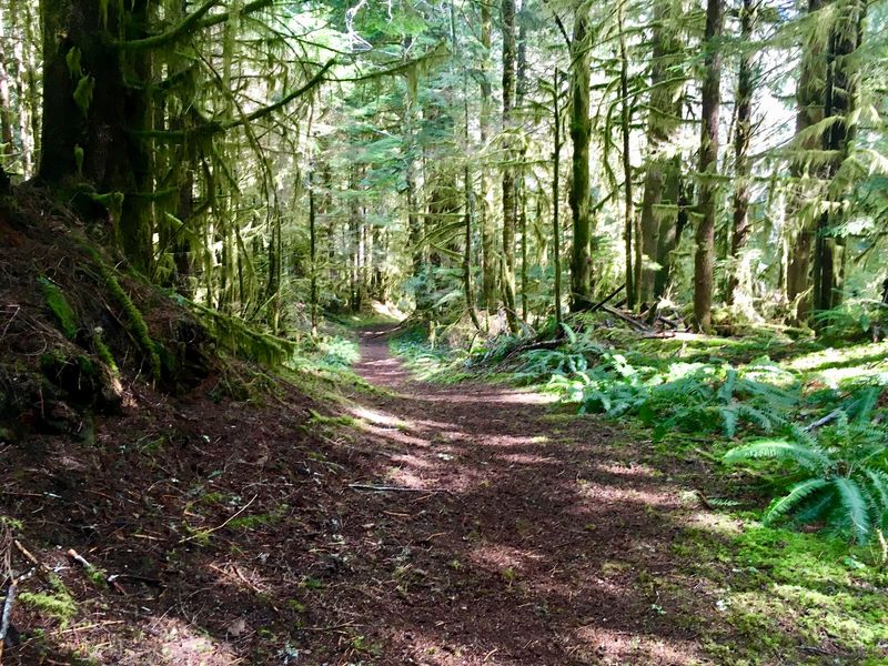
Spotting your first tiny orange marker feels like finding treasure. Those road delineator signs, printed with the letters VOG and an arrow, quietly confirm you are on the right track.
Do not expect them right away, though. Several travelers mention seeing no signage until roughly halfway up the mountains.
After that, the markers become your best friends, and the final one points you right toward the trailhead.
Preparation matters because cell service vanishes out here, and Falls City offers none either. Smart visitors download the area map before leaving home and call ahead to check conditions.
Most forks along the way are gated, which helps you spot the main road, but logging crews sometimes close sections or remove signs. Some hikers found the route only after asking a local for help.
Treat the search as part of the fun, and pack patience along with snacks.
Gravel, Gates, and Ground Clearance
A rental sedan once made it all the way, but its driver bottomed out more than once. That story sums up the drive nicely.
Many visitors recommend a vehicle with six to eight inches of ground clearance.
Opinions vary on the roads themselves. Some say they are in better shape than typical forest service roads, while others call the final 30 minutes bumpy.
Narrow single-lane stretches are common, and active logging means big trucks move fast and hold the right of way.
Gates add another wrinkle. One posted notice says the gate closes one hour after sunset, so plan your timing with care.
Travelers have occasionally found roads closed for logging operations or a landslide, including closures reported in 2021 and 2023. Having a backup plan is wise.
Still, many drivers say the scenery along the way, with rivers and mountain views, makes every rattle worthwhile.
The Steel Footbridge Over the Siletz
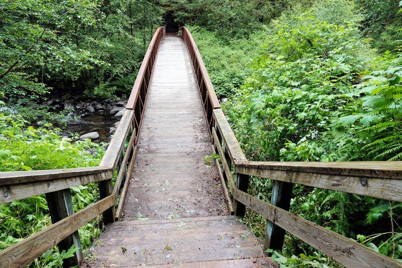
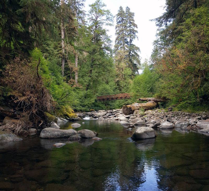
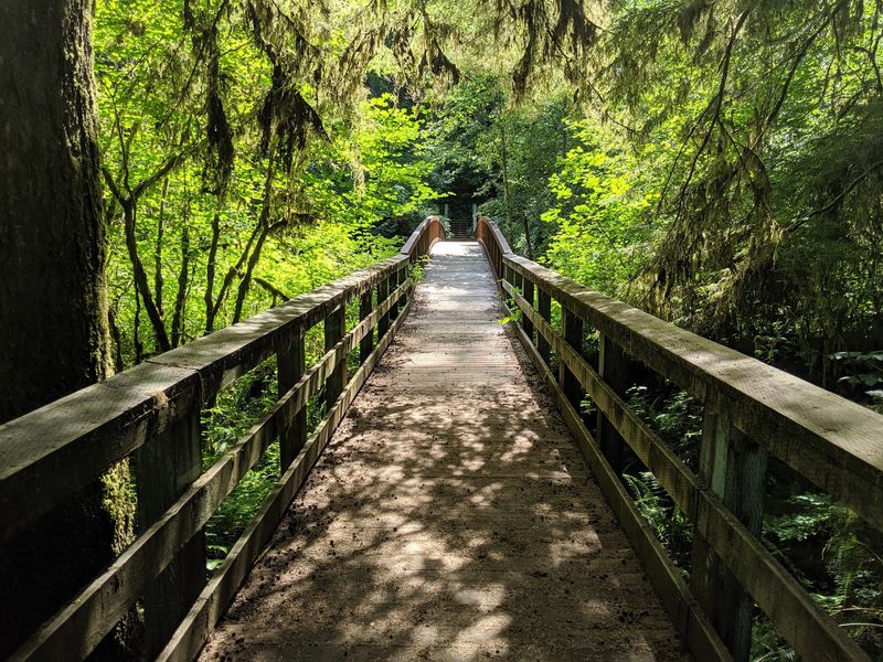
Twenty-five years ago, a Boy Scout camped near this trailhead and crossed the river on a giant old growth log. Today, that same hiker returns to find an engineered steel footbridge standing in the very same spot.
The bridge marks the first highlight of the hike. You walk down into the valley and cross over the Siletz River, where clear water rushes beneath your feet.
It is a lovely place to pause, catch your breath, and snap a few photos before the climb.
Water shows up throughout the trip, too. The Siletz is beautiful enough that drivers often stop along the road just to admire it.
One visitor even suggests taking a summer swim. Along the loop, hikers mention around five mini bridges crossing creeks, each adding a little charm to the walk through the trees.
A Short Loop With Real Elevation
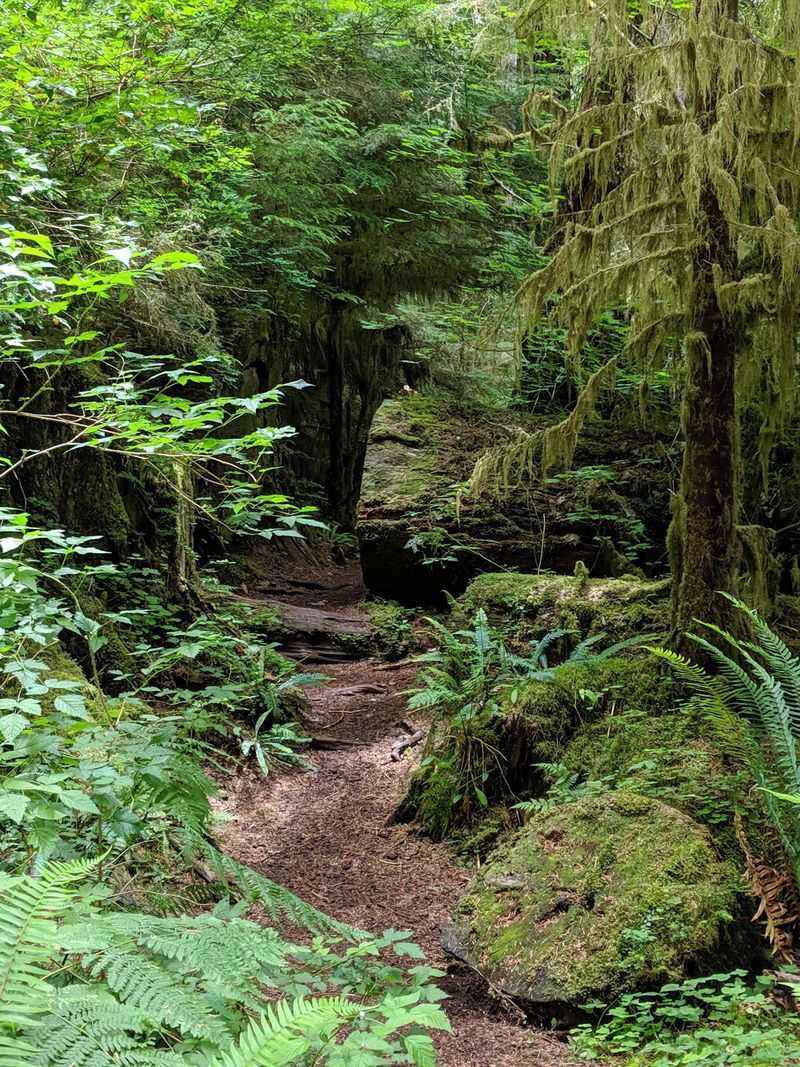
Numbers first: the hike runs about 2.2 to 2.5 miles round trip, with roughly 1,200 feet of elevation change. Most people finish in about an hour.
After the river crossing, the trail climbs up and around in a loop through the old growth before returning to the bridge. Then you hike back out.
Expect a mix of level stretches and steeper climbs that will get your heart pumping.
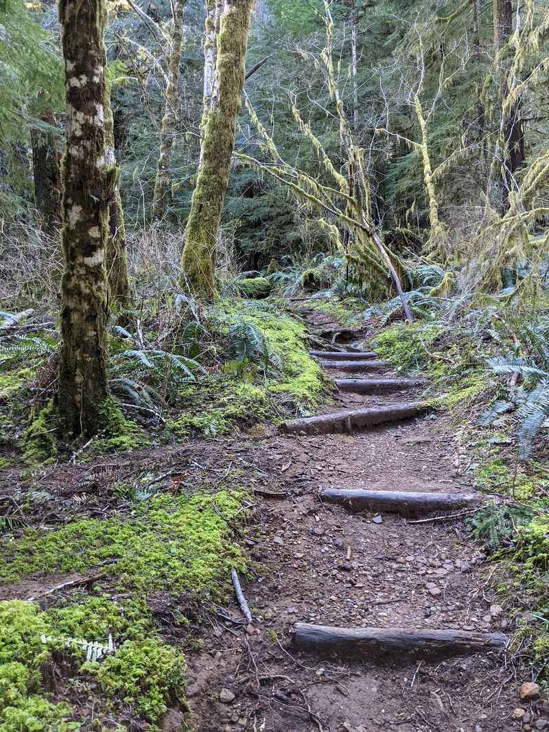
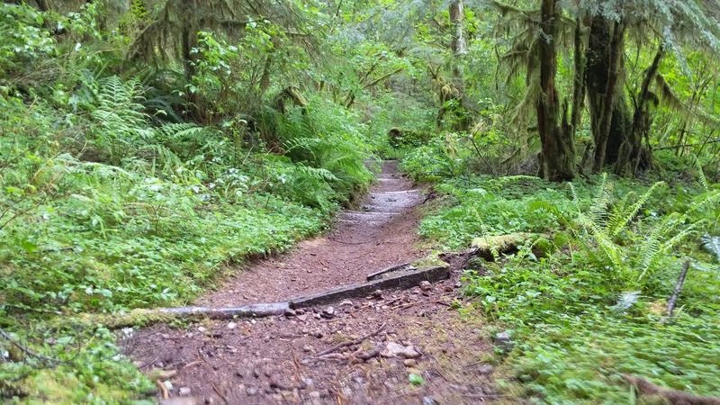
Hikers rate it somewhere between easy and moderate, leaning moderate. The trail is mostly well groomed, yet roots can catch your toes and rain turns some spots slick and muddy.
One visitor joked you should expect to land on your back pockets after a downpour. Winding paths through old fallen trees keep things fun, though a few unofficial side trails can confuse newcomers.
Sure-footed walkers will feel right at home, and sturdy shoes are always a smart choice.
Douglas Firs Older Than the Country
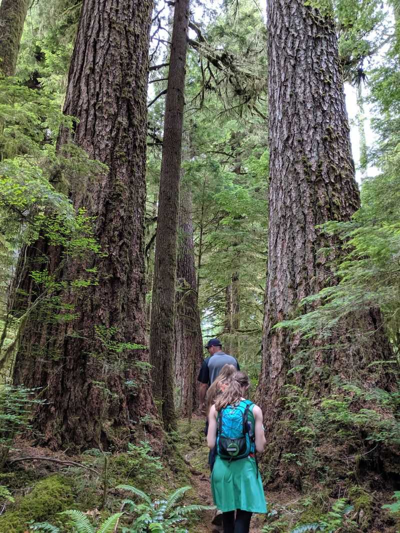
Did you know one tree here once ranked as the second largest Douglas fir in Oregon? It stood tall until it tipped over in 1981.
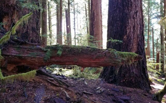
Even without that champion, the remaining giants leave visitors speechless. Many of the Douglas firs are around 400 years old, and hemlocks share the canopy.
As one hiker put it, these trees are older than the United States itself.
Photos never quite capture the scale. People who visit say you simply cannot sense the size or the colors until you stand at the base and crane your neck upward.
Some describe the place as a city of trees where every trunk is a skyscraper. Being close to something so ancient tends to feel humbling.
You might find yourself touching the bark, quietly counting the centuries, and realizing just how brief a human afternoon really is.
Moss, Shadow, and a Forest Hush
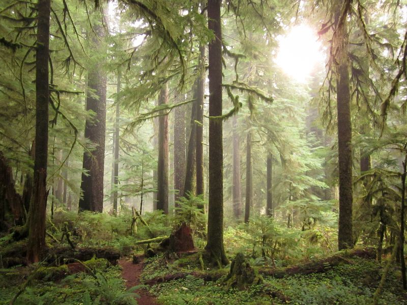
Sunlight barely sneaks through the canopy here. Everything wears a coat of green moss, and the earthy smell of an old rainforest fills the air.
Visitors describe a mood that is both calming and a little spooky. One group compared it to stepping into a mysterious movie set, while another hiker said leaving felt like having their soul cleansed.
Many mention a nostalgic sense of traveling back in time.
Wildlife adds to the magic. Elk wander through from time to time, and travelers report animals along the drive as well.
If you stay until dark, the night sky rewards you, since one visitor called the stargazing some of the best around. Fall and winter bring extra mist and drama, while summer offers long days for the trip.
Whatever the season, bring a beanie, because it can get chilly at the top.
Made for Patient Explorers
Crowd-haters, rejoice. One visitor found theirs was the only car in the lot, and another praised the valley for not being overrun with people.
On busier days, you might share the trailhead with four or five other vehicles.
This spot suits a certain kind of traveler. Adventurous Oregonians who enjoy a puzzle, love old trees, and do not mind a long gravel drive will feel richly rewarded.
Photographers should charge their devices fully, since you will snap plenty of pictures.
Solo hikers and pairs of friends both do well here. Kids who handle a moderate climb may love the bridges and giant logs, though steep, slippery spots call for steady feet.
Anyone who needs restrooms, easy navigation, or quick access might prefer somewhere else. For everyone else, the reward is a rare feeling of having the forest almost to yourself.
Hours, Contacts, and What to Pack
Good news for early risers and late planners: the preserve is listed as open 24 hours, every day of the week. Keep that gate notice in mind, though, since one sign says it closes an hour after sunset.
Before heading out, call the BLM at 503-375-5646 or check the official BLM website for the Valley of the Giants page. Road closures from logging and landslides have happened, so a quick check can save you a wasted trip.
Pack a lunch and plenty of water. There are no bathrooms at the trailhead, and parking fits only about five cars.
Bring a printed map, downloaded directions, a warm hat, sturdy shoes, and a fully charged phone or camera. Plan to make a whole day of it, because the drive takes far longer than the hike itself.
A Final Word on the Journey
Worth it? Almost every visitor says yes, even those who took two tries to arrive.
One group drove and drove, only to turn back ten minutes short, then returned and finally made it.
That persistence tells you everything. Valley of the Giants asks a lot from you, between confusing roads, missing signal, and the occasional closed gate.
In return, it offers ancient firs, a rushing river, moss-draped silence, and the sweet feeling of standing somewhere few people ever see.
Some visitors think it deserves national park status. Others simply treasure it as a quiet secret tucked into the Coast Range.
Either way, it remains a reminder of what Oregon’s forests once were. Plan carefully, start early, and leave room for wrong turns.
The giants have waited centuries, and they will happily wait for you a little longer.
Share this story