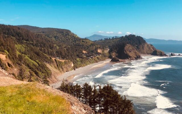
Oregon has a way of hiding its best drives in plain sight, and the Three Capes Scenic Route is one of the finest examples. Tucked between Tillamook and the coast, this roughly 40-mile stretch trades the busy highway for forest roads, ocean bluffs, and quiet bays that make stopping feel less like a choice and more like a reflex.
The scenery changes so often that the drive itself becomes the destination, not just the path to one. Whether you live here or you are finally making the trip, this route has a way of slowing things down in the best possible way.
The Three Capes Scenic Route turns 40 miles into a full coastal day
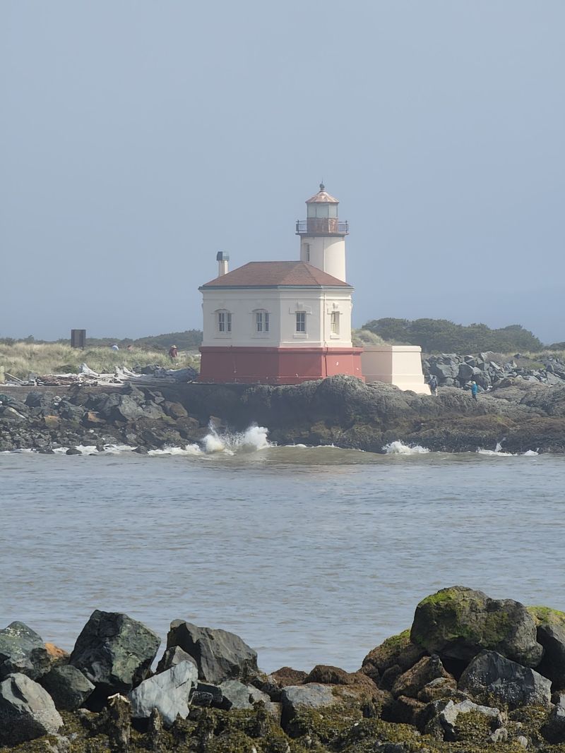
Forty miles sounds like a quick afternoon. On the Three Capes Scenic Route, that same distance regularly turns into a full, unhurried Oregon day, and most people who drive it would not have it any other way.
The Oregon Coast Visitors Association describes the route as a 40-mile stretch linking Tillamook and Cape Kiwanda through forests, coastal cliffs, and a generous sequence of stopping points, with Cape Meares, Cape Lookout, and Cape Kiwanda as its three defining landmarks.
Along the way, the route passes through or near Netarts Bay, Oceanside, Sand Lake, and Pacific City, each one offering something different from the last. The nominal driving distance covers the road itself.
Add a lighthouse walk, a beach scramble, a tidepool pause, or a slow lunch in Pacific City, and the math changes considerably.
That gap between distance and experience is exactly the point. The route works best when treated as a framework for noticing things rather than a corridor between destinations.
No unsupported promises about what it will do for your mood, but the opportunity to slow down and look around is genuinely built into every mile.
Why the route keeps interrupting your schedule
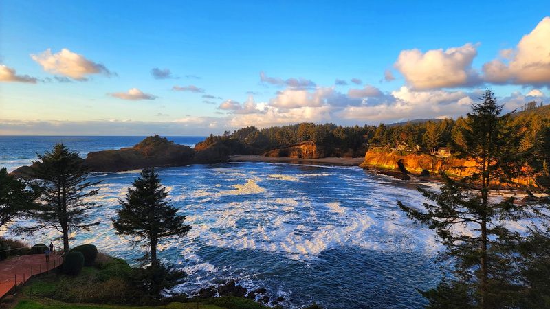
Something about the rhythm of this route makes a strict timetable feel almost beside the point. Forest closes in, then opens suddenly to a cliff-edge view of the Pacific.
A bay appears where you expected more trees. A beach access sign shows up just when your legs needed a stretch.
According to the Oregon Coast Visitors Association’s guide to the route, the Three Capes area weaves together forests, coastal cliffs, and multiple natural stopping points in a way that genuinely rewards slow travel. That variety is not accidental.
The landscape itself keeps changing the subject, which makes forward momentum harder to maintain.
Whether any of that translates into a measurable sense of calm depends on the person, the day, and what they brought with them into the car. The restorative quality is real for many travelers, but it is a subjective experience rather than a guaranteed outcome.
What the route does reliably is offer repeated reasons to look up, pull over safely, and stay a little longer than planned.
Cape Meares supplies the first convincing excuse to linger
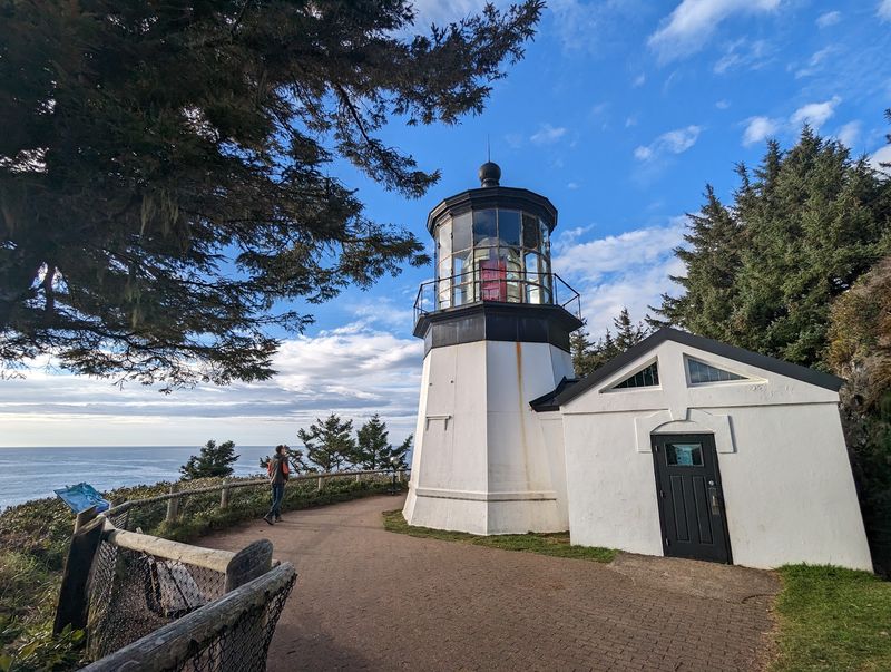
Cape Meares State Scenic Viewpoint tends to do what the best coastal stops do: make you forget you were going somewhere. The ocean overlooks alone are worth the turn, but the viewpoint layers on a historic lighthouse, a famously strange tree, and trails through some of the oldest forest on the Oregon coast.
According to Oregon State Parks, Cape Meares offers a 0.2-mile paved path to the lighthouse, a 0.1-mile path to the Octopus Tree, and a 0.8-mile forest trail that leads toward the largest Sitka spruce in Oregon. None of those are required activities, but each one is short enough to feel like a reasonable detour and substantial enough to justify the stop.
The lighthouse and its gift shop are listed as open daily from 11 a.m. to 4 p.m. through September 30, 2026, and a day-use parking permit is required. Both details are worth verifying before you go, since hours and permit requirements can change.
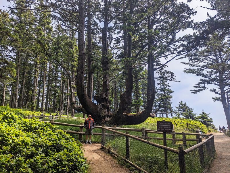
The Octopus Tree, for its part, is exactly as strange as it sounds: a massive Sitka spruce with multiple trunks spreading out from the base like something out of a coastal folktale.
Cape Lookout belongs on the map—but its facilities need checking
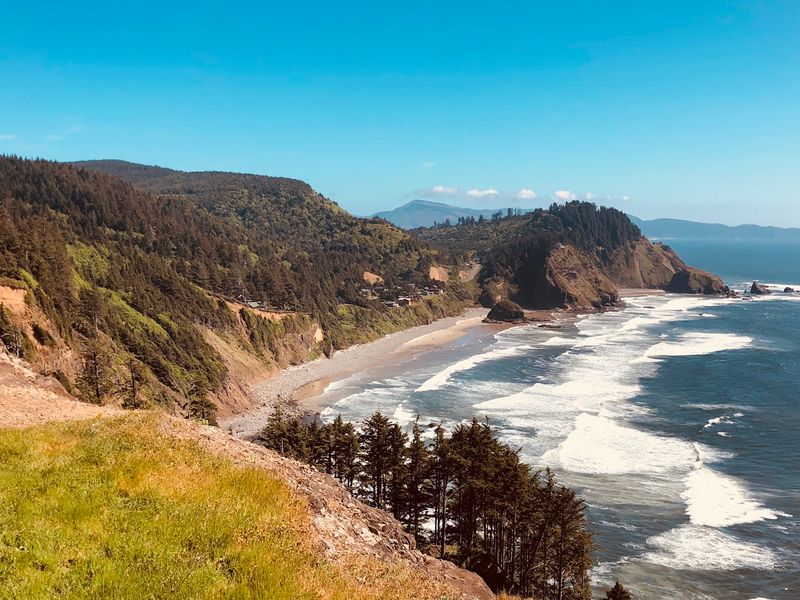
Cape Lookout is one of those places that earns its spot on the map through sheer physical presence. The cape itself extends more than two miles into the Pacific, flanked by forest and edged by cliffs that make the ocean feel genuinely close.
For many travelers, it represents the route’s most dramatic middle chapter.
Practical note before you count on it as a planned stop: Oregon State Parks reports that Cape Lookout State Park’s day-use area, campground, and hiker/biker camp closed on August 3, 2026, for park improvements, with construction closures subject to change as work progresses. That closure applies to specific facilities, not necessarily to the cape’s entire existence on the landscape, but it does affect what you can access and plan around.
Check the current official park page before treating Cape Lookout as a confirmed stop on your itinerary. Conditions on coastal routes change, and arriving to find a closed gate is a much less satisfying interruption than the kind the scenery provides on its own.
The middle miles make room for a slower kind of detour
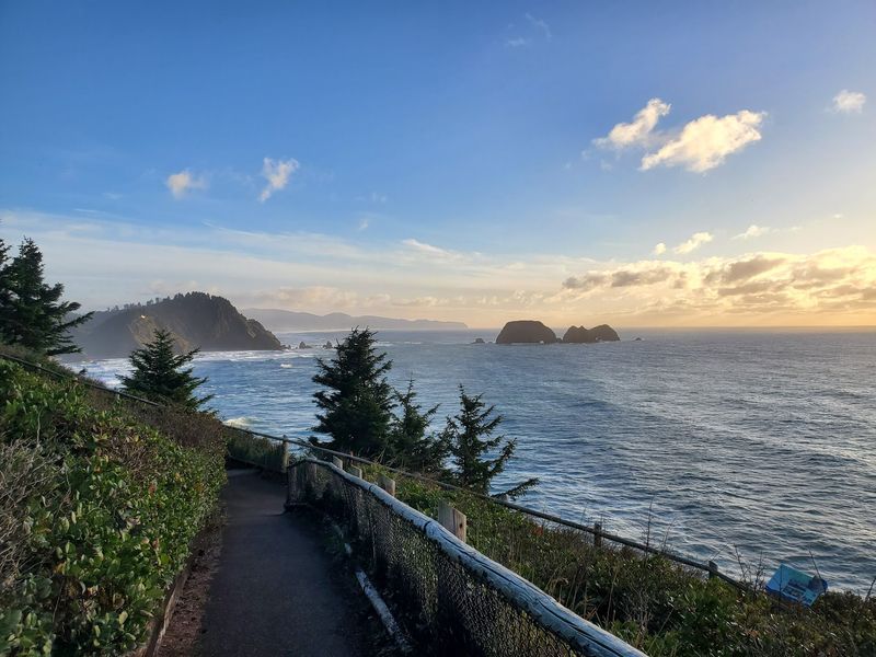
Netarts Bay shows up between capes with no fanfare and a lot of quiet. The bay is long and calm, edged by tideflats and a narrow spit, and it has a way of making the drive feel less like a checklist and more like a meander.
Oceanside, just north, adds a small-town coastal pocket worth slowing down for, with beach access and a tunnel through the headland that leads to a second, less-visited stretch of sand.
Sand Lake and Pacific City fill out the southern end of the middle section, each with its own character. The Oregon Coast Visitors Association notes that the route passes through all of these communities, which collectively prevent the drive from becoming a simple transfer between three headline capes.
One practical heads-up for this stretch: Sandlake Road has a one-lane section near McPhillips Beach regulated by an automated traffic signal. Build a delay into your expectations rather than a normal two-lane passage.
On a slow-day itinerary, a few extra minutes watching the dunes from a stopped car is not exactly a hardship.
Cape Kiwanda delivers the dramatic finish—with boundaries
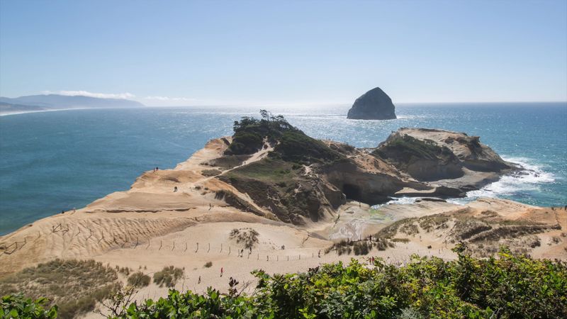
Pacific City comes into view and then, almost immediately, so does Cape Kiwanda. The sandstone headland rises above the beach in warm shades of orange and tan, and the contrast with the grey-green Pacific behind it is the kind of thing that makes people reach for their cameras before they have even parked.
The views from established viewpoints are genuinely striking: ocean swells rolling in, the offshore rock called Haystack Rock anchoring the horizon, and the flat-bottomed dory boats that launch directly from the beach here in a tradition unique to Pacific City. The steep sandy climb up the headland is popular, and the perspective from the top is broad and satisfying.
Stay behind the barriers and on established viewpoints or trails. Oregon State Parks warns that Cape Kiwanda’s sandstone cliff edges can crumble without warning and that sinkholes have formed in the dune area above underlying sea caves.
The headland is actively eroding, which means the dramatic scenery and the genuine hazard come from the same source. The finish is satisfying precisely because you respected what made it dramatic in the first place.
A scenic pause only works when you choose a safe place to stop
Wanting to pull over every few minutes is a completely understandable impulse on this route. Acting on it safely is the part that requires a little planning.
Marked viewpoints, designated parking areas, and signed turnouts exist precisely because the scenery tempts people to stop in places that were not designed for stopping.
The Oregon Driver Manual advises using the first safe turnout if traffic begins stacking up behind you, and ODOT guidance is clear that stopping in a travel lane is not an option, regardless of what just came into view around the bend. Pulling fully off the road, where visibility is good and the shoulder is stable, is the standard to meet.
A slower itinerary actually helps here. When you are not rushing between stops, the pressure to grab a view from wherever you happen to be eases up.
You can drive past an imperfect spot knowing the next one is not far ahead. That unhurried pace reduces the temptation to improvise, which makes the drive more enjoyable for everyone on the road, including the people behind you.
The calming effect is plausible, not a prescription
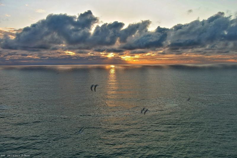
The title’s claim that this drive will leave you calmer than any meditation app is a fun piece of promotional framing, not a research finding. No study located compares the Three Capes Scenic Route with meditation apps, and no source establishes that a coastal road trip outperforms any specific stress-reduction tool for any specific person.
What the research does support is more modest and still genuinely interesting. A systematic review of nature exposure studies found lower physiological stress markers in all seven studies that measured them and lower self-reported stress in five of six studies that assessed it.
Separately, a study on stress recovery found that participants recovered from sympathetic stress faster during pleasant nature sounds than during urban noise. Those findings concern general nature exposure, often measured in brief, controlled settings, not a full coastal road trip.
Research on nature exposure therapies and meditation suggests both may offer some stress-related benefits, but they are not interchangeable, and neither replaces professional or medical care when that is what someone needs. The honest version of the promise is this: spending time outdoors, moving slowly, and paying attention to an interesting landscape may help some people feel less tense for a while.
That is a reasonable thing to hope for on a good Oregon drive.
The best itinerary starts with current conditions, not a rigid timetable
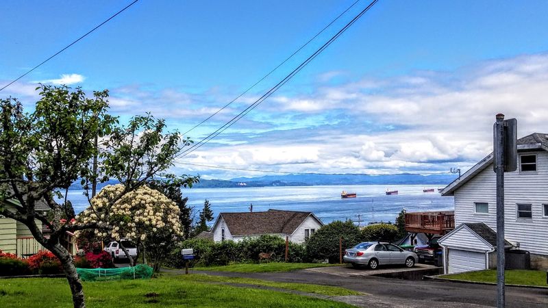
Before you back out of the driveway, spend ten minutes checking the actual state of the route. Coastal roads in Oregon can close, narrow, or change on short notice, and the Three Capes area is no exception.
ODOT’s TripCheck service provides current traffic incidents, road closures, cameras, and construction conditions for state routes and can flag anything that would affect your plan before you are already on the road.
The Cape Meares Loop is a good example of why current verification matters. The loop road was rebuilt after landslide damage and reopened in 2024, restoring the central connection in the historic Three Capes route.
That is good news, but the original road had experienced repeated slide problems, which is a useful reminder that coastal geology does not stay fixed just because a road was recently repaired.
Tide and beach conditions deserve their own check. Oregon State Parks advises visitors to check tide conditions before exploring beaches or tidepools, watch for sneaker waves, and stay away from unstable cliffs and bluffs.
Oregon’s coastal geology agency notes that average offshore wave heights roughly double from summer to winter storm conditions, so the season shapes what the beaches will actually look and feel like. Leave room in the schedule for safe, legitimate pauses, and the slow day takes care of itself.
Let the Three Capes take the time it takes
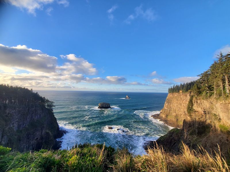
Forty miles of Oregon coastline, three capes, one bay, a lighthouse, an ancient tree, and more excuses to stop than any reasonable schedule allows. The Three Capes Scenic Route is not a guaranteed path to inner peace, and it does not outperform meditation apps in any study that exists.
What it offers is a 40-mile framework for paying closer attention to one of the more interesting stretches of coast in the Pacific Northwest.
How restorative that feels depends on the individual, the weather, what facilities are open, and whether you gave yourself enough time to actually stop. Nature exposure research suggests modest, short-term stress benefits are plausible for many people, but the experience is yours to shape.
Plan it as an intentionally spacious Oregon day, one where arriving late is fine and the detour is often the best part. The coast has been doing this longer than any app.
Share this story