Leaves do not change color because they are tired of being green. They change because shorter days tell trees to stop making chlorophyll, and the yellow and orange pigments that were hiding underneath finally get their turn.
Virginia is a great state to watch this happen, since its mountains stretch across a wide range of elevations. That means color arrives at the high peaks first and then slowly rolls down into the valleys, giving leaf fans several weeks of good viewing.
This list covers ten places that show off the season in different ways, including a famous scenic drive, state parks with hiking trails, a historic mill, and a city overlook. Each one comes with practical tips, like where to park, when to go, and what to bring.
Grab a jacket, charge your phone, and get ready to plan a few autumn trips.
1. Shenandoah National Park – Skyline Drive
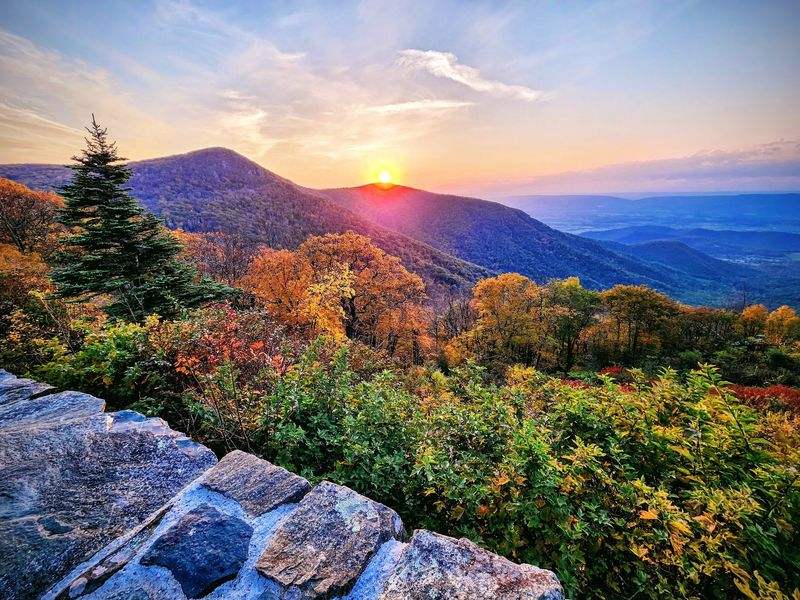
Skyline Drive runs 105 miles through Shenandoah National Park, and its speed limit is just 35 miles per hour. That is the park’s polite way of telling you to slow down and look around.
The road has 75 overlooks, so there are plenty of places to pull over. Higher spots near the northern end often change first, usually in early to mid October, while lower areas peak a bit later.
The park charges an entrance fee, and it is good for seven days. Weekends in October can bring long lines at the gates, so weekday mornings are much easier.
Hikers have lots of choices. Stony Man is a short trail with a big view, and Hawksbill Summit reaches the tallest point in the park at about 4,050 feet.
Fuel is not sold along the drive, so fill your tank before you enter. Cell service can also be spotty, so download a map ahead of time.
2. Blue Ridge Parkway – Western Virginia
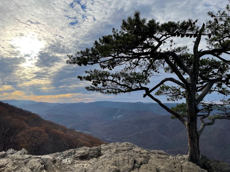
The Blue Ridge Parkway is often called America’s Favorite Drive, and it has no stoplights and no billboards. Its 469 miles stretch from Virginia into North Carolina, and the Virginia section holds about 217 of them.
Mile markers make planning simple. Milepost numbers begin at zero near Afton, so you can match a stop to a number and know exactly how far you have gone.
Elevation changes along the road, which stretches out the color season. Higher sections near Peaks of Otter and Rocky Knob can turn earlier, while lower stretches keep glowing into late October.
Driving the full Virginia portion takes most of a day once you add photo stops. Splitting it into two shorter trips is less tiring.
Parts of the road can close during ice or fog, so check the National Park Service website before leaving. Pack snacks, because towns can be a few miles off the route.
3. Grayson Highlands State Park – Mouth of Wilson
Wild ponies are the unofficial greeters at Grayson Highlands. They roam the open balds, and visitors are asked to keep a respectful distance and never feed them.
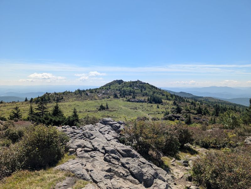
The park sits near Mount Rogers, the highest point in Virginia at 5,729 feet. Because of that height, fall color here can arrive in late September, earlier than most of the state.
Trees are only part of the show. The grassy highlands turn gold and tan, and rocky outcrops give wide views across ridges in several directions.
The Rhododendron Trail and Wilburn Ridge are popular routes for spotting ponies and scenery. Weather can shift fast up high, so bring layers and a windproof jacket.
Camping is available for those who want to stay overnight. The park also has a visitor center with maps and trail updates that help you pick a hike that fits your energy level.
4. Peaks of Otter – Bedford
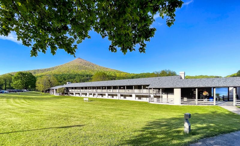
Thomas Jefferson once guessed that the Peaks of Otter were the tallest mountains in Virginia, and he was off by quite a bit. They are still impressive, with Sharp Top rising to about 3,875 feet.
Abbott Lake sits at the base and makes one of the easiest fall photo spots in the state. A flat trail circles the water, and it works well for families and slower walkers.
Sharp Top has a steep trail to the summit, about 1.5 miles one way. A seasonal bus also runs part of the way up, which saves some leg power.
The Peaks of Otter Lodge and a visitor center are right there, so restrooms and information are easy to find. Weekends in mid October tend to be busy.
Get there early for parking, and bring water, since the climb is rocky and exposed.
5. Shenandoah River State Park – Bentonville
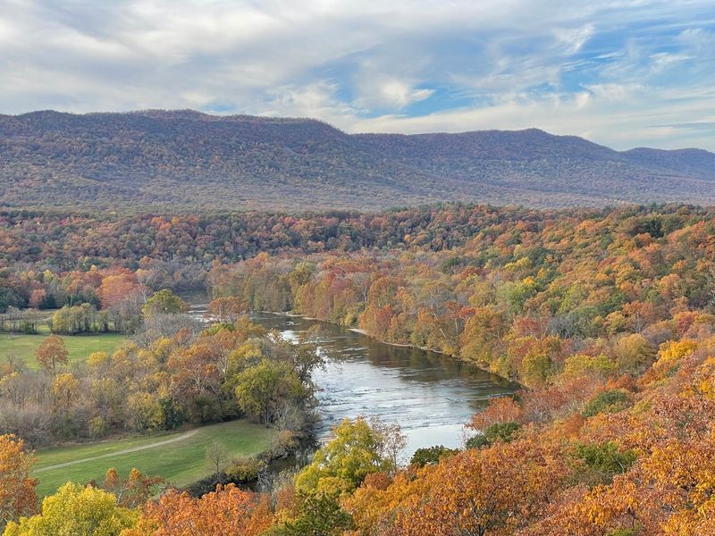
Six miles of river frontage make this park a fine place to watch leaves float by. It sits along the South Fork of the Shenandoah River, with views toward Massanutten Mountain and Shenandoah National Park.
The park covers about 1,600 acres and has more than 24 miles of trails. Many are gentle, so you can see fall color without a tough climb.
Bluff Trail and Riverside Trail are good picks for river views. Mid to late October is usually the best timing here, since the elevation is lower than in the high mountains.
Kayaking and tubing are popular in warm months, but cool autumn days are better for hiking and picnics. The park has picnic areas with tables.
Horseback riders also use dedicated trails. A parking fee applies, and arriving before noon on weekends helps you avoid crowds.
6. Hungry Mother State Park – Marion
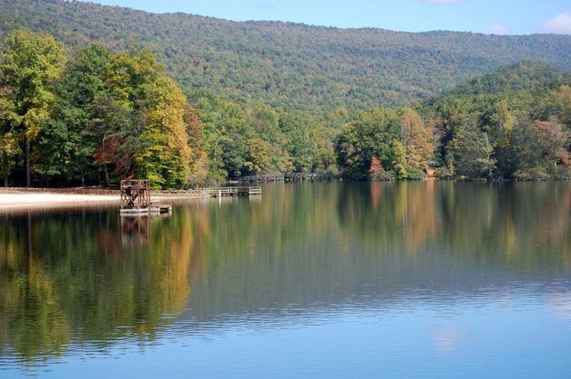
Legend says the park got its name from a settler woman and her child who escaped capture, and the child supposedly kept asking for food. Whatever the truth, the story gave Virginia one of its most memorable park names.
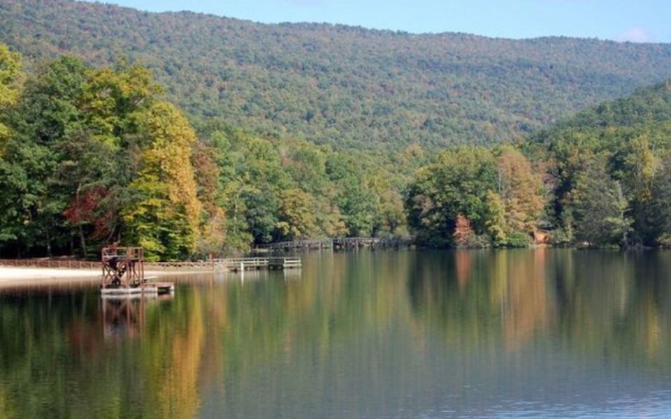
The centerpiece is a 108-acre lake, which doubles the color by reflecting the hillsides around it. Civilian Conservation Corps workers built much of the park in the 1930s, including stone buildings still in use.
The Lake Trail circles the water and is mostly easy. For a bigger view, Molly’s Knob Trail climbs to a ridge overlook.
Peak color usually lands in mid to late October. Cabins and campsites let you stay close to the trails.
A restaurant near the lake sits inside one of the historic stone buildings. Call ahead for seasonal hours, since schedules change after summer.
7. Natural Bridge State Park – Natural Bridge
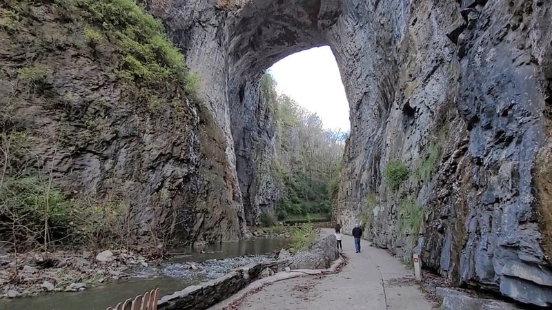
George Washington is said to have surveyed this 215-foot limestone arch, and Thomas Jefferson once owned it. Today it is the centerpiece of a Virginia state park with trails through colorful forest.
The arch rises about 10 stories high and spans roughly 90 feet. The Cedar Creek Trail leads beneath it, is paved for part of the way, and is an easy stroll of about a mile round trip.
Along the path you will find a lost river channel, a small waterfall, and a recreated Monacan Native American village. These stops give the walk more variety than a single view.
Fall color generally peaks in mid to late October. Trees fill the gorge, and the surrounding ridges add even more hues.
The park also offers longer hikes for those wanting a workout. Check the park website for entrance fees and trail conditions before you go.
8. Douthat State Park – Millboro
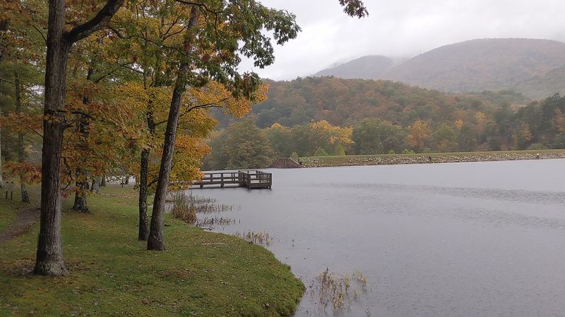
Douthat was one of the original six Virginia state parks, and it opened in 1936. Much of its charm comes from work done by the Civilian Conservation Corps, including cabins, a dam, and a lake.
The park covers more than 4,500 acres and has over 40 miles of trails. That is a lot of ground for leaf watchers, and the ridgelines give wide views over the Allegheny Highlands.
Tuscarora Overall Run Falls Trail leads to a waterfall, while Buck Lick Trail is a gentler walk. Mid October is usually a dependable time for color.
The 50-acre lake is stocked with trout, and anglers show up even in cool weather. A Virginia fishing license is needed for those who plan to cast a line.
Cabins, campsites, and a lodge make overnight stays easy. Book early, because fall weekends fill up fast.
9. Mabry Mill – Meadows of Dan
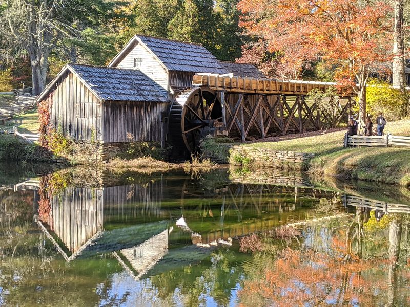
Few buildings in Virginia get photographed as often as Mabry Mill. Ed Mabry built it in the early 1900s, and it sits at milepost 176 on the Blue Ridge Parkway.
The mill has a large waterwheel, a millpond, and a short trail through demonstration areas. Nearby are a blacksmith shop and a sawmill, which show how mountain residents once worked.
In autumn, red and gold trees frame the wooden mill and its reflection in the pond. Crowds peak on sunny weekends, so early morning visits are the calmest.
Park rangers and volunteers sometimes run craft demonstrations on certain days. Schedules vary, so check the parkway’s website first.
The Mabry Mill Restaurant next door is known for buckwheat pancakes and cornmeal dishes. It usually closes for the winter season, so confirm dates before planning a meal stop.
10. Mill Mountain – Roanoke
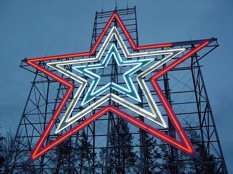
A 88.5-foot illuminated star has watched over Roanoke since 1949. It stands on Mill Mountain, and it is the largest freestanding man-made illuminated star in the world.
A short drive from downtown leads to the overlook. From there you can see the city, the Roanoke Valley, and the ridges beyond, all dotted with seasonal color.
The Mill Mountain Park has several trails for people who would rather walk. The Lower Monument Trail and the Star Trail are popular, and some connect to the Blue Ridge Parkway.
Mill Mountain Zoo is also on the mountain, making it a good choice for families. Check its hours, since fall schedules can be shorter.
Late October is usually a good time for peak color in the valley. Parking at the star is free, which makes this one of the easiest fall views to reach.
Share this story