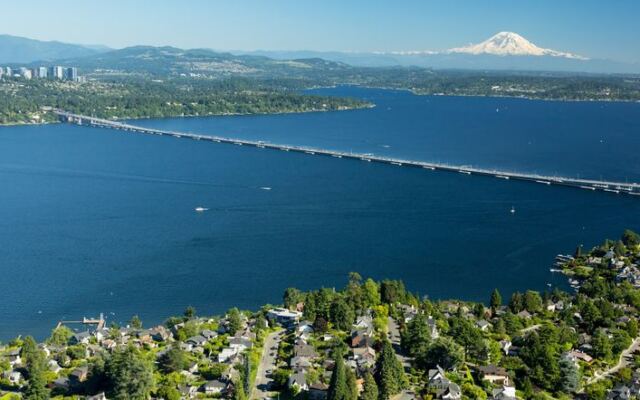
Some of the best surprises in Washington look like ordinary roads until you are standing on them. The Evergreen Point Floating Bridge is one of those places, a highway that sits right on top of a deep lake instead of standing on tall legs.
You can drive it, bike it, or walk it, and the water stretches out on both sides like you are riding a giant raft. Once you learn how it works, you will never cross it the same way again.
A Highway Resting on the Water
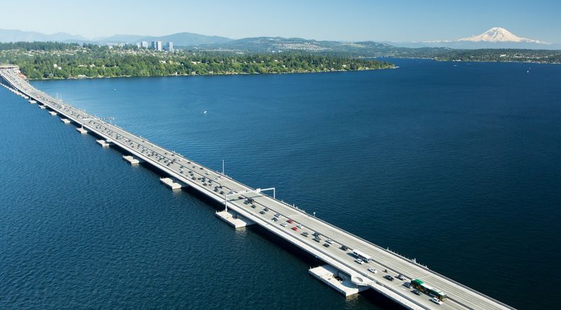
Most bridges reach down to the ground with big concrete legs. The Evergreen Point Floating Bridge skips all that and simply floats on Lake Washington, carrying State Route 520 from Seattle over to the Eastside communities.
Locals usually call it the 520 Bridge, and its official name is the Governor Albert D. Rosellini Bridge.
Whatever you call it, the address is easy to remember: WA-520, Seattle, WA 98105, with the western end near the University of Washington.
Visitors often describe it as a true technical wonder, and that reputation is well earned. For miles, you feel like you are sitting right on the water instead of high above it.
The bridge is open 24 hours a day, every day of the week. So whether you cross at sunrise, at lunch, or late at night, the lake is always waiting underneath you, calm or choppy depending on the weather.
Why Engineers Chose to Float
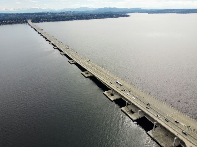
Here is the fun part. Lake Washington drops more than 100 meters deep in places, and the bottom does not offer firm soil for normal bridge foundations.
Building towers down into that kind of lakebed would have been a huge headache. So designers did something clever and let the roadway float, supported by the water itself.
Visitors love sharing this detail, often with a bit of amazement. One runner pointed out that yes, the bridge really is floating because the water is simply too deep.
Another described the lake as no duck pond, which is a pretty good way to put it.
Did you know? The current bridge replaced an older floating span, and regulars who crossed the old one remember it as worn and bumpy, especially in storms.
The newer version is described as a big improvement, smoother and sturdier, while keeping that same floating magic.
Record-Setting Size
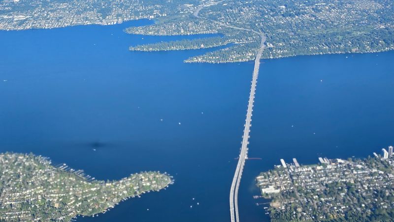
Numbers tell a big story here. The floating span measures about 7,710 feet long, or roughly 2,350 meters, which makes it the longest floating bridge in the world.
It also holds the title of the widest, measuring about 116 feet across at its midpoint. That extra space makes room for traffic lanes plus a generous path for people on foot and on bikes.
Visitors who crossed both versions mention that the new replacement is even longer than the old one. On the road, that length really shows up in how it feels.
One traveler said it seems like you are on the water for several kilometers, calling the experience a little scary but also very cool.
Drivers get two general purpose lanes and one carpool lane in each direction. Even with all that pavement, the lake never feels far away, which is exactly the charm.
Mountains in Three Directions
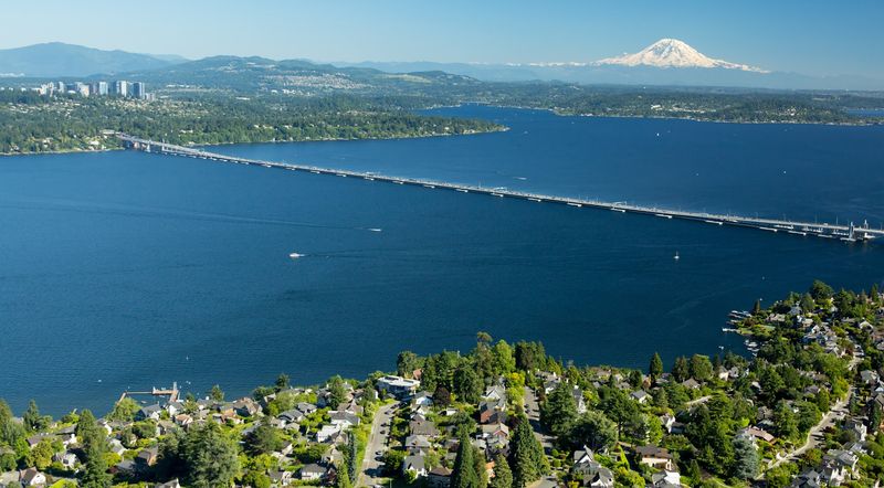
Clear skies turn this commute into a postcard. On a good day, you can spot the Olympic Mountains to the west, the Cascades to the east, and Mount Rainier rising in the south.
Some drivers heading eastbound even say they sometimes catch Mount Baker to the north, near the North Cascades. That is a lot of famous peaks from one strip of road.
Visitors talk about these sweeping views more than almost anything else. One person described dramatic mountain scenes in three directions, with blue water below on sunny days.
The west end adds its own treats. Runners mention lovely views of Union Bay, including Husky Stadium, Foster Island, and nearby wetlands.
Keep your eyes on the lightposts too. Some visitors have spotted bald eagles perched up top, watching the lake like they own the place.
Honestly, with views like these, maybe they do.
Golden Hour Over the Lake
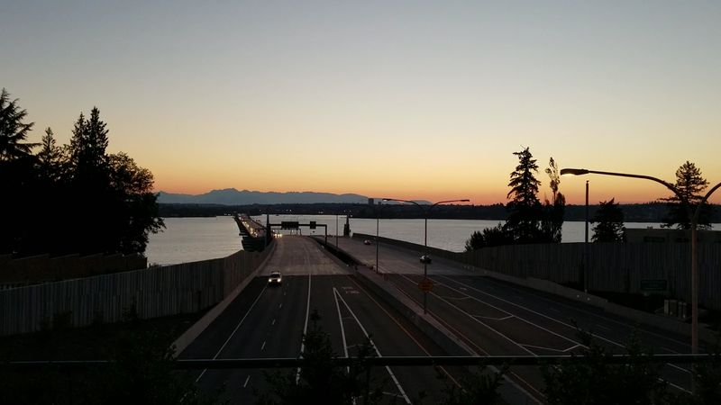
Timing your visit for evening pays off in a big way. As the sun drops toward the Olympics, the sky over Lake Washington often glows pink and orange.
One visitor described the scene as dreamlike, with the colors spreading across the deep water below. Others agree that sunset on a sunny day is the best time to walk or bike across.
There is something peaceful about standing on a floating road while the light fades. The water picks up every shade, and the city skyline softens in the distance.
After dark, the bridge sometimes puts on a show of its own. Multi-colored lights mark special occasions, such as purple and gold for UW events, green for St. Patrick’s Day, and rainbow colors for Pride Month.
A quick heads up: some regulars feel the bridge is quite dark at night, so plan your return trip with that in mind.
The North Side Trail for Walkers and Riders
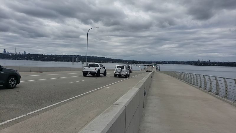
Cars get the lanes, but people on foot get the real treat. A wide multi-use path runs along the north side of the bridge, built for bikes, runners, and walkers.
Fans describe it as straight, long, and flat, except for the climbs at each end. Earlier visitors noted the trail was not finished yet, but it now connects Seattle with Medina and Evergreen Point.
Runners call it one of their favorite places to log miles in Seattle. Cyclists like the smooth ride, and walkers enjoy taking it slow.
The path is wide enough for bikes going both directions and pedestrians to share. Still, one visitor felt some cyclists pass a little too close, so a friendly bell and some patience go a long way.
Best of all, crossing on foot or by bike is completely free. No tolls, no tickets, just you and the lake.
Learning Along the Way
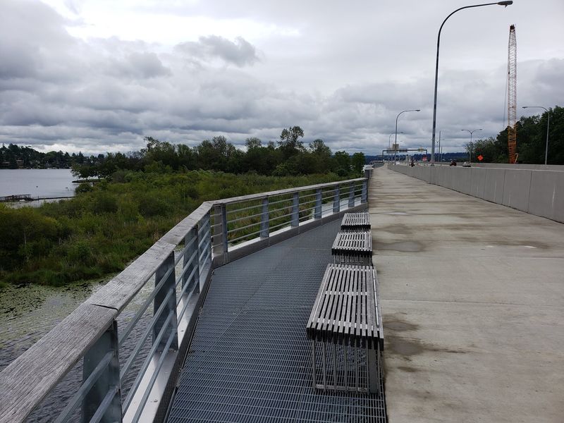
Curious minds, this part is for you. Along the trail, informative boards explain how the bridge was designed and share details about the natural world around it.
Visitors who enjoy geography and engineering say these signs add a lot to the walk. One person mentioned they help you understand the area’s landscape much better.
It turns a simple stroll into a mini outdoor classroom. Kids and adults alike can stop, read a little, then look up and see the exact thing being described.
Rest areas and viewpoints break up the journey too, with benches placed along the route. They are handy spots to catch your breath, sip some water, and soak in the mountains.
One regular gave simple advice: walk this bridge at least once and really take your time. With signs, benches, and nonstop views, slowing down feels like the whole point.
Wind, Sun, and Other Realities
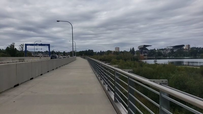
Out on the open lake, the weather is in charge. Visitors warn that there is no real shade anywhere on the path, so sunscreen and a hat are smart on bright days.
Wind is another big factor. Regulars say it is windy and sometimes very windy, which can make walking or biking feel like more work.
On the bright side, windy days bring waves, and some people think watching them roll across the lake is pretty cool. Rainy days can feel crowded and gray, but as one visitor shrugged, that is just Mother Nature.
Noise is worth knowing about too. One visitor found the expansion joint sounds loud and unpleasant.
Safety comes first here. Walking the full span is a real workout, so bring water and dress in layers.
A little planning keeps the trip fun instead of exhausting.
Tolls, Parking, and Getting There
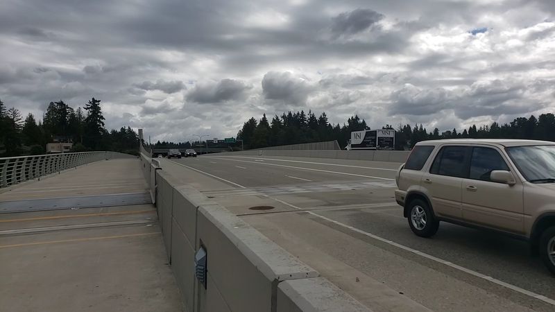
Practical stuff first. Drivers pay an electronic toll, and the system reads your license plate as you cross, so out-of-town visitors should look into the Good To Go setup ahead of time.
Some travelers find the tolls frustrating, and traffic comes up often. Still, a few commuters feel the 520 saves time compared to I-90, even during busy hours.
Walkers and cyclists, good news again: you cross free. From the west side, head to E Park Dr E, where a small parking lot leads to a flat paved path.
Coming from the east, go to 520 Bridge View Park at Evergreen Point Road, which has a small park-and-ride lot. Expect a steep stretch near the east end either way.
Visitors also suggest checking for events before you go. The official WSDOT website at wsdot.com has current bridge information.
Worth the Crossing
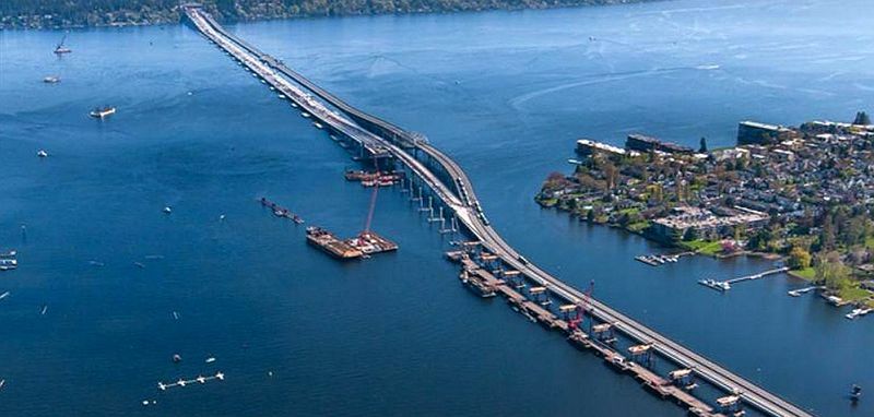
So, should you make the trip? If you love big views, clever engineering, or a long easy walk, the answer leans strongly toward yes.
Drivers get a quick link between Seattle and the Eastside, with mountains for company. Runners and cyclists get a flat, scenic route.
Families get a free outing packed with eagles, signs, and sunsets.
It is not perfect. Tolls, traffic, wind, and the lack of shade can test your patience on certain days.
Yet visitors keep coming back to the same feeling: this is more than just a road. It is a spot that shows off the natural beauty of Washington State in a way few places can.
One cheerful fan summed it up by saying the bridge carried them across with no fuss at all. That calm, gliding feeling is exactly what makes it worth crossing at least once.
Share this story