The West Coast sits on some of the most dangerous earthquake zones in North America. From California’s famous San Andreas Fault to the massive Cascadia Subduction Zone, millions of people live directly above active fault lines that could shake at any moment. Understanding these earthquake hotspots can help you prepare for what scientists say is not a matter of if, but when the next big one hits.
1. Cascadia Subduction Zone: The Sleeping Giant
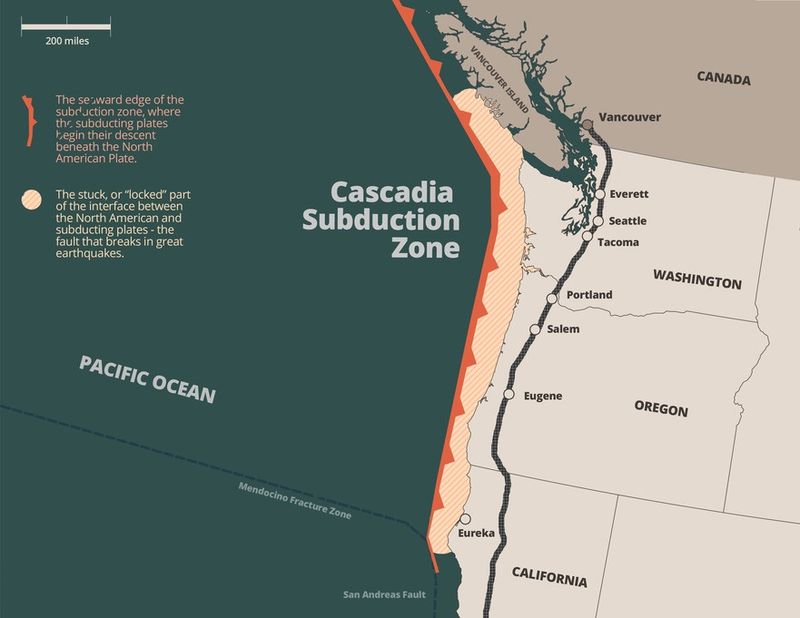
Scientists call it the most dangerous fault system in North America, and for good reason. This massive underwater fault stretches 600 miles from Northern California to British Columbia, capable of producing earthquakes stronger than magnitude 9.0.
The last time Cascadia ruptured was January 26, 1700, creating a quake so powerful it sent tsunamis all the way to Japan. Researchers estimate a 37% chance of another magnitude 9.0 event within the next 50 years.
Cities like Seattle, Portland, and coastal communities would face devastating shaking followed by massive tsunamis, potentially affecting millions of residents across three states.
2. San Andreas Fault: California’s Most Famous Fracture
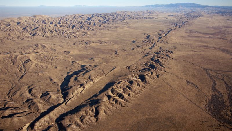
Running 800 miles through California like a massive scar, the San Andreas Fault has shaped the state’s earthquake history. This notorious fault produced the devastating 1906 San Francisco earthquake that killed over 3,000 people and left the city in ruins.
The southern section near Los Angeles hasn’t ruptured in over 300 years, making it dangerously overdue according to seismologists. When it finally breaks, scientists predict it could generate a magnitude 8.0 earthquake.
Over 15 million Californians live within 30 miles of this fault system, making it one of the most populated earthquake zones in the world.
3. Hayward Fault: The Bay Area’s Ticking Time Bomb
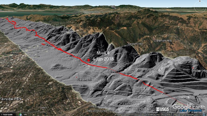
Cutting directly through densely populated East Bay cities like Oakland, Berkeley, and Fremont, the Hayward Fault sits beneath millions of homes and businesses. This 74-mile fault last produced a major earthquake in 1868, earning the nickname “the great San Francisco earthquake” before the more famous 1906 event.
Seismologists consider it the most likely source of the next big Bay Area earthquake, with a 33% chance of magnitude 6.7 or larger by 2043. The fault creeps slowly but steadily, cracking sidewalks and buildings.
A major Hayward Fault rupture could cause more damage than the San Andreas due to its location directly under urban areas.
4. San Jacinto Fault: Southern California’s Active Threat
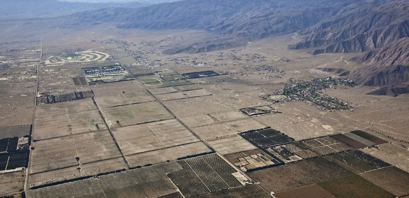
While the San Andreas gets more attention, the San Jacinto Fault system quietly ranks as one of California’s most active earthquake producers. Running parallel to its famous cousin, this fault zone has generated over 20 earthquakes magnitude 6.0 or larger since 1890.
Cities like Riverside, San Bernardino, and Palm Springs sit directly on or near this fault system. The 2020 Monte Cristo Range earthquake (magnitude 6.5) reminded residents of the ongoing danger.
Recent studies suggest the San Jacinto Fault accommodates about 25% of the motion between the Pacific and North American plates, making it increasingly important for regional earthquake hazard.
5. Walker Lane: California’s Rising Earthquake Rival
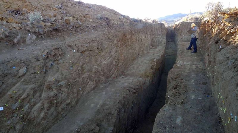
The 2019 Ridgecrest earthquake sequence put this fault system on everyone’s radar when back-to-back magnitude 6.4 and 7.1 quakes rattled Southern California. Located in the Eastern California Shear Zone, Walker Lane handles up to 25% of the Pacific-North American plate boundary motion.
This 600-mile-long zone of faults extends from the Garlock Fault in California to the Nevada-Utah border. Scientists now recognize it as a major earthquake threat that could rival the San Andreas Fault system.
The Ridgecrest quakes caused billions in damage and were felt as far away as Las Vegas, demonstrating the far-reaching impact of Walker Lane earthquakes.
6. Mendocino Triple Junction: Where Three Plates Collide
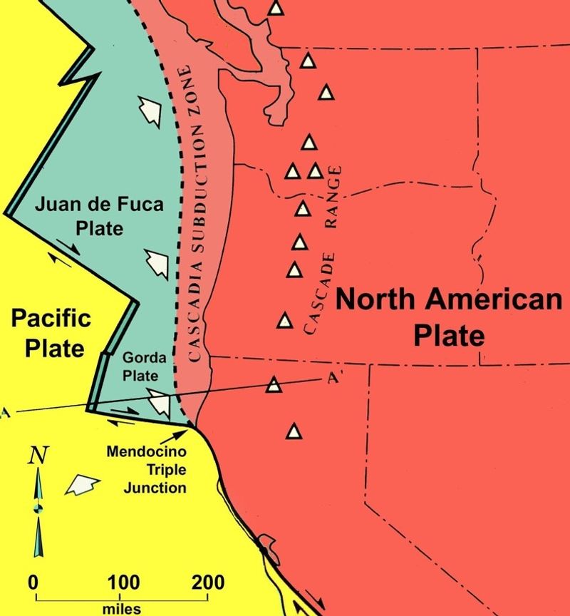
Off the coast of Northern California, three massive tectonic plates meet in a geological collision zone called the Mendocino Triple Junction. The Pacific, North American, and Juan de Fuca plates grind against each other here, creating frequent moderate to strong earthquakes.
This offshore location creates a double threat: strong shaking from earthquakes and potential tsunamis from underwater fault ruptures. The area experiences more earthquake activity than almost anywhere else on the West Coast.
Coastal communities like Eureka and Fort Bragg face regular reminders of this seismic activity, with earthquakes occurring several times per month in the surrounding region.
7. Seattle Fault Zone: Urban Earthquake Danger
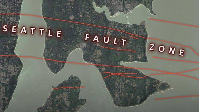
Running directly beneath Seattle’s downtown core, the Seattle Fault poses a unique urban earthquake threat. This east-west trending fault system last ruptured about 1,100 years ago, producing a magnitude 7.5 earthquake that uplifted land and triggered local tsunamis in Puget Sound.
Geological evidence shows the ancient earthquake lifted the shoreline by up to 20 feet and caused massive landslides. Today, over 750,000 people live directly above this fault system in the greater Seattle metropolitan area.
A repeat performance could devastate the region’s economy, collapse older buildings, and disrupt the busy Port of Seattle, one of the nation’s largest shipping hubs.
8. Tacoma Fault: The Puget Sound Sleeper
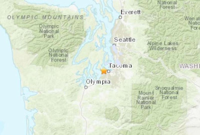
South of Seattle, the Tacoma Fault system threatens another major Pacific Northwest population center. This fault zone runs beneath Tacoma and surrounding communities, capable of producing magnitude 7.0 or larger earthquakes that could devastate the region.
The fault’s location near major shipping ports, industrial facilities, and residential areas makes it particularly dangerous. A major rupture could disrupt international trade through the Port of Tacoma, the fourth-largest container port in North America.
Like other Puget Sound faults, Tacoma’s fault system can trigger local tsunamis in addition to strong ground shaking, creating multiple hazards for coastal communities around the sound.
9. San Diego Trough: The Understudied Ocean Threat

Offshore from San Diego lies a lesser-known but potentially dangerous fault system called the San Diego Trough. This underwater fault zone receives less attention than California’s inland faults, but recent studies suggest it could produce magnitude 6.5 to 7.0 earthquakes.
The fault’s offshore location means coastal communities face both strong shaking and potential tsunami threats. San Diego’s millions of residents and visitors could experience significant damage from a direct hit by this fault system.
Scientists continue studying this fault zone to better understand its earthquake potential, but limited research means the true danger remains partially unknown, making it a wild card in California’s seismic future.
10. Garlock Fault: The Stress Transfer Master

Stretching 250 miles across Eastern California, the Garlock Fault system operates like a massive stress transfer mechanism for Southern California’s earthquake network. This east-west trending fault connects the San Andreas system with the Eastern California Shear Zone, capable of producing magnitude 7.0 or larger earthquakes.
When the Garlock Fault eventually ruptures, it could trigger a cascade of earthquakes across Southern California by transferring stress to other fault systems. The 2019 Ridgecrest earthquakes increased stress on portions of the Garlock Fault.
Though it runs through sparsely populated desert areas, a major Garlock earthquake could affect millions of people in Los Angeles and surrounding metropolitan areas through secondary earthquake triggering.
Share this story