Missouri’s landscape preserves nearly two billion years of geological history, from ancient volcanic rock and enormous granite boulders to sinkholes, waterfalls, and thousands of caves. These natural formations reveal a dramatically different side of the state hiding beneath its forests, farms, and towns.
These 12 publicly accessible geological wonders offer a fascinating look at Missouri’s ancient past. Each tells part of a story shaped by volcanoes, prehistoric seas, erosion, and underground water over immense stretches of time.
1. Johnson’s Shut-Ins State Park, Middle Brook, Missouri
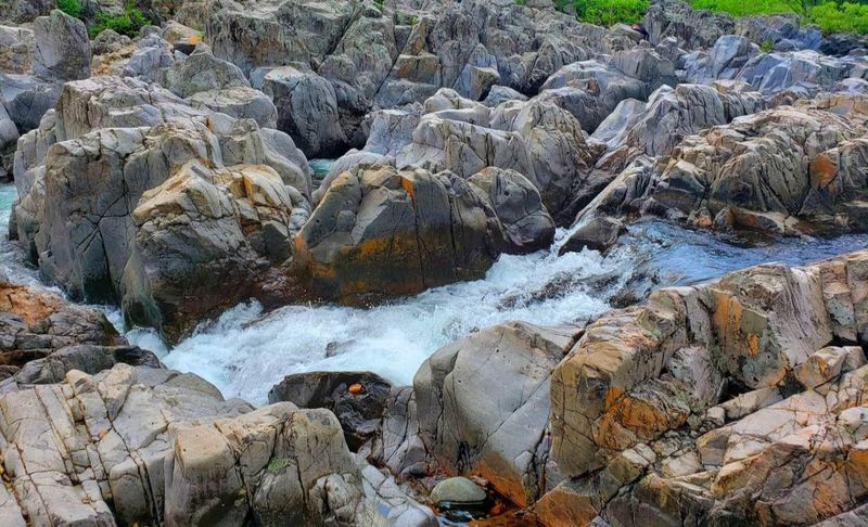
At Johnson’s Shut-Ins, the East Fork of the Black River runs into a wall of ancient volcanic rock and loses the argument. The river gets squeezed into a tight maze of channels, chutes, potholes, and calm pools carved into Precambrian rhyolite and diabase that formed more than a billion years ago.
The term “shut-in” refers specifically to this geological situation, where a river is forced into a constricted path by extremely hard, erosion-resistant bedrock. The polished surfaces on the rock tell the story of countless years of water carrying abrasive sand and gravel through the same narrow passages.
The Shut-Ins Trail runs 2.75 miles and brings hikers into direct contact with the formations, including cliff edges and boardwalk sections above the channels. The park sits within the St. Francois Mountains, one of the oldest exposed sections of the North American continent, and supports over 850 plant species across its diverse habitats.
2. Hughes Mountain Natural Area, Irondale, Missouri
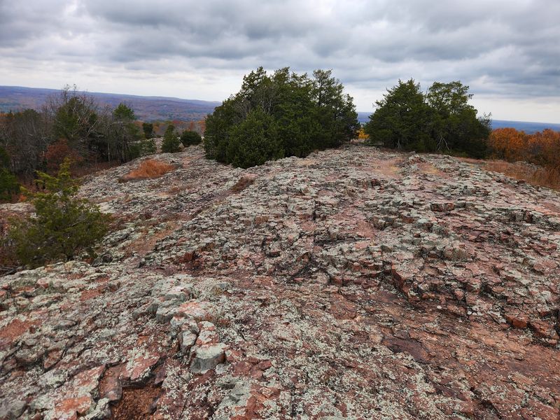
Most mountains in Missouri are rounded and forested, which makes the summit of Hughes Mountain feel like a completely different planet. The top is covered in angular, multi-sided columns of rhyolite that fractured as the volcanic rock cooled rapidly around 1.5 billion years ago, producing a pattern that geologists call columnar jointing.
The central attraction is a formation called the Devil’s Honeycomb, where these geometric columns cluster together in a way that genuinely looks like an oversized, petrified beehive built by engineers with very strict standards. Columnar jointing in rhyolite is unusual; the pattern is far more commonly seen in basalt, which makes Hughes Mountain a site of real scientific interest.
Reaching the Devil’s Honeycomb requires a climb of about one mile, but the payoff includes sweeping views across Washington County alongside the striking rock formations. The rhyolite here is exceptionally resistant to weathering, which is exactly why these columns are still standing after more than a billion years of exposure.
3. Pickle Springs Natural Area, New Offenburg, Missouri
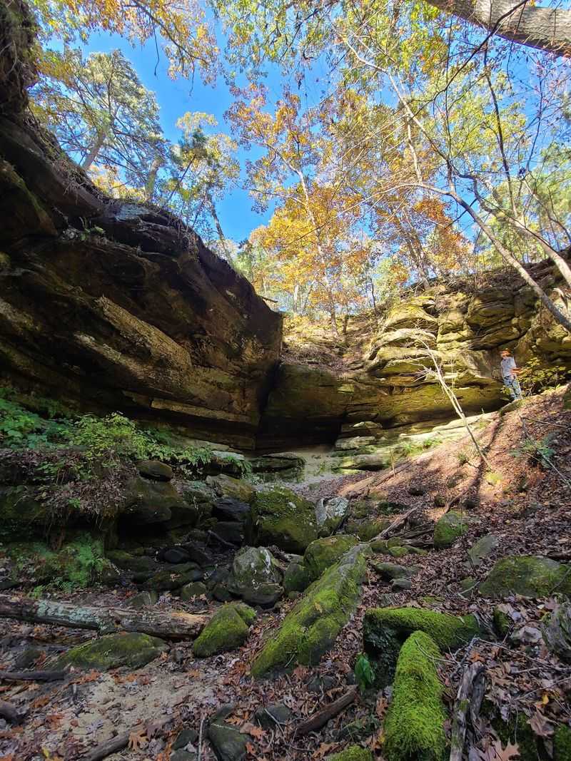
About 500 million years ago, the ground where Pickle Springs now stands was a sandy beach at the edge of a shallow sea. That sand eventually compacted into Lamotte Sandstone, and millions of years of uplift and erosion have since carved it into one of Missouri’s most intricate and surprising landscapes.
The formations here include cliffs, arches, hoodoos, slot-like passages, and box canyons, all packed into a two-mile loop called the Trail Through Time. Named highlights along the route include the Keyhole, a distinct opening carved cleanly through the rock, and Cauliflower Rock, whose bumpy surface reflects the unusual way this particular sandstone weathers over time.
Small waterfalls appear along the trail after rainfall, adding movement to an already visually rich environment. The sandstone is softer than the igneous rock found in other parts of the Ozarks, which is precisely why it has been shaped into such detailed and delicate forms rather than the massive rounded boulders seen elsewhere.
4. Onondaga Cave State Park, Leasburg, Missouri
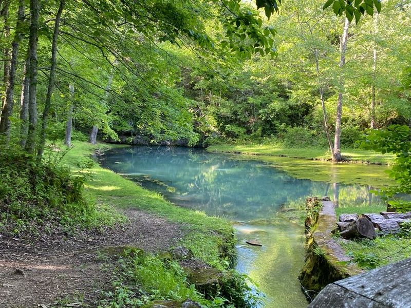
Missouri has roughly 7,500 recorded caves, but Onondaga earned National Natural Landmark status for good reason. The cave formed within Gasconade dolomite, a carbonate rock deposited when a vast shallow sea covered the Ozarks approximately 520 million years ago, and groundwater has been slowly dissolving and reshaping it ever since.
The mineral formations inside are exceptional in both variety and density. Stalactites, stalagmites, flowstones, soda straws, draperies, and rimstone dams all coexist within the same passages, and one particularly large flowstone called the Queen’s Canopy reaches 40 feet in height.
Calcite formations that grow on the surface of still cave pools, sometimes called lily pads, add an extra layer of geological curiosity to the guided tour route.
The cave was discovered in 1886 and gained enough attention to become a featured attraction at the 1904 St. Louis World’s Fair. Its formation was significantly influenced by the Leasburg Fault, which provided the initial pathways that groundwater later enlarged into the passages visitors walk through today.
5. Ha Ha Tonka State Park, Camdenton, Missouri
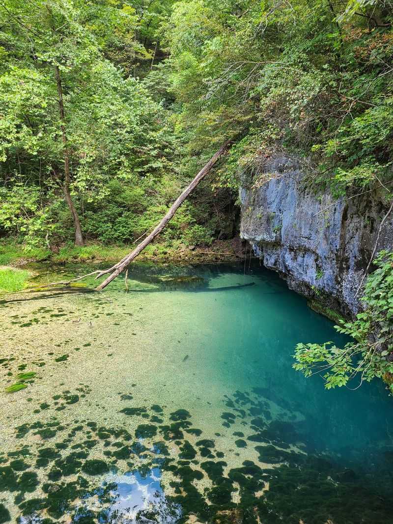
Ha Ha Tonka packs more karst geology into one park than most states manage across entire regions. Dissolving carbonate bedrock has produced sinkholes, caves, springs, sheer cliffs, a natural bridge, and a massive gorge, all within walking distance of each other, making the park an unusually complete outdoor classroom for this type of landscape.
The gorge is particularly dramatic, with cliffs approaching 250 feet in height cutting through the terrain. The Colosseum sinkhole formed when an underground cave ceiling collapsed, leaving a wide, open-air depression that gives a clear visual explanation of how karst landscapes develop from the inside out.
Ha Ha Tonka Spring delivers an average of roughly 48 million gallons of water per day, a figure that reflects the enormous underground drainage network hidden beneath the surface. The natural bridge, a remnant of a former cave system, stands 70 feet high and spans 100 feet, and the ruins of a century-old stone castle nearby add an unexpected layer of human history to the geological narrative.
6. Grand Gulf State Park, Koshkonong, Missouri
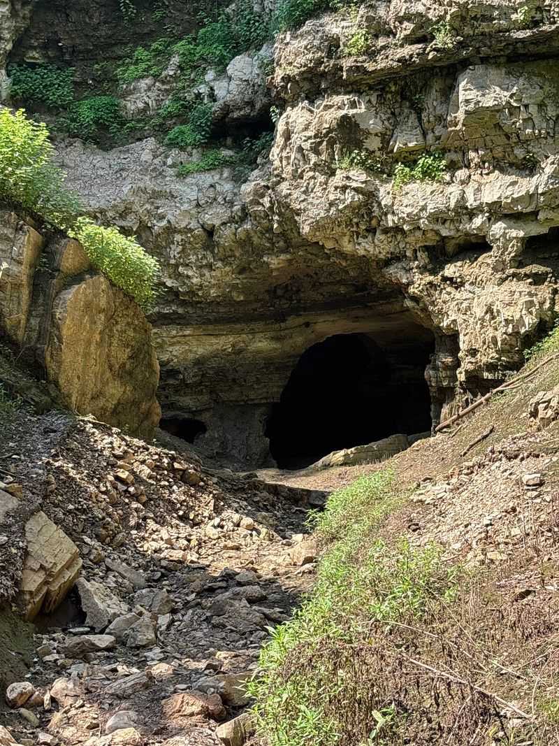
Grand Gulf did not form the way most canyons do. Rather than being carved from above by a river, it began as a massive underground cave system that dissolved through soluble limestone and dolomite over thousands of years before its roof finally gave way, leaving a canyon stretching more than a mile through the Ozarks.
The walls drop 100 to 130 feet in some sections, making the gulf notably deeper than it is wide. One segment of the former cave ceiling survived the collapse and now forms a natural bridge spanning roughly 200 to 250 feet, with an opening 75 feet high, offering a clear picture of just how large the original cavern must have been.
A surface creek called Bussell Branch disappears into the gulf and then travels nine miles underground before re-emerging as Mammoth Spring in Arkansas. Grand Gulf was designated a National Natural Landmark in 1971, and during heavy rains the canyon can fill with over 100 feet of water, which slowly drains back through the same underground system over several weeks.
7. Elephant Rocks State Park, Belleview, Missouri
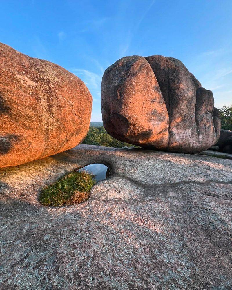
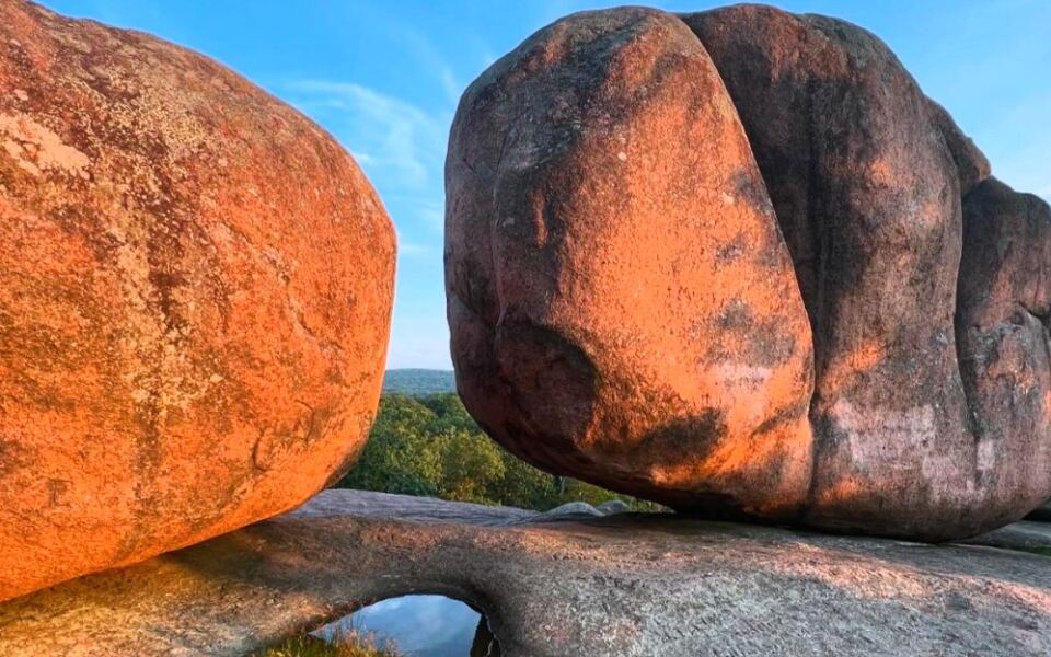
A billion and a half years ago, molten rock cooled slowly underground and eventually became the enormous pink granite boulders that now define Elephant Rocks State Park. The largest of these rounded giants stands 27 feet tall, measures 34 feet long, and tips the scale at roughly 680 tons.
The granite formed through a process called spheroidal weathering, where water crept into underground fractures and rounded off the angular blocks before erosion exposed them at the surface. That slow transformation took hundreds of millions of years, which makes every boulder a genuinely staggering piece of natural history.
The one-mile Braille Trail loops directly among the formations and is paved for accessibility, making this one of the few geological sites in Missouri where visitors of nearly any ability can get within arm’s reach of billion-year-old rock. The granite was also quarried here starting in 1869 and used to build the piers of the famous Eads Bridge.
8. Castor River Shut-Ins, Fredericktown, Missouri
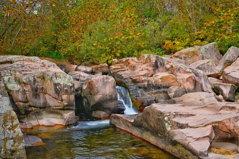
Missouri has several shut-ins, but only one set is carved from pink granite, and this is it. The Castor River Shut-Ins formed within Breadtray Formation rock, a Precambrian granite approximately 1.5 billion years old that gives the boulders and channels a distinctive salmon color found nowhere else in the state’s river system.
The river tumbles around massive rounded boulders and through narrow passages, producing small cascades and quiet pools along a stretch of water that looks almost artificially vibrant in good light. The surrounding granite glades, where sparse vegetation grows directly on exposed bedrock, reinforce the rugged character of the landscape.
A one-mile trail provides access to the main formations, keeping the site manageable for a half-day visit. The geological contrast between these pink granite shut-ins and the darker rhyolite formations at Johnson’s Shut-Ins or Rocky Falls is immediately obvious to anyone who visits both, illustrating how varied Missouri’s ancient igneous rock can be across a relatively short distance.
9. Rocky Falls, Winona, Missouri
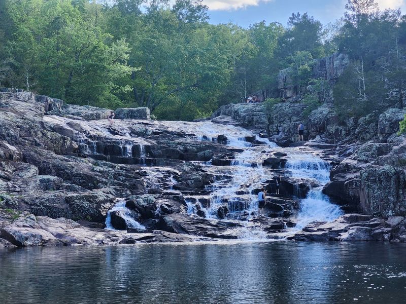
Rocky Falls looks like a straightforward waterfall until you notice the rock it runs over, which is dark, angular volcanic rhyolite with a color and texture that sets it apart from almost every other waterfall in Missouri. That rhyolite cooled from ancient lava flows roughly 1.5 billion years ago, making each ledge the water crosses a direct remnant of the violent geological events that built the original Ozarks.
The stair-step shape of the falls is a product of how rhyolite fractures. The rock breaks along distinct planes, and water exploits those weaknesses over time, carving out the regular cascading tiers that give Rocky Falls its characteristic form.
The deep purplish-red and dark gray tones of the stone create a visual contrast with the surrounding Ozark forest that is hard to overlook.
Water collects in a clear pool at the base, and the site sits within the Ozark National Scenic Riverways, keeping the surrounding landscape largely undeveloped. The falls are most impressive after significant rainfall, when the full width of the rhyolite ledges is covered by moving water.
10. Mina Sauk Falls, Arcadia Township, Missouri
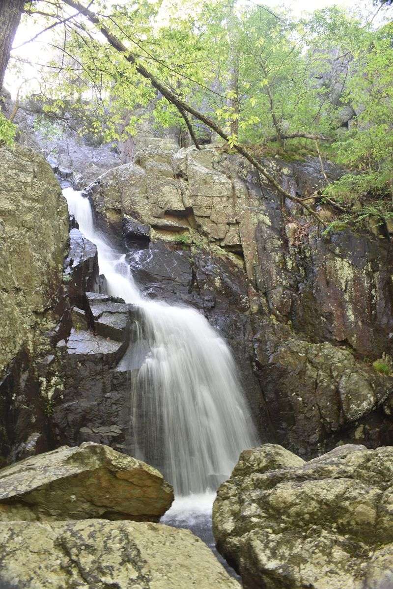
Missouri’s tallest waterfall drops 132 feet down a series of ancient rhyolite ledges hidden within Taum Sauk Mountain State Park, and most visitors have never heard of it. Mina Sauk Falls is seasonal, meaning its most dramatic displays happen after heavy rain, with the period from March through May generally offering the best conditions for a genuinely impressive flow.
The loop trail to the falls is moderately rugged and runs downhill on the way in, which means the return hike demands considerably more effort. The volcanic landscape along the trail reinforces the geological character of the St. Francois Mountains at nearly every step, with exposed rhyolite appearing throughout the route.
Continuing past the main falls leads to Devil’s Tollgate, a narrow passage sliced through 30-foot rhyolite walls that stand only eight feet apart. The valley surrounding Devil’s Tollgate is reportedly the deepest in Missouri, and the combination of the tall waterfall, the ancient rock, and the tight passage makes this one of the most geologically varied hikes in the state.
11. Pinnacles Youth Park, Sturgeon, Missouri
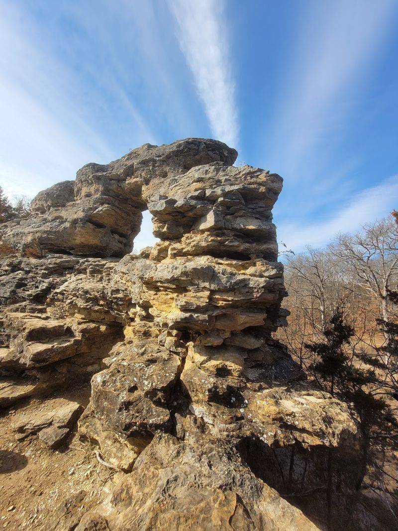
Central Missouri is not generally known for dramatic rock formations, which is exactly what makes Pinnacles Youth Park such a surprise. A narrow ridge of limestone rises unexpectedly between Rocky Fork and Silver Fork creeks just north of Columbia, creating steep fins, cliffs, narrow passages, and pointed rocky pinnacles in a landscape that otherwise consists of gently rolling farmland.
The limestone here preserves evidence of the shallow sea that once covered this part of the continent, including fossilized remains of ancient marine creatures embedded in the rock. Those fossils serve as a direct record of the ocean ecosystem that existed here hundreds of millions of years ago, long before the Midwest looked anything like it does today.
Visitors can explore the formations on foot, moving through narrow corridors between rock walls and climbing to spots that offer views of both creek channels below. The contrast between the sharp, vertical limestone features and the surrounding flat countryside makes the site feel genuinely out of place, which is precisely what makes it worth seeking out.
12. Devil’s Icebox, Columbia, Missouri
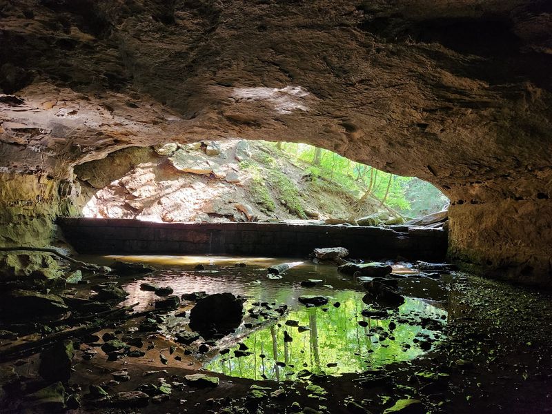
Rock Bridge Memorial State Park sits on top of a karst landscape that has been quietly rearranging itself for millions of years, and the Devil’s Icebox is one of the clearest windows into that process. Groundwater working through soluble limestone has created an underground drainage system beneath the park that includes about 6.5 miles of passages, making it the seventh longest cave in Missouri.
The cave entrance stays at a consistent temperature of around 56 degrees Fahrenheit year-round, a straightforward result of the stable thermal conditions underground that have nothing to do with the weather above. The cool air drifting out of the opening is one of the more immediately noticeable things about the site, especially on a hot summer afternoon.
The surrounding park also features Rock Bridge, a natural arch formed when part of a former cave ceiling collapsed while leaving a central span intact. Connor’s Cave, a smaller and easier-to-enter passage nearby, provides an additional point of access into the same karst system, rounding out a park that offers more underground geology per acre than almost anywhere else in central Missouri.
Share this story