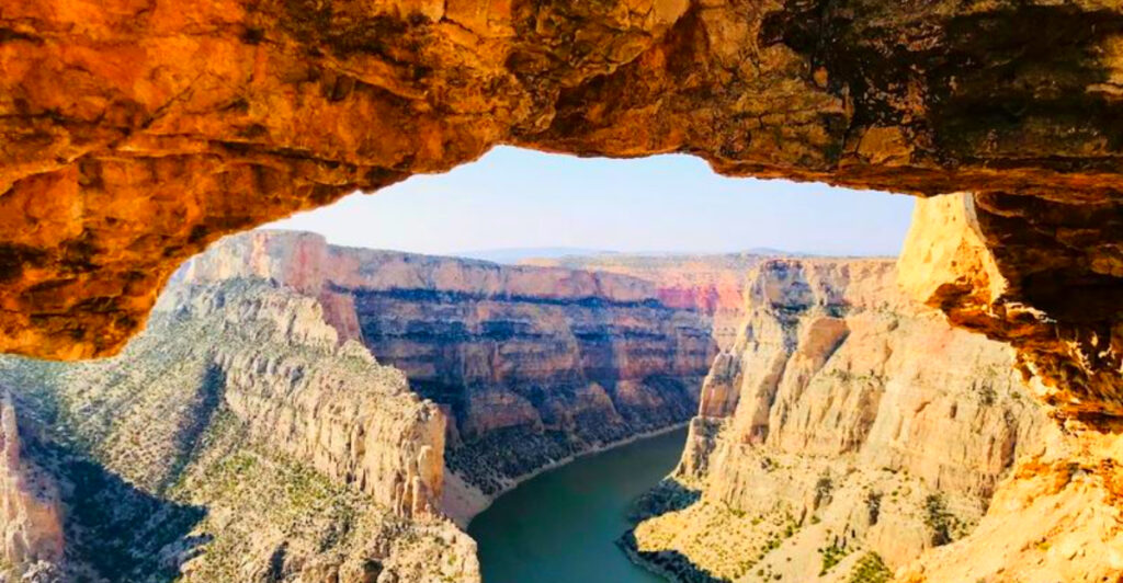
Montana is home to far more natural wonders than its famous national parks alone. Beyond the well-known attractions, you’ll find limestone caverns, rugged badlands, crystal-clear springs, waterfalls, and ancient forests that showcase the state’s remarkable diversity.
Whether you’re planning a road trip or looking to explore beyond the usual stops, these 14 natural wonders offer unforgettable scenery and unique outdoor experiences. Each highlights a different side of Big Sky Country’s extraordinary landscape.
1. Natural Bridge Falls Picnic Area, Big Timber, Montana
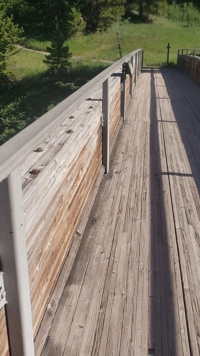
The Boulder River near Big Timber pulls off one of geology’s best magic tricks: it vanishes underground, threads through porous limestone channels, and then bursts out of the cliff face as a 105-foot waterfall.
The visual changes dramatically depending on the season. Early spring brings a powerful cascade over the top of the cliff, while late summer can make the entire river appear to disappear into the rock and re-emerge from lower caverns.
The U.S. Forest Service manages the site and has installed paved accessible trails with interpretive panels explaining exactly how this geological sleight of hand works. An unpaved East Rim Trail offers a second viewing angle for those who want a broader perspective of the canyon. Keep an eye on the sedimentary rocks along the trail, because fossilized seashells from an ancient sea are embedded right there in the limestone walls.
2. Giant Springs State Park, Great Falls, Montana
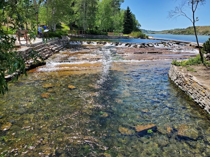
Few natural features in the United States match the sheer output of Giant Springs, which pours roughly 156 million gallons of crystal-clear water to the surface every single day at a constant temperature of 54 degrees Fahrenheit.
The water originates as snowmelt in the Little Belt Mountains, travels underground for approximately 3,000 years, and resurfaces here in one of the most dramatic groundwater reveals on the continent. The park also contains the Roe River, once recognized by the Guinness Book of World Records as the world’s shortest river at just 200 feet long, flowing directly into the Missouri.
With more than 30 miles of trails, a fish hatchery raising about 1.3 million fish annually, and wildlife viewing areas along the Missouri River, this park offers far more than most visitors expect from a spot just minutes from downtown Great Falls.
3. Lewis & Clark Caverns State Park, Whitehall, Montana
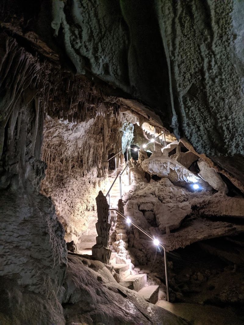
Montana’s first state park hides one of the largest known limestone cavern systems in the entire Northwest, and you have to earn the view by going underground to get it.
Guided tours run from May through September, with two main options. The Classic Tour covers two miles over two hours, gaining 300 feet in elevation and descending more than 500 stairs. The shorter Paradise Tour leads to some of the cave’s most elaborately decorated rooms in about 90 minutes.
Inside, formations called helictites twist in unexpected directions, while cave bacon, drapery, and clusterite popcorn cover the walls in textures that took millions of years to develop. A maternity colony of western big-eared bats also calls these caverns home, adding a lively biological dimension to the geological spectacle. Special candlelight tours in December offer a completely different atmosphere for return visitors.
4. Makoshika State Park, Glendive, Montana
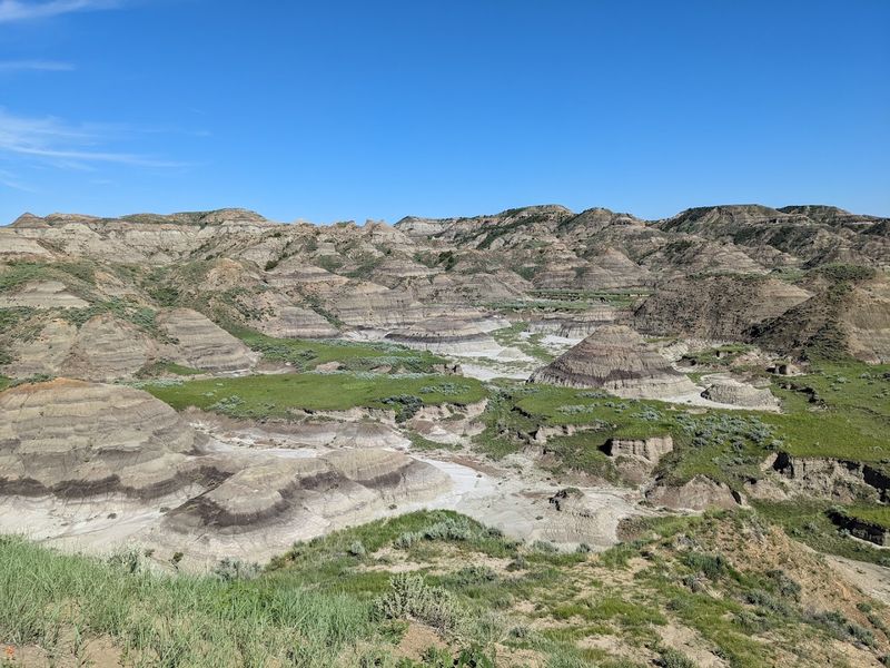
Montana’s largest state park at over 11,000 acres looks like it was assembled by a committee of geologists who wanted to show off every type of dramatic landform in one place.
The name Makoshika comes from a Lakota phrase meaning bad land or bad earth, and the terrain absolutely earns that label with its hoodoos, spires, hogback ridges, natural bridges, and deeply fluted hillsides. The park sits within the Hell Creek Formation, one of the world’s most celebrated dinosaur fossil beds. Triceratops, Tyrannosaurus Rex, and Edmontosaurus remains have all been found here, and a complete Triceratops skull is on display at the visitor center.
Hikers can choose trails ranging from an easy one-mile loop to more challenging routes through terrain with little shade, so bringing water and sun protection is genuinely important rather than just a polite suggestion.
5. Sluice Boxes State Park, Belt, Montana
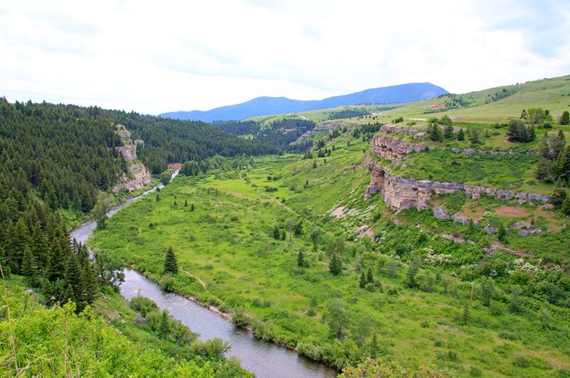
Belt Creek spent a very long time carving through limestone, and the result is a canyon with walls rising up to 500 feet that most Montana visitors have never heard of.
The hiking trail follows an old railroad grade for up to 8.7 miles through the gorge, passing remnants of abandoned towns, former mines, historic cabins, and even an old tunnel from Montana’s mining era. This was once the route of the Trout Train, which shuttled fishermen to Belt Creek back when it was designated a blue-ribbon trout stream in the 1920s.
The trail requires at least 12 creek crossings, so timing matters. The recommended window is mid-July through September, when water levels drop and fording becomes manageable. Spring visits mean cold, fast water and a genuinely challenging hike, which is worth knowing before lacing up the boots.
6. Hidden Falls, St. Mary, Montana
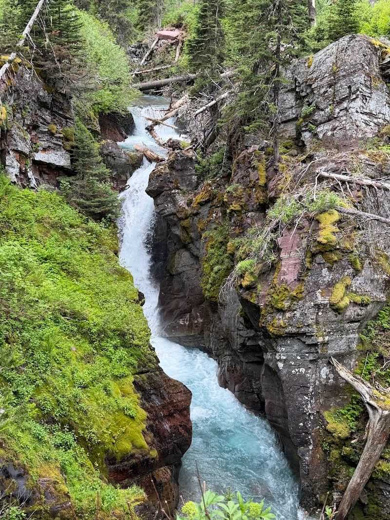
Tucked inside Glacier National Park is a 25-foot waterfall that thousands of visitors walk past every summer without ever knowing it exists, which is a remarkable achievement for something that dramatic.
Cataract Creek carved a deep gorge to hide this one, and reaching it involves a genuinely fun approach: two shuttle boat rides across Swiftcurrent Lake and Lake Josephine, followed by a short walk through quiet forest past thimbleberry patches and small streams.
A suspension bridge spans Cataract Creek less than a mile from the boat dock, and a brief side trail from that bridge leads to a wooden viewing platform positioned directly in front of the falls. The trail includes a short steep section just before the overlook. Hikers who want more can continue another half mile to Grinnell Lake, turning a quick detour into a full afternoon worth remembering.
7. Gates of the Mountains Wilderness, Helena, Montana
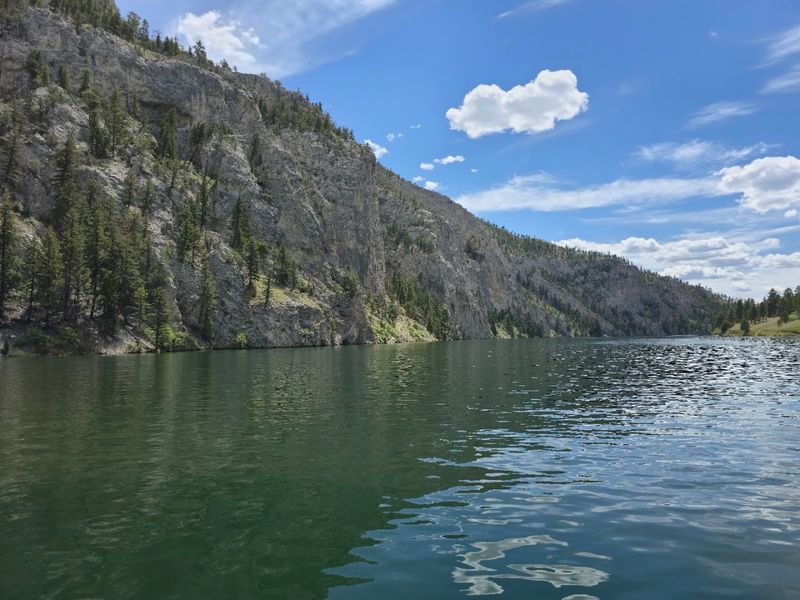
Meriwether Lewis described these cliffs in 1805 as the most remarkable he had seen during the entire expedition, and the limestone walls rising above the Missouri River have not toned things down since.
The canyon earned its name because the cliffs appear to close off the river ahead and then swing open as the boat moves forward, an effect that stopped the Corps of Discovery in their tracks. Scenic boat tours lasting around two hours navigate the corridor today, with guides sharing expedition history while bighorn sheep and mountain goats watch from the rock faces above.
The sheer scale of the canyon walls is best appreciated from the water, where the full vertical rise becomes obvious in a way that no photograph quite captures. Wildlife sightings are common enough that bringing binoculars is a practical decision rather than an optimistic one.
8. Bighorn Canyon National Recreation Area, Fort Smith, Montana
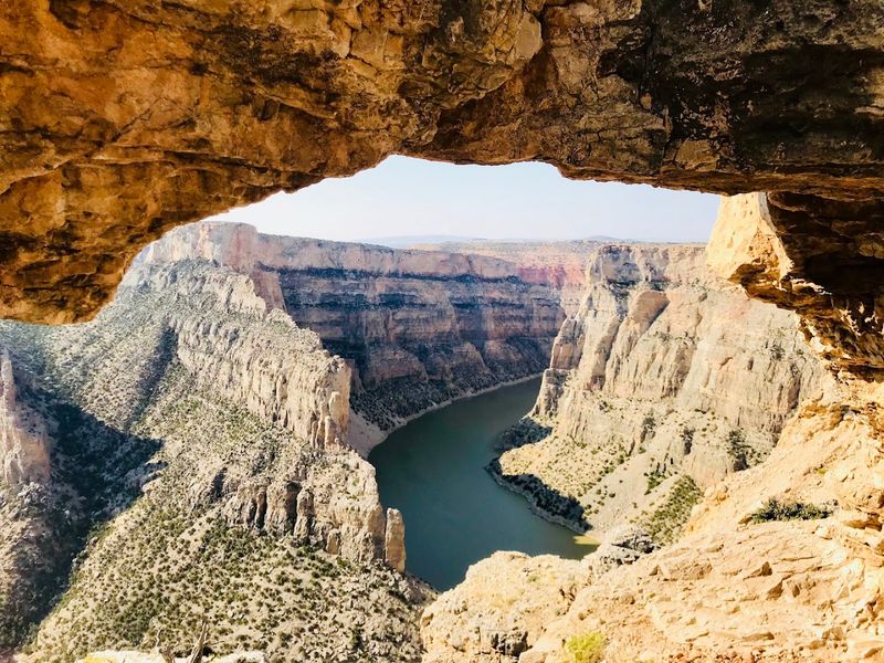
Canyon walls dropping 2,500 feet into deep blue water is the kind of statistic that sounds exaggerated until you are actually standing at the overlook staring down at it.
Bighorn Canyon spans roughly 68,000 acres along the Montana-Wyoming border and supports an ecosystem that ranges from desert shrubland to pine-fir woodland. Wild horses from the Pryor Mountain Wild Horse Range roam the area in a managed herd of 120 to 140 animals, sharing the landscape with bighorn sheep, bald eagles, pelicans, and more than 200 bird species.
Bighorn Lake draws boaters, water skiers, and scuba divers, while the Bighorn River below Yellowtail Dam is one of Montana’s top fishing destinations for brown and rainbow trout. First-time visitors consistently underestimate the canyon’s scale until they see it, which is exactly the kind of surprise that makes the drive out here worth every mile.
9. Missouri Headwaters State Park, Three Forks, Montana
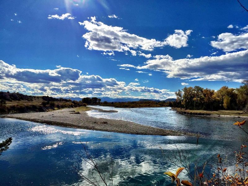
Three rivers walk into a bar and become the Missouri River. That is essentially what happens at this park near Three Forks, where the Jefferson, Madison, and Gallatin Rivers converge at one of the most geographically significant spots in the American West.
Lewis and Clark reached this confluence in 1805 and recognized immediately that they had found something important. The site was also a historical gathering place for Indigenous peoples long before the expedition arrived, and interpretive signs throughout the park cover both timelines in useful detail.
Cottonwood-shaded trails follow the riverbanks to overlooks where the three rivers visibly meet, creating a calm and surprisingly uncrowded atmosphere for a place with this much historical weight. The park works well as a fishing stop, a picnic destination, or simply a place to stand at the birthplace of the mighty Missouri and think about how far it travels from here.
10. Sun Point Nature Trail, Browning, Montana
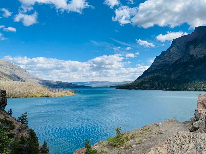
On the eastern side of Glacier National Park, a short trail leads to overlooks so panoramic that first-time visitors sometimes just stop walking and stand there for a while trying to process what they are seeing.
Sun Point sits above Lake St. Mary, where turquoise glacial water stretches toward dramatic mountain peaks and glacier-carved valleys fill the horizon in multiple directions. Summer brings a rotating display of wildflowers that adds color to the already striking mountain backdrop. The trail draws noticeably fewer visitors than Glacier’s more advertised viewpoints, which means the overlooks rarely feel crowded even during peak season.
The accessible pathways make the experience available to a wide range of hikers, not just those looking for a strenuous day. Photography opportunities here are essentially continuous, with the light and cloud patterns constantly shifting the appearance of the lake and surrounding peaks throughout the day.
11. Renova Hot Springs, Whitehall, Montana
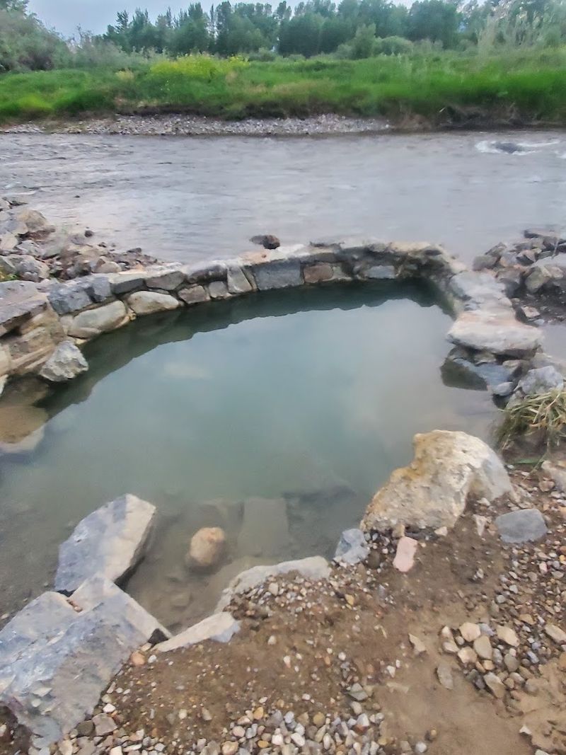
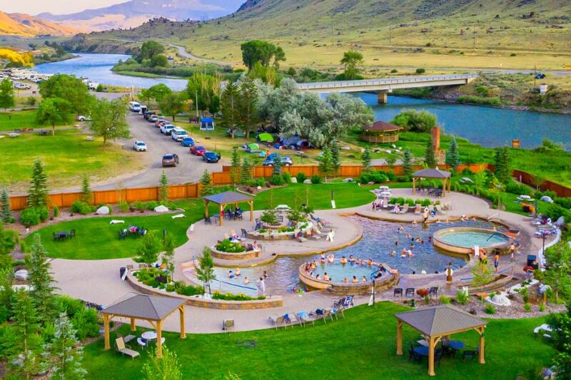
About 10 miles south of Whitehall, a pair of rock-walled pools built by volunteers sits beside a side channel of the Jefferson River, fed by geothermal water that reaches 110 to 122 degrees Fahrenheit at the source before mixing with the cooler river.
The actual soaking temperature fluctuates with the river level, landing in the ideal range of 100 to 108 degrees when conditions cooperate. There are no facilities here, no changing rooms, no restrooms, and no resort infrastructure of any kind. Access involves several miles of dirt road, and conditions vary considerably depending on the season.
The legal access situation is worth researching before making the trip, as the practical trail crosses private land and the Madison County Sheriff’s Office occasionally restricts access. For visitors who do make it, the combination of open Montana sky, mountain backdrop, and genuinely warm mineral water creates an experience that is hard to replicate at a developed resort.
12. Pictograph Cave State Park, Billings, Montana
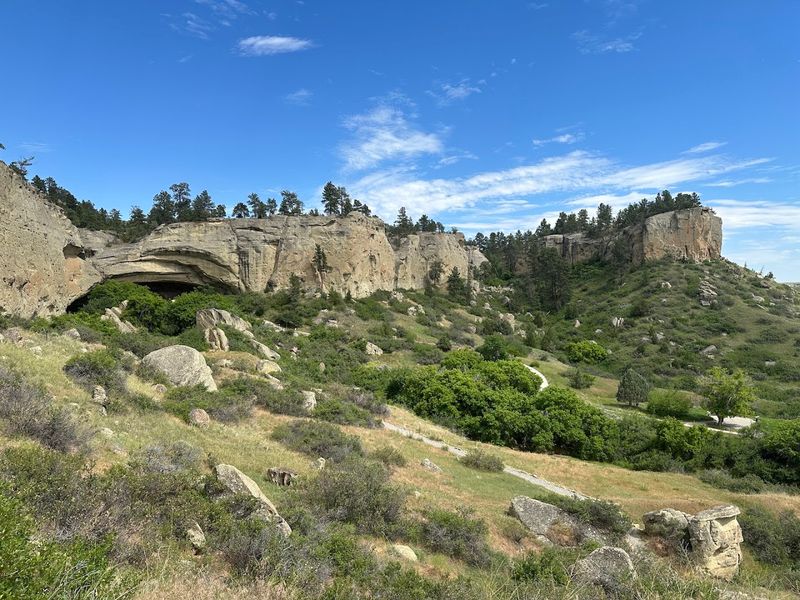
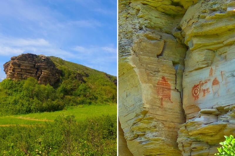
Just five miles south of Billings, a sandstone cliff face contains more than 100 painted images created by Indigenous peoples over a span of roughly 2,100 years, making it one of the most significant archaeological sites in the northern plains.
The oldest pictograph on record here is a turtle estimated at 2,100 years old. Images of animals, warriors, and even rifles document changing eras of life in this region across a remarkably long timeline. Archaeological excavations beginning in 1937 uncovered more than 30,000 artifacts including stone tools, weapons, jewelry, and animal remains, and the site was designated a National Historic Landmark in 1964.
A three-quarter-mile loop trail connects three caves: Pictograph, Middle, and Ghost. Binoculars help considerably when viewing the often-faded images, and visiting after rain or snowmelt can make the pictographs more visible. The interpretive center at the park entrance provides solid context before hitting the trail.
13. Kootenai Falls, Libby, Montana
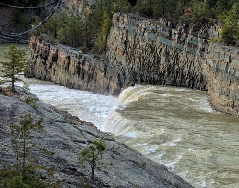
Montana’s largest undammed waterfall measures up to 1,000 feet wide at its broadest point, drops a total of 90 feet, and has appeared in two major Hollywood films including The River Wild and The Revenant, which gives some indication of how cinematic it looks in person.
The Kootenai Falls Swinging Bridge spans 210 to 220 feet across the river and hangs 35 to 100 feet above the water. Originally built by the Civilian Conservation Corps in the 1930s for firefighting access, it was most recently rebuilt in 2019 with steel cables and a wooden deck. The noticeable swaying motion as you cross adds a layer of excitement that most visitors find either thrilling or immediately humbling.
The trail to the falls and bridge is roughly half a mile from the trailhead, passing through woodlands of pines, cedars, and hemlock. The Kootenai Tribe considers this site sacred, adding cultural significance to the already impressive natural scale.
14. Ross Creek Cedars Scenic Area, Troy, Montana
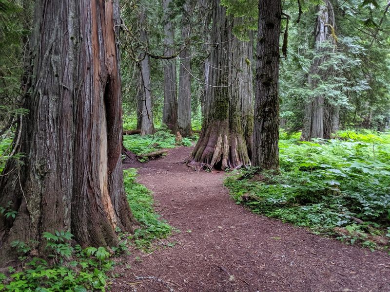
Some of the trees in this 100-acre preserve near Troy have been standing for more than 500 years, which means they were already old when European explorers first reached North America.
These western red cedars reach up to 175 feet in height with trunk diameters of 8 to 12 feet, and walking among them feels genuinely different from any other forest experience Montana offers. A self-guided 0.9-mile nature trail loops through the old-growth grove with interpretive signs covering the ecology and history of this rare ecosystem. The path follows Ross Creek, whose waters originate in the rugged alpine basins of the upper valley.
Recent flood events in late 2025 damaged the access road and closed it to motorized vehicles, but the grove itself remains open for hiking and biking. For visitors expecting only open plains and mountain peaks from Montana, this ancient cedar forest delivers a completely different side of the state.
Share this story