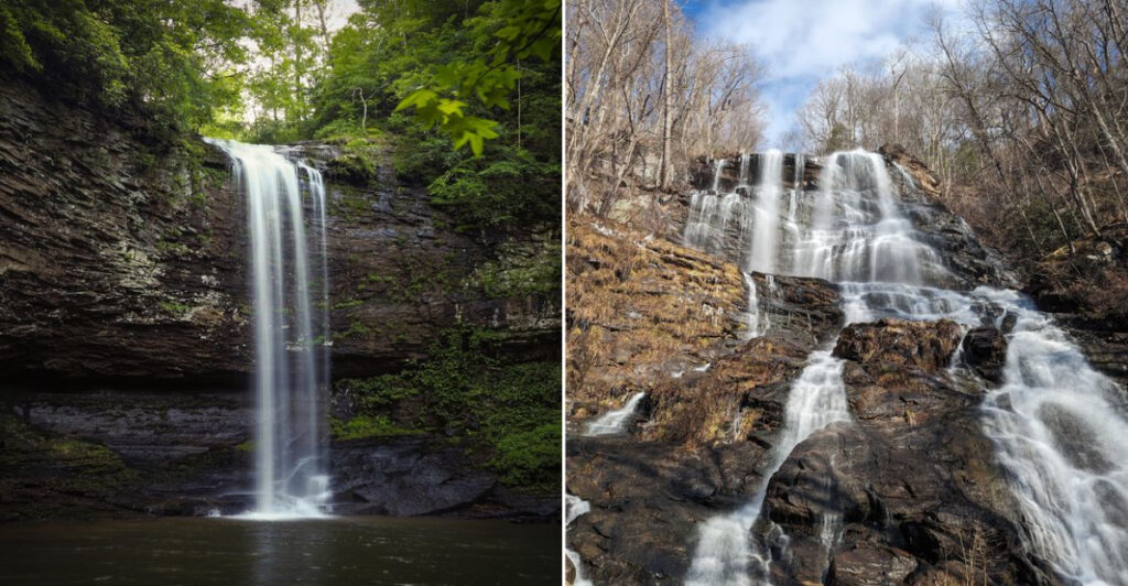
Georgia is packed with state parks that combine rushing waterfalls, forested ridges, and trails that range from easy strolls to serious backcountry adventures. Whether you live in Atlanta or are planning a road trip through the South, these parks offer scenery that genuinely earns a spot on your weekend list.
From the tallest cascading waterfall in the Southeast to a canyon carved by erosion over centuries, the variety across Georgia is hard to beat. This list covers 11 state parks where the trails lead somewhere worth going, the water is always moving, and the views tend to stick with you long after you get home.
Amicalola Falls State Park And Lodge, Dawsonville
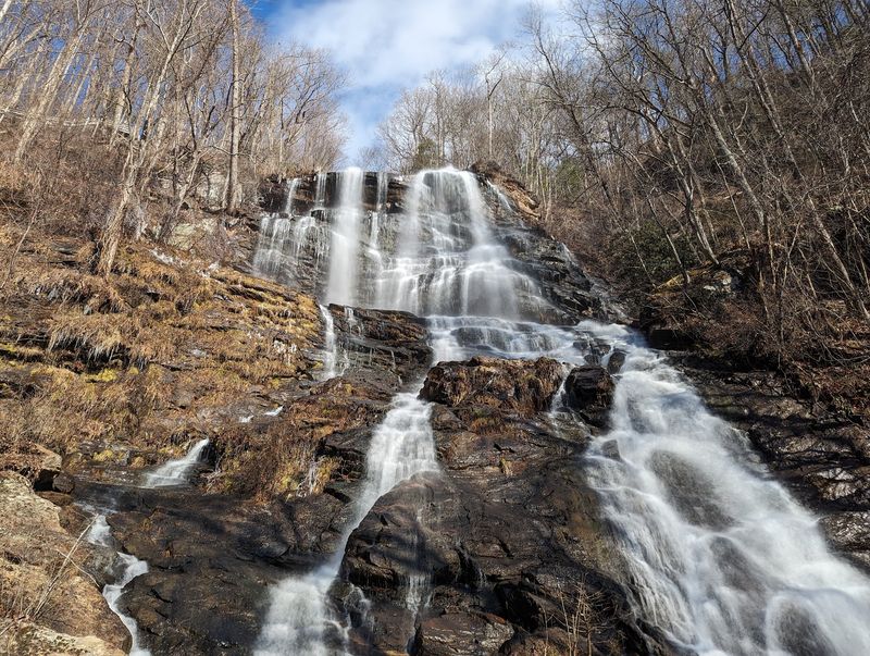
At 729 feet, Amicalola Falls is the tallest cascading waterfall in the entire Southeast, and standing at its base makes that number feel very real. The falls drop in stages down a rocky, tree-lined mountainside in the North Georgia foothills, and the sound alone is worth the drive from Atlanta.
Visitors have real options here. A paved, accessible route brings you to a lower viewing area without requiring a strenuous climb.
If you want more, a series of staircases and steeper paths lead hikers alongside different sections of the cascade for closer views at multiple levels.
The park also connects to the Appalachian Approach Trail, which stretches toward Springer Mountain, the southern terminus of the Appalachian Trail. For a completely different overnight experience, the Len Foote Hike Inn is accessible by trail and offers backcountry lodging without roughing it entirely.
This park earns its reputation as one of North Georgia’s best starting points for outdoor adventure.
Cloudland Canyon State Park, Rising Fawn
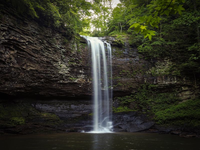
Cloudland Canyon sits along the western edge of Lookout Mountain and contains some of the most dramatic terrain in the entire Georgia state park system. Deep canyons, sandstone cliffs, and forested slopes make this a genuinely striking destination even before you reach the waterfalls.
The Waterfalls Trail covers about 1.8 miles round trip and leads hikers down into the canyon toward Cherokee Falls and Hemlock Falls. That distance sounds manageable, but reaching Hemlock Falls requires approximately 600 stairs each direction.
The climb back up is where the trail earns its reputation.
Travelers who prefer a less physical experience can walk the Overlook Trail, which provides canyon views without the stair descent. Stronger hikers can extend their day with the West Rim Loop.
Worth knowing before you go: entrance roadwork currently creates one-lane traffic during parts of the day, and the permanent visitor center is under construction. The park remains fully open, with visitor services running from a temporary location near the Group Lodge.
Tallulah Gorge State Park, Tallulah Falls
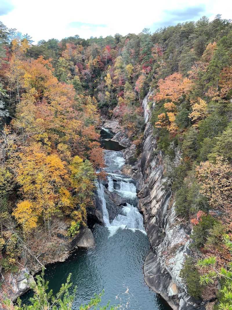
Tallulah Gorge stretches two miles long with rock walls rising as high as 1,000 feet on either side. The Tallulah River runs through the bottom, forming a series of waterfalls, pools, and cascades that visitors can view from multiple overlooks along the North Rim and South Rim trails.
The overlooks provide views of L’Eau d’Or Falls, Tempesta Falls, Hawthorne Pool, and Hurricane Falls. One of the most memorable parts of the hike is crossing a suspension bridge roughly 80 feet above the canyon floor.
Getting there requires a long stair descent followed by an equally demanding climb back up.
Access to the gorge floor is more restricted. Permits may be required, and floor access can be suspended due to high water, weather, or scheduled water releases.
During aesthetic and whitewater release events, hiking and rock climbing inside the gorge are prohibited entirely. The rim trails and overlooks remain open during releases, giving visitors a chance to watch the increased water flow from above.
Black Rock Mountain State Park, Mountain City
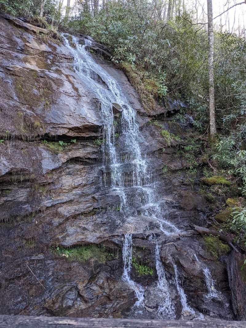
Black Rock Mountain State Park holds the distinction of being the highest state park in Georgia, and the views from its upper elevations on clear days can stretch across multiple states. The park sits deep in the Blue Ridge Mountains near the North Carolina border, and the surrounding forest feels genuinely remote.
The Ada-Hi Falls Trail is a short but worthwhile hike through a moist Appalachian cove filled with hardwoods, ferns, rhododendrons, and lichen-covered rocks. The trail covers only about a quarter-mile each way, but the elevation change makes it more physically demanding than its length suggests.
The route ends at an observation platform overlooking Ada-Hi Falls, a small mountain cascade whose flow depends heavily on recent rainfall.
For longer views, the 2.2-mile Tennessee Rock Trail climbs through high-elevation forest to overlooks that face Georgia and neighboring states. Visitors looking for an easier walk can take the 0.85-mile Black Rock Lake Trail, which crosses wooden bridges over Taylor Creek and Greasy Creek.
Each trail here offers something genuinely different.
Vogel State Park, Blairsville
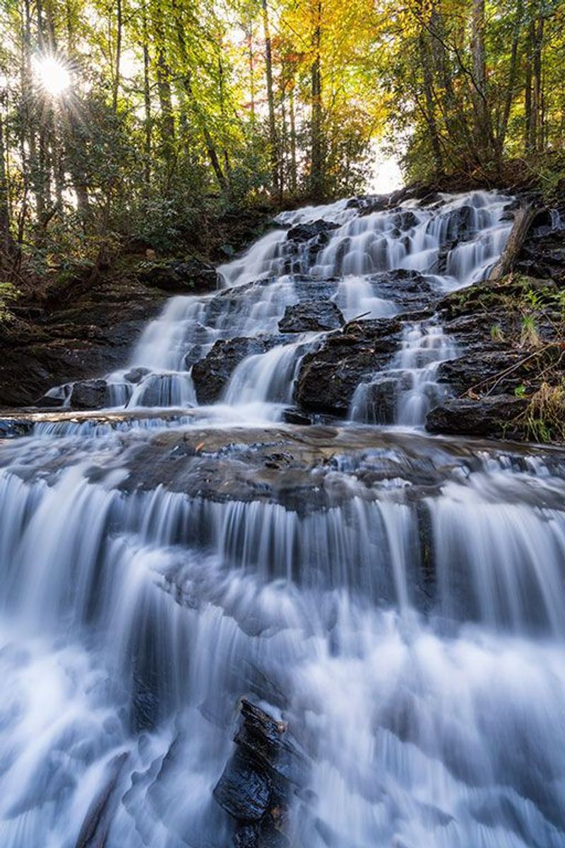
Vogel State Park opened in 1931, making it one of Georgia’s oldest state parks. It sits at the base of Blood Mountain in the Blue Ridge range, and its combination of a calm mountain lake, forested trails, and CCC-era infrastructure gives it a character that feels both historic and approachable.
The easy one-mile Trahlyta Lake Trail circles the lake and crosses a dam built by the Civilian Conservation Corps in 1935. A spur path leads to an observation deck below the spillway, where water from the lake spills over into Trahlyta Falls.
The bridge near the dam also provides one of the park’s most photographed views, with the lake in the foreground and Blood Mountain rising behind it.
Hikers ready for a longer challenge can tackle the 4.1-mile Bear Hair Gap Trail or the more demanding 12.9-mile Coosa Backcountry Trail. Both routes travel through adjoining national forest land and cross steep mountain ridges.
Vogel works well as either a relaxed family outing or a serious hiking destination, depending on how far you want to push.
High Falls State Park, Jackson
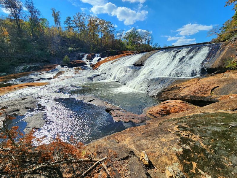
High Falls State Park sits northwest of Macon and protects what Georgia State Parks describes as the largest waterfall south of Atlanta. Water tumbles across approximately 135 feet of rocky terrain along the Towaliga River, and the sheer volume of moving water during higher flow periods is genuinely impressive.
The 1.5-mile Falls View Trail follows the river closely through rocky, uneven terrain and is rated strenuous for its footing rather than its elevation. It offers the closest hiking access to the falls themselves.
For a more relaxed experience, the Historic Trail includes an accessible route and a viewpoint overlooking the cascade from a safer distance.
The Historic Trail also passes remnants of the area’s industrial past, including an old dam, grist mill features, and the remains of hydroelectric infrastructure. That combination of natural scenery and visible history makes the park worth a stop even for visitors who are not planning a long hike.
High Falls is a practical waterfall destination for anyone who wants to skip the North Georgia mountain drive.
Fort Mountain State Park, Chatsworth
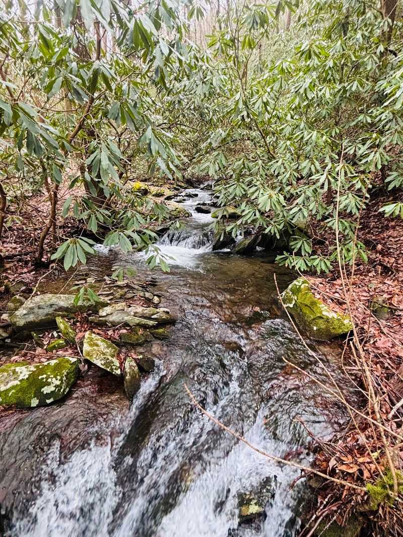
Fort Mountain State Park sits inside the Cohutta Mountains and offers a wider mix of trail experiences than most Georgia parks its size. Small waterfalls, mountain overlooks, an ancient stone wall of uncertain origin, and long backcountry routes all share the same landscape here.
The 0.75-mile Big Rock Nature Trail descends into a mountain hollow and follows Gold Mine Creek through a forested corridor. Along the way, hikers pass several small cascades and waterfalls tucked between moss-covered rocks and hardwood trees.
The route is short but the terrain keeps it interesting.
For bigger views, the 8.7-mile Gahuti Trail loops around the park and eventually reaches the Cool Springs Overlook, which looks across Holly Creek Valley toward the surrounding mountains. A shorter loop connects the West Overlook with the park’s stone fire tower and the mysterious ancient stone wall whose exact history remains unknown.
The park also has a lake loop and longer shared-use trails that travel between ridges, old mine areas, and wooded creek corridors.
James H. “Sloppy” Floyd State Park, Summerville
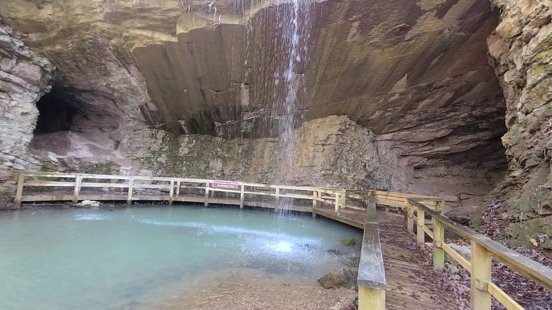
Not every Georgia state park waterfall comes with a dramatic canyon or a towering drop. At James H.
Floyd State Park in Summerville, the waterfall is seasonal and tied to one of the more unusual geological features in the northwest Georgia park system: a marble outcropping near an old mining site.
The Marble Mine Trail follows an old road roughly one mile to the former mining area. During wetter periods, water drops approximately 35 feet over the marble rock face near the mine entrance.
The flow is most noticeable after winter and spring rainfall. During dry weather, visitors may find only a thin stream across the rock surface, so timing matters.
The trail can be extended another 0.8 miles to connect with the Pinhoti Trail, which provides winter views toward Lookout Mountain when the trees are bare. The park also offers fishing lakes and a quieter atmosphere than most northwest Georgia destinations.
This is a rewarding stop for hikers who enjoy combining natural scenery with traces of the region’s industrial history.
F.D. Roosevelt State Park, Pine Mountain
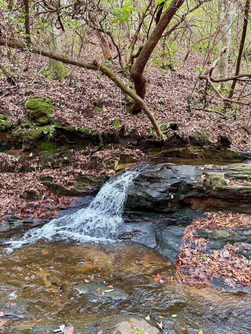
F.D. Roosevelt State Park covers more than 10,000 acres across Pine Mountain’s ridges, making it Georgia’s largest state park by a significant margin.
Its trail system spans more than 40 miles and crosses hardwood forests, creek drainages, and small waterfalls spread across rolling western Georgia terrain.
The 23-mile Pine Mountain Trail is the park’s major backcountry route, but shorter options exist for visitors who prefer a more manageable outing. The one-mile Dowdell’s Knob Trail descends from the ridge through changing forest habitat and ends near a waterfall at Brown Dog Bluff.
Dowdell’s Knob itself is a scenic overlook on the Pine Mountain ridge associated with President Franklin D. Roosevelt, who visited the area regularly during his time in office.
Unlike the steep Blue Ridge terrain farther north, F.D. Roosevelt State Park offers a rolling mountain experience in western Georgia.
That makes it a practical choice for travelers coming from Columbus or LaGrange who want long trail miles without driving to the state’s northern edge. The scale of this park alone sets it apart.
Sweetwater Creek State Park, Lithia Springs
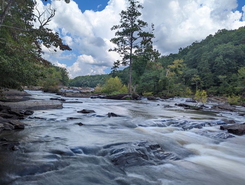
Sweetwater Creek State Park sits less than 20 miles from downtown Atlanta, which makes the level of wilderness it delivers genuinely surprising. The park combines Civil War history, rocky whitewater, and forested creek corridors into a hiking experience that feels far removed from the suburban sprawl surrounding it.
The popular Red Trail follows the creek for one mile each way, leading first to the five-story ruins of the New Manchester Manufacturing Company, a textile mill burned during Sherman’s march through Georgia. Beyond the ruins, the trail grows rockier and more demanding as it travels above powerful whitewater rapids and rolling shoals.
Sweetwater Creek does not have a single dramatic waterfall like Amicalola. Instead, the draw is continuous rushing water, rocky terrain, and the kind of raw creek scenery that takes most Georgia parks a two-hour drive to deliver.
Other routes extend deeper into the park’s forests and along quieter sections of water. Its accessibility from Atlanta makes it one of the most frequently visited parks on this list.
Providence Canyon State Park, Lumpkin
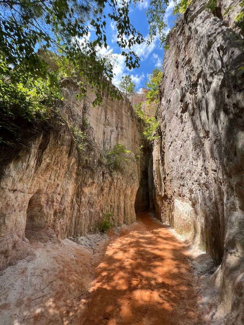
Providence Canyon looks like it belongs in the American Southwest, not southwest Georgia. Known as Georgia’s Little Grand Canyon, the park contains deep gullies with layered canyon walls streaked in orange, pink, red, and white.
The formations were created not by ancient geology but by severe erosion that accelerated after poor farming practices disturbed the land in the 1800s.
The 2.5-mile Canyon Loop Trail gives hikers access to both the rim and the floor. Visitors descend into the canyon and can explore the entrances to nine numbered canyons before climbing back toward the top.
Small amounts of water commonly flow along portions of the floor, so expect wet sand, mud, or shallow puddles depending on recent weather conditions.
The canyon walls and edges are fragile and can collapse without warning, so staying on designated trails and behind safety fences is strictly enforced. Climbing or carving into the formations is prohibited.
Providence Canyon rounds out this list as proof that Georgia’s most striking scenery does not always involve mountains or traditional waterfalls.
Share this story