Most borders are simple lines on a map, but some push that idea to its absolute limits. Around the world, there are places where countries overlap in ways that seem almost impossible, cutting through buildings, splitting tiny islands by a full day on the calendar, or creating pockets of land that nobody wants to claim.
These quirky geographic situations reveal just how complex and fascinating our world really is. Get ready to explore some of the strangest border crossings on the planet.
1. Baarle-Hertog and Baarle-Nassau: Belgium and the Netherlands
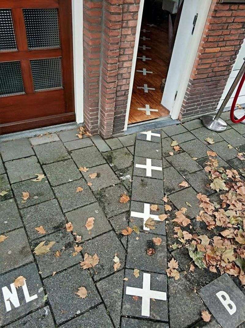
Imagine stepping out of your front door and landing in a different country. That is everyday life in Baarle-Hertog and Baarle-Nassau, two municipalities where the international border zigzags unpredictably through streets, shops, and even individual buildings.
The Belgian territory of Baarle-Hertog consists of dozens of separate parcels surrounded by Dutch territory. Some buildings literally straddle the border, meaning a family could eat dinner in Belgium and sleep in the Netherlands without ever leaving home.
Small brass crosses and plaques embedded in the pavement mark exactly where the boundary runs. Local rules once determined which country’s laws applied based on where a building’s front door stood.
Shopkeepers would sometimes move their doors a few feet just to benefit from different tax rates. It remains one of Europe’s most endearing and truly mind-bending territorial puzzles.
2. Diomede Islands: United States and Russia
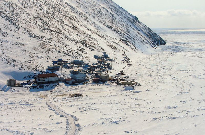
Just a few miles of icy Arctic water separates two small islands in the Bering Strait, yet they exist almost a full day apart on the calendar. Little Diomede belongs to the United States, while Big Diomede belongs to Russia, and the International Date Line runs directly between them.
On a clear day, residents of Little Diomede can literally see tomorrow from their doorsteps. This quirk makes the Diomede Islands one of the most dramatic examples of how time zones and political borders can collide in a single narrow channel of water.
During the Cold War, the stretch between the islands was nicknamed the “Ice Curtain,” reflecting the deep political divide between the two superpowers. Today, crossing between the islands remains extremely difficult due to strict border controls.
The community on Little Diomede is one of Alaska’s most remote, reachable only by helicopter or small boat.
3. Derby Line and Stanstead: United States and Canada
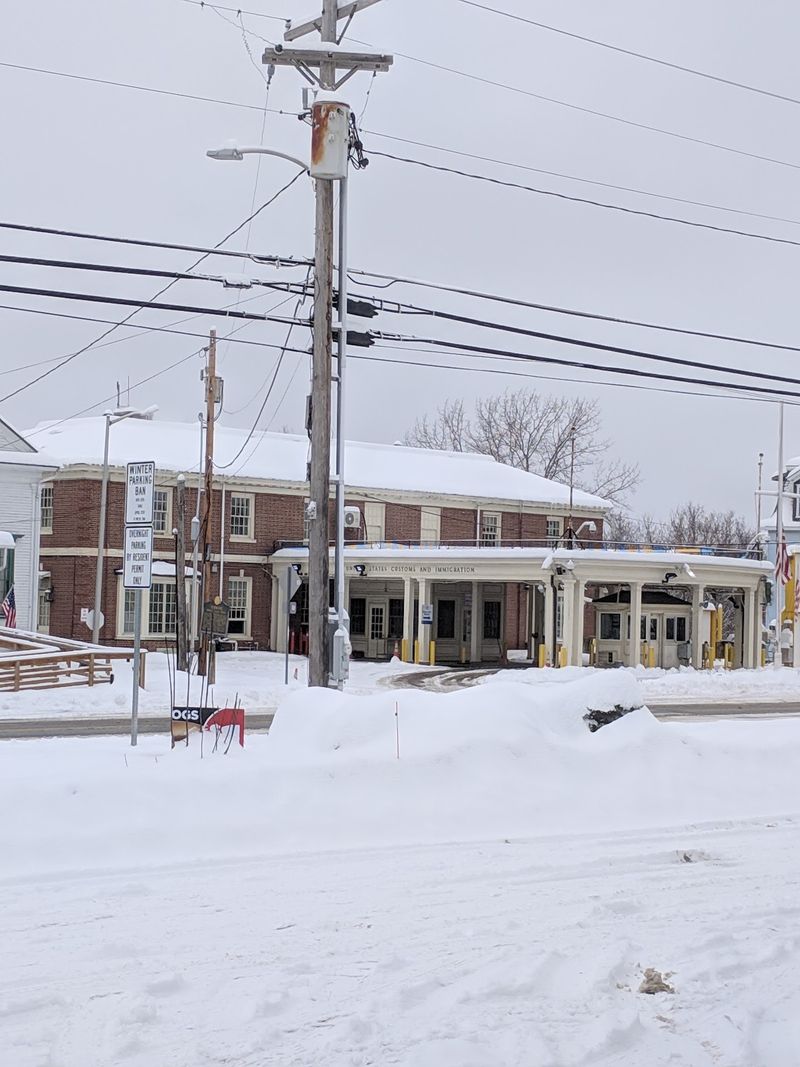
A library where you can borrow a book in one country and return it in another sounds like fiction, but that is the reality in Derby Line, Vermont, and Stanstead, Quebec. The Haskell Free Library and Opera House was deliberately built straddling the international border in 1904, making it a shared cultural institution for both communities.
A thick black line painted on the library’s floor shows exactly where the United States ends and Canada begins. Readers can sit on the American side while the books they need are shelved on the Canadian side.
The opera house stage sits entirely in Canada, while most of the audience watches from American seats.
The surrounding town is equally unusual, with the border running directly through residential streets and backyards. Locals have long maintained a relaxed, neighborly relationship across the line, making this community one of the most genuinely integrated border towns in North America.
4. Bir Tawil: Egypt and Sudan
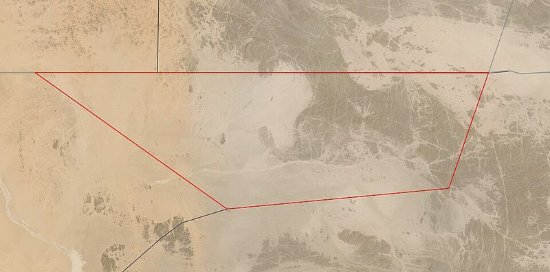
Most territorial disputes involve two countries fighting over land they both want. Bir Tawil flips that idea completely: it is a roughly 800-square-mile patch of desert that neither Egypt nor Sudan is willing to claim as its own.
The unusual situation stems from two competing boundary agreements drawn in 1899 and 1902. Each country prefers the version of the border that gives it the more valuable Halaib Triangle along the Red Sea coast, and accepting Bir Tawil would mean giving up that larger claim.
So the barren interior patch simply sits unclaimed.
A handful of adventurous travelers have visited Bir Tawil and even planted flags, humorously “claiming” it as their own micronation. One American farmer famously traveled there in 2014 so his daughter could become a princess of a real kingdom.
It remains one of the only pieces of habitable land on Earth that no recognized government calls its own.
5. Point Roberts: United States Geographic Oddity in Canada
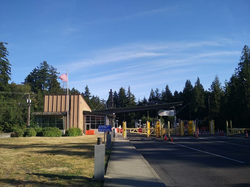
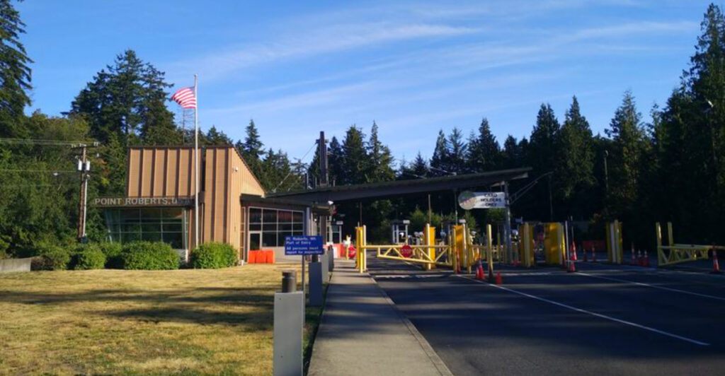
Point Roberts is a small peninsula at the southern tip of British Columbia that dips just far enough below the 49th parallel to belong to the United States. Because of its location, the only land route connecting it to the rest of Washington State runs entirely through Canada.
Residents who want to drive to Seattle, their nearest major American city, must cross two international borders each way. They pass through Canadian customs leaving Point Roberts, drive through British Columbia, and then cross back into the United States.
A simple grocery run can become a minor international event.
The community has about 1,300 full-time residents and a relaxed, small-town atmosphere. Many Canadians own vacation homes there, drawn by lower American property prices.
During the COVID-19 pandemic, border closures hit Point Roberts especially hard, cutting off many residents from their everyday shopping and medical services in nearby Tsawwassen, British Columbia.
6. Northwest Angle: Minnesota’s Isolated Corner
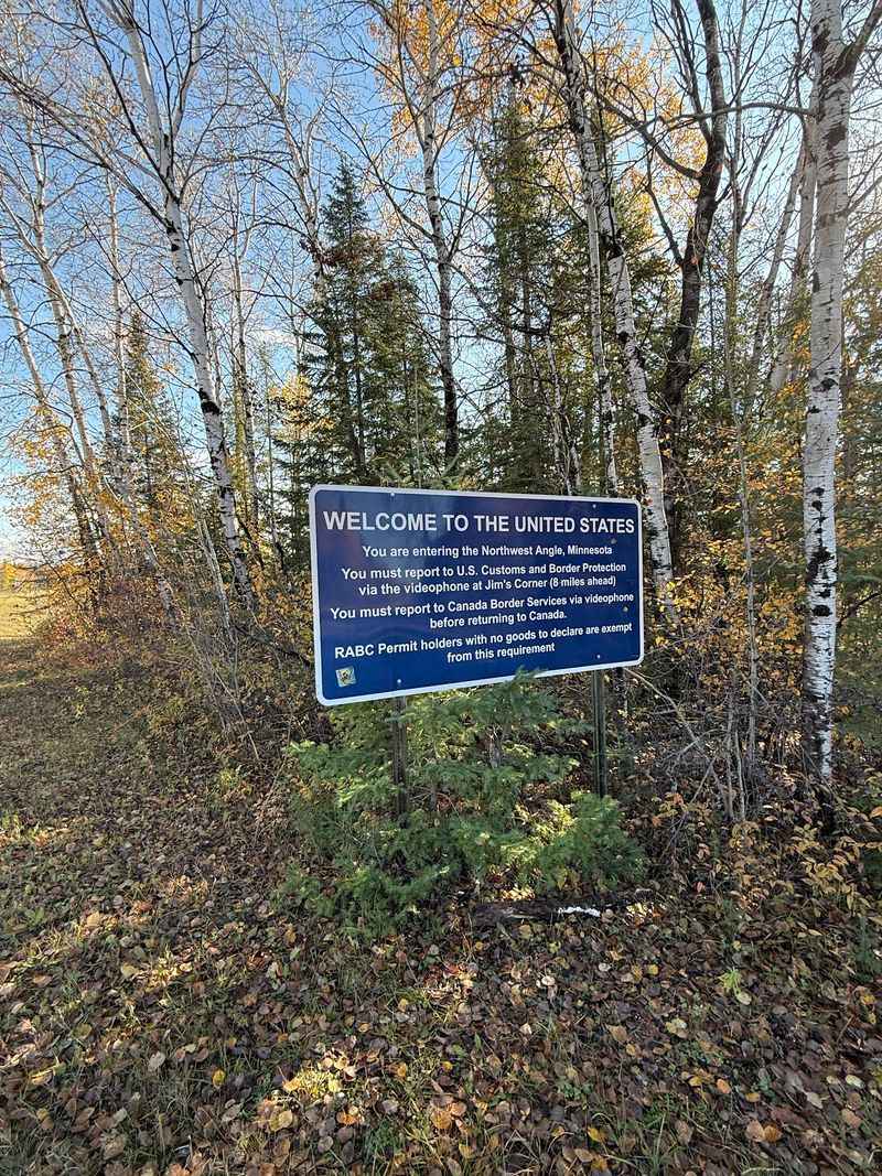
Tucked into the top of Minnesota, the Northwest Angle is the only part of the contiguous United States that sits north of the 49th parallel. Getting there by land from the rest of America requires driving through Canada, making it one of the country’s most isolated communities.
The oddity traces back to a mapping error made after the American Revolution. Negotiators used an inaccurate map that misidentified the source of the Mississippi River, and by the time the mistake was discovered, the border had already been formally established.
Fixing it would have meant renegotiating an international treaty.
About 120 people call the Northwest Angle home year-round, and the area is popular with anglers who come for the walleye fishing on Lake of the Woods. Crossing into Canada and back is a relatively relaxed process, though travelers must still check in with customs, often using a video phone kiosk at an unmanned border station.
7. Llivia: A Spanish Town Surrounded by France
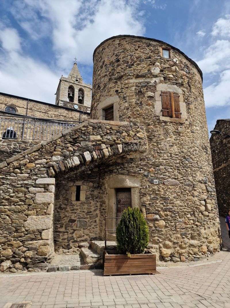
Nestled in the eastern Pyrenees, Llivia is a Spanish town of roughly 1,500 people that has been completely surrounded by France for more than 350 years. A narrow road officially designated as Spanish territory connects it to the rest of Spain, but the surrounding fields and villages are all French.
The situation began with the 1659 Treaty of the Pyrenees, which transferred 33 villages in the region from Spain to France. Llivia, however, had been officially classified as a town rather than a village, and that single legal distinction was enough to keep it Spanish.
The treaty’s wording created an accidental enclave that has persisted ever since.
Visitors to Llivia often find the experience charming rather than confusing. The town has its own pharmacy museum, which claims to house one of Europe’s oldest operating pharmacies.
Crossing between Llivia and France feels seamless today, thanks to open European Union borders, but the historical quirk remains genuinely fascinating.
8. Nahwa and Madha: UAE Inside Oman Inside UAE
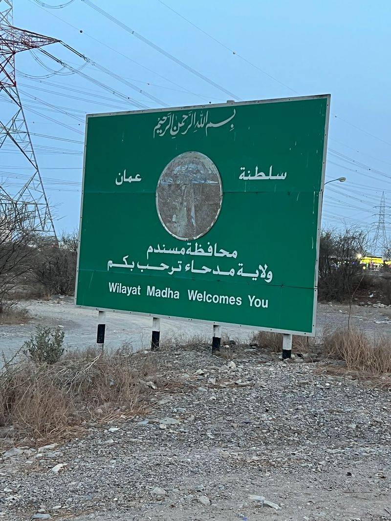
Geography rarely gets more complicated than this. Madha is a small piece of Omani territory completely surrounded by the United Arab Emirates.
Inside Madha sits Nahwa, a tiny UAE exclave, making it a counter-enclave: a territory inside a territory inside another territory entirely.
Nahwa consists of just a handful of houses and a police station, yet it represents an extraordinarily rare geographic arrangement. Counter-enclaves are so uncommon worldwide that most geography enthusiasts consider them the ultimate curiosity in the study of political boundaries.
Crossing between these territories is generally calm and uneventful for locals who live in the area. The borders are well-marked but lightly staffed, reflecting the friendly diplomatic relationship between Oman and the UAE.
Travelers driving through the region sometimes pass through multiple border checkpoints within just a few miles, experiencing three different jurisdictions in a single short journey without much fanfare at all.
9. Tumen River Area: China, Russia, and North Korea
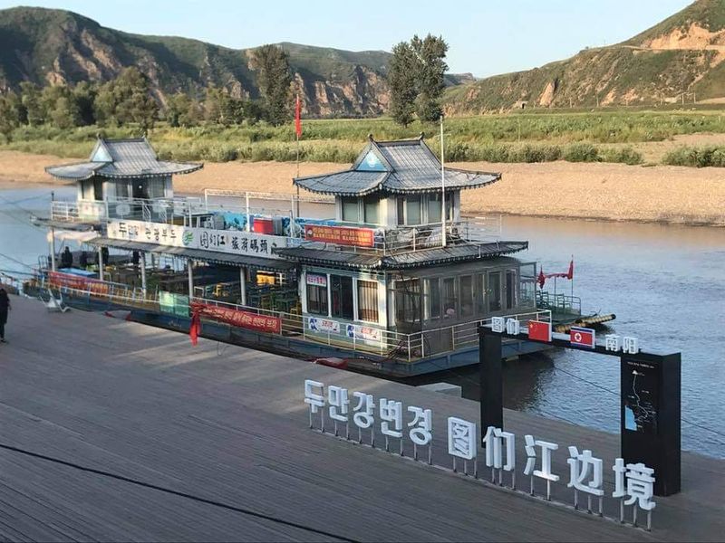
Near the mouth of the Tumen River in northeastern Asia, three countries come together in a remarkably compact stretch of land and water. China, Russia, and North Korea share borders in this region, creating one of the continent’s most geopolitically sensitive and geographically unusual convergence points.
The area has long attracted attention from economists and diplomats because China’s territory here is tantalizingly close to the Sea of Japan. However, the narrow strips of Russian and North Korean land along the river’s final miles block China from having direct coastal access.
That geographic reality has fueled decades of regional development discussions.
A bridge connects China and Russia near Hunchun, and the surrounding region has seen investment in trade zones and transportation links. North Korea’s presence adds significant tension and complexity to any cross-border cooperation plans.
Standing near the tripoint, visitors can observe three very different political worlds pressing close together within a surprisingly small geographic space.
10. Kazungula: Where Four Countries Nearly Meet
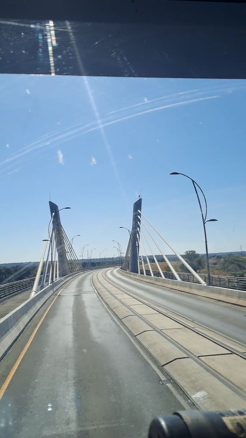
At Kazungula, along the Zambezi River, Botswana and Zambia share one of the shortest international borders in the world, estimated at just a few hundred meters. What makes this location truly remarkable is how close Namibia and Zimbabwe come to that same tiny meeting point, creating what many describe as a four-country convergence.
Geographers debate whether all four nations technically share a single point, but even the near-miss is extraordinary. The area sits at the intersection of four sovereign states within a stretch of river that a person could swim across on a calm day.
A modern road bridge now spans the Zambezi here, replacing the old Kazungula Ferry that connected Botswana and Zambia for decades.
The bridge opened in 2021 and has transformed regional trade by reducing long delays at the ferry crossing. Travelers passing through can experience a remarkable geographic rarity: watching multiple national flags flutter within clear eyesight of each other across the same flowing river.
11. Ceuta and Melilla: Spain on the African Coast
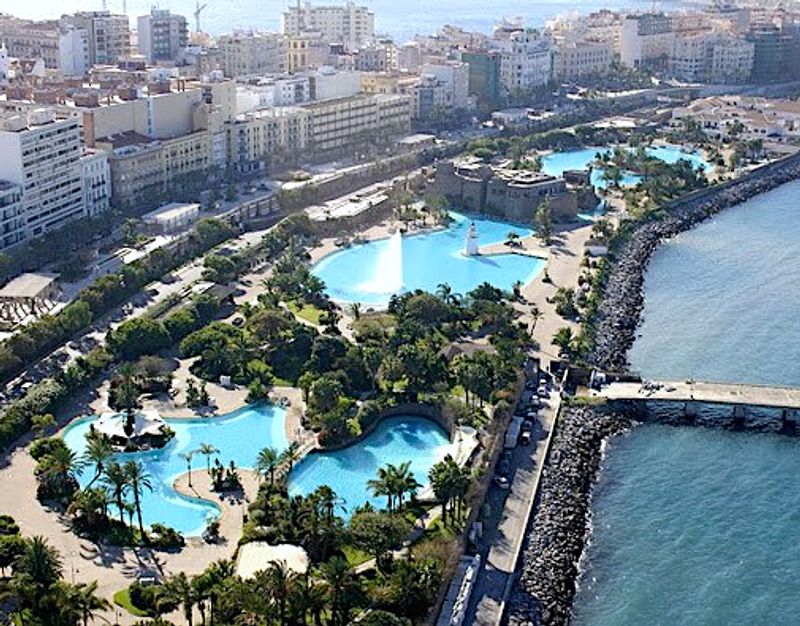
On the northern coast of Africa, two Spanish cities create a genuinely unusual geopolitical situation. Ceuta and Melilla are fully part of Spain and, by extension, the European Union, yet they share land borders with Morocco on the African continent.
They are the only two EU land borders located in Africa.
Both cities have been under Spanish control for centuries, predating Morocco’s modern statehood. Morocco disputes Spain’s sovereignty over them, but Spain considers them integral parts of its national territory, not colonies.
The cities function as regular Spanish municipalities, complete with Spanish schools, hospitals, and local governments.
The borders of Ceuta and Melilla have become focal points for migration into Europe, drawing significant international attention. Thousands of people attempt to cross each year, hoping to reach EU territory.
Tall security fences and surveillance technology line both perimeters, making these borders among the most heavily monitored points where Africa and Europe physically touch.
12. Vatican City and Italy: The World’s Smallest Border
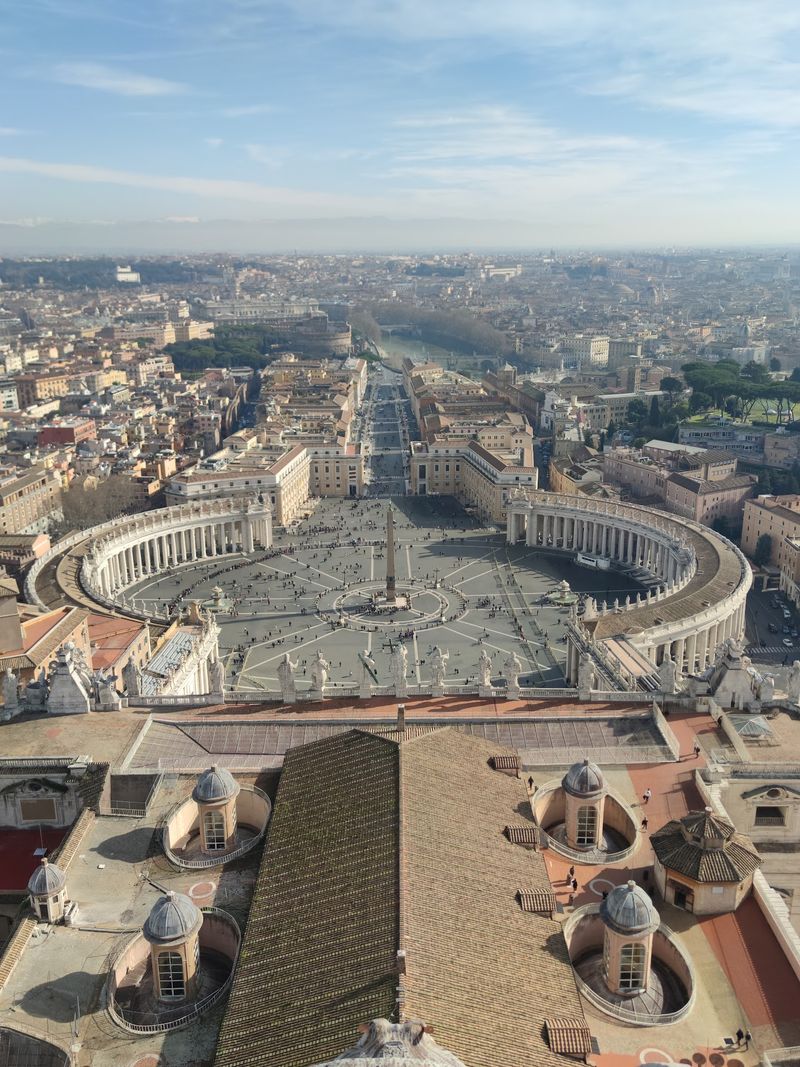
Walking through Rome, you can step from Italy into a fully independent sovereign nation without passing through a gate, showing a passport, or even noticing a traditional border crossing. Vatican City, covering just 44 hectares inside Rome, is the world’s smallest internationally recognized independent state.
Most of the boundary between Vatican City and Italy follows the old Leonine Wall, a historic fortification built in the 9th century. Along St. Peter’s Square, the border is marked only by a subtle change in pavement and small brass markers set into the ground.
There are no passport stamps, no customs checks, and no visa requirements for most visitors.
The Vatican operates its own postal service, radio station, and even issues its own euro coins, which are considered collector’s items. Despite its tiny size, it maintains diplomatic relations with countries around the world.
Crossing this border on a busy afternoon feels less like an international journey and more like a pleasant Sunday stroll.
Share this story