Some travel bucket list stops come with warning signs, permit systems, and weather alerts. Visitors keep showing up anyway, because the views are huge and the stories are even bigger.
This list covers cliffs, volcanoes, deserts, waterfalls, and mountain trails across the United States and the world. Each one is open to visitors in some form, though many have strict rules, seasons, or limits.
Knowing what to expect can make a big difference before you pack a bag. Here is a look at 17 spots where the scenery is wild and a little planning goes a long way.
Angels Landing, Zion National Park, Utah
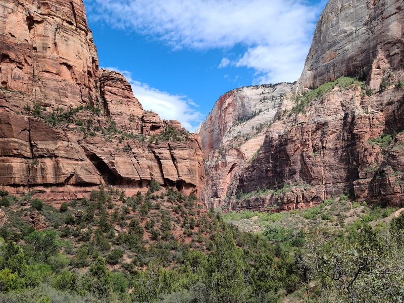
Chains bolted into solid rock are a big clue that this is no ordinary walk. Angels Landing is one of Zion National Park’s best-known hikes, and its final stretch is famously exposed.
Hikers follow a narrow sandstone ridge where some sections are less than three feet wide. Steep drops sit on both sides, and the chains give extra support along the way.
Crowding made the route riskier, so the National Park Service created a permit system for anyone going beyond Scout Lookout. More than 200,000 permits are issued each year, which shows how strong the pull remains.
The trail is still open to people who hold a valid permit. Hikers are expected to take the exposure, weather, and trail conditions seriously before heading up.
I would plan this one well ahead, since permits are part of the trip. Checking the forecast the day before is a smart habit, and turning around at Scout Lookout is always an option for anyone who feels unsure.
Half Dome, Yosemite National Park, California
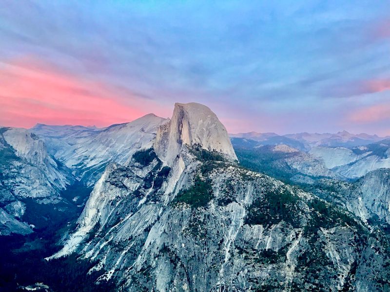
Two metal cables, 400 feet of steep granite, and no climbing gear required. That is the legend of Half Dome’s final push, and it is why so many hikers want a turn.
The cables let regular hikers reach the top without technical rock-climbing equipment. Still, wet granite can turn extremely slippery, and Yosemite warns people not to try the cables when the rock is wet.
Thunderstorms are another reason to be careful. Lightning is a major concern on the exposed summit, so hikers should stay off when storms are nearby.
The cables are normally up from late May until around mid-October, depending on conditions. Permits are required during that cable season, so booking ahead matters.
Half Dome remains one of Yosemite’s signature adventures despite the difficulty. Early starts, plenty of water, and a good look at the sky can help keep the day on track.
Bright Angel Trail, Grand Canyon National Park, Arizona
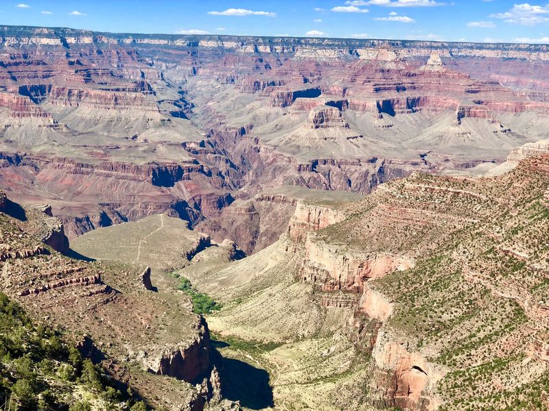
Going down is the easy part. The Grand Canyon can look manageable from the rim, but the Bright Angel Trail brings big elevation changes and extreme heat once hikers drop below it.
The National Park Service repeatedly warns summer visitors about dangerous inner-canyon temperatures. During intense heat, it recommends avoiding strenuous hiking between 10 a.m. and 4 p.m.
In June 2026, an 18-year-old hiker suffered fatal heat-related symptoms on this trail, a sober reminder of those warnings.
The route is still a major attraction, and many people hike part of it every day. The park stresses that hiking down is far easier than climbing back out.
A smart plan is to turn around early, carry more water than seems necessary, and start at sunrise. Short out-and-back hikes can still give a great taste of the canyon.
Death Valley National Park, California
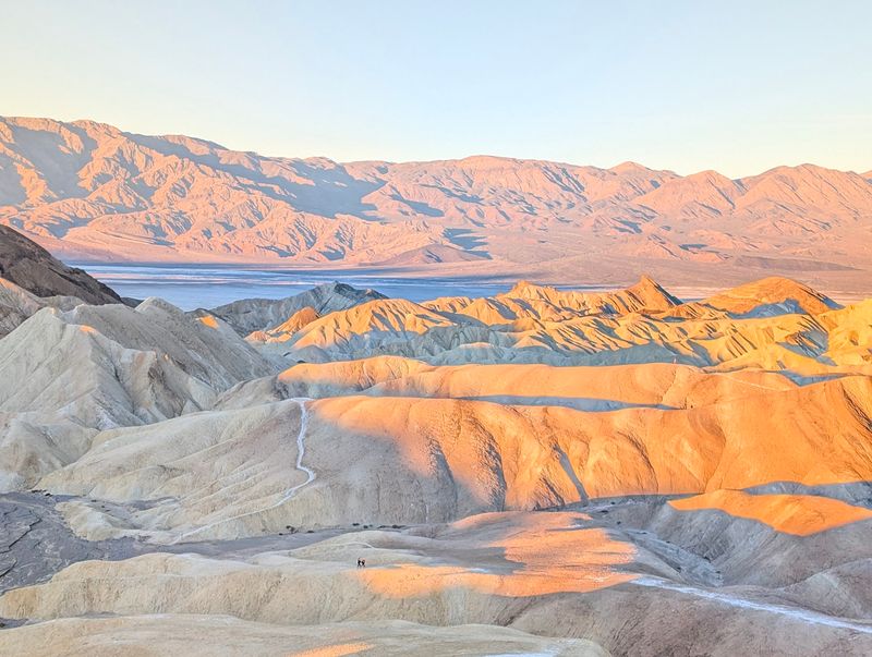
The name sets the tone, and the thermometer backs it up. Death Valley draws visitors because of its extreme desert landscape, and summer conditions can become severe.
The National Park Service notes that temperatures can reach around 130°F, or 54°C. It strongly discourages hiking at lower elevations during hot weather.
Visitors are advised to carry large quantities of water and stay near paved roads in summer. If a vehicle breaks down, the guidance is to stay with it.
Most of the park continues to operate for visitors. Individual areas can close temporarily because of storms, fires, flooding, or other hazards, so checking current conditions is a good first step.
For many travelers, cooler months make the visit far more comfortable. Summer trips call for early mornings, full gas tanks, and a cooler packed with extra water.
Reynisfjara Black Sand Beach, Iceland
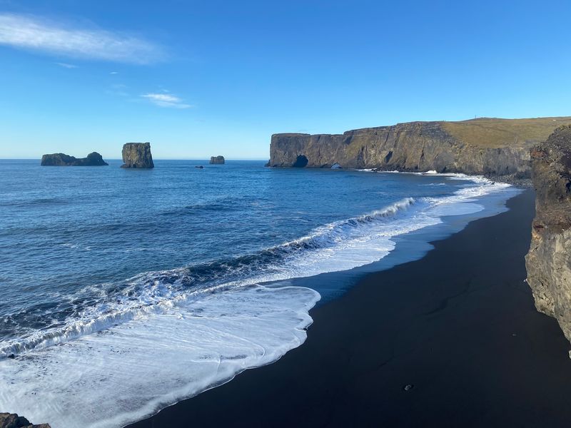
Black sand, tall basalt columns, and rugged sea stacks make this one of Iceland’s most photographed beaches. The Reynisdrangar formations rise just offshore and frame the view.
Beauty is only half the story here. The beach is also known for sneaker waves, unusually powerful waves that can travel much farther up the sand than the ones before them.
These waves have swept people into the ocean. Iceland’s tourism authorities specifically warn visitors to stay well away from the shoreline.
The beach remains easy to reach and extremely popular. Even so, it should not be treated like an ordinary swimming beach.
A good habit is to keep a generous distance from the water and never turn your back on the sea. Photos look just as good from higher, drier sand.
Cliffs of Moher, County Clare, Ireland
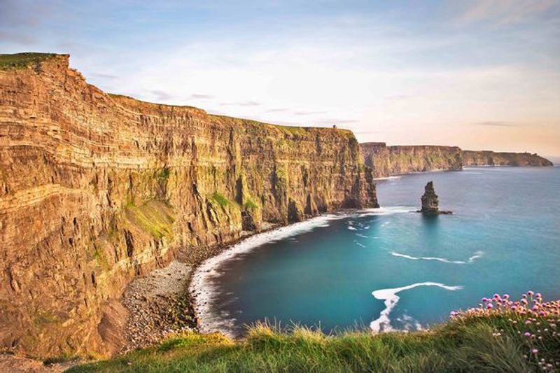
Here is a place that uses a color code to tell visitors how the day looks. The Cliffs of Moher rise dramatically above the Atlantic, and strong winds plus exposed edges can create hazardous conditions.
The attraction runs a weather-status system. Under yellow conditions, visitors are advised to use extra caution near cliff pathways and viewing areas.
Orange conditions can trigger closure of the cliff viewing areas. Red conditions can lead to evacuation and a complete site closure.
On calmer days, the visitor experience operates normally and huge numbers of people come through. The cliffs show how quickly a place can shift from easy to risky when the weather turns.
Checking the status before you go is a simple step. Staying behind barriers and on marked paths keeps the visit enjoyable.
Trolltunga, Norway
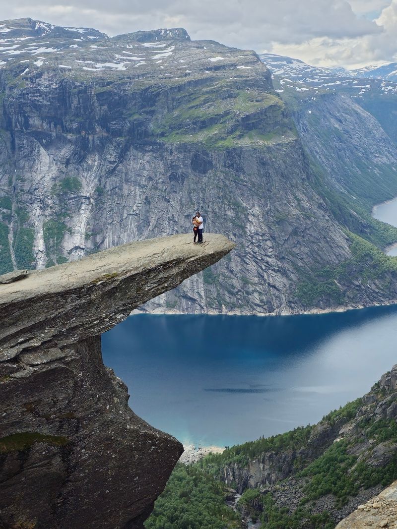
Round trip, the walk to Trolltunga is roughly 20 kilometers from Mågelitopp. Plan on seven to ten hours, which surprises many people who only know the famous photo.
The rock formation juts out over the landscape with steep cliffs and no protective fencing. Visit Norway warns that fog can make those cliffs especially hazardous.
Rescue crews help tired, injured, or poorly prepared hikers every year. That fact alone says a lot about how demanding this trip can be.
The attraction is open seasonally. Guided options are strongly recommended outside the main summer period.
Good boots, snacks, layers, and an early start are the basics. Photo lines can form at the rock, so patience helps too.
Kjerag and Kjeragbolten, Norway
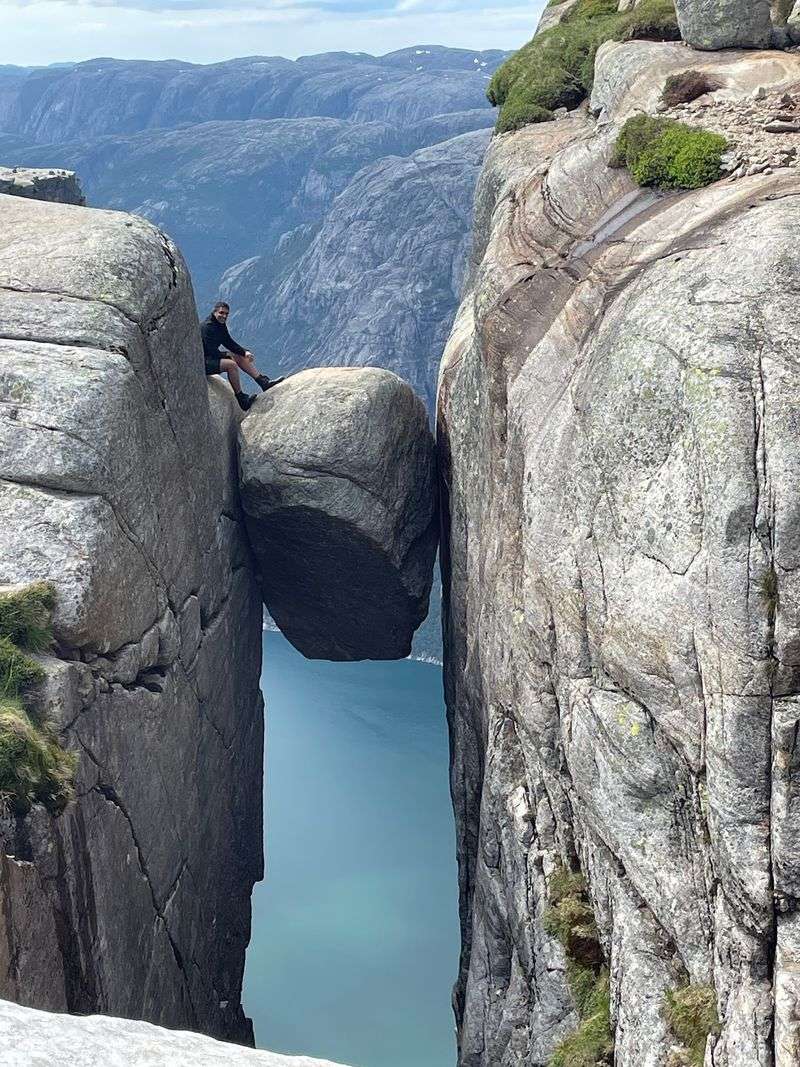
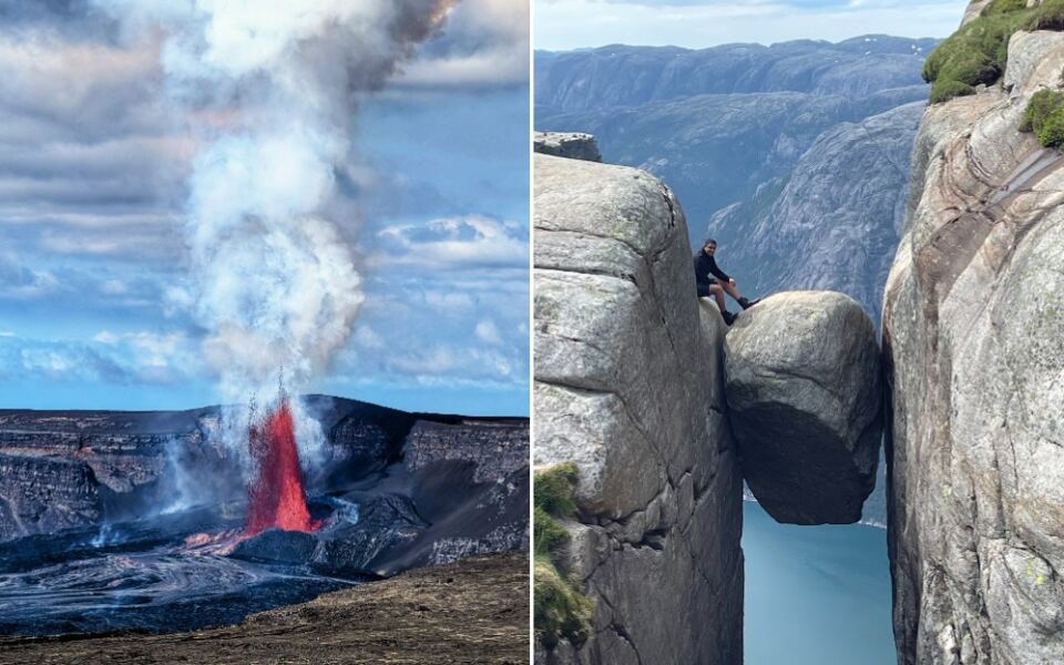
A boulder stuck between two cliff walls is the star of this mountain. Kjeragbolten hangs high above Lysefjord, and Kjerag itself rises about 1,084 meters.
The hike takes roughly six to ten hours. Steep sections require hikers to use cables for assistance.
Rain can make the rock slippery, and sudden weather changes add another layer of difficulty. Visit Norway notes that rescue operations take place here every year.
Kjerag is a seasonal destination. Normal hiking access typically begins after the mountain road opens in spring and ends when snow closes it again in autumn.
Dry weather and sturdy footwear make a real difference on this route. Anyone who feels uneasy on steep rock can happily enjoy the views from the trail.
Preikestolen, Norway
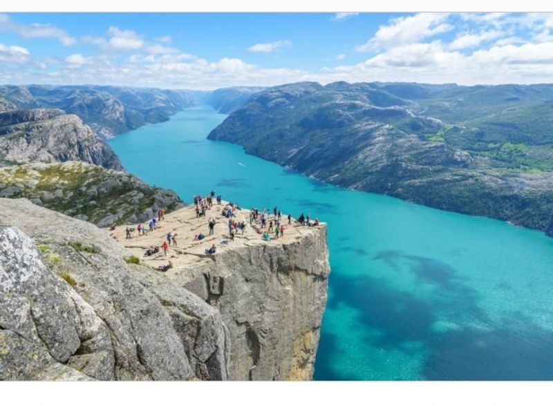
Rising roughly 604 meters above Lysefjord, Pulpit Rock is a broad, flat platform with an eye-catching lack of railing. Most developed viewpoints have barriers, but this one leaves the edge open.
The hike is about eight kilometers round trip. It includes roughly 500 meters of elevation gain, and some sections are steep and rocky.
The main hiking season generally runs from spring through autumn. Winter visits require extra preparation and, in many cases, specialized equipment or a guide.
Thousands still make the trek for one of Norway’s most famous views. Many hikers find it a more approachable day than some of the country’s other big cliff hikes.
Wear solid shoes, bring water, and give the edge plenty of room. Taking photos from a comfortable distance is perfectly fine.
Mount Fuji, Japan
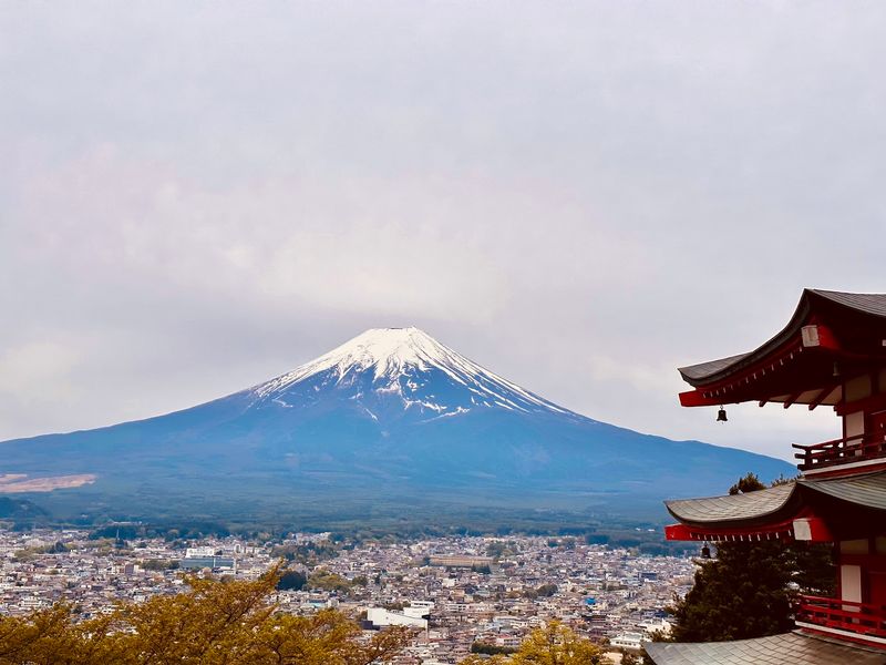
Climbing Mount Fuji comes with an official calendar. Japan’s climbing authorities repeatedly stress the risks of poor preparation, sudden weather changes, altitude, and climbing outside designated periods.
For 2026, the main summit routes operated during July and early September before closing for winter. Outside that season, summit trails are closed.
Authorities warn that conditions can become extremely dangerous then, because mountain huts, first-aid facilities, and other services are unavailable.
The mountain is so popular that officials introduced climbing fees, registrations, and crowd-management measures on major routes.
The best approach is to climb during the official season and follow the posted rules. Warm layers matter, since the weather near the top can differ a lot from the base.
Mount Vesuvius, Italy
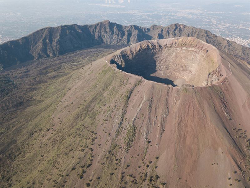
Standing at the crater of one of the world’s best-known volcanoes is a big reason to visit Naples. The Gran Cono trail is a regulated tourist attraction with advance online ticketing and controlled access.
Conditions can still shut things down. In 2026, the route temporarily closed after snow and ice.
Another section was restricted after landslides and then restored. That shows how quickly the mountain’s rules can change.
Visitors can currently reach the official crater route when conditions allow. Certain upper sections remain restricted for safety and environmental protection.
Booking tickets ahead and checking the park’s updates on the day are smart steps. Comfortable shoes help on the volcanic path.
Devil’s Pool, Victoria Falls, Zambia
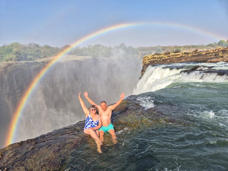
Swimming right beside the edge of Victoria Falls looks almost unreal. Devil’s Pool is a natural rock pool where visitors can enter the water when river levels are low enough.
Zambia Tourism stresses that the enormous force of the Zambezi should not be underestimated. That respect is built into how the activity runs.
Access is limited to certain months, generally around August through January. Visitors must go with an authorized guide.
When water levels are unsuitable, the activity does not operate. Plans can change based on the river rather than the calendar.
Booking in the right season and following the guide’s directions closely are the main rules. Anyone who prefers to stay dry can enjoy the falls from the viewing paths.
Caminito del Rey, Málaga, Spain
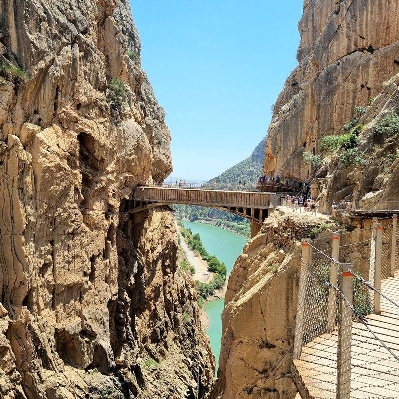
This path once had a reputation as one of the scariest walkways around, with a crumbling surface clinging to a gorge wall. Its past still draws curious travelers.
After a major reconstruction, the modern route is much safer. It now has wooden boardwalks, railings, controlled admission, and mandatory helmets.
The height is still part of the attraction. Access can also be restricted because of bad weather.
Today it operates as a regulated visitor attraction rather than the abandoned, highly dangerous path of the past. Its history continues to add a thrill to the walk.
Reserving tickets ahead and wearing comfortable shoes are good ideas. Anyone nervous about heights can take it slowly and enjoy the gorge views.
Mount Washington, New Hampshire
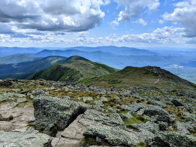
Weather here can change fast, and the summit is known for severe conditions. Mount Washington draws visitors by foot, by Cog Railway, and by the historic Mount Washington Auto Road.
The Auto Road operates seasonally and only when weather permits. Its published 2026 schedule extends into autumn.
Arriving by vehicle does not remove the risks. Cold, wind, fog, and quickly shifting conditions can bear little resemblance to the weather at the mountain’s base.
That makes layers important even on a warm day below. A jacket in the car is a simple precaution.
Checking the forecast and the road’s status before you set out can save a wasted trip. Hikers should be extra careful with timing.
Skellig Michael, County Kerry, Ireland
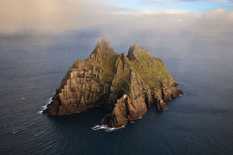
Getting to this remote monastery takes a boat ride and a climb of 618 stone steps. The steps rise more than 600 feet up a steep rocky island above the Atlantic.
Heritage Ireland describes the ascent as demanding. It advises visitors with health concerns to think carefully about their physical limits.
Children under 12 are not permitted. That rule alone shows how seriously the site is managed.
Access is seasonal and heavily weather-dependent. Visits are available only through authorized boat operators during the official season.
Booking early is wise, and trips can be changed by rough seas. Sturdy shoes and layers will help on the climb.
Haleakalā Summit, Maui, Hawaii
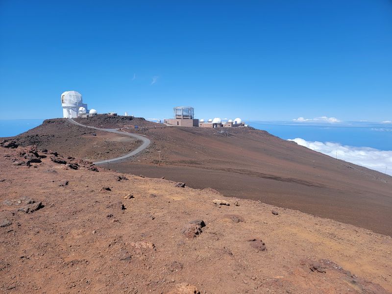
Cold surprises many people who visit a tropical island. Haleakalā’s volcanic summit is open to visitors, but its high elevation and fast-changing conditions deserve respect.
The National Park Service warns that winds during storms can exceed 80 mph. Temperatures can drop below freezing.
Hiking routes may include loose rock, steep terrain, and significant elevation changes. Cell service can be limited or missing altogether.
Visitors often arrive for sunrise, sunset, or crater hikes. Hikers are advised to stay on marked trails and carry enough clothing, water, and emergency supplies.
Packing warm layers is a smart move even on a sunny beach day. Download directions before heading up.
Kīlauea, Hawaiʻi Volcanoes National Park, Hawaii
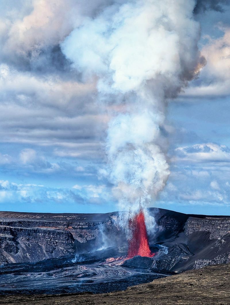
Few places show how unpredictable nature can be quite like Kīlauea. Hawaiʻi Volcanoes National Park stays open to tourism, but conditions around the active volcanic landscape can change quickly.
After Hurricane Nolo in September 2026, most summit areas reopened. Certain roads and trails stayed closed because of loose rocks, damaged vegetation, and unstable terrain.
Volcanic activity can also cause more closures and access limits. That makes the park’s alerts a key part of any visit.
Checking current alerts before arriving is essential. Following posted closures keeps the day simple and safe.
With that homework done, there is plenty to see across the open areas of the park. Flexible plans help when sections change.
Share this story