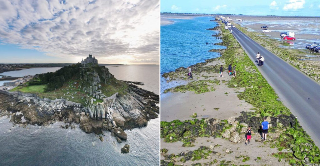
The ocean is always moving, but in certain places around the world, the tides do something truly remarkable. They don’t just rise and fall quietly.
They completely change what the land looks like, turning walkable beaches into open water, revealing hidden roads, and exposing vast ocean floors that were submerged just hours before. Some of these places look like two entirely different locations depending on what time of day you arrive.
Whether you’re a curious traveler or just someone who loves watching nature do something unexpected, this list covers 14 places where the tide puts on a show unlike anything else. Each one is real, currently accessible, and worth planning a visit around.
Just remember to check the tide tables before you go, because timing is everything at every single one of these destinations.
Hopewell Rocks, New Brunswick, Canada
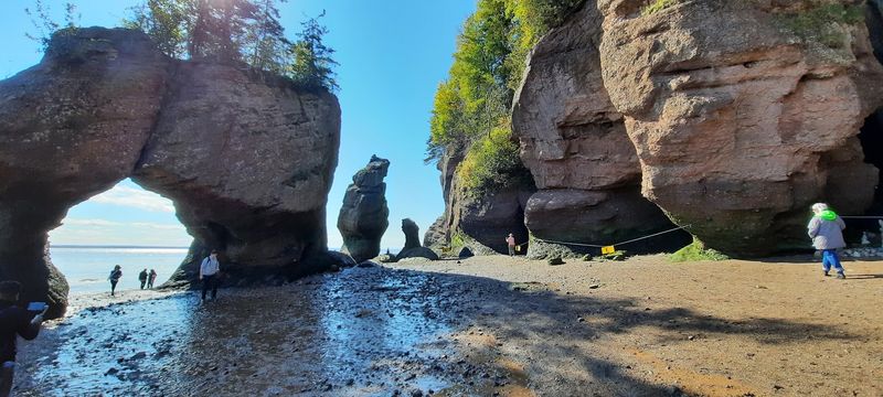
Walking on the ocean floor sounds like something out of a fantasy, but at Hopewell Rocks Provincial Park in New Brunswick, it is simply a matter of checking the tide schedule. The Bay of Fundy holds the record for the highest tidal range on Earth, and this park puts you right in the middle of that phenomenon.
At low tide, visitors descend a staircase to the exposed seabed and walk between towering rock formations called flowerpots. These sea stacks rise dramatically above the ocean floor, draped in seaweed and topped with trees.
A few hours later, that same walkable ground is completely underwater and the formations look like small rocky islands from above.
The provincial park publishes detailed 2026 tide schedules and strongly encourages visitors to experience the site at both water levels. Seeing both versions of Hopewell Rocks in a single visit makes the tidal transformation feel genuinely hard to believe.
Mont Saint-Michel, Normandy, France
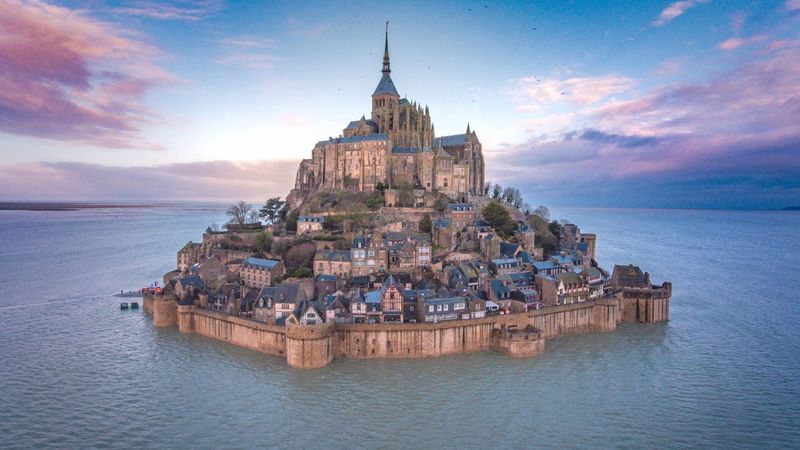
Few sights in Europe are as dramatic as Mont Saint-Michel at high tide, when water surrounds the ancient mount and the medieval village appears to float entirely on its own. The transformation from a broad landscape of sand and mudflats to a moat-encircled island happens with surprising speed.
The Bay of Mont Saint-Michel records some of Europe’s most extreme tidal differences, with water levels shifting by as much as 15 meters between low and high tide. During the highest tides, water can cover the entrance esplanade for roughly an hour, adding to the sense that the mount is completely cut off from the world.
The medieval village, abbey, and surrounding attractions remain open throughout the year. Official 2026 tide schedules are available for visitors who want to plan their arrival around a specific tidal moment.
Catching the water at full height, with the mount reflected in the bay, is a genuinely rare visual experience.
Passage du Gois, Noirmoutier, France
Most roads stay put. Passage du Gois is not most roads.
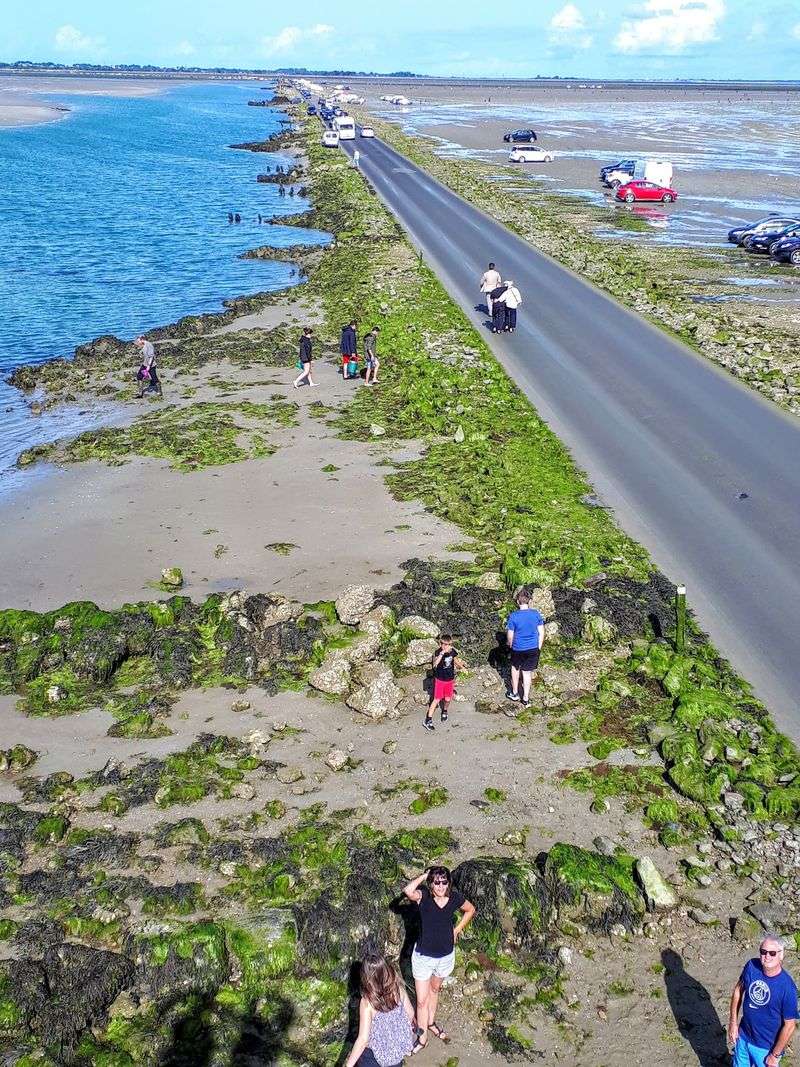
This natural causeway connecting the French mainland to the island of Noirmoutier spends a large portion of every day completely submerged beneath the Atlantic Ocean.
When the tide retreats, the pavement reemerges along with wide stretches of exposed tidal flats on either side. Drivers can cross for a limited window before the sea returns and swallows the road again.
Tall marker poles line the route, serving as a reminder of just how high the water gets when the causeway is underwater.
Noirmoutier’s tourism authorities publish 2026 tide schedules and recommended crossing windows so visitors can plan safely. The passage is roughly 4.3 kilometers long, and the landscape around it shifts completely depending on the tide.
Arriving at the edge of the crossing window and watching the road slowly reappear from beneath the water is one of those experiences that genuinely stops people in their tracks.
St Michael’s Mount, Cornwall, England
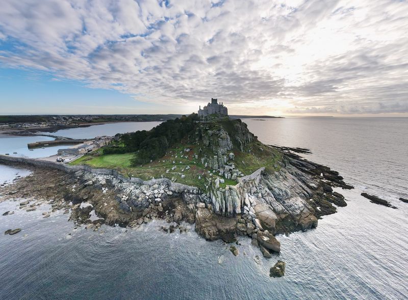
Cornwall is full of beautiful coastal scenery, but St Michael’s Mount offers something most coastlines cannot. At low tide, a cobbled stone causeway rises from the sea between the village of Marazion and the island, and visitors simply walk across it like it has always been there.
At high tide, that same pathway disappears under the water and the mount becomes a true island again. The shift happens predictably with every tidal cycle, but it still catches first-time visitors off guard when they see the water creeping back across the stones.
The site remains fully operational in 2026. When the causeway is underwater during visitor hours, a small passenger boat handles the crossing instead.
The mount itself features a medieval castle, gardens, and harbor that are worth exploring once you arrive. Checking the tide times before visiting helps you decide whether you want the scenic walk or the boat approach, both of which offer their own appeal.
Holy Island of Lindisfarne, Northumberland, England
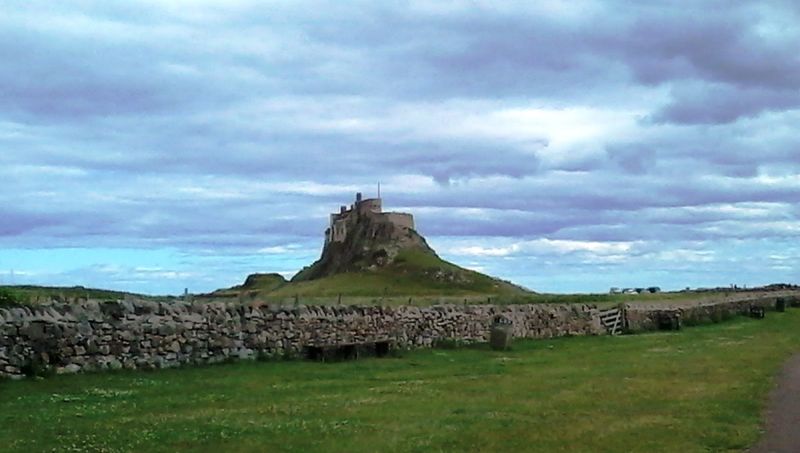
Holy Island has been attracting visitors for over a thousand years, but the tidal causeway connecting it to mainland Northumberland still manages to surprise people who show up without checking the schedule. At low tide, the road across the flats looks completely ordinary.
A few hours later, it is part of the North Sea.
The causeway floods on a twice-daily cycle, temporarily cutting the island off from the mainland for several hours at a time. Cars caught by a rising tide have been stranded more than once, which is exactly why English Heritage and local authorities post clear warnings urging travelers to check the tide tables before making the crossing.
Lindisfarne Priory, the castle, and the island’s small village remain open to visitors in 2026. The priory dates back to the seventh century and gives the island a quiet, historically layered atmosphere.
Arriving just as the causeway reemerges and the flats begin to drain is a particularly striking way to experience the place.
Burgh Island, Devon, England
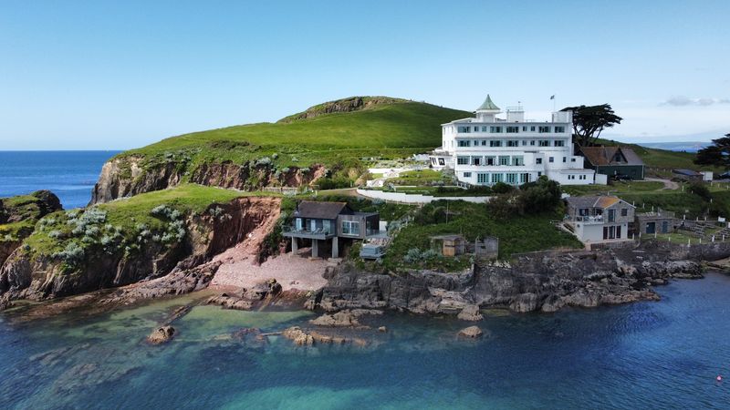
Burgh Island has one of the most unusual transport solutions in England, and it only exists because of the tide. When the water retreats, a broad sandy stretch connects the island to Bigbury-on-Sea and visitors simply walk across.
When the tide returns and covers that sandy route, the island switches to a sea tractor.
The sea tractor is exactly what it sounds like: a raised platform mounted on a tractor chassis that rolls through the shallow water between the mainland and the island. It has been operating in various forms for decades and remains one of the more memorable ways to arrive anywhere in Britain.
Burgh Island itself features a historic art deco hotel that has hosted notable guests over the years. The island remains an active visitor destination in 2026.
Whether the tide is in or out changes the whole feel of the approach, which is part of what makes Burgh Island worth the trip to this quieter corner of Devon.
Cramond Island, Edinburgh, Scotland
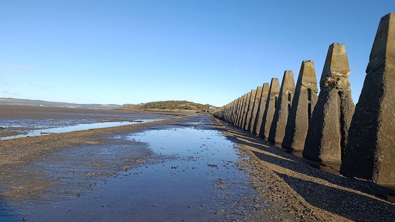
Just a short drive from central Edinburgh, Cramond Island sits quietly in the Firth of Forth and becomes reachable on foot for a few hours around each low tide. What makes the crossing particularly distinctive is the line of concrete World War II anti-submarine defenses that runs alongside the causeway, rising from the tidal flats like a row of angular teeth.
The paved path emerges at low water and gives visitors a chance to reach the island, explore its overgrown wartime structures, and take in views across the Firth. As the tide returns, the route disappears again and the island reverts to its offshore status.
Current 2026 guidance notes that the safe crossing window is generally only three to four hours wide, making it essential to check tide times before setting out. Getting the timing wrong means waiting a full tidal cycle on either side of the water, which is a genuinely inconvenient situation that happens more often than the signs suggest it should.
Lihou Island, Guernsey
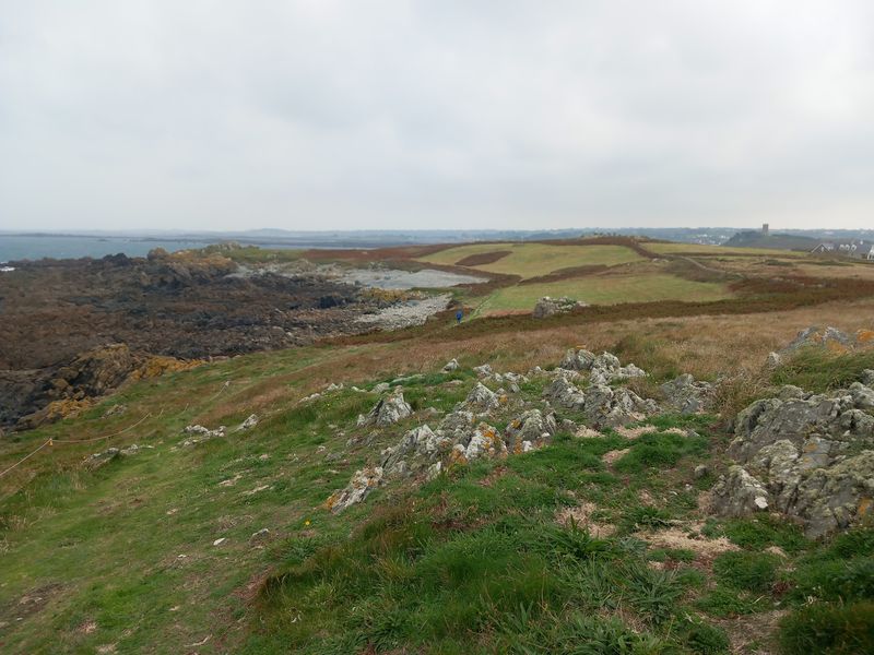
Lihou is the kind of place that rewards people who pay attention to the tide schedule. This small island off the western coast of Guernsey becomes accessible only when a long cobbled causeway rises from the sea at low water, giving visitors a temporary pedestrian connection to the mainland island.
The surrounding shoreline transforms at the same time. Rock pools emerge across the exposed seabed, and the Venus Pool, a natural seawater pool near the island, becomes visible and accessible.
The landscape that greets visitors at low tide looks nothing like the open water that replaces it a few hours later.
Visit Guernsey continues to promote the Lihou crossing in 2026 while making clear that following safe tidal access times is not optional. The causeway floods quickly and the water depth rises significantly once the tide turns.
Lihou Island features a historic farmhouse and nature reserve, giving the crossing a genuine destination feel rather than just a novelty walk.
Bar Island, Maine, USA
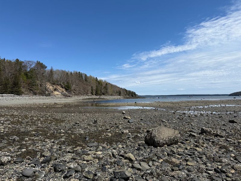
Bar Harbor got its name from the natural sand and gravel bar that connects the town to nearby Bar Island at low tide. That bar sits quietly beneath Frenchman Bay for much of the day, then rises to the surface and becomes a walkable path that draws visitors out across what had recently been open water.
The National Park Service notes that Bar Island is generally accessible on foot for approximately 1.5 hours on either side of low tide, giving visitors a roughly three-hour window to cross, explore the island’s forested trails, and return before the bar disappears again. The island sits within Acadia National Park and offers views back across the bay toward Bar Harbor.
Getting the timing wrong means a longer wait than most visitors plan for, so checking the posted tide schedule at the waterfront is worth the extra minute. The bar itself is easy to spot when it emerges, a clear and visible reminder that the landscape here is always changing.
Burntcoat Head Park, Nova Scotia, Canada
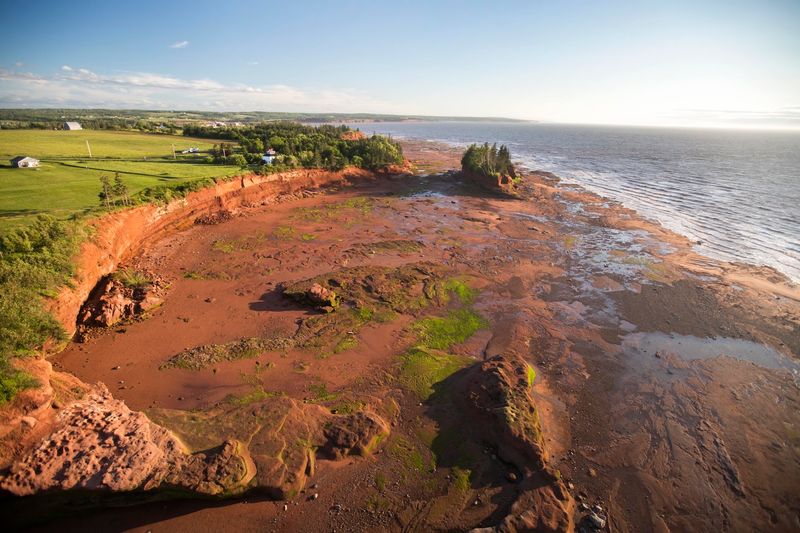
Burntcoat Head sits along one of the most dramatic stretches of the Bay of Fundy, and the tidal range here is genuinely extreme. At low tide, an enormous expanse of ocean floor is exposed along the base of the red sandstone cliffs, giving visitors the rare experience of standing on ground that will be several meters underwater by the time the next high tide arrives.
The park has published dedicated 2026 tide schedules and identifies specific safe windows for ocean-floor access around low tide. Exploring the exposed seabed reveals rock formations, tidal pools, and the layered geology of the cliffs up close in a way that is simply not possible at other times of day.
Burntcoat Head is less internationally famous than Hopewell Rocks, but the tidal transformation here is just as dramatic and the crowds are considerably smaller. The park sits in Hants County and is reachable by car, making it a manageable stop for anyone exploring the Nova Scotia side of the Bay of Fundy.
Wadden Sea, Denmark, Germany, and the Netherlands
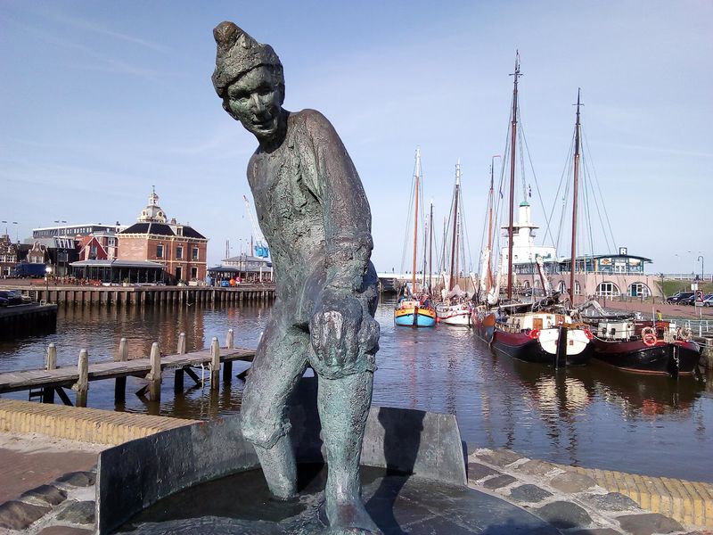
No single road or island defines the Wadden Sea. At low tide, a massive system of mudflats, tidal channels, salt marshes, and sandbars is exposed across the coastline of three countries: Denmark, Germany, and the Netherlands.
The scale of the transformation is hard to process from any single viewpoint.
UNESCO recognizes the Wadden Sea as the world’s largest unbroken system of intertidal sand and mud flats, and the designation reflects just how significant this environment is. Millions of migratory birds use the exposed flats as a feeding ground, and the landscape supports a complex web of marine and coastal life that depends entirely on the tidal cycle.
The flats that appear at low tide are not static. Tidal channels shift position over time, sandbars move, and the boundary between land and sea is never quite the same twice.
Guided mudflat walking tours, known locally as wadlopen, are available across the region and offer a close-up way to experience the landscape during low water.
Jindo Mysterious Sea Route, South Korea
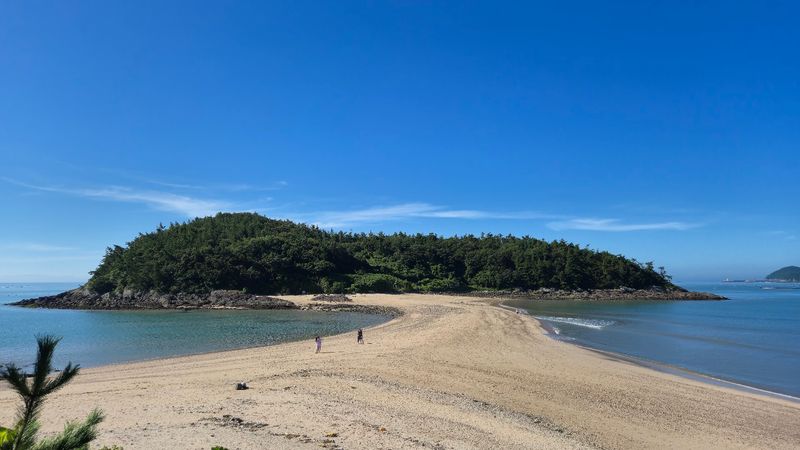
Once a year near Jindo Island in South Korea, the sea pulls back far enough to reveal a long strip of land connecting Hoedong-ri to Modo Island. The exposed route is roughly 2.8 kilometers long and 30 to 40 meters wide, and it stays visible for about an hour before the water returns.
Visit Korea describes the phenomenon as the result of an exceptionally low tidal event that occurs during specific lunar and seasonal conditions. The route is narrow enough that standing on it with the sea on both sides creates a striking visual that draws large crowds every year.
The Jindo Miracle Sea Road Festival celebrates the event with cultural performances, food, and activities along the coast. The 2026 festival ran from April 17 to April 20, confirming that both the natural phenomenon and the surrounding tourism tradition remain fully active.
Planning a trip around the festival window gives visitors the best chance of seeing the route at its most dramatic.
Sunderland Point, Lancashire, England
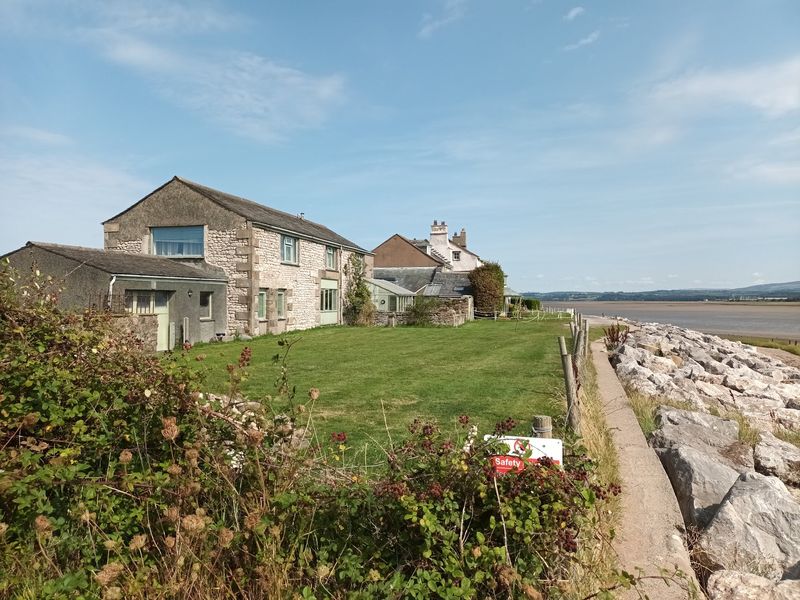
Getting to Sunderland Point requires paying close attention to the Lune Estuary’s tidal schedule, because the only road into this small settlement crosses a stretch of low-lying ground that floods twice every day. At low tide, visitors can drive the causeway out to the village.
As the tide rises, water spreads across the surrounding salt marshes before covering the road entirely.
The 2026 Morecambe Bay visitor guide specifically warns that Sunderland Point is cut off twice daily by the incoming tide, and that tide tables are essential for anyone planning a visit. Getting the timing wrong means waiting several hours for the water to retreat before the road becomes passable again.
The village itself is small and quiet, with a historic character shaped by its maritime past. A notable landmark near the settlement is the grave of Sambo, an eighteenth-century enslaved man whose burial site has become a place of reflection and remembrance.
The combination of tidal access and layered history makes Sunderland Point genuinely unlike anywhere else on this list.
Morecambe Bay, England
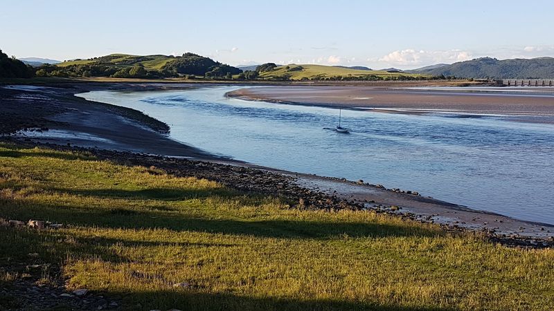
Morecambe Bay is one of Britain’s most visually striking tidal landscapes, and it earns that description through sheer scale. At low water, the bay exposes an enormous area of sand and mudflats that stretches toward the horizon, cut through by tidal channels that shift position with each passing cycle.
The open expanse looks almost walkable in every direction, which is part of what makes it dangerous without proper guidance.
Organized Cross Bay Walks continue to take groups across sections of the exposed sands during suitable tidal conditions. The walks are led by an official Queen’s Guide, a role with centuries of history behind it, and cover a route of roughly 11 miles across the bay between Arnside and Kents Bank or similar crossing points.
The 2026 regional visitor guide is clear that independent crossings are not advisable, as the channels and flats change constantly and incoming tides can move faster than expected. Joining a guided walk is the practical way to experience the bay’s extraordinary low-tide landscape without the associated risks.
Share this story