South Jersey keeps a few places tucked behind plain roads and ordinary turns, and this preserve is one of the most interesting. It has long trails, water views, old railroad traces, sandy paths, and the kind of Pine Barrens quiet that makes a short trip feel much farther from town.
The place is beautiful, but it also asks hikers to pay attention, because signs can be limited and the routes are not always clear. Keep reading for what makes it special, what to watch for, and how to plan a smarter visit.
A Cumberland County Preserve With A Plain Road Entrance
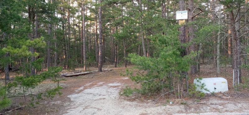
The address tells the story with almost no drama: Manumuskin River Preserve is on Barth Rd, Millville, NJ 08332, in Cumberland County, New Jersey, United States. That simple location detail matters because the preserve does not present itself like a polished park with a grand welcome area, a big visitor center, or a menu of neatly labeled loops.
Barth Road is the access point that comes up most clearly in current local guidance, and the preserve itself is a nature preserve with land that regular users describe as large and remote. The trailhead from Barth Road can connect hikers, bikers, and often horse-friendly trail users to more than 25 miles of blazed and unblazed routes.
That scale is part of the appeal, but it also changes the way a person should approach the trip. A quick stroll may be possible, yet the preserve is better understood as a place where planning, navigation, footwear, and respect for local access concerns all matter.
The first rule here is simple: treat the entrance like the start of real backcountry-style wandering, not a casual paved-path detour.
A Pine Barrens Landscape With A More Remote Personality
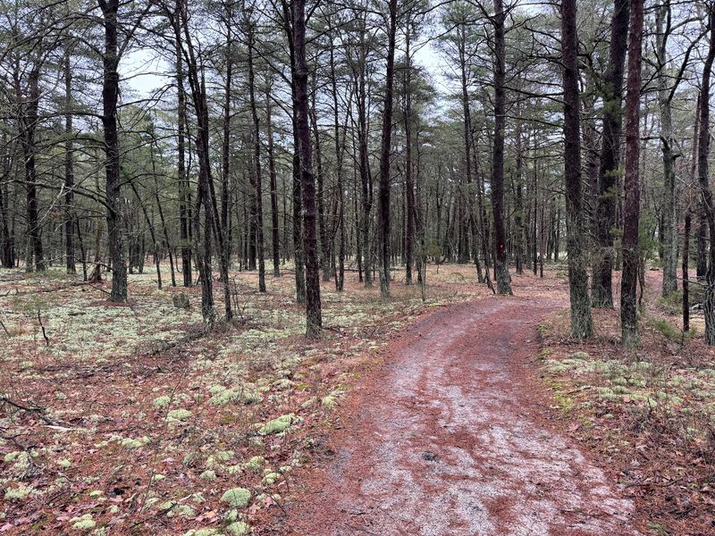
Not every New Jersey nature outing comes with tidy edges, and that is exactly why this one stands out. Manumuskin River Preserve has the personality of the Pine Barrens without pretending to be a city park dressed in trail shoes.
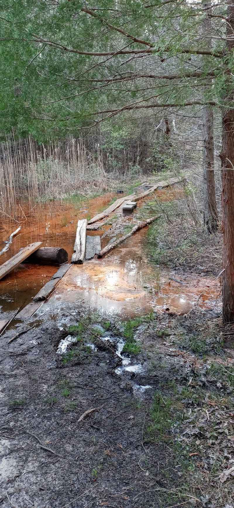
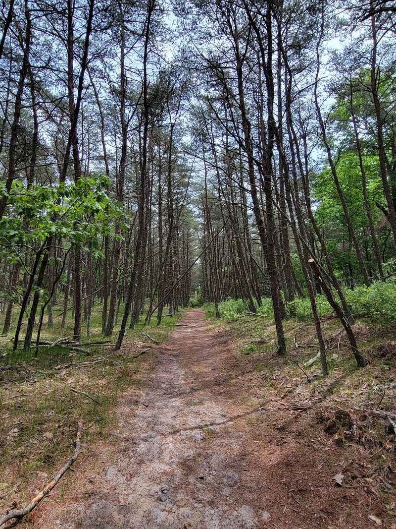
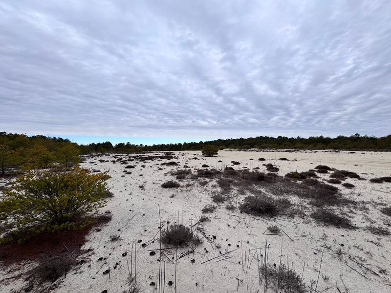
The ground can shift between hard soil, sand, and occasional old pavement remnants connected to past access routes. Low places may become muddy, and grassy stretches can hide prickly plants or poison ivy, so long pants and good hiking shoes are not just a fussy suggestion.
The preserve also has less undergrowth in some areas than people expect from a Pine Barrens setting, which can make certain stretches feel more open than nearby woodland routes. That does not mean the terrain is effortless, because poor marking and route confusion can quickly turn a simple outing into a longer puzzle.
The place rewards people who like local nature without too much packaging. It is not trying to entertain anyone every few steps, and that restraint is part of the reason it stays memorable.
Blue Water Ponds That Pull People Deeper In
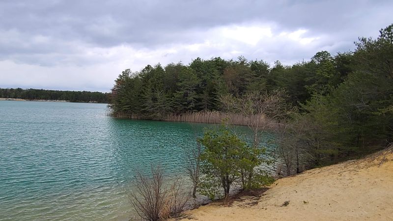
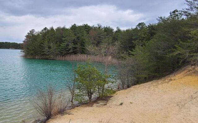
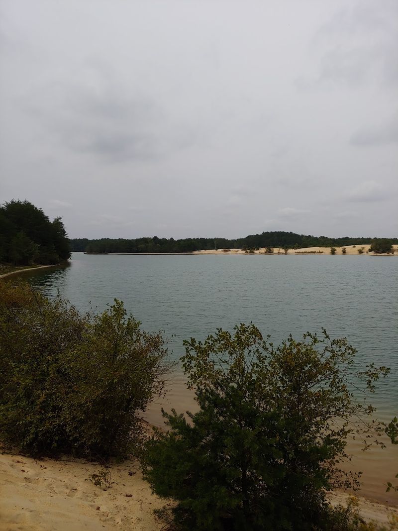
The most talked-about surprise here is the water. People mention lakes, ponds, white sand, and striking blue-green water, the kind of feature that can make a woodland hike suddenly feel like it has changed chapters.
Those bright water areas are part of the preserve’s draw, but they also come with clear limits. Posted rules referenced on site prohibit swimming, camping, and fires, and one account specifically warns against walking in the water because of the risk of foot injury.
That combination gives the preserve its slightly eerie reputation. The water can look inviting in photos, yet the smarter move is to treat it as something to observe from land rather than a place for experimenting, wading, or testing shortcuts.
Canoeing and boating are described as permitted on Manumuskin Creek, Menantico Creek, and some Menantico Ponds, while fishing requires a current fishing license. Anyone considering water access should use current posted rules and common sense, because this is still a preserve first and a recreation stop second.
The blue ponds may be the headline act, but respect is the admission ticket.
Trails That Refuse To Hold Your Hand
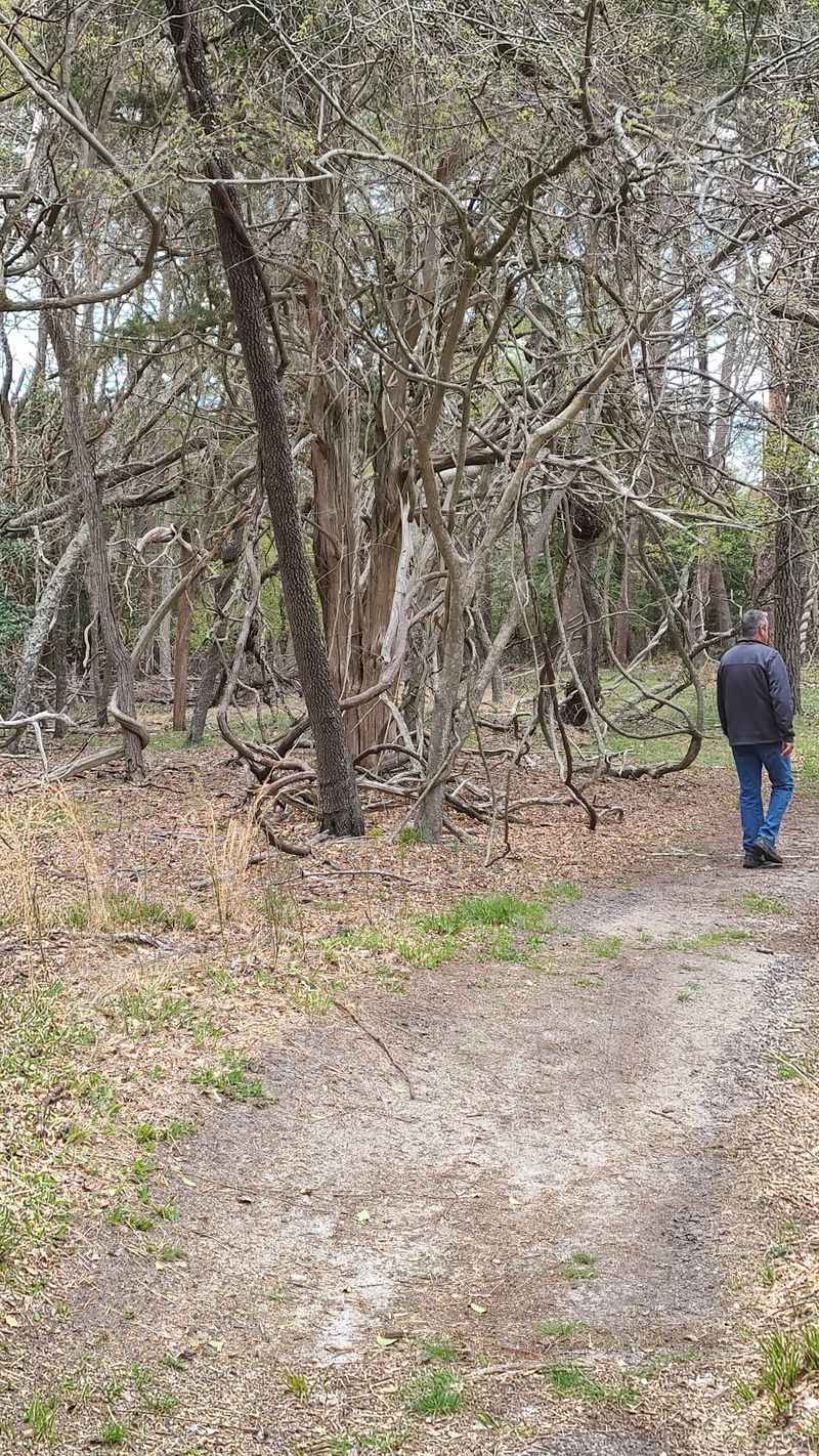
A funny thing happens at Manumuskin River Preserve: the trail system offers plenty of options, then quietly declines to explain all of them. Blazed and unblazed paths cross the land, and several accounts describe markings as limited, weathered, or hard to follow.
Some routes dead-end in the woods. Others open into wider spaces without obvious direction, and connecting trails toward Menantico Wildlife Management Area are described as unsigned or unmarked.
That makes navigation the preserve’s biggest practical issue. A GPS device or reliable phone map is a smart tool here, especially because there does not appear to be a widely trusted simple hiking map that clearly covers the full web of trails and old industrial roads.
The payoff is variety. Hikers have described out-and-back walks, nine-mile outings that still covered only part of the area, and routes that pass water, railroad tracks, and traces of older structures.
This is not the place to prove that confidence is a navigation system. Bring a plan, leave extra time, and consider turning around before the trail starts acting like it knows a secret.
Railroad Tracks, Old Roads, And Ruins Nearby
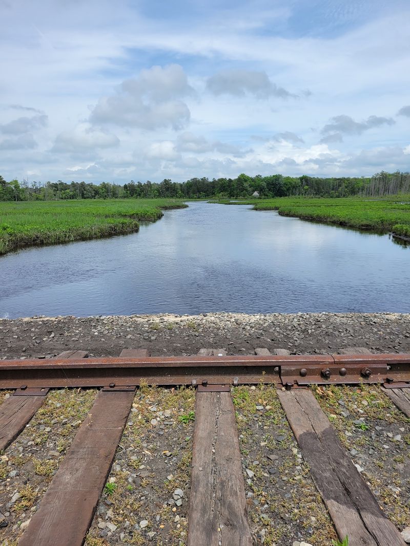
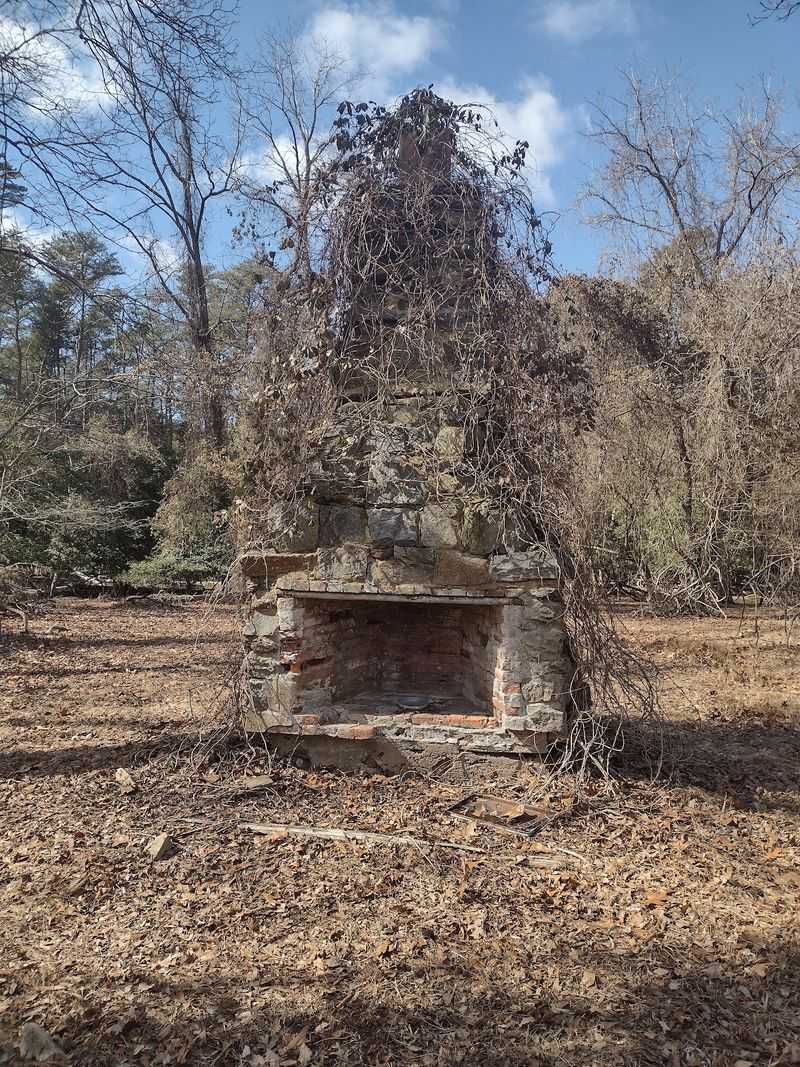
Manumuskin River Preserve is not only about trees and water. Parts of the hike can bring people near railroad tracks, old access roads, painted walls, an old chimney, and nearby ruins connected with the Fries Mill area if one leaves the preserve and crosses the tracks.
That mix gives the outing a little local mystery without needing to invent a legend. The area carries signs of past human use, including bits of pavement left from sand mine access, and those traces sit beside the preserve’s natural routes.
The railroad tracks come up often because they help define how some people navigate the area. One legal parking option described by a long-time user is at the dirt area by the railroad crossing on Port Elizabeth Cumberland Road, where a trail skirts the tracks before connecting toward hiking and horse routes.
Still, railroad areas require caution and respect for lawful access. The preserve’s odd charm comes from its blend of nature and remnants, not from treating working or restricted spaces carelessly.
For New Jersey locals who enjoy places with a little leftover history, this preserve has enough clues to keep a hike from feeling plain.
Wildlife Encounters Across The Preserve
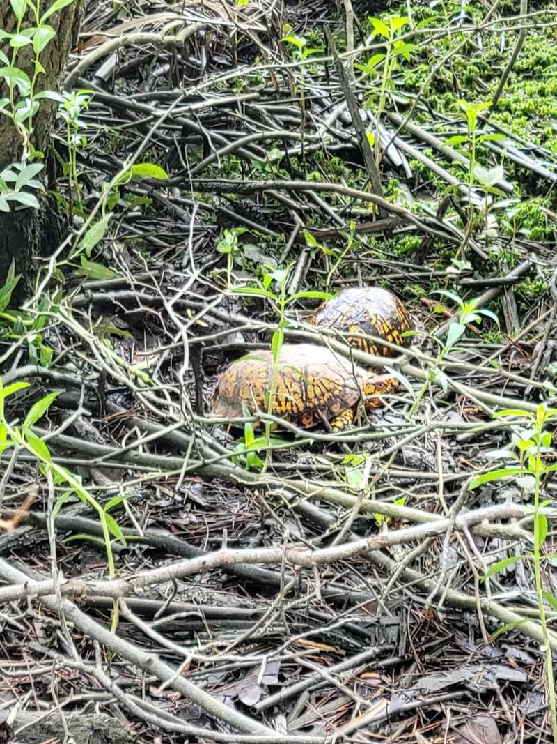
Wildlife gives this preserve a steady reason to slow down, even when the trail markings are testing everyone’s patience. Long-time users have reported frogs, toads, lizards, snakes, hawks, bald eagles, falcons, turkeys, deer, owls, squirrels, mice, chipmunks, turtles, and once a coyote.
That list is not a guarantee for any single trip, but it shows the variety of habitat around the preserve, creek corridors, ponds, sandy woods, and more open stretches. It also explains why the area feels important beyond simple recreation.
Deer and wild turkey tracks may be noticeable to careful hikers, and birds of prey add another reason to keep attention on open views and woodland edges. The preserve works best when people move through it as guests, not as trail conquerors with a step-count deadline.
Rules around hunting are also specific: hunting is by special permission only within Manumuskin Preserve and Menantico Wildlife Management Area. That detail reinforces the managed nature of the land, even though parts of the trail system feel rough around the edges.
The preserve’s wild residents are not decorations. They are the main event, just operating on their own schedule.
Barth Road Access And Parking Realities
Parking here deserves its own section because it can shape the entire visit. Several older public entrances have reportedly been closed or limited because of illegal ATV use, parties, vandalism, and neighborhood concerns.
Barth Road remains a key access point, but people should be careful and respectful around nearby homes. While one local account notes no parking restriction signs at the court at the end of the road, it also describes neighbors as watchful because of past misuse tied to illegal riding and damage.
Schooner Landing Road is more complicated. Although it has been identified as a designated hiking and horse trailhead, the area near the barricade and across the Route 55 overpass has been described as having no parking and a tow zone monitored by police.
Other legal parking options mentioned include a dirt parking area at the railroad crossing on Port Elizabeth Cumberland Road behind a large metal electrical box, or the open area across the street. Another option is the parking lot at Menantico Wildlife Management Area, with a longer approach by trail.
The short version is not glamorous, but it is useful: check signs, avoid blocked areas, and do not create problems for the next person.
A No-Frills Visit With Clear Limits
Manumuskin River Preserve is open 24 hours every day, Monday through Sunday, according to the available listing. No entrance fee is provided in the data, and no bathroom facilities are noted, so planning ahead is part of visiting responsibly.
The preserve is not set up like a fully serviced recreation complex. People should expect unimproved trails, limited signage, weathered information panels, fallen branches at times, and sections that may require careful footing.
Camping is not allowed, despite some outside hiking sources apparently suggesting otherwise. Posted signs have been described as saying no camping, fires, or swimming, and those rules matter because the area has dealt with damage from misuse.
Fishing is described as permitted only with a current fishing license, and boating or canoeing is permitted on Manumuskin Creek, Menantico Creek, and some Menantico Ponds. Anyone planning those activities should follow current state and posted rules, since preserve conditions and access details can change.
A good visit here starts before the car leaves home. Water, long pants, solid footwear, navigation tools, and a realistic schedule can make the difference between a satisfying outing and a preventable headache.
Who Will Love The Quiet Challenge
Some people want railings, restrooms, and a loop that tells them exactly when the fun is finished. Manumuskin River Preserve is probably not that outing, and it is better for being honest about it.
The preserve suits hikers who like a little problem-solving, people comfortable with rougher trails, and New Jersey day-trippers who appreciate places that feel local rather than packaged. Bikers and horse-friendly trail users may also find suitable routes from Barth Road, based on available descriptions.
It may be less ideal for anyone who needs clear signs at every turn, easy facility access, or guaranteed dry footing. Buggy conditions, muddy low places, and confusing paths have all been mentioned, so expectations should stay practical.
Families can still consider shorter outings if everyone is prepared, but adults should keep the navigation role serious. The water areas are for looking, not swimming, and the trail network is not the place for wandering without a return plan.
The best match is a patient explorer with good shoes and a sense of humor. Around here, the trail does not always explain itself, but it usually has a reason to keep going.
A Preserve Shaped By Misuse And Protection
The access story at Manumuskin River Preserve is a reminder that public land depends on public behavior. Reports tied to the area mention illegal ATV and dirt bike riding, teenage parties, vandalism, and neighborhood resistance as reasons some entrances have been closed or limited.
That history can be frustrating for responsible hikers, especially when a legal route becomes harder to use because others treated the land poorly. Yet it also explains why certain roads, barricades, tow zones, and access limits should be taken seriously.
Illegal riding can damage trails, disturb habitat, and create conflict with nearby residents. The preserve’s future as a visitable place depends on people following rules even when the landscape feels wide open.
Staying on appropriate routes, parking legally, avoiding fires, skipping camping, and leaving water areas alone are not just polite habits. They help protect access for hikers, bikers, horse users, and nature lovers who want the preserve to remain available.
New Jersey has plenty of places that ask for money before offering a view. This one asks for something simpler and harder: self-control, good judgment, and respect for the land.
A Soft Verdict For Patient New Jersey Explorers
Manumuskin River Preserve is not the easiest nature stop in South Jersey, and that may be exactly why it sticks with people. It has water views, sandy trails, wildlife, old railroad traces, nearby ruins, and a large remote feeling that is increasingly rare in a busy state.
The tradeoff is real. Trail blazes can be sparse, signs can be limited, some routes can be rough, and parking requires attention to current restrictions and local concerns.
For a casual half-hour walk with full facilities, another park may be a better fit. For a prepared hiker who wants a New Jersey preserve with character, scale, and a little Pine Barrens mystery, this place earns a careful spot on the day-trip list.
The smartest visit keeps expectations grounded: use Barth Road or another lawful access point, bring navigation, dress for sandy and muddy trails, and follow posted rules around swimming, camping, fires, fishing, and water access. That approach leaves room for the preserve to be what it is.
Manumuskin River Preserve does not need polish to be worth knowing. It just needs people willing to meet it on its own terms.
Share this story