Idaho is full of surprises, and some of the best ones happen right outside your car window. The state stretches from the rugged Panhandle in the north all the way down to the high desert in the south, packing an enormous variety of landscapes into one road trip.
You can go from peering down into a canyon 800 feet deep to gazing across a glassy mountain lake without ever lacing up a hiking boot. These 13 overlooks prove that Idaho rewards the curious driver, the one willing to slow down, pull over, and actually look around.
Pack a camera, keep your eyes open, and get ready to see why Idaho might just be the most underrated road-trip state in the country.
1. Galena Summit Overlook, Sawtooth City, Idaho
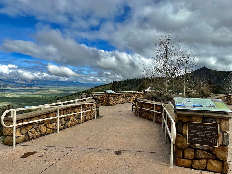
At 8,400 feet above sea level, Galena Summit Overlook earns its reputation as one of the most dramatic pullouts along any Idaho highway. Also known as the Bethine and Frank Church Overlook, this viewpoint sits along Highway 75 on the Sawtooth Scenic Byway, where the road does most of the climbing before rewarding drivers with an immediate payoff.
The Sawtooth Mountains cut a jagged silhouette to the northwest while the headwaters of the Salmon River begin their long journey east across the Stanley Basin. The valley below stretches roughly fifteen miles wide and thirty miles long, giving the overlook a sense of scale that is genuinely hard to absorb all at once.
Informational plaques on the viewing platform explain the geology and natural history of the Sawtooth National Recreation Area. The first road over this summit was built in 1881 to serve nearby mining communities, making this viewpoint a layered mix of natural grandeur and frontier history.
2. Lewiston Hill Overlook, Genesee, Idaho
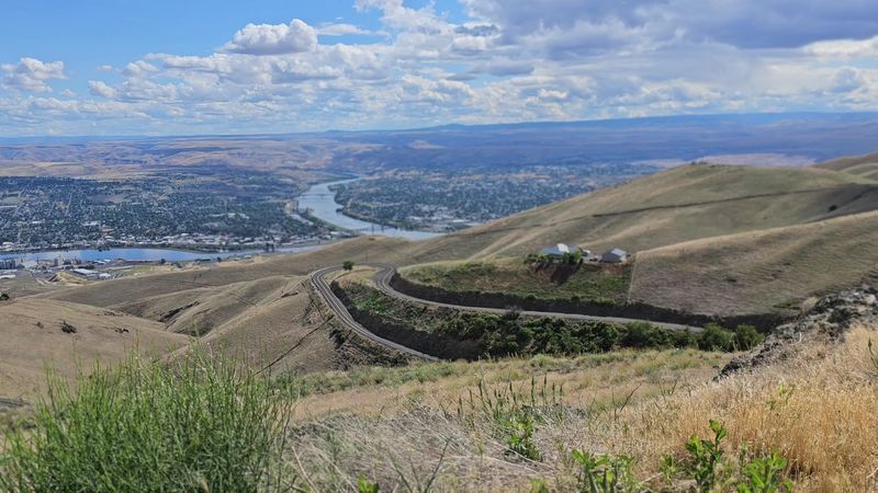
From 2,756 feet above the valley floor, the Lewiston Hill Overlook delivers one of northern Idaho’s most comprehensive panoramas. Lewiston, Idaho, and Clarkston, Washington, sit side by side far below, connected by the confluence of the Snake and Clearwater Rivers, two of the region’s most historically significant waterways.
The view gets an extra dimension from the Old Spiral Highway, which descends the hillside in 64 distinct curves. Opened in 1917, this engineering feat was considered one of the finest mountain road designs of its era and served as the main north-south route for six full decades.
Travelers can still drive it today as a scenic alternative to the modern highway.
The modern U.S. Route 95 sweeps down in a dramatic Z-shaped descent built between 1975 and 1977, and both roads are visible from the overlook.
Large white letters spelling out “L” and “C” on the hillside represent Lewiston and Clarkston, a charming detail that ties the landscape directly to its communities below.
3. Lower Mesa Falls Observation Site, Ashton, Idaho
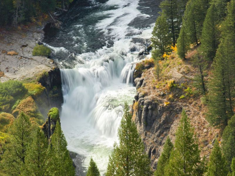
Most waterfalls demand you get close to appreciate them, but the Lower Mesa Falls Observation Site proves that distance can tell an equally compelling story. This elevated viewpoint along the Mesa Falls Scenic Byway lets visitors see the falls from above, giving a broader sense of how Henry’s Fork of the Snake River moves through its forested volcanic canyon.
The falls drop 65 feet over a 200-foot-wide ledge of volcanic tuff that formed roughly 1.3 million years ago. Unlike many Idaho waterways, this stretch of Henry’s Fork has never been dammed or diverted, so the falls remain in their natural state year-round.
A short paved path leads from the parking area to the observation platform, where interpretive signs explain the geology and history of the site. The nearby Upper Mesa Falls, just 1.2 miles upstream, drops a more dramatic 114 feet and offers closer viewing, making the two sites natural companions on a single byway drive.
No entry fee is required.
4. Dedication Point, Melba, Idaho
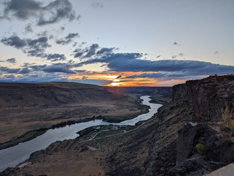
Dedication Point sits on the rim of the Snake River Canyon inside the Morley Nelson Snake River Birds of Prey National Conservation Area, a protected area covering more than 485,000 acres. The canyon drops roughly 400 feet to the river below, and the cliff faces reveal layers of basalt shaped by ancient volcanic activity and the catastrophic Lake Bonneville flood about 15,000 years ago.
A short interpretive trail, approximately 0.2 to 0.3 miles long, leads from the parking area to the main viewing platform. The path is designed to be wheelchair-accessible in its primary sections, making this one of the more inclusive canyon viewpoints in southern Idaho.
Birdwatchers come here specifically for the raptors. Golden eagles, peregrine falcons, prairie falcons, and red-tailed hawks are regularly spotted riding thermals above the canyon, particularly during spring and early summer.
Even visitors without binoculars often catch impressive aerial displays overhead. Bringing a pair of binoculars, however, turns a good visit into a great one.
5. Snake River Scenic Overlook, Twin Falls, Idaho
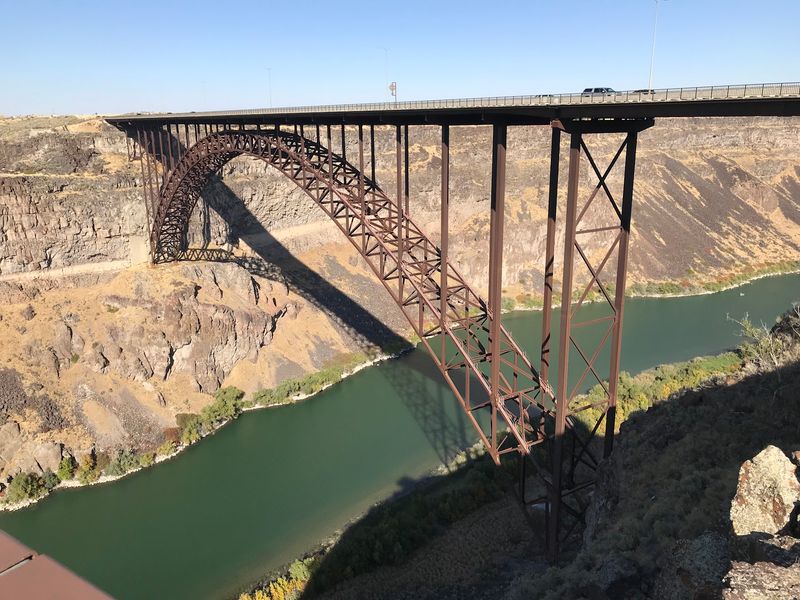
Twin Falls is one of those rare places where a canyon of genuine geological scale sits right alongside everyday city life. The Canyon Rim Trail, stretching over 10 miles along the south rim, connects multiple overlook points above the Snake River Canyon, giving visitors plenty of options for taking in the dark basalt walls and the river far below.
The trail passes under the Perrine Bridge, which clears the canyon floor by nearly 500 feet. That bridge holds the distinction of being the only spot in the United States where BASE jumping is permitted year-round, so do not be surprised if you spot a canopy opening mid-air during your visit.
Trailheads are conveniently located at the Twin Falls Visitor Center and along Washington Street North, making access straightforward for anyone passing through town. A short distance east along the rim, history buffs can also spot the site of Evel Knievel’s famous 1974 jump attempt, adding an unexpected chapter to an already remarkable canyon story.
6. Bruneau Canyon Overlook, Bruneau, Idaho
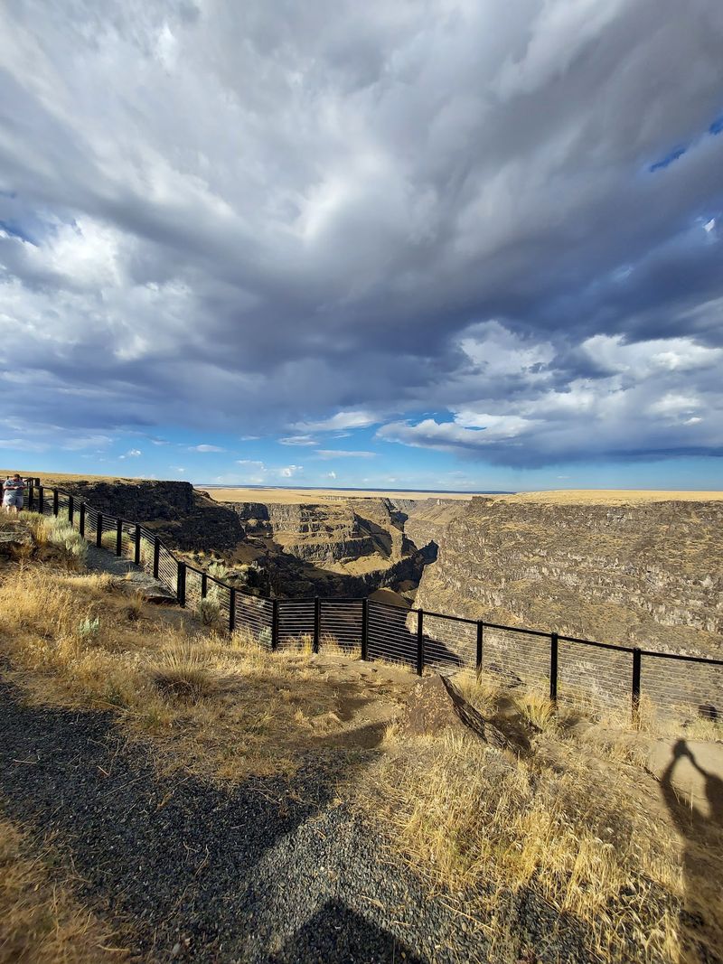
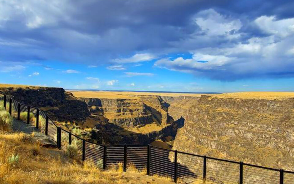
Nothing about the flat high-desert approach to Bruneau prepares you for the moment the ground simply vanishes beneath your feet. The Bruneau Canyon Overlook sits at the edge of a gorge roughly 800 feet deep, with the Bruneau River winding far below and the opposite rim about 1,300 feet away across open air.
The canyon system extends approximately 60 miles, carved through layers of basalt and rhyolite over thousands of years. Getting there involves about three miles of well-maintained gravel road, generally passable for most standard vehicles in dry conditions, so it is worth checking road conditions before heading out after rain.
A paved parking area, safety railings, and interpretive signs make the overlook comfortable for a leisurely stop. The juxtaposition of the unremarkable approach and the sudden, jaw-dropping drop into the canyon is part of what makes Bruneau so memorable.
It is the kind of place that earns a permanent spot in road-trip conversation.
7. Shoshone Falls Park, Twin Falls, Idaho
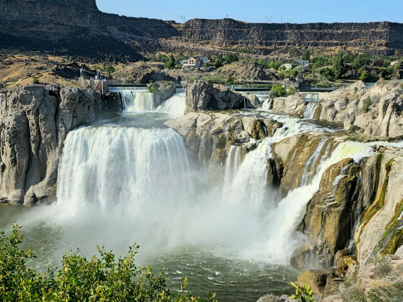
Shoshone Falls has been pulling travelers off the road since the Oregon Trail era, and it is not hard to understand why. Plunging 212 feet and spanning up to 1,000 feet in width, the falls are one of the most visually commanding natural features in the entire Pacific Northwest, and the park road delivers you right to the rim without much effort.
Spring is when the falls are at their most powerful, with flows sometimes reaching 20,000 cubic feet per second as snowmelt surges downstream. During drier summer months, a portion of the river is diverted for irrigation, which reduces the volume, though the canyon walls and the broad amphitheater shape of the site remain striking regardless of season.
The park typically charges a small vehicle fee from March through fall and offers picnic areas, hiking trails, a boat launch, and nearby Dierkes Lake for swimming. The land was donated for public use in 1932, preserving a landmark that had already captured imaginations for nearly a century before that.
8. Malad Gorge, Hagerman, Idaho
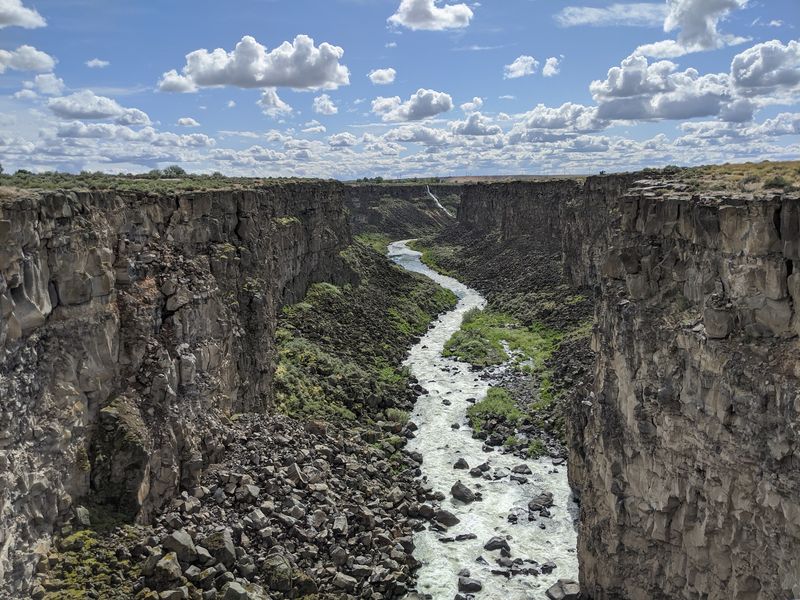
Most drivers barrel past the Malad Gorge exit on Interstate 84 without a second thought, which means they are missing one of southern Idaho’s most rewarding quick stops. The Malad River cuts a gorge roughly 250 feet deep and 2.5 miles long before joining the Snake River, and the canyon walls expose dramatic layers of ancient basalt at every turn.
The standout feature is the Devil’s Washbowl, where the river drops about 60 feet into a naturally carved circular pool. A footbridge spans the gorge near this formation, letting visitors stand directly above the rushing water for a perspective that feels more adventurous than the easy drive in might suggest.
Malad Gorge is part of Thousand Springs State Park, a region also known for the numerous springs that emerge from canyon walls and feed additional smaller waterfalls throughout the area. Spring typically brings the highest water flows, making the Devil’s Washbowl particularly active.
For road trippers on a schedule, few detours deliver this much geological drama in this little time.
9. MacDonald Viewpoint, Athol, Idaho
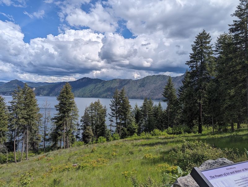
Farragut State Park is better known for its campgrounds and trails, but the MacDonald Viewpoint tucked inside the park offers something quieter and equally worthwhile. From this elevated position, Lake Pend Oreille spreads out in every direction, its deep blue water framed by dense forest and the rising mountain ridges of northern Idaho’s panhandle country.
Lake Pend Oreille is one of the largest and deepest lakes in the United States, reaching depths of over 1,150 feet in places. That sheer scale is evident from the viewpoint, where distant shorelines seem to blend into the horizon rather than coming to a clear end.
The park itself has an interesting backstory: it was once a naval training station during World War II, and the scenic drives within it now pass through land that once housed thousands of recruits. MacDonald Viewpoint offers a noticeably quieter experience than the busier lakefront areas closer to Coeur d’Alene, making it a solid choice for travelers who prefer their panoramas without a crowd.
10. White Bird Hill Summit, White Bird, Idaho
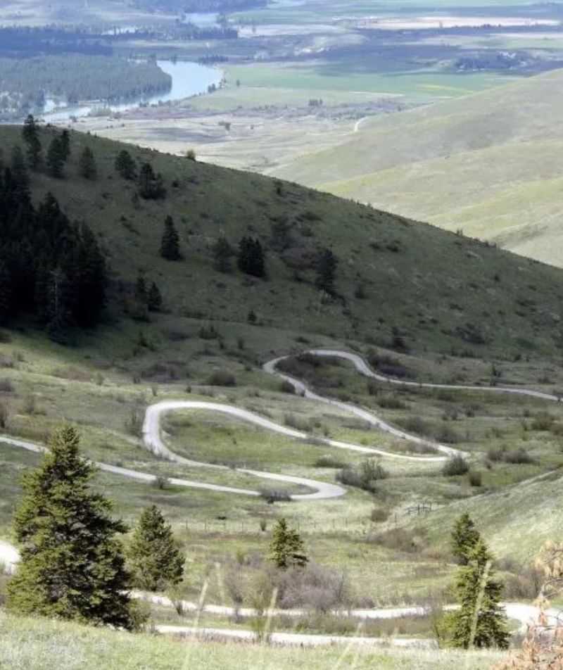
White Bird Hill Summit is the kind of place where geography and history collide in a way that makes a simple roadside stop feel much larger than it looks on a map. At 4,245 feet, the summit marks the boundary between the rolling Camas Prairie to the north and the canyon country of the Salmon River drainage to the south, and the difference between the two landscapes is striking from up here.
Several scenic pullouts along U.S. Highway 95 give drivers a chance to pause and absorb the southward view, where the land falls away steeply into White Bird Canyon over a descent of roughly 2,700 vertical feet in just seven miles.
The 1877 Battle of White Bird Canyon, the opening engagement of the Nez Perce War, took place in the valley visible from these overlooks, lending the scenery a layer of historical weight.
11. Higgens Point, Coeur d’Alene, Idaho
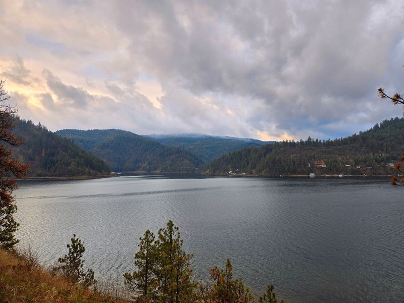
Higgens Point sits at the eastern end of the Coeur d’Alene Parkway, and the drive out to it is nearly as pleasant as the view itself. The road follows the lake east of downtown before arriving at a recreation area with wide views across Lake Coeur d’Alene toward the forested hills on the far shore.
From November through February, the area around the lake becomes one of Idaho’s best spots for watching wintering bald eagles. The birds are drawn by spawning kokanee salmon, and their numbers can exceed 200 during peak weeks.
Free permanent binoculars are often available at viewing areas near the point, and the eagles tend to be most active in the mornings and evenings.
12. Moyie River Overlook, Moyie Springs, Idaho
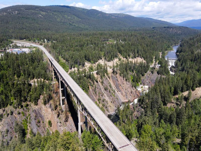
The closer you get to the Canadian border in Idaho, the more the landscape digs in and gets serious, and the Moyie River Overlook near Moyie Springs captures that shift better than almost any other roadside stop in the Panhandle. This convenient pullout on U.S.
Route 2 looks out over the Moyie River Canyon, a forested gorge that feels genuinely remote even with a highway running alongside it.
The most striking feature from the overlook is the Moyie River Canyon Bridge, a steel truss cantilever structure built in 1965 that stretches 1,223 feet and sits 464 feet above the river. The bridge is an impressive piece of engineering, and seeing it from the overlook gives a clear sense of just how deep the canyon actually runs.
13. Stanley Lake Overlook, Stanley, Idaho
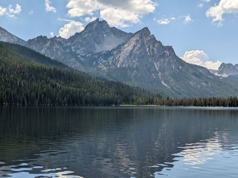
Stanley Lake has a way of making every other mountain view on the trip feel like a warm-up act. Located in the northwest corner of the Sawtooth National Recreation Area off Highway 21, this overlook frames a 170-acre lake against the jagged Sawtooth Mountains in a composition that photographers and painters return to repeatedly.
McGown Peak, rising to 9,860 feet, appears to ascend almost directly from the water’s edge, giving the scene a dramatic vertical quality that sets it apart from flatter alpine vistas. The overlook sits conveniently near campsites 3 and 4 of Stanley Lake Campground, so the view is accessible without any serious hiking commitment.
Share this story