Ireland’s Wild Atlantic Way stretches for over 2,500 kilometers along the western edge of the country, connecting some of the most dramatic coastal scenery in all of Europe. From towering sea cliffs and sheltered sandy bays to ancient mountain landscapes and remote peninsulas, the Atlantic coast offers something genuinely different at every turn.
Whether you are planning a road trip, looking for hiking destinations, or simply want to understand why so many travelers make Ireland their top choice, this list covers 14 natural attractions worth knowing about. Each one has its own character, its own landscape, and its own reason to visit.
Slieve League Cliffs, County Donegal
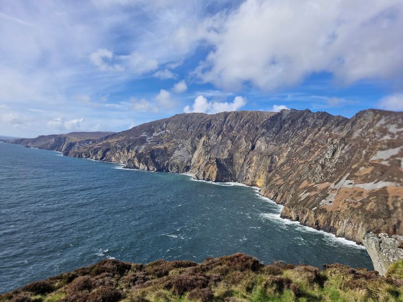
Standing nearly three times the height of the Cliffs of Moher, Slieve League is one of the tallest sea cliffs in Europe, rising approximately 601 meters above the Atlantic. Many visitors do not realize just how massive this place is until they are standing at the edge looking down.
The main viewing area at Bunglass is accessible by car and gives an immediate sense of the scale involved. From there, walkers can continue onto more demanding routes along the cliff tops, including sections of the One Man’s Pass, a narrow ridgeline that rewards confident hikers with sweeping views in every direction.
County Donegal tends to attract fewer tourists than the more famous sites in Kerry or Clare, which means Slieve League often feels quieter and more raw. Spring and early summer offer the best light and the most manageable weather conditions for exploring the trails safely.
Fanad Head, County Donegal
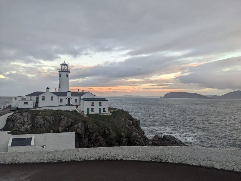
Fanad Head sits at the northern tip of a rugged peninsula wedged between Lough Swilly and Mulroy Bay, and the lighthouse there has guided ships since 1817. The building itself has been restored and now offers guided tours and even overnight accommodation for visitors who want a truly unusual stay.
The coastal scenery around the headland combines exposed cliffs, sea-carved rock formations, and open Atlantic views that stretch far to the north. On clear days, the contrast between the dark water of the lough and the open ocean is striking from the clifftop paths near the lighthouse.
Fanad Head is part of the Wild Atlantic Way route through northern Donegal, and it pairs naturally with nearby Portsalon Beach, one of the finest sandy beaches in the county. Driving the peninsula loop gives you a proper feel for how remote and beautiful this corner of Ireland actually is.
Glenveagh National Park, County Donegal
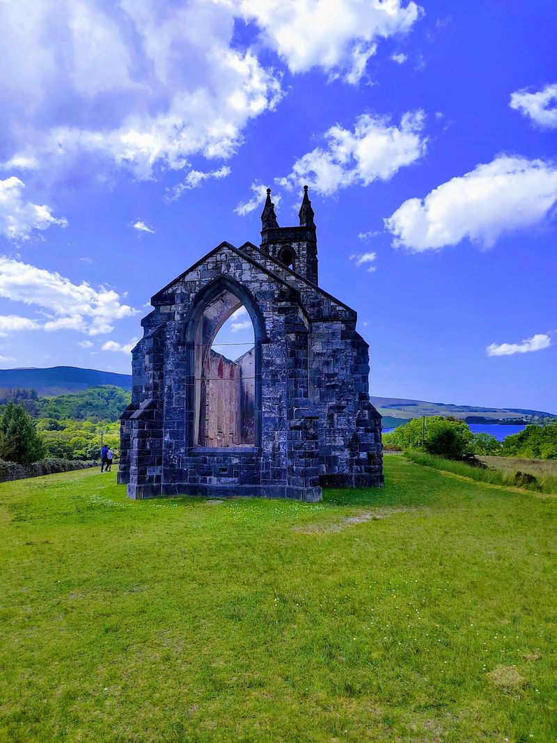
Glenveagh covers roughly 16,000 hectares of mountain, lake, and woodland in the heart of County Donegal, making it one of the largest national parks in Ireland. The landscape here has a completely different personality from the coastal cliffs that dominate this part of the Wild Atlantic Way.
At the center of the park sits Lough Veagh, a long glacial lake flanked by steep hillsides and ancient oak woodland. Glenveagh Castle stands on its shores and can be reached by a shuttle bus from the visitor center, which is a practical detail worth knowing before you arrive.
Red deer roam freely through the park, and golden eagles were successfully reintroduced to the area in the early 2000s, giving wildlife watchers a genuine reason to look up as well as around. The park is open year-round, with the visitor center operating seasonally, so checking ahead before an off-season visit is a smart move.
Mullaghmore Head, County Sligo
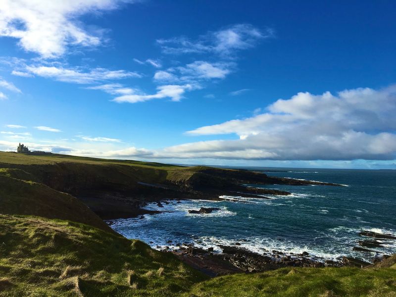
Few places on the Wild Atlantic Way combine dramatic wave action, rugged headland scenery, and a mountain backdrop quite like Mullaghmore Head in County Sligo. When large Atlantic swells arrive in autumn and winter, this spot becomes one of the premier big-wave surfing locations in all of Europe.
The waves at Mullaghmore can reach heights of over 15 meters during the biggest swells, drawing experienced surfers from around the world to watch or compete. For non-surfers, the headland walk offers solid coastal views with Benbulben rising sharply behind the village of Mullaghmore.
The small harbor village itself has a tidy seafront and a castle visible from the road, which adds a bit of historical texture to what is otherwise a very wild and weather-exposed landscape. Visiting during a storm swell, even just to watch from a safe distance, is an experience that stays with you for a long time.
Benbulben, County Sligo
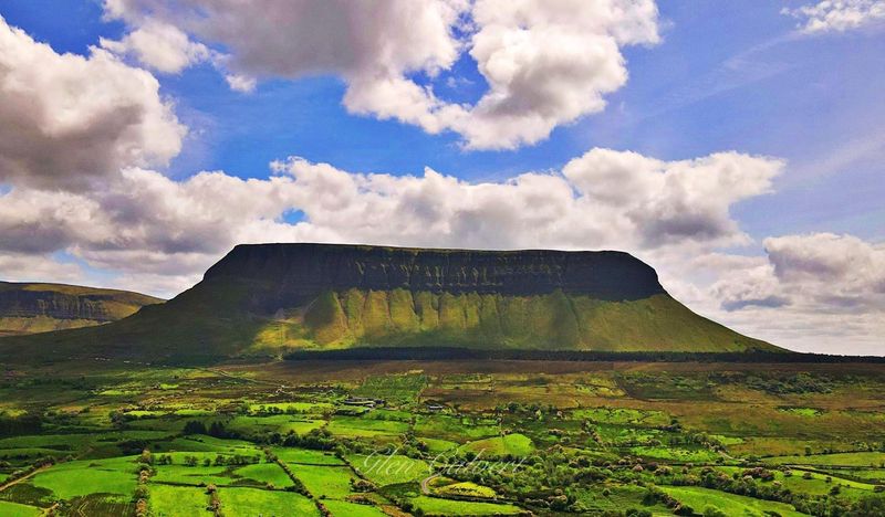
Benbulben’s flat-topped silhouette is one of the most recognizable mountain shapes in Ireland, and it dominates the northern Sligo landscape in a way that makes it hard to ignore from almost any direction. The mountain rises to 526 meters and its layered limestone and shale profile was carved by glaciers during the last Ice Age.
The poet W.B. Yeats famously requested to be buried in its shadow, and his grave at Drumcliffe churchyard sits just a short drive away at the mountain’s base.
That literary connection gives Benbulben a cultural weight that goes beyond its physical presence.
Walkers can access routes around the base and onto the plateau, though the upper terrain is serious mountain ground that requires proper footwear and navigation skills. Views from the summit plateau extend toward Sligo Bay, the Donegal hills, and on clear days, far out over the Atlantic.
Checking local trail conditions before heading up is strongly recommended.
Downpatrick Head, County Mayo
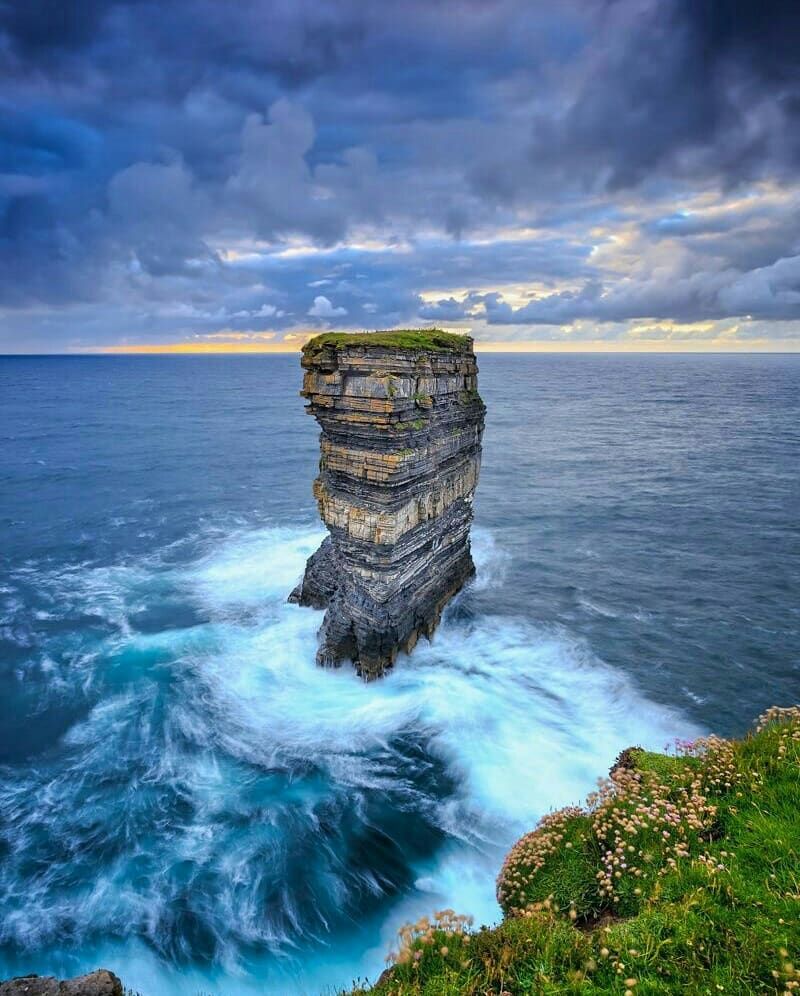
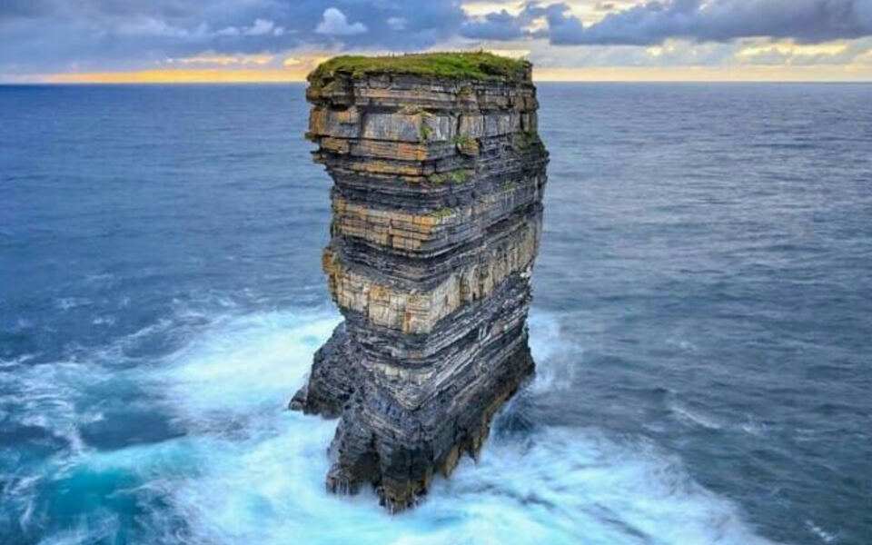
The sea stack known as Dun Briste is what most people come to see at Downpatrick Head, and it delivers. This isolated pillar of rock stands about 50 meters high just offshore, separated from the mainland by a narrow channel that formed when the connecting arch collapsed centuries ago.
The headland itself sits on the north Mayo coast and offers broad Atlantic views in multiple directions. Blow holes in the clifftop surface add an unpredictable element to the walk, as water can surge up through them during rough seas, which makes staying on marked paths genuinely important here.
Archaeological and early Christian features connected to St. Patrick are also found around the headland, including a holy well and the site of an ancient oratory. The combination of geological drama and historical layering makes Downpatrick Head one of the more interesting stops along this stretch of the Mayo coast.
Parking is available at the site and entry is free.
Keem Bay, Achill Island, County Mayo
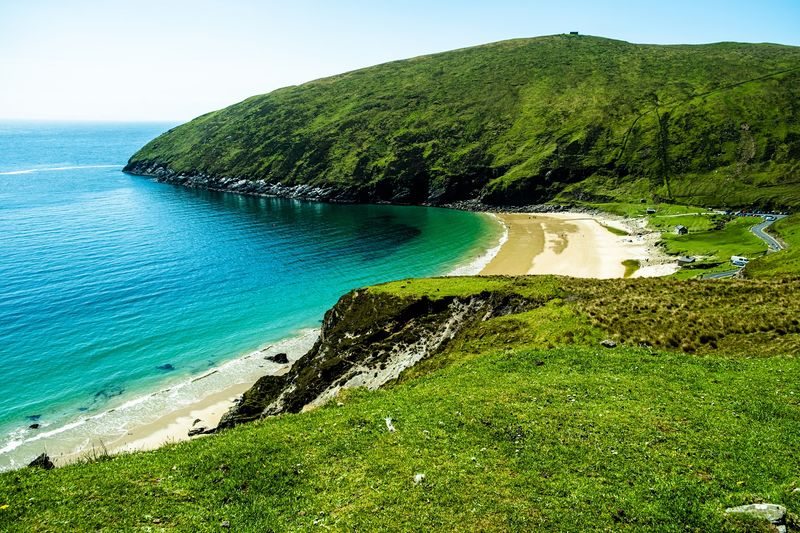
Keem Bay earns its reputation honestly. The horseshoe-shaped beach at the western tip of Achill Island is sheltered by steep cliffs on three sides, which creates a calm, almost enclosed atmosphere that feels separate from the wild coastline just around the corner.
The water here is remarkably clear by Atlantic standards, and the bay is popular for swimming, kayaking, and snorkeling during summer months. Basking sharks were historically spotted feeding in these waters, and occasional sightings still occur during warmer months when plankton blooms attract them close to shore.
Getting to Keem Bay requires driving a narrow, winding road along the cliff edge above the beach, and the views on the way down are arguably as impressive as the bay itself. Achill Island is connected to the mainland by a bridge, so no ferry is needed.
Parking at the beach fills up quickly on sunny summer weekends, so arriving early makes a real difference.
Wild Nephin National Park, County Mayo
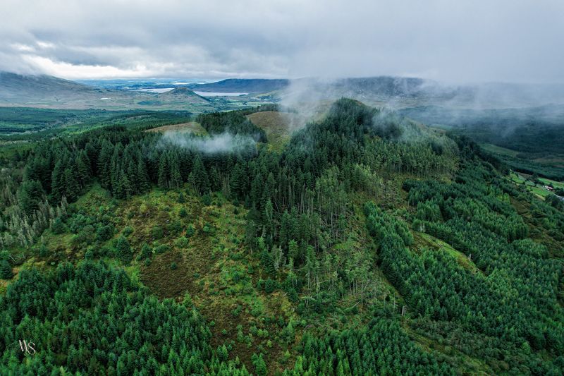
Wild Nephin is Ireland’s only designated wilderness national park, covering over 11,000 hectares of blanket bog, mountain terrain, and Atlantic woodland along the western edge of County Mayo. The sheer absence of artificial light in this area earned it recognition as one of the darkest sky areas in Europe.
Ballycroy Visitor Centre serves as the main entry point to the park and offers exhibits on the bog ecosystem and local heritage. Walking options range from an accessible 2-kilometer nature trail suitable for most visitors to the demanding Bangor Trail, a challenging multi-day route crossing remote mountain terrain.
The park protects one of the largest intact blanket bog systems in Ireland, and the landscape has a raw, undisturbed quality that is increasingly rare. Birdwatchers come for species including golden plover and red grouse, while the night skies draw stargazers from across the country.
Seasonal visitor services are available, so checking the park’s website before a winter visit is worth doing.
Connemara National Park, County Galway
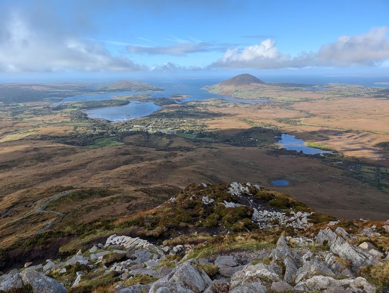
Connemara National Park protects around 2,000 hectares of mountain, heathland, grassland, and bog in one of the most scenically distinctive parts of western Ireland. The Twelve Bens mountain range forms a rugged backdrop that changes color and mood with every shift in weather.
The park is open year-round with free admission, which makes it accessible for visitors on any budget. The visitor center near Letterfrack currently operates on reduced days, so checking the schedule ahead of time avoids disappointment.
The Ellis Wood trail is temporarily closed for maintenance, but other walking routes remain open and give good access to the landscape.
Connemara ponies, the native breed associated with this region, are sometimes visible grazing on the surrounding land. The nearby village of Letterfrack has accommodation and food options, which makes the park a practical base for a night or two rather than just a single day stop.
Weather here changes quickly, so layers and waterproofs are a practical necessity.
Killary Harbour, County Galway and County Mayo
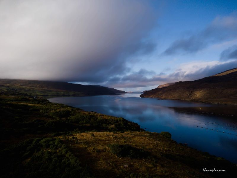
Killary Harbour is often described as Ireland’s only true fjord, stretching about 16 kilometers inland from the Atlantic between the mountains of Connacht. Whether or not it meets the strict geological definition of a fjord, the visual effect of steep mountain walls dropping into dark, still water is genuinely striking.
The harbour forms a natural border between County Galway and County Mayo, and the road running along its southern shore offers some of the most dramatic valley-meets-ocean views in the country. Leenane village at the eastern end of the harbour is a practical stop with cafes and a visitor attraction focused on the local wool and sheep farming tradition.
Boat trips run from Killary Harbour into the open water, giving visitors a different perspective on the surrounding landscape from the water level. The area also connects to walking routes in the Mweelrea and Ben Gorm mountain ranges for those looking to get higher ground and broader views across the Connemara interior.
Cliffs of Moher, County Clare
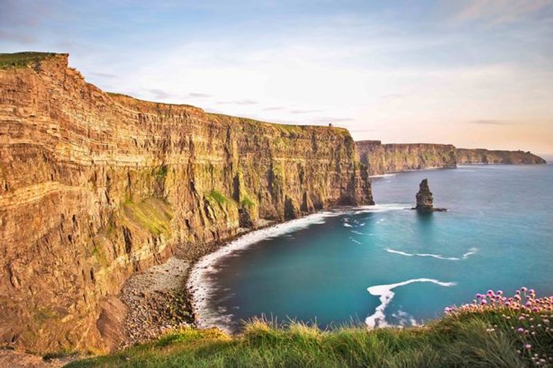
The Cliffs of Moher rise as high as 214 meters above the Atlantic and run for approximately 14 kilometers along the County Clare coastline, making them one of the most visited natural sites in Ireland. On clear days, the Aran Islands are visible from the clifftop, sitting in Galway Bay to the north.
O’Brien’s Tower, a 19th-century lookout point near the highest section of the cliffs, gives visitors an elevated vantage point over both the cliff face and the ocean below. The visitor center is built into the hillside and includes exhibits on the ecology and geology of the cliffs, along with parking, cafes, and facilities.
Puffins and other seabirds nest in the cliff faces during spring and early summer, which adds a wildlife dimension that many first-time visitors do not expect. Admission to the visitor center and main viewing areas carries a fee.
Arriving early in the morning or later in the afternoon helps avoid the busiest crowds during peak summer season.
Burren National Park, County Clare
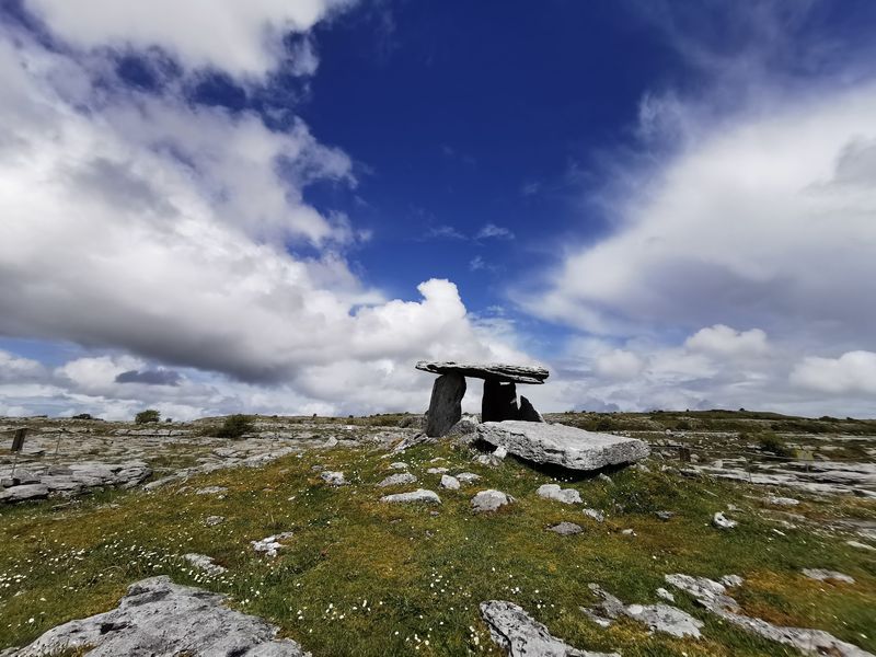
The Burren looks like no other landscape in Ireland. Exposed limestone pavement stretches across the hills of County Clare in wide grey sheets, broken by deep natural cracks called grykes that shelter an unusual mix of Arctic, Mediterranean, and alpine plant species growing side by side.
The national park is open year-round with free admission, and seven waymarked walking trails currently operate across Burren National Park and the adjacent Slieve Carran Nature Reserve. Trail lengths and difficulty levels vary, making the area workable for casual walkers as well as those looking for a longer day out on the rock.
Spring is the most popular season for botanists and wildflower enthusiasts, when the limestone pavement fills with color from species including spring gentian, mountain avens, and bloody cranesbill. The nearby Burren town of Ballyvaughan serves as a useful base, with access to the coast, the Aran Islands ferry, and the Cliffs of Moher all within reasonable driving distance.
Dingle Peninsula and Slea Head, County Kerry
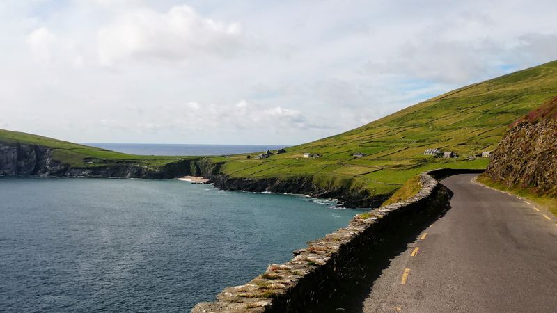
The Dingle Peninsula packs an extraordinary variety of coastal and mountain scenery into a relatively compact stretch of County Kerry. Slea Head Drive, a loop road that follows the western tip of the peninsula, passes sea cliffs, sandy coves, ancient stone structures, and open Atlantic viewpoints within a single route.
Coumeenoole Beach sits along this drive and offers one of the most dramatic beach settings in Ireland, backed by steep cliffs and directly facing the Blasket Islands. The Blaskets were inhabited until 1953, when the last remaining residents were evacuated, and their story is told at the Blasket Centre in Dunquin, which is open seasonally.
The town of Dingle itself is a full destination with restaurants, craft shops, and boat trips to see the resident bottlenose dolphin known as Fungie, though recent sightings have been inconsistent. The peninsula also holds a remarkable concentration of early Christian and prehistoric stone monuments along its hillsides and clifftops.
Beara Peninsula, County Cork
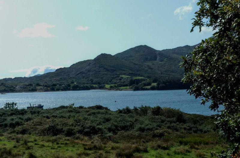
The Beara Peninsula extends westward from County Cork into the Atlantic, sharing its northern shore with County Kerry across the Kenmare River estuary. Compared to the busier Ring of Kerry route nearby, Beara has a noticeably quieter character and a landscape that rewards slow, exploratory travel.
The Caha Mountains form the spine of the peninsula, and the road over the Healy Pass connects Cork and Kerry through one of the most scenic mountain crossings in the southwest. The pass reaches about 334 meters at its highest point, with views down both sides of the range toward the sea.
Dursey Island, accessible by Ireland’s only cable car, sits at the western tip of the peninsula and is a genuinely unusual side trip for those who make it that far. The Beara Way, a long-distance walking route, circles the entire peninsula and can be walked in sections.
Villages like Castletownbere and Eyeries give the route practical stopping points with accommodation and food.
Share this story