Peru is a country where history and geography are impossible to separate. From cloud-forest ridges to coastal deserts and high Andean plateaus, ancient civilizations built their greatest monuments in some of the most extreme environments on Earth.
These 15 landmarks show just how boldly Peru’s early peoples shaped the land around them, leaving behind cities, temples, and geoglyphs that still astonish visitors today. Whether you are a history lover or simply someone who enjoys a jaw-dropping view, Peru delivers on every front.
Machu Picchu
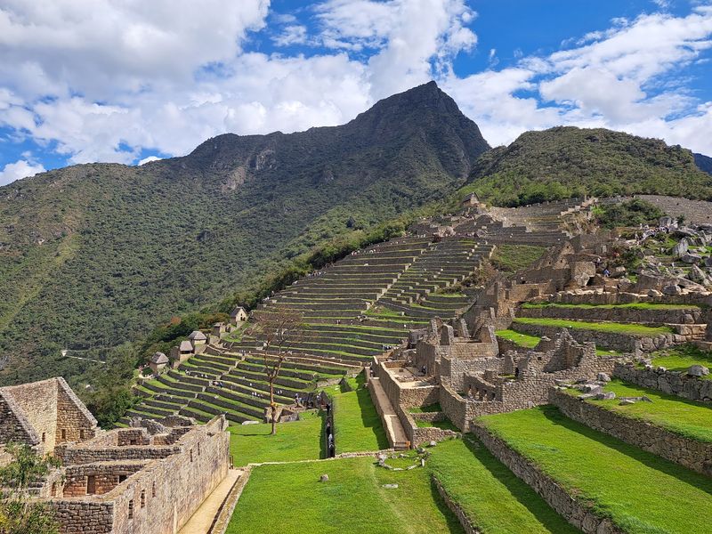
Balanced on a narrow mountain ridge like something out of a dream, Machu Picchu is one of those places that genuinely looks better in person than in any photograph. Built during the 15th century, this Inca complex sits about 2,430 meters above sea level where the Andes begin their steep drop toward the Amazon Basin.
Around 200 stone structures cover the site, organized into agricultural, residential, ceremonial, and astronomical zones.
The terraces that fan out across the slopes were not just decorative. They prevented erosion, managed rainfall, and allowed farming on land that would otherwise be useless.
UNESCO recognizes Machu Picchu for both its cultural and natural value, which is rare for a single site. The surrounding sanctuary protects more than 32,000 hectares of peaks, valleys, and tropical mountain forest.
Visitors typically arrive by train through the Urubamba Valley, then take a winding bus ride up to the entrance gate. Morning hours offer cooler temperatures and fewer crowds.
The stone walls seem to grow directly from the rock beneath them, making it genuinely hard to tell where the mountain ends and the architecture begins.
Sacsayhuamán, Cusco
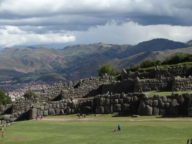
The stones at Sacsayhuamán are so perfectly fitted together that not even a sheet of paper can slide between them. Sitting on a commanding hilltop above the former Inca capital of Cusco, this complex is one of the most striking examples of Inca stonework anywhere in South America.
Some of the limestone blocks weigh more than 100 tons, which raises an obvious question: how exactly did they get there?
Historians believe tens of thousands of laborers moved the stones using ramps, ropes, and organized workforce systems. The result is a series of massive zigzagging terraces that stretch across the hillside in a way that feels almost theatrical.
The Inca ruler Pachacutec redesigned Cusco during the 15th century, and Sacsayhuamán was a centerpiece of that ambitious project.
Today, the site hosts Inti Raymi, the Festival of the Sun, every June, drawing thousands of visitors and local participants. Walking among the walls gives a real sense of scale that photos struggle to capture.
From the top, the red-tiled rooftops of modern Cusco spread out below, making the contrast between ancient and colonial Peru wonderfully clear.
Ollantaytambo
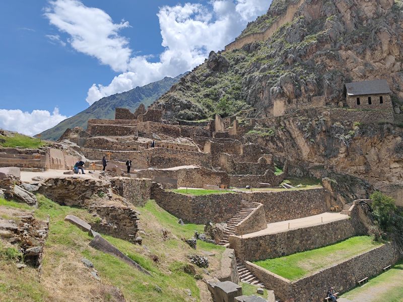
Ollantaytambo is one of those rare places where the ancient world feels genuinely alive. The town below still follows its original Inca street grid, with water channels running along cobblestone lanes that have been in use for centuries.
Above the town, massive agricultural terraces climb sharply up the mountainside toward ceremonial structures assembled from enormous, carefully shaped stone blocks.
The logistics of building here were extraordinary. Stone was quarried from a cliff face across the valley, transported across the Urubamba River, and then hauled up steep slopes to their final positions.
The effort required was staggering, yet the finished complex has a confident, deliberate look that suggests no one involved was improvising.
Ollantaytambo also served a strategic purpose, controlling movement through the Urubamba Valley and toward the approaches to Machu Picchu. During the Spanish conquest, it became the site of one of the few successful Inca military victories against European forces.
Visitors today can explore both the archaeological complex and the living town below, making Ollantaytambo one of the Sacred Valley’s most complete and rewarding stops. The combination of terraces, temples, canals, and mountain backdrop is hard to match.
Pisac
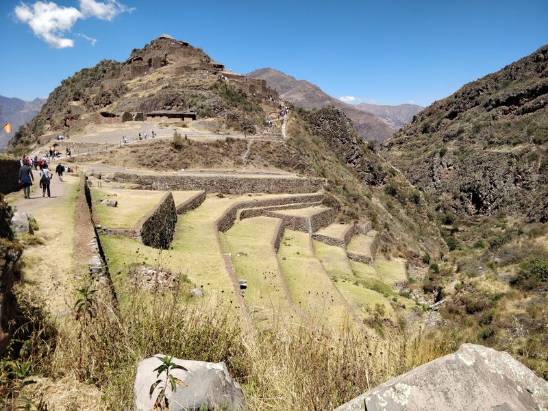
Pisac turns a steep, awkward mountainside into something almost sculptural. Long curving arcs of Inca terraces wrap around the slopes above the Sacred Valley, following the natural contours of the mountain rather than forcing a rigid pattern onto the land.
The result looks organic, almost as if the terraces grew there naturally, even though each one required enormous effort to construct and maintain.
Higher up the site, residential and ceremonial structures occupy more protected positions, connected to the terraces below by carefully planned pathways and stairways. The elevated setting also gave Pisac a strategic advantage, offering commanding views across the valley in every direction.
Controlling movement through this region mattered deeply to the Inca administration.
The modern town of Pisac at the valley floor is famous for its Sunday market, where textiles, ceramics, and produce are sold in a setting that feels genuinely local rather than purely tourist-oriented. Combining a market morning with an afternoon hike up to the ruins makes for a satisfying full day.
Pisac is often overshadowed by Machu Picchu in travel conversations, but for visitors who want to understand how the Incas thought about landscape and agriculture together, it is absolutely essential.
Moray
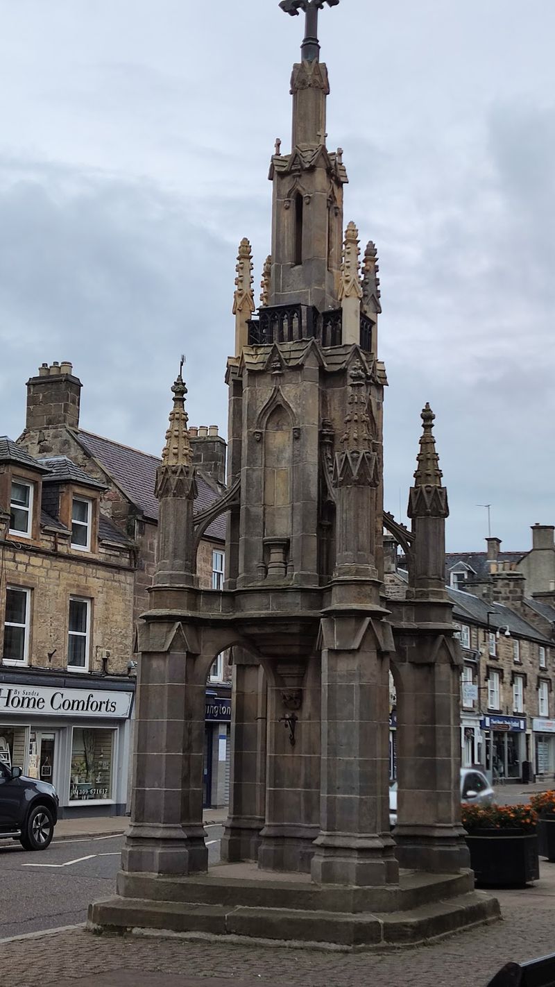
From above, Moray looks like something a giant pressed into the earth with a perfectly round thumb. Several sets of concentric circular terraces descend into natural depressions in the highlands near Cusco, creating a geometry that has puzzled and fascinated researchers for decades.
Nothing else in the Inca world looks quite like it.
The leading theory connects Moray to agricultural experimentation. Different levels within the depressions experience slightly different temperatures and exposure conditions, which may have allowed Inca specialists to study how various crops responded to different growing environments.
The drainage systems built into the terraces are sophisticated enough to suggest serious engineering knowledge was applied here.
Getting to Moray usually involves a visit to the nearby salt pans of Maras, where thousands of small terraced pools have been used to evaporate salt from a natural brine spring since pre-Inca times. Combining both sites in a single trip is popular and makes practical sense.
The open Andean landscape around Moray adds to its strangeness: there are no dramatic peaks looming nearby, just wide sky, rolling highlands, and these mysterious circular forms cut into the earth below your feet.
Chavín de Huántar
Roughly 3,000 years before the Incas built Machu Picchu, Chavín de Huántar was already one of the most important religious centers in South America. Tucked into a high mountain valley where two rivers meet, the site became a destination for pilgrims traveling from widely separated regions of the Andes.
The culture associated with it flourished broadly between the second and first millennia BCE.
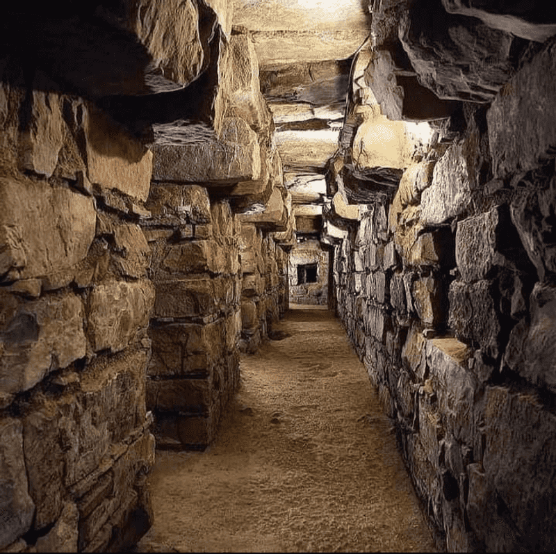
What survives is genuinely impressive. Stone buildings, terraces, open plazas, and a network of underground galleries with working ventilation systems and drainage channels all point to sophisticated engineering.
Elaborate carved stone sculptures depicting supernatural figures covered in fangs and serpents suggest a complex religious tradition that influenced art styles across a wide area.
UNESCO recognizes Chavín as one of the earliest and best-preserved pre-Columbian ceremonial centers, which is a significant distinction in a country full of ancient sites. The underground galleries are open to limited visitor access, offering a slightly eerie but memorable walk through narrow stone passages.
Reaching Chavín requires a mountain journey from Huaraz, but the combination of remote valley setting and genuinely ancient atmosphere makes the effort worthwhile for anyone serious about Peru’s deep archaeological history.
Chan Chan

Chan Chan is proof that you do not need stone to build something extraordinary. The ancient Chimú capital on Peru’s northern coast was constructed almost entirely from adobe, yet it grew into the largest pre-Columbian earthen city in the Americas.
At its peak, the urban area covered roughly 20 square kilometers of coastal desert near present-day Trujillo.
The monumental core contained nine enormous palace-like complexes, each enclosed by thick adobe walls that still rise several meters in places. Inside, decorative friezes cover the walls with repeating geometric patterns, fish, birds, and sea creatures, reflecting the Chimú civilization’s close relationship with the Pacific Ocean.
Storehouses, reservoirs, workshops, and ceremonial spaces completed a fully functioning urban system in one of the driest environments on Earth.
Managing water was the key to Chan Chan’s survival. Sophisticated irrigation systems and reservoirs allowed the city to support a large population despite minimal rainfall.
UNESCO lists Chan Chan as a World Heritage site but also flags it as endangered, primarily because rainfall events and erosion continue to damage the fragile adobe structures. Visiting today means walking through corridors of weathered but still-detailed walls that somehow survived centuries of coastal desert conditions.
Nazca and Palpa Lines
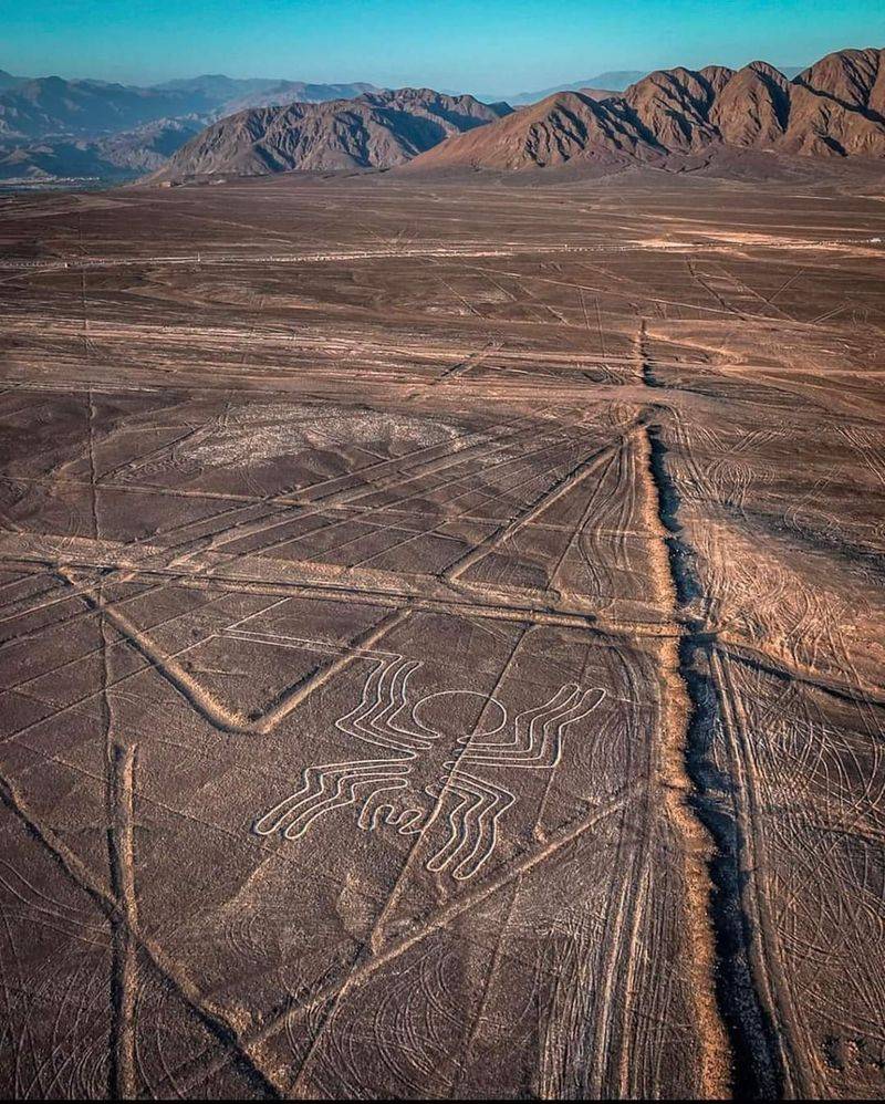
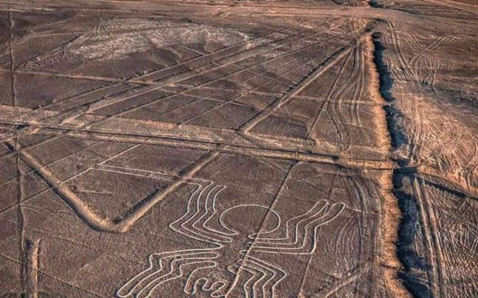
Seen from the air, the Nazca Lines look like someone drew on the desert with a ruler and then forgot to stop. Spread across a vast arid plateau in southern Peru, the geoglyphs include perfectly straight lines stretching for kilometers, geometric shapes, and recognizable figures of animals including a spider, a hummingbird, a monkey, and a condor.
Some figures are several hundred meters across.
Ancient creators made the designs by removing darker surface stones to reveal lighter ground beneath, a deceptively simple technique that produced images visible only from above. The extreme dryness of the Nazca desert helped preserve them for roughly 2,000 years.
UNESCO added the geoglyphs to the World Heritage List in recognition of their extraordinary cultural significance and remarkable state of preservation.
What the lines were actually for remains one of archaeology’s most entertaining open questions. Theories range from astronomical calendars to ritual pathways to offerings visible to sky deities.
Small observation towers near the site allow limited ground-level viewing, but most visitors take short flights from Nazca or Ica for the full aerial perspective. The lines are also accompanied by nearby Palpa geoglyphs, which include earlier, more figurative designs that add further depth to the mystery.
Sacred City of Caral-Supe
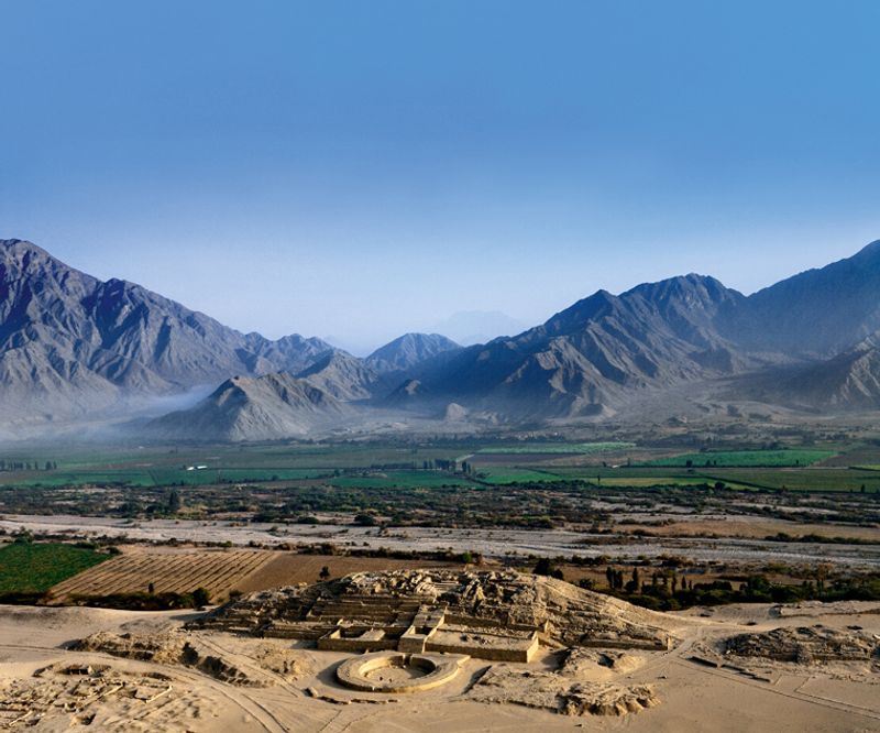
Caral-Supe is older than the Egyptian pyramids, which is a fact that tends to stop people mid-sentence. At roughly 5,000 years old, it is the oldest known center of civilization in the Americas, and it sits in a place that looks almost too dramatic to be real: a dry desert terrace perched above a narrow strip of green river valley on Peru’s central coast.
The 626-hectare site contains six major pyramid-like platforms, sunken circular courts, and residential areas organized in ways that suggest a complex, hierarchically structured society. A quipu, the knotted string recording device later associated with the Incas, was also found at Caral, pushing the history of that technology back thousands of years.
UNESCO added Caral to the World Heritage List in 2009.
The civilization here thrived without ceramics and without writing as far as researchers can determine, yet they built monumental architecture, managed large populations, and traded with coastal fishing communities. The site is about 180 kilometers north of Lima, making it reachable as a long day trip or an overnight excursion.
The contrast between the barren plateau and the vivid green valley below gives the ruins a visual drama that photographs rarely do justice.
Kuélap
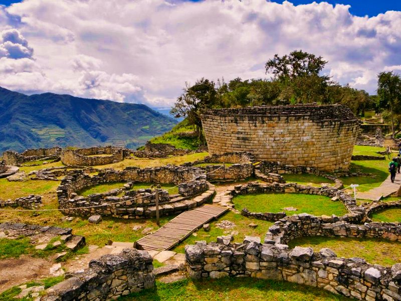
Kuélap hides in the clouds, quite literally. Perched on a high ridge in the cloud forests of northern Peru at around 3,000 meters elevation, this Chachapoya complex is enclosed by stone walls that reach up to 20 meters in height in some sections, making them among the tallest pre-Columbian walls in South America.
The scale is startling when you round a bend in the trail and suddenly see them rising from the mist.
Inside the walls, more than 400 circular building foundations survive, a distinctive architectural style that sets Chachapoya construction apart from the rectangular forms favored by the Incas. The Chachapoyas were eventually absorbed into the Inca Empire during the late 15th century, but their cultural identity and building traditions remained distinct.
Researchers continue to study what daily life, ritual practice, and social organization looked like here.
Getting to Kuélap used to involve a long, winding mountain road, but a cable car system now connects the valley below to the site entrance, dramatically reducing travel time. The cloud forest setting gives the ruins a moody, atmospheric quality that feels very different from the open Andean sites near Cusco.
Green moss, humid air, and occasional low cloud make Kuélap one of Peru’s most visually distinctive archaeological experiences.
Pachacamac
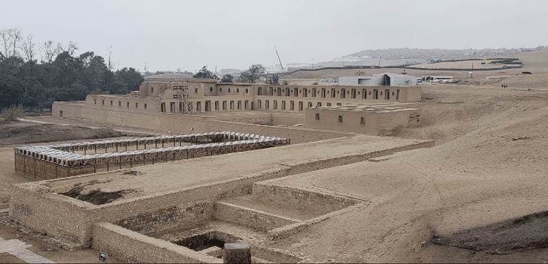
Just south of Lima, where the coastal desert meets the Pacific, Pachacamac spent more than a thousand years as one of the most powerful religious centers on Peru’s coast. Long before the Inca Empire arrived, multiple cultures built temples, pyramids, and ceremonial spaces here, layering history into a complex that still covers a large stretch of desert landscape today.
The site’s oracle was its biggest draw. People traveled from distant regions to consult the deity of Pachacamac, making the sanctuary a hub of long-distance religious and cultural exchange.
When the Incas incorporated Pachacamac into their empire, they added their own temples rather than demolishing what already existed, which is why the site contains architecture from several different periods and traditions.
Pyramids with wide ramps, enclosed plazas, administrative buildings, and road connections to the wider Inca road network all survive in varying states of preservation. An on-site museum houses objects recovered from excavations, including wooden idols and textiles.
The combination of ocean views, desert landscape, and layered cultural history gives Pachacamac a contemplative atmosphere that feels distinct from the highland sites. It is easily visited from Lima as a half-day trip, making it one of the most accessible major archaeological sites in Peru.
Chankillo Archaeoastronomical Complex
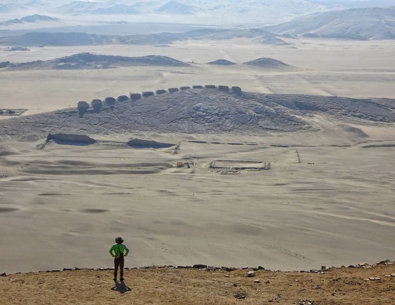
Chankillo may be the oldest solar observatory in the Americas, and it works using nothing more than careful positioning and the predictable movement of the sun. A line of 13 stone towers runs along a natural ridge on Peru’s desert coast, spaced so that their positions align with different points on the horizon as the sun rises and sets throughout the year.
From two identified observation points, this tower sequence tracked the entire solar calendar.
The system is elegant in its simplicity. No complex instruments were needed: just towers, open sky, and patient observation over many years.
UNESCO added Chankillo to the World Heritage List in 2021, recognizing it as exceptional evidence of organized astronomical knowledge in ancient Peru. The surrounding complex also includes a fortified structure and a ceremonial area, suggesting the site served multiple social and religious functions.
The barren desert landscape around Chankillo is not incidental. Wide, unobstructed horizons were essential to the observatory’s function, meaning the builders chose this location deliberately for its astronomical suitability.
Visiting the site today requires a trip to the Casma region north of Lima. The stark setting, with pale sand, rocky ridges, and clear sky, makes it easy to imagine ancient observers standing at their fixed points, watching the sunrise shift tower by tower through the seasons.
Sillustani
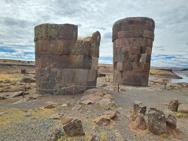
Sillustani is one of those places where the setting and the subject reinforce each other perfectly. Tall cylindrical funerary towers called chullpas rise from a windswept peninsula above Lake Umayo, near Lake Titicaca, in a landscape so open and still that the towers feel genuinely monumental even before you know what they are.
Some stand more than 12 meters tall and were built to house the remains of elite individuals.
The towers were constructed by Colla communities before the Inca period, though later examples show the influence of Inca masonry techniques in their more precisely fitted stonework. The variety is interesting: some chullpas are built from rough fieldstone while others feature carefully shaped blocks arranged with considerable skill.
One famous unfinished tower still has a stone ramp leaning against it, frozen mid-construction.
Sunset at Sillustani is something visitors consistently mention as a highlight. The warm light hits the pale stone towers while the lake and distant peaks shift through shades of gold and purple.
The site is about 35 kilometers from the city of Puno, making it a comfortable afternoon excursion. Unlike the densely packed ruins of Cusco or the Sacred Valley, Sillustani offers solitude and wide open sky in equal measure, which gives the experience a genuinely different emotional quality.
Lake Titicaca and the Uros Islands
Lake Titicaca sits so high and looks so intensely blue that first-time visitors often spend a few minutes just staring at it, slightly disbelieving. At more than 3,800 meters above sea level, it is the world’s highest navigable lake, and its waters have been central to Andean mythology for thousands of years.
Inca tradition held that the first Inca, Manco Capac, emerged from the lake itself.
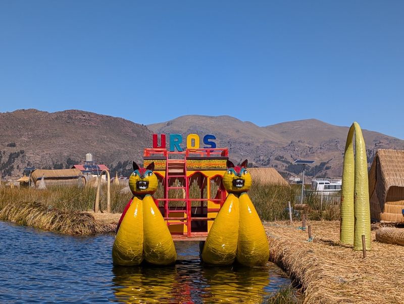
The Uros people take the lake’s relationship with human life one step further by living on it. Their floating islands are constructed from layers of totora reeds, the same plant used to build their traditional boats.
As the bottom layers decompose, new reeds are added on top, keeping the islands buoyant and habitable. Some families have lived on these floating platforms for generations.
Archaeological sites around the lake document much older cultures as well, including the Tiwanaku civilization centered on the Bolivian side. The Peruvian shore near Puno offers access to the Uros Islands by boat in under an hour, and further trips reach the island of Taquile, where traditional textile weaving is recognized by UNESCO as intangible cultural heritage.
The combination of living culture, ancient mythology, and extraordinary high-altitude scenery makes Lake Titicaca one of Peru’s most layered destinations.
Cusco
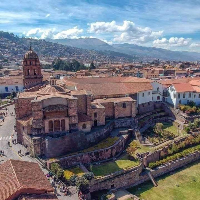
Cusco is a city where you can place your hand on a wall and touch two civilizations at once. The finely fitted Inca stonework that forms the lower sections of many buildings in the historic center has been standing for over 500 years, while Spanish colonial churches, monasteries, and palaces rise from the same foundations above.
Few cities in the world layer their history quite so literally.
The Inca ruler Pachacutec redesigned Cusco during the 15th century, turning it into the administrative and religious capital of Tawantinsuyu at roughly 3,400 meters elevation. The former Temple of the Sun, known as Qorikancha, is one of the best places to see this layering in action: its curved Inca walls now support the Church of Santo Domingo built directly over them.
UNESCO recognizes Cusco as a World Heritage site for this extraordinary fusion of cultures.
Walking the city’s streets rewards close attention. Look down at the base of a colonial building and you will often find trapezoidal Inca doorways or perfectly fitted polygonal blocks that have outlasted everything built on top of them.
The altitude takes some adjustment, but Cusco’s mix of living city, Inca engineering, and Baroque architecture makes it the natural starting point for any serious exploration of Peru’s ancient landmarks.
Share this story