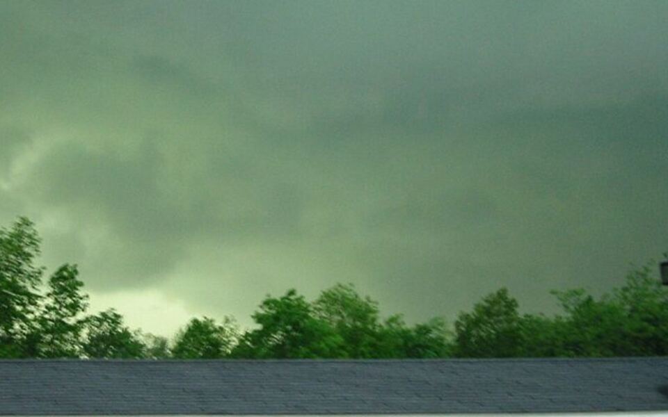
Oklahoma thunderstorm season has a way of stopping people mid-sentence and pulling every eye toward the horizon. Sometimes the sky shifts into something hard to describe, a greenish cast that feels wrong in the best and most unsettling way.
That color has become part of the state’s weather lore, passed down through front-porch conversations and emergency-drill memories alike. What actually causes it, and what should you do when you see it, turns out to be more nuanced and more interesting than most people realize.
Oklahoma Knows the Drama of a Changing Sky
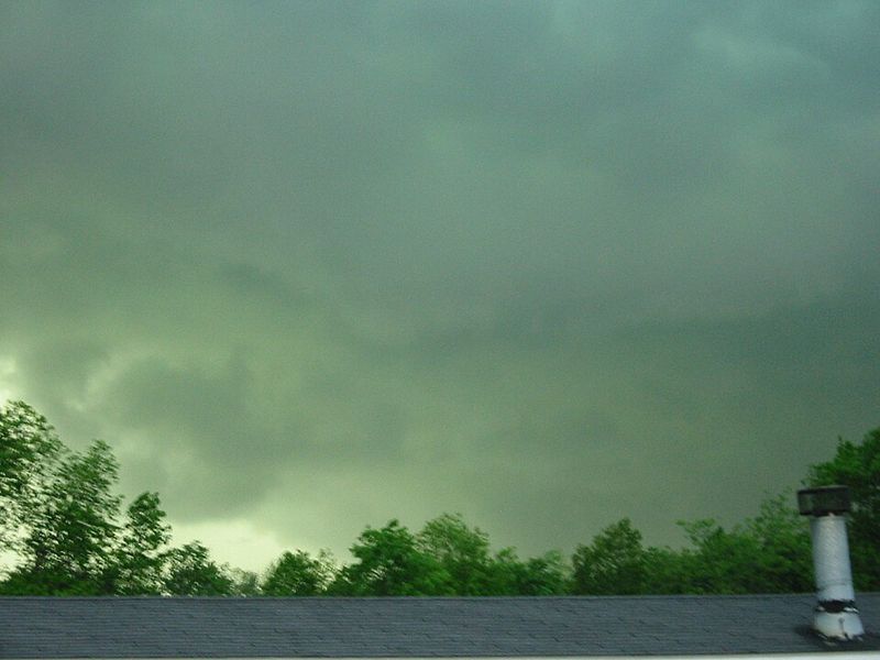
Spend enough springs in Oklahoma and your relationship with the sky becomes something personal. Clouds that elsewhere might earn a passing glance here demand full attention, because the state logs roughly 45 to 55 thunderstorm days per year depending on the region, according to the Oklahoma Climatological Survey.
That volume of storm activity means residents build up a mental library of sky colors, cloud shapes, and air pressures that outsiders simply do not carry.
Among the entries in that library, few are as striking as the greenish cast that can settle over the landscape when a big storm rolls through. People describe it differently: a murky olive wash, a yellow-green glow, something that makes the familiar look foreign.
The description varies from person to person, and that variation is part of what makes the phenomenon interesting rather than a single standardized signal.
Oklahoma’s tornado history and its place near the heart of Great Plains storm activity give the green sky a cultural weight here that goes beyond meteorology. It shows up in childhood memories, in text messages sent between family members during storm season, and in the instinct to step outside and look up before heading for cover.
That instinct is understandable, but the color itself carries less precise information than the lore suggests.
The real question the green sky raises is not “how bad will this get?” but rather “what is the storm actually doing to the light, and what should I do next?” Those two questions lead to very different answers, and both are worth understanding before the next storm season arrives.
Scientists See an Optical Effect, Not a Single Cause
When atmospheric scientists look at a green-tinted storm sky, they see a light-filtering problem, not a simple one. A large, deep thunderstorm can grow so tall and optically thick that it fundamentally changes the color of the sunlight passing through or around it.
NOAA’s National Severe Storms Laboratory acknowledges that scientists do not fully agree on why the sky sometimes appears green, though there is anecdotal evidence linking the color to storms that also produce hail.
Several competing and complementary explanations have been proposed. One idea involves reddened late-day sunlight combining with the blue light scattered by water droplets inside a storm, producing a greenish result when the two mix.
Another points to the sheer optical depth of a towering storm: when sunlight must travel through miles of cloud water and ice before reaching the observer, the spectrum of colors that survive the journey shifts. Peer-reviewed research published in the Bulletin of the American Meteorological Society has documented green thunderstorms and examined how combinations of reddened sunlight, cloud water, ice, and storm geometry can contribute to the appearance.
Hail is a plausible piece of the puzzle in some storms. Large hailstones and the dense water surrounding them can alter how light moves through a storm’s lower levels.
But calling hail a guaranteed cause overstates what the science actually shows. Follow-up optical modeling work has found that no single ingredient, hail included, fully explains every observed case.
One explanation that published measurements have consistently ruled out is ground reflection. The idea that Oklahoma’s grass or cropland reflects green light upward into the storm base sounds intuitive, but the numbers do not support it as a general mechanism.
The color originates in the interaction between sunlight and the storm’s own interior, not in what lies beneath it.
The Shade Changes With the Storm and the Light

Ask ten Oklahomans to describe the color of a green storm sky and you will likely get ten slightly different answers. Some say it looks like old glass, others call it a sickly yellow-green, and a few reach for words like turquoise or teal.
Those differences are not errors in perception. Observational research on green thunderstorms has found that color judgments can vary between witnesses looking at the same storm, which reflects the fact that the phenomenon is not a fixed, standardized hue.
Several variables shift the exact appearance. The thickness and height of the cloud base matter, as does the amount of liquid water and ice suspended inside the storm at the moment of observation.
Storm geometry plays a role too: the angle between the observer, the storm, and the sun changes how much of the altered light reaches the ground and from which direction.
Low-angle sunlight, the kind that occurs near sunrise or sunset, can intensify the effect in some situations. When the sun is already casting reddish or orange light across the landscape and a deep storm filters that light further, the result can look especially vivid.
Optical modeling research confirms that the angle of incoming sunlight is one of several interacting factors, though it also makes clear that sunset is not the only condition under which green skies appear. Storms have produced greenish skies in mid-afternoon and under overcast conditions that have nothing to do with a low sun angle.
The takeaway is that the color is real and the optics behind it are genuinely complex, but no single shade serves as a reliable threshold. What looks green-gray to one person may look bluish-green to another, and both observers may be watching the same storm at the same moment.
Green Does Not Mean a Tornado Is Coming

The most important thing to understand about a green storm sky is what it does not tell you. University of Wisconsin researchers who examined the phenomenon specifically distinguish between “associated with severe weather” and “a tornado predictor,” and that distinction matters enormously.
Green skies have appeared with storms that produced large hail and no tornado. Tornado-producing storms have moved through without displaying any particular sky color.
The two things do not reliably go together.
Part of the confusion comes from the fact that green skies and tornadoes can both occur in the same general storm environment. A supercell thunderstorm capable of producing a tornado is also capable of producing large hail, and hail may contribute to a greenish appearance in some cases.
But that shared environment does not create a predictable sequence. NOAA’s severe-weather researchers note that large hail and tornadoes can occur together, but hail alone does not confirm that a tornado is present or forming nearby.
Color also cannot tell you whether a storm meets official severe-thunderstorm criteria. The National Weather Service defines a severe thunderstorm as one capable of producing hail at least one inch in diameter or wind gusts of at least 58 miles per hour.
Those thresholds are measured by instruments and trained spotters, not by looking at the sky’s color. A storm can look greenish and fall short of those benchmarks.
A storm can blow past them with a perfectly ordinary sky.
Waiting to see a specific shade before taking shelter is a gamble that the science does not support. Hazards can arrive before any color shift is visible, after the green fades, or during storms that never produce unusual coloration at all.
The color is a cue to pay attention, not a forecast of what comes next.
Let Watches and Warnings Set the Timing

Official alert language exists precisely because visual cues like sky color are unreliable on their own. The National Weather Service explains the difference clearly: a severe thunderstorm watch means that conditions favor severe weather in or near the watch area, and people should stay alert and be ready to act.
A warning means severe weather is occurring or imminent, and the time for watching has passed.
A tornado warning requires immediate movement, not a moment of deliberation. NWS tornado safety guidance is specific about where to go: a basement, storm cellar, or FEMA-rated safe room is the best option.
If none of those is available, move to a small interior room on the lowest floor of a sturdy building, away from windows and exterior walls. Covering the head and body with whatever is at hand reduces the risk from flying debris, which is one of the most common sources of injury in tornadoes.
Certain shelter options that feel intuitive are actually dangerous. Mobile homes, travel trailers, tents, garden sheds, and open-sided structures do not provide meaningful protection from tornado-strength winds.
Vehicles are a last resort in very specific circumstances, not a substitute for a sturdy building. If you live in a mobile home, the guidance is to identify a nearby permanent structure or designated community shelter and move there before conditions become urgent, not after the warning is issued.
A preplanned severe-weather safety plan makes all of this faster and less stressful when the sky starts doing something unusual. Knowing your shelter location, your alert sources, and your household’s plan before storm season is what closes the gap between a green sky and a safe outcome.
A Storm Can Hurt You Without Turning the Sky Green

Focusing too much on sky color can create a blind spot for the hazards that arrive quietly or without any visual drama. The National Weather Service lists the full range of severe-thunderstorm hazards: large hail, damaging straight-line winds, tornadoes, dangerous lightning, and flash flooding.
Any one of those can injure or kill without the storm ever producing an unusual sky color.
Lightning is the hazard most likely to be underestimated on a day when a storm does not look especially dramatic. NWS lightning safety guidance is straightforward: when you hear thunder, go indoors immediately.
Thunder means lightning is close enough to be dangerous, regardless of how far away the storm appears. Stay indoors for at least 30 minutes after the last thunder, because storms can produce lightning even as they appear to be pulling away.
Flash flooding is the other hazard that catches people off guard, partly because it can develop quickly and partly because flooded roads can look passable when they are not. The NWS Turn Around, Don’t Drown campaign exists because moving water conceals road damage and can sweep a vehicle away in as little as two feet of flow.
Walking through floodwater carries the same risks. The rule is simple: if you cannot see the road surface, do not cross.
Hail deserves its own mention because NOAA notes that large hail is a reason to seek shelter even when no tornado is present or expected. A storm producing baseball-sized hail is dangerous to people, vehicles, and property whether or not the sky looks green or a funnel ever forms.
Official alerts, not visual assessment, are the right tool for tracking all of these threats at once.
Treat the Green Sky as a Cue, Not a Countdown

The green storm sky is a genuine optical phenomenon, a product of complicated interactions between sunlight, cloud water, ice, storm geometry, and possibly hail. NOAA researchers acknowledge it while also acknowledging that the science is not fully settled.
It is also, undeniably, a piece of Oklahoma’s weather identity, something that gets mentioned in family storm stories and recognized as a signal that the atmosphere is doing something serious.
What the color cannot do is replace official information. Researchers who have studied the phenomenon directly are careful to separate “intense storm environment” from “tornado incoming,” and that separation should guide how anyone responds to the sight.
The behavior sequence that actually protects people is straightforward: notice the color, check trusted alerts through a weather app, NOAA Weather Radio, or local broadcast, confirm the location of the nearest sturdy shelter, and act on watches and warnings without waiting for a particular shade or a visible funnel.
A prepared severe-weather plan means the green sky becomes a prompt rather than a puzzle. Oklahoma’s storms are frequent, dramatic, and sometimes genuinely dangerous, and the sky turning an unsettling color is one of the more vivid reminders that this is storm country.
The right response to that reminder is not to stand and stare, but to move with calm purpose toward safety. That combination of respect and readiness is, more than any particular shade of green, what it actually means to know Oklahoma weather.
Share this story