Missouri takes its nickname, the Cave State, seriously. Beneath its rolling Ozark hills, water has been quietly carving out springs, sinkholes, natural bridges, and caverns for millions of years, and a good pair of hiking boots is all you need to reach them.
The hikes range from a 0.1-mile stroll to a rugged 4.6-mile backcountry loop, so there is genuinely something here for every fitness level and schedule. Whether you are planning a full weekend in the Ozarks or just want a quick afternoon escape, these 13 trails deliver the kind of scenery that makes you wonder why you ever stayed on the main road.
1. Spring Trail, Camdenton, Missouri
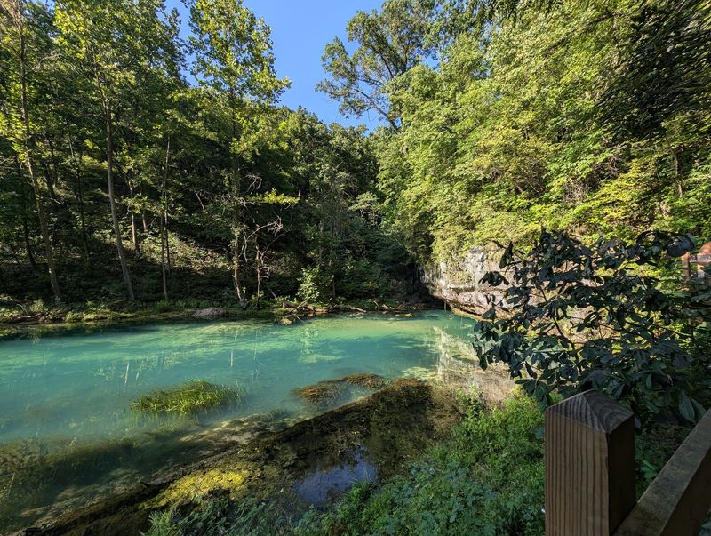
Ha Ha Tonka State Park holds one of the finest karst landscapes in Missouri, and the Spring Trail leads straight to its most spectacular feature. Ha Ha Tonka Spring pushes an average of roughly 48 million gallons of water per day out of the limestone bedrock before feeding into the Lake of the Ozarks.
The name Ha Ha Tonka is said to derive from Native American words meaning “laughing waters” or “big waters,” which feels entirely appropriate once you see the volume of water surging from the ground. The surrounding landscape adds dramatic cliffs, a natural bridge, and the remnants of collapsed cave systems to the experience.
Visiting during the warmer months, when the surrounding woods are fully green, creates a vivid contrast with the spring’s blue-green water below the bluffs. The trail is accessible enough for most visitors while still delivering scenery that feels genuinely impressive.
2. Mina Sauk Falls Trail, Ironton, Missouri
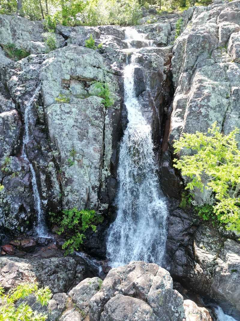
Missouri’s tallest waterfall does not sit on a famous river or inside a well-known park entrance. Mina Sauk Falls drops 132 feet over a series of ancient volcanic ledges inside Taum Sauk Mountain State Park, reached by a rugged 2.9-mile loop that also passes the state’s highest point at 1,772 feet.
The falls are seasonal, meaning a visit timed after heavy rain, typically from March through May, will reward hikers with the most dramatic flow. During drier stretches, Taum Sauk Creek carries little water, and the ledges may be mostly dry.
The trail involves rocky switchbacks, steep descents, and a demanding climb back out, so sturdy footwear is a genuine requirement rather than a suggestion. For hikers willing to put in the effort and choose their timing carefully, the combination of Missouri’s high point and its tallest waterfall in a single loop is hard to beat.
3. Greer Spring Trail, Alton, Missouri
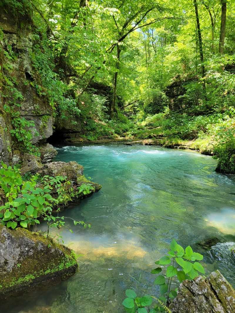
Greer Spring holds a title that most Missouri hikers have never heard: it is the largest spring on National Forest land in the entire United States. The spring discharges roughly 210 to 222 million gallons of water daily, emerging from two separate outlets at the base of a steep, shaded ravine inside Mark Twain National Forest.
The upper outlet exits from a small cave, while the lower produces a dramatic spring boil in the middle of the stream channel. The combined output more than doubles the flow of the Eleven Point National Scenic River, which the spring branch joins just 1.25 miles downstream.
The round trip is approximately 0.9 to 1.4 miles, but the trail drops about 250 feet in elevation to reach the spring, meaning the return trip involves a noticeable climb. Swimming and wading are prohibited in the spring branch, preserving the pristine aquatic habitat for native fish and coldwater crayfish.
4. Blue Spring Trail, Ellington, Missouri
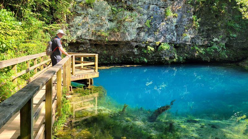
Missouri’s deepest known spring reaches roughly 300 to 310 feet below the surface, and that extraordinary depth is precisely what gives it its remarkable color. Blue Spring, located in the Current River country near Ellington, produces water so intensely vivid on a sunny day that it has become one of the most photographed natural features in the state.
Native Americans once called it the “Spring of the Summer Sky,” a name that requires no explanation once you see it. Early surveyors, baffled by its depth, reportedly lowered an anvil and concluded the spring was bottomless when it appeared to float due to water pressure.
The trail winds through bottomland forest near the Current River before following the spring branch to the pool, covering roughly 0.7 miles each way. Blue Spring averages 90 million gallons of water daily and is protected as a Missouri Natural Area, with swimming and wading strictly prohibited.
5. Alley Spring Trail, Eminence, Missouri
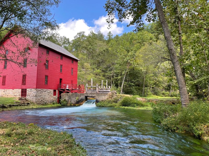
The combination of an intensely turquoise spring and a bright red 1894 grist mill is so visually striking that first-time visitors sometimes stop mid-trail just to confirm the scene is real. Alley Spring and Mill is one of Missouri’s most instantly recognizable natural landmarks, and the easy loop trail that circles it delivers the full effect from multiple angles.
The path follows the base of a towering dolomite bluff, passing mossy rock formations and several small cave openings along the way. These details reward hikers who slow down enough to look beyond the famous mill and spring.
The mill served local farmers as a grain-grinding hub and community gathering point for decades before the area became part of the Ozark National Scenic Riverways in 1969. Its preservation alongside the spring creates a rare pairing of natural and historical scenery that makes this short walk feel like considerably more than its modest distance suggests.
6. Big Spring Branch Trail, Van Buren, Missouri
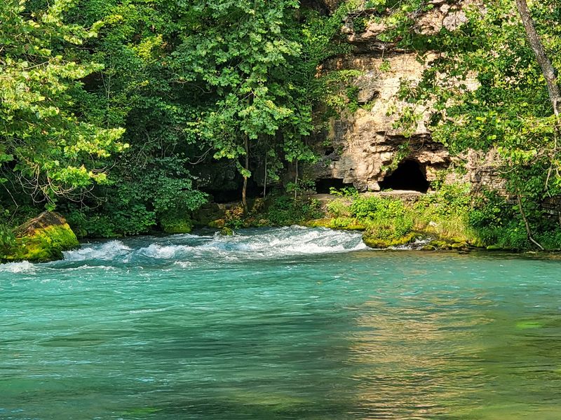
Big Spring is not shy about what it does. One of the largest freshwater springs in the world, it discharges an average of 276 to 289 million gallons of water daily, effectively creating a river out of bare rock at the base of a dolomite cliff near Van Buren.
The Big Spring Branch Trail covers roughly one mile round trip, looping around the spring before following the crystal-clear branch toward the historic dining lodge. Mosses, ferns, and wildflowers line the path, and the water maintains a consistent temperature of around 55 to 58 degrees Fahrenheit throughout the year.
Dye tracing studies have shown that water feeding Big Spring travels from as far as 40 miles away, sometimes taking more than 130 days to reach the outlet. The spring also dissolves an estimated 70 to 175 tons of limestone daily, quietly enlarging the underground cave system that feeds it.
Big Spring became one of Missouri’s first state parks in 1924.
7. Round Spring Trail, Eminence, Missouri
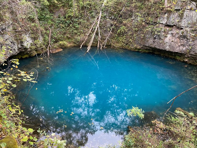
Not every great trail destination requires a long hike to reach it. Round Spring proves the point thoroughly, offering a nearly circular pool of vivid blue-green water beneath a moss-covered limestone bluff at the end of a 0.1-mile path that almost anyone can manage.
The spring descends to approximately 55 feet and flows beneath a natural bridge before joining the Current River, making the immediate geology around it a compact showcase of karst features. The consistent water temperature supports a delicate aquatic ecosystem year-round, and the visual contrast between the blue water and the green moss on the surrounding bluff is particularly sharp.
Round Spring became part of the Ozark National Scenic Riverways in 1969, alongside Big Spring and Alley Spring, ensuring its long-term preservation. For travelers exploring the Current River corridor who want classic Ozark spring scenery without a strenuous commitment, this short trail delivers an outsized visual reward for minimal effort.
8. Devil’s Icebox Trail, Columbia, Missouri
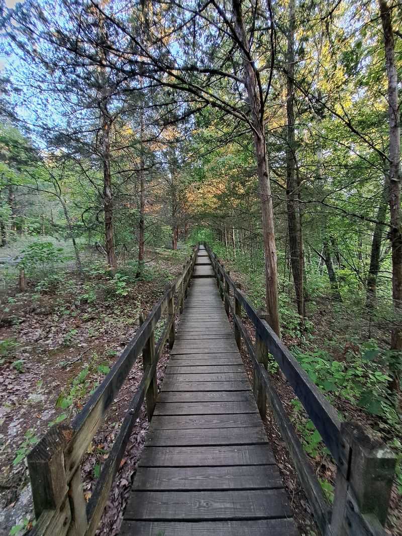
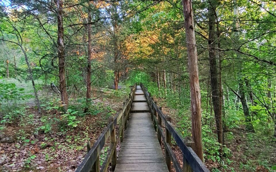
Rock Bridge Memorial State Park quietly packs more geological drama into half a mile than most parks manage across their entire trail systems. The Devil’s Icebox Trail runs along a wooden boardwalk that passes a natural 125-foot rock bridge, a cold spring, a series of sinkholes, and an underground stream viewpoint in rapid succession.
The main Devil’s Icebox Cave is closed to protect its bat population, including the endangered Indiana bat. Connor’s Cave nearby is open for self-guided exploration, stretching about 166 feet and typically holding a shallow stream along its floor.
Bring a flashlight and wear shoes you do not mind getting wet if you plan to enter Connor’s Cave. Informative displays along the boardwalk explain the area’s karst geology and the specialized creatures that live underground, making this one of Missouri’s most educational short hikes.
9. Cave Spring Trail, Salem, Missouri
Starting near Devil’s Well, the Cave Spring Trail commits fully to the backcountry experience with a 4.6-mile loop that crosses oak-pine ridges, limestone glades, deep hollows, and intermittent streams before arriving at its namesake destination. This is a hike designed for people who enjoy the journey as much as the destination.
One segment traces a high limestone bluff overlooking the Current River, while another winds through Parker Hollow, giving the route a varied rhythm that prevents it from feeling repetitive. The changing terrain makes the full loop feel like a genuine exploration of multiple Ozark ecosystems rather than a simple out-and-back.
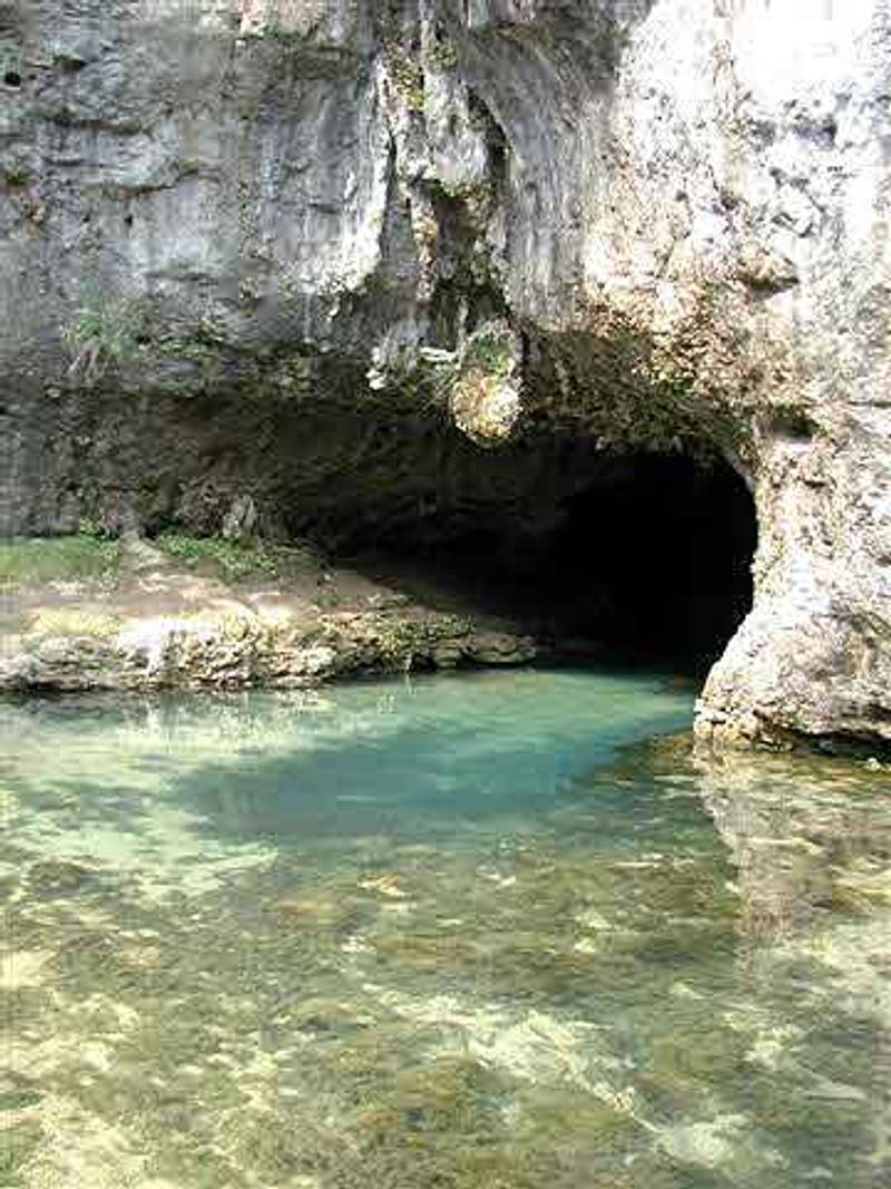
Cave Spring itself sits beside the Current River, where a significant cave mouth and a flowing spring combine to provide the headline attraction. The cool air from the cave entrance provides a refreshing contrast during summer visits.
Hikers who appreciate longer, more challenging routes with a strong geological payoff at the end will find this trail particularly satisfying.
10. Waterfall Trail, Hickory Canyons, Missouri
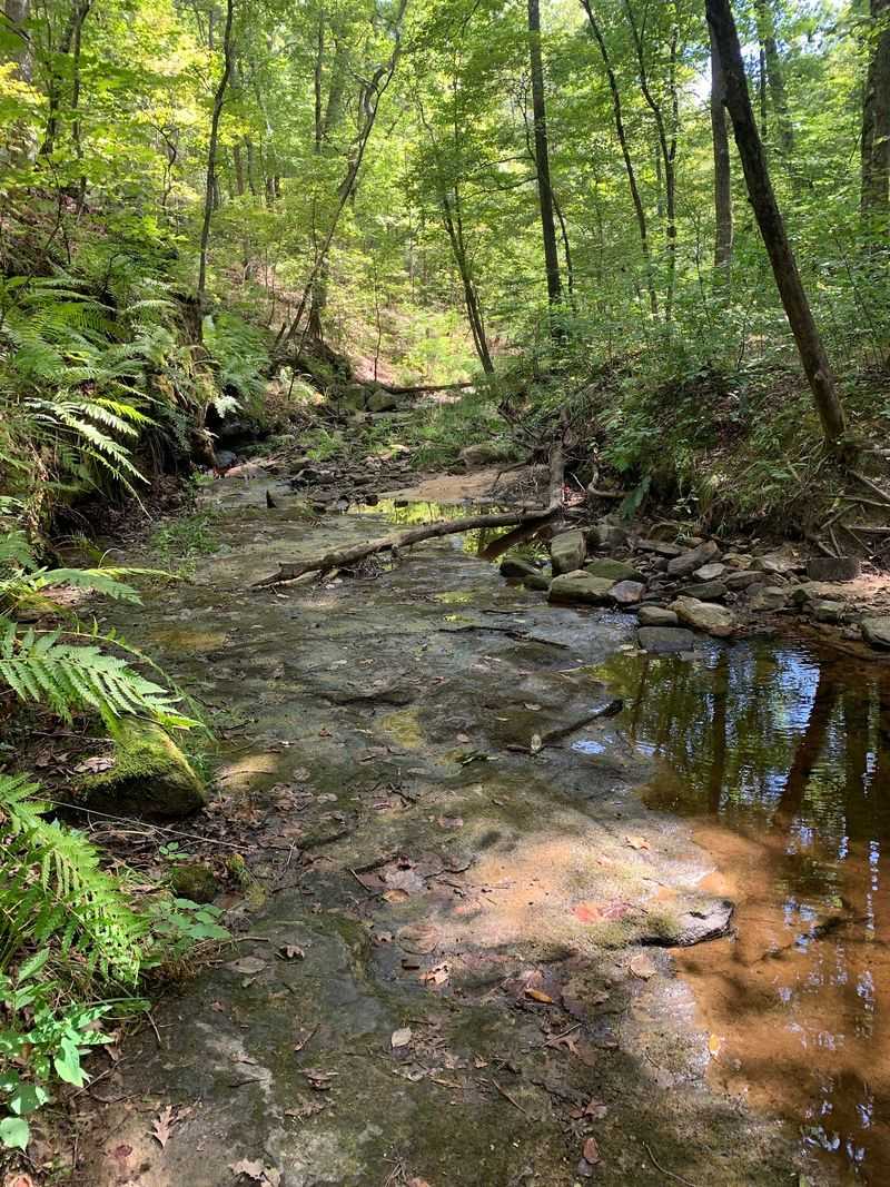
Hickory Canyons Natural Area plays by different geological rules than most of Missouri’s Ozark hikes, and that distinction is the whole point of visiting. Ancient sandstone, rather than the more common limestone, shapes the steep canyon walls and rocky outcrops that define this natural area south of Sprott Road.
A short trail leads through mature forest to a wet-weather waterfall tucked within the sandstone canyons, and timing the visit correctly makes all the difference. After substantial rainfall, water spills over the layered rock faces, framed by ferns and the cool, moisture-loving plant communities that Hickory Canyons is known for supporting.
The sandstone also creates distinctive rock shelters and overhangs along the canyon walls, adding interesting structural detail to the scenery even when the waterfall is dry. For hikers who enjoy finding Missouri’s less-publicized corners, this natural area offers a satisfying combination of unusual geology and genuinely quiet, uncrowded trails.
11. Natural Bridge Trail, Thayer, Missouri
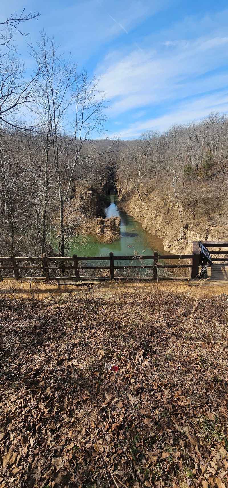
Grand Gulf State Park earns its nickname, Missouri’s Little Grand Canyon, the moment the trail reaches the edge of the gulf and the full scale of the place becomes clear. The roughly three-quarter-mile Natural Bridge Trail crosses a colossal natural bridge, spanning 200 to 250 feet, that represents the last surviving section of an ancient cave system’s roof.
Below the bridge, the Grand Gulf stretches nearly a mile long with vertical walls reaching about 130 feet high, and the canyon is notably deeper than it is wide. Bussell Branch, a surface creek draining roughly 20 to 28 square miles, disappears underground here and resurfaces nine miles away at Mammoth Spring in Arkansas, a journey that can take one to four days.
The trail is especially impressive during the leaf-off seasons, when clearer sightlines into the gulf reveal the full drama of the collapsed cave walls below. Grand Gulf was declared a National Natural Landmark in 1971 and became a state park in 1984.
12. Deer Hollow Trail, Sullivan, Missouri
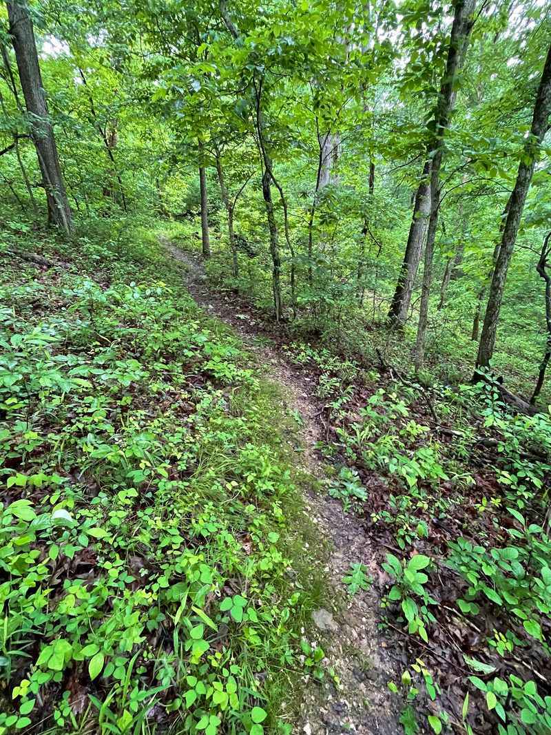
Meramec State Park contains more than 40 known caves, the highest count of any state park in Missouri, and the Deer Hollow Trail connects two of the park’s most popular areas while heading toward one of its best-known caverns. The moderate 1.2-mile linear route runs through mature forest between the dining lodge and Fisher Cave, following one of the park’s earliest established paths.
Fisher Cave tours are led by park naturalists and take visitors past bear claw marks, unique cave wildlife, and calcite formations that include columns stretching over 30 feet tall. Tours run primarily from May through August, with limited availability in early May and September, so checking the current schedule before visiting is worthwhile.
The trail itself changes character with the seasons, brightened by dogwood blossoms in spring and wrapped in strong fall color by October. The Civilian Conservation Corps helped develop much of Meramec State Park in the 1930s, and several of their original structures remain in use today.
13. Cave Spring Park Trails, Kansas City, Missouri
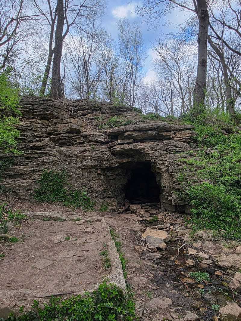
Kansas City does not immediately come to mind when people think of caves and springs, but Cave Spring Park makes a convincing case for itself within the city limits. The 36-acre wooded property at 8701 E.
Gregory Boulevard contains a network of 4.5 to 6 miles of trails, a small explorable cave, a seasonal waterfall, and the spring that gives the park its name.
Stone chimneys standing along the trails are the only remnants of a spring house that burned in 1925 on a dairy farm that once occupied the land, adding an unexpected layer of local history to the walk. The park is also a designated National Historic Landmark, marking a documented stop along the historic Santa Fe, Oregon, and California Trails.
Native American groups including the Osage, Sac, Kansa, and Fox used the spring as a gathering place long before covered wagons arrived in the 1840s. An interpretive center, a wildlife pond, and a butterfly garden round out the visitor experience for those who cannot make it to the Ozarks.
Share this story