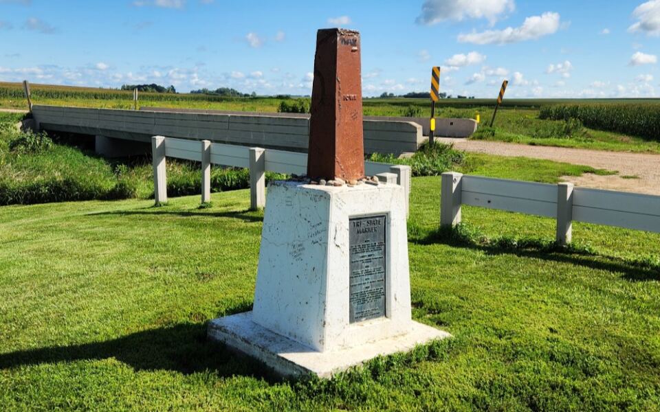
There is a quiet stretch of gravel road in the upper Midwest where you can stand in Iowa, Minnesota, and South Dakota all at the same time. Most people drive past it without ever knowing it exists.
A small stone marker sits just off the pavement, surrounded by open farmland and wide prairie sky, marking one of the most unusual geographic points in this part of the country. If you have ever wanted to be in three places at once, this is the spot that makes it possible.
What the Tripoint Actually Is
Most state borders are invisible lines you cross without thinking twice. This one is different.
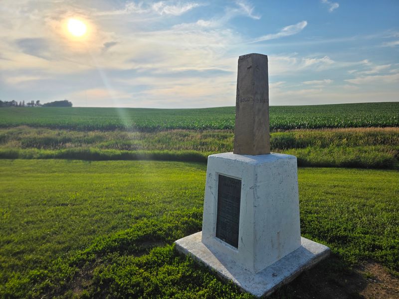
The Tripoint IA, MN, SD is the exact geographic point where the borders of Iowa, Minnesota, and South Dakota all converge at a single location, marked by a physical monument you can walk right up to and touch.
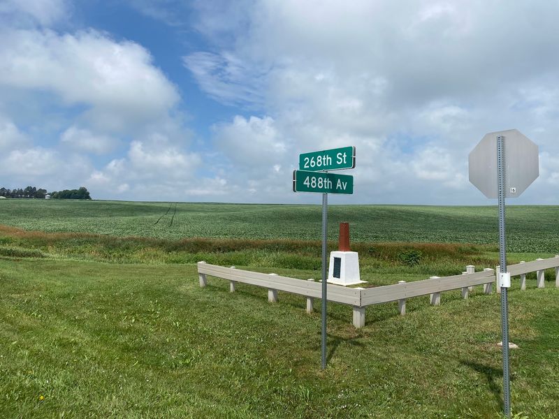
The marker sits at 26799 488th Ave, Valley Springs, SD 57068, United States, just off a rural gravel road near Valley Springs. There are no toll booths, no welcome centers, and no grand entrance.
Just open land, a quiet road, and a monument that represents something genuinely rare.
Three state lines meeting at one point is a geographic phenomenon that only happens in a handful of places across the entire country. That alone makes this worth knowing about, especially when it sits just a short drive from a major regional city.
How Close It Is to Sioux Falls
One of the most surprising things about this spot is how easy it is to reach. From Sioux Falls, South Dakota, the drive takes roughly 25 to 30 minutes, making it a completely doable side trip on a weekend afternoon or even a quick detour during a longer road trip through the region.
The roads leading to the tripoint are paved for most of the route, which matters more than you might expect. A lot of geographic markers like this require bumpy dirt roads and some off-road confidence.
This one does not. Even a low-clearance rental car can make the trip without any trouble.
The surrounding landscape during the drive is all open farmland, rolling prairie, and big Midwestern sky. There is something calming about that kind of scenery, especially when you know something genuinely interesting is waiting at the end of the road.
Standing in Three States at Once
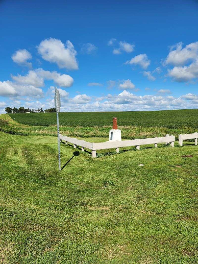
The moment you step up to the marker and position yourself just right, you are technically standing in Iowa, Minnesota, and South Dakota simultaneously. That is not a metaphor or a tourist gimmick.
It is a real, surveyable geographic fact, and it feels oddly thrilling when you actually do it.
Most people spend a few minutes walking around the monument, shifting from one state to another, laughing about the fact that they can technically claim to have visited three states in about four seconds. Kids especially get a kick out of hopping back and forth across the border lines.
There is something playful about the whole experience that you do not expect from a roadside historical landmark. It strips away the seriousness of state borders and turns geography into something fun, tangible, and worth talking about long after the visit.
The Monument Itself Up Close
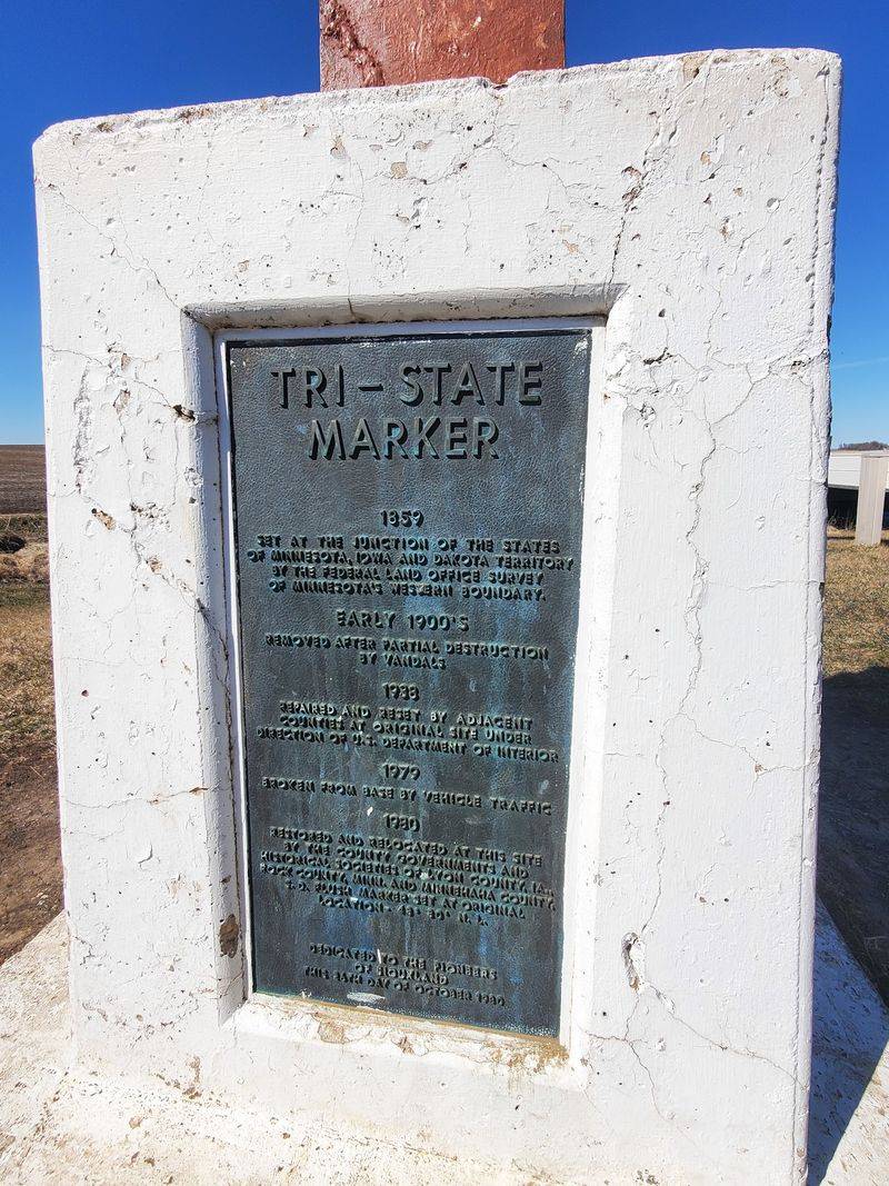
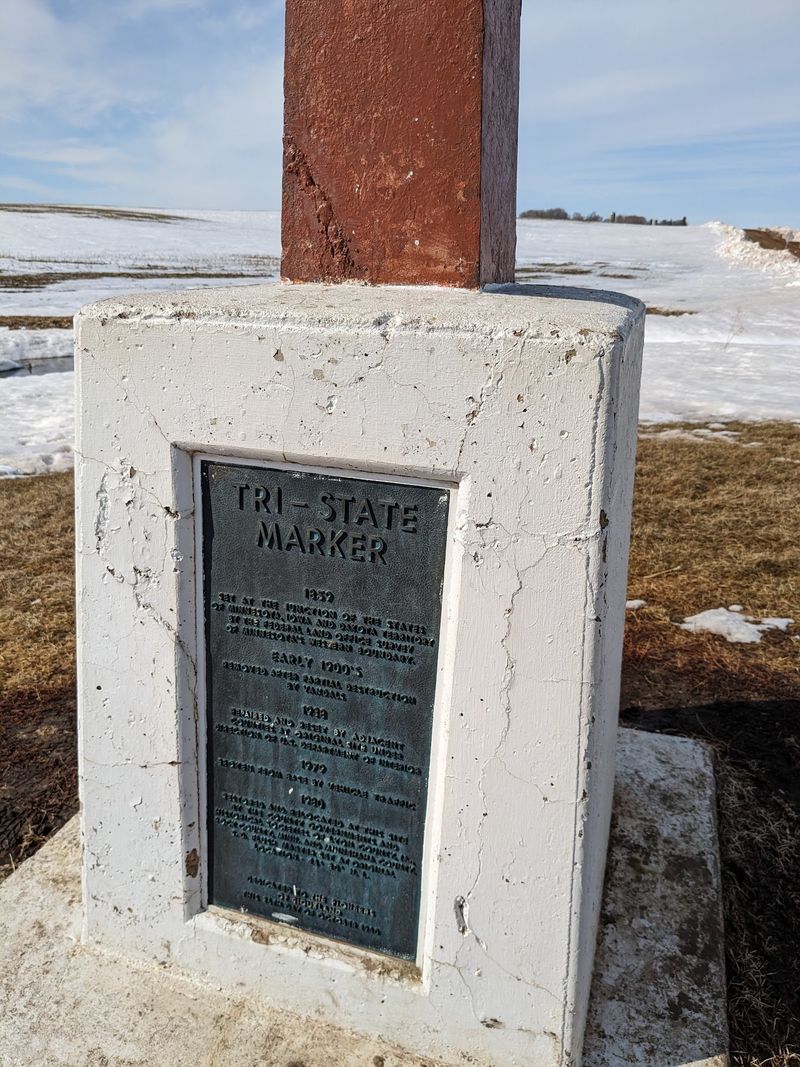
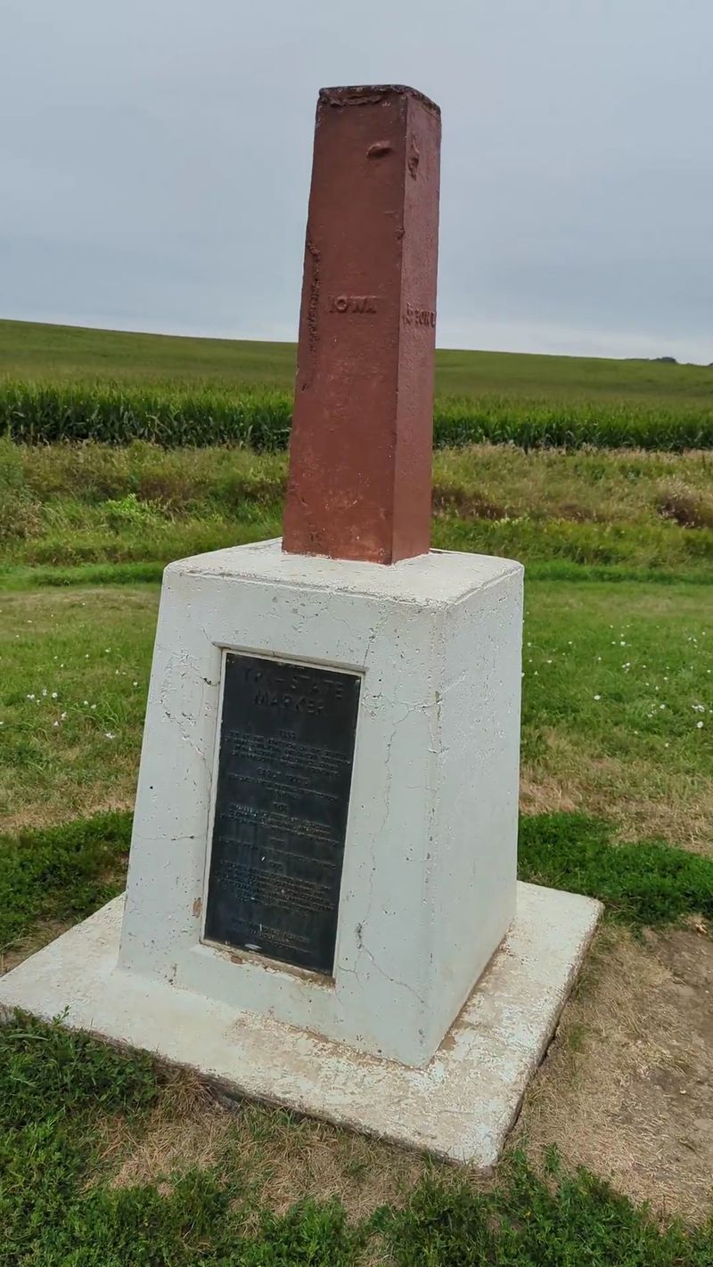
The physical marker at the tripoint is modest by most standards. A stone monument marks the general area, and a geodetic survey disk embedded in the ground pinpoints the actual intersection of the three state lines.
Survey disks like this are placed by the National Geodetic Survey and are used to establish precise geographic coordinates.
Sadly, the disk at this location has not been immune to damage over the years. The stamped geodetic information on the disk surface has been worn away and defaced, which is genuinely frustrating given how much history it represents.
Someone made an effort to recreate the information using a marker, which says a lot about how much people care about preserving this spot.
The monument also includes text about its own history of vandalism and replacement, which adds an unexpectedly honest layer to the visit. It does not hide the fact that this marker has had a rough life.
The History of Vandalism and Replacement
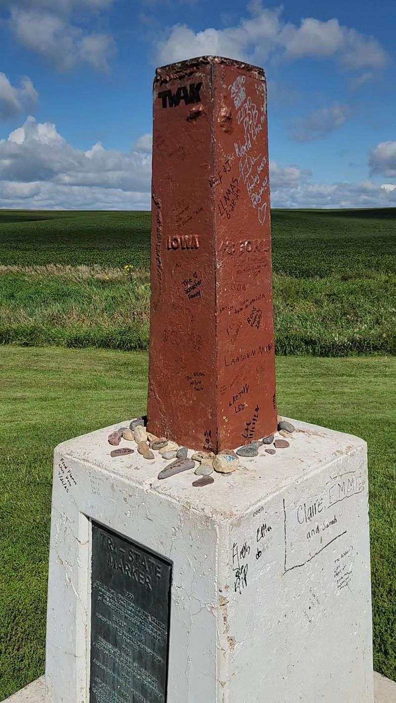
The tripoint marker has had a harder history than most people expect. The original marker used to sit in the middle of the road, which, as you might guess, did not end well.
Vehicles struck it repeatedly, and the marker had to be relocated off the roadway for its own protection.
Even after being moved, the monument has faced ongoing issues with vandalism and damage over the years. The geodetic disk embedded at the precise intersection point was defaced by lawnmower blades, erasing the stamped survey information that made it historically significant.
The text on the monument itself acknowledges this history directly.
That transparency is actually refreshing. Rather than pretending the marker is pristine, it tells visitors the truth about what happened.
It is a small detail, but it makes the stop feel more honest and more human than a polished tourist attraction ever could.
Parking and Access at the Site
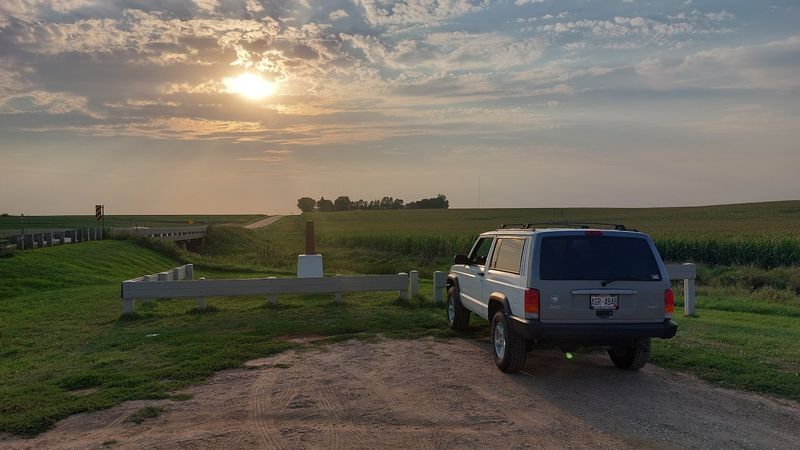
Getting to the tripoint is straightforward, but parking is limited. There is a small gravel area right next to the marker that fits about one or two cars comfortably.
That is genuinely all the space available, so if another vehicle is already there when you arrive, you may need to wait a few minutes or park carefully along the road shoulder.
The good news is that traffic in the area is extremely light. This is not a busy highway intersection.
The road running past the marker carries very little traffic, which makes the whole experience feel calm and unhurried rather than stressful.
The marker is right next to the road, so you do not need to hike or navigate any trails to reach it. The access is about as easy as it gets for a roadside geographic landmark.
Just pull over, step out, and you are already there.
What the Surrounding Landscape Looks Like
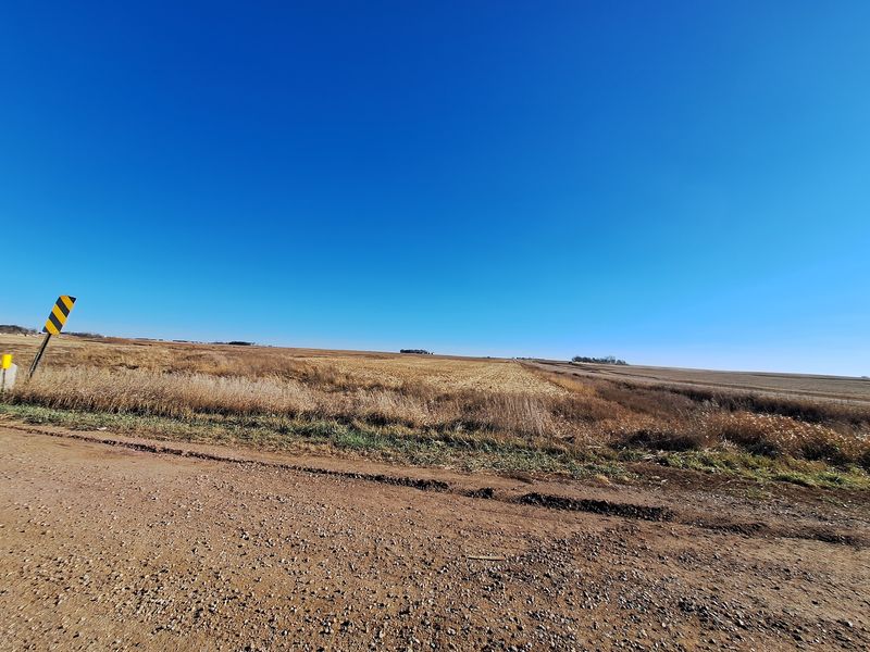
The landscape around the tripoint is quintessential upper Midwest. Flat fields stretch in every direction, broken up by the occasional tree line or farmstead.
In late summer and fall, the corn and soybean fields surrounding the marker are at full height, giving the area a lush, agricultural feel that is genuinely beautiful in its own quiet way.
Visitors who make the trip during harvest season have noted that the combination of fall colors and working farm equipment in the fields adds an unexpected layer of atmosphere to the stop. It turns a simple geographic curiosity into something that feels connected to the living landscape around it.
The sky above this part of the country is enormous. On a clear day, you can see for miles in every direction.
There are no mountains, no tall buildings, and nothing blocking the horizon, which gives the whole visit a feeling of wide-open space that is hard to find elsewhere.
Why Geocachers Love This Spot
The tripoint has become a popular stop within the geocaching community, and it is easy to understand why. Tripoints, state line markers, and geodetic survey points are exactly the kind of specific, location-based targets that geocachers seek out on their travels across the country.
Finding a geocache at a spot like this adds a second layer of purpose to the visit. You are not just stopping to look at a marker.
You are also participating in a worldwide scavenger hunt that connects you to thousands of other people who have stood in the same spot and signed the same log.
Even if you have never tried geocaching before, the tripoint is a great introduction to why people find it so addictive. The combination of geography, history, and the small thrill of discovery makes it more engaging than a typical roadside stop.
It rewards people who pay attention to the details.
The Photo Opportunity Here Is Genuinely Fun
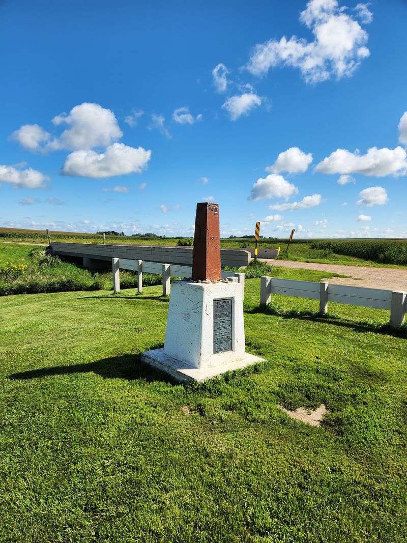
One of the most reliable highlights of a tripoint visit is the photo opportunity. Spreading yourself across three state lines at once makes for a genuinely entertaining picture, and the flat, open setting gives you plenty of natural light and a clean background without any visual clutter getting in the way.
Families with kids tend to have a great time here. Getting each child to stand in a different state while a parent photographs the moment from the road is a creative and memorable way to document the stop.
The marker itself adds context to the image, so anyone looking at the photo later immediately understands what they are seeing.
Solo travelers and couples get equally good shots. The marker frames well against the open sky, and the simplicity of the setting actually works in your favor.
No crowds, no distractions, just you, the monument, and three states stretching out in every direction.
Visiting with Kids
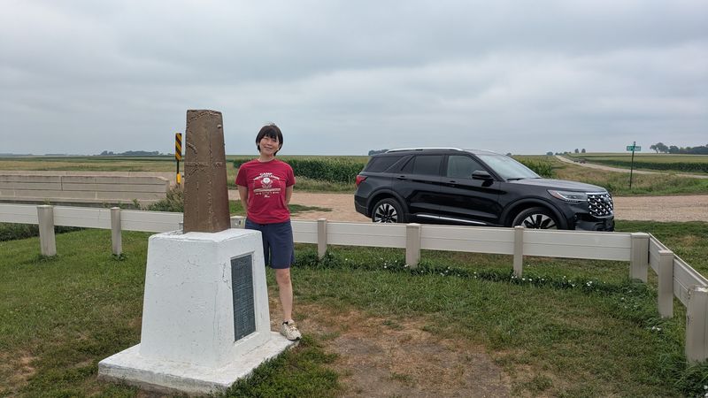
Bringing children to the tripoint turns a geography lesson into something they will actually remember. Hopping from state to state in a matter of seconds is the kind of hands-on experience that sticks with kids far longer than anything they read in a textbook about state borders and survey lines.
Parents who have made the trip report that the drive itself becomes part of the fun. The open road, the farm fields, and the anticipation of arriving at a spot where three states meet builds a sense of adventure that even younger children respond to enthusiastically.
The site is wide open, which means kids have room to move around without the stress of crowds or confined spaces. Traffic is minimal, though adults should keep an eye on younger children near the road.
The visit is free, quick, and easy, which checks all the right boxes for a family road trip detour.
What Makes It Different from Four Corners
Four Corners, where Utah, Colorado, Arizona, and New Mexico meet, is probably the most famous multistate meeting point in the country. It has paved parking lots, vendor stalls, an entrance fee, and regular crowds.
The tripoint in the upper Midwest is essentially the opposite of all that.
There are no vendors here, no fee to visit, no restrooms, and no signage from the road. The marker sits quietly next to a gravel pullout, waiting for the handful of people who knew to look for it.
That low-key atmosphere is either a disappointment or a feature, depending entirely on what you are looking for.
For travelers who prefer their geographic curiosities without the commercial layer, this spot delivers something Four Corners cannot: genuine solitude. You are unlikely to share the marker with more than one other group at a time, and on many visits, you may have it entirely to yourself.
The Best Time of Year to Visit
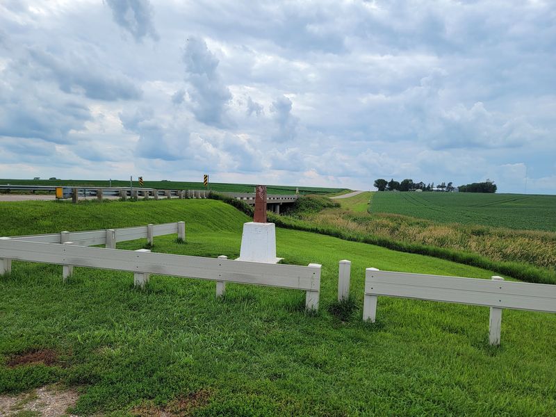
The tripoint is open around the clock, every day of the year, which means there is technically no wrong time to visit. That said, some seasons offer a noticeably better experience than others, and a little planning goes a long way when the destination involves standing on a gravel road in the middle of farm country.
Fall is widely considered the most scenic time to make the trip. Harvest season brings golden fields, cooler temperatures, and the kind of wide-sky clarity that makes the surrounding landscape look like a painting.
The colors and the agricultural activity give the stop a sense of place and season that summer visits sometimes lack.
Winter visits are possible but not particularly comfortable, and one visitor made the trip during a blizzard, which is a story worth telling but not worth repeating. Spring and early summer are pleasant and quiet, with green fields just beginning to fill in around the marker.
Tips for Finding It Without Getting Lost
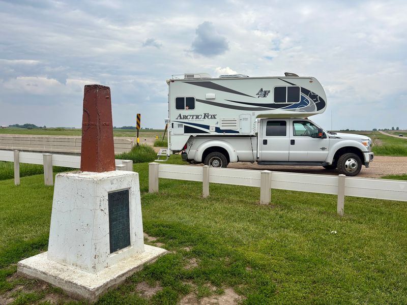
The tripoint does not have any road signs pointing toward it, which means GPS navigation is essentially required for a first visit. Plugging the address into your preferred map app will get you there reliably, but pay close attention as you approach because the marker is easy to drive past if you are moving too fast.
The gravel pullout next to the monument is small and sits right along the road, so slow down well before you expect to arrive. Rural roads in this area look similar for long stretches, and the marker does not stand out dramatically from a moving vehicle.
Once you park, the monument is immediately visible just steps from your car. There is no trail to follow and no terrain to navigate.
The whole stop from parking to walking back to your car typically takes between 10 and 20 minutes, making it a genuinely low-effort addition to any regional itinerary.
What Visitors Often Overlook About the Marker
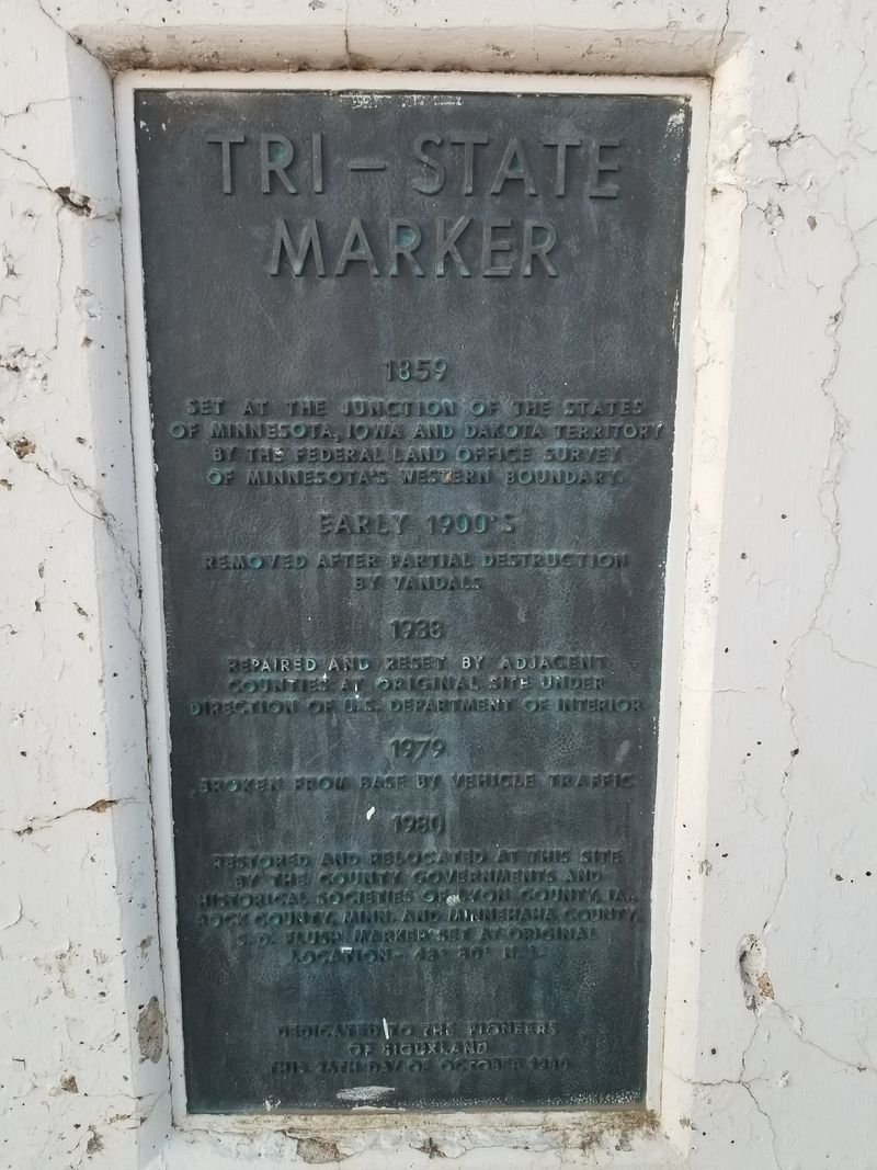
Most people arrive at the tripoint, take their photos, and head back to the car within a few minutes. That is a perfectly reasonable approach, but it means missing some of the more interesting details that reward a slower look at the monument itself.
The text carved into or displayed on the marker tells a story about the site’s history of damage, replacement, and relocation. Reading it carefully gives you a much better sense of how long people have been trying to preserve this particular geographic point and how much effort has gone into keeping it accessible to the public.
The geodetic disk at the base, even in its damaged state, is worth examining up close. Survey disks like this are precision instruments of geographic measurement, and seeing one in person connects you to a long history of American land surveying that most people never think about.
That context transforms the stop from a novelty into something genuinely educational.
Why This Stop Is Worth Adding to Your Route
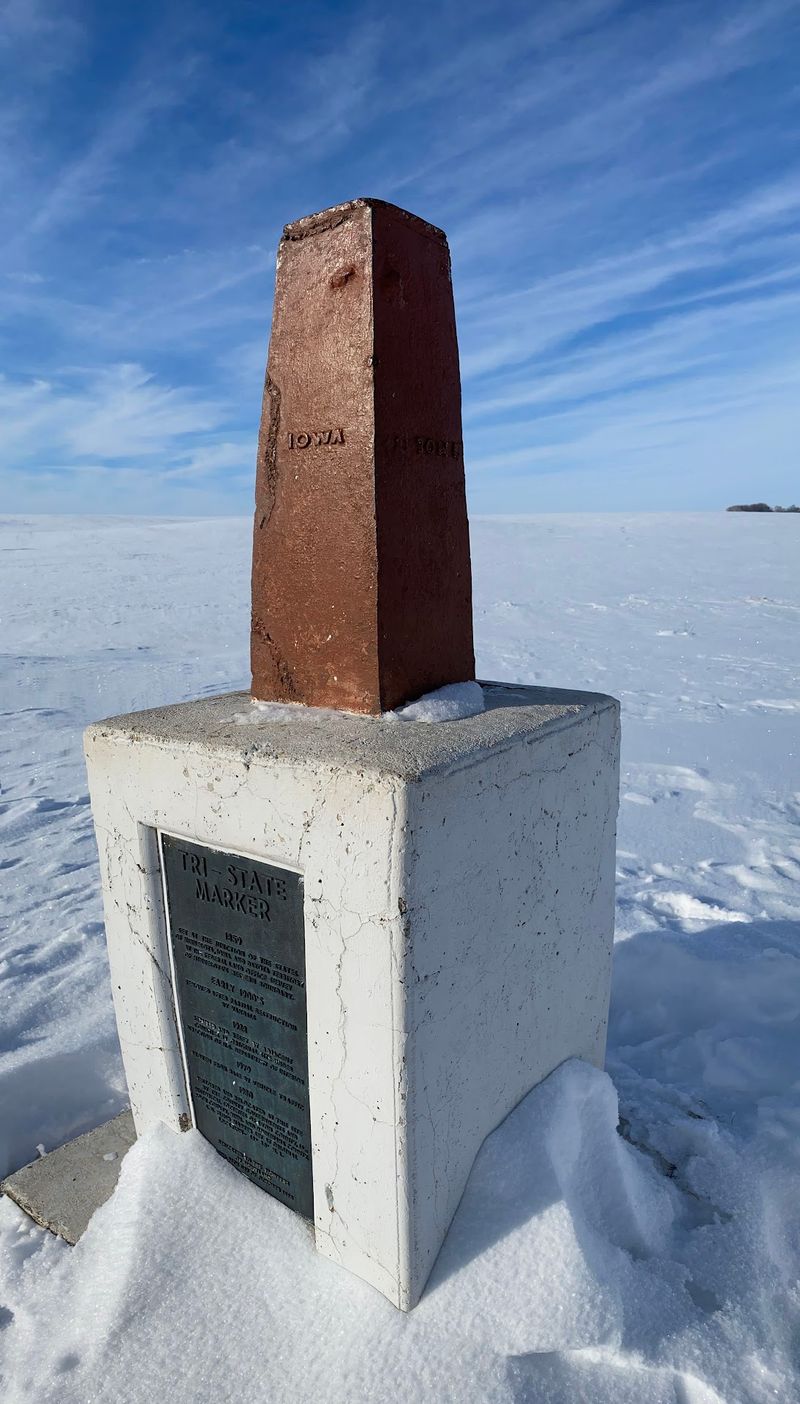
The tripoint is not going to be the most dramatic stop on any road trip itinerary. There is no restaurant on site, no gift shop, and no interpretive center explaining the history of the border survey.
What it offers instead is something harder to manufacture: a genuine geographic curiosity that most people have never heard of.
For anyone already traveling through the Sioux Falls area, adding this stop requires minimal extra time and zero extra cost. It is free to visit, easy to access, and quick enough that it fits naturally into almost any schedule without disrupting other plans.
The lasting appeal of a place like this is simple. You leave having stood in three states at once, with a photo to prove it and a story that most people back home will find genuinely surprising.
That combination of ease, novelty, and quiet satisfaction is exactly what makes a road trip detour worth taking.
Share this story