Lines on a map can look permanent, but history shows they can shift fast. Wars, treaties, and political choices have moved borders and created new countries.
Each change affected millions of people, shaping languages, cities, and daily life. Here are twelve border changes that left a lasting mark on the world map.
1. Germany and Poland After World War II
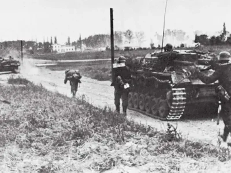
Few border shifts moved as far as Poland’s after 1945. At the Potsdam Conference, Allied leaders agreed that Poland would take land in the west, up to the Oder and Neisse rivers.
In return, Poland lost territory in the east to the Soviet Union.
The result was a country that effectively slid westward on the map. Cities such as Breslau became Wroclaw, and Danzig became Gdansk.
Millions of Germans left or were forced out of these areas, while Poles from the lost eastern lands moved in.
The Oder-Neisse line stayed a sensitive issue for decades. West Germany only accepted it step by step, and a united Germany confirmed it in a treaty in 1990.
Today the river border is calm, and the two countries are close partners in the European Union.
2. India and Pakistan After Partition
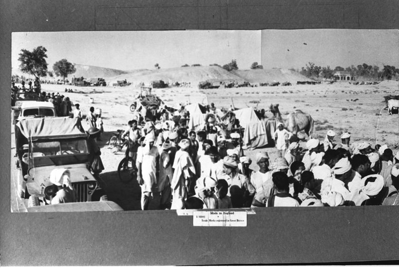
In August 1947, British rule in India ended, and the land split into two new countries. India would have a Hindu majority, and Pakistan would be made up of Muslim-majority areas in the northwest and east.
A British lawyer named Cyril Radcliffe drew the lines in just a few weeks.
The border cut through Punjab and Bengal, two regions where communities had lived side by side for centuries. Roughly 15 million people crossed the new lines, and violence took the lives of hundreds of thousands.
The story did not end there. In 1971, East Pakistan broke away and became Bangladesh.
Kashmir remains disputed, and the border near Wagah draws crowds each evening for a flag ceremony that mixes pride with tension.
3. The Soviet Union’s Breakup
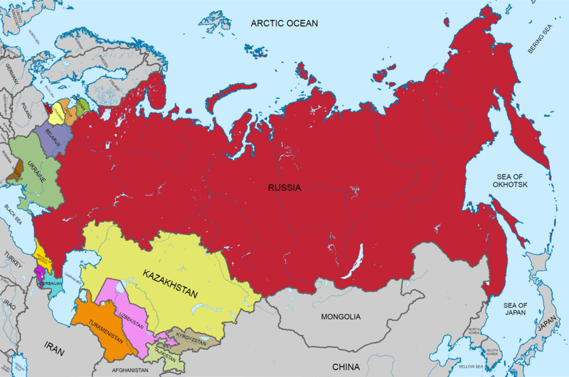
On December 26, 1991, the Soviet Union formally ceased to exist. One huge country that stretched across eleven time zones became fifteen independent nations.
Russia, Ukraine, Kazakhstan, and Estonia were among them.
Old internal republic lines suddenly became international borders. That created complicated situations, since many people found themselves living in a different country without ever moving.
Russian speakers, for example, became minorities in several new states.
The change reshaped global politics, ending the Cold War rivalry with the United States. It also left unsettled questions, including conflicts in Georgia, Moldova, Armenia, Azerbaijan, and Ukraine.
More than thirty years later, the effects of those new borders are still part of the daily news.
4. Yugoslavia’s Breakup
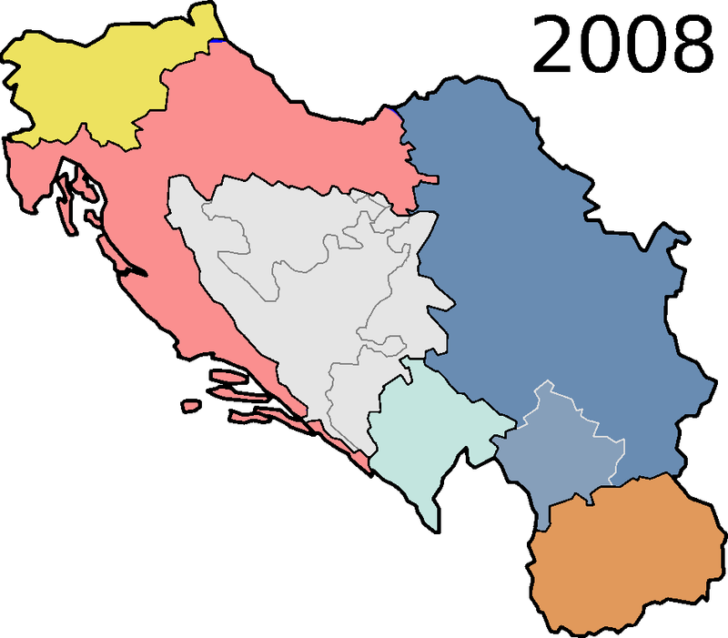
Picture a country with six republics, five major nations, four languages, and three religions. That was Yugoslavia, held together for decades under leader Josip Broz Tito.
After his death in 1980 and the end of communism in Europe, tensions grew.
Slovenia and Croatia declared independence in 1991, followed by Macedonia and Bosnia and Herzegovina. Wars brought great suffering, especially in Bosnia, where the siege of Sarajevo lasted almost four years.
Serbia and Montenegro stayed together for a time, then separated in 2006.
Kosovo declared independence in 2008, though not every country recognizes it. Today seven states cover the land once called Yugoslavia, and several have joined or hope to join the European Union.
5. The Ottoman Empire’s Dissolution
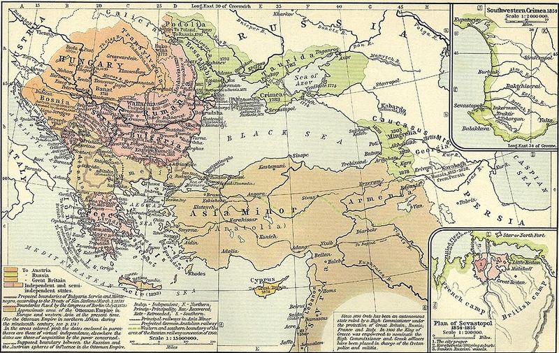
For about 600 years, the Ottoman Empire controlled lands across southeastern Europe, western Asia, and North Africa. Its defeat in World War I changed everything.
The Treaty of Sevres in 1920 planned to divide it, and the Treaty of Lausanne in 1923 set the borders of modern Turkey.
Much of the Arab world came under British and French control through mandates. Out of these arrangements came Iraq, Syria, Lebanon, Jordan, and Palestine.
The Sykes-Picot agreement of 1916 had secretly sketched some of these lines.
Many of these borders were drawn with little attention to local communities. Historians often point to this period when explaining later disputes in the Middle East.
The old empire is gone, but its fall still shapes the region.
6. Austria-Hungary’s Dissolution
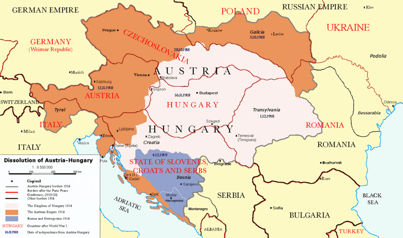
When Austria-Hungary entered World War I in 1914, it was one of Europe’s largest powers. By late 1918, it was falling apart.
Defeat, food shortages, and growing national movements pushed different peoples to seek their own states.
Treaties in 1919 and 1920, including Saint-Germain and Trianon, created the final map. Austria and Hungary became small separate countries.
Czechoslovakia and Yugoslavia were formed, while Poland, Romania, and Italy gained land.
Hungary lost about two thirds of its territory under the Treaty of Trianon, a loss still remembered there today. The Habsburg family, which had ruled for centuries, left power.
Central Europe was suddenly a patchwork of younger states that struggled to stay secure in the years that followed.
7. Czechoslovakia’s Velvet Divorce
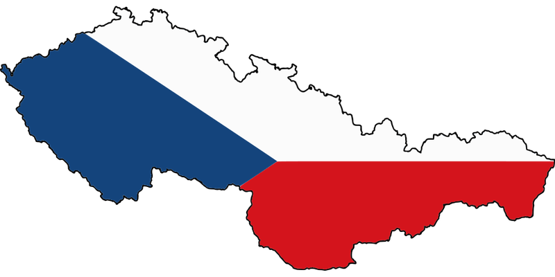
Some breakups are loud. This one was remarkably quiet.
On January 1, 1993, Czechoslovakia split into the Czech Republic and Slovakia without a single shot fired.
The two parts had been joined since 1918. After the Velvet Revolution of 1989 ended communist rule, leaders disagreed about how much power Slovakia should have.
Talks led to a mutual decision to separate, and the national parliament approved it. Polls at the time showed that most citizens did not actually demand a split.
The two countries shared assets, divided the army, and even ended up with different currencies within weeks. Both joined NATO and the European Union, and they still cooperate closely.
Many people see the Velvet Divorce as a model for a peaceful separation.
8. Korea’s Division
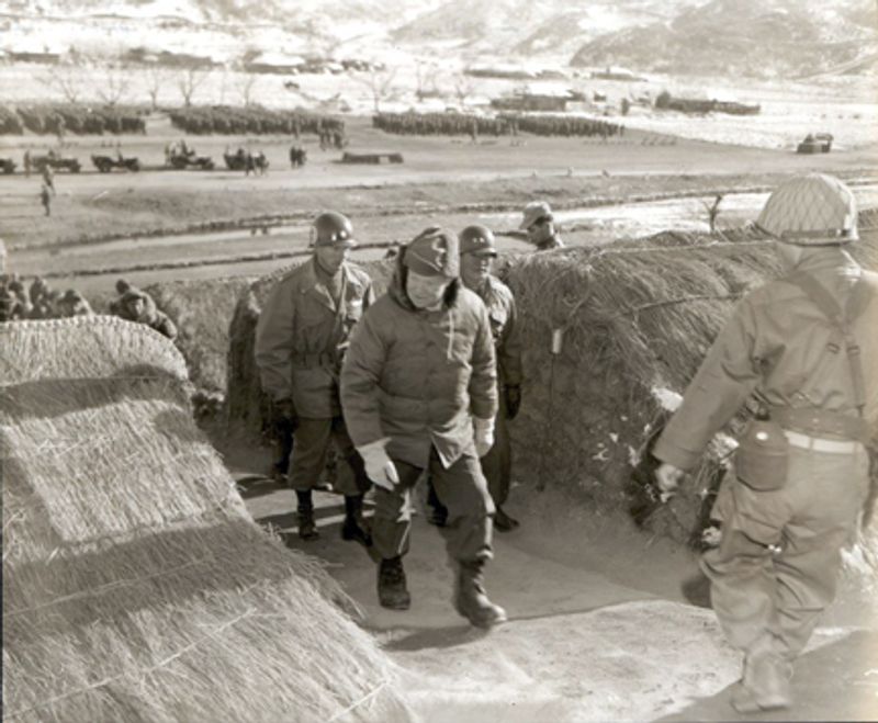
At the end of World War II in 1945, Japan’s rule over Korea ended. The United States and the Soviet Union agreed to temporarily split the peninsula at the 38th parallel.
A short-term plan soon became permanent.
In 1948, two governments formed: South Korea, backed by the United States, and North Korea, backed by the Soviet Union. Then in 1950 North Korea invaded the south, starting the Korean War.
Fighting stopped in 1953 with an armistice, not a peace treaty.
The border today is the Demilitarized Zone, a strip about 150 miles long and 2.5 miles wide. Ironically, because people stay out, it has become a haven for wildlife, including rare cranes.
The two Koreas remain among the most different neighbors in the world.
9. Germany’s Division and Reunification
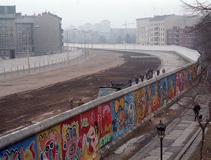
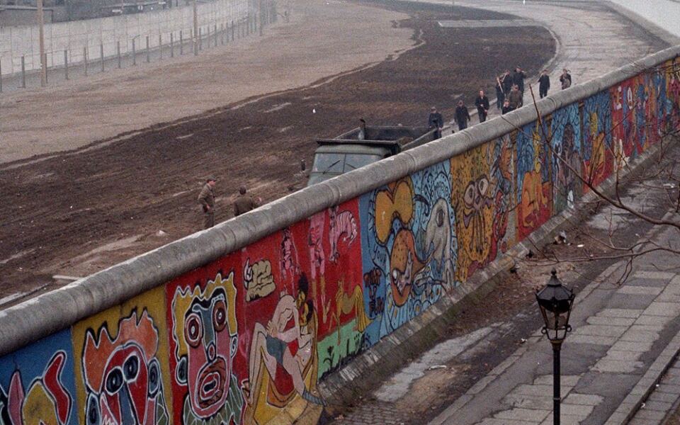
On the night of November 9, 1989, thousands of Berliners poured through checkpoints and climbed the wall that had split their city. It was a moment few thought they would see.
After World War II, Germany was divided into four occupation zones. By 1949 these became two countries: democratic West Germany and communist East Germany.
The Berlin Wall, built in 1961, stopped people from leaving the east.
When the wall fell, change moved quickly. Germany formally reunified on October 3, 1990, which is now a national holiday.
Rebuilding the east cost enormous sums, and differences in income and opinion have lasted for years. Still, the reunited country became the largest economy in Europe, and bits of the wall now stand as memorials.
10. Sudan and South Sudan
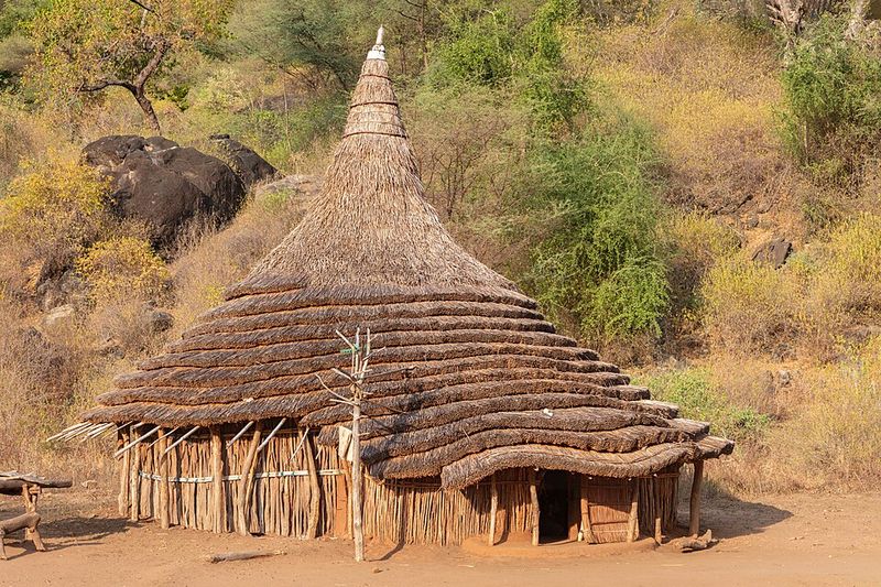
South Sudan is the world’s youngest widely recognized country, born on July 9, 2011. Before that, Sudan was the largest country in Africa by area.
Decades of conflict between the government in the north and rebels in the south caused great loss of life. A peace agreement in 2005 promised the south a vote on its future.
In January 2011, nearly 99 percent of voters chose independence.
Joy turned to hardship quickly. A civil war began in South Sudan in 2013, and millions were displaced.
Disputes over oil, which lies mostly in the south but must travel through northern pipelines, and over areas like Abyei still trouble the two neighbors. The new border remains partly unsettled.
11. The Partition of Ireland
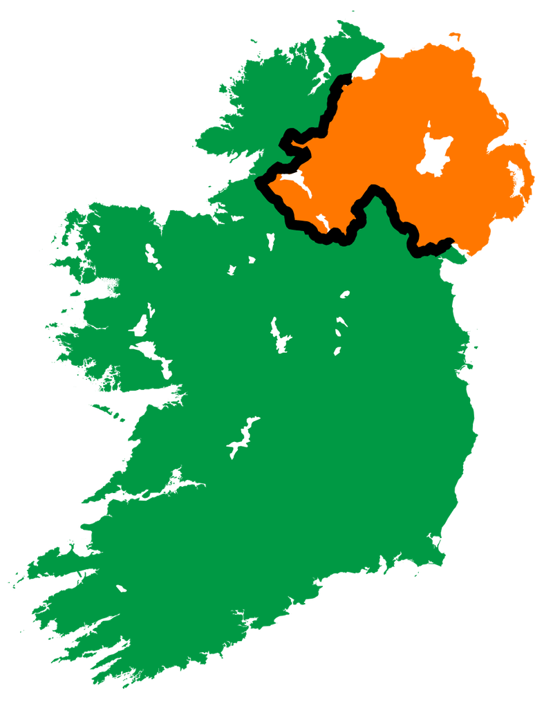
Drive across the Irish border today and you might only notice the road signs change from kilometers to miles. Yet this invisible line has a loud history.
The Government of Ireland Act of 1920 divided the island into Northern Ireland and Southern Ireland. Northern Ireland, with a Protestant and unionist majority, stayed in the United Kingdom.
The south became the Irish Free State in 1922 and later the Republic of Ireland.
Partition led to decades of tension, including the conflict known as the Troubles from the late 1960s to 1998. The Good Friday Agreement brought a lasting peace framework.
After Brexit, the question of how to keep the border open became a major topic for both governments and the European Union.
12. The Creation and Expansion of the United States
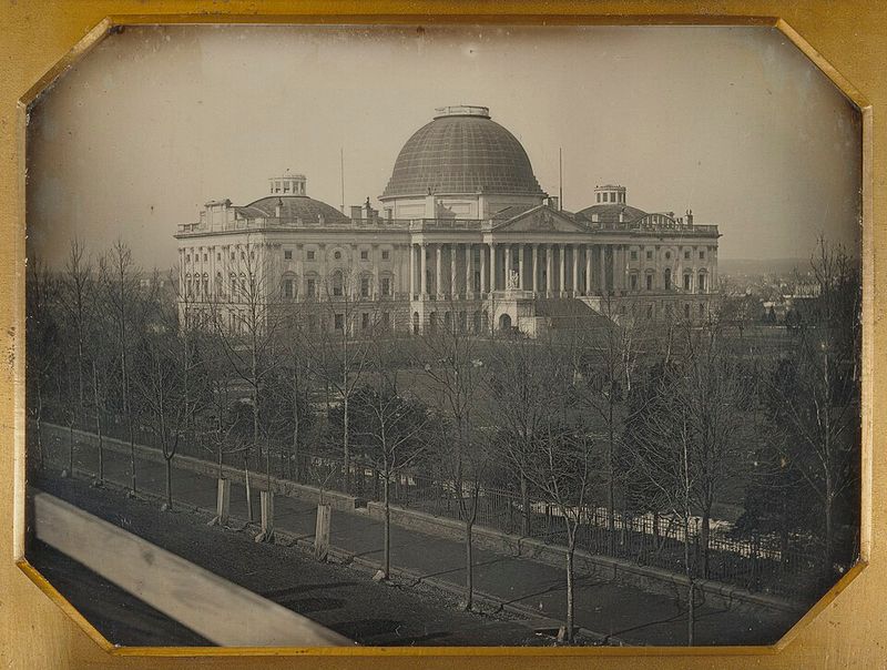
In 1783, the United States stretched from the Atlantic Coast to the Mississippi River. Within about 85 years, it reached the Pacific Ocean.
The biggest jump came with the Louisiana Purchase in 1803, when the country bought land from France for about 15 million dollars and roughly doubled its size. Florida was acquired from Spain in 1819, and Texas joined in 1845.
After the Mexican-American War, the 1848 treaty added California and much of the Southwest.
Alaska was purchased from Russia in 1867, and Hawaii was annexed in 1898. This growth came at a huge cost to Native American nations, whose lands were taken through treaties, pressure, and war.
The map of the country took shape through both deals and conflict.
Share this story