Stretching 272 miles across the heart of Nebraska, the Sandhills Journey Scenic Byway takes travelers through one of the state’s most striking landscapes. Rolling sand dunes, quiet ranch country, scenic lakes, and charming small towns make this route a rewarding drive for anyone looking to experience Nebraska beyond the interstate.
Along the way, you’ll find abundant wildlife, scenic rivers, unique roadside attractions, and some of the darkest night skies in the Midwest. Whether you’re planning a weekend getaway or a longer road trip, the Sandhills Journey Scenic Byway offers an unforgettable look at the beauty of the Great Plains.
The Visitor Center That Sets the Scene Right
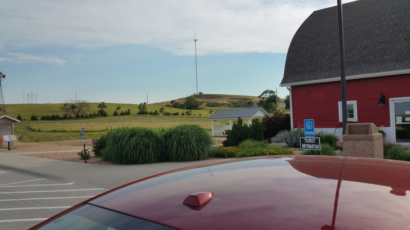
Before the dunes even begin to show off, the Sandhills Journey Scenic Byway Visitor Center near Broken Bow makes a strong first impression. The center is housed in a beautifully restored 1920s barn at 44106 NE-2, Broken Bow, NE 68822, sitting on a 14-acre parcel along the south side of Highway 2.
The moment you walk in, the staff greets you like they have been waiting all day just for you. They take real time explaining local history, pointing out points of interest down the road, and sharing tips that no map app would ever think to tell you.
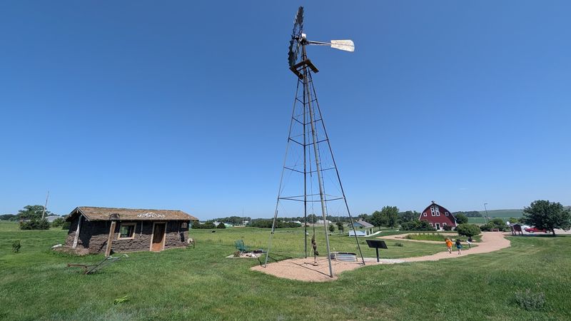
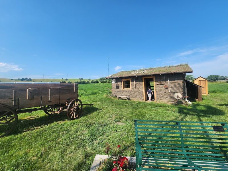
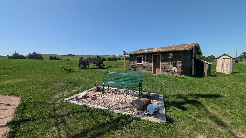
Outside, a working windmill stands beside a sod house with walls nearly 18 inches thick, a quiet reminder of how tough early settlers really were. Walking trails weave through the grounds with educational panels at every turn, and an observation deck offers a sweeping panoramic view of the surrounding hills. The center is open Thursday through Wednesday, 10 AM to 5 PM, and Sundays from 1 to 5 PM. Call ahead at 308-872-8331 to confirm hours before making the trip.
A Landscape Built by Ancient Wind and Time
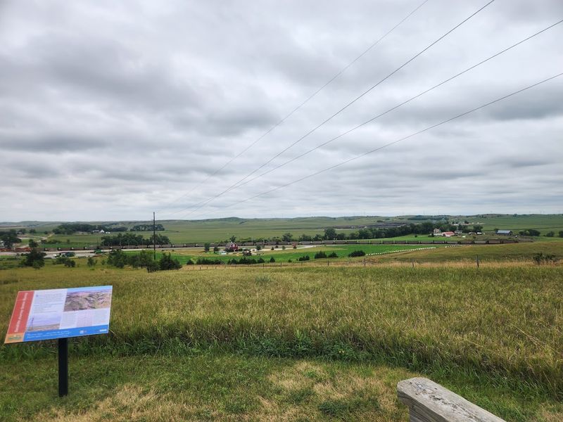
Long before any road existed here, the Nebraska Sandhills were already one of the most remarkable landforms on the continent. These dunes formed during the Pleistocene Epoch, when glaciers eroded sediment from the Rocky Mountains and wind carried it eastward, eventually depositing and shaping what became nearly 20,000 square miles of sand.
What makes the Sandhills unusual compared to other dune regions is that native grasses locked the sand in place thousands of years ago. That stabilization means the hills look soft and green rather than bare and shifting, giving the landscape a quiet, almost dreamy quality that catches first-time visitors completely off guard.
About 80 to 85 percent of the natural habitat here remains intact, which is an extraordinary number for any region in the continental United States. The sandy soil is largely unsuitable for farming, so most of this land has never been plowed. What you see rolling past your window is essentially a living snapshot of the ancient Great Plains, preserved almost exactly as it has always been.
The Ogallala Aquifer Hiding Beneath Your Feet
One of the most fascinating things about driving through the Sandhills is knowing what lies directly beneath the road. The entire region sits atop the Ogallala Aquifer, one of the largest groundwater sources in North America, and the dunes act like a massive natural sponge, absorbing rainfall quickly and feeding the aquifer below.
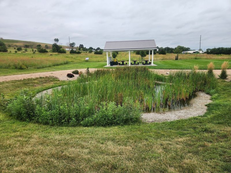
That underground water does not stay hidden for long. It pushes back up through the landscape in the form of thousands of natural lakes, wetlands, and springs scattered across the hills. On a clear day, those vivid blue lakes shimmer between the dunes like scattered mirrors, and they are absolutely real, not a mirage.
Victoria Springs State Recreation Area, near Anselmo and Merna, is one of the most accessible spots to experience this water-rich landscape up close. Nebraska’s third oldest state recreation area, it offers mineral springs, fishing, paddleboating, picnicking, and even cabin rentals. The connection between the ancient dunes above and the vast water reserve below is one of those geological relationships that genuinely makes you rethink how you see a landscape.
Half a Million Cranes and the Sky Turns Gray
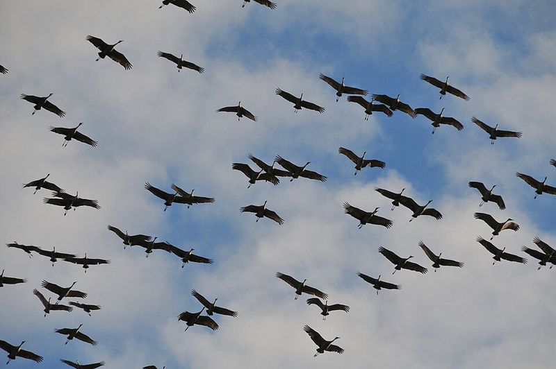
Nothing quite prepares you for the Sandhill Crane migration. Every spring, roughly 500,000 Sandhill Cranes gather in the Platte River valley near Grand Island, which sits at the eastern gateway of the byway, making it the largest concentration of cranes on Earth during their annual migration.
The birds arrive from mid-February through April, and the best viewing happens at dawn and dusk when the flocks lift off or settle onto the river sandbars in enormous, noisy waves. The sound alone is unforgettable, a rolling chorus of rattling calls that fills the air from every direction at once.
Beyond cranes, the byway corridor sits along North America’s Central Flyway, meaning over 14 million ducks and geese pass through each spring and fall. Prairie chickens and sharptail grouse perform their distinctive booming mating rituals in April, adding yet another layer to the wildlife calendar. If birds are your thing, this stretch of Nebraska is legitimately world-class, and the timing of your visit can completely change what you witness out the window.
More Than 300 Bird Species Along the Route
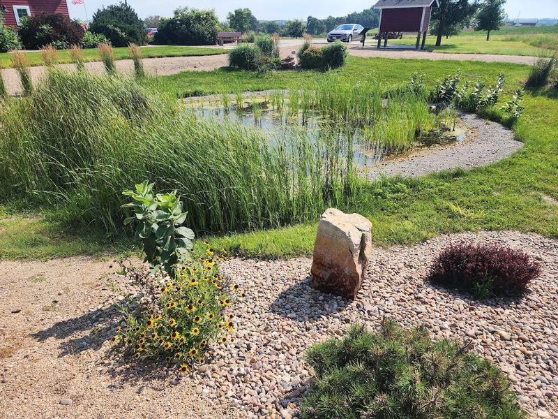
The crane migration gets most of the attention, but the full bird list along the Sandhills Journey Scenic Byway is genuinely staggering. Over 300 species have been recorded along the route, turning the byway into a serious destination for birders at every skill level.
White pelicans drift over the lakes in graceful formations. Great blue herons stand motionless along the shorelines. Meadowlarks, Nebraska’s state bird, perch on fence posts and fill the air with bright, flute-like songs. Raptors circle overhead, scanning the open grasslands below with sharp, patient eyes.
The Valentine National Wildlife Refuge and Crescent Lake National Wildlife Refuge sit close to the byway and provide protected habitat for migratory waterfowl throughout the year. Bluebirds, warblers, grosbeaks, and vireos round out a list that keeps serious birders busy for days. Bringing a good pair of binoculars is not optional here. Every pullout, every lake edge, and every stretch of open grassland is a potential stage for something worth watching.
The Forest That Human Hands Built From Scratch
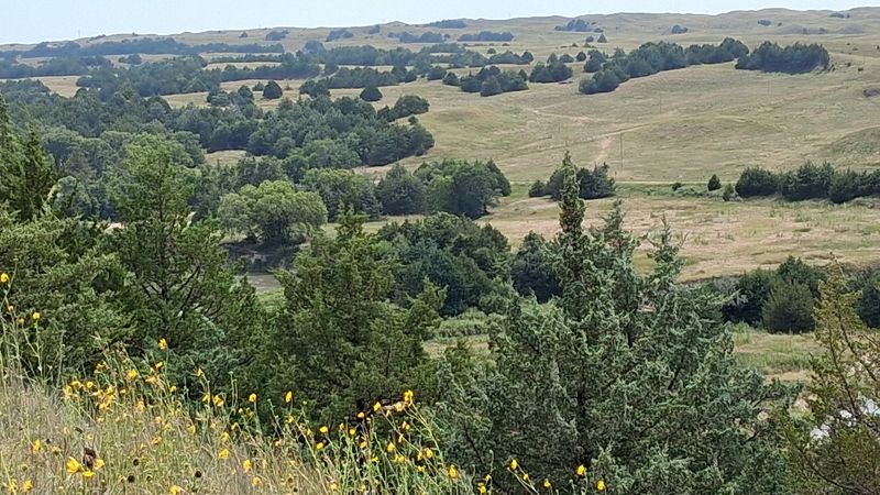
Most forests grow on their own. The Nebraska National Forest near Halsey did not get that option. In the 1930s, the Civilian Conservation Corps planted over 20,000 acres of trees in the middle of the open Sandhills, creating what is now recognized as the largest hand-planted forest in the Northern Hemisphere.
The Bessey Ranger District manages this remarkable place today, and it offers a surprisingly full menu of outdoor activities. Campsites sit tucked among the pines, and trails wind through the forest for hiking, biking, and horseback riding. Off-highway vehicle trails add another dimension for adventure-seekers who want to cover more ground.
The contrast between stepping into this dense, cool forest after miles of open grassland is genuinely striking. One moment you are surrounded by endless rolling hills, and the next you are standing in deep shade beneath towering pines. The story of how this forest came to exist, planted by hand during one of the country’s hardest economic periods, gives every trail here a layer of meaning that the scenery alone cannot provide.
Rivers That Move Slowly and Reward Patience
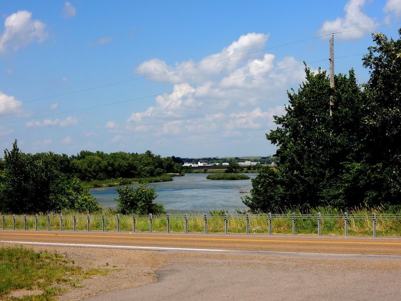
The Loup River system runs through the heart of the Sandhills region, and it is one of the most underrated waterways in the entire state. The South Loup, Middle Loup, North Loup, and Dismal Rivers all flow through the area, offering calm and clear water that is perfectly suited for kayaking, canoeing, and leisurely floating.
Outfitters like Glidden Canoe Rental make it easy to get on the water without hauling your own gear across the state. The rivers move at a gentle pace, which means you spend more time looking at herons and sandpipers than paddling hard. Sandy banks invite spontaneous rest stops, and the surrounding grasslands give the whole experience an open, unhurried feeling.
Fishing is also popular along the Loup system, with walleye, catfish, and white bass available at spots like Sherman Reservoir State Recreation Area near Loup City. Whether you prefer a paddle or a fishing line in the water, the rivers here offer a completely different perspective on the Sandhills than the view from a car window ever could.
Carhenge: Where Art Meets the Open Plains
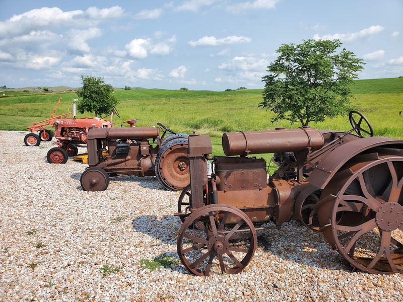
At the western end of the byway near Alliance sits one of the most genuinely unexpected roadside attractions in the entire country. Carhenge is exactly what it sounds like: a full-scale replica of England’s Stonehenge, built from 38 vintage American-made automobiles and completed in 1987 by Jim Reinders and his family.
Every car is painted gray to mimic the appearance of the original stones, and the alignment follows the same astronomical orientation as the real Stonehenge in Wiltshire. The result is both absurd and oddly moving, a tribute to ancient mystery assembled from the wreckage of American automotive history, standing alone on the flat Nebraska plains.
The site is free to visit and open around the clock, which means a midnight or early morning visit under those famously dark Sandhills skies is entirely possible. The Carnegie Arts Center in Alliance offers a more traditional cultural experience nearby, but Carhenge tends to linger in the memory longer than most conventional museums. It is the kind of place that makes you laugh first and then quietly think for a while after.
Ranching Culture That Has Shaped Every Mile
The Sandhills have long been called cattle country, and that reputation is earned honestly. Multi-generational ranching families have worked this land for well over a century, adapting their operations to the rhythms of the seasons and the demands of the sandy, unpredictable terrain.
Driving through, you will notice cattle on the hillsides at almost every turn, often tended by ranchers on horseback who look entirely at home in a landscape that most visitors find breathtaking but slightly intimidating. The ranching community here has a reputation for genuine hospitality, and the famous Nebraska steering wheel wave, where drivers lift a few fingers off the wheel to acknowledge passing cars, is alive and well on Highway 2.
Community rodeos, ranch rodeos, bull riding events, and county fairs pop up throughout the summer and fall, giving visitors a chance to experience the culture rather than just observe it from the road. The Sandhills ranching identity is not a performance put on for tourists. It is simply how life has always worked out here, and that authenticity comes through in every interaction.
Small Towns With Big Personalities Along the Way
The towns along the byway are small by any measure, but they punch well above their weight when it comes to character. Dannebrog celebrates its Danish heritage with Danish Days each summer. Loup City hosts Polish Days. Hemingford holds Czech Days.
These are not tourist fabrications; they reflect the actual ethnic roots of the families who homesteaded this region generations ago.
Art communities have also taken root in unexpected places. The Carnegie Arts Center in Alliance showcases regional talent, and studios and galleries operate in towns like Ashby, drawing artists who come specifically for the quality of light and the visual drama of the surrounding landscape.
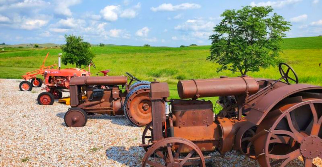
The Stuhr Museum of the Prairie Pioneer in Grand Island brings 19th-century frontier life to vivid detail through interactive exhibits and historic farm machinery. The Knight Museum and Sandhills Center in Alliance covers Native American history, early homesteaders, and the railroad era that shaped this region. Each town along the 272-mile route adds a different texture to the story, making the drive feel like flipping through a well-illustrated history book.
Practical Tips Before You Hit the Road
A 272-mile scenic byway sounds manageable until you realize how much there is to stop for. Most travelers who try to do the full route in a single day end up wishing they had planned for at least two, if not three. The landscape rewards patience, and the wildlife viewing alone can add hours to any itinerary.
Fuel is not available in every small community along the route, so filling up whenever you see a gas station is genuinely good advice. Cell service can be limited depending on your carrier, and not every small business accepts cards, so carrying some cash is a practical move. Hospitals are located in Grand Island, Broken Bow, and Alliance if medical services are needed.
The byway also crosses two time zones: Central Time from Grand Island to just east of Seneca, and Mountain Time from Seneca to Alliance. Spring brings strong winds and the possibility of sand on the road surface, while autumn offers cooler temperatures and excellent wildlife activity. Mid-February through April is the prime window for crane migration, which remains the single most spectacular natural event the byway has to offer.
Share this story