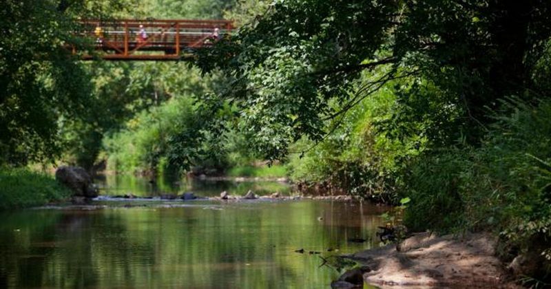
Tucked into the small town of Hillsborough, North Carolina, the Riverwalk along the Eno River gives locals and nearby visitors a genuinely pleasant way to spend an afternoon outdoors without paying a trail fee. The route connects downtown Hillsborough with parks, wooded greenway, and river views across a paved, accessible path that feels unhurried from the first step.
Whether you have an hour or a full afternoon, understanding the trail’s real layout before you go makes the whole outing go more smoothly.
Hillsborough Riverwalk Offers a Low-Cost Eno River Afternoon
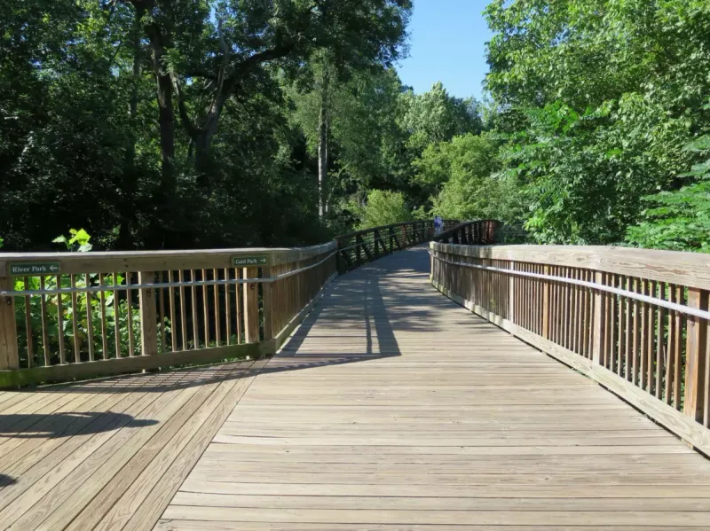
Hillsborough Riverwalk sits in the heart of Hillsborough, North Carolina, where the Eno River bends close to downtown and the surrounding parks create a natural corridor for walking, jogging, or simply taking in the scenery. The Town of Hillsborough describes the Riverwalk as an accessible, paved urban greenway with no admission charge, connecting downtown with Gold Park, River Park, and trail links toward Occoneechee Mountain State Natural Area and the Historic Occoneechee Speedway trails.
That combination of river setting, downtown proximity, and free public access gives the trail a lot of appeal for a low-cost afternoon out.
The headline framing of “two miles” deserves a quick correction before you plan your route. Current town information places the full Riverwalk at approximately three miles, while Orange County describes a 3.2-mile corridor along the Eno River from Eno Mountain Road to U.S. 70.
A tourism listing does identify a nearly two-mile section running from Gold Park through downtown toward the Occoneechee Speedway trails, but that figure reflects a portion of the route rather than the entire greenway.
Treat the two-mile description as an approximate selected segment, and use a current map to verify whatever distance you plan to walk before heading out. Visit Hillsborough lists the Riverwalk as a paved, ADA-accessible greenway, which makes it a reasonable choice for walkers who want a mostly smooth surface without committing to the full trail length.
Planning your portion in advance keeps the outing practical and avoids surprises about distance or surface changes along connected sections.
The Riverwalk Changes Character Along the Eno
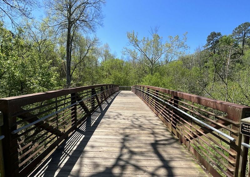
One of the more pleasant surprises about the Hillsborough Riverwalk is how much the scenery shifts as you move along it. Rather than a single continuous boardwalk running beside open water, the route functions as an urban greenway that weaves through downtown areas, wooded stretches, and connected park settings.
Some segments put the river close at hand; others pull back into tree cover or open onto park fields, giving the walk a varied quality that keeps the outing from feeling repetitive.
The town describes the Riverwalk as paved and accessible in its core sections, but the route also includes street crossings, connections through parks, and wooded portions where the surface or setting can differ from the main paved greenway. No official difficulty rating covers the entire trail, so calling it uniformly easy would overstate what the sources actually say.
For most walkers who are comfortable on paved paths and occasional crossings, the feel of the route is manageable and unhurried rather than strenuous.
Interpretive signage adds a layer of interest that rewards a slower pace. Hillsborough’s recreation resources note that the Riverwalk features signs covering local history, geology, river habitat, conservation efforts, industry, and railroads, giving walkers context for what they are passing through rather than just a path to cover distance.
The Alliance for Historic Hillsborough also highlights the sign trail as a way to engage with the town’s layered past while moving through the landscape. Pausing at a few of those markers turns a standard walk into something closer to a self-guided tour of how Hillsborough grew up alongside the Eno.
Treat Two Miles as a Portion, Not the Trail’s Total
Keeping the two-mile framing useful means understanding exactly what it describes. The tourism listing for the Hillsborough Riverwalk identifies a nearly two-mile section that runs from Gold Park, through downtown Hillsborough, and toward the Occoneechee Speedway trails.
That segment captures a meaningful slice of the route and passes through some of the most varied scenery on the greenway, but it does not represent the trail’s full extent.
Official descriptions from the Town of Hillsborough place the complete Riverwalk at roughly three miles, and Orange County identifies a 3.2-mile corridor along the Eno River from Eno Mountain Road to U.S. 70. Both figures are notably longer than two miles, which is why the article frames that shorter distance as an approximate portion rather than a guaranteed itinerary.
Distances along greenways can also shift slightly depending on which access point you start from and how far into connected trail segments you travel.
The practical move is to pull up a current map from the town or a reliable trail app before you visit, confirm the segment you want to walk, and note any recent updates to the route. Visit Hillsborough’s Riverwalk page is a reasonable starting point for orientation, and the town’s own Riverwalk page links to route information that reflects current conditions.
Once you have your segment in mind, the connections toward River Park, Occoneechee Mountain State Natural Area, and the Historic Occoneechee Speedway trails are worth knowing about as optional extensions rather than required parts of the walk. Each of those destinations adds mileage and a change of character, so treat them as choices you make based on how much time and energy you have that day rather than as default stops on a fixed route.
Pick the Access Point That Fits Your Afternoon
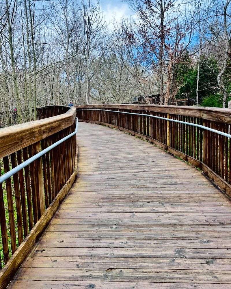
Where you start on the Hillsborough Riverwalk shapes the entire character of your outing. Three principal access points serve the trail, and each one offers a different balance of downtown convenience, park space, and river scenery.
The downtown entrance at the Eno River Parking Deck, located at the end of Nash and Kollock streets, puts you within easy reach of Hillsborough’s restaurants, shops, and historic streetscape right from the start. Starting here works well if part of the appeal is combining a walk with a stop in town before or after.
The Town of Hillsborough lists this deck as a primary access point, and it connects directly to the paved greenway heading toward the river.
Gold Park, at 415 Dimmocks Mill Road, anchors the western end of the route and offers a more park-centered starting experience. Families with children or visitors who want open space before stepping onto the greenway tend to find Gold Park a natural fit.
River Park, at 140 E. Margaret Lane, rounds out the options with its own parking area, restrooms, a farmers-market pavilion, paved trails, and open fields.
The Alliance for Historic Hillsborough notes that the sign trail connects these destinations, so each starting point eventually leads toward the others along the greenway. Choosing your access point based on your priorities rather than defaulting to the nearest parking spot helps you get the most out of whichever portion of the Riverwalk you decide to walk.
Free Access and Parking Keep the Budget Flexible
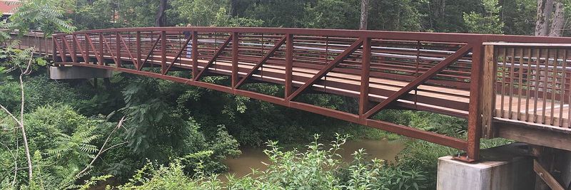
Trail admission on the Hillsborough Riverwalk costs nothing, which is the foundation of its appeal as a low-cost outing. Documented free parking supports that low-cost framing at two of the main access points.
The Alliance for Historic Hillsborough identifies free parking at Gold Park and the Eno River Parking Deck, and nearby downtown parking is also noted as free in Orange County visitor guidance.
That said, parking availability and rules can shift depending on the day. Downtown events, seasonal demand, and any temporary restrictions can change what is open or free on a given afternoon, so checking the town’s current parking map before you arrive is a worthwhile step.
The town’s Riverwalk page and related resources are the most reliable place to confirm current conditions rather than assuming a spot will be available.
The greenway itself connects to downtown amenities that can extend your visit without requiring any spending. Restrooms are available at River Park and through downtown, and the area around the trail includes restaurants, shops, and lodging for visitors who want to turn a walk into a longer afternoon.
Visit Hillsborough’s Riverwalk listing notes the range of amenities accessible from the route. None of those options are necessary to enjoy the walk, but knowing they exist makes it easier to plan around your own preferences and budget.
A cold drink from a downtown shop after a summer walk costs money; the walk itself does not.
Daylight and Storm Checks Matter on the Riverwalk
Planning your visit around daylight is not just a preference on the Hillsborough Riverwalk – it is the town’s stated guidance. The Town of Hillsborough directs users to travel the Riverwalk only during daylight hours, and its parks and greenways are listed as open daily from 7 a.m. until 30 minutes after sunset.
Building your outing around those hours keeps you on the right side of town policy and gives you the best visibility for navigating street crossings and changing trail surfaces.
The town’s Riverwalk page outlines trail etiquette that makes the shared path work better for everyone: stay on the trail, yield at street crossings, keep right, pass on the left, and travel in pairs or groups when possible. Leaving valuables in your vehicle is also discouraged.
Emergency markers are placed every 0.1 miles along the route, which helps users communicate their location if something goes wrong, though the markers themselves do not guarantee a particular response time.
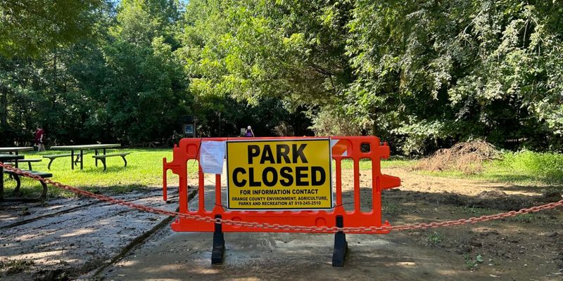
Storm-related closures are a real operational factor on this trail. The Riverwalk runs partly through the Eno River floodplain, and heavy rain can bring flooding, debris, damaged sections, and sanitation hazards that make portions of the route unsafe.
The town has posted closure notices after past storm events, and after Tropical Storm Chantal caused substantial damage in July 2025, the town worked through multiple phases of repairs before announcing a full reopening on September 29, 2025. Always check current town notices after heavy rain, obey any posted barricades, and never assume a section is safe just because it was open on your last visit.
Conditions along a floodplain trail can change faster than posted information gets updated.
Build a Gentle Hillsborough Outing Around the Route
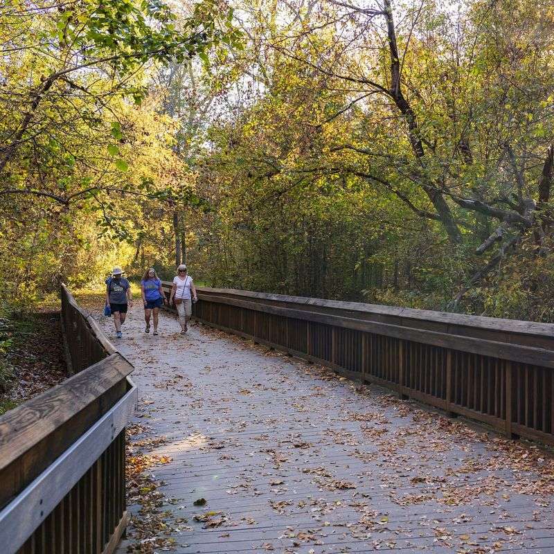
Putting together a Hillsborough Riverwalk outing is mostly a matter of making a few choices before you leave home. Start by pulling up a current map – either from the town’s website or a reliable trail app – and decide which segment fits your time and energy.
Confirm your access point, note the current parking situation, and check whether the town has posted any recent closure notices, especially if there has been rain in the past few days.
Arrive during permitted daylight hours, give yourself a little extra time for interpretive signs along the way, and leave room at the end for a stop in downtown Hillsborough or a few minutes in one of the parks. The town’s Riverwalk page and Visit Hillsborough’s listing both give useful orientation for first-time visitors.
Trail access is free, parking is documented as free at several points, and the route’s paved sections make it accessible for a wide range of walkers, though the experience varies by segment and conditions on the day.
The Hillsborough Riverwalk is a well-used, publicly valued greenway that rewards the visitors who take a few minutes to plan ahead. Arriving with realistic expectations about distance, surface, and conditions turns a good walk into a genuinely memorable one.
Share this story