There is a place in central Oregon where the earth looks like it forgot to finish cooling down. Ancient lava fields stretch for miles, obsidian glass glitters under the sun, and two stunning crater lakes sit inside a caldera that formed thousands of years ago.
Just a short drive south of Bend, this volcanic monument covers nearly 55,000 acres and packs in more geological drama than most places you will ever visit. With 110 miles of trails, underground lava caves, roaring waterfalls, and views that stretch across the Cascade Range, this is the kind of destination that makes you feel like you have landed on another planet while still being able to grab a snack at the visitor center gift shop.
Where Earth Science Becomes an Adventure: Location and Overview
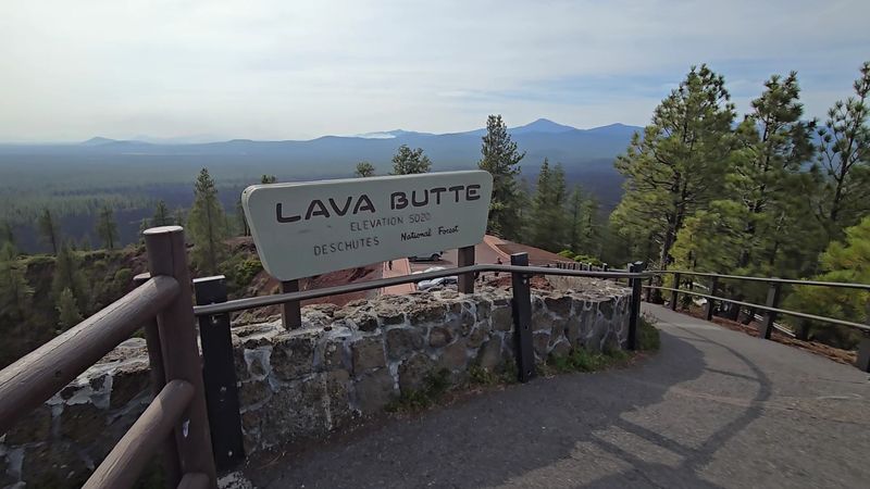
Newberry National Volcanic Monument sits about 13 miles south of Bend, Oregon, just off US Highway 97, with its main visitor hub at the Lava Lands Visitor Center at Bend, OR 97702. The monument is managed by the Deschutes National Forest and covers nearly 55,000 acres of some of the most dramatic volcanic terrain in the entire United States.
The monument was established in 1990 and protects a landscape shaped by millions of years of volcanic activity. Newberry Volcano itself is one of the largest shield volcanoes in the country, and the caldera at its summit holds two gorgeous lakes, Paulina Lake and East Lake, along with obsidian flows and hot springs.
The visitor center is open daily from 9 AM to 5 PM, and the staff and rangers there are genuinely enthusiastic about helping guests make the most of their visit. You can reach the monument by phone at (541) 383-5300.
A federal recreation pass or a day-use fee gets you in, and the National Parks pass is accepted here. Plan for at least a full day, because a couple of hours simply will not do this place justice.
The Caldera at the Summit: Paulina Lake and East Lake
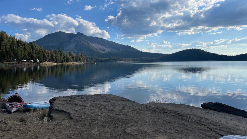
At the heart of Newberry Volcano, roughly 6,400 feet above sea level, two crater lakes rest inside a caldera that stretches about four miles wide. Paulina Lake and East Lake are both fed by snowmelt and hydrothermal activity, and the water in each one has a slightly different chemistry because of it.
Paulina Lake is the larger of the two and offers fishing, kayaking, and a small resort with cabin rentals and boat launches. East Lake sits just across a volcanic ridge and draws anglers and campers who want a quieter experience.
Hot springs bubble up along the shoreline of East Lake, and on cooler mornings, wisps of steam drift across the water in a way that feels almost cinematic.
The drive up to the caldera is about 15 miles from the highway, and some sections of road can get rough, so a higher-clearance vehicle helps. Once you arrive, the views across the caldera rim are genuinely jaw-dropping.
The combination of volcanic geology, sparkling lakes, and surrounding pine forest makes this one of the most memorable spots in all of Oregon, and that is not an overstatement.
Lava Butte: The Cinder Cone With Cascade Views
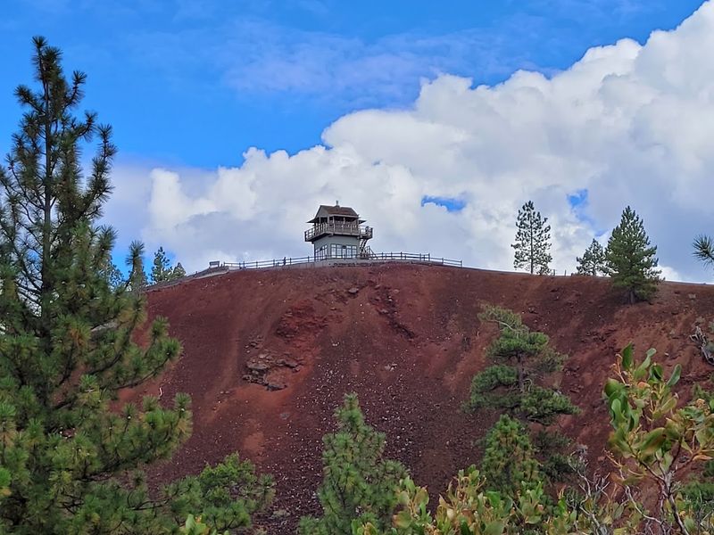
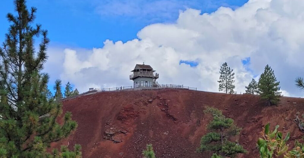
Rising 500 feet above the surrounding lava plain, Lava Butte is a perfectly formed cinder cone that offers one of the best panoramic views in central Oregon. On a clear day, you can see Mount Bachelor, Broken Top, the Three Sisters, and Mount Jefferson stretching across the horizon like a volcanic family portrait.
Getting to the top is part of the fun. A shuttle bus runs from the visitor center for a small fee, typically around three to five dollars for a round trip, and the ride takes about five minutes.
Outside of peak hours, the gate at the base of the road is sometimes open for personal vehicles, which saves your legs for the half-mile crater rim trail at the top.
The rim trail circles the cinder cone and gives you a close-up look at the volcanic rock formations while rangers stationed at the summit share fascinating details about the geology below. The wind up top can be brisk even on warm days, so a light jacket is worth tucking into your bag.
Lava Butte is one of those spots where the effort-to-reward ratio is almost embarrassingly favorable.
The Big Obsidian Flow: Walking on Volcanic Glass
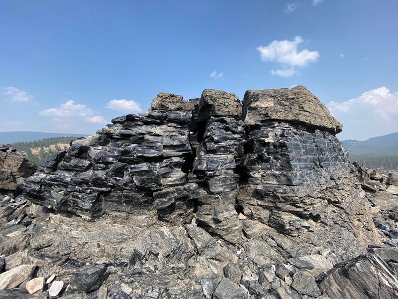
About 1,300 years ago, a massive eruption inside the Newberry Caldera pushed a thick river of obsidian and pumice across the landscape. Today, the Big Obsidian Flow is one of the youngest and most visually striking lava flows in the Pacific Northwest, and walking across it feels genuinely surreal.
The trail to explore the flow is about one mile long with a boardwalk and some steep sections. Chunks of jet-black obsidian catch the light and glitter like broken mirrors scattered across a pale pumice field.
The contrast between the glassy black rock and the cream-colored pumice is something that photographs simply cannot capture with full accuracy.
A day-use fee of five dollars applies specifically to the Big Obsidian Flow area, which is separate from the main monument entrance fee. The trail has informational signs throughout that explain how the flow formed and why obsidian was so valuable to Indigenous peoples of the region, who used it to make tools and traded it across hundreds of miles.
This short hike packs more geological storytelling into one mile than most full-day trips manage to deliver.
Lava River Cave: Underground Oregon at Its Coolest
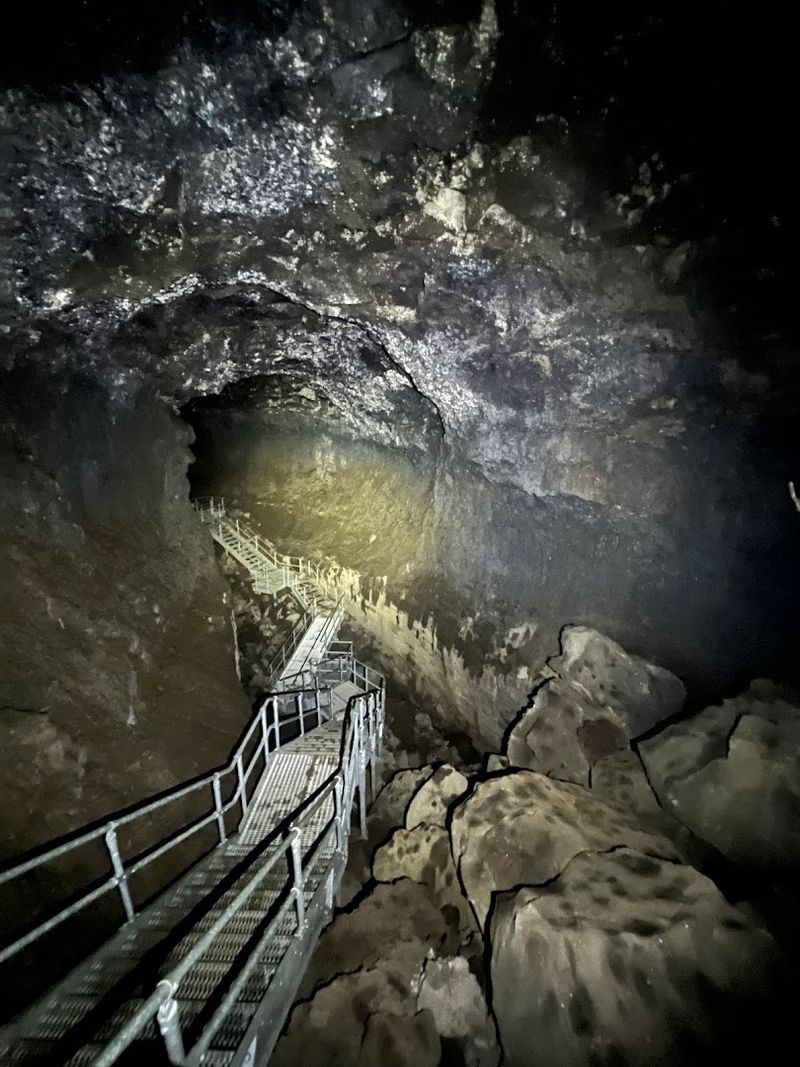
Underneath a stretch of ponderosa pine forest just off Highway 97, a lava tube stretches for more than a mile underground, making it the longest uncollapsed lava tube in the state of Oregon. The Lava River Cave is a genuinely thrilling experience, and the temperature inside hovers around 42 degrees Fahrenheit year-round, so bring a jacket no matter what month you visit.
Lanterns are available to rent at the cave entrance, and renting one is highly recommended because they throw significantly more light than most personal flashlights. The cave is open seasonally, typically from late May through September, and reservations fill up quickly during summer weekends, so planning ahead saves a lot of frustration.
The cave floor is uneven and the ceiling varies in height, so wear sturdy shoes with good grip and be prepared to duck in a few spots. The silence inside is profound.
With your light off, the darkness is total and the quiet is the kind that makes you suddenly very aware of your own breathing. It is one of the most unique natural experiences in the Pacific Northwest, and the staff at the entrance are well-prepared to help first-timers feel comfortable before heading in.
Paulina Falls: A Waterfall Worth the Walk
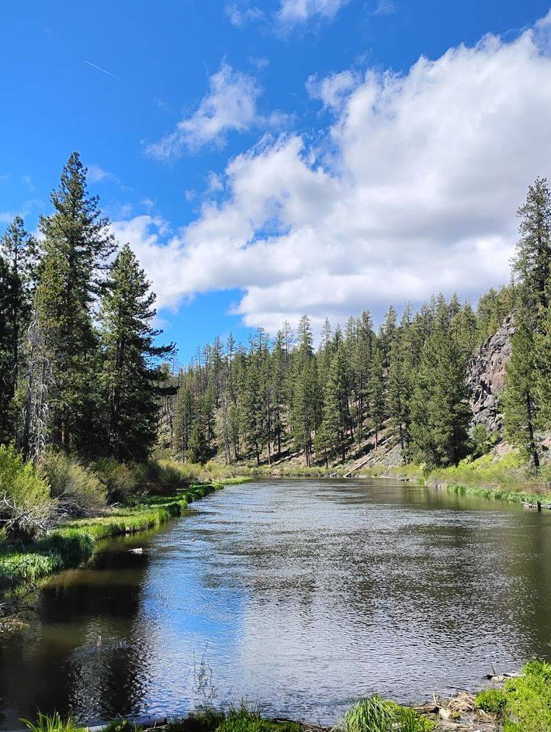
Tucked inside the monument near the outlet of Paulina Lake, Paulina Falls drops about 80 feet over a basalt cliff into a narrow canyon below. The falls are actually a double cascade, with two channels of water splitting and rejoining as they tumble over the volcanic rock, creating a scene that feels almost theatrical.
The viewpoint for the upper falls is an easy short walk from the parking area, but a slightly longer trail leads down to the base of the falls where the mist and the sound of rushing water make the whole experience feel immersive. The trail to the lower viewpoint involves some uneven terrain, so solid footwear is a good idea.
Late spring and early summer tend to produce the highest water flow, when snowmelt from the caldera rim feeds the lake and pushes a strong current over the edge. By late summer, the flow mellows but the setting remains beautiful.
Paulina Falls is the kind of waterfall that earns its own trip rather than just serving as an afterthought on the way to something else. Many visitors say it is a highlight of the entire monument, and after seeing it in person, that reaction makes complete sense.
Trail of the Molten Lands: A Walk Through Lava History
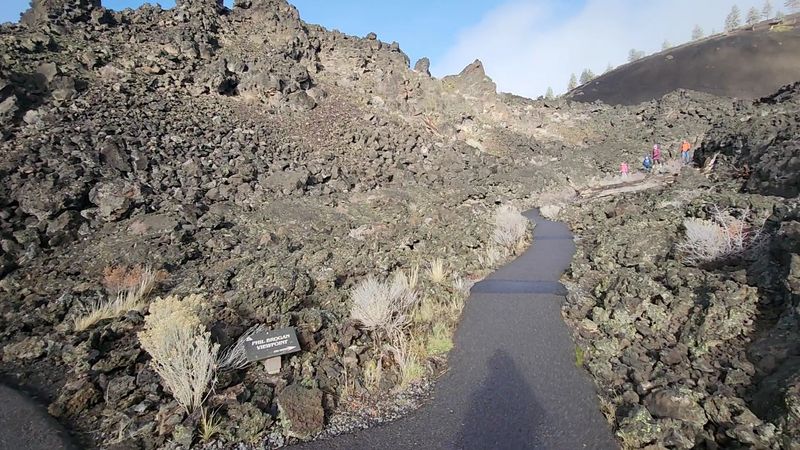
The Trail of the Molten Lands is a 1.1-mile paved loop that starts near the Lava Lands Visitor Center and winds through one of the most visually dramatic lava fields in the monument. The trail surface is in good condition, but do not let the word paved fool you into thinking it is entirely flat.
Several sections climb noticeably, and one stretch near the viewpoint at the top gets fairly steep.
Informational signs are posted throughout the trail, and they do a great job of explaining how the lava flow formed, what plants and animals have slowly reclaimed the rocky terrain, and how long it takes for life to return to a landscape after a volcanic eruption. Spoiler: it is a very long time.
The views from the upper portion of the trail stretch across the lava field toward Lava Butte, and on clear days, the Cascade peaks line the western horizon. There is also a halfway loop option for anyone who wants a shorter walk without tackling the steepest section.
The trail gets full sun for most of the day, so water and sunscreen are not optional accessories here. Early morning visits tend to be cooler and significantly less crowded, which makes the whole experience more enjoyable.
110 Miles of Trails: Finding Your Own Path
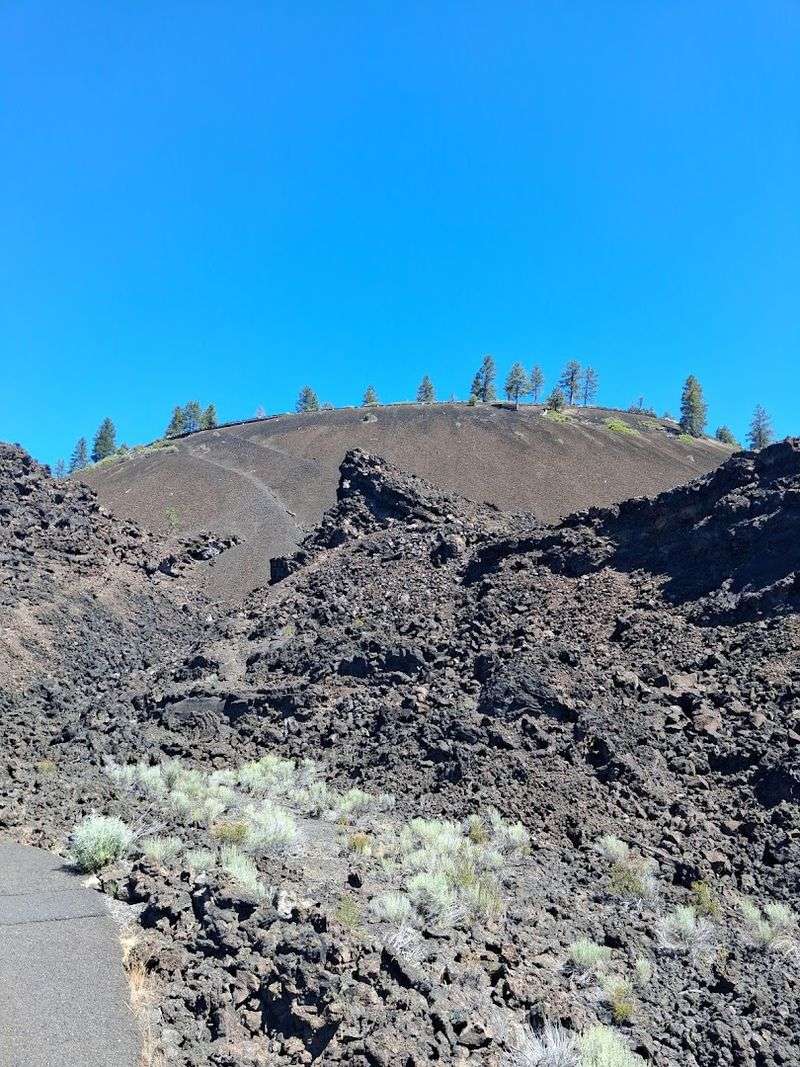
With 110 miles of trails spread across nearly 55,000 acres, Newberry National Volcanic Monument offers enough hiking variety to keep you busy for multiple trips without repeating yourself. The trail network connects lava fields, forested ridges, lake shorelines, caldera rims, and backcountry zones that most casual visitors never reach.
The Paulina Lake Trail circles the entire lake in about seven miles and offers constantly changing views of the water, caldera walls, and surrounding forest. The Crater Rim Trail is a more demanding option that follows the edge of the caldera and rewards hikers with sweeping views in every direction.
For something shorter and more accessible, several trails near the visitor center are flat enough for families with young children.
Mountain biking is also permitted on many trails within the monument, and the varied terrain makes it a popular destination for riders who enjoy a mix of smooth forest paths and more technical volcanic surfaces. Horseback riding is allowed on designated trails as well.
Whatever pace you prefer, the sheer size of the trail network means you can almost always find a quiet corner of the monument to call your own for the day, even during busy summer weekends.
Wildlife, Flora, and the Slow Return of Life After Lava
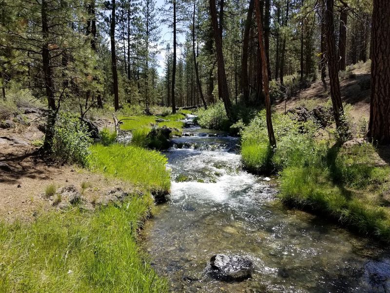
One of the quieter stories that Newberry National Volcanic Monument tells is the story of ecological recovery. Across the monument, you can watch life reclaim terrain that was once buried under molten rock.
Ponderosa pines have pushed their roots into cracks in the lava, and wildflowers bloom in pumice fields where nothing seemed capable of growing just a few centuries ago.
The monument supports a healthy population of mule deer, and black bears are present in the more forested areas, though sightings are not common. Osprey and bald eagles hunt over Paulina Lake and East Lake, and the caldera area is a reliable spot for birdwatchers who bring binoculars.
Smaller mammals like pika and marmots are often spotted along the rocky upper trails near the caldera rim.
The ponderosa pine forest that covers much of the monument has a character all its own. The trees grow tall and spread apart, letting shafts of sunlight reach the forest floor and creating a warm, open atmosphere that feels very different from the dense forests of the Oregon coast.
Walking through this landscape while volcanic rock peeks through the pine needles underfoot is a reminder that the ground beneath your feet has a very dramatic past.
Practical Tips for Making the Most of Your Visit
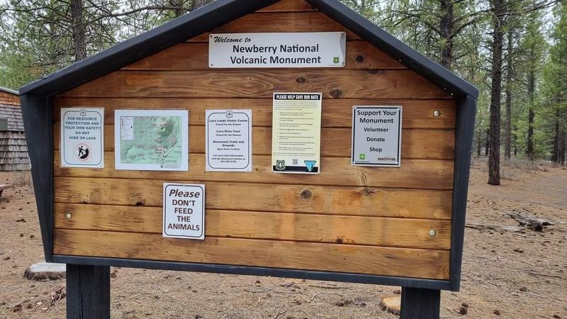
A few practical details can make the difference between a great visit and a frustrating one at Newberry National Volcanic Monument. The monument is open year-round, but many facilities including the Lava River Cave and some upper caldera roads close during winter.
The visitor center operates from 9 AM to 5 PM daily, and arriving close to opening time on weekends helps you beat the crowds.
Bring more water than you think you need. Shade is scarce in the lava fields, and the sun reflects off the dark rock in a way that makes the heat feel more intense than the air temperature suggests.
A hat, sunscreen, and layers for the cave and upper caldera are all worth packing.
The America the Beautiful pass and other federal recreation passes are accepted at the monument, which is a great value if you plan to visit multiple federal lands during your trip. The shuttle to the top of Lava Butte requires a small cash fee at certain times, so keeping a few dollars on hand is useful.
Cell service is spotty in parts of the monument, so downloading offline maps before you leave Bend is a smart move that saves a lot of guesswork once you are deep inside the volcanic landscape.
Share this story