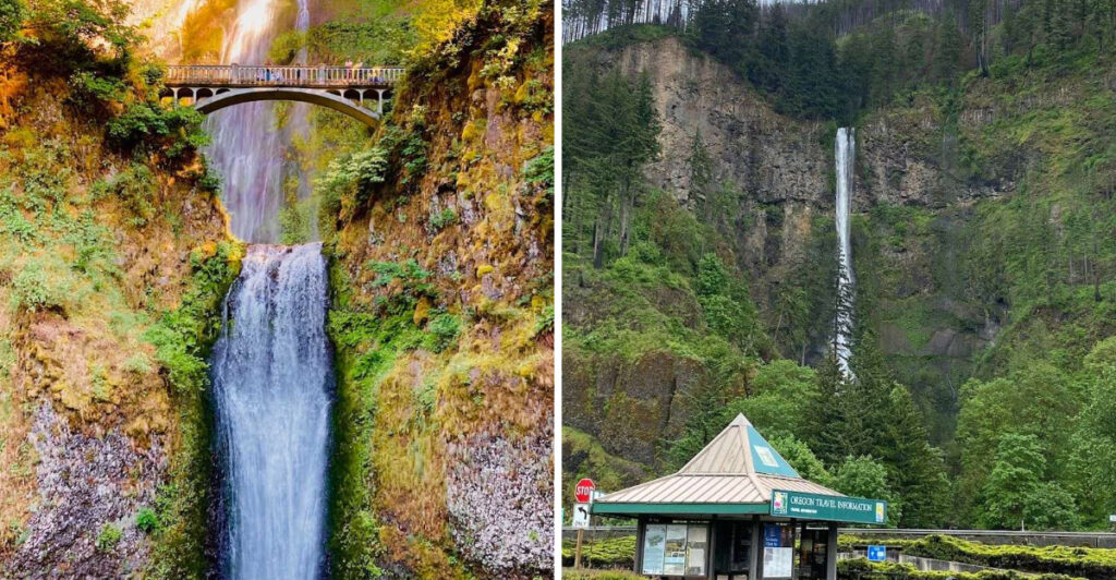
There is a waterfall in Oregon that stops people mid-sentence. You round a bend, pass under a highway, and suddenly 620 feet of roaring water is right in front of you, crashing down through layers of ancient volcanic rock that have been building since long before humans walked the Pacific Northwest.
The scale of it is hard to process at first. Multnomah Falls, tucked into the Columbia River Gorge east of Portland, is the tallest waterfall in Oregon and one of the most visited natural sites in the entire country, drawing over two million people every year.
What makes it even more remarkable is the geology beneath it, six distinct layers of basalt formed over 400,000 years of volcanic activity. This article walks you through every angle of this extraordinary place.
Where to Find This Waterfall and How to Get There
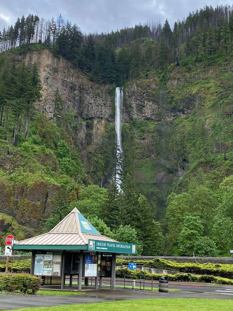
The address that gets you closest to the action is Historic Columbia River Highway, Bridal Veil, Oregon 97014, right in the heart of the Columbia River Gorge National Scenic Area, about 30 miles east of Portland.
The drive out on Interstate 84 is already worth the trip. Dense forest lines both sides of the road, and the Columbia River runs wide and steady to your north the entire way out.
Once you exit at Multnomah Falls, the parking situation requires a bit of planning. A timed-entry permit, which costs around $2, is required for vehicles arriving before 6 p.m. from May through October.
The permit system exists because this place draws enormous crowds, especially on summer weekends.
There is also a free parking area on the west side of the highway that many visitors miss entirely because GPS apps tend to route drivers directly to the paid lot. Arriving before 9 a.m. on weekends gives you the best shot at a smooth experience.
The falls are visible almost immediately after you walk through the pedestrian tunnel beneath Interstate 84.
The 620-Foot Drop That Makes Oregon Famous
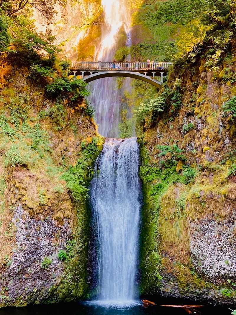
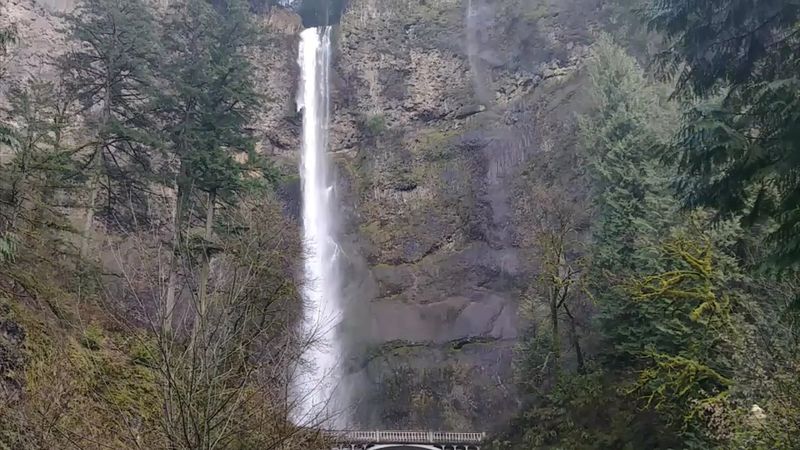
At approximately 620 feet from top to bottom, Multnomah Falls holds the title of the tallest waterfall in Oregon and consistently ranks among the tallest year-round waterfalls in the United States.
The falls are split into two distinct tiers. The upper falls drop a dramatic 542 feet, which alone would make it a landmark worth crossing state lines to see.
The lower falls add another 69 feet before the water reaches the pool at the base.
What makes the drop feel even more intense is the narrowness of the canyon walls around it. The water does not spread out lazily; it plunges fast and straight, hitting the rocks below with a force you can feel in your chest when you stand close enough.
Spring and early summer are when the falls run at full power, fed by snowmelt from the surrounding mountains. By late summer, the flow slows noticeably, but the visual impact remains strong.
The roar of the water in May is something that genuinely catches first-time visitors off guard, even when they think they are prepared for it.
Six Layers of Volcanic Basalt Built Over 400,000 Years
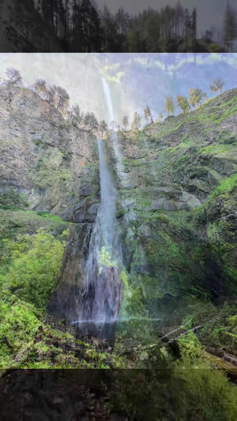
The rock behind Multnomah Falls is not just a backdrop. It is a geological record of volcanic activity stretching back roughly 400,000 years, and if you look carefully at the cliff face, you can actually count the different layers.
Six distinct flows of Columbia River Basalt make up the canyon walls here. Each layer represents a separate volcanic event, with lava cooling and hardening into dense, dark basalt before the next eruption added another sheet on top.
Over thousands of years, water carved through these stacked layers, exploiting cracks and weak points until a channel formed deep enough to sustain a permanent waterfall. The result is one of the most visually striking geological formations in the Pacific Northwest.
The basalt itself is nearly black when wet, which creates a sharp contrast against the white rushing water. Geologists point to this site as an excellent example of how volcanic landscapes evolve slowly over enormous timescales.
You are not just looking at a pretty waterfall; you are reading a 400,000-year-old story written in rock.
The Benson Bridge and the View That Stops Everyone Cold
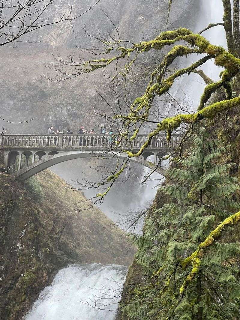
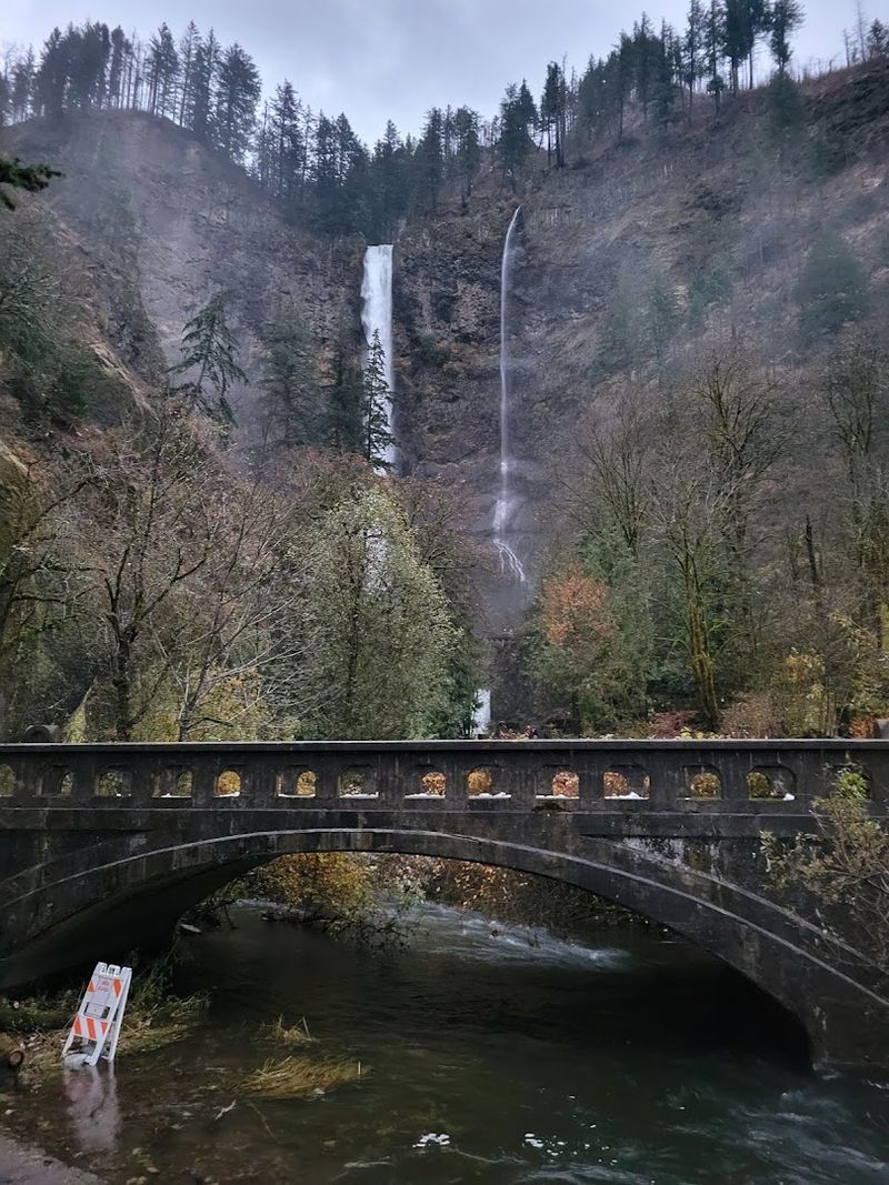
Benson Bridge is one of those structures that earns its reputation every single day. Built in 1914 and named after Portland businessman Simon Benson, this concrete arched bridge spans the gorge directly between the upper and lower falls, putting visitors right in the middle of the action.
The hike from the base to the bridge is paved and takes most people about 15 to 20 minutes at a comfortable pace. The trail is smooth enough that visitors have successfully made the climb with strollers, though the incline is steady and real.
Once you reach the bridge, the view looking back toward the upper falls is genuinely breathtaking. Mist drifts across the railings, the sound of falling water fills the air completely, and the scale of the cliff above you only becomes clear from this vantage point.
There is a well-known optical illusion you can try from the bridge. Stare at the downward rush of the falls for about a minute, then shift your gaze to the stationary rocks beside it.
The rocks will appear to drift upward, a phenomenon called the Motion Aftereffect that the waterfall produces perfectly.
The Full Hike to the Top and What Awaits Up There
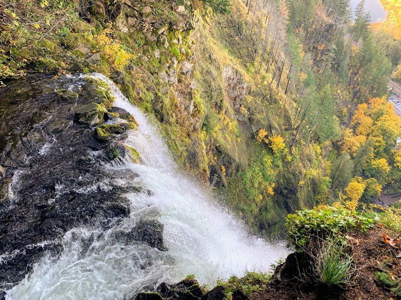
Most visitors stop at Benson Bridge and call it a day, which means the upper trail stays noticeably quieter, even when the area below is packed with people. The full hike to the top of Multnomah Falls covers about one mile of switchbacks above the bridge and takes roughly 40 minutes each way for a moderately fit person.
The trail gets steeper past the bridge, and some sections are slick when wet, so proper footwear matters more than people expect. Athletic shoes work, but hiking shoes with grip give a noticeably more confident experience on the mossy sections.
At the top, the Columbia River Gorge opens up in front of you in a way that the lower viewpoints simply cannot match. You can see the river stretching east, the Washington hills on the far bank, and the forest canopy dropping away below your feet.
There are also additional waterfalls visible along the trail above the main falls, tucked into side creeks and visible through the trees. Bringing water and a snack is a practical move, since the round trip takes most people between 90 minutes and two hours total.
Multnomah Falls Lodge: History, Food, and a Gift Shop Worth Browsing
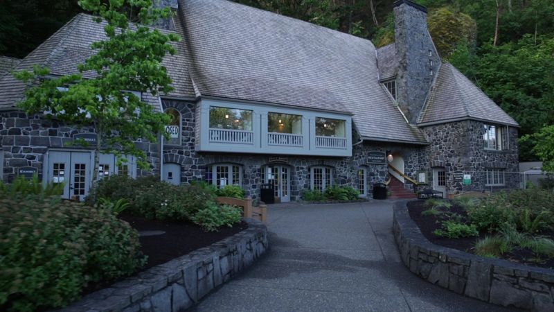
Right at the base of the falls, the Multnomah Falls Lodge has been welcoming visitors since 1925. The building itself is a piece of Pacific Northwest history, constructed from local stone in a style that feels completely at home against the basalt canyon walls surrounding it.
Inside, the lodge houses a full-service restaurant on the upper floor that serves breakfast, lunch, and dinner. The menu leans toward Pacific Northwest comfort food, and the dining room has large windows that frame the waterfall in a way that makes every meal feel slightly surreal.
A coffee stand near the entrance serves hot drinks and snacks, which is genuinely useful for early-morning arrivals who want something warm before starting the trail. The gift shop stocks a solid range of souvenirs, books about the gorge, and locally made goods that are a step above the typical tourist shop fare.
It is worth noting that the lodge is currently undergoing a multi-year renovation project that includes updated restrooms and elevator upgrades. Portable restrooms are available at the lower level during construction, and the main facilities upstairs remain functional throughout the project.
The Best Times to Visit and How to Beat the Crowds
Timing a visit to Multnomah Falls makes a measurable difference in the quality of the experience. The falls draw over two million visitors annually, which means that showing up at noon on a Saturday in July puts you in shoulder-to-shoulder territory from the parking lot to the bridge.
Early morning arrivals, before 9 a.m., consistently report a calmer, more personal experience. The light is softer in the morning, the mist catches the early sun in a way that afternoon light does not replicate, and the trail feels like it actually belongs to you for a while.
Weekday visits in spring or fall hit a sweet spot between good weather and manageable crowds. Early May is particularly well-regarded because the falls run full and powerful from snowmelt, the air is cool and fresh, and the surrounding forest is a vivid, saturated green.
Winter visits are an underrated option for people comfortable with cold weather. The crowds thin dramatically, the falls do not freeze, and the canyon takes on a moody, atmospheric quality that summer simply cannot replicate.
Late evening visits after 6 p.m. also tend to be quieter, since the permit enforcement typically eases by that hour.
Wildlife, Flora, and the Living Forest Around the Falls
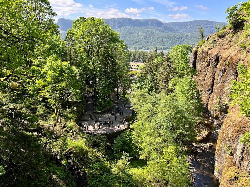
The canyon around Multnomah Falls is not just a geological feature; it is a functioning ecosystem that supports a rich variety of plant and animal life. The constant moisture from the falls creates a microclimate that allows species to thrive here that would struggle in drier parts of Oregon.
Towering Douglas firs and big-leaf maples dominate the forest canopy, and the forest floor is blanketed in sword ferns, mosses, and wildflowers that peak in late spring. The green is so dense and layered in May that the whole canyon feels almost artificially vivid.
Dippers, small gray birds that feed by walking along the streambed underwater, are commonly spotted near the base of the falls. Osprey and bald eagles are frequently seen riding thermals above the gorge.
Black-tailed deer move through the forest along the upper trail, particularly in the early morning hours.
The Columbia River Gorge National Scenic Area, which surrounds the falls, is one of the most botanically diverse regions in the Pacific Northwest. Over 800 species of wildflowers have been documented in the gorge, and the area around Multnomah Falls is one of the most concentrated spots for that diversity.
The Historic Columbia River Highway and Other Waterfalls Nearby
Multnomah Falls sits along one of the most scenic drives in the United States. The Historic Columbia River Highway, also known as U.S.
Route 30, was completed in 1922 and was specifically engineered to give motorists access to the dramatic scenery of the Columbia River Gorge.
The highway connects a series of waterfalls that can be visited in a single half-day loop. Latourell Falls, Bridal Veil Falls, Wahkeena Falls, and Horsetail Falls are all within a short drive of Multnomah, and each has its own distinct character and trail system.
Latourell Falls, the westernmost of the group, drops over a mossy basalt overhang in a single clean plunge that looks almost theatrical. Wahkeena Falls, just a mile west of Multnomah, is connected to the Multnomah trail system and can be incorporated into a longer loop hike.
The highway itself is worth slowing down for. Stone guardrails, curved viaducts, and viewpoints overlooking the Columbia River appear regularly along the route.
Many visitors use Multnomah Falls as the anchor stop on a full-day gorge itinerary, working their way through several waterfalls before ending the day with the big one.
Practical Tips Every First-Time Visitor Should Know
A few practical details can turn a frustrating visit into a smooth one. The timed-entry permit system runs from May through October and requires a $2 reservation made in advance through Recreation.gov.
Permits are tied to specific time windows, and they sell out on peak weekends, sometimes days in advance.
Non-slip footwear is not optional on the upper trail. The path above Benson Bridge gets genuinely slick from mist and runoff, and regular sneakers can feel unreliable on the steeper sections.
Hiking shoes or trail runners with decent grip make a real difference in confidence and safety.
Cell service in the gorge can be inconsistent, so downloading offline maps before leaving Portland is a smart move. Bringing your own water is also recommended, since the only food and drink options on site are at the lodge and the coffee stand at the base.
Restrooms are available inside the lodge, and portable facilities are stationed at the lower level during the current renovation. If you have young children or anyone in the group who needs a restroom stop, plan that before you start the trail rather than after.
The falls reward preparation generously.
Share this story