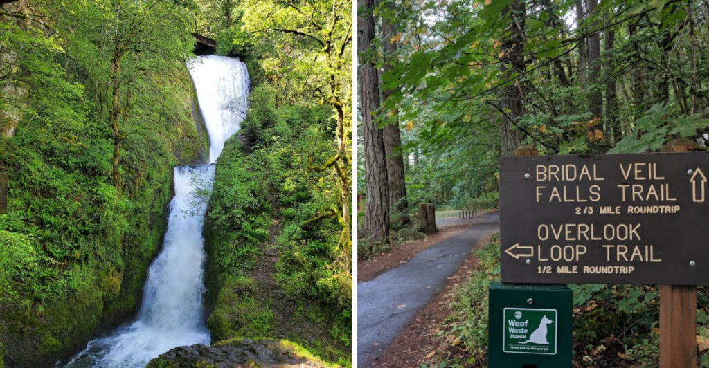
There is a waterfall in Oregon that most people drive right past without knowing it exists. It spills over basalt rock into a mossy canyon, sending a cool mist across a wooden bridge below, all while sitting on land that once rumbled with the sounds of a working lumber mill.
The history hiding beneath your hiking boots here is just as interesting as the view waiting at the bottom. This spot along the Historic Columbia River Highway earns its near-perfect rating for good reason, and once you see it, you will completely understand why people keep coming back.
Where Exactly You Are Going
The full address is 46701 Historic Columbia River Hwy, Corbett, OR 97019, and that highway number alone should tell you something exciting is waiting. This is not some random pull-off on a back road.
The Historic Columbia River Highway, also known as Highway 30, is one of the most celebrated scenic drives in the entire Pacific Northwest.
Bridal Veil Falls State Scenic Viewpoint sits roughly 30 miles east of Portland, which makes it an easy day trip from the city without any major planning required. You are technically inside the Columbia River Gorge National Scenic Area, a federally protected stretch of river canyon that draws visitors from around the world.
The park is managed by Oregon State Parks, and you can reach them at 1-800-551-6949 or visit oregonstateparks.org for current conditions. The park opens daily at 7 AM and closes at 6 PM every day of the week, year-round.
Arriving early on weekends is a smart move since the parking lot fills up faster than you might expect on sunny days.
The Lumber Mill That Once Stood Here
Long before hikers laced up their boots here, this land was buzzing with industrial activity. The Bridal Veil Lumber Company operated a mill on this very site from the late 1800s into the mid-20th century, and the town of Bridal Veil grew up around that operation.
Workers cut timber from the surrounding forested slopes and processed it right here along the gorge. The mill used a flume system to move logs, and a company town with homes, a store, and a post office once stood nearby.
At its peak, Bridal Veil was a fully functioning community built entirely around the timber trade.
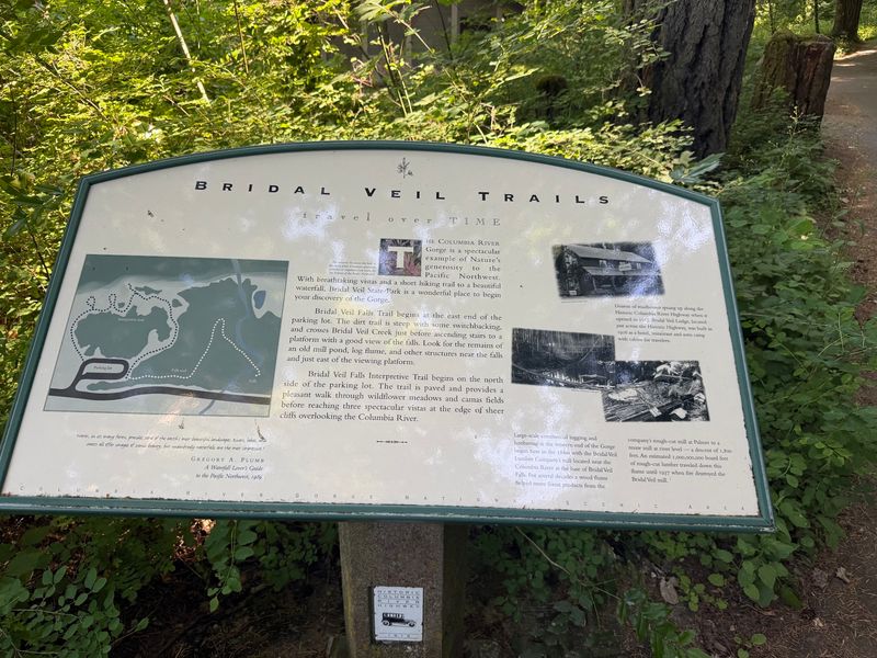
After the mill closed, the structures were gradually reclaimed by nature, and Oregon State Parks eventually took over the land. Today, interpretive signs along the paved upper trail share pieces of that industrial past, giving the walk a layered feeling that goes well beyond just a pretty waterfall.
The contrast between the old mill history and the peaceful forest that has grown back in its place is genuinely striking to think about while you walk.
Two Trails for Two Very Different Experiences
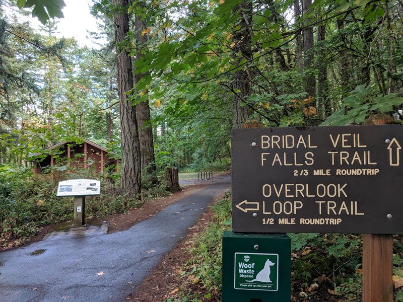
One of the first things you notice at the trailhead is that there are actually two separate trails here, and they offer completely different experiences. The waterfall trail is the one most people come for, and it descends about 0.6 miles round trip down a series of switchbacks to the base of the falls.
The upper trail is paved and relatively flat, looping through a meadow area with interpretive signs about the mill history and offering open views toward the Columbia River. That upper loop is accessible and great for anyone who prefers a gentler surface underfoot.
Both trails start from the same parking area, so you can easily combine them into one visit without backtracking to your car.
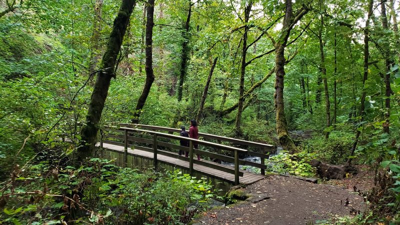
The waterfall trail starts on pavement but transitions to packed dirt and rock as you descend, with a few sections that can get slick after rain. Benches are placed at each switchback turn, which are genuinely appreciated on the way back up.
The round trip on the waterfall trail takes most people between 30 and 45 minutes at a relaxed pace, making the whole outing feel very manageable.
The Waterfall Itself Up Close
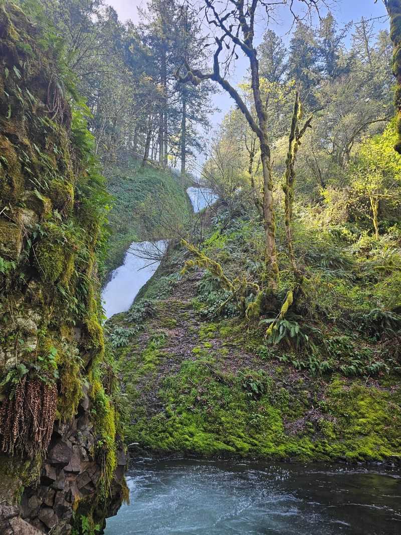
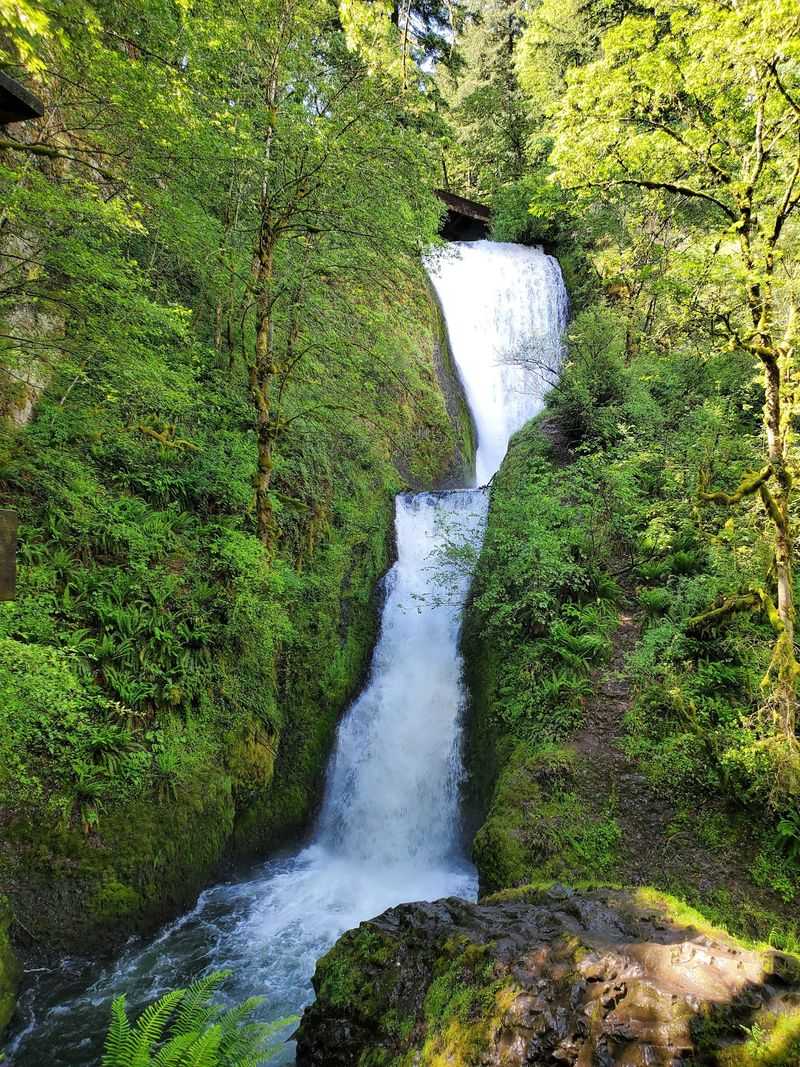
The falls drop in two distinct tiers over dark basalt columns, which is a rock formation created by ancient volcanic lava flows. The water fans out as it falls, creating a soft, veil-like curtain effect that explains the name perfectly.
Up close, the mist from the lower tier reaches the wooden bridge and viewing platform, giving you a refreshing cool feeling even on warmer days.
The sound is one of the best parts. The rushing water echoes off the canyon walls in a way that feels almost surrounding, and it is the kind of sound that makes it very easy to just stand there longer than you planned.
A bridge spans the creek just below the falls, and from that spot you get a direct face-on view that photographs beautifully in almost any light.
The falls are not enormous by Pacific Northwest standards, but their setting inside a narrow, fern-lined canyon makes them feel intimate and special in a way that larger, more crowded waterfalls sometimes do not. The basalt rock face behind the water is covered in dark green moss, which adds rich color to every photo you take from the platform.
What the Parking Situation Actually Looks Like
Parking at Bridal Veil Falls is free, which is a genuinely pleasant surprise compared to many other popular spots along the Columbia River Gorge. The paved lot holds a limited number of vehicles, and on busy weekend mornings it can fill up by mid-morning.
Arriving before 9 AM on Saturdays and Sundays gives you the best chance of snagging a spot without stress.
When the main lot is full, visitors often park along the road loop that circles the lot area. That adds only a short extra walk to reach the trailhead.
Clean restrooms with flush toilets sit right next to the parking area, which is a detail that makes a real difference when you are planning a longer day of gorge exploration.
There is no fee station or pay kiosk, so you will not need to dig around for cash or a credit card before hitting the trail. The park does ask visitors to follow Leave No Trace principles and to stay on marked trails.
Weekday mornings are consistently the quietest times to visit, and the light filtering through the trees at that hour has a quality that weekend crowds rarely get to enjoy.
Wildlife and Plants Along the Way
The trail down to the falls passes through a genuinely lush stretch of Pacific Northwest forest, and the plant life alone is worth paying attention to as you walk. Sword ferns line the path in thick clusters, and in spring the trailside fills with wildflowers including trillium and various native blooms that add color to the green surroundings.
One plant you absolutely want to watch for is poison oak. Signs along the trail warn hikers specifically about it, and for good reason.
Poison oak grows close to the path in several spots, particularly on the lower section near the falls. Wearing long pants and staying on the trail is the simplest way to avoid any unpleasant contact.
Birds are active throughout the forest, and you might hear the drumming of a woodpecker or the call of a Steller’s jay overhead. The creek at the bottom supports its own small ecosystem, and the mossy rock walls near the falls often have tiny ferns and wildflowers growing directly out of the stone.
Dogs are welcome on the trail as long as they are kept on a leash, which most visitors seem to follow without any issues.
Columbia River Gorge Views From the Upper Trail
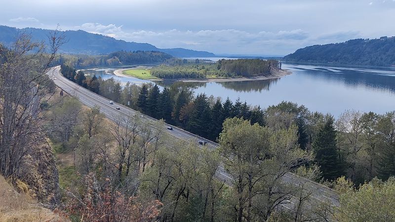
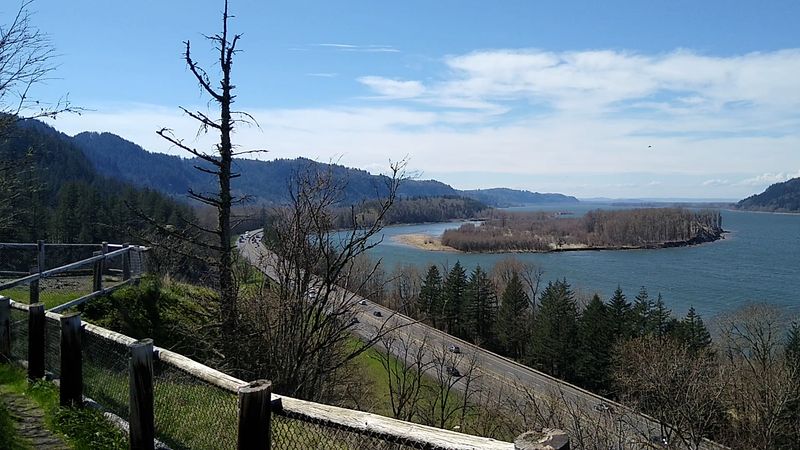
The paved upper trail at this park does something the waterfall trail does not: it opens up to wide, sweeping views of the Columbia River and the gorge walls on the Washington side. That river is enormous up close, stretching several hundred feet across with forested cliffs rising on both banks.
Picnic tables are scattered along the upper loop, and several overlook spots give you a chance to sit and take in the view without rushing. The interpretive signs posted along this trail explain the geology of the gorge, the history of the mill, and some of the native plants you are walking past.
Reading them as you go turns a short stroll into something genuinely educational.
Spring is an especially rewarding time to walk the upper trail because the meadow areas fill with wildflowers, and the contrast of the blooms against the deep blue of the river below is one of those views that sticks with you. Even on overcast days, the gorge has a dramatic quality that feels almost cinematic.
The upper trail is also significantly less crowded than the waterfall trail, which means you often have those river views entirely to yourself.
The Abandoned Building and Train Tracks Nearby
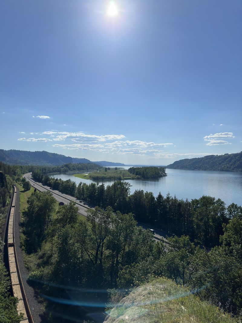
Most visitors head straight for the waterfall and never explore the other direction from the trailhead. Take the opposite fork and you will eventually come across the remnants of the old mill site, including an abandoned building covered in layers of graffiti that has become its own kind of visual record of everyone who has passed through over the years.
Keep walking past that building and you reach the old railroad tracks that once served the timber industry in this area. The tracks are still there, running along the base of the gorge, a physical reminder of how connected the mill operation was to the broader regional economy of the early 20th century.
This part of the property has a completely different atmosphere from the waterfall trail. The forest has grown back thick and wild around the old structures, and the combination of industrial ruins and reclaimed nature gives the area a quiet, slightly eerie quality that feels very different from the cheerful waterfall scene just a short distance away.
It is not a heavily promoted part of the park, but curious visitors who wander that way tend to find it surprisingly memorable and worth the extra few minutes of walking.
Best Times to Visit and What to Expect Each Season
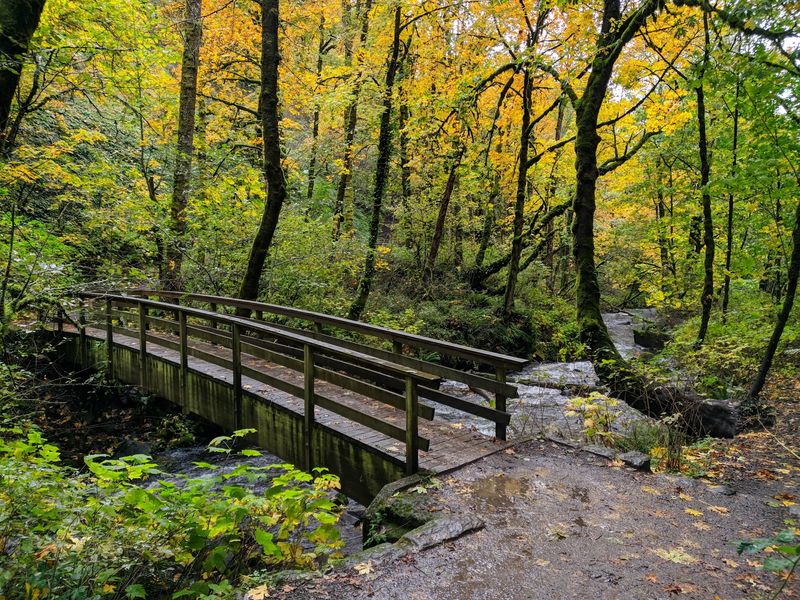
Spring brings the falls to their most dramatic flow levels, fed by snowmelt and rain from the surrounding mountains. The forest is intensely green in April and May, and wildflowers appear along both trails in a way that makes every step feel rewarding.
This is widely considered the peak season for photography at the falls.
Summer is the busiest time of year, with the parking lot filling early on weekends and the trail seeing a steady stream of visitors throughout the day. The falls are still beautiful in summer, though the flow is noticeably lower than in spring.
Arriving before 9 AM in July and August is the single best strategy for a peaceful visit.
Fall brings a quieter crowd and a shift in the forest colors, with the surrounding trees turning gold and orange while the moss stays vivid green. Winter visits are possible since the park is open year-round, and the falls can look especially dramatic against a grey sky with no other hikers around.
Waterproof footwear is a smart call from October through March, when the trail surface tends to hold moisture and can get muddy in sections near the bottom.
How This Spot Fits Into a Gorge Road Trip
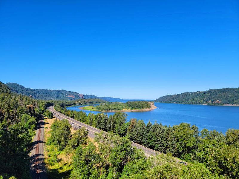
Bridal Veil Falls sits on one of the most waterfall-dense stretches of highway in the United States. Within a few miles in either direction along the Historic Columbia River Highway, you can visit Latourell Falls, Shepperds Dell, Wahkeena Falls, and Multnomah Falls, which is the tallest waterfall in Oregon and one of the most visited natural sites in the entire country.
Most visitors fold Bridal Veil into a longer gorge day trip, stopping at two or three waterfalls in sequence. The trail here is short enough that it does not eat up much time, making it easy to include without throwing off the pace of a full day of exploring.
Multnomah Falls is only a few minutes east by car, and the contrast between the two sites is interesting since Multnomah is grand and crowded while Bridal Veil feels quieter and more tucked away.
The Historic Columbia River Highway itself is worth driving slowly and deliberately, with pullouts and viewpoints offering gorge panoramas at regular intervals. Planning the waterfall stops from west to east and finishing at Crown Point Vista House gives the day a natural arc with a strong finish.
A full gorge loop from Portland and back can be done comfortably in five to six hours with stops at three or four sites.
Share this story