Nobody hired an engineer for these bridges. Water, wind, and plenty of patience did all the heavy lifting, and the results still stop travelers in their tracks.
Some of these stone spans are taller than a 20-story building, while others are small enough to spot from a quick roadside stroll. One was once owned by a future president who paid about 20 shillings for it.
Another lost roughly 4,000 tons of rock in a single event, proving that nature is still editing its work. You will find bridges carved from sandstone, limestone, travertine, and even cemented gravel.
Some sit in hot desert canyons, others hide in leafy forests, and a few stand right on the ocean shore. The list below covers 15 standout formations across the country, with key facts, trail tips, and the best times to visit.
Lace up your hiking shoes, because the first stop is one of the largest natural bridges on the planet.
1. Natural Bridge, Natural Bridge, Virginia
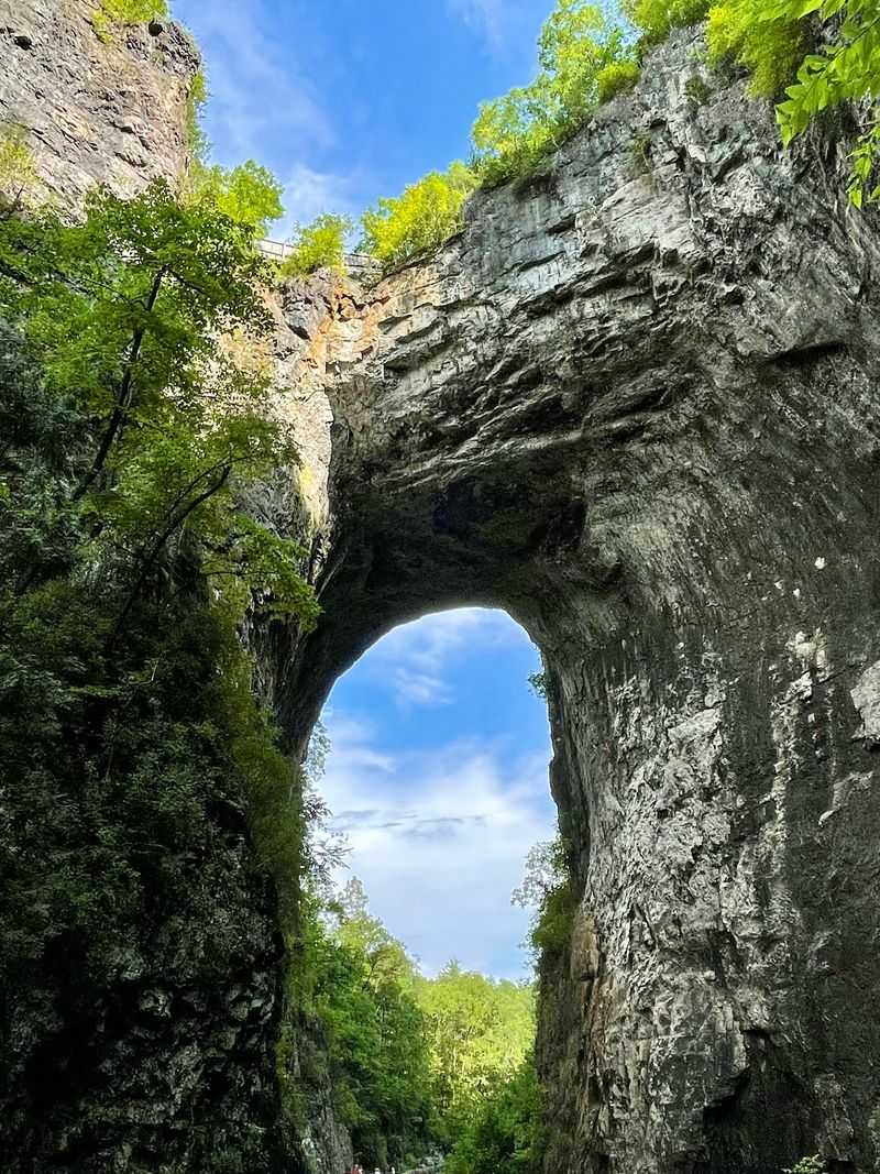
Thomas Jefferson bought this bridge in 1774 for 20 shillings, which might be the best real estate deal in American history. The purchase from King George III included 157 acres around the formation.
Jefferson called it the most sublime of nature’s works. He even built a two-room log cabin and kept one room for guests, making the site one of America’s earliest tourist stops.
The limestone arch rises about 215 feet above Cedar Creek and spans roughly 90 feet. It became a National Historic Landmark in 1998.
Since 2016, Virginia has managed the site as a state park. The accessible Cedar Creek Trail leads right beneath the arch.
Keep walking past the bridge to reach Lace Falls, a 30-foot cascade. The easy path makes this a great pick for families exploring the Blue Ridge region.
2. Tonto Natural Bridge, Pine, Arizona
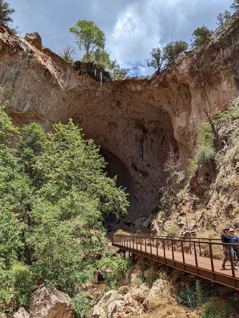
Forget the cactus postcards for a moment. Arizona hides a leafy canyon where a giant travertine bridge spans Pine Creek, and it surprises almost everyone who visits.
Travertine is a type of limestone left behind by mineral-rich water. Over time, the flowing creek carved a tunnel through it, creating the bridge seen today.
Tonto Natural Bridge State Park offers several overlooks near the parking area. These spots give a solid view without much effort.
Hikers wanting a closer look can take steep trails down into the canyon. From below, the towering walls, trees, and seasonal waterfalls look even more impressive.
Wear shoes with good grip, since rocks near the water can be slippery. The climb back up is steeper than the walk down, so save some energy.
Arrive early on weekends. Parking fills quickly during busy months.
3. Natural Bridge, Slade, Kentucky
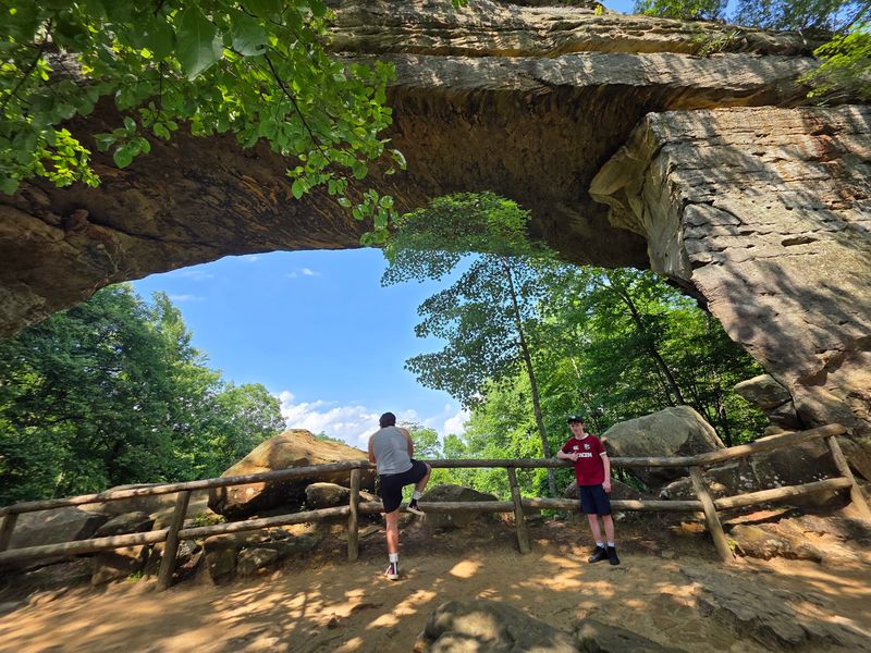
Some people hike to this bridge, and others ride a chairlift to it. Kentucky’s Natural Bridge lets visitors pick their own adventure level.
The sandstone arch stretches 78 feet across and stands 65 feet tall. It sits among the cliffs of the Red River Gorge region, a favorite area for hikers and climbers.
Several forest trails climb toward the formation. The Original Trail is the most direct route, though it includes plenty of uphill steps.
A seasonal skylift carries guests toward the upper viewpoints. It is a handy option for younger kids or anyone saving their legs for later.
Visitors can walk across the top of the bridge for wide views of the hills. Stay behind railings near the edges.
Autumn is the star season here. The hillsides turn red, orange, and gold, so expect busy trails in October.
4. Sipapu Bridge, Lake Powell, Utah
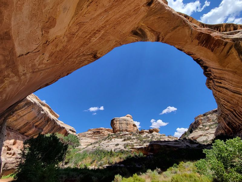
Sipapu is a Hopi word meaning the place of emergence, or the opening between two worlds. William Douglas gave the bridge that name while leading a government survey party in 1908.
The name fits. Sipapu is the largest of the three major bridges in Natural Bridges National Monument.
It stands 220 feet tall with a span of 268 feet. Water flowing through White Canyon shaped its huge rounded opening over a very long time.
A scenic overlook gives a broad view from the rim. It works well for quick visits or anyone short on time.
Adventurous hikers can take the trail down into the canyon. The route includes three wooden ladders and two flights of metal stairs, so it is not for anyone afraid of heights.
Bring plenty of water. Shade is limited, and the climb out takes real effort.
5. Natural Bridge, Natural Bridge, Alabama
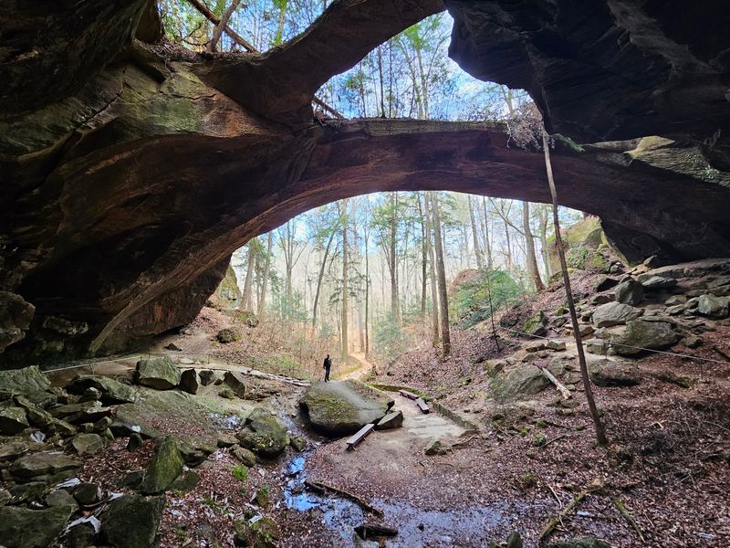
East of the Rocky Mountains, few rock arches can match the length of this one. Alabama’s Natural Bridge stretches 148 feet across and rises 60 feet high.
Its story began about 200 million years ago. Water wore away the softer sandstone, leaving behind tougher veins of iron ore that now form the bridge.
Forest wraps around the whole site. That shady setting gives it a very different look from the bare desert arches out West.
An easy one-mile loop trail leads toward and beneath the bridge. Families with young kids can usually finish it without trouble.
Keep an eye out for a rock formation that looks like a carved head. Bird watchers also enjoy the quiet trails.
Walking on top of the bridge is not allowed for safety reasons. Admire it from below instead.
6. Natural Bridges, Brookings, Oregon
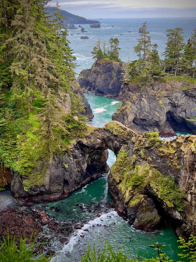
The Pacific Ocean has been running a sculpture class on the Oregon coast for thousands of years. Its best work sits at the Natural Bridges viewpoint near Brookings.
This stop lies within Samuel H. Boardman State Scenic Corridor.
The area features seven well-known arched rock formations, plus blowholes that spray water during strong waves.
A short trail from the parking lot leads to the main overlook. It takes only a few minutes, making it an easy stop on a Highway 101 road trip.
Unofficial paths lead down toward the rocks. Skip them, since they are steep and unsafe.
The official viewpoint already shows off the coastline well. Bring binoculars for a closer look at the arches and seabirds.
Morning fog is common on this stretch of coast. Afternoon visits often offer clearer views.
7. Kachina Bridge, Lake Powell, Utah
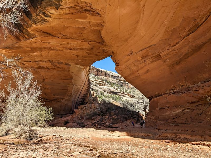
In 1992, roughly 4,000 tons of rock dropped from the inside of Kachina Bridge. Nobody had to wonder whether these formations still change over time after that.
Kachina stands 210 feet tall and spans 204 feet. Its sandstone is unusually thick, which makes it look sturdier than its neighbors in Natural Bridges National Monument.
Geologists consider it middle-aged. It is older than Owachomo but younger than Sipapu.
A viewpoint along the monument’s scenic drive shows the bridge and the canyon around it. The drive connects all three bridges, so visiting them in one day is easy.
Hikers can follow a trail down to the bridge’s base for a closer view. The path is steep in places, so take it slow.
Look for ancient rock art near the base. Please view it without touching.
8. Rainbow Bridge, Lake Powell, Utah
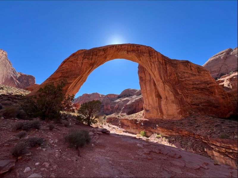
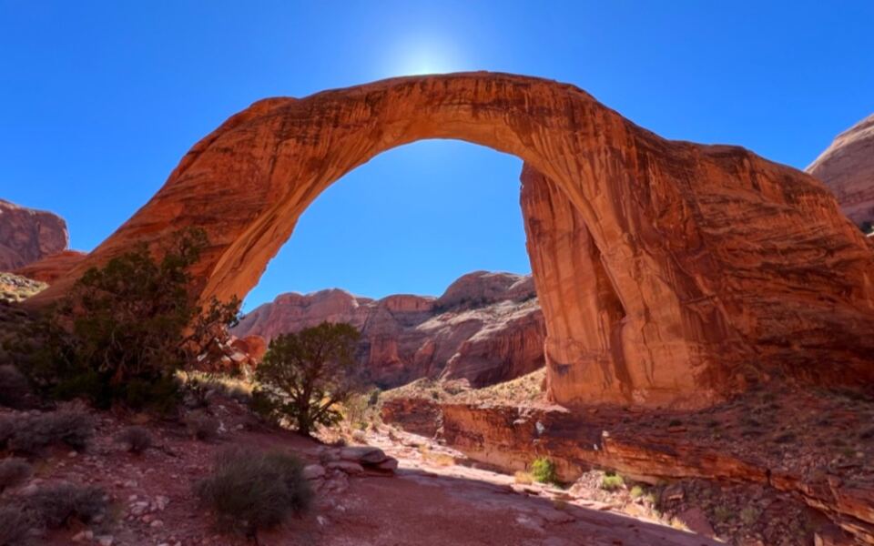
At 290 feet tall, this sandstone giant could nearly fit the Statue of Liberty underneath it. Rainbow Bridge ranks among the largest natural bridges in the world, and its span stretches 275 feet across a remote canyon.
Several Native American tribes consider the bridge sacred. Visitors are asked to view it respectfully and avoid walking beneath it.
Getting there takes real planning. For years, most people arrived by boat on Lake Powell, but low water levels have made that route unreliable.
Permitted backcountry hiking is now the steadier option. The trails cross Navajo Nation land, so a hiking permit from the tribe is required before you go.
Pack extra water, sun protection, and a good map. Spring and fall bring the most comfortable hiking temperatures.
The long trip is part of the reward. Few landmarks in Utah feel this hard-earned.
9. Natural Bridge, Clinton, Arkansas
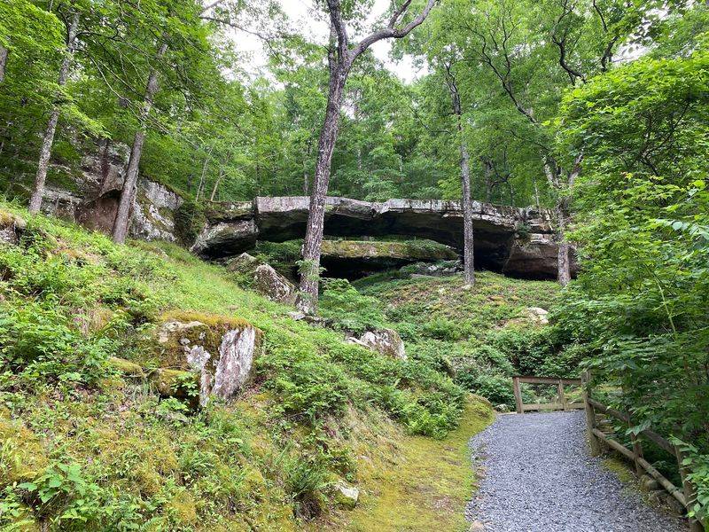
Outlaw legend Belle Starr may have hidden near this bridge, according to local rumor. Even without the gossip, the site has plenty of history.
The Natural Bridge of Arkansas is a weathered sandstone formation about 100 to 120 feet long. It crosses a small wooded ravine in the Ozarks near Clinton.
Quapaw Indians used the area long ago. Later, pioneers crossed Little Johnny Creek on the bridge, and loggers followed.
Today, the site is privately operated and full of old-fashioned charm. Two century-old hand-hewn cabins stand on the property, and one serves as the entrance and gift shop.
Inside, visitors can browse period artifacts from Ozark life. It is a fun stop for history fans.
Walking on the bridge is not allowed. Plan for a short, relaxed visit rather than a long hike.
10. Natural Bridge, Death Valley National Park, California
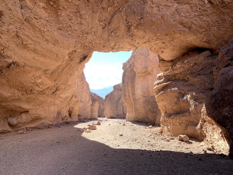
Sandstone gets most of the attention in the West, but Death Valley’s bridge is built from something rougher. It formed from rock, gravel, and sediment cemented together.
Geologists call this material alluvial deposits. Flash floods and erosion carved through it over a long time.
A one-mile round-trip hike leads up a rocky wash to the bridge. The formation rises about 35 feet above the canyon floor and is roughly 35 feet thick.
Keep walking past the bridge for more surprises. The canyon shows off dry waterfalls, vertical chutes, and hanging canyons.
Timing matters a lot here. Summer temperatures can climb above 130 degrees Fahrenheit.
Plan your trip between mid-fall and mid-spring. Bring more water than you think you need, along with a hat and sturdy shoes for the loose gravel.
11. Natural Bridge, North Freedom, Wisconsin
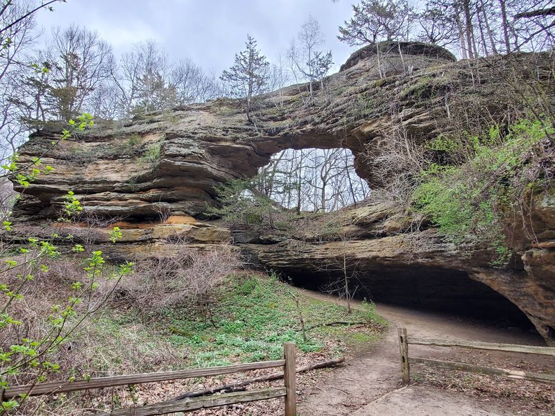
Glaciers flattened much of the Midwest during the last Ice Age, but they missed this spot. That lucky escape helped Wisconsin’s largest natural arch survive.
Wind and weathering shaped the sandstone opening. It measures 25 feet wide and 15 feet high inside, with its top about 35 feet above the ground.
The arch overlooks the Raddatz Rockshelter, an important archaeological site. Artifacts found there date back 9,000 to 12,000 years.
That makes it one of the oldest known places of human living in the upper Midwest. History buffs will find plenty to think about here.
Natural Bridge State Park sits among quiet wooded hills. A hiking trail leads to the arch, and the park rarely feels crowded.
Stay on marked trails during your visit. The rule helps protect the shelter and its valuable history.
12. Owachomo Bridge, Lake Powell, Utah
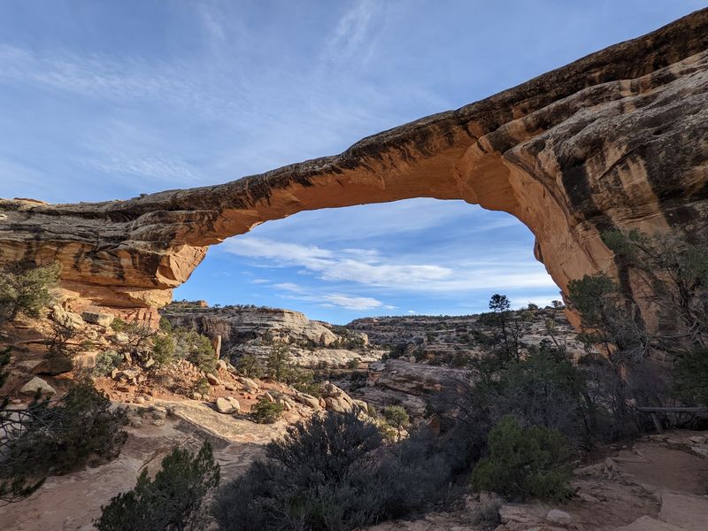
Nine feet thick at its narrowest point. That slim measurement makes Owachomo the most delicate of the three big bridges at Natural Bridges National Monument.
Its span still stretches 180 feet across. The thin shape makes it one of the most photographed features in the park.
Owachomo is also the oldest of the trio. Erosion has worn it down further than Sipapu or Kachina, which explains its slender look.
Good news for tired legs: the trail is short. A half-mile round trip brings visitors right up to the bridge.
That makes it the easiest bridge in the monument to see up close. It is a smart choice for families or anyone short on time.
The monument is also known for very dark night skies. Staying after sunset offers a great bonus view of the stars.
13. Natural Bridges State Beach, Santa Cruz, California
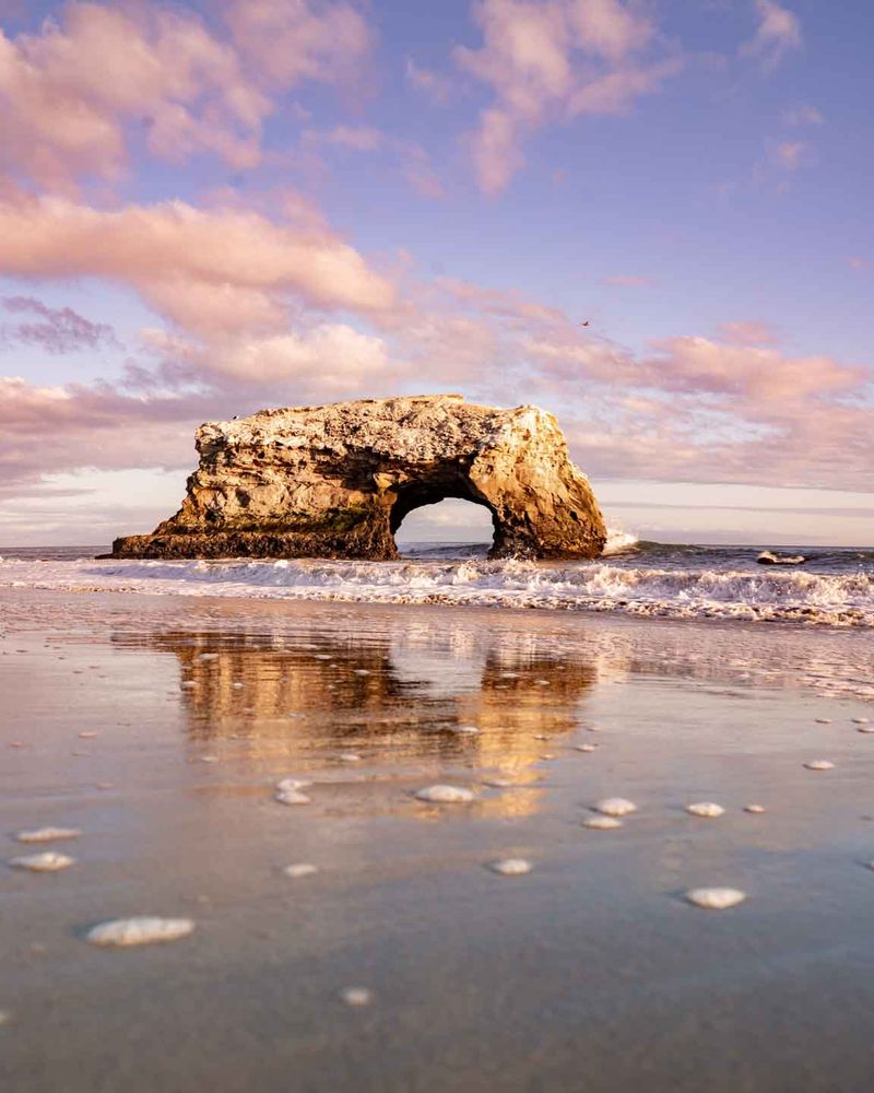
Once upon a time, this beach had three arches. Today, only the middle one remains, and it is the reason the park keeps its name.
The outer arch fell in the early 1900s. A strong storm in 1980 brought down the inner arch.
Ocean waves carved the surviving arch from coastal mudstone over millions of years. It now stands just offshore as one of Santa Cruz’s best-known landmarks.
The arch is only part of the fun. Rocky tide pools hold mussels, sea stars, and sea anemones, so check a tide chart and visit at low tide.
From October through early February, a eucalyptus grove fills with monarch butterflies. Up to 150,000 of them may gather there.
Bring a light jacket, since coastal weather changes fast. Watch your step on the wet rocks.
14. Natural Bridge Caverns, San Antonio, Texas
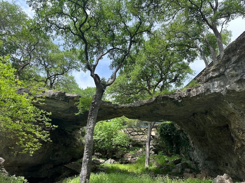
Most bridges on this list lead across something. This one in Texas leads down into an entire underground world.
Natural Bridge Caverns gets its name from a limestone bridge that spans the entrance to the cave system. It sits just outside San Antonio.
The bridge is only the opening act. Guided tours head deep underground into huge chambers filled with stalactites, stalagmites, and other rock formations.
Here is an easy trick for remembering the difference. Stalactites hang tight from the ceiling, while stalagmites rise from the ground.
Tours run throughout the year, and the cave stays fairly warm and humid. Wear comfortable shoes with good grip, since paths can be damp.
Buying tickets ahead of time is a smart move during holidays and summer. Popular tour times often sell out.
15. Arch Rock, Mackinac Island, Michigan
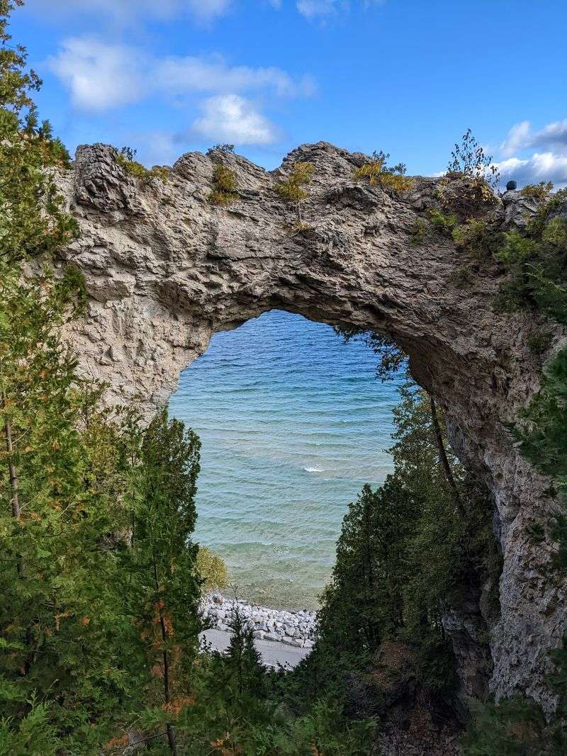
Cars are banned on Mackinac Island, so reaching Arch Rock means walking, biking, or riding behind a horse. That old-school travel style fits this landmark well.
The limestone arch rises about 146 to 150 feet above Lake Huron. Its opening spans roughly 50 feet at the widest point.
Wind and water wore away softer rock long ago, leaving harder breccia behind. Arches like this are rare in the Great Lakes region.
Native Americans saw it as a place of spiritual power. Later, the famous French writer Alexis de Tocqueville came to admire it.
Arch Rock helped lead to the creation of Mackinac National Park in 1875. That later became Mackinac Island State Park in 1895.
Renting a bike is a popular way to visit. Expect a short climb near the top.
Share this story