Most travelers heading to Central and South America have a shortlist ready: Machu Picchu, the Galapagos, Patagonia, Costa Rica’s national parks. Those are all spectacular, but the region holds dozens of places that rarely make it onto a standard itinerary.
Remote canyons, ancient rock paintings, jungle waterfalls, and villages built entirely on wooden walkways are out there waiting, often with far fewer crowds and far more breathing room. This list covers 20 destinations that remain comparatively overlooked by international travelers in 2026.
Some require boats, guides, or four-wheel-drive vehicles to reach. A few demand advance planning.
All of them offer something genuinely different from the usual highlights, and every place on this list has been confirmed as a legitimate, currently active visitor destination using official tourism and government sources.
Semuc Champey, Guatemala
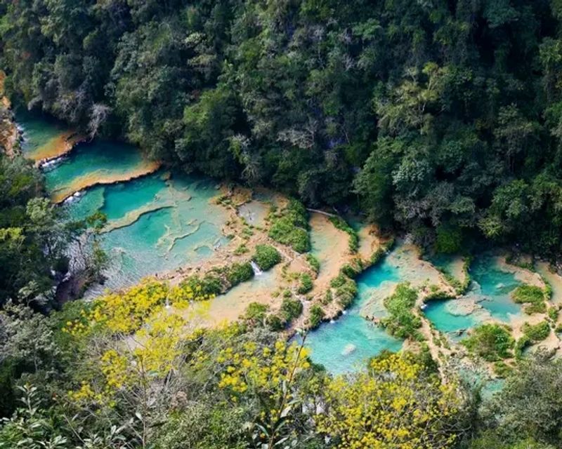
Turquoise water sitting inside a limestone bridge above a rushing river sounds like something from a nature documentary, but Semuc Champey is very real and completely swimmable. Located deep in Alta Verapaz, the site features a chain of stepped pools formed over the Cahabón River, surrounded by dense tropical forest on every side.
One of the most popular activities is climbing to a lookout above the entire formation, where the full chain of blue-green pools becomes visible at once. Guatemala’s protected-area tourism authority continues to list Semuc Champey as an active visitor destination in 2026.
Road conditions during the rainy season can become challenging, so a four-wheel-drive vehicle is recommended. Water shoes or slip-resistant footwear are also important because the limestone surfaces get extremely slick.
Its remote location in Alta Verapaz keeps visitor numbers far lower than Antigua or Lake Atitlán, which makes the experience feel genuinely unhurried.
Cockscomb Basin Wildlife Sanctuary, Belize
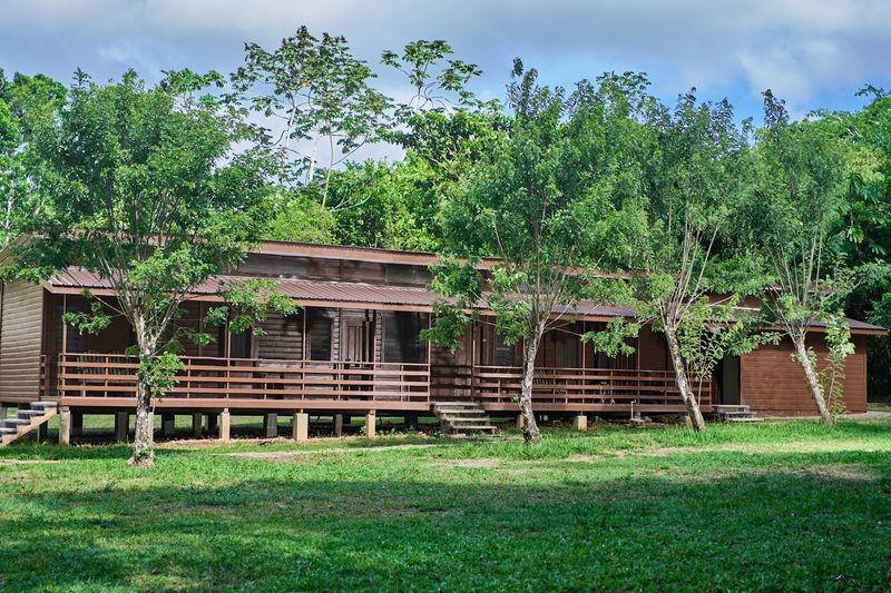
Belize’s coastline and cayes get most of the international attention, but inland lies one of the most significant jaguar conservation areas in the world. Cockscomb Basin Wildlife Sanctuary covers approximately 128,000 acres in the Maya Mountains, making it a serious protected landscape rather than a small reserve.
Actually spotting a jaguar is difficult, though guided evening walks give visitors a realistic chance of encountering nocturnal wildlife. Day visitors still have plenty to explore, with trails leading through tropical forest toward viewpoints, waterfalls, and natural swimming areas.
More than 300 bird species have been recorded across the sanctuary, which adds another strong reason to visit beyond the jaguar connection. Belize’s official tourism organization actively promotes Cockscomb for hiking, wildlife watching, and guided excursions in 2026.
For travelers who want to experience Belize beyond its famous reef, this inland reserve offers a genuinely different perspective on the country.
El Imposible National Park, El Salvador
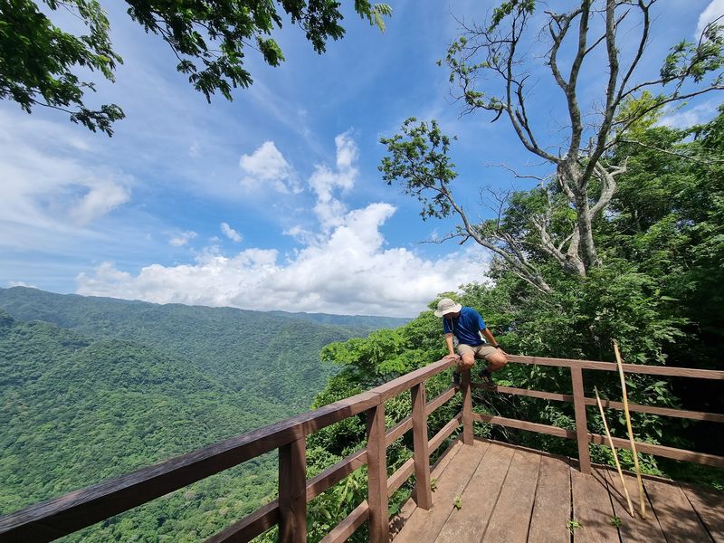
The name comes from a historically treacherous mountain passage that coffee farmers once had to navigate while transporting their harvest through the rugged terrain of western El Salvador. That difficult geography is exactly what kept this landscape intact, and today El Imposible is one of the country’s most significant protected forest areas.
The park sits near the Guatemalan border and offers forest trails, wildlife observation, canyon viewpoints, and a dramatically different experience from El Salvador’s well-known surf towns. El Salvador’s official tourism portal lists El Imposible as open in 2026 and provides information on permits and cabin reservations.
Travelers planning longer hikes should arrange their visit properly rather than assuming every section of the protected area can be explored independently. For anyone who has only experienced El Salvador’s Pacific coast, this national park introduces a completely different side of the country, one defined by altitude, forest cover, and genuine wildness.
Somoto Canyon, Nicaragua
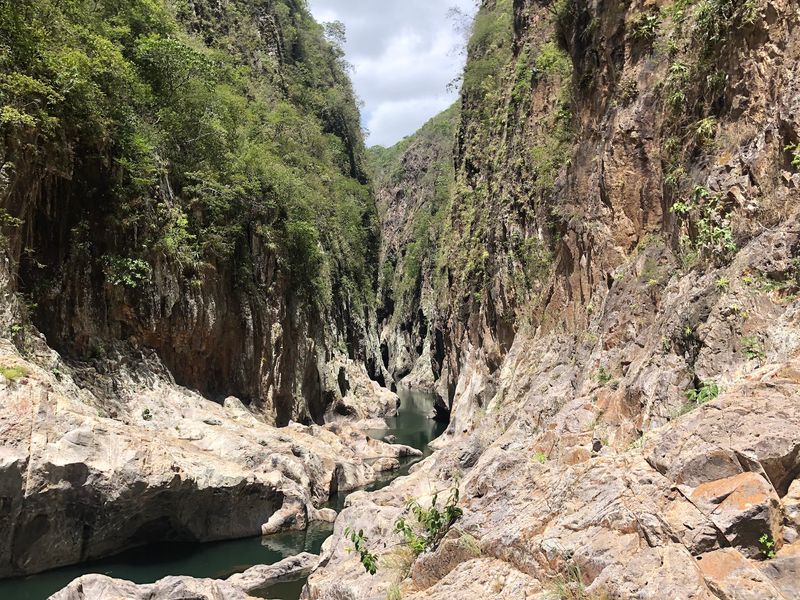
Rock walls rising more than 100 meters above a narrow river channel create one of Central America’s more dramatic natural corridors, and most international travelers have never heard of it. Somoto Canyon formed millions of years ago in northern Nicaragua, and exploring it can involve hiking, swimming through tight sections, floating downstream, rappelling, and jumping from rocks where conditions allow.
Nicaragua’s tourism authority offers routes of varying difficulty, all conducted with authorized local guides. The destination is clearly active in 2026, with Nicaragua’s tourism institute holding a major adventure trail event at Somoto Canyon in May that drew hundreds of participants.
For travelers who associate Nicaragua primarily with colonial cities like Granada and León, or with Pacific volcanoes, this canyon offers something completely different. The combination of ancient geology, river navigation, and physical challenge makes it one of the region’s more memorable outdoor experiences for people willing to get genuinely wet.
Pulhapanzak Falls, Honduras
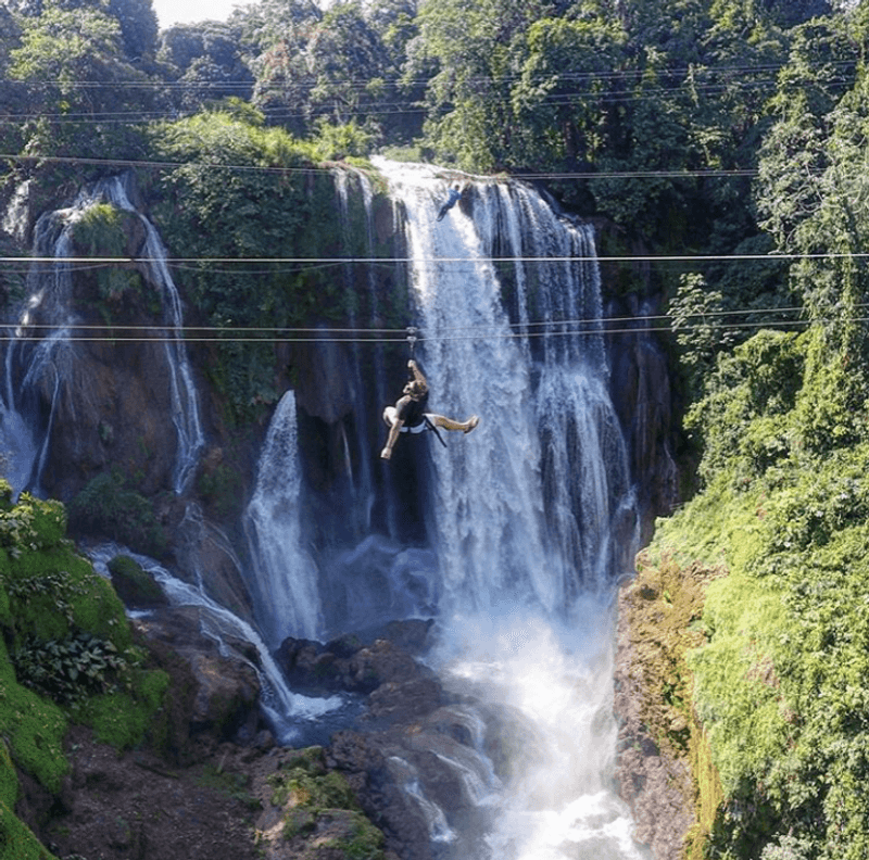
At roughly 43 meters, Pulhapanzak is one of Honduras’s most impressive waterfalls, yet it sits outside the main tourist circuit in a way that keeps crowds manageable. The Río Lindo drops through dense vegetation near Lake Yojoa, and the site offers considerably more than a viewpoint and a photograph.
Current Honduran tourism information highlights zipline activities, river tubing, and lodging options around the property, making it a practical base for a day or longer. What makes Pulhapanzak particularly interesting, though, is its archaeological dimension.
Honduras’s official tourism site notes traces of a pre-Columbian stone walkway and a plaza surrounded by four mounds at the site.
That combination of natural and historical features in one location is unusual and genuinely worth the detour. Pulhapanzak continues to be actively promoted as a visitor destination in 2026, and its position between Honduras’s major cities and the Lake Yojoa region makes it a logical stop along that route.
Bajos del Toro, Costa Rica
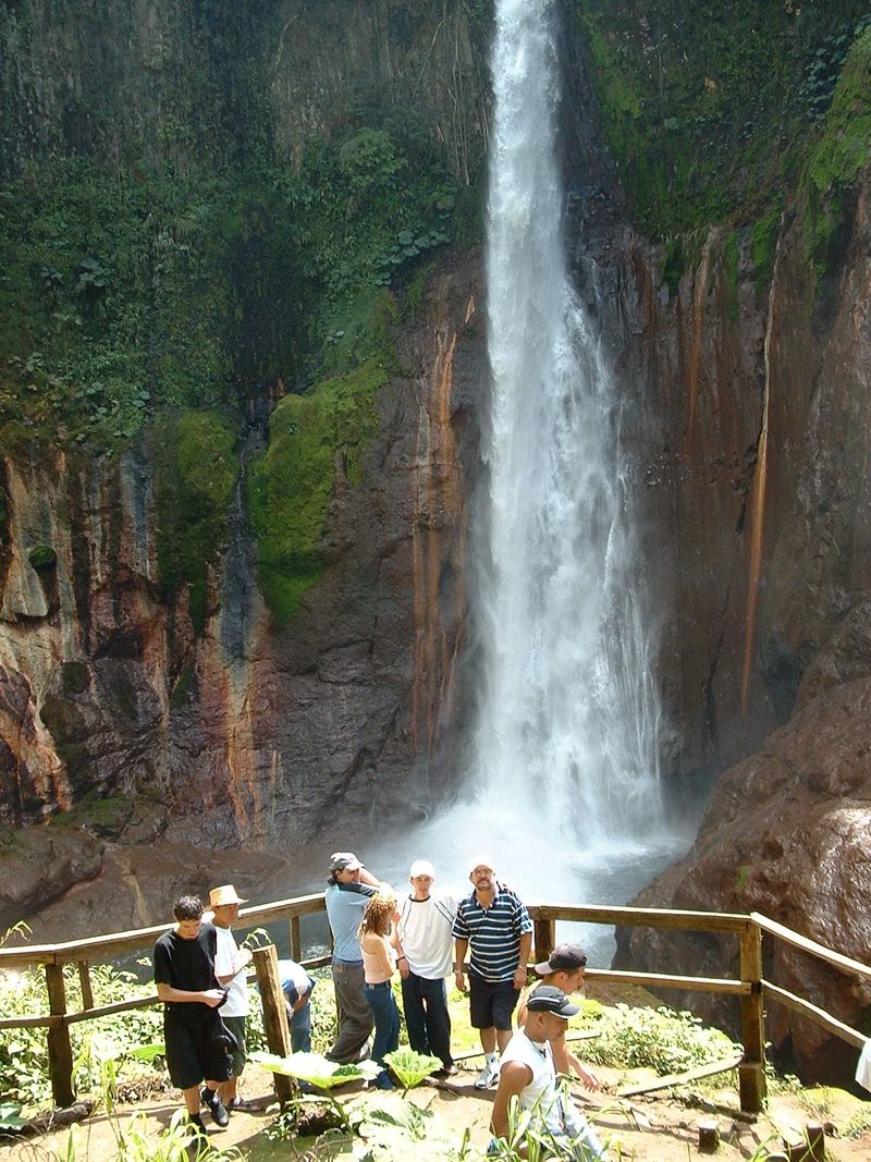
Costa Rica’s most famous waterfalls attract enormous visitor numbers, but the mountain community of Bajos del Toro in Alajuela Province holds an entire collection of alternatives that most tourists never find. The area includes Río Agrio, Tesoro Escondido, Pozas Celestes, and several other waterfalls and swimming spots connected by forest and farmland trails.
Volcanic minerals influence some of the unusual water colors in the region, and Río Agrio has a distinctly acidic character that even affects its smell. Costa Rica’s official tourism organization specifically describes Bajos del Toro as relatively unknown among international tourists, which is a notable acknowledgment from the country’s own promotional body.
Current visitor information covers parking, trail distances, admission details, and swimming opportunities at multiple sites, showing that the area is properly set up for visitors rather than being raw wilderness. For travelers who want waterfalls without the crowds that follow La Paz or Nauyaca, this is a strong alternative.
Los Cangilones de Gualaca, Panama
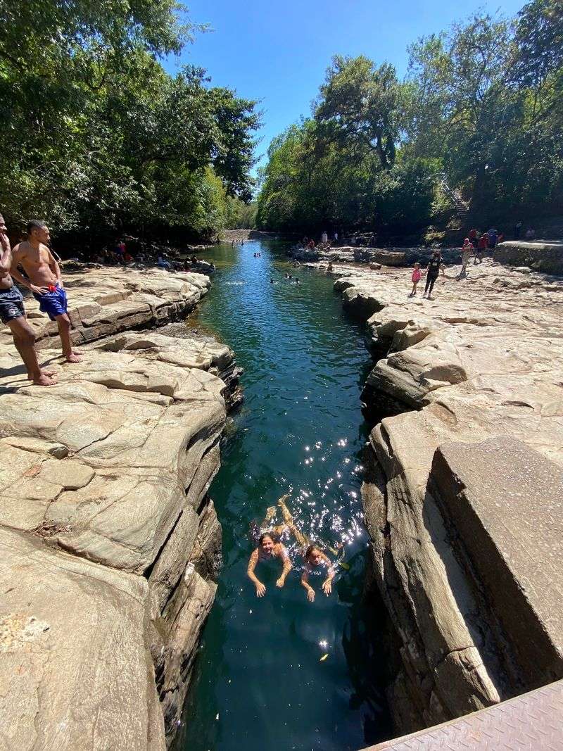
Rather than spreading into a wide valley, the Estí River near the town of Gualaca forces its way through an unusually tight channel of sculpted rock. The result is Los Cangilones, a natural swimming area where steep, smooth walls rise on both sides of a narrow corridor of clear water.
Its location in western Panama makes it a useful detour for travelers exploring Chiriquí who want something different from Boquete’s coffee farms or the hiking routes around Volcán Barú. The Municipality of Gualaca confirms that the site is locally maintained and has a staircase allowing visitors to descend toward the bathing area.
The formation sits less than a kilometer from the town center, so despite looking like a remote geological wonder, reaching it requires no serious expedition. That accessibility, combined with the striking visual of a river squeezed through rock, makes it one of the more rewarding quick stops in western Panama for travelers passing through the region.
Cerro Azul and Serranía de La Lindosa, Colombia
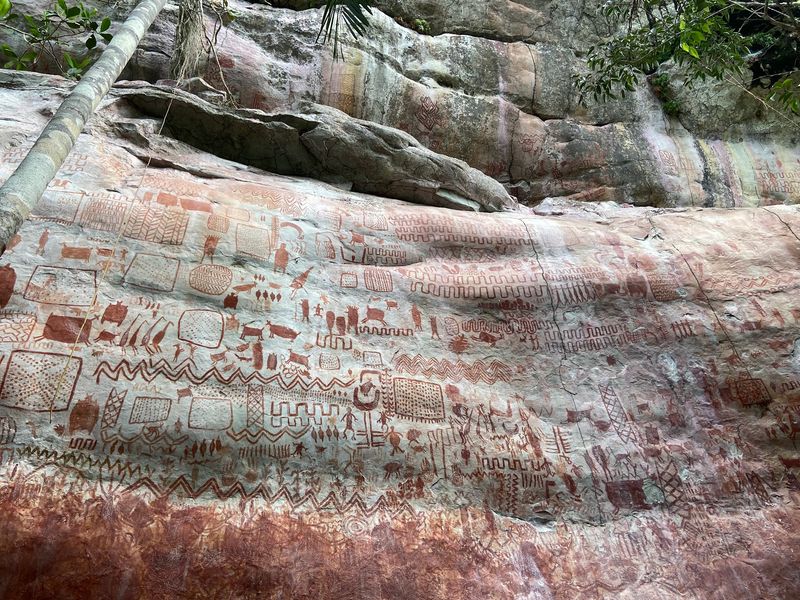
Around San José del Guaviare, enormous rock surfaces are covered with thousands of ancient images painted by people who lived here long before any European set foot in South America. At Cerro Azul in the Serranía de La Lindosa, visitors can see pictographs depicting humans, animals, rituals, and scenes from daily life estimated to be around 12,000 years old.
Colombia’s tourism authority says the wider region contains tens of thousands of individual rock images, making it one of the most significant prehistoric art landscapes in the Americas. The hike to Cerro Azul crosses forest and rocky terrain, so the experience combines archaeology with a genuine outdoor excursion.
Colombia’s official tourism pages continue to promote the site alongside Guaviare’s rivers, unusual geological formations, and surrounding forest. For travelers who have explored Colombia’s colonial cities and Caribbean coast but want something older and more remote, this region offers a completely different kind of discovery.
Gocta Waterfall, Peru
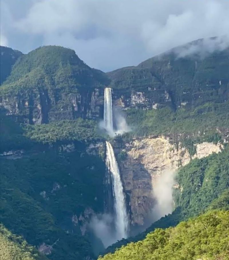
Northern Peru holds far more than Inca ruins, and Gocta makes one of the strongest arguments for exploring the Amazonas region. The waterfall drops more than 700 meters through cloud forest near the village of Cocachimba, and reaching it involves a substantial hike through agricultural land and forest that is rewarding in its own right.
Although local communities had long known the falls, Gocta received wider international attention only after measurements and research in the early 2000s brought it to the notice of the outside world. That relatively recent recognition helps explain why it remains far less crowded than Peru’s most famous natural attractions.
Peru’s official tourism organization lists Gocta as one of the major attractions around Chachapoyas in 2026, alongside the fortress of Kuélap and other archaeological and natural sites in the region. Established hiking routes from local communities make the falls accessible without requiring a specialist expedition or technical skills.
Torotoro National Park, Bolivia
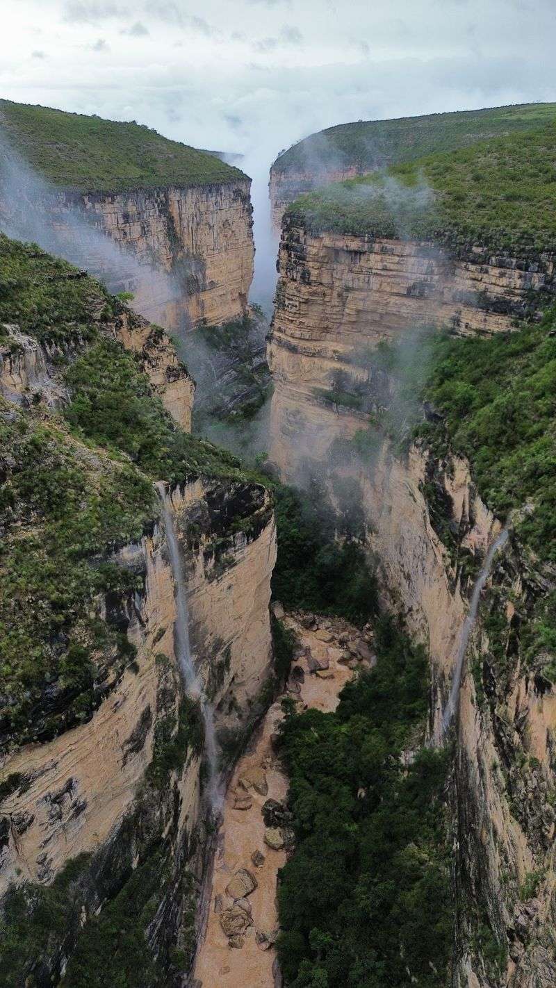
Somewhere in Potosí Department, a protected landscape combines dinosaur footprints, deep canyons, and enormous limestone caves in a way that feels almost too varied to be real. Torotoro National Park lets visitors walk alongside fossilized tracks, hike above dramatic gorges, and enter cave systems like Umajalanta, which contains impressive formations and an underground lake.
The park is not simply surviving in 2026. Bolivia’s protected-area authority expanded the Ciudad de Itas tourism circuit this year and trained additional guides, bringing the total number of officially enabled visitor circuits to 12.
That level of active development signals genuine institutional support rather than a site left to manage itself.
Travelers register at park offices, pay an entrance fee, and use accredited local guides for most attractions. That structure makes Torotoro far easier to explore responsibly than its remote location in central Bolivia might suggest.
The variety of experiences packed into one park is genuinely difficult to match anywhere else in the country.
Marble Caves, Chile
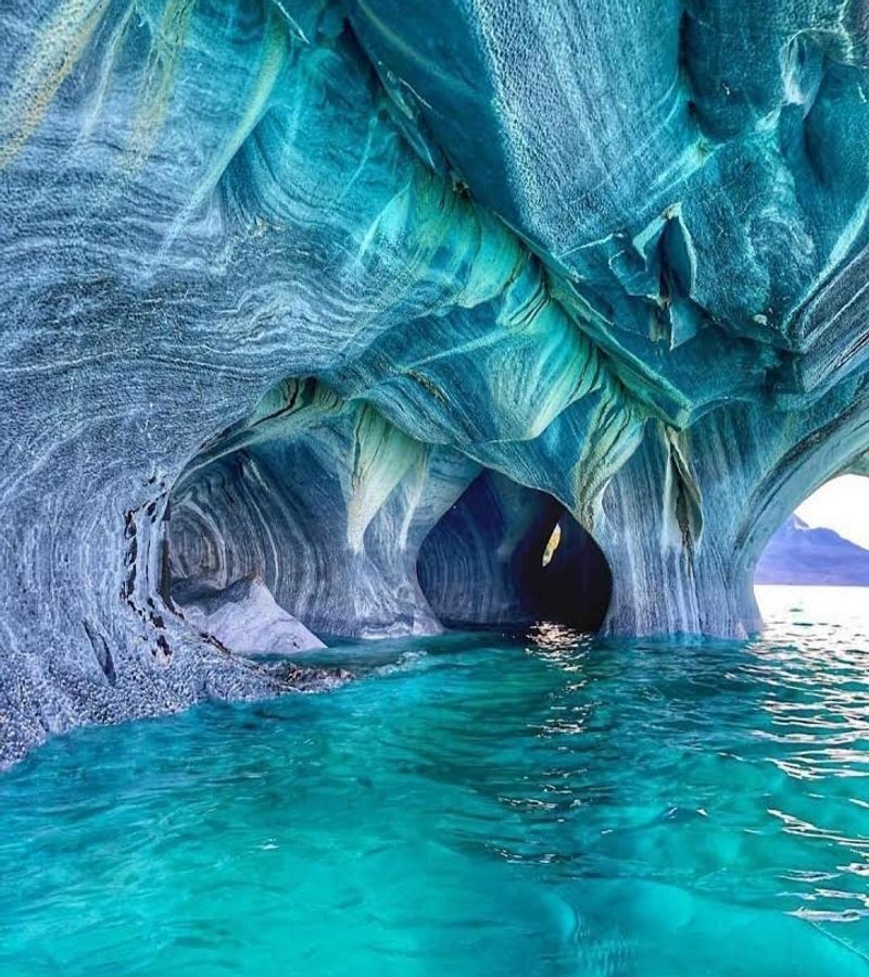
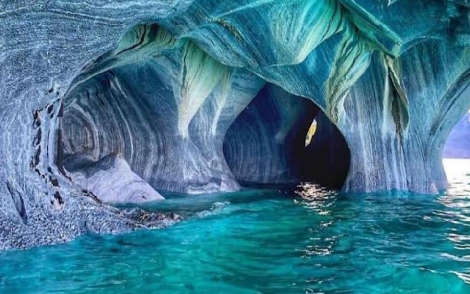
Wave erosion working on marble for thousands of years has produced something on Lake General Carrera that most people would not believe without seeing it. The Marble Chapel, Marble Cathedral, and surrounding caverns feature swirling patterns carved into solid rock, and the reflected turquoise water of the lake casts shifting blue tones across the interior surfaces.
There is no road leading into the formations. Visitors reach them by boat or kayak, with trips departing primarily from Puerto Río Tranquilo on the Chilean side of the lake.
The appearance of the caves changes with sunlight, water level, and glacial sediment, so no two visits look identical.
Chile’s tourism authority published updated guidance in July 2026 confirming that visits continue year-round, though weather affects navigation conditions on the lake. Advance booking with a registered tour provider is recommended.
For travelers already traveling the Carretera Austral, this stop adds one of Patagonia’s most visually unusual experiences to an already remarkable route.
Iberá Wetlands, Argentina
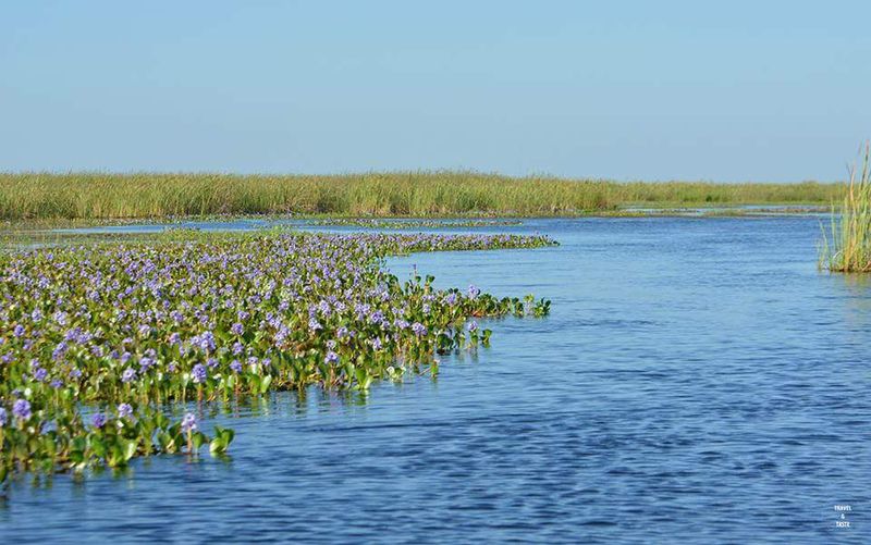
Wildlife travelers heading to South America tend to think immediately of the Amazon or the Pantanal, but northeastern Argentina holds an enormous wetland system that deserves far more attention than it currently receives. Iberá is a mosaic of lagoons, marshes, grasslands, rivers, palm groves, and patches of forest spread across Corrientes Province.
Exploring the park can involve canoe trips, boat excursions, hiking, and horseback riding, with different park entrances known as portals offering access to different ecosystems and activity types. Capybaras are among the animals most commonly associated with the region, while the broader landscape supports remarkable bird diversity and ongoing restoration programs for species like the giant anteater and marsh deer.
Argentina’s national tourism organization promotes Iberá National Park for year-round visitation in 2026, with each portal offering a distinct experience. For travelers who want serious wildlife watching without the logistics and expense of an Amazon expedition, Iberá provides a compelling and far more accessible alternative.
Jalapão, Brazil
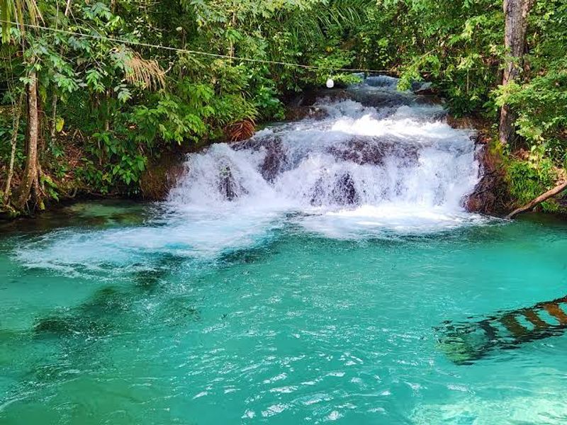
Jalapão sits in Tocantins State and looks almost nothing like the Brazil that appears on most travel posters. The landscape combines golden dunes, Cerrado scrubland, waterfalls, clear rivers, and a geological curiosity known as fervedouros, natural springs where underground water rises through sand with enough upward pressure to create remarkable buoyancy.
Among the best-known examples are Fervedouro Bela Vista and Fervedouro Ceiça, where swimmers find it genuinely difficult to sink. That combination of dune landscapes and pressurized springs in a single region is unusual anywhere in South America.
Brazil’s official tourism organization promotes Jalapão for ecotourism and recommends hiring local guides because phone reception and road signage can disappear in remote areas. Four-wheel-drive transportation is also important for many routes through the region.
For travelers who want a Brazilian landscape that feels completely unlike the Amazon, the Pantanal, or the coast, Jalapão offers an experience that is difficult to categorize and hard to forget.
Cabo Polonio, Uruguay
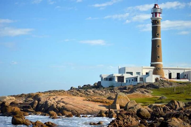
Getting to Cabo Polonio already signals that this place operates differently from Uruguay’s more polished beach resorts. The protected landscape is cut off from ordinary road traffic, and the settlement inside it sits among sandy beaches, rocky headlands, wetlands, and an extensive system of mobile dunes, some rising more than 20 meters above the surrounding terrain.
That dune system is particularly significant because few comparable moving dune landscapes remain along this stretch of South America’s Atlantic coast. The surrounding coastal environment also supports numerous protected and migratory species, adding a wildlife dimension to what might otherwise seem like a simple beach destination.
Uruguay’s Ministry of Tourism continues to promote Cabo Polonio National Park in 2026. The combination of physical isolation, dramatic dune geography, and wildlife habitat creates an atmosphere that feels genuinely removed from the beach-town circuit elsewhere along the Uruguayan coast.
For travelers who want a coastal experience defined by landscape rather than amenities, Cabo Polonio is difficult to match in this part of the continent.
Cóndor Machay Waterfall, Ecuador
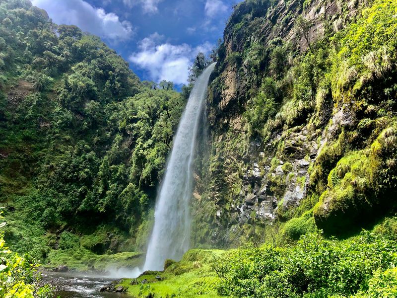
Just outside Sangolquí, a hiking route through Andean farmland and river valley leads to a waterfall that most international visitors to Ecuador never find. Cóndor Machay lies near the Pita River in the rural parish of Rumipamba, set within a landscape shaped by the chain of volcanoes and mountains surrounding the region.
Ecuador’s tourism authority explains that the name translates to “Condor’s Nest” and connects with stories of Andean condors historically nesting in the area. That local naming history adds a layer of cultural context that purely scenic destinations often lack.
The attraction continues to be actively promoted as a hiking and nature destination in 2026. For travelers based in Quito, Cóndor Machay offers a practical and rewarding alternative to the country’s more heavily marketed adventure destinations, without requiring a long journey across the country.
The relatively short distance from the capital makes it a realistic half-day or full-day excursion that still feels far removed from urban life.
Kaieteur Falls, Guyana
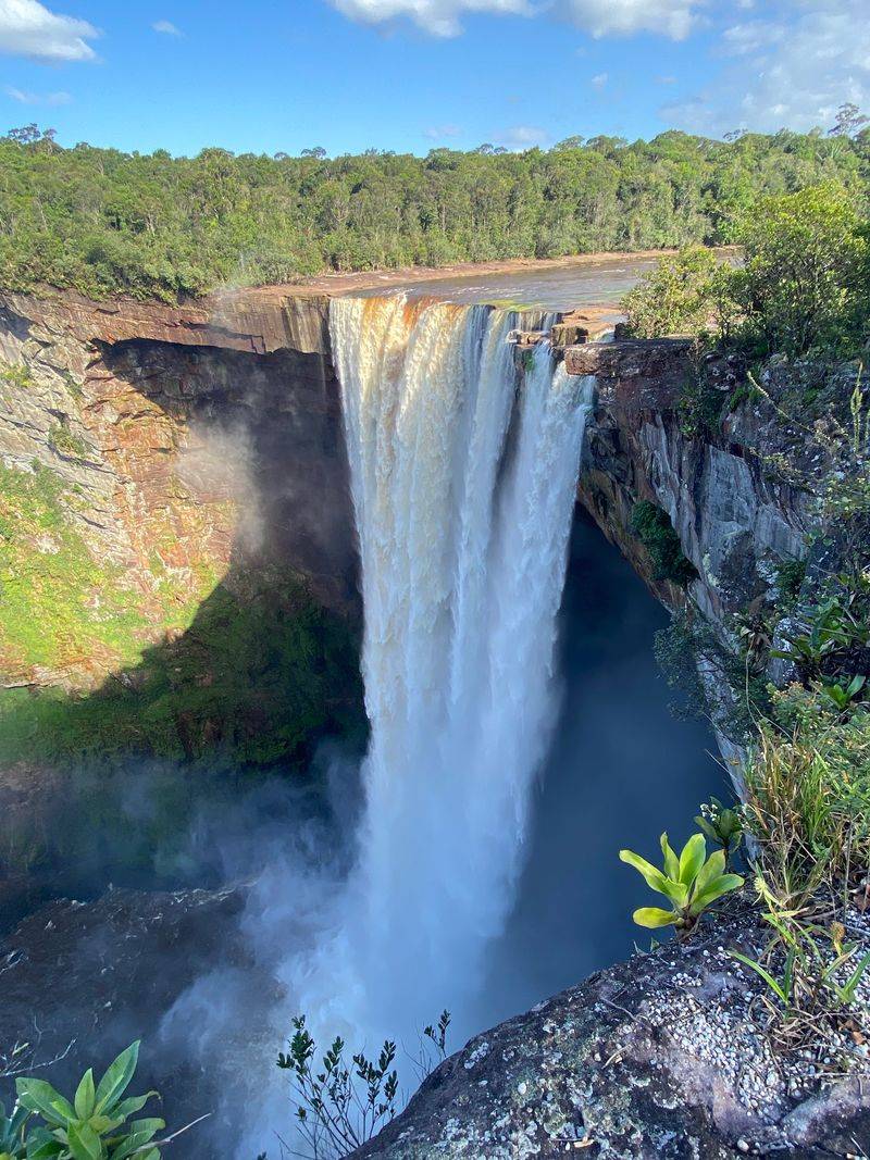
Kaieteur Falls drops through one of the most intact rainforest landscapes in South America, and Guyana receives a fraction of the international visitors that neighboring countries attract each year. That imbalance works in the traveler’s favor.
The experience of standing near Kaieteur is defined by scale and remoteness in a way that waterfalls surrounded by hotels and souvenir stands simply cannot replicate.
Many tourist visits involve a small aircraft to reach the falls before exploring the surrounding area on foot. Guyana’s national tourism organization continues to feature Kaieteur as one of the country’s signature attractions in 2026 and promotes visits through licensed tourism companies.
The combination of dense rainforest, relative isolation, and limited surrounding development creates a completely different atmosphere from major waterfalls that have become heavily commercialized. For travelers who want to experience a genuinely large natural spectacle without the infrastructure that usually surrounds one, Guyana and Kaieteur represent one of the most compelling cases in all of South America.
Brownsberg Nature Park, Suriname
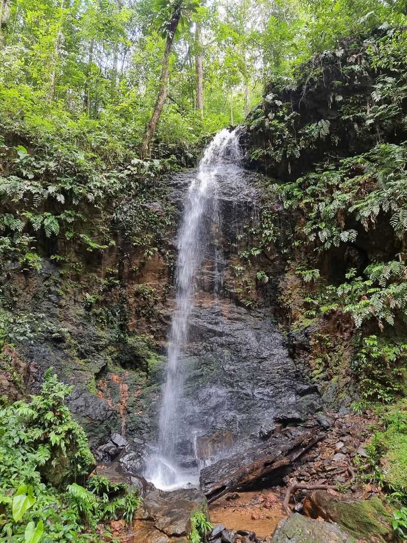
Suriname sits outside most South American travel itineraries entirely, which makes Brownsberg Nature Park even easier to overlook. The protected rainforest covers roughly 12,200 hectares in Brokopondo District and rises above the vast Brokopondo Reservoir, a combination that gives the park both forest depth and striking water views from elevated positions.
Trails descend through dense vegetation toward waterfalls including Leo, Irene, Kumbu, and Mazaroni. Wildlife across the park includes several monkey species, a wide range of tropical birds, reptiles, and the broader community of species that intact lowland rainforest supports.
Current Suriname tourism information promotes Brownsberg for hiking, wildlife observation, waterfall access, and reservoir views. Accommodation and excursions are commonly arranged through local conservation and tourism organizations, giving the park a structured visitor experience despite its remote setting.
For travelers who genuinely want to explore somewhere that most South American visitors never consider, Suriname and Brownsberg together offer an itinerary that feels like a real discovery rather than a familiar circuit.
Campo de Piedra Pómez, Argentina
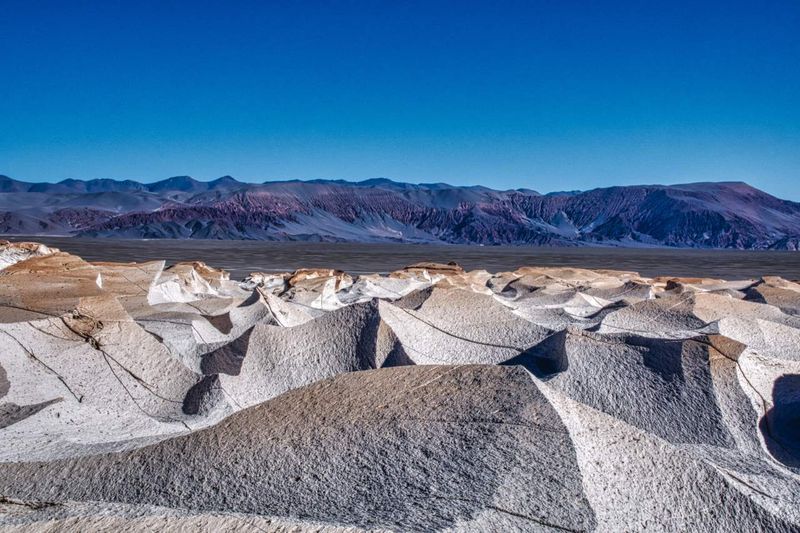
Wind and erosion working on volcanic pumice deposits at high altitude have produced a landscape in Catamarca Province that looks unlike anything else in Argentina. Campo de Piedra Pómez consists of thousands of pale formations sculpted into walls, columns, and irregular shapes spread across the stark terrain of the Puna plateau.
Its isolation has kept it far from the tourist circuits that Patagonia’s most recognizable parks attract. Argentina’s official nature-tourism program currently lists the area as visitable from the community of El Peñón, with an entrance fee charged for access.
This is not a destination suited to an ordinary rental-car detour. Reaching the formations requires a four-wheel-drive vehicle, and a guide or organized excursion is necessary rather than optional.
That combination of logistical requirements and extreme remoteness has preserved the site’s raw character. For travelers who are willing to plan carefully and travel overland through one of Argentina’s least-visited provinces, the reward is a geological landscape that feels genuinely unlike anywhere else on the continent.
Caleta Tortel, Chile
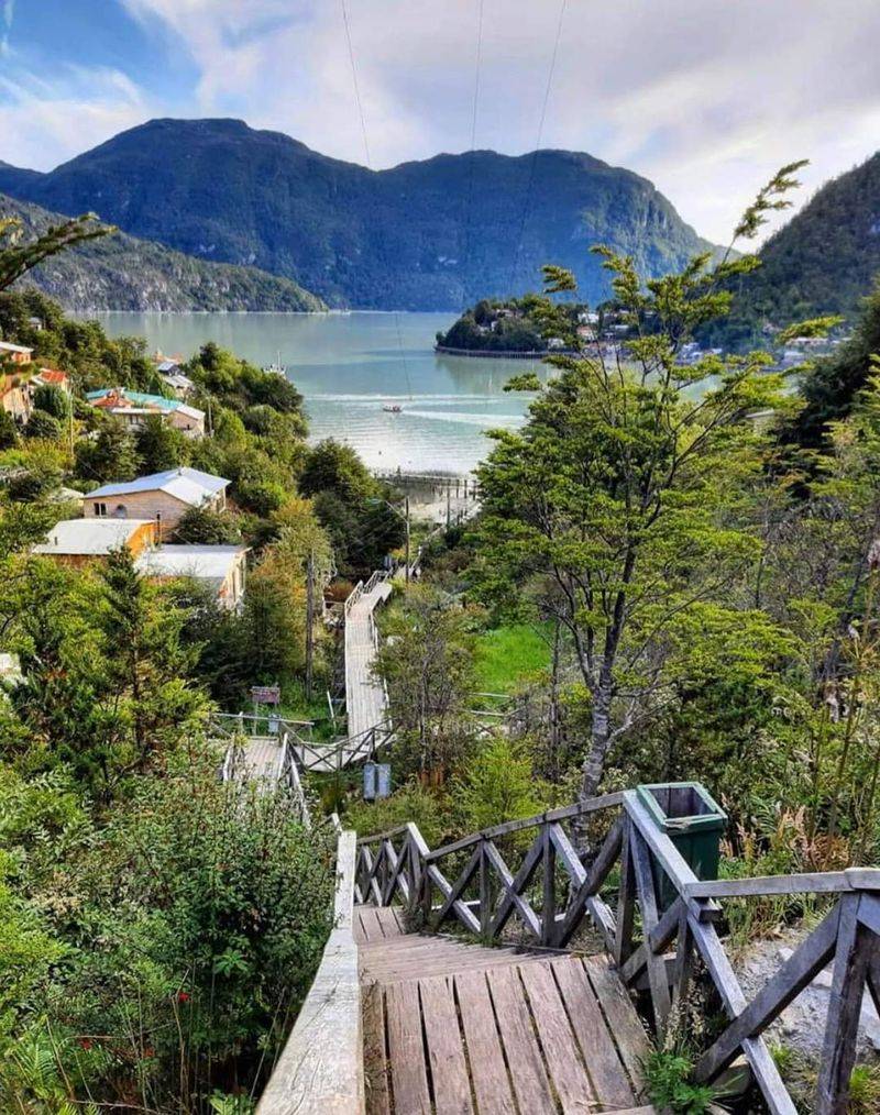
Walking through Caleta Tortel means navigating kilometers of elevated wooden boardwalks rather than conventional streets. The settlement’s entire layout relies on these raised pathways built primarily from Guaitecas cypress, linking homes, docks, and public areas beside the mouth of the Baker River in Chilean Patagonia.
The town’s long isolation along the Carretera Austral helped preserve both its distinctive architecture and its relationship with the surrounding water and forest. There are few places in South America where a community’s infrastructure is so directly shaped by its natural environment.
Chile’s tourism authority confirmed current access information for Tortel in 2026, including the long road journey from Coyhaique. Visitors can walk the full boardwalk system, climb to viewpoints above the settlement, and arrange excursions on the river and around nearby islands.
For travelers already making the journey along the Carretera Austral, Caleta Tortel is the kind of stop that tends to stay in memory long after the road trip is finished.
Mavecure Hills, Colombia
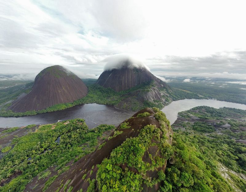
Far out in Colombia’s Guainía region, three massive rock formations rise from the jungle above the Inírida River in a way that looks almost implausible from river level. Mavecure, Mono, and Pajarito are part of the ancient Guiana Shield, one of the oldest geological formations on Earth, and their dark, sheer faces contrast sharply with the surrounding forest canopy.
Colombia’s tourism authority says travelers generally reach the hills by a roughly 90-minute speedboat trip south from Inírida. Mavecure is the hill visitors can climb with a guide, offering panoramic views over the river and surrounding rainforest that justify the considerable journey to get there.
Tourism here also connects with the nearby Indigenous communities of El Remanso, including Puinave and Curripaco cultural experiences and community-based activities. That human dimension sets Mavecure apart from a purely geological attraction.
For travelers who want a destination that combines ancient landscape, river travel, and genuine cultural engagement, this remote corner of Colombia delivers all three.
Share this story