National parks are some of the most breathtaking places on Earth, but they come with a side of real, unpredictable danger. A sunny morning hike can turn into a race against a flash flood.
A calm river can become a raging torrent before you even hear it coming. These 13 parks are stunning, but they demand respect, preparation, and the understanding that nature does not wait for anyone to catch up.
Death Valley National Park, California and Nevada
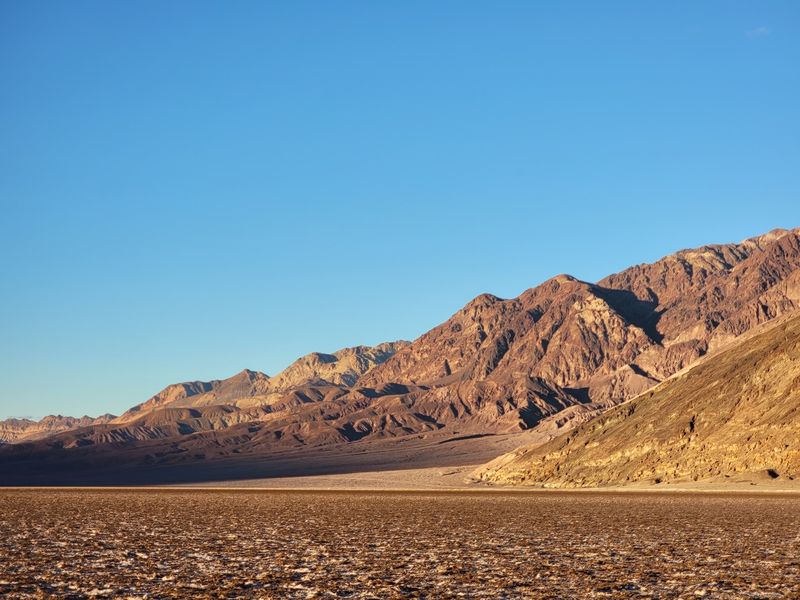
The hottest place on Earth does not hide its reputation. Death Valley recorded a surface air temperature of 130 degrees Fahrenheit, and the National Park Service advises against hiking at lower elevations during peak heat.
Rangers recommend carrying at least one gallon of water per person per day, and even that may not be enough during extreme conditions.
Heat illness moves fast. What starts as a headache and mild nausea can escalate to confusion, organ failure, and life-threatening heat stroke before a victim fully realizes what is happening.
The desert does not give many second chances.
Here is the twist: water is also a danger in Death Valley. Desert ground absorbs rainfall poorly, so even moderate storms can send fast-moving floodwater rushing through canyons and washes, carrying rocks, debris, and anything else in its path.
Roads have been washed out and visitors stranded after sudden desert storms.
That combination of extreme heat and surprise flooding makes Death Valley uniquely unforgiving. A visitor can be managing heat exhaustion one afternoon and find their route blocked by flood debris the next morning.
Always check current NPS alerts before entering the park.
Zion National Park, Utah
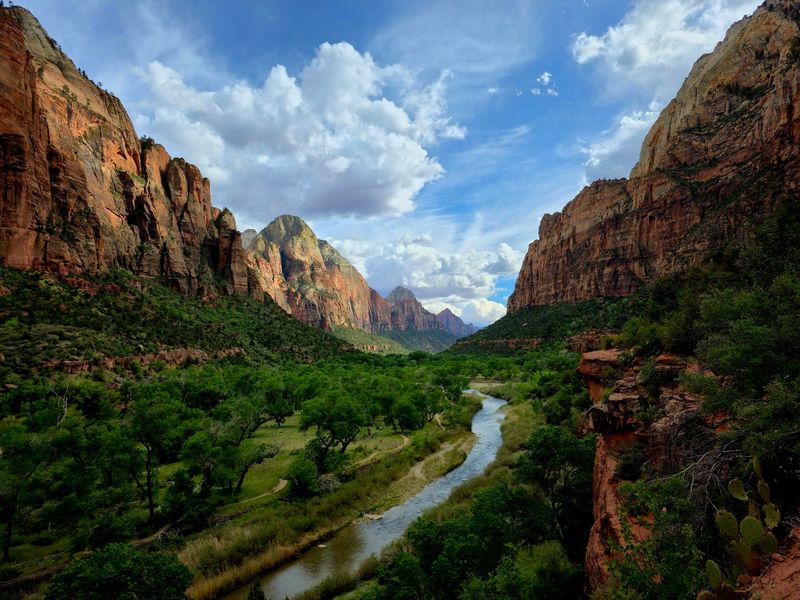
Wading through a narrow canyon with 1,000-foot walls on either side sounds thrilling until the water turns brown and starts rising. The Narrows at Zion is one of the most popular hikes in America, and it is also one of the most flood-vulnerable.
The hike takes visitors directly into the Virgin River, with very few spots to climb to safety.
Flash floods here can be triggered by storms miles away, and water levels can rise within seconds. Floodwater in narrow canyons does not just rise, it carries boulders, tree trunks, and debris moving at dangerous speeds.
NPS closes the Narrows when a Flash Flood Warning is issued, but risk can still exist below that official threshold.
Knowing the warning signs could save your life. Watch for increasing cloud cover, distant thunder, muddy or debris-filled water, a rising current, or a low rumbling sound coming from upstream.
If any of those appear, move to higher ground immediately and do not wait to confirm what is happening.
Zion’s beauty is inseparable from its geology, and that same geology is what makes flooding so dangerous there. The canyon’s narrow walls that make photos stunning are also what trap water and funnel it directly toward hikers.
Yellowstone National Park, Wyoming, Montana, and Idaho
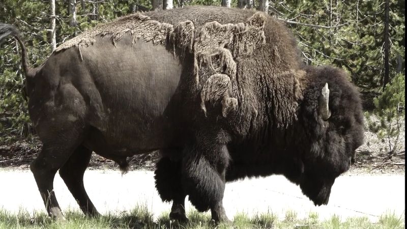
Yellowstone is the only place in the United States where you can watch a geyser erupt, spot a grizzly bear, and accidentally step through the ground into scalding water, all within the same afternoon. The park stacks its hazards like layers of a very dangerous cake.
Wildlife rules require visitors to stay at least 100 yards from bears and wolves and 25 yards from bison and elk.
People have been gored, charged, and seriously injured by bison in Yellowstone. These animals look slow and docile but can sprint at 35 miles per hour and weigh up to 2,000 pounds.
Keeping your distance is not optional, it is survival.
Thermal areas carry their own deadly risk. The crust around geysers and hot springs can be paper-thin, and visitors who step off boardwalks have broken through and fallen into water that can exceed 200 degrees Fahrenheit.
NPS has documented fatal incidents involving people who left designated paths near thermal features.
Weather can shift quickly too. Summer snowstorms, cold river crossings, and rapid temperature drops add to the challenge.
Yellowstone rewards prepared visitors and punishes overconfident ones. The boardwalks are not suggestions, they are the line between a great story and a tragedy.
Grand Canyon National Park, Arizona
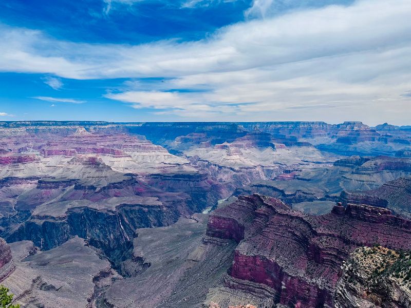
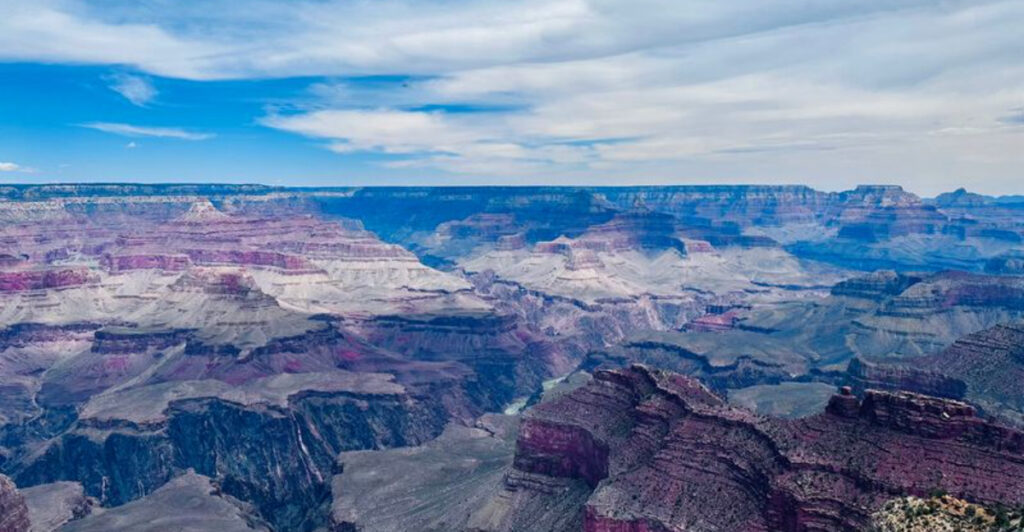
Standing at the Grand Canyon rim on a clear morning, it is easy to forget that the weather 25 miles away can kill you. The National Park Service warns that flash floods can surge through canyons and dry washes during the summer monsoon season, which runs from July into mid-September.
Storms do not need to be directly overhead to trigger a flood.
A bone-dry channel can go from harmless to raging torrent in minutes. Heat compounds the problem for hikers descending into the canyon, where temperatures can be significantly hotter than at the rim.
The deeper you go, the harder it is to escape quickly.
Lightning adds yet another layer of risk. NPS notes that lightning can strike across the canyon over long distances, and heavy downpours can loosen rocks and trigger rockfalls along canyon walls.
Hikers have been caught off guard by all three hazards in the same trip.
The safest mindset at Grand Canyon is to treat distant weather as a direct threat. Check the forecast before you descend, know your exit routes, and never assume a dry wash is safe simply because the sky above you looks clear.
Glacier National Park, Montana
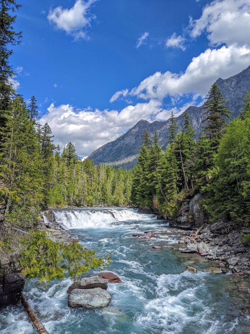
Glacier National Park looks like it was painted specifically to make people feel safe. Turquoise lakes, wildflower meadows, and snow-capped peaks give it a postcard quality that can lower your guard.
But the water temperature in those gorgeous lakes and streams stays dangerously cold even during the height of summer, and cold-water immersion can cause hypothermia within minutes.
Water is the leading cause of fatalities in Glacier, according to NPS. A slip on a slick rock near a fast-moving stream can send a hiker into water cold enough to cause muscle failure before they can swim to safety.
Distances that look short from the bank can become impossible to cover in freezing current.
Mountain weather adds another threat. A warm, sunny morning hike can turn into a cold, wet emergency when a storm rolls across high terrain.
Temperatures can drop sharply, wind can pick up fast, and exposed ridgelines offer nowhere to shelter.
Glacier is also home to nearly 1,000 bears, including both black bears and grizzlies. NPS recommends carrying bear spray, making noise while hiking, and traveling in groups.
The park is genuinely wild in ways that its beauty does not immediately advertise. Treat every trail with that in mind.
Rocky Mountain National Park, Colorado
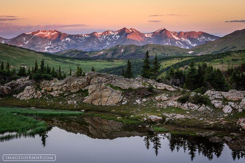
Rocky Mountain National Park has one of the most reliable afternoon lightning shows in North America, and it is not a show you want to watch from a ridgeline. Lightning is one of the most common causes of injury and death in the park, especially during the June through September storm season.
The park’s high elevation means there is often nowhere to hide.
Trail Ridge Road climbs above 12,000 feet, and many popular hiking routes travel across open tundra where a person becomes the tallest object around. That is a bad position when lightning is searching for a path to the ground.
NPS strongly advises hikers to plan summit attempts so they are back below treeline before noon or early afternoon storms develop.
Altitude sickness catches visitors off guard more often than most people expect. Headaches, nausea, dizziness, and shortness of breath can hit people who ascend too quickly, even those who are physically fit.
Pre-existing heart and lung conditions can worsen significantly at elevation.
The Rockies reward early risers who start hikes at sunrise and turn around before the clouds build. That dark mass gathering over the ridge in the distance is not a photo opportunity.
It is a signal to move downhill, fast.
Mount Rainier National Park, Washington
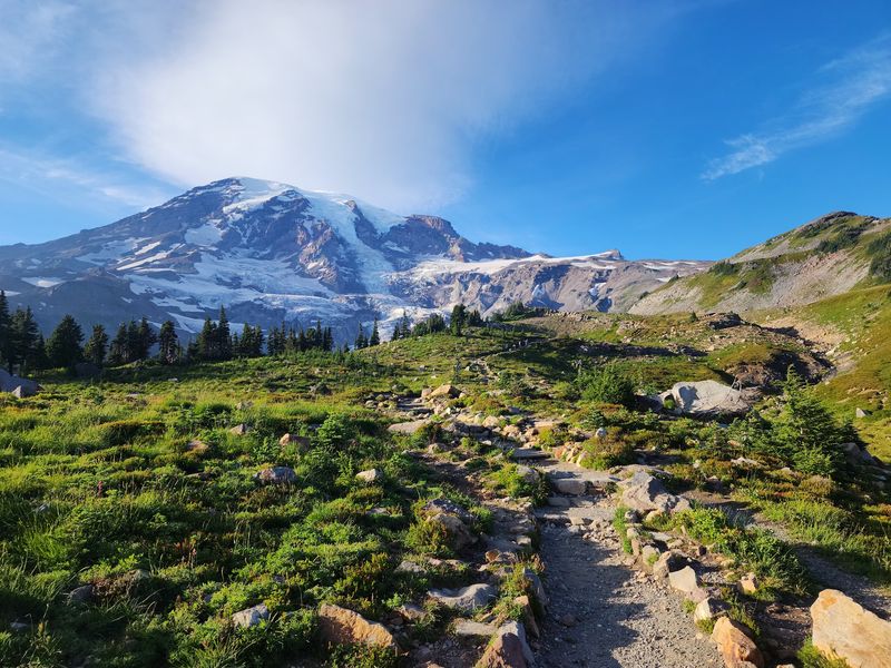
Mount Rainier is not just a mountain. It is an active stratovolcano wrapped in more glacial ice than any other peak in the contiguous United States, and that combination creates hazards that go well beyond ordinary mountain weather.
Glacially fed rivers in the park can experience debris flows triggered by heavy rain, seismic activity, volcanic unrest, or sudden releases of meltwater.
These flows move fast. A debris flow is not like a slow-rising flood, it is a churning wall of mud, rocks, uprooted trees, and water that can travel down a valley at terrifying speed.
NPS instructs visitors near rivers to move immediately to higher ground if they hear a roaring sound like an approaching freight train, feel extended ground shaking, or see water rising rapidly without explanation.
Weather at Rainier shifts without much notice. Conditions can go from calm and clear to stormy and dangerous within hours.
Snow can persist well into summer, river crossings can become hazardous after rainfall, and cell coverage across much of the park is minimal or nonexistent.
Rainier’s landscape is spectacular precisely because it is so geologically active. That activity is also what makes it one of the most genuinely dynamic and potentially dangerous parks in the country.
Respect the rivers, watch the sky, and always tell someone your plan.
Yosemite National Park, California
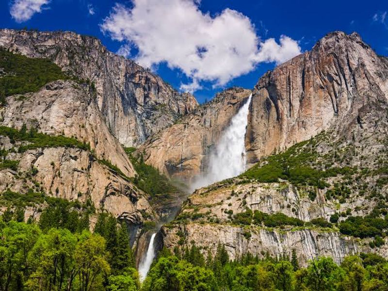
Yosemite’s waterfalls are so beautiful that people wade toward them. That instinct has cost lives.
NPS warns visitors never to swim or wade upstream from the brink of a waterfall, even when the water looks shallow and calm. The current near a waterfall’s edge can be far stronger than it appears, and the granite is slippery in ways that boots and sandals cannot handle.
Water-related accidents are the second most common cause of death in Yosemite. During spring and early summer, snowmelt turns rivers and streams into fast, cold, powerful channels that look deceptively manageable from the bank.
Rangers conduct numerous swift-water rescues each year involving people who entered the water intentionally or accidentally.
Summer afternoons bring lightning. Thunderstorms build regularly over the park’s high granite ridges and exposed terrain, and the smooth rock provides little shelter.
A hiker on a granite dome during an afternoon storm has very limited options.
Yosemite’s hazards are often hidden in plain sight. The same clear water that photographs beautifully may be only yards from a powerful drop.
The granite that makes the valley famous also makes every wet surface a potential slip hazard. Stay on marked paths, obey posted warnings, and resist the pull of the waterfall’s edge.
Olympic National Park, Washington
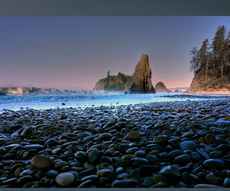
Olympic National Park protects more than 70 miles of wild Pacific coastline, and the ocean there plays by its own rules. Tides can cut off routes around headlands, leaving hikers trapped between the water and sheer cliffs with no way forward or back.
NPS tells coastal visitors to carry printed tide tables and keep a close eye on the time throughout their hike.
Sneaker waves are the coastline’s most unpredictable threat. These unusually large waves surge far higher up the beach than the waves around them, striking without warning and with enough force to knock an adult off their feet and drag them into the surf.
People have been killed on Olympic’s beaches by sneaker waves while standing at what seemed like a safe distance.
Beach logs add another hazard that most visitors do not consider. Surf can move large waterlogged logs with surprising force, and a log rolling or shifting in the water can crush a person.
Storms offshore can also push water higher than standard tide charts predict, making a passable route impassable while hikers are already committed to it.
At Olympic’s coastline, tide awareness is as essential as trail maps. The ocean does not announce when it is about to change the rules.
Checking conditions before you start and staying alert throughout can be the difference between a great coastal hike and a dangerous emergency.
Everglades National Park, Florida
Everything about the Everglades looks calm until it is not. South Florida’s subtropical climate is intensely hot and humid during the summer wet season, and heat exhaustion can develop faster than most visitors expect when temperatures climb and humidity removes the body’s ability to cool down efficiently.
Staying hydrated out here is a constant job, not an occasional reminder.
Thunderstorms form with remarkable speed in South Florida. A clear sky can produce a violent lightning storm within 30 to 45 minutes, and those same storms can turn a peaceful paddling trip into a dangerous situation on open water.
Boating and kayaking conditions can deteriorate rapidly when wind and rain arrive together.
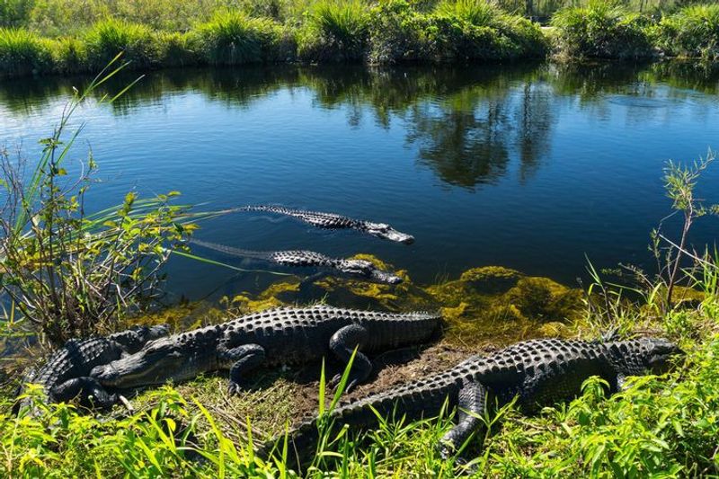
Wildlife in the Everglades is genuinely wild, not the roadside-zoo variety. Alligators and American crocodiles live throughout the park, and NPS advises visitors never to approach, feed, or touch them.
Even an animal that appears motionless and unbothered can move explosively fast when it decides to. Venomous snakes, biting insects, and plants like poisonwood that cause painful skin reactions round out the biological hazards.
The Everglades does not announce its dangers with steep cliffs or roaring rivers. The risks are woven into the landscape itself, quiet and easy to miss until they are not.
Preparation and awareness matter every step of the way here.
Canyonlands National Park, Utah
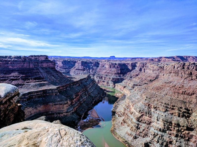
Canyonlands has a reputation for being remote, rugged, and unforgiving, and it earns all three descriptions. Flash floods can strike washes and narrow side canyons with almost no warning, turning a dry trail into a fast-moving river of mud and debris in the time it takes to check your phone.
In 2026, flood damage and washouts temporarily closed routes in parts of the park.
Heat is an equally serious threat. During August of 2026, rangers at Canyonlands and neighboring Arches had already responded to 23 heat-related search-and-rescue incidents between the two parks, including 12 specifically in Canyonlands.
That number reflects how quickly heat exhaustion and heat stroke can overtake visitors in exposed desert terrain with limited shade and long distances between water sources.
Lightning over high desert terrain, remote roads that can become impassable after rain, and minimal cell service mean that a small mistake can snowball into a serious emergency before help can reach you. Self-sufficiency is not optional in Canyonlands, it is the baseline requirement for entering the backcountry.
A bright blue sky over canyon country is not a safety certificate. Weather can build fast, storms can hit from a distance, and the landscape holds water in ways that surprise even experienced hikers.
Check the forecast, know your exits, and carry more water than you think you need.
Great Smoky Mountains National Park, Tennessee and North Carolina
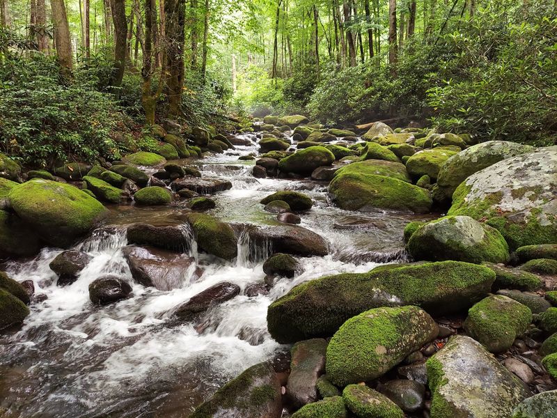
The Smoky Mountains fool people with their soft green ridges and misty valleys. Nothing about the landscape screams danger the way a desert canyon or a glacier does, which is exactly why the hazards here catch visitors off guard.
The park’s streams are the biggest culprit. A thunderstorm high in the mountains can send a surge of water downstream to a spot where no rain has fallen at all.
Hikers who crossed a stream easily in the morning may find it swollen and unsafe by early afternoon after heavy rainfall upstream. Slippery rocks, wet logs, and unstable footing near waterways account for a significant share of the park’s accidents each year.
The Smokies get more annual visitors than any other national park, which means more people encountering these hazards.
Black bears live throughout the park and behave unpredictably around people. NPS emphasizes that wild bears should never be approached, fed, or treated as tame animals.
A bear that seems comfortable near a trail is still a wild animal capable of reacting defensively without warning.
Even the roads carry natural hazards: winding mountain routes combine blind curves, steep drop-offs, fog, heavy rain, and frequent wildlife crossings. The Smokies prove that a park does not need extreme terrain to become dangerous.
Sometimes all it takes is rain falling somewhere else on the mountain.
Hawaii Volcanoes National Park, Hawaii
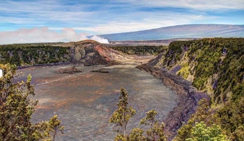
Nowhere else in the American national park system can the ground literally change while you are standing on it. Hawaii Volcanoes National Park sits on one of the most geologically active spots on the planet, and as of 2026, eruptive activity at Kilauea has continued to produce volcanic gas and falling tephra significant enough to trigger temporary park closures.
This is not a historical exhibit. It is an ongoing geological event.
The ground itself is the hazard that surprises most visitors. Lava tubes, hidden cracks, and thin crusts of hardened lava can exist just beneath the surface of what looks like solid rock.
NPS advises hikers to stay strictly on marked trails, because stepping off them in volcanic terrain can mean breaking through into voids or unstable material with no warning.
Volcanic gas, primarily sulfur dioxide, can cause serious breathing problems and poses the greatest risk to people with heart or respiratory conditions. Wind can carry gas far downwind from an active vent, affecting areas that look completely safe from a distance.
The park’s history underscores how fast conditions can escalate. The 2018 Kilauea summit collapse forced a 134-day closure.
Visitor infrastructure today still reflects that event. Hawaii Volcanoes is extraordinary, but it asks visitors to stay alert, follow closures, and remember that the landscape is not finished forming.
Share this story