When lowland cities bake under summer heat, high-altitude destinations quietly enjoy something most travelers forget is possible: genuinely cool temperatures with jaw-dropping views. Perched thousands of feet above sea level, these cities sit in the clouds rather than the heat, and their scenery tends to be just as remarkable as their refreshing climates.
From Andean canyon cities to East African highland capitals, elevation changes everything. Whether you are planning a trip or just dreaming about cool breezes and mountain panoramas, these 15 cities prove that going up is often the best way to escape the heat.
La Paz, Bolivia
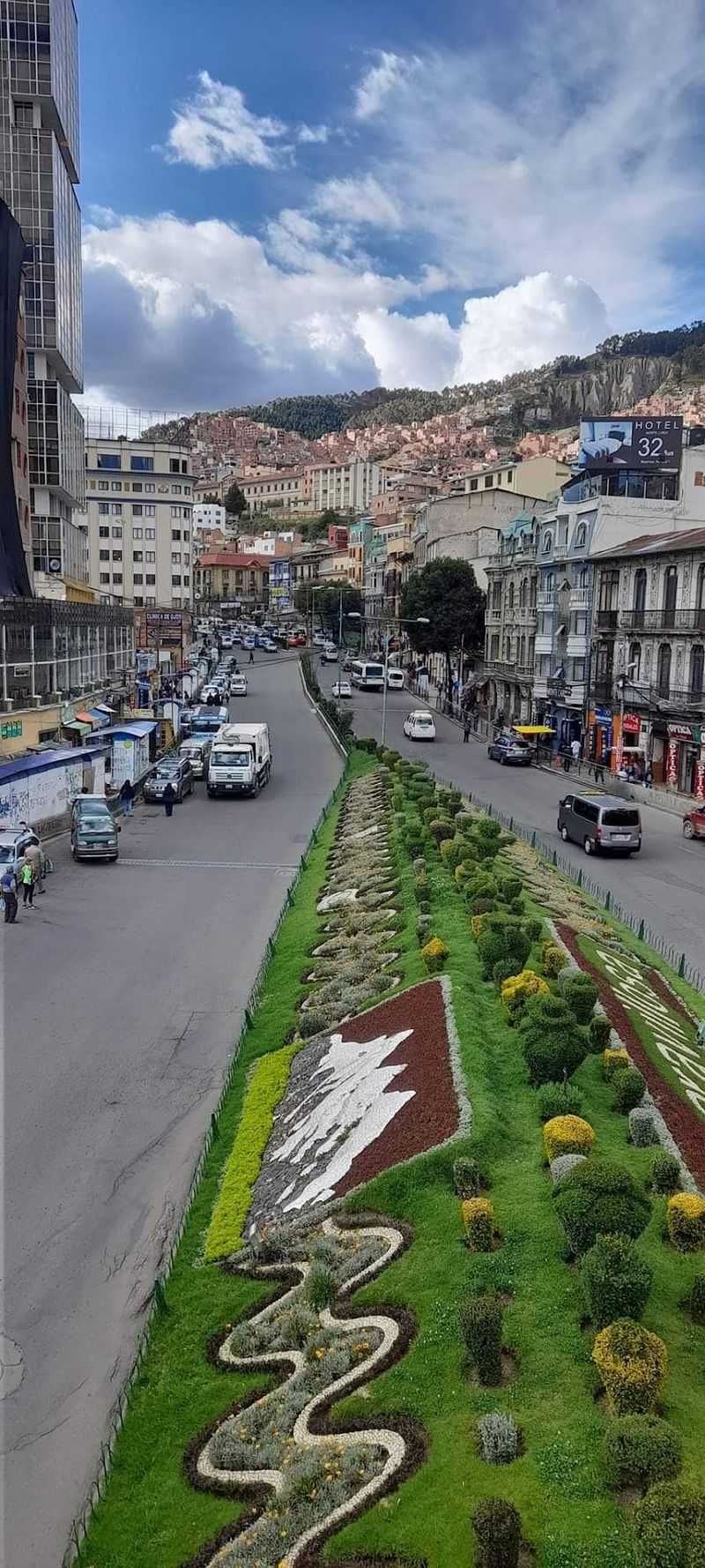
No city on Earth quite pulls off what La Paz does every single day. Bolivia’s seat of government is jammed inside an enormous Andean canyon at roughly 3,640 meters above sea level, making it the world’s highest administrative capital.
Higher neighborhoods push toward the flat Altiplano above, while lower sections tumble into somewhat warmer valleys below.
The altitude keeps temperatures startlingly low for a city only about 16 degrees south of the equator. Municipal climate data put the mean temperature in the La Paz valley at just 11.7 degrees Celsius, or roughly 53 degrees Fahrenheit.
Even on warm afternoons, the air carries a crisp mountain edge that feels nothing like a typical South American city.
Then there is the view. Snow-covered Illimani, rising to 6,438 meters, towers beyond the canyon rim and has become one of the most recognized skylines in South America.
Cable cars drift above brick houses stacked on hillsides, and mountain walls seem to physically contain the entire metropolis. La Paz does not merely sit near the Andes.
It feels carved directly out of them.
Lhasa, Tibet
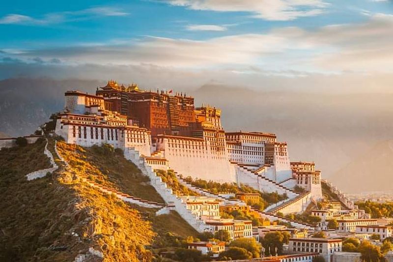
Midsummer in Lhasa feels more like a cool spring afternoon almost anywhere else. The city sits around 3,650 meters above sea level, and World Meteorological Organization climate data show an average July maximum of only about 22.1 degrees Celsius, or roughly 72 degrees Fahrenheit, with nights averaging closer to 10 degrees.
June and August are equally pleasant, making summer one of Lhasa’s most comfortable and visually vibrant seasons.
The landscape is unmistakably Tibetan. The Potala Palace rises above the city like a fortress from another era, while barren high-altitude mountains frame the surrounding valley on every side.
Beyond the city limits lie turquoise lakes, wide plateau landscapes, ancient monasteries, and peaks that make ordinary viewpoints feel like genuine mountain expeditions.
Summer rain also tends to push the surrounding vegetation into a noticeably greener state, adding color to what can otherwise feel like a stark and monochrome landscape. One of the strangest sensations of a Lhasa summer is wearing a light jacket while still needing sunscreen.
The sun is fierce at this altitude even when the air feels genuinely cool. That contrast alone makes Lhasa one of the most memorable high-altitude experiences on the planet.
Quito, Ecuador
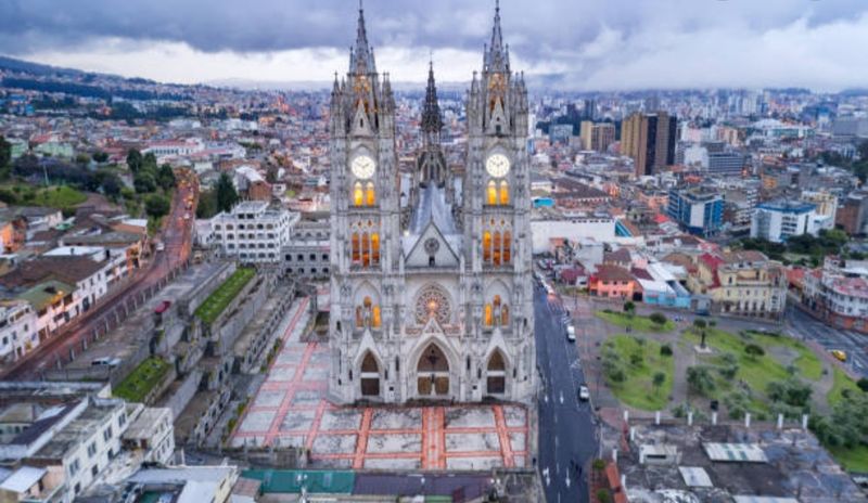
Quito sits almost exactly on the equator. You would never know it from the temperature.
UNESCO places Ecuador’s capital at approximately 2,850 meters above sea level, squeezed between Andean hills and the slopes of Pichincha volcano, and that elevation rewrites everything the equator normally promises.
World Meteorological Organization data show average daily maximum temperatures of only 21.1 degrees Celsius in June, 21.5 degrees in July, and 22.2 degrees in August. Nights hover around 9 to 10 degrees.
Essentially, Quito delivers spring weather while sitting on the equatorial line, which is one of the more remarkable climate tricks any city on Earth manages to pull off.
The scenery adds another layer of drama. Ecuador’s official tourism organization describes Quito as sitting in the heart of an Andean region filled with mountains, paramo, cloud forests, lagoons, and a famous Avenue of the Volcanoes containing more than 70 volcanic peaks and mountains.
On clear days, snow-covered summits appear beyond the city’s rooftops. The colonial old town, a UNESCO World Heritage Site, provides gorgeous foreground for those mountain views.
Few capitals combine equatorial geography with alpine atmosphere this convincingly or this effortlessly.
Cusco, Peru
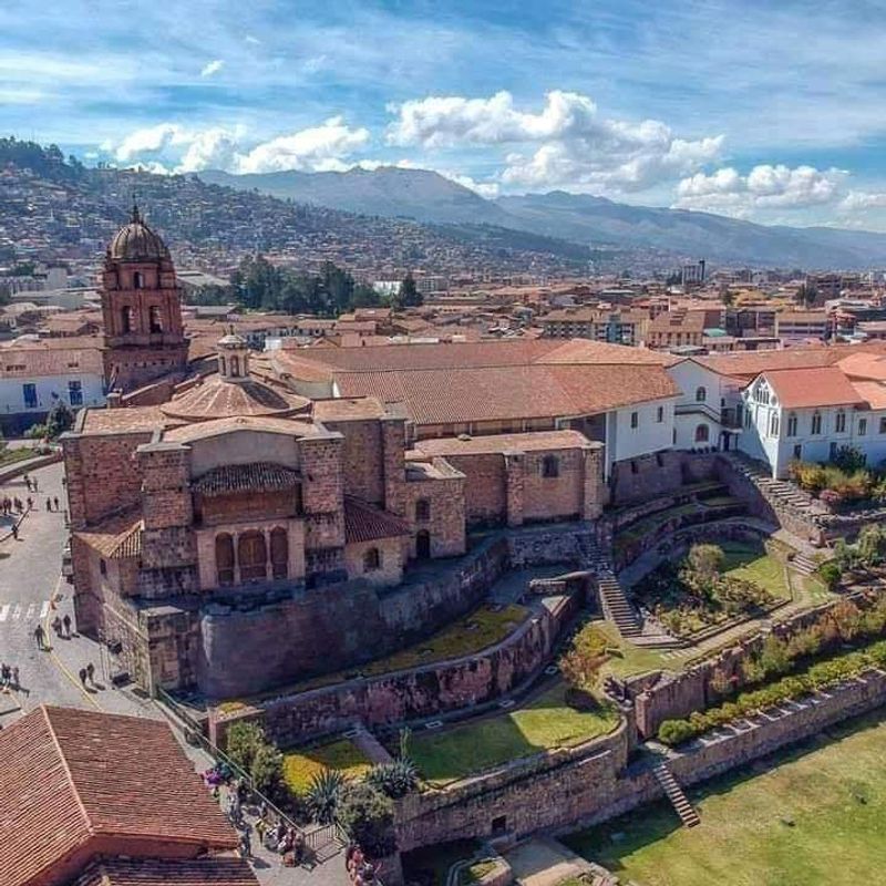
Millions of travelers pass through Cusco each year on their way to Machu Picchu, often treating the city as a quick stop rather than a destination. That is a genuine mistake.
Peru’s former Inca capital deserves far more attention than a single acclimatization day.
Peru’s official tourism data place Cusco at approximately 3,395 meters above sea level, with temperatures ranging from around 2 degrees Celsius at night to roughly 17 degrees during the day. Even during its warmest months, the city remains firmly in jacket territory after sunset.
The colonial Plaza de Armas is ringed by Spanish-era churches and buildings constructed directly on top of surviving Inca stonework, creating a layered visual history found nowhere else on Earth.
Walk uphill from the plaza and surrounding mountains begin appearing between tiled rooftops. Travel farther and the landscape becomes extraordinary, with high passes, agricultural terraces carved into steep slopes, archaeological sites, and the Sacred Valley dropping between dramatic mountain ranges below.
Cusco’s cool climate is not just a meteorological detail. It is part of what makes the entire city feel genuinely mountainous.
Visitors arriving from sea level should take acclimatization seriously, even when the weather feels deceptively comfortable and mild.
Leh, India
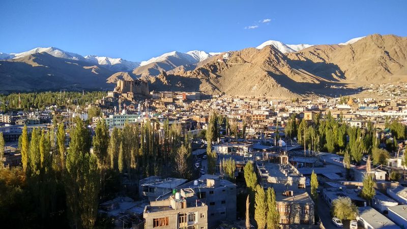
When most of South Asia is sweltering through one of the most intense summer heat seasons on the planet, Leh quietly goes about its business at a comfortable 14 to 25 degrees Celsius. The Ladakh city sits at approximately 3,500 meters above sea level in a high-altitude cold desert beside the Indus River, and its July and August temperatures feel nothing short of miraculous compared to the lowland plains below.
The landscape surrounding Leh is equally extraordinary. Treeless mountains in shades of brown, ochre, and rust rise behind whitewashed buildings and ancient monasteries perched on barren ridges.
Pockets of bright green irrigated farmland create vivid color contrasts against the otherwise stark desert slopes. Snow-covered peaks remain visible on the horizon throughout summer, giving the city a constant reminder of just how high it sits.
Summer is also when many high mountain roads and remote valley routes become accessible, which explains why tourism peaks during these short but spectacular warmer months. Indian tourism planning documents describe Leh as most reachable during summer, since winter conditions can become genuinely severe.
There is a word that keeps coming up among travelers who visit Leh for the first time. Lunar.
The landscape earns it completely.
Bogota, Colombia
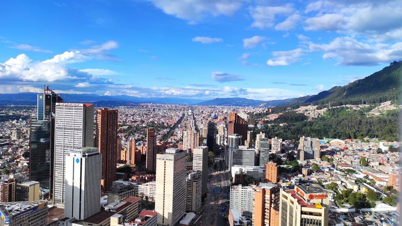
Bogota sits only a few degrees north of the equator, yet a sweater is more useful here than sunscreen for most of the year. Colombia’s capital occupies a high Andean plateau at about 2,600 meters above sea level, and long-term World Meteorological Organization climate records show average daily highs staying around 15 to 17 degrees Celsius throughout the year.
July averages approximately 14.9 degrees. The equator is close.
The heat is not.
The most famous perspective on the city comes from Monserrate, a sanctuary perched at 3,172 meters above sea level on the eastern mountain range. Visitors can hike, take a funicular, or ride a cable car to panoramic viewpoints overlooking the immense capital spreading across the plateau below.
The contrast between the dense urban grid and the green mountain walls rising sharply behind it is genuinely striking.
Beyond the city, paramo ecosystems, high-altitude reservoirs, green valleys, and additional Andean peaks fill out the surrounding landscape. Bogota proves that tropical latitude tells you remarkably little about actual climate when a city sits more than a mile and a half above the ocean.
Colombia’s capital is living proof that elevation rewrites every expectation a traveler might bring from the coast.
Huaraz, Peru
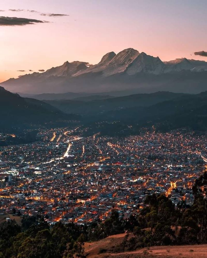
Travelers who think Cusco has the most impressive mountain backdrop in Peru have clearly not yet visited Huaraz. Peru’s official travel information places the city at approximately 3,091 meters above sea level, with temperatures ranging from near freezing at night to a maximum around 18 degrees Celsius on sunny days.
Those numbers sound modest until you step outside and look up.
Huaraz sits beside the Cordillera Blanca, an extraordinary chain of glaciated Andean peaks containing dozens of summits above 6,000 meters. The region includes turquoise glacial lakes, deep river valleys, high mountain passes, and Huascaran, Peru’s tallest mountain.
That combination makes Huaraz one of South America’s premier trekking and mountaineering bases, drawing serious outdoor travelers from around the world during the dry season months.
Laguna 69 is one of the most photographed spots in the entire country, a vivid blue lake sitting beneath a sheer glaciated wall at high altitude. The Santa Cruz trek, Llanganuco lakes, and numerous other mountain valleys are all accessible from the surrounding area.
Huaraz itself may lack Cusco’s architectural polish and colonial grandeur. The mountains visible from almost every street corner more than make up for whatever the city lacks in historical drama.
Puno, Peru
At 3,827 meters above sea level, Puno sits at a height where the word summer needs a serious asterisk. Peru’s tourism information lists temperatures of roughly 2 degrees Celsius at night to around 19 degrees during the day.
Even on bright sunny afternoons, the cold returns quickly the moment the light fades. Packing layers for Puno is not optional.
It is simply how things work at this altitude.
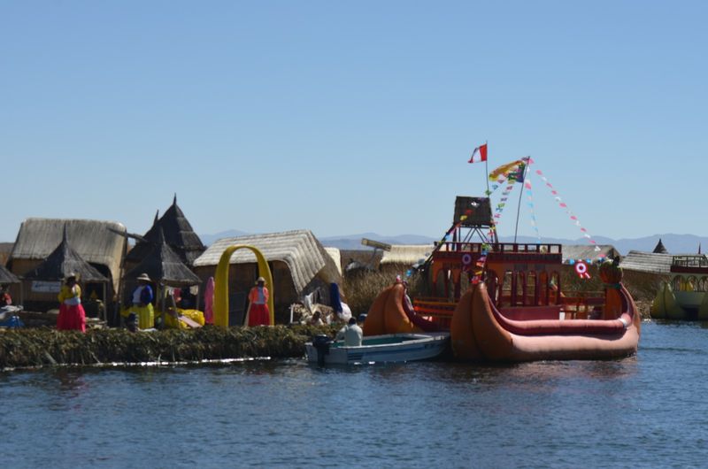
Then there is Lake Titicaca, which makes everything else almost irrelevant. The lake spreads toward the horizon like an inland sea beneath enormous Andean skies, its surface shifting between deep blue and silver depending on the light and cloud cover.
Boats leave Puno regularly for the famous Uros floating reed islands and the communities of Taquile and Amantani, where traditional Andean culture remains remarkably intact.
The light quality at this altitude is something photographers and painters talk about with genuine reverence. Clouds appear closer than they should.
Sunsets seem to expand across more sky than seems physically possible. The difference between sunny afternoon warmth and sudden nighttime cold can be genuinely shocking for first-time visitors.
Puno is one of those places where you peel off a jacket at noon and desperately want it back by three in the afternoon.
Sucre, Bolivia
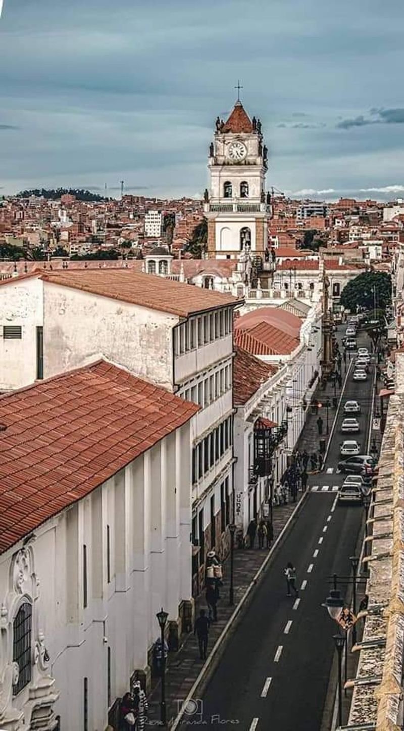
Sucre offers a gentler, quieter version of Bolivian mountain living. At roughly 2,800 meters above sea level, it sits considerably lower than La Paz but still high enough to enjoy a mild highland climate that keeps summer daytime temperatures generally in the low-to-mid 20s Celsius.
The air is crisp without being punishing, and the pace of life feels slower than Bolivia’s chaotic administrative capital.
UNESCO recognizes Sucre’s historic center for its unusually well-preserved combination of local traditions and European colonial architectural styles. Whitewashed facades, ornate churches, shaded courtyards, and terracotta tiled roofs spread across the foothills of Sica Sica and Churuquella, giving the city a cohesive beauty that feels almost cinematic.
That geography also creates excellent viewpoints without La Paz’s extreme vertical drama.
Climb above the city center and Sucre appears as a sea of pale buildings enclosed by dry Andean hills, all of it glowing under the intense highland sun. The nickname, the White City, fits perfectly when seen from above on a clear morning.
For travelers who find La Paz’s extreme altitude a bit intimidating, Sucre provides a softer, more approachable introduction to Bolivia’s remarkable mountain climate and deeply layered colonial history.
Leadville, Colorado
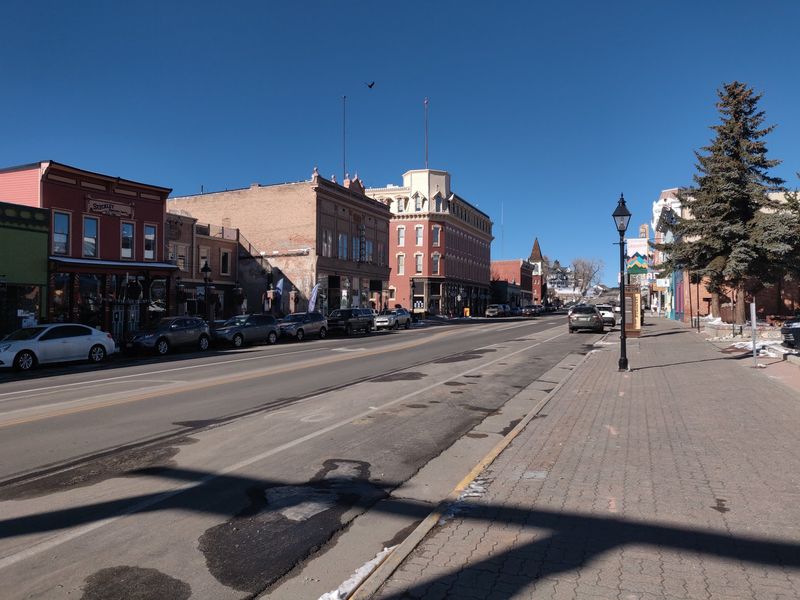
Leadville makes a compelling case that Colorado’s best summer weather is found by simply climbing higher than everyone else. The city sits at approximately 10,200 feet above sea level, and its official tourism organization proudly calls it the highest incorporated city in North America.
Summer daytime temperatures typically stay in the mid-70s Fahrenheit, nights turn genuinely crisp, and the city records more than 300 sunny days per year. That is a hard combination to argue with.
Colorado’s two highest mountains, Mount Elbert and Mount Massive, dominate the skyline in a way that makes the surrounding landscape feel almost theatrical. Turquoise Lake shimmers among pine forests just outside town, the Mineral Belt Trail loops through old mining country, and alpine meadows stretch across the Sawatch Range in every direction.
Almost any road out of downtown leads quickly into scenery that looks more like a national park than a city neighborhood.
Leadville was a booming silver and lead mining city long before outdoor recreation became its identity. Victorian storefronts and old mining history survive alongside world-class trail access and mountain views.
That combination of genuine frontier history and spectacular Rocky Mountain scenery gives Leadville a character that purpose-built resort towns rarely manage to replicate, no matter how hard they try.
Flagstaff, Arizona

Drive north from Phoenix in July and the thermometer does something almost theatrical. Every thousand feet of elevation peels away several degrees, and by the time Flagstaff appears through the ponderosa pines, the air feels like a completely different season.
The city sits at approximately 7,000 feet above sea level, and its tourism bureau reports average highs of about 79 degrees Fahrenheit in June, 82 in July, and 80 in August, with nights dropping close to 50 degrees.
That is not cold by mountain standards. But compared with Phoenix regularly hitting 110 degrees in the same months, Flagstaff can feel like a different planet entirely.
The landscape transformation is equally dramatic. Saguaro cactus and desert scrub give way to tall ponderosa pines, the largest contiguous ponderosa forest in the world, and the San Francisco Peaks rise north of the city into genuine alpine terrain.
Volcanic landscapes, high meadows, pine-covered trails, and even barren tundra at the highest elevations are all within reach of downtown Flagstaff. The city’s tourism bureau specifically highlights ecosystems ranging from high desert to alpine forest, an unusual range for a single community.
Flagstaff is the rare Arizona destination where packing a sweatshirt for a summer trip is not just reasonable. It is genuinely necessary.
Baguio, Philippines
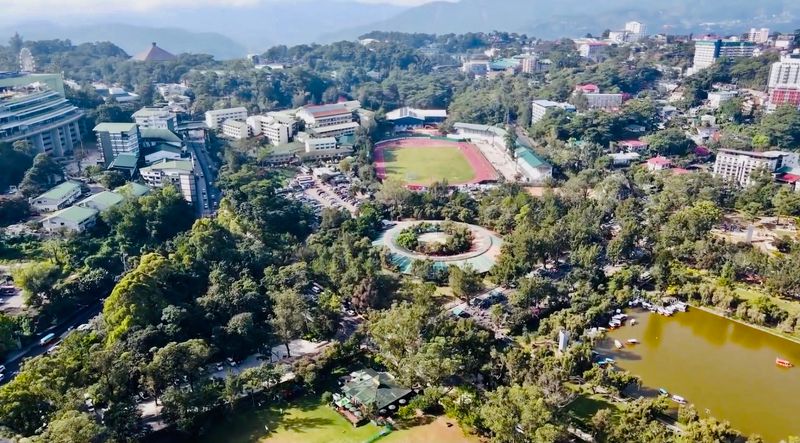
The nickname says it all without any further explanation needed. Baguio is the Summer Capital of the Philippines, and it earned that title by being the one place in a hot tropical country where lowland residents can reliably escape to cool air and pine-scented breezes.
The national tourism authority confirms the city sits above 1,500 meters, high enough to create a refreshing highland climate that feels dramatically different from the beaches and humidity most international travelers associate with the Philippines.
Pine forests cover the surrounding hills instead of palm trees. Gardens flourish in the cooler air, and the city’s famous Botanical Garden and Burnham Park add green, walkable spaces right inside the urban center.
Mines View provides mountain panoramas that stretch across forested ridges, while the city’s status as a UNESCO Creative City for Crafts and Folk Art adds genuine cultural depth to its climate appeal.
Summer in Baguio overlaps with the wet season, which means afternoon mist and cloud are common. Rather than being a drawback, that atmospheric moisture makes the pine-covered hills feel cinematic and slightly mysterious.
In a country defined by tropical heat, Baguio operates as its own separate climatic zone, a cool, green, fog-wrapped highland world sitting above the lowland heat.
Addis Ababa, Ethiopia
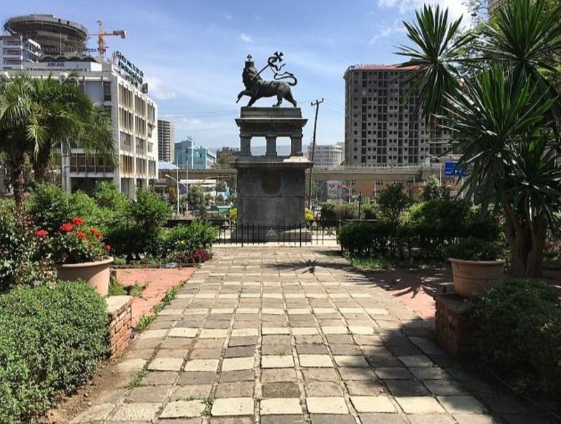
Most travelers picture East African cities as hot and dusty. Addis Ababa politely disagrees.
Ethiopia’s capital occupies the highlands at about 2,355 meters above sea level, with some sections climbing toward 3,000 meters around the Entoto Mountains to the north. That elevation keeps temperatures far milder than the continent’s reputation might suggest, and no month records a mean temperature above roughly 22 degrees Celsius.
The June-to-September rainy period is actually the coolest part of the year, when clouds and frequent showers hold daytime temperatures down and the surrounding landscape turns green. Mount Entoto gives the city its most obvious scenic escape.
Climb north from central Addis and urban density gradually gives way to eucalyptus forest, highland viewpoints, ancient churches, and wide panoramas across the entire capital below.
The Great Rift Valley begins not far beyond the city, adding extraordinary geological drama to Ethiopia’s already remarkable topography. Addis Ababa therefore combines three things that rarely appear together in popular travel imagination: African capital city, equatorial latitude, and genuine jacket weather after dark.
Altitude explains all of it. For travelers who arrive expecting tropical heat and find themselves reaching for an extra layer, the surprise is one of the most pleasant the continent has to offer.
Nairobi, Kenya
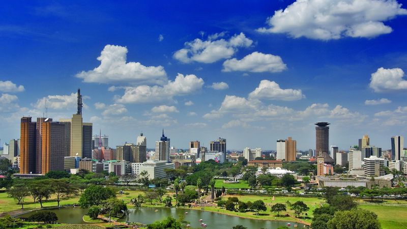
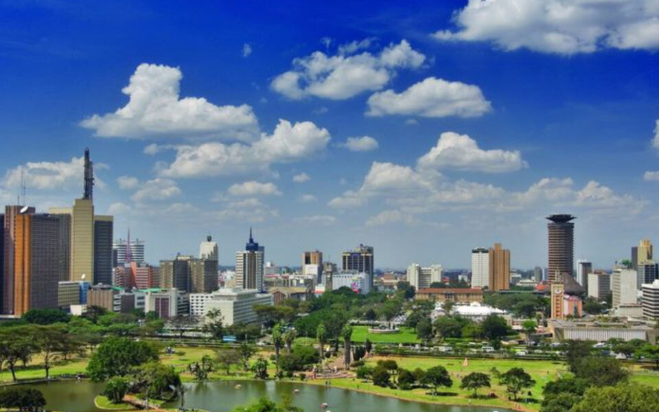
Safari animals grazing with a city skyline in the background is not a photo composite. In Nairobi, it is just a Tuesday.
Kenya’s capital sits around 1,795 meters above sea level, and that elevation keeps temperatures moderate year-round. During the cooler June and July period, nights can drop toward 9 degrees Celsius, while even the warmest months generally reach only the mid-to-upper 20s during the day.
For a city sitting virtually on the equator, that is genuinely surprising.
Nairobi National Park lies only minutes from the central business district, where visitors can watch lions, rhinos, and giraffes move across open grassland with office towers visible in the distance. Kenya’s official tourism portal describes it as the only national park in the world located immediately beside a major capital city.
That fact alone makes Nairobi unlike any other urban destination on the planet.
The Ngong Hills rise west of the city, offering hiking trails and sweeping highland views. On exceptionally clear days, the wider highland geography reaches toward Mount Kenya to the north and Kilimanjaro to the south.
Few places on Earth combine genuinely mild weather, metropolitan energy, highland scenery, and the possibility of spotting a rhinoceros before lunch. Nairobi manages all of it without breaking a sweat.
San Cristobal de las Casas, Mexico
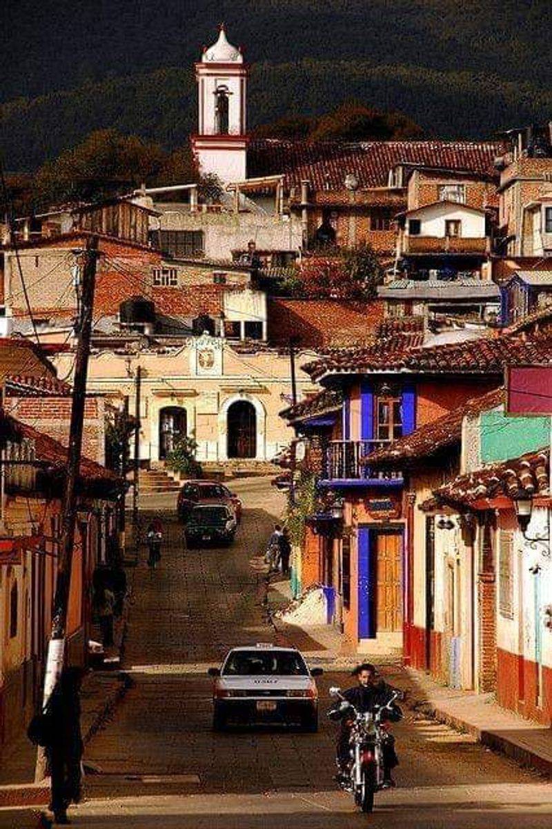
Southern Mexico is not the first place most travelers think of when searching for cool summer air. San Cristobal de las Casas has been quietly proving that assumption wrong for centuries.
The Chiapas city sits at roughly 2,200 meters inside a mountain valley surrounded by forested hills, and its elevation creates a temperate highland climate that feels completely disconnected from the tropical lowlands just a few hours away by road.
Climate averages put June and July highs around 24 degrees Celsius, while nights fall into the low-to-mid teens Fahrenheit equivalent, cool enough to make a blanket feel genuinely necessary. The historic center is a delight of colorful colonial buildings, tiled rooftops, ornate churches, artisan markets, and strong Indigenous Maya cultural influence that gives the city a character unlike anywhere else in Mexico.
Summer is part of the rainy season, which means afternoon showers arrive regularly and the surrounding pine-covered highlands turn an especially vivid shade of green. Mist settles into the valleys between hills on cool mornings, and the entire city takes on a slightly atmospheric, old-world quality that is hard to describe but easy to feel.
On a quiet morning with clouds hanging low over the hills, San Cristobal feels much farther from tropical Mexico than the map would ever suggest.
Share this story