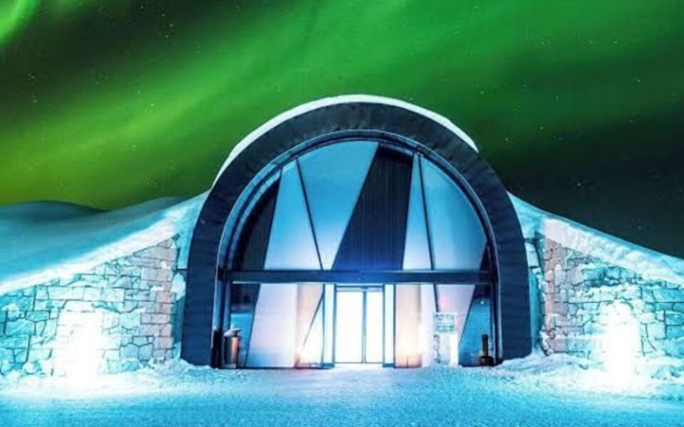
Sweden is a country that keeps surprising you the further you travel through it. Sandy beaches and medieval walled towns give way to dense forests, mirror-like lakes, and candy-red wooden cottages as you head inland and north.
Push even further and the landscape shifts again into reindeer country, frozen rivers, and mountains lit by the midnight sun. These 15 destinations trace that remarkable journey from the southern Baltic coast all the way to the Arctic wilderness of Swedish Lapland.
Stenshuvud National Park, Skåne
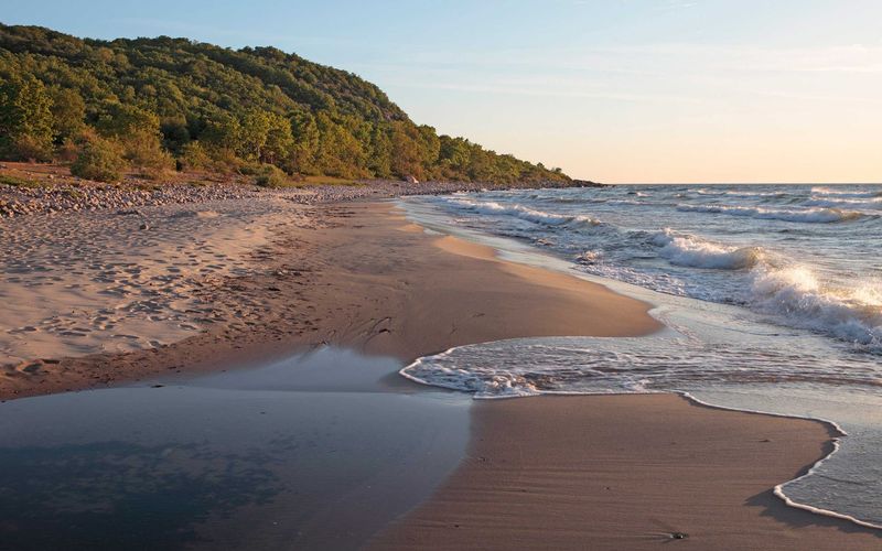
Southern Sweden has a well-kept secret, and Stenshuvud National Park is it. Most people expect pine trees and snow when they think of Sweden, but this coastal gem in Skåne serves up sandy beaches, rolling heathland, and lush broadleaf woodland all in one compact package.
Established in 1986, the park shelters around 600 species of vascular plants, which is a remarkable number for a relatively small protected area.
The park’s highest point climbs just 97 meters, but the views from the summit stretch impressively along the Baltic coastline. On an exceptionally clear day, you can spot Denmark’s Bornholm island hovering on the horizon.
Walking trails weave through hornbeam, oak, and beech woodland before tumbling down to the sea, making the route feel like a miniature world tour of European forest types.
Wildlife lovers will appreciate the variety of birds and insects that thrive here. The mix of habitats, from open meadows to shaded forest floors, creates conditions that support species rarely seen elsewhere in Sweden.
Stenshuvud is an ideal first stop for anyone discovering that Sweden’s south is far greener and warmer than its reputation suggests.
Karlskrona, Blekinge
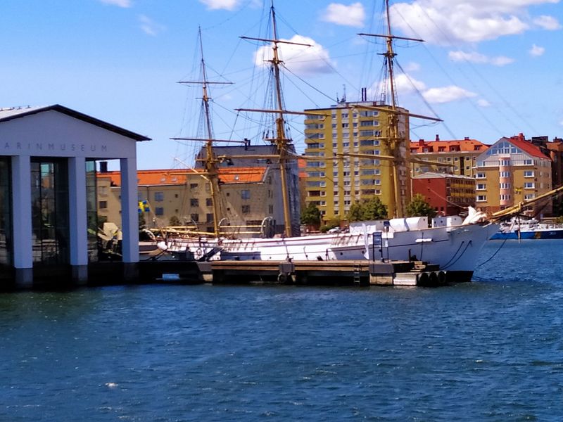
Karlskrona was not built beside the sea by accident. Sweden’s naval ambitions in the late 17th century demanded a purpose-designed base, and so in 1680 an entirely new city was engineered across a cluster of islands in the Blekinge archipelago.
The result is one of Europe’s most deliberate urban plans, still readable today in its wide Baroque streets and symmetrical squares.
The historic naval port earned UNESCO World Heritage status for good reason. Fortifications, shipbuilding facilities, admiralty buildings, and two remarkable churches designed by Nicodemus Tessin the Younger all survive in excellent condition.
A ferry ride to the nearby island of Aspö brings you face to face with Drottningskär Citadel, a star-shaped fortress rising from the water like something from a strategy game.
What makes Karlskrona especially rewarding is that it remains a working maritime city. The Swedish Navy still operates here, giving the place a living energy rather than the dusty atmosphere of a preserved outdoor museum.
Wander the main island of Trossö, grab a coffee overlooking the harbour, and you will quickly understand why this city feels proud rather than simply old. It earned that pride over more than three centuries of seafaring history.
Southern Öland
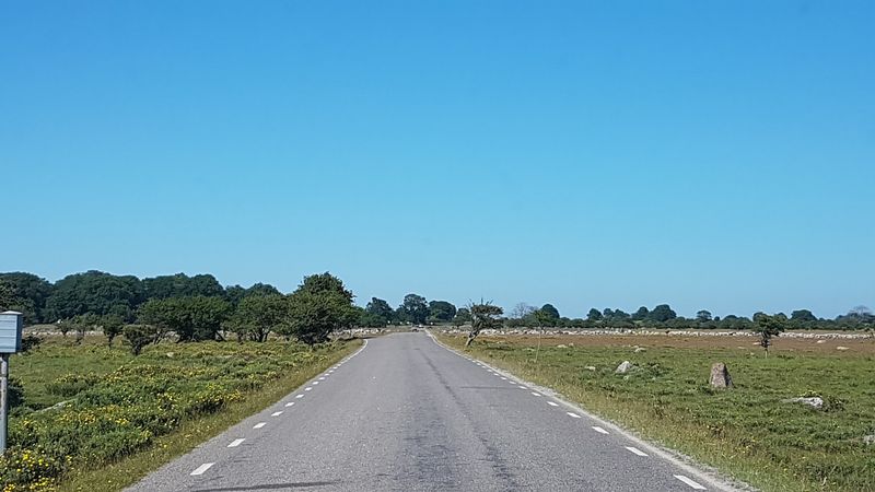
Cross the bridge from mainland Sweden to Öland and something shifts almost immediately. The sky grows bigger, the land flattens out, and the vegetation becomes low and sparse in a way that feels closer to a steppe than a Scandinavian island.
Southern Öland’s UNESCO listing recognizes not just the scenery but thousands of years of human farming that shaped the island’s unusual limestone terrain.
The star attraction is Stora Alvaret, an enormous open grassland covering much of the southern island. Thin soils and exposed limestone bedrock make conditions tough for most plants, but the species that do survive here are fascinating specialists.
Stone walls, old windmills, and villages arranged along ancient roads complete a landscape that feels genuinely timeless rather than artificially preserved.
UNESCO classified Southern Öland as a cultural landscape rather than simply a nature reserve, which is a meaningful distinction. The grasslands exist because generations of farmers grazed livestock here and maintained traditional practices under difficult conditions.
Remove the farming and the landscape would change entirely. Visiting in late spring or early summer is particularly rewarding, when wildflowers carpet the alvar in colours that seem almost out of place on such a stark and windswept island.
Visby and Gotland
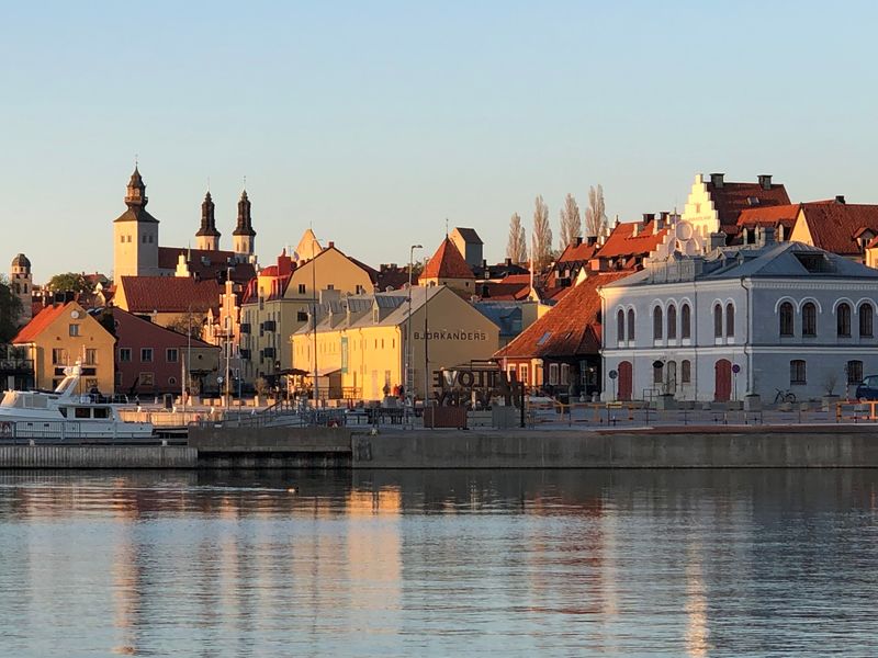
Sitting in the middle of the Baltic Sea, Gotland operates by its own rules. The island enjoys more sunshine than almost anywhere else in Sweden, its coastline bristles with extraordinary limestone sea stacks called raukar, and its main town Visby contains some of the best-preserved medieval architecture in northern Europe.
That combination makes Gotland one of Sweden’s most genuinely distinctive destinations.
Visby flourished as a powerful Hanseatic trading hub during the Middle Ages, and its prosperity is written into every cobblestone. The ring wall that still encircles much of the old town stretches nearly four kilometers, punctuated by towers that once defended the city’s merchant wealth.
Inside, ruined church walls stand open to the sky beside functioning streets lined with roses in summer, creating a romantic contrast that photographers never seem to tire of.
Beyond Visby, the rest of Gotland rewards slow exploration. An extraordinary 92 medieval churches are scattered across the island, most dating from the 12th to 15th centuries and many still in regular use.
Beaches, cliff walks, and small fishing harbours fill the coastline between them. Gotland gets busy in July, so arriving in late spring or early September gives you the beauty without quite so much competition for the best spots.
Stockholm Archipelago
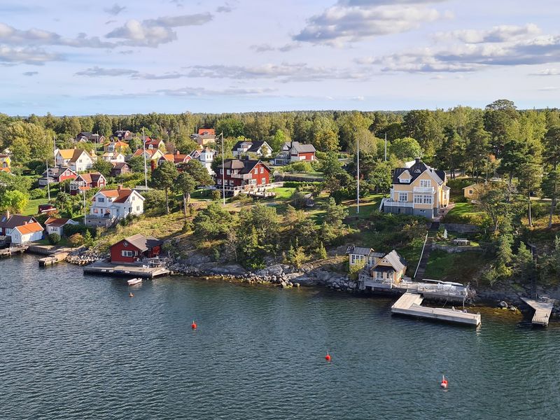
Roughly 30,000 islands, skerries, and bare rocks spread eastward from Stockholm into the Baltic Sea, forming one of the most intricate coastal landscapes in the world. The Stockholm Archipelago stretches about 80 kilometers from the city’s edge, ranging from busy islands with restaurants and year-round residents to tiny exposed rocks where only seabirds bother to stop.
Getting out among them by ferry is one of the great pleasures of visiting the Swedish capital.
Communities like Vaxholm, Sandhamn, and Utö are popular and easy to reach without a private boat. Each has its own personality: Vaxholm is known for its fortress and painted wooden houses, while Sandhamn draws the sailing crowd with its lively harbour atmosphere.
Smaller islands offer kayaking, wild swimming, and the particular Swedish pleasure of sitting on a smooth rock watching the evening light play across the water.
The archipelago captures something essential about Swedish culture. Summer cottages, boat ownership, and the tradition of spending warm months close to water are deeply rooted habits here.
Even city residents with no rural connections often have a relationship with the archipelago through sailing clubs or summer rentals. For visitors, it offers a beautiful and accessible way to experience Scandinavian coastal life beyond the capital’s streets.
Falun, Dalarna
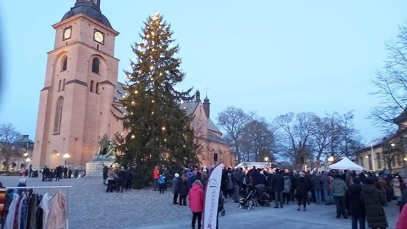
For a period during the 17th century, the mine at Falun was producing around two-thirds of Europe’s copper supply. That staggering output funded Sweden’s rise as a major European power and left a physical legacy that is still visible across the entire country.
Every classic red wooden cottage you spot in the Swedish countryside owes its colour to Falu Rödfärg, a paint pigment historically derived from the mine’s waste materials.
The mine and its surrounding industrial landscape are now a UNESCO World Heritage Site, recognizing both the scale of the operation and its cultural impact. Visitors can descend underground through tunnels that took centuries to carve, passing enormous caverns and learning how miners worked in conditions that were genuinely dangerous.
The surface buildings, workshops, and manager’s houses above ground tell the social side of the story, showing how an entire community organized itself around copper extraction.
Falun sits in the heart of Dalarna province, which makes it a natural stop on any journey through central Sweden. The nearby town centre has a comfortable, unhurried atmosphere, and the combination of industrial heritage and traditional countryside architecture gives the area a depth that goes well beyond a single museum visit.
This is a place that explains a surprising amount about how modern Sweden came to be.
Lake Siljan and Dalarna
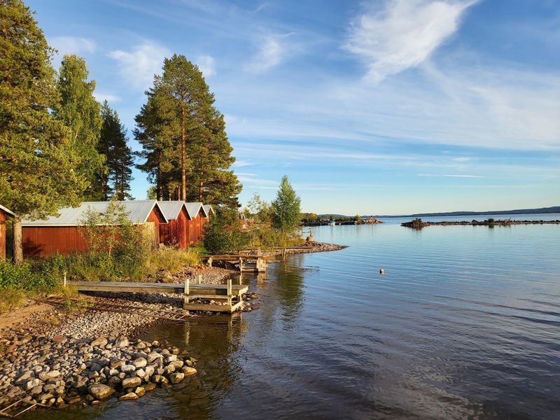
Ask most Swedes to picture the Swedish countryside and the image that appears will almost certainly look like Dalarna. Red wooden farmhouses, flower-decorated midsummer poles, painted Dala horses on windowsills, and church boats gliding across a glassy lake: this province holds a uniquely powerful place in Swedish national identity.
Lake Siljan sits at the centre of it all, both geographically and emotionally.
The lake itself has an unusual origin story. It occupies part of a massive ancient impact structure left by a meteorite that struck hundreds of millions of years ago.
The circular basin created by that collision now holds one of central Sweden’s most beautiful stretches of water, ringed by villages and towns including Rättvik, Leksand, Mora, and the charming hillside settlement of Tällberg. Each has its own character and traditions.
Mora is the finishing point of Vasaloppet, the famous long-distance ski race first run in 1922 and now attracting thousands of participants each February. In summer the same landscape offers hiking, boating, and swimming.
Dalarna also hosts some of Sweden’s most authentic midsummer celebrations, where the traditions of raising a maypole and dancing in folk costumes are taken seriously rather than performed purely for tourists. Visiting in June or February gives very different but equally memorable experiences.
The High Coast, Ångermanland
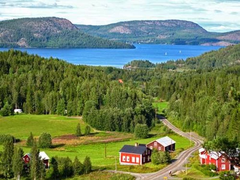
Here is a coastline doing something genuinely unusual: it is rising. The High Coast, known in Swedish as Höga Kusten, sits on the Gulf of Bothnia in Ångermanland and continues rebounding upward after being pressed down under the immense weight of Ice Age glaciers.
The ancient shoreline has already climbed to approximately 286 meters above present sea level, and the land is still rising at around eight millimeters per year. That is not something most coastlines can claim.
UNESCO recognized the area for this exceptional post-glacial land uplift, which is among the most dramatic examples of the process anywhere on Earth. The landscape it has produced is spectacular: steep forested cliffs, rocky bays, islands that were once hilltops, and hiking routes that cut across exposed ancient bedrock.
Skuleskogen National Park protects a significant portion of this terrain, including deep geological fissures that split the rock like something out of a fantasy novel.
The region rewards active visitors. Trails range from gentle coastal walks to more demanding routes across high ridges with sweeping views over the Gulf of Bothnia.
Kayaking between islands is popular in summer, and the relative lack of crowds compared to more famous Swedish destinations gives the High Coast a pleasantly unhurried feel that serious nature travellers tend to appreciate enormously.
Gammelstad Church Town, Luleå
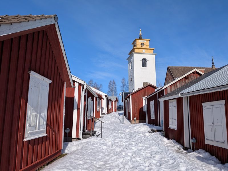
Imagine travelling two days through snow and forest just to attend a Sunday church service, then needing somewhere to sleep before the long journey home. That was the reality for farming communities scattered across northern Sweden for centuries, and Gammelstad Church Town is the physical answer they built.
More than 400 small wooden cottages cluster tightly around a medieval stone church outside Luleå, forming a settlement unlike almost anything else in Europe.
Parishioners from distant farms used the cottages during church holidays and important services, staying overnight rather than attempting to return through harsh winter conditions on poor roads. This pattern of church towns once existed widely across northern Scandinavia, but Gammelstad is by far the best-preserved surviving example and carries UNESCO World Heritage recognition to prove it.
Many of the cottages remain in private ownership and are still used by families descended from the original parishioners.
Walking through Gammelstad feels quietly affecting in a way that larger heritage sites sometimes miss. The scale is human and intimate: narrow lanes between low wooden buildings, a church that has stood since the 15th century, and a stillness that makes the practical ingenuity of the settlement easy to appreciate.
It is a compelling window into how northern climate, religious life, and scattered rural populations shaped architecture in ways that left a lasting mark on the landscape.
Jokkmokk
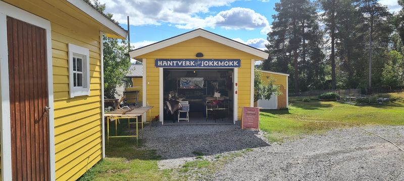
Just north of the Arctic Circle, Jokkmokk punches well above its weight as a small town. Every February, the Jokkmokk Winter Market transforms the place into one of northern Sweden’s most vibrant gatherings, drawing visitors from across Scandinavia and beyond to browse Sámi crafts, taste traditional foods, and watch reindeer racing on a frozen lake.
The market has roots stretching back more than 400 years, making it one of Sweden’s oldest continuous trading events.
Outside market week, Jokkmokk is the home of Ájtte, the Swedish Mountain and Sámi Museum. The museum documents Sámi history, reindeer husbandry, traditional clothing, and the ecology of northern mountain environments with genuine depth and sensitivity.
It avoids treating Sámi culture as something frozen in time, instead presenting it as a living tradition that continues to evolve and adapt.
The town also serves as a natural gateway to the enormous Laponian World Heritage landscape that spreads across the surrounding region. Jokkmokk’s importance is rooted in living culture rather than simply dramatic scenery, which makes it a more meaningful stop than many Arctic destinations.
Come for the market if you can, but stay for the museum and the sense of being at the threshold of one of Europe’s last great wilderness areas.
Laponian Area
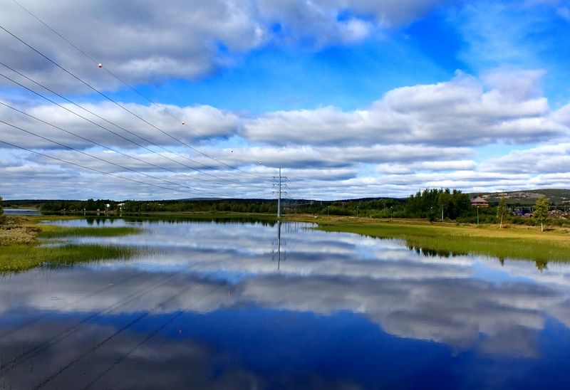
Covering nearly 941,000 hectares of northern Sweden, the Laponian Area is one of the largest UNESCO World Heritage Sites in the world. Its scale is almost difficult to process: mountains, ancient forests, wetlands, glaciers, major river systems, and alpine meadows all contained within a single protected region.
The landscape has been shaped over millions of years by geology and ice, and it shows.
What makes the Laponian Area particularly significant is that it is not simply wilderness. Sámi communities have practiced seasonal reindeer herding here for generations, moving between lowland winter grazing areas and high mountain summer pastures in a pattern that has shaped the landscape as much as any geological force.
UNESCO recognized both the natural and cultural dimensions of the area, making it one of relatively few sites to hold that dual distinction.
Four national parks sit within Laponia: Sarek, Padjelanta, Stora Sjöfallet, and Muddus. Each has its own character, from Muddus’s ancient boreal forest and wetlands to the high-alpine drama of Sarek.
Accessing the more remote parts requires genuine preparation and outdoor experience. But even the edges of Laponia, reachable by road or boat, offer scenery and silence that most of Europe simply cannot match anymore.
This is landscape on a scale that recalibrates your sense of what wild actually means.
Sarek National Park
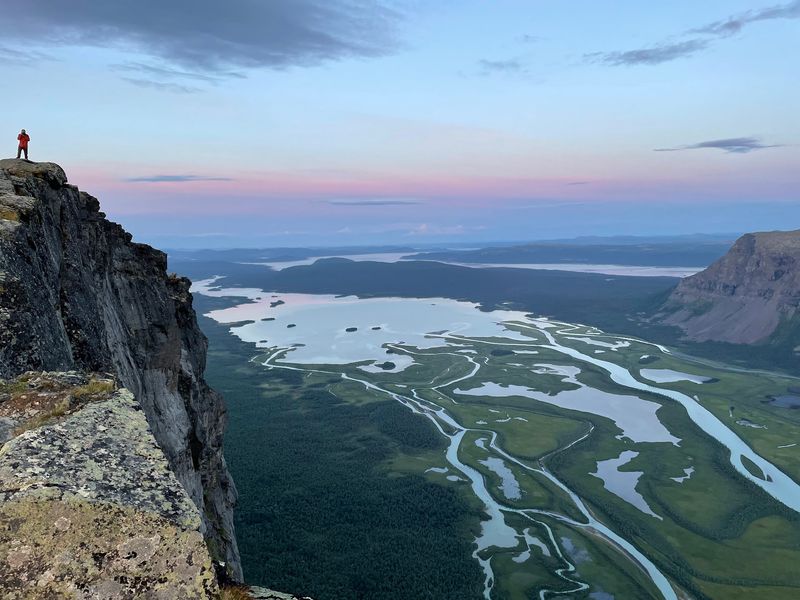
Sarek National Park does not make things easy for you, and that is precisely the point. Established in 1909, it protects a vast high-alpine landscape in northern Sweden with almost no visitor infrastructure: no marked trails in most areas, no mountain huts run by outdoor organizations, and no roads cutting through its interior.
Getting in requires genuine planning, physical fitness, and a solid respect for unpredictable Arctic mountain weather.
The numbers alone are impressive. Sarek contains six of Sweden’s highest mountains and nearly 100 glaciers, making it the most alpine terrain in the country.
The Rapa Valley, fed by glacial rivers, forms one of Scandinavia’s most celebrated wilderness landscapes, with a braided river delta that spreads across the valley floor in a pattern best appreciated from above. Moose, wolverine, bear, and lynx all inhabit the park, though sightings require patience and luck.
Sarek is also part of the Laponian World Heritage Area, a reminder that this landscape has a human dimension alongside its ecological drama. Sámi reindeer herders have used these mountains seasonally for generations.
For experienced hikers willing to carry everything they need, Sarek offers something increasingly rare: a place where the landscape has not been adjusted to make visitors comfortable, and is all the more powerful for it.
Jukkasjärvi and the Icehotel
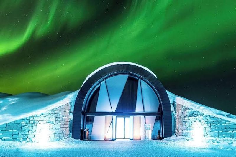
About 200 kilometers north of the Arctic Circle, the small village of Jukkasjärvi does something remarkable every winter: it builds a hotel entirely from ice and snow harvested from the frozen Torne River. The Icehotel has been doing this since 1990, inviting artists from around the world to design individual suites and installations that are then inhabited by guests sleeping on reindeer-skin covered ice beds.
Each year’s hotel is a completely new creation, which means no two winters are ever the same.
The seasonal sections melt away each spring, but a permanent component of the hotel now stays open year-round, kept frozen by refrigeration technology and allowing visitors to experience ice interiors even in midsummer. The craftsmanship in the carved suites is genuinely extraordinary, ranging from minimalist geometric forms to elaborate figurative scenes.
The hotel also runs ice art workshops for guests who want to try sculpting themselves.
Beyond the hotel, Jukkasjärvi sits within a landscape deeply connected to Sámi culture and the Torne River valley. Dog sledding, snowmobile safaris, and northern lights viewing are all available nearby during the winter season.
The village itself is tiny and quiet, which makes the contrast with the internationally famous hotel it contains all the more entertaining. Few places in Sweden manage to be simultaneously this remote and this renowned.
Kiruna
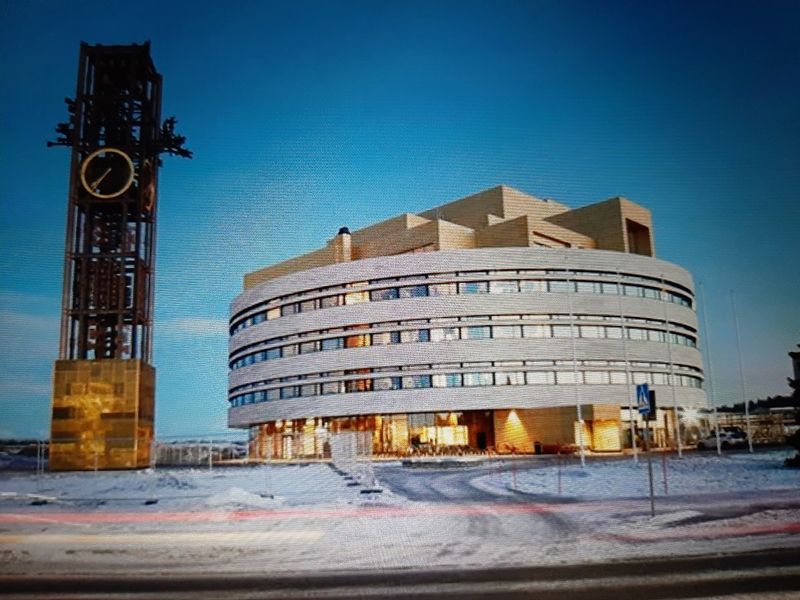
Kiruna is doing something no other city in Europe has attempted quite like this. Founded around 1900 to serve the vast iron ore deposits beneath its ground, the city has spent recent years physically relocating itself.
Underground mining created ground deformation risks for parts of the original settlement, so a new city centre was developed roughly three kilometers to the east, with selected historic buildings dismantled and carefully moved rather than simply demolished. The new centre opened in 2022.
The relocated church, originally built in 1912 and once voted Sweden’s most beautiful building, now stands in its new position and continues functioning as a place of worship. The old city hall clock tower was also moved, preserving a piece of Kiruna’s visual identity even as the urban landscape transforms around it.
The broader relocation process is expected to continue for years, making Kiruna an ongoing experiment in how mining communities adapt when the industry that created them keeps growing beneath their feet.
As Sweden’s northernmost city, Kiruna also serves as the main hub for Arctic adventures in the region. Kebnekaise, Sweden’s highest mountain, is accessible from here.
The Icehotel at Jukkasjärvi, Abisko National Park, and some of northern Sweden’s best northern lights viewing spots are all within reach. Kiruna manages to be simultaneously a working mining city and a gateway to extraordinary Arctic wilderness, which is a combination found almost nowhere else.
Abisko National Park
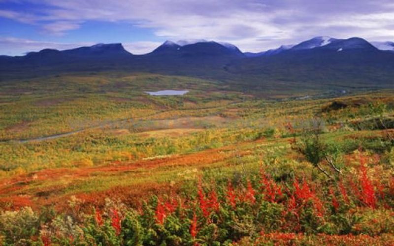
At the very top of Sweden’s long journey northward, Abisko National Park waits near the Norwegian border with a landscape that feels like the world’s edge in the best possible way. Established in 1909, the same year as Sarek, it protects mountain birch woodland, exposed alpine peaks, rushing rapids, and the shores of Torneträsk, which is Scandinavia’s largest mountain lake.
The scale of the lake is genuinely startling the first time you see it stretching toward distant Norwegian mountains.
The Abiskojåkka River cuts through a dramatic canyon before spreading into a delta where it meets Torneträsk, and the canyon walk is one of the park’s most rewarding short routes. Abisko is also the northern trailhead for Kungsleden, the King’s Trail, a roughly 450-kilometer hiking route that heads south through mountain landscapes and several national parks all the way to Hemavan.
Starting here and walking even a few days of the trail gives a powerful sense of the terrain’s scale.
Two very different kinds of visitor are drawn to Abisko. Summer brings hikers seeking continuous daylight, wildflowers, and the particular freedom of walking under a sun that never quite sets.
Winter attracts aurora hunters, because Abisko sits in a microclimate that produces unusually clear skies compared to surrounding areas. The Aurora Sky Station above the village operates during the dark months specifically to take advantage of this natural advantage.
Share this story