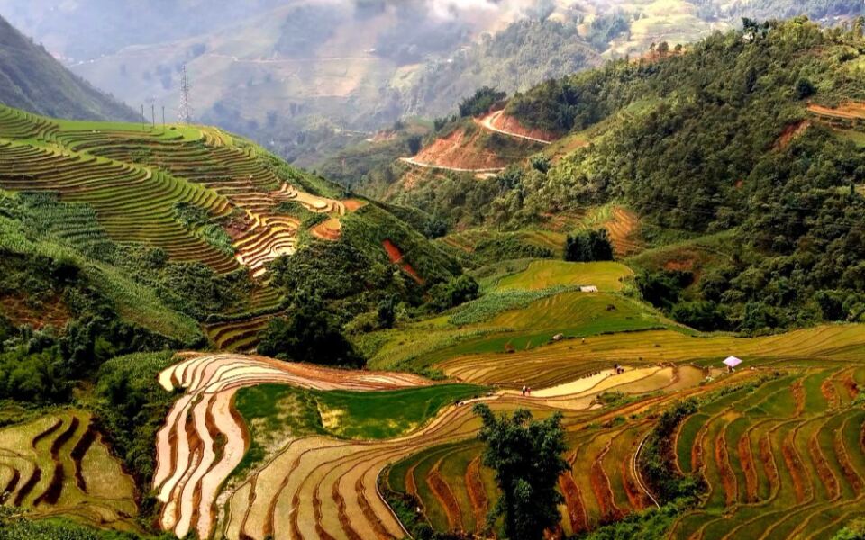
Vietnam packs misty mountains, glowing old towns, quiet caves, and sunny islands into one long, curvy country. Every stop tells a story, from ancient kingdoms to busy river markets.
Some places are famous, and others feel like secrets. Get ready to meet fifteen spots that show why Vietnam keeps travelers coming back.
Ha Long Bay and Cat Ba Archipelago
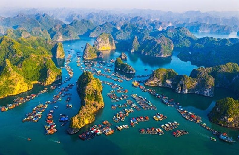
Picture 1,133 islands and islets poking out of green water like a crowd of stone giants at a party. That is Ha Long Bay, and it covers 65,650 hectares of UNESCO-protected sea and rock.
Nobody forgets their first sight of it.
The scenery includes lone limestone pillars, tight clusters of peaks, hidden lagoons, caves, and forested islands. Cat Ba joined the World Heritage property in 2023, which helps protect wildlife such as the critically endangered Cat Ba langur.
Only a small number of these monkeys remain, so their forest home matters a lot.
Kayaking is the best way to slip into quiet corners where the cliffs tower over your paddle. Boat trips also let you glide past caves and floating spots without the noise of a road.
Each shape in the rock took millions of years to form, through dissolving limestone, uplift, erosion, and rising seas.
Plan for early morning or late afternoon when the light turns the water golden and the crowds thin out. Bring a hat, sunscreen, and a camera with plenty of space.
You will use it.
Trang An and Ninh Binh
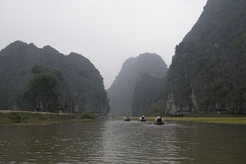
Your boat driver may row with their feet, and that is just the start of the surprises. Trang An in Ninh Binh sends small boats through dark cave tunnels beneath steep limestone cliffs.
Cool air, dripping water, and soft splashes set the mood.
The UNESCO-listed area covers 6,226 hectares of towers, valleys, rivers, forests, rice paddies, temples, and villages. Cave deposits show people lived here more than 30,000 years ago and adapted as ancient seas rose and fell.
Few places in Vietnam link archaeology and scenery so neatly.
History also sits nearby at Hoa Lu, which served as Vietnam’s capital in the 10th and 11th centuries. Visiting both gives you a feel for how rulers chose this fortress of rock for safety.
For a big view, climb the roughly 500 steps up to Hang Mua. Your legs will complain, but the panorama of winding river and green fields pays them back.
Go early to beat the heat and the tour groups, and wear shoes with good grip for the stairs.
Hoi An Ancient Town
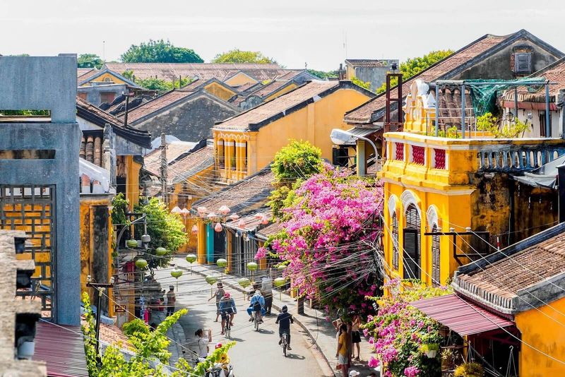
Lanterns glow, bicycles hum past, and the smell of grilled pork floats down the lane. Hoi An feels like a movie set, yet it is a real town where people live and work.
It survived mostly because its port faded in importance, so nobody rebuilt it.
Between the 15th and 19th centuries, merchants from China, Japan, Southeast Asia, and later Europe traded along the Thu Bon River. UNESCO calls it an exceptionally well-preserved small trading port, with buildings that blend local and foreign styles.
Look for timber merchant houses, assembly halls, temples, and the Japanese Covered Bridge.
The historic center covers only about 30 hectares, so walking or cycling works perfectly. Ride out to nearby farming villages and the coast for a change of pace from the busy old streets.
Evenings bring the best atmosphere, though the lanes fill up fast. Try a morning stroll when shopkeepers are sweeping steps and the light is soft.
Wear comfortable shoes, because the old paving stones can be uneven after rain.
Hue
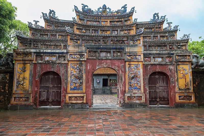
Emperors once planned every angle of this city, right down to the mountain view. Hue became the capital of unified Vietnam in 1802 and stayed the political, cultural, and religious center of the Nguyen Dynasty until 1945.
That is a lot of history packed along one river.
The Imperial City and the Forbidden Purple City sit inside the fortified core. Beyond the walls, royal tombs, temples, and ceremonial sites spread across the Perfume River area and nearby hills.
Thien Mu Pagoda rises beside the water and makes a lovely stop.
UNESCO notes that the city’s layout was joined with nature, including Ngu Binh Mountain and the river, following traditional cosmological ideas. Buildings and landscape were designed as one picture instead of separate parts.
Give yourself at least a full day, and think about hiring a bike or a boat to reach the tombs. Each tomb has its own mood, from grand to peaceful.
Summer can be hot, so pack water and start early before the sun gets strong.
Phong Nha-Ke Bang National Park
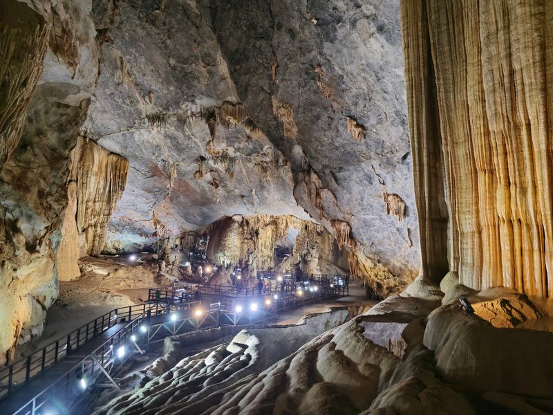
Under the green hills of central Vietnam lies a world with its own rivers, skies, and echoes. Phong Nha-Ke Bang protects limestone that began forming around 400 million years ago.
That makes the rock older than dinosaurs.
In 2025, UNESCO expanded the property across the border into Laos. The new transboundary site is called Phong Nha-Ke Bang and Hin Nam No National Parks.
More than 220 kilometers of caves and underground waterways have been documented across it.
Visitors find giant chambers, sinkholes, hidden rivers, steep cliffs, and thick forest full of rare plants and animals. The Vietnamese side is famous for Phong Nha Cave, Paradise Cave, and Son Doong.
Even so, the real star is the whole ecosystem, valued for its age, scale, and untouched feel.
Phong Nha Cave is usually explored by boat, while Paradise Cave has a walkway for easy exploring. Son Doong needs a special guided expedition, so book far ahead.
Bring a light jacket, since caves stay cool even on hot days.
Ha Giang Highlands
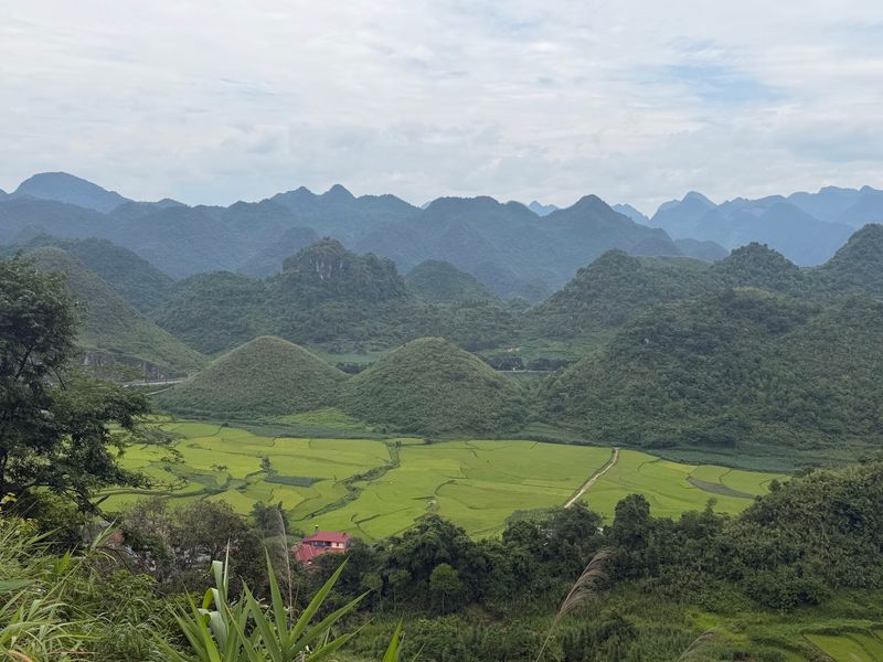
Hold onto your helmet, because the road here twists like a dropped noodle. In far northern Vietnam, the land turns sharp and vertical.
The Dong Van Karst Plateau is full of jagged peaks, deep valleys, and rocky fields tucked between stones.
Hmong and other ethnic communities live here and farm in places that look almost impossible. Ma Pi Leng Pass is among the most dramatic roads, climbing high above the Nho Que River through very steep terrain.
Stop at the viewpoints, because the drop is stunning.
Autumn adds color. Golden rice fills some valleys, and buckwheat flowers usually bloom from October into November.
Administrative boundaries changed in 2025, and the former Ha Giang province was folded into Tuyen Quang. Vietnam’s tourism authorities still use Ha Giang as the familiar name for this travel region.
Most visitors tour by motorbike with a local rider or guide, which is a safer choice on narrow bends. Pack layers, because mountain weather swings fast.
Sa Pa and the Hoang Lien Mountains
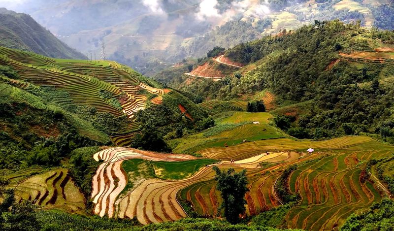
Mornings in Sa Pa often start with fog so thick the valley disappears. Then the mist lifts and rice terraces appear, stacked along the slopes like green stairs.
Families have farmed these hills for generations.
The Hoang Lien range holds Fansipan, Vietnam’s highest peak at 3,143 meters. A cable car now carries visitors to the top, so no multi-day trek is needed.
Trails near town still lead through villages of Hmong, Dao, Tay, and other communities.
The climate feels nothing like the tropical lowlands. Winters can be truly cold, and frost sometimes shows up at higher elevations.
September through November brings clearer skies and golden terraces, which many travelers consider the best time. Hire a local guide for village walks, since they can explain farming life and help you find quieter paths.
Bring a warm jacket, rain gear, and sturdy shoes, because trails turn slick and muddy quickly.
My Son Sanctuary

Moss-covered bricks, birdsong, and silence set the tone at My Son. Tucked into a mountain valley in central Vietnam, it was the religious and political heart of the Champa Kingdom.
The ring of green hills makes it feel set apart from everyday life.
UNESCO dates the surviving tradition from about the 4th to the 13th century. Its link to Indian Hinduism is strong, and the brick tower-temples were mainly dedicated to Hindu gods, especially Shiva.
The designs show how outside ideas became a distinct Cham art style.
War damaged big parts of the complex in the 20th century. Today, surviving towers, rebuilt sections, and archaeological remains stand side by side.
Some ruined spots are left as they are, which gives an honest picture of the past.
Arrive early, because mornings are cooler and calmer. Nearby Hoi An and Da Nang make easy bases for a half-day trip.
Bring water, a hat, and a guide if you want the stories behind each tower.
Hanoi and the Imperial Citadel of Thang Long
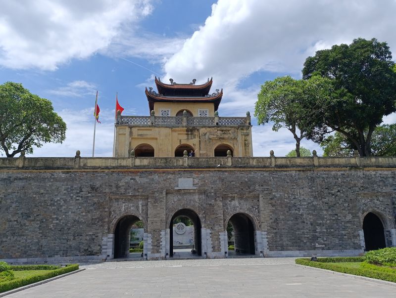
Crossing a Hanoi street can feel like a sport, yet the city’s story runs far deeper than traffic. The capital mixes modern speed with more than a thousand years of political history.
A great place to see this is the Imperial Citadel of Thang Long.
The Ly Dynasty founded the citadel in the 11th century, building on the remains of an earlier Chinese fortress. UNESCO says it was a seat of power for almost 13 centuries.
Digs have uncovered layers from many dynasties, like pages in a stone book.
The Old Quarter tells a different tale through narrow streets once packed with trade. Hoan Kiem Lake is the city’s living room, where people exercise at dawn and chat at dusk.
Add temples, colonial buildings, and busy street food corners, and Hanoi becomes a rich lesson in how history keeps going. Walk the Old Quarter slowly, and stop for a bowl of pho.
Visit the citadel in the morning for fewer crowds.
Mekong Delta and Can Tho
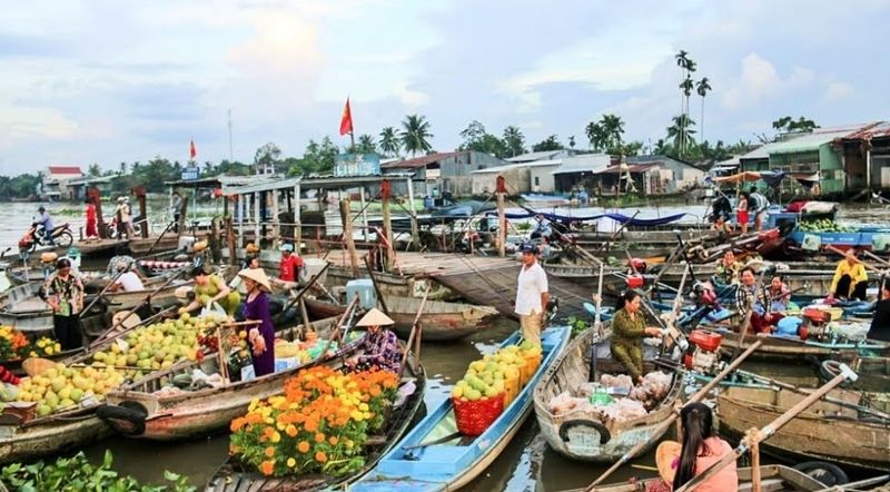
Here, the road is often water. In southern Vietnam, the Mekong splits into canals, channels, orchards, wetlands, and rice plains before meeting the sea.
Boats carry people, fruit, and gossip from one bank to the next.
Can Tho makes a handy base for exploring. From there you can reach markets, farms, temples, and smaller waterways that ordinary roads skip.
Tropical fruit and fishing are part of daily life, and you will smell mango, pomelo, and fresh fish in the air.
Vietnam’s tourism authority highlights the delta for its floating waterways, orchards, island stays, and river culture. There is no single grand monument to tick off.
Instead, travelers come to see how a great river shaped where people settled, what they eat, how they travel, and who they are. Rise early for a market trip, since the best trading happens at sunrise.
Wear light clothes, bring a hat, and carry small bills for fruit.
Con Dao Islands
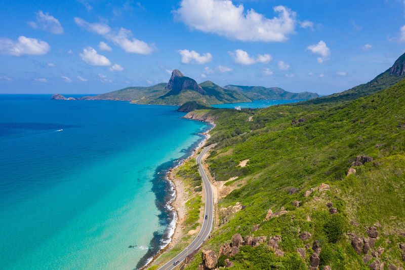
Turtles lay eggs on these beaches, while old prison walls stand just inland. Con Dao holds beauty and sorrow in the same place.
It is a remote southern archipelago that deserves a thoughtful visit.
Most of it lies within Con Dao National Park, with roughly 6,000 hectares of tropical forest and 14,000 hectares of marine habitat. Coral reefs, forested hills, quiet beaches, migratory birds, and sea-turtle nesting areas make it important for conservation.
The islands also served as a penal colony for more than a century under French colonial rule and later governments. Former prisons, the Con Dao Museum, and Hang Duong Cemetery tell that story.
Visitors are asked to behave respectfully, especially at memorial sites.
Because of this mix, Con Dao is far more than a beach getaway. Spend one day on history and another on snorkeling or hiking.
Check the season for turtle nesting, and book boat trips with operators who follow park rules.
Da Lat
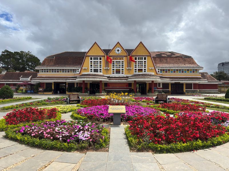
Sweaters in Vietnam? Yes, in Da Lat, you might actually need one.
Sitting at about 1,500 meters in the Central Highlands, the city is cool, breezy, and covered in pines. French colonial authorities built it in the early 20th century as a mountain escape from the lowland heat.
That era left churches, villas, hotels, and a distinctive railway station. Nature adds its own charm with lakes, waterfalls, coffee slopes, and nearby mountains around the city.
Coffee is now part of Da Lat’s farming identity, according to Vietnam Tourism. Rich volcanic uplands help crops grow well.
A café stop here is almost a duty.
Outdoor fans can hike, cycle, or try canyoning in the highland terrain. The mix of cool air, colonial buildings, and farmland sets Da Lat apart from the coastal cities and the northern karst regions.
Visit in the dry season for clearer views, and bring a light jacket for evenings.
Phu Quoc
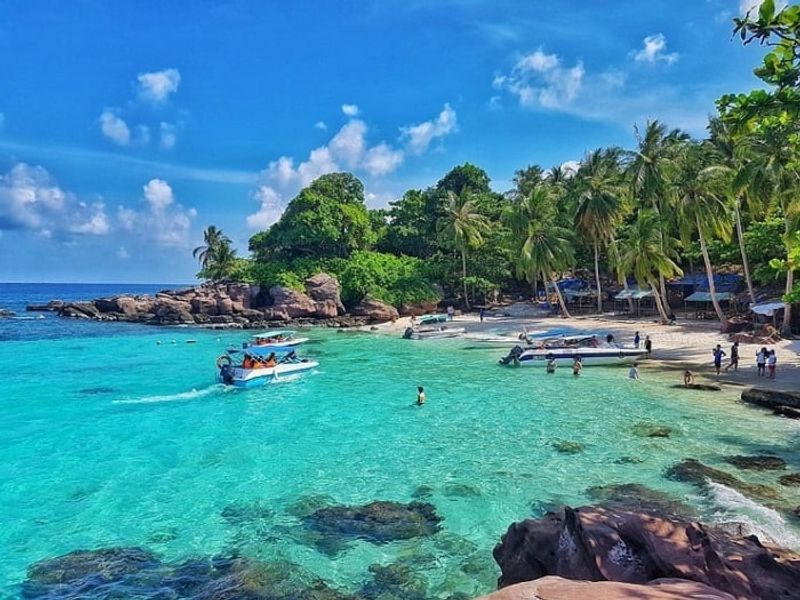
Fish sauce may not sound like a vacation highlight, but on Phu Quoc it is a point of pride. The island is known for beaches, yet its story also includes tropical forest, fishing, and pepper farming.
Phu Quoc fish sauce is one of Vietnam’s best-known food products.
Phu Quoc lies off the southwestern coast, and a large share of its land is protected within Phu Quoc National Park. Forest trails, streams, small beaches, and offshore islands offer calm alternatives to the fast-growing resort zones.
Traditional barrel houses still make fish sauce, and you can often watch the process. Pepper gardens add another local industry worth a visit, and the spicy scent is hard to miss.
The dry season, from November through April, usually brings calmer seas and clearer skies. Try staying beyond the main resort strips to see the island’s farming and fishing life.
Rent a scooter carefully, or hire a driver for easy day trips.
Yen Tu Mountain and Sacred Landscape
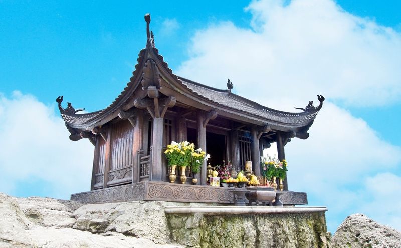
Pilgrims have walked these steps for centuries, and many still do. Yen Tu gained new fame in 2025, when UNESCO inscribed the Yen Tu-Vinh Nghiem-Con Son, Kiep Bac Complex of Monuments and Landscapes.
It became Vietnam’s ninth World Heritage property.
The serial site has 12 components scattered across forested mountains, river valleys, temples, pagodas, shrines, and archaeological remains. It matters greatly as the birthplace of Truc Lam Buddhism, a Vietnamese Zen tradition founded in the 13th century during the Tran Dynasty.
Pilgrimage routes climb through wooded slopes toward sacred sites, so the landscape is part of the spiritual meaning. Walking here is not just exercise but a way of taking part.
UNESCO stresses that the tradition remains alive, not frozen in the past. Monks and visitors still gather at the sites.
If you go, dress modestly, speak softly at temples, and wear shoes made for long stone stairs. Early starts help you avoid heat and busy festival crowds.
Ba Be National Park
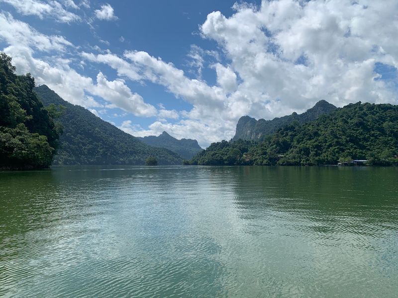
Quiet is the big headline at Ba Be. This northern park is built around a large freshwater lake, ringed by forested karst mountains, caves, rivers, and waterfalls.
Villages of Tay communities dot the area.
Limestone scenery here feels different from Ha Long Bay or Trang An, where sea and river tours take the spotlight. Ba Be is clearly inland and mountainous, with a calm, green mood.
Boats cross the lake and connect with parts of the Nang River. Hiking routes lead into forest and farm landscapes around the protected area, giving you a close look at daily rural life.
The region is far less urban than Vietnam’s headline stops. That makes it especially valuable for anyone curious about how villages, freshwater ecosystems, and limestone geology fit together in the northeast.
Consider a homestay in a Tay stilt house for local meals and stories. Pack insect repellent and a rain jacket, and give yourself at least two days to slow down.
Share this story