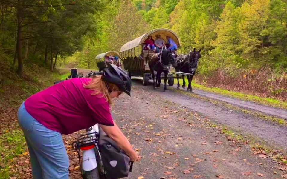
Trains once rumbled along the bottom of a canyon in Pennsylvania that drops roughly 1,000 feet from rim to creek. Today, bikes, hikers, and even horses follow that same old railroad path.
It stretches about 62 miles, and much of it stays close to the water. The bald eagles overhead are a nice bonus, and the trail is mostly flat, so you can enjoy the views without huffing up hills.
Meet the Grand Canyon of Pennsylvania From the Bottom
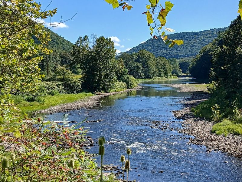
Most people see a canyon from the top, peering over a railing. The Pine Creek Rail Trail flips that around.
It runs along the floor of Pine Creek Gorge, the place many folks call the Grand Canyon of Pennsylvania.
The trail sits in north-central Pennsylvania, with its northern end near the Wellsboro area in Tioga County. From there it follows Pine Creek south for about 62 miles to Jersey Shore in Lycoming County.
The deepest part of the gorge drops close to 1,000 feet, and the trail rolls right through it.
That gives riders a view few overlooks can match. Instead of looking down at a ribbon of water, you look up at steep, wooded walls rising on both sides.
The creek stays close by for long stretches, so the sound of moving water often keeps you company.
I like that the trail lets you set your own pace. You can ride a short piece and turn back, or plan a longer trip over a couple of days.
Either way, the canyon slowly opens up around you, one bend at a time.
Old Railroad Bones Under Your Tires
Trains still rolled through this gorge within living memory. The railroad line along Pine Creek carried freight for decades before service ended in the late 1980s.
After that, Pennsylvania turned the old rail bed into the trail people use today.
That history explains a lot about the ride. Railroads hate steep hills, so engineers built the line on a gentle, steady grade.
Your legs get to enjoy the same easy slope that heavy trains once needed.
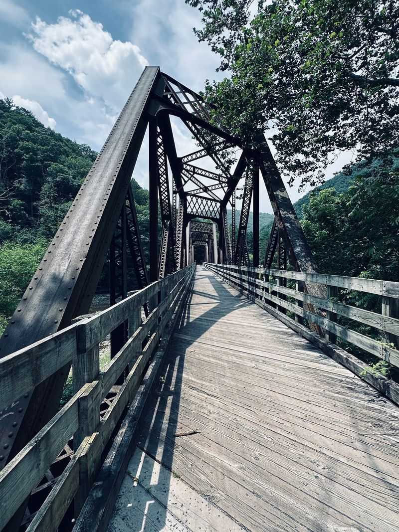
You can still spot signs of the trail’s past. Old rail bridges carry riders over the creek, and they make some of the best spots for photos along the route.
Standing on one gives you a long look up and down the water.
The Pennsylvania Department of Conservation and Natural Resources manages the trail now. The route was built in sections over several years before reaching its full length.
It is a nice example of an old transportation corridor finding a fresh purpose.
Knowing the backstory makes those quiet bridges feel a little more interesting. Somebody once watched coal and lumber cars cross exactly where you are pedaling.
Flat, Smooth, and Friendly to Tired Legs
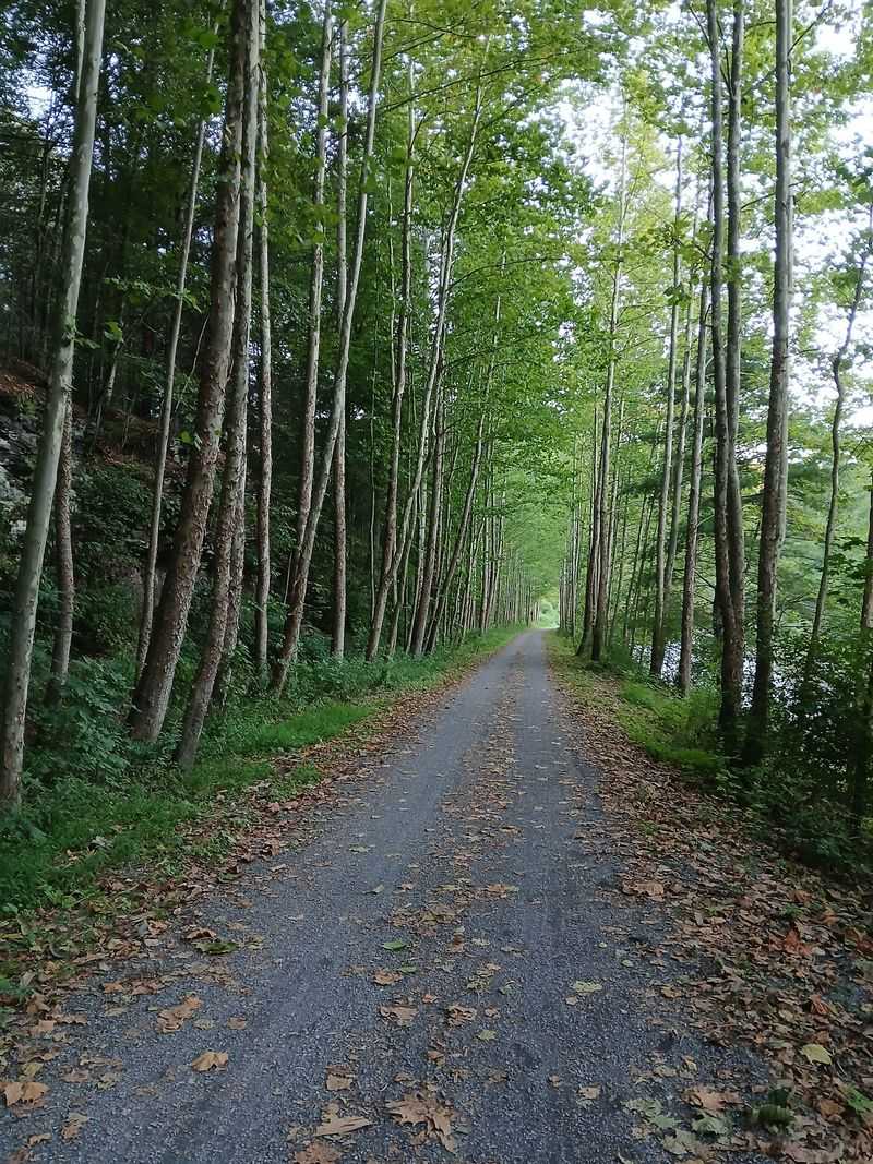
Good news for anyone who dreads hills: this trail barely has any. The old railroad grade keeps the slope gentle almost the whole way.
Many riders say the northern stretch feels nearly flat for miles.
The surface is mostly hard-packed crushed stone, with paved sections near some towns. It is wide and well kept, so passing other riders is easy.
Hybrid bikes and gravel bikes handle it well, and skinny road tires can manage when conditions are dry.
That makes the trail a solid choice for families and newer riders. Kids on bikes, parents pushing strollers, and folks pulling wagons can all move along without much trouble.
Walkers and joggers share the path too.
One small tip helps on longer rides. Since the trail drops slightly as it heads south, many people prefer riding north to south.
Gravity gives a quiet assist, even if you barely notice it.
Still, flat does not mean short. Sixty-two miles is a big day, so most visitors pick a section that fits their energy.
A ten or fifteen mile out-and-back can feel just right.
Keep an Eye on the Sky for Bald Eagles
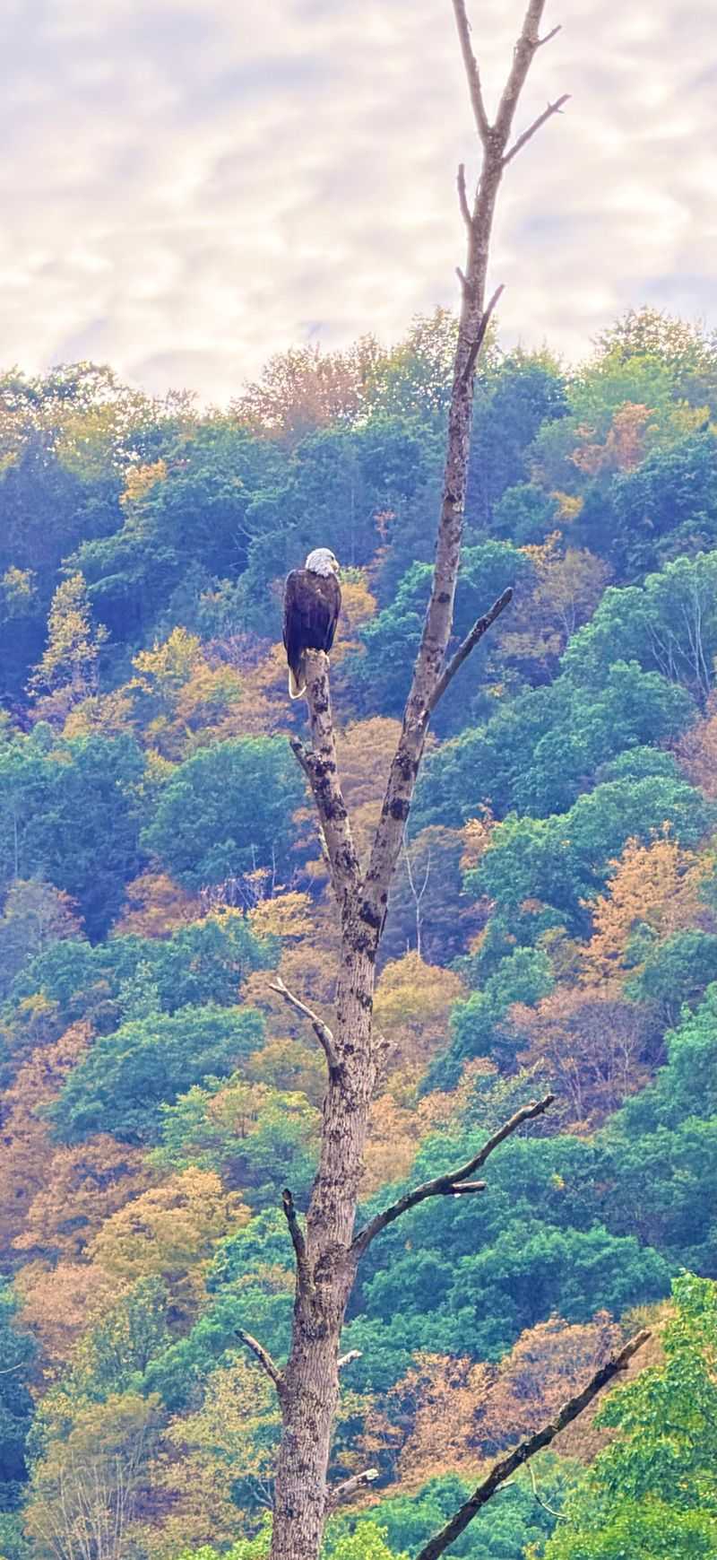
Bring your neck muscles, because you will be looking up a lot. Bald eagles hunt along Pine Creek, and riders often spot them soaring above the water or perched in tall trees.
Seeing one glide over the canyon is a real thrill.
The gorge supports plenty of other wildlife too. White-tailed deer often cross the trail, especially in the early morning or near dusk.
Hawks, herons, and many smaller birds also make their homes here.
Some riders have even watched porcupines climbing trees beside the path. Snakes, including timber rattlesnakes, live in the area as well.
Give any snake plenty of space and let it move along on its own schedule.
A small pair of binoculars fits easily in a bike bag. It turns a quick break into a chance for some easy wildlife watching.
A quiet approach helps too, since animals often scatter when groups are loud.
I’d plan at least one slow stretch of the ride just for looking around. The creek and the trees hold more life than you might notice at full speed.
Where the Canyon Gets Its Deepest
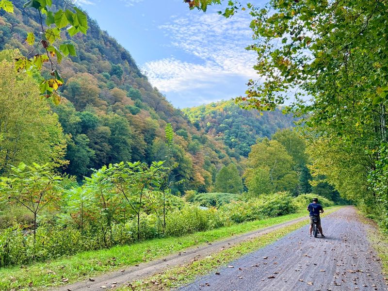
If you only have one day, the stretch between Darling Run and Blackwell is the one many riders aim for. This section runs through the heart of the gorge.
The canyon walls feel their tallest here.
Darling Run is an access area near Ansonia, just west of Wellsboro. Heading south from there, the trail slips into the deepest part of the canyon.
Blackwell sits farther south and works as another handy starting point.
The distance between them is roughly 17 to 18 miles. Some people ride it one way with a shuttle waiting at the end.
Others ride halfway from each end on different days and turn back.
Along the way, the trail passes Tiadaghton, a spot with a campground that makes a good halfway goal. Cell service is spotty or missing in much of the gorge.
That is part of the charm, but it also means planning ahead matters.
Pick up a printed trail map before you go. Paper maps never lose signal, and they show access points, restrooms, and parking areas clearly.
Ice Cream Stops in Tiny River Villages
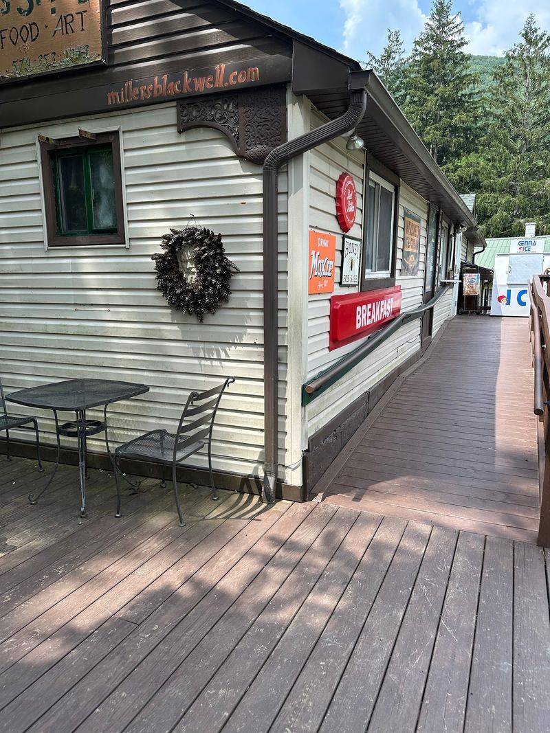
Few things taste better after a long ride than ice cream in a small village. The southern half of the trail passes through several tiny towns along Pine Creek.
Blackwell, Cedar Run, and Slate Run are favorite pause points.
Slate Run is home to Wolfe’s General Store, a popular place to begin or end a ride. Cedar Run has a small shop near the trail with snacks and sandwiches.
Up near Blackwell, riders often stop at a general store just off the path.
These villages feel quiet and old-fashioned, with homes scattered along the creek. They also give you a chance to refill supplies before the next long, remote stretch.
Shop hours can change by season, so check ahead.
Food stops make it easier to plan longer rides. You can break a big day into smaller chunks with treats in between.
Kids tend to pedal harder with a cone waiting at the end.
I would schedule at least one village stop into any trip. Sitting outside with a snack while bikes roll by makes a fine little break.
Bring More Water Than You Think
Here is a practical lesson many riders learn the hard way. The gorge can get warm in summer, and the trail runs through long, remote stretches.
Water sources are not always where you expect.
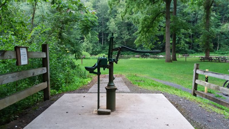
Some older maps show water pumps at different access points. Riders have reported that many are shut down or hard to reach.
Counting on them could leave you thirsty miles from town.
So pack plenty. Two large bottles per person is a smart start for shorter rides, and more for long days.
An electrolyte drink can help on hot afternoons.
The good news is that restrooms, benches, and picnic tables show up regularly. Several access areas have parking and facilities, which makes rest stops easy to plan.
Shaded spots near the creek offer a nice place to cool down.
Also pack snacks, a basic repair kit, and a spare tube. Help can be far away when there is no cell signal.
A little preparation keeps the ride relaxed instead of stressful.
Sunscreen and bug spray round out a solid kit. Your future self will be grateful.
Horses, Skiers, and Paddlers Share the Fun
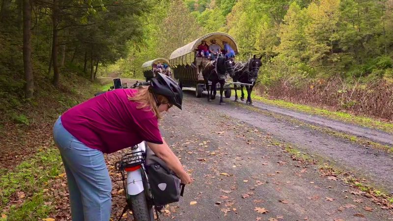
Bikes get most of the attention, but they are not alone out here. The trail welcomes hikers, joggers, and horseback riders too.
Some sections include space set aside for horses.
Winter brings a quieter crowd. When snow covers the path, cross-country skiers and snowshoers take over.
The gentle grade works just as well for gliding as it does for pedaling.
Pine Creek itself adds even more options. Paddlers float the creek in spring when water levels run higher.
Anglers cast for trout in many spots along the way.
On hot summer days, some visitors simply wade in and cool off. Setting a camp chair in shallow water is a simple pleasure.
Just watch for slippery rocks and changing currents.
Wagon rides have also rolled through the gorge, adding an old-time feel. Offerings like that can vary by season, so check with local outfitters first.
With so many ways to enjoy it, the trail stays busy all year without feeling crowded. Each season brings a slightly different group of people to the canyon floor.
Fall Colors Turn the Gorge Into a Painting
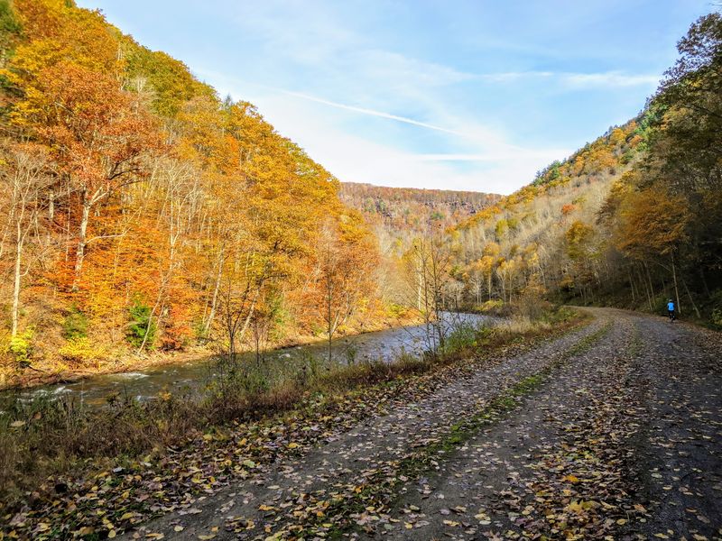
Autumn might be the most popular time to ride, and one look explains why. The steep canyon walls fill with orange, red, and gold leaves.
Since the trail sits low, color surrounds you from every side.
Peak foliage usually arrives around early to mid October, though timing shifts each year. Pennsylvania posts fall foliage reports that help with planning.
Weekends during peak season can be busier at popular access points.
Spring has its own appeal. Fresh green leaves return, small waterfalls trickle down the hillsides, and wildflowers bloom near the path.
Pine Creek often runs high and fast this time of year.
Summer brings deep shade and warm water for wading. Long days give you more hours to explore.
Early mornings stay cooler and calmer.
Winter turns the gorge quiet and bare. Snow may cover the trail, opening it to skiers instead of cyclists.
Every season changes the mood here. A rider who visits in October and again in May might feel like they saw two different canyons.
Make Wellsboro Your Home Base
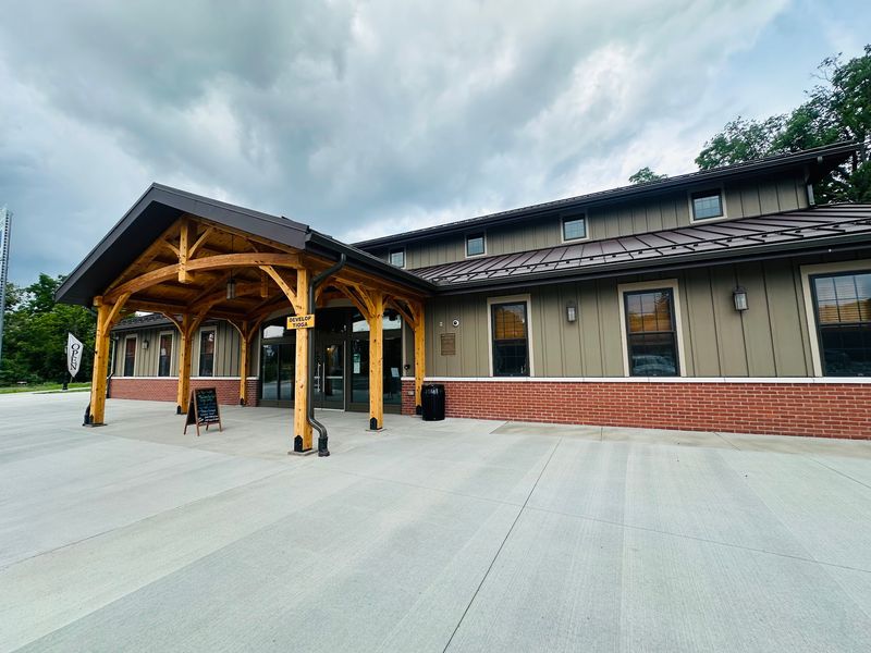
Wellsboro makes a handy place to start your adventure. The small town sits just a few miles from the northern end of the trail.
Its main street is known for old-fashioned gas street lamps.
The local visitor center is a good first stop. Staff can share maps, trail tips, and suggestions for access points.
Some trail sections near town even include train-themed touches that kids enjoy.
Bike rentals and shuttle services operate in the region. Shuttles let you ride one direction without doubling back.
That opens up longer sections for riders who prefer not to repeat the same miles.
Nearby Leonard Harrison and Colton Point State Parks sit on opposite rims of the gorge. Their overlooks show the canyon from above.
Seeing it from both the top and the bottom gives you a fuller picture.
Lodging ranges from campgrounds to small inns and cabins. Booking early helps during fall foliage season.
After a day on the trail, an evening stroll under those glowing lamps feels like a fitting way to end things. The canyon will still be there for round two.
Share this story