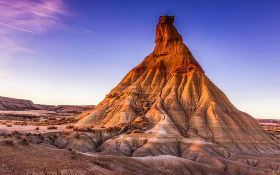
Europe is not just cobblestone streets and cathedral squares. Tucked behind the postcard version of the continent are raw, dramatic landscapes that can genuinely take your breath away.
From Arctic islands where mountains drop straight into the sea to semi-arid badlands that look nothing like the Europe most travelers imagine, the variety is stunning. This list covers 14 real wild places across the continent, each one worth planning a trip around.
Whether you are a serious hiker, a casual explorer, or someone who just wants to stand somewhere that feels genuinely untouched, there is a destination here that will make you want to book a flight.
Lofoten Islands, Norway
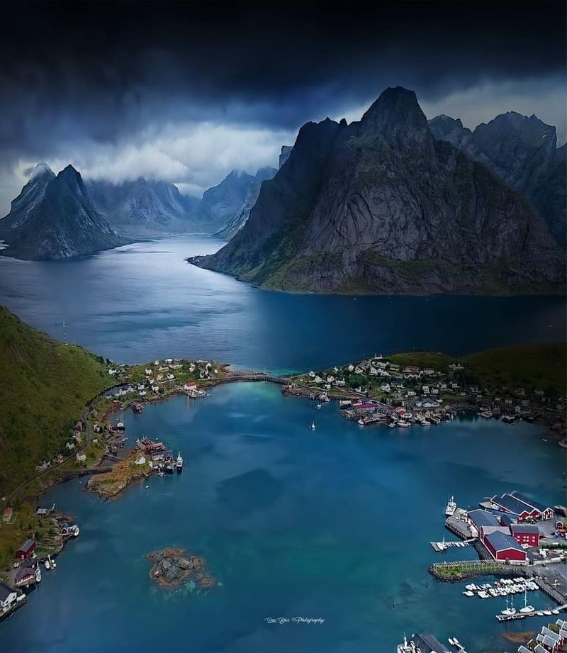
Few places in Europe compress so much drama into such a small space. In Lofoten, jagged peaks rise almost directly from the Norwegian Sea, leaving just enough flat ground for fishing villages, red wooden cabins, and narrow roads connecting the islands.
The scenery rewards hikers at every level. Shoreline walks stay accessible even without technical skills, while the more demanding mountain routes deliver views that stretch across open ocean and neighboring islands.
The midnight sun lights the landscape well past midnight during summer, making long hiking days genuinely possible.
Lofoten also sits above the Arctic Circle, which means the northern lights become a realistic target during the darker months. Visit Lofoten maintains an active trail network, though mountain weather can shift fast.
Checking conditions before heading into the hills is not optional here, it is just common sense. Pack layers even in July.
The Dolomites, Italy
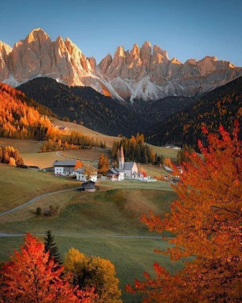
The Dolomites look like someone took a standard Alpine mountain range and decided the peaks needed to be sharper, taller, and more theatrical. Pale limestone towers and vertical walls dominate a landscape that has earned UNESCO World Heritage status across nine separate mountain systems.
Hiking options range from relaxed valley strolls to serious high-altitude routes. Cable cars and lifts provide access to panoramic viewpoints for travelers who want the views without committing to a full climb.
The surrounding valleys offer well-organized trail infrastructure and mountain huts along many routes.
One thing worth knowing before you go: recent summers have brought extreme weather events that occasionally make specific trails impassable. The UNESCO Dolomites Foundation advises checking current trail conditions rather than assuming a route is open.
The mountains are absolutely still one of Europe’s premier outdoor destinations, but a little pre-trip research goes a long way.
Plitvice Lakes National Park, Croatia
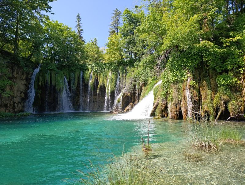
Water is the main character at Plitvice Lakes. Sixteen named lakes form a chain through a forested limestone landscape, connected by waterfalls, cascades, and streams that constantly shift the scenery as you move through it.
The color of the water is one of those things that photographs struggle to fully capture. Depending on light conditions and mineral content, the lakes shift between turquoise, deep green, and vivid blue.
Elevated wooden walkways bring visitors right to the water’s edge without requiring any serious backcountry experience.
Plitvice is also one of the more practical wild landscapes on this list for travelers combining it with a broader Croatia itinerary. The park is open year-round, though seasonal hours affect entrances, boat services, and the panoramic vehicle that loops through the lower sections.
Visiting outside peak summer months means smaller crowds and a noticeably more peaceful experience along the boardwalks.
Þingvellir National Park, Iceland
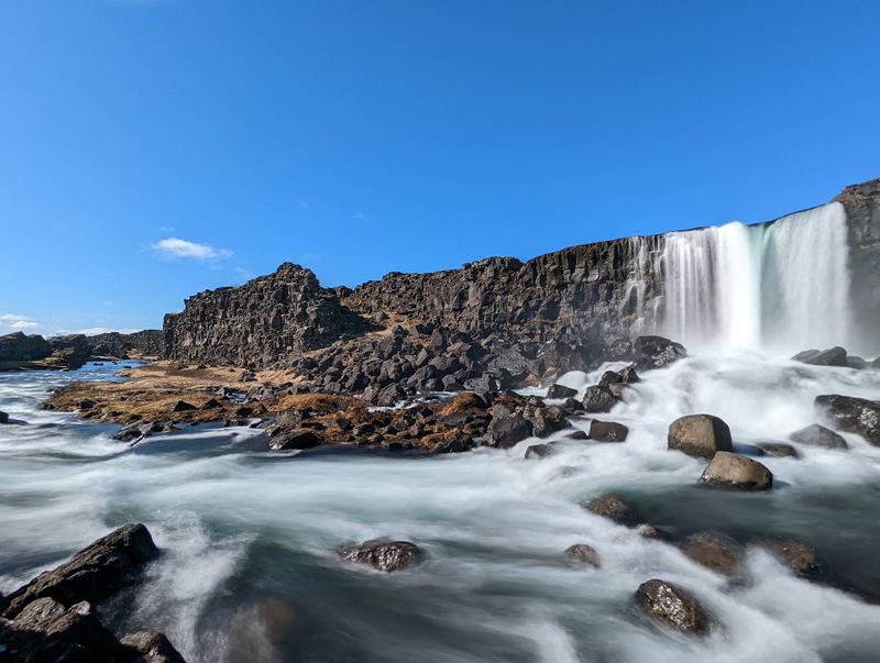
Geology does not get more visible than at Þingvellir. The park sits in a rift valley associated with the boundary between the North American and Eurasian tectonic plates, and the evidence is everywhere.
Cliffs, lava formations, open plains, and the wide waters of Þingvallavatn fill the landscape in every direction.
What makes Þingvellir unusual among Europe’s wilderness destinations is the combination of natural drama and deep historical significance. This is where Iceland’s early settlers gathered to establish the Althing, one of the world’s oldest parliaments, making the park a layered place to spend time.
Paths lead from viewpoints down into Almannagjá gorge and across the national park’s broader trail network. The visitor center operates year-round, with extended hours from April through October.
For travelers building an Icelandic road trip, Þingvellir fits naturally as a first or last stop on the classic Golden Circle route.
Skaftafell, Iceland
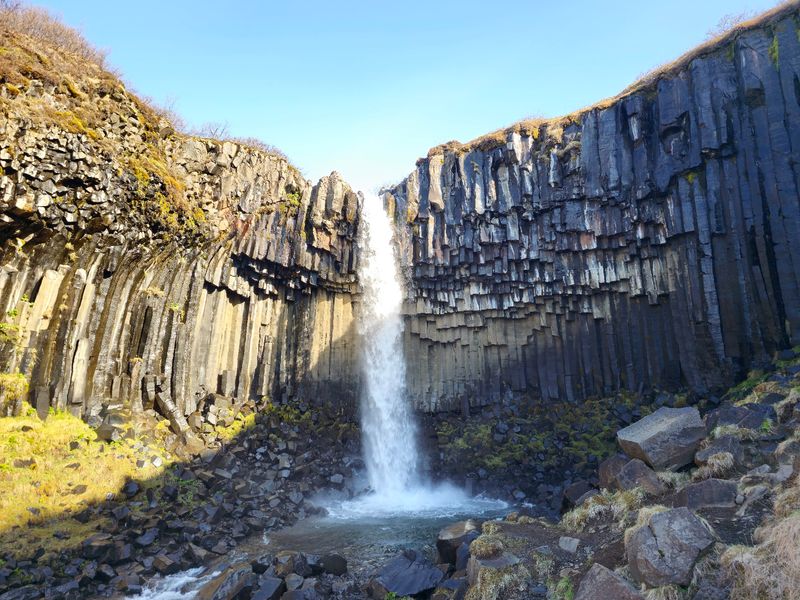
Skaftafell is the kind of place that packs Iceland’s greatest hits into one manageable area. Glacial tongues extend from the Vatnajökull ice cap, dark mountains rise sharply over broad floodplains, and a network of trails connects waterfalls, woodland, and ice viewpoints within a few kilometers of each other.
One of the most accessible routes leads to Skaftafellsjökull, where visitors can get close to an active glacier tongue without specialized equipment. The trail to Svartifoss waterfall, which flows over a distinctive cliff of basalt columns, is another popular option that rewards a moderate effort.
Skaftafell is accessible year-round when road and weather conditions allow, and the visitor center operates throughout the year. As of late 2026, the Austurbrekkur trail area is temporarily closed for maintenance, but alternative routes remain available across the park.
The surrounding landscape along the Ring Road adds further context to the sheer scale of the Vatnajökull region.
Picos de Europa National Park, Spain
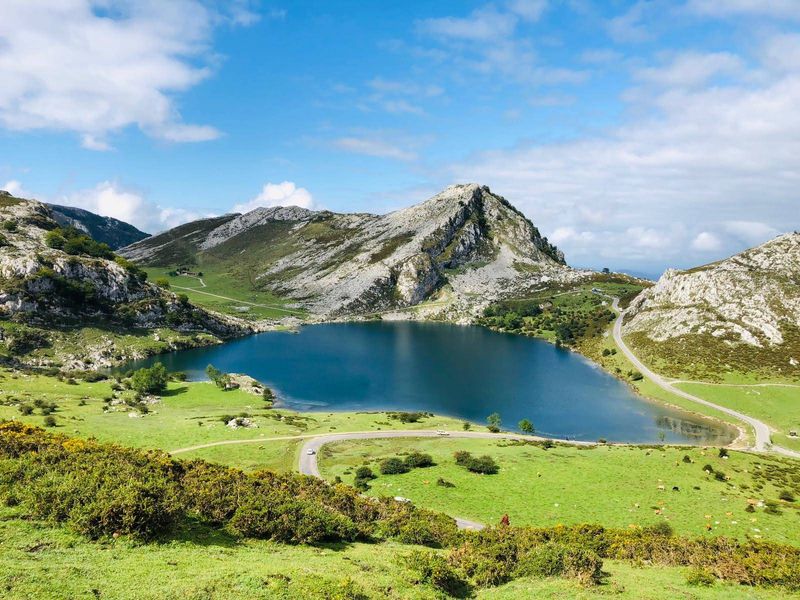
Northern Spain surprises a lot of travelers who associate the country with sun-baked coasts and flat plains. Picos de Europa sits between Asturias, Cantabria, and León, and the terrain is anything but flat.
Steep limestone peaks, narrow gorges, high pastures, and rock walls dominate a landscape that feels genuinely remote.
Walking is the main reason most visitors come. The Cares Gorge trail is one of the most celebrated routes in Spain, following a narrow path carved into cliff walls above a river for roughly 12 kilometers.
Viewpoints and lake areas provide accessible options for those who prefer shorter outings.
Official park visitor facilities and marked itineraries are available throughout the park. During busy periods, particularly around the Lakes of Covadonga, road access controls and transportation restrictions may apply.
Planning transport in advance during summer weekends avoids unnecessary frustration and keeps the focus on the scenery rather than parking logistics.
Triglav National Park, Slovenia
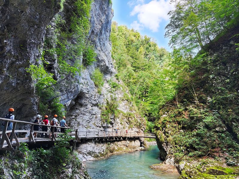
Slovenia’s only national park covers a substantial portion of the Julian Alps, and the variety packed into that space is genuinely impressive. Glacier-carved valleys, rocky summits, waterfalls, dense forests, and the vivid blue-green Soča River all exist within the same protected area.
Reaching the top of Mount Triglav at 2,864 meters is a serious undertaking, but the park offers plenty for visitors who are not planning a summit attempt. The Soča Trail follows the river through the Trenta Valley, offering a relatively accessible route through spectacular Alpine scenery.
The Vrata Valley provides a different perspective, with views directly toward Triglav’s enormous north face.
The park is actively welcoming visitors in 2026, with seasonal public transportation and visitor monitoring operating in popular areas. Some individual paths undergo periodic maintenance or temporary closures, so checking current trail conditions before setting out is always a good idea.
The park’s infrastructure makes it one of the better-organized wild areas in the Alps.
Giant’s Causeway, Northern Ireland
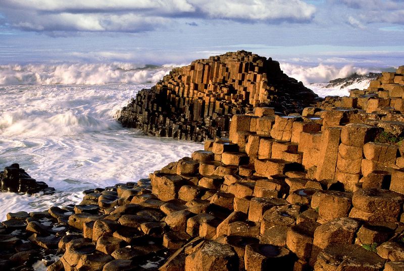
The first time you see Giant’s Causeway, the sheer geometric precision of the basalt columns makes the whole thing look constructed rather than natural. Around 40,000 interlocking columns of volcanic rock line the Atlantic coast, the result of ancient lava cooling and contracting over thousands of years.
The columns are striking up close, but the walking paths extending through the surrounding cliffs and coastal scenery offer a broader perspective on the landscape. Viewpoints along the headlands reveal the Causeway from above, which gives a completely different sense of its scale compared to standing among the columns themselves.
The coastline is generally accessible from dawn to dusk, and the National Trust visitor center operates on scheduled hours. Visitors can explore the rock formations without entering the paid exhibition, though the full visitor experience includes parking, interpretation, and guided tours.
The combination of geology and coastal scenery makes this one of the most distinctive natural landmarks in the British Isles.
Calanques National Park, France
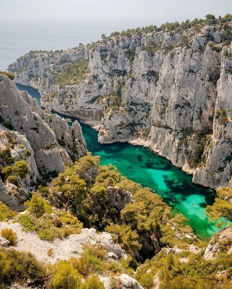
Sitting just outside Marseille, the Calanques manage to look more like a tropical destination than a European one. Pale limestone cliffs drop sharply into water that ranges from electric blue to deep turquoise, and narrow inlets cut through the coastline to create hidden coves accessible only by foot, boat, or kayak.
Walking routes connect viewpoints and beaches across the park, while boat trips and kayak rentals reveal the cliff faces from sea level in a way that land routes simply cannot match. The combination of accessible urban location and genuinely wild scenery makes the Calanques unlike almost any other national park in France.
The wildness comes with a seasonal catch. From June through September, land access can be restricted or completely closed on days when fire risk is assessed as high.
The national park publishes daily access updates during this period. Checking the evening before a planned hike is not just advisable, it is essential to avoid a wasted journey.
Vikos Gorge and Zagori, Greece
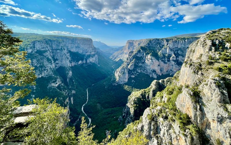
Most travelers picture Greek islands when they think of Greece. Zagori, in the country’s mountainous northwest, operates in an entirely different register.
Stone villages, arched bridges, forested slopes, and the sheer walls of Vikos Gorge create a landscape that feels completely removed from the Aegean coast.
Vikos Gorge is one of the deepest gorges in the world relative to its width, and several viewpoints allow travelers to appreciate its scale without committing to a full crossing on foot. Hiking routes connect villages that have been linked by stone paths for centuries, giving the area a layered sense of history alongside its natural drama.
One particularly striking route follows the Skala Vradetou, an 18th-century stepped path climbing from Kapesovo toward Vradeto with wide views across the surrounding mountains. Greece’s official tourism organization actively promotes the route for hikers, recommending appropriate footwear and careful attention on exposed sections.
The region rewards travelers who take the time to slow down.
Pico Ruivo, Madeira, Portugal
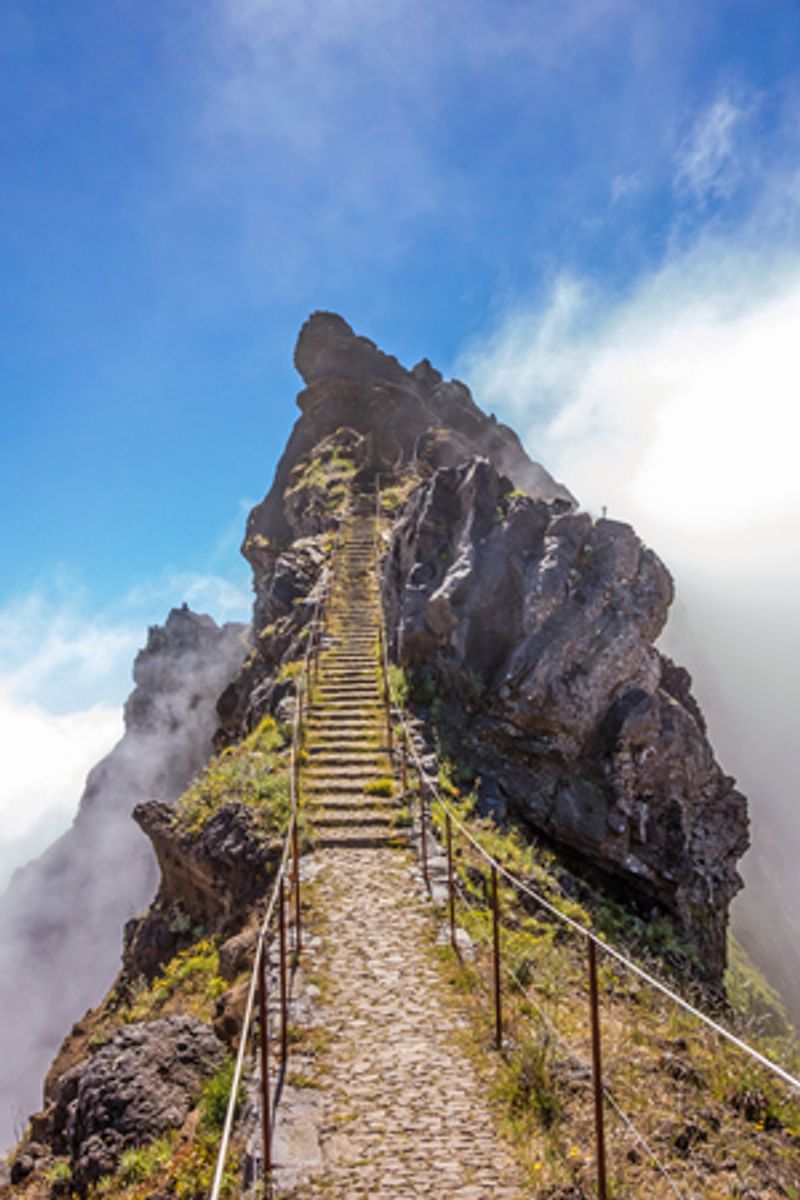
Madeira tends to get overshadowed in European travel conversations, which is a genuine oversight. The island’s interior is dominated by volcanic peaks, knife-edge ridges, deep green valleys, and sudden cloud banks that roll in and out of the mountains in minutes.
It is a landscape that feels genuinely wild despite being a relatively short flight from mainland Europe.
Pico Ruivo is Madeira’s highest point at 1,862 meters, and one of the most practical routes to the summit is the PR 1.2 trail starting from Achada do Teixeira. The path climbs through the central mountain massif and frequently places hikers above a cloud layer, with the ridgelines and peaks rising above a white sea below.
Madeira’s official tourism authority currently lists PR 1.2 as open. Conditions on other mountain trails can shift because of weather or maintenance, so checking trail status before heading out is a sensible habit on the island.
Good waterproof gear is worth bringing regardless of the forecast.
High Tatras, Slovakia
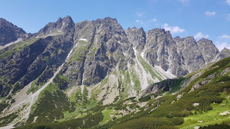
The High Tatras rise with surprising abruptness above the plains of northern Slovakia. Jagged granite peaks, glacial lakes, waterfalls, pine forests, and traditional mountain huts create an Alpine environment that feels far more remote than the region’s relatively compact geography would suggest.
A well-marked trail network makes the mountains unusually accessible for independent hikers, and cable cars near Tatranská Lomnica and Štrbské Pleso provide additional access to higher elevations without requiring a full day’s climb. The infrastructure around the main resort towns means accommodation and services are easier to find here than in some of Europe’s more isolated ranges.
Current visitor information for late 2026 shows lifts, tourist facilities, and the majority of the hiking network operating. A small number of trails are temporarily closed, and higher routes follow regular winter closures from November 1 through May 31.
Many paths to mountain huts remain accessible year-round, making the Tatras a viable destination across multiple seasons for different types of visitors.
The Quiraing and Trotternish, Isle of Skye, Scotland
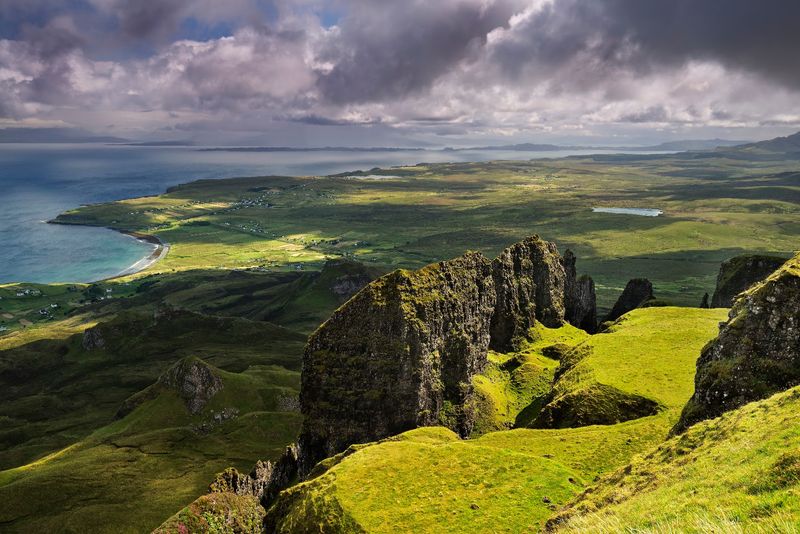
The northern tip of Skye looks like geology is still working out the details. Ancient landslips along the Trotternish Peninsula created a terrain of cliffs, grassy plateaus, hidden valleys, rock towers, and steep ridges that does not resemble anywhere else in Scotland.
The Quiraing is the most celebrated section of this landscape, and walking into it means passing formations with names like the Needle and the Prison while views across the Sound of Raasay open up toward the Scottish mainland. The combination of strange terrain and wide coastal views is what keeps photographers and hikers returning to this corner of the island.
VisitScotland continues to feature hiking itineraries through the Trotternish area, though some routes include steep, exposed, or rough sections that require appropriate footwear and a reasonable level of fitness. Skye’s weather can shift from clear to dramatic within an hour, making flexible plans and waterproof layers essential rather than optional.
Early morning visits tend to offer better light and fewer other walkers on the path.
Bardenas Reales, Spain
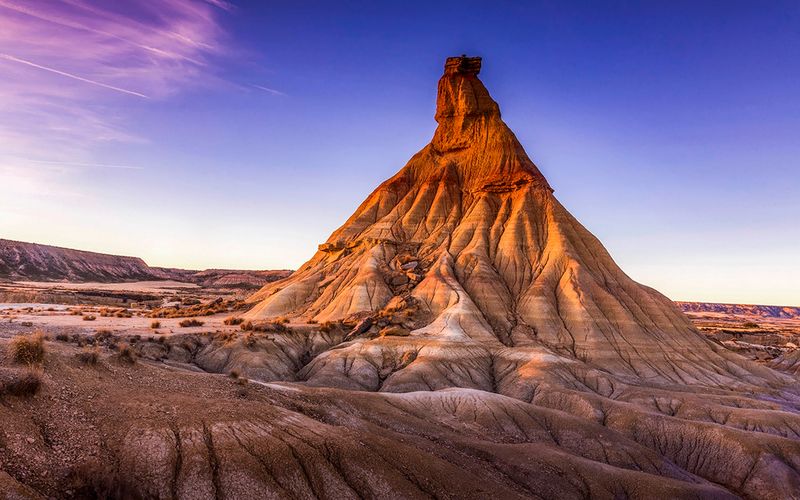
Bardenas Reales does not look like the rest of Spain, and that contrast is exactly what makes it worth visiting. In southeastern Navarra, erosion has carved a semi-arid landscape of gullies, flat-topped hills, clay formations, and bare ridges that feel strikingly out of place in a country more often associated with green mountains and Mediterranean coasts.
The reserve is protected as a UNESCO Biosphere Reserve, and wildlife remains an active part of what makes it ecologically significant. Conservation management continues actively in 2026, including measures designed to maintain water availability for animals during periods of intense summer heat.
Visitors share the landscape with birds of prey, reptiles, and other species adapted to the dry conditions.
Designated routes and temporary restrictions apply within the protected area, and respecting those boundaries keeps both the wildlife and the landscape in good shape for future visits. Early morning and late afternoon light tends to bring out the textures of the eroded formations most dramatically, making timing worth considering when planning your visit.
Share this story