There is something almost magnetic about a river. It moves, it changes, and it always seems to be heading somewhere worth following. Across the United States, some cities have turned their riverfronts into remarkable public spaces where you can walk, bike, explore history, and simply watch the water go by for hours on end. This list covers 14 of the best places to do exactly that, from a Texas waterway that runs below street level to a North Carolina riverwalk with a battleship parked right across the water.
Each destination offers its own personality, its own pace, and its own reasons to keep going just a little farther. Whether you have a full day or just a few hours to spare, these river routes deliver the kind of easy, rewarding outdoor time that is genuinely hard to beat.
1. San Antonio River Walk, San Antonio, Texas
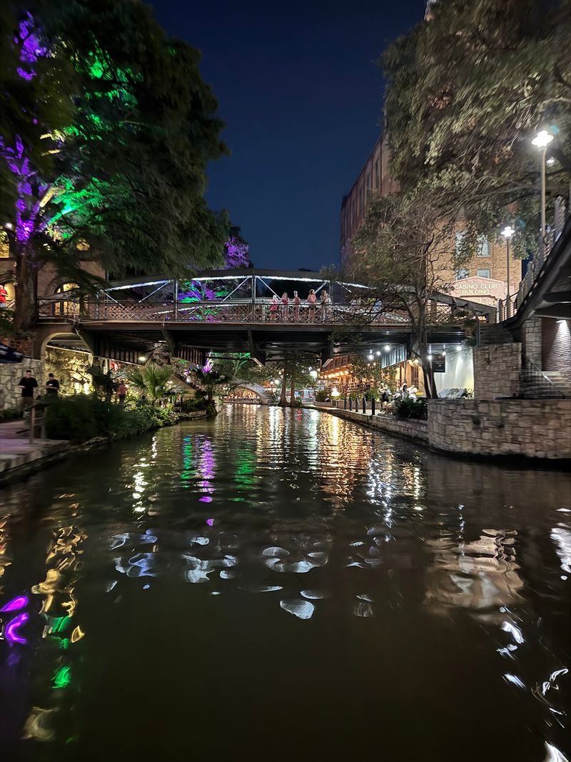
Back in the 1920s, city officials nearly paved over the San Antonio River to build a storm sewer, which would have been one of the worst decisions in Texas history. Thankfully, citizens pushed back, and architect Robert H.H. Hugman designed a vision for a walkway system that eventually became one of America’s most visited urban riverfronts.
The downtown section sits below street level, creating a world that feels separate from the traffic above. From there, the Museum Reach extends three miles north to the Pearl, a converted brewery complex packed with restaurants and shops.
Head south on the Mission Reach for eight miles of restored riverside habitat connecting to four UNESCO-listed Spanish missions. Narrated riverboat tours with Go Rio Cruises add a relaxed way to cover ground between stops.
2. Chicago Riverwalk, Chicago, Illinois
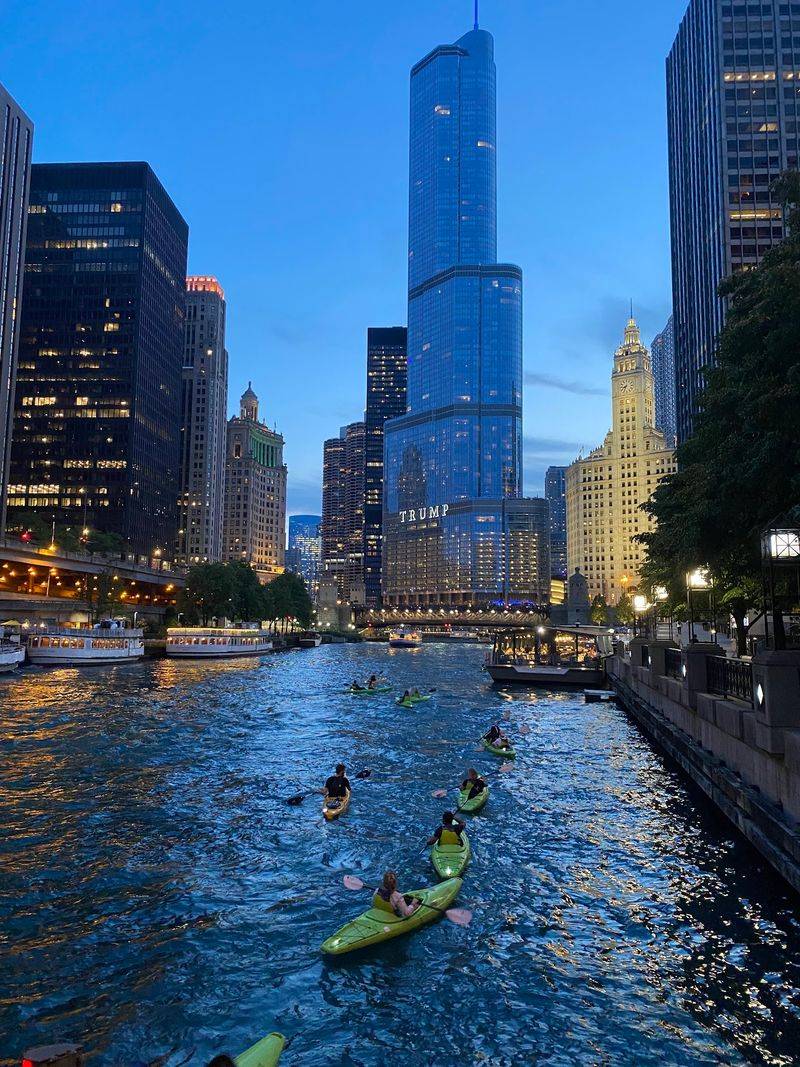
Most cities put their best architecture on a pedestal. Chicago puts it right at eye level from the water, which makes following the Chicago River through downtown feel more like a private tour than a casual walk.
The Riverwalk runs along the south bank of the main branch of the Chicago River, stretching about 1.25 miles through the heart of the city. It is organized into distinct zones, including areas for kayak rentals, outdoor seating, a veterans memorial, and a small history museum built into one of the bridge houses.
Architecture boat tours depart from the Riverwalk and are widely considered one of the best ways to understand Chicago’s skyline. Bikes are also welcome on the upper paths, giving you a faster way to cover more ground along this compact but detail-packed stretch of river.
3. Detroit RiverWalk, Detroit, Michigan
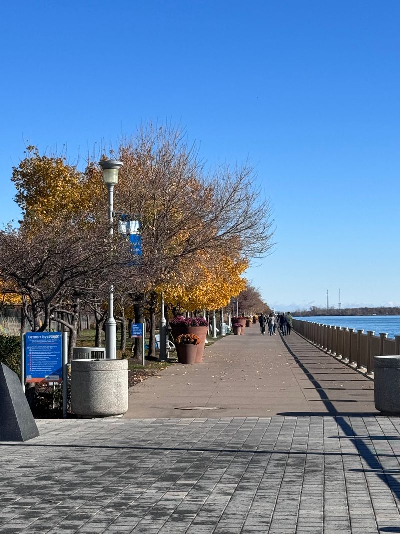
Detroit’s riverfront comeback is one of the more remarkable urban stories of the past two decades, and the RiverWalk is the clearest proof of that progress. What was once a largely inaccessible industrial shoreline is now a nearly five-mile paved path connecting parks, plazas, and greenways along the Detroit River.
One of the RiverWalk’s unique features is the view across the water to Windsor, Ontario, making it one of the few places in the United States where you look south into Canada. Milliken State Park sits along the route and includes a wetland habitat that draws migrating birds each season.
Cyclists and inline skaters share the path with walkers, and the route connects to the Iron Belle Trail for those who want to keep going well beyond the riverfront. Dequindre Cut Greenway also links the RiverWalk to Eastern Market.
4. Tom Lee Park, Memphis, Tennessee
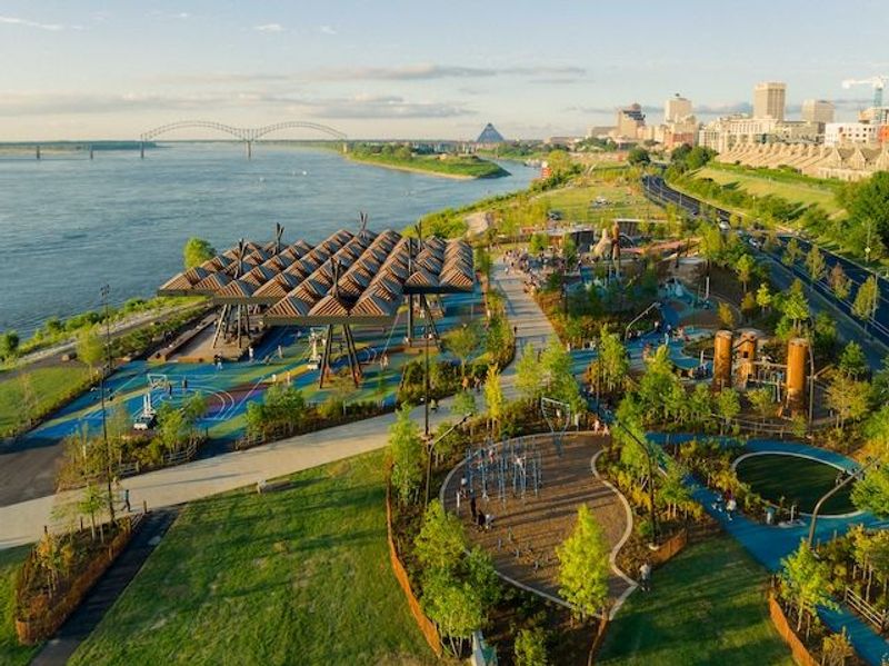
The Mississippi River does not do anything small, and Tom Lee Park gives you a front-row seat to that fact. The park sits right along the western edge of Memphis, where the river is wide, brown, and busy with commercial barge traffic moving goods up and down the country’s largest waterway.
A recent multimillion-dollar renovation transformed the park into a far more engaging destination. It now includes a hammock grove, a playground, public art installations, a dog run, and the Memphis Flyway elevated overlook, which frames both the river and the city skyline in one sweeping view.
The park also hosts major events including Memphis in May, which draws large crowds each spring. On quieter days, the riverside paths are calm enough to feel almost meditative, with downtown Memphis just a short uphill walk away whenever you need a change of scenery.
5. Tom McCall Waterfront Park, Portland, Oregon
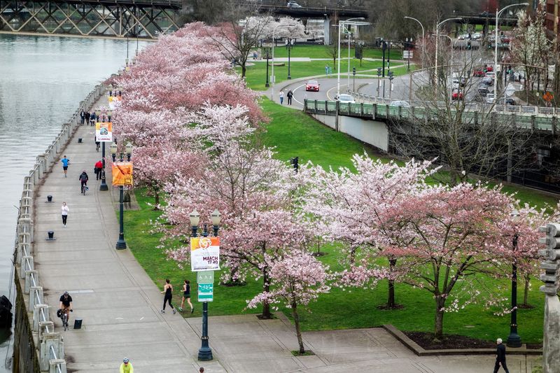
In 1974, Portland made a decision that most cities would not have the nerve to attempt: they removed a four-lane highway to give the riverfront back to the public. The result is Tom McCall Waterfront Park, a 36-acre strip of green space running along the west bank of the Willamette River through the heart of downtown.
The park stretches about two miles and connects to the Eastbank Esplanade via the Steel Bridge and Hawthorne Bridge, creating a popular loop that gives walkers and cyclists views from both sides of the river. On the west bank side, the path runs past the Oregon Maritime Museum, the Japanese American Historical Plaza, and several public art installations.
Saturday Market, one of the largest open-air craft markets in the country, sets up at the park’s north end on weekends. The whole loop covers about three miles and takes a comfortable hour or two at a relaxed pace.
6. Old Sacramento Waterfront, Sacramento, California
Gold Rush history has a way of making a waterfront feel more interesting, and Old Sacramento delivers that feeling without trying too hard. The district sits right along the Sacramento River and preserves more than 50 historic buildings from the 1850s and 1860s, making the waterfront walk feel like moving through a chapter of California’s past.
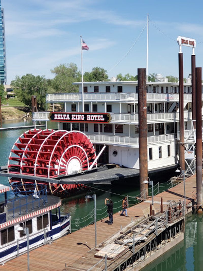
The Delta King, a restored paddlewheel riverboat, is permanently docked here and operates as a hotel and restaurant, giving the riverfront a visual centerpiece that is hard to miss. The California State Railroad Museum is also within easy walking distance, adding another layer of 19th-century history to the visit.
Boardwalks and paved paths run along the water’s edge, and the area connects to a longer Sacramento Riverfront trail for those who want to extend the walk north or south. The Sacramento River Bike Trail runs 32 miles in total for more ambitious explorers.
7. Waterfront Park, Louisville, Kentucky
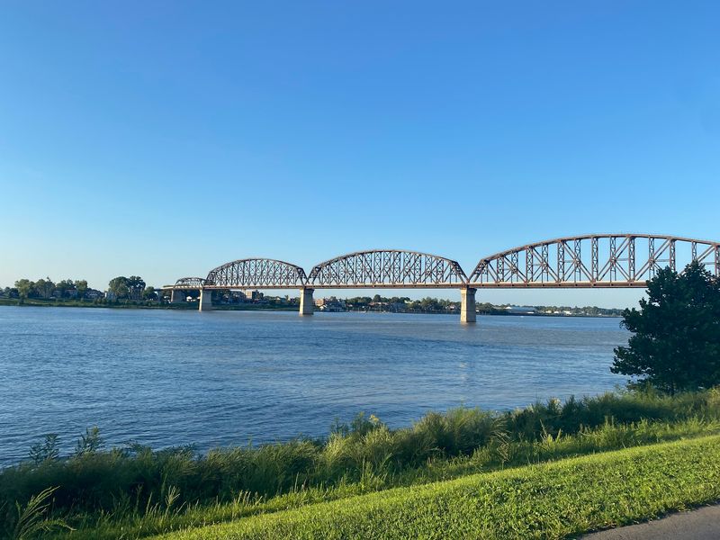
Louisville’s Waterfront Park proves that a river does not need to be narrow or cute to anchor a great public space. The Ohio River here is broad and powerful, and the park leans into that scale with wide lawns, open plazas, and long sightlines that make the whole place feel genuinely spacious.
The Big Four Bridge is one of the park’s most popular features. It is a converted railroad bridge that now carries pedestrians and cyclists across the Ohio River to Jeffersonville, Indiana, making a cross-river round trip a natural extension of any visit. The bridge offers elevated views of both the river and the Louisville skyline.
The park covers 85 acres and includes a water plaza, a play area, and a large open lawn that hosts major events throughout the year. The riverwalk path connects to the Louisville Loop, a planned 100-mile trail circling the city.
8. Smale Riverfront Park, Cincinnati, Ohio
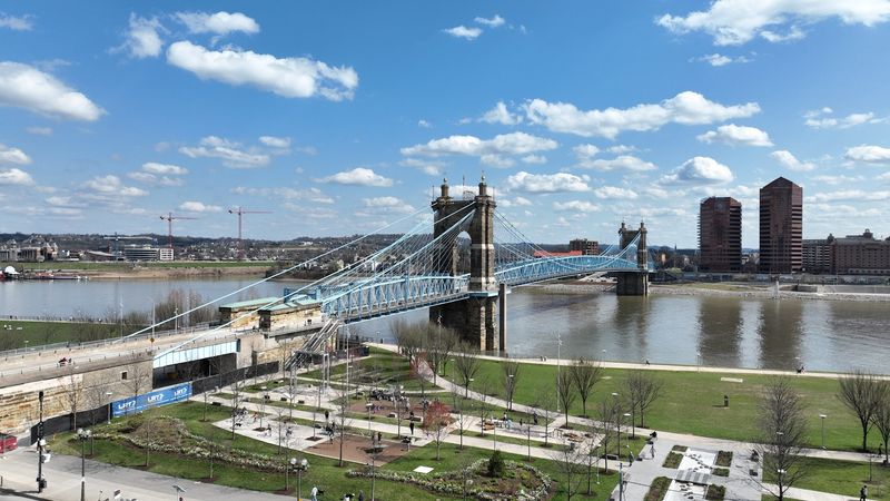
Not every riverfront park takes itself seriously, and that is exactly what makes Smale Riverfront Park such a refreshing place to spend a few hours. Giant swings face the Ohio River, interactive water jets pop up from the ground in summer, and a carousel adds a touch of old-fashioned charm to a thoroughly modern park design.
The park runs along the Cincinnati riverfront for about a mile and a half, with the John A. Roebling Suspension Bridge serving as a dramatic backdrop. That bridge, completed in 1867, was a prototype for the Brooklyn Bridge and connects Cincinnati to Covington, Kentucky, directly from the park’s edge.
Gardens, monuments honoring the city’s sports history, and a dedicated event lawn fill out the space between the water and the street. The Purple People Bridge nearby offers another pedestrian crossing and connects to additional riverfront paths on the Kentucky side.
9. Point State Park, Pittsburgh, Pennsylvania
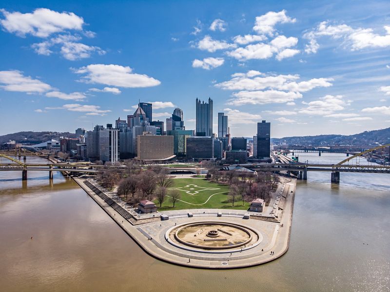
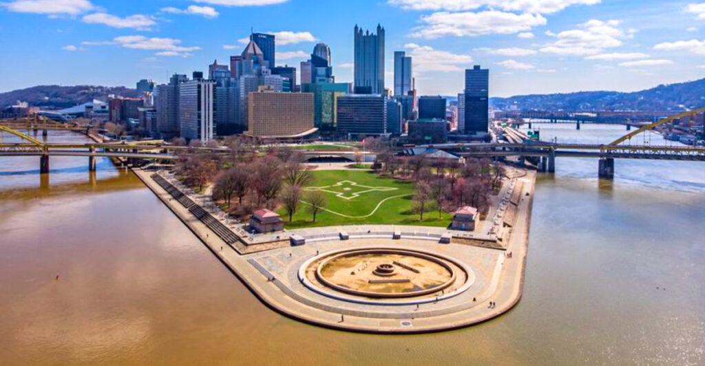
Pittsburgh is a city built on rivers, and Point State Park sits at the exact spot where that fact becomes impossible to ignore. The park occupies the tip of downtown where the Allegheny and Monongahela rivers converge to form the Ohio River, a geographical moment that shaped the entire history of the region.
A large fountain at the point marks the confluence and is one of the most photographed spots in the city. The park also contains remnants of Fort Pitt, a British fortification built in 1758, with a small museum on-site explaining its role in the French and Indian War.
Paved promenades along the park’s edges connect to the Three Rivers Heritage Trail, a 33-mile network of riverfront paths circling Pittsburgh along all three rivers. From the point, you can follow the trail north along the Allegheny or south along the Monongahela for miles in either direction.
10. Goldring Woldenberg Riverfront Park, New Orleans, Louisiana
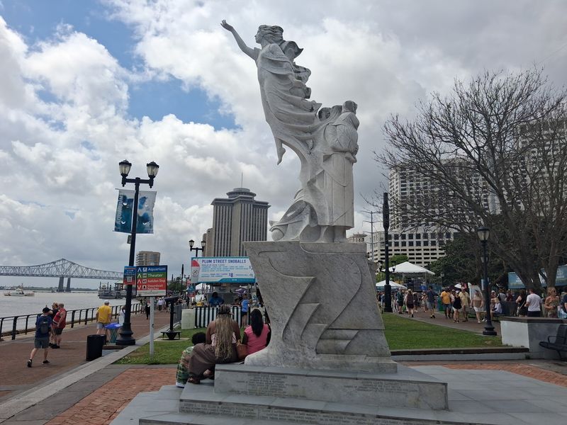
The Mississippi River moves fast past New Orleans, and Goldring Woldenberg Riverfront Park puts you close enough to appreciate just how serious that current is. The park stretches along the edge of the French Quarter, offering a calm, open space that contrasts sharply with the busy streets just a block inland.
Large public sculptures are placed throughout the park, and the wide levee path gives you an elevated vantage point for watching river traffic. Container ships, towboats pushing barges, and the occasional cruise vessel all pass through, making the river itself one of the park’s main attractions.
The Steamboat Natchez departs from nearby and offers narrated river cruises that provide historical context for what you are seeing from the bank. The park connects to the Moon Walk, another riverside promenade, extending your options for following the Mississippi further through this historic city.
11. Belle Isle, Richmond, Virginia
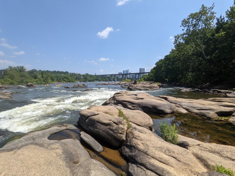
An island in the middle of a city river sounds like a fantasy, but Belle Isle in Richmond is very much real and very much worth the short walk across the pedestrian suspension bridge to reach it. The island sits in the James River near downtown and feels completely removed from urban life despite being minutes from the city center.
The James River at this point is fast-moving and rocky, dropping over exposed granite outcroppings that attract kayakers and swimmers in warmer months. The island itself has several miles of trails through wooded terrain, along with the ruins of a Civil War-era prisoner-of-war camp and a hydroelectric plant from the early 1900s.
Belle Isle is part of the James River Park System, which covers more than 550 acres of river parks through Richmond. The system connects multiple access points along both banks for anyone who wants to extend the day well beyond the island itself.
12. Ann and Roy Butler Hike and Bike Trl, Austin, Texas
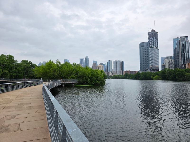
Austin’s trail around Lady Bird Lake might be the most democratic stretch of pavement in Texas. On any given morning, you will find marathon runners, dog walkers, commuters on bikes, and families with strollers all sharing roughly 10 miles of paved and natural surface path circling a reservoir on the Colorado River right through the city’s core.
The trail passes through more than 200 acres of surrounding parkland and offers shifting views between the downtown skyline, wooded banks, and open water. Several kayak and paddleboard rental operations set up along the shoreline, making it easy to swap land for water mid-outing.
Barton Springs Pool, one of Austin’s most beloved outdoor swimming spots, sits nearby and connects to the trail system. The Pfluger Pedestrian Bridge and the South Congress Bridge provide crossing points that let you build a loop of whatever length fits your day.
13. E River St, Savannah, Georgia
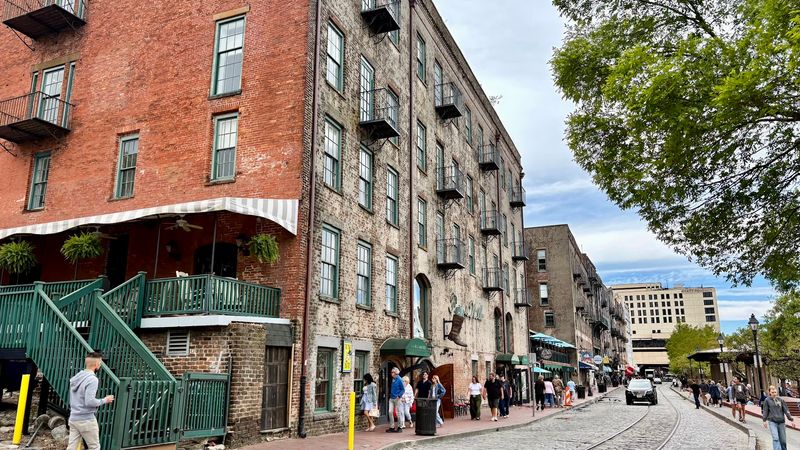
Savannah’s River Street does not pretend to be a quiet nature walk, and that honesty is part of its appeal. The cobblestone street runs along the south bank of the Savannah River and is lined with 19th-century cotton warehouses that have been converted into shops, galleries, and restaurants, all with the working river right out front.
The Savannah River here is a major shipping channel, and cargo ships pass surprisingly close to the waterfront buildings. When a massive container vessel glides past at eye level with the upper floors of a two-story building, the scale is genuinely startling.
Factors Walk, the elevated walkway above River Street, connects the waterfront to the historic squares of downtown Savannah via a series of iron bridges and ramps. The combination of active river traffic, historic architecture, and the city’s famous street life makes this one of the most layered waterfront experiences on the East Coast.
14. Wilmington Riverwalk, Battleship Eastside Site., Wilmington, North Carolina
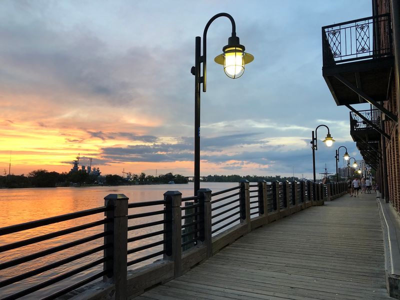
Across the Cape Fear River from Wilmington’s downtown sits the Battleship North Carolina, a World War II-era vessel that served in every major naval offensive in the Pacific. From the Wilmington Riverwalk, the ship is a constant presence, giving the walk a sense of historical weight that most riverfronts cannot match.
The Riverwalk itself runs about 1.75 miles along the downtown waterfront, passing marinas, historic buildings, and a mix of locally owned shops and restaurants. The wooden boardwalk sections are well-maintained and wide enough for comfortable two-way foot traffic without congestion.
A small ferry runs across the river to the Battleship site, making it easy to turn the Riverwalk into a half-day trip that includes the ship’s self-guided tour. The surrounding downtown historic district, with its 19th-century commercial architecture, adds another layer of interest for anyone willing to wander a block or two inland from the water.
Share this story