Canada’s North is one of those rare places where the landscape feels genuinely bigger than anything you’ve seen before. Glaciers stretch for miles, tundra rolls to the horizon, and the sky seems to go on forever.
From the gold rush history of Dawson City to the polar desert silence of Ellesmere Island, these destinations offer experiences that are hard to find anywhere else on the planet. Whether you’re a road tripper, a wildlife enthusiast, or someone who simply wants to feel small in the best possible way, the Canadian North has something that will stay with you long after you return home.
Kluane National Park and Reserve, Yukon
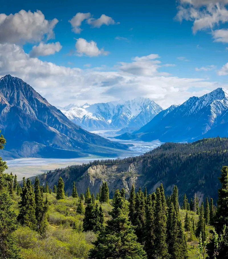
Some national parks take your breath away with their beauty. Kluane takes it away with sheer scale.
Located in southwestern Yukon, this UNESCO World Heritage Site holds some of the largest non-polar glaciers on the planet, wrapped inside a landscape of soaring peaks, boreal forest, and wildlife-rich valleys.
Haines Junction is the most practical base, sitting roughly 160 kilometers west of Whitehorse and right at the park’s edge. From there, Kathleen Lake is a popular and accessible destination, offering paddling, camping, picnicking, and access to trails like the King’s Throne, which climbs above the treeline for wide mountain views.
For those wanting to see the interior without a serious expedition, flightseeing tours offer a remarkable perspective over the ice fields. Parks Canada continues to list camping, hiking, rafting, and visitor center services for 2026, making Kluane genuinely approachable for a range of travelers.
Tombstone Territorial Park, Yukon
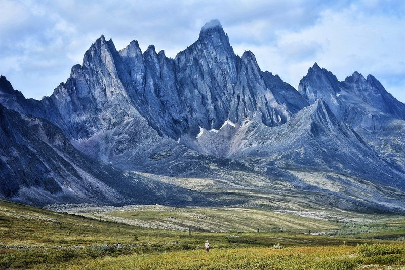
The drive north from Dawson City along the Dempster Highway starts to feel surreal around the time Tombstone Mountain comes into view. The jagged, dark peaks rising above tundra-covered valleys look like something painted for a fantasy novel, not a real Canadian territory.
Tombstone Territorial Park protects roughly 2,200 square kilometers of rugged terrain within the Traditional Territory of the Tr’ondek Hwech’in. The Dempster Highway runs directly through the park, so road-trippers get impressive scenery without needing to hike far from the vehicle.
More adventurous visitors can reserve backcountry campsites at Grizzly, Divide, and Talus lakes.
The Tombstone Interpretive Centre is scheduled to operate through September 20, 2026, while Tombstone Mountain Campground stays serviced through October 1. Backcountry camping has its own seasonal dates and reservation requirements, so checking conditions before leaving Dawson City is strongly recommended.
Dawson City, Yukon
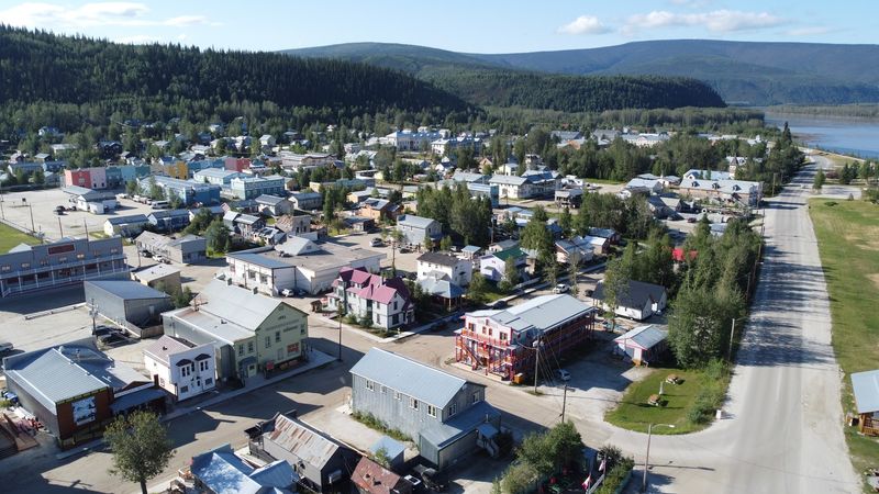
Dawson City is one of those places where history feels genuinely present rather than reconstructed for tourists. The wooden buildings, boardwalk streets, and surrounding wilderness all point back to the Klondike Gold Rush, when tens of thousands of people flooded this remote corner of Yukon in search of fortune.
Modern Dawson is a layered community. Arts festivals, cultural events, wilderness excursions, and its position at the start of the Dempster Highway all give it a personality that goes well beyond museum pieces.
The town sits at the meeting point of the Yukon and Klondike rivers, and that geography alone tells you something about why it mattered.
Travel Yukon publishes a dedicated 2026 visitor guide for Dawson City, covering its boardwalks, history, and surrounding landscape. For anyone planning a Tombstone Territorial Park trip or a Dempster Highway journey, Dawson is the natural and logical starting point.
Whitehorse, Yukon
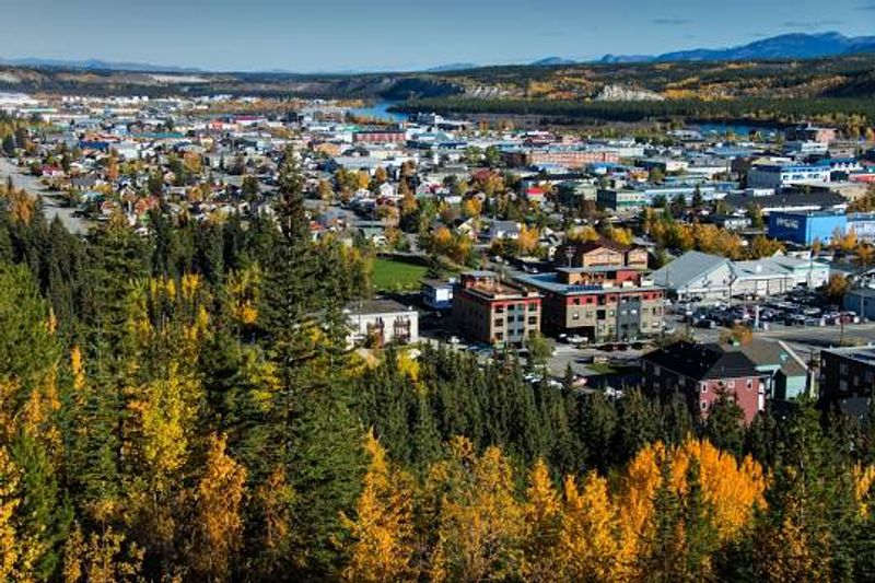
Not every northern destination requires remote access and expedition planning. Whitehorse is proof that you can experience genuine wilderness, northern lights, and First Nations culture while still having a comfortable hotel and a good restaurant waiting at the end of the day.
As Yukon’s territorial capital and its largest community, Whitehorse functions as the main transportation hub for the entire territory. Flights arrive from Vancouver, Calgary, and Edmonton, making it the most accessible entry point for visitors who want to explore Yukon without starting from a long road trip south.
The city sits beside the Yukon River, and trails, paddling routes, and wildlife areas are genuinely close to the urban center. Yukon’s tourism organization promotes year-round travel through Whitehorse, covering the midnight sun in summer, aurora viewing in winter, hiking, road trips toward Kluane, and cultural experiences tied to First Nations communities throughout the region.
Nahanni National Park Reserve, Northwest Territories
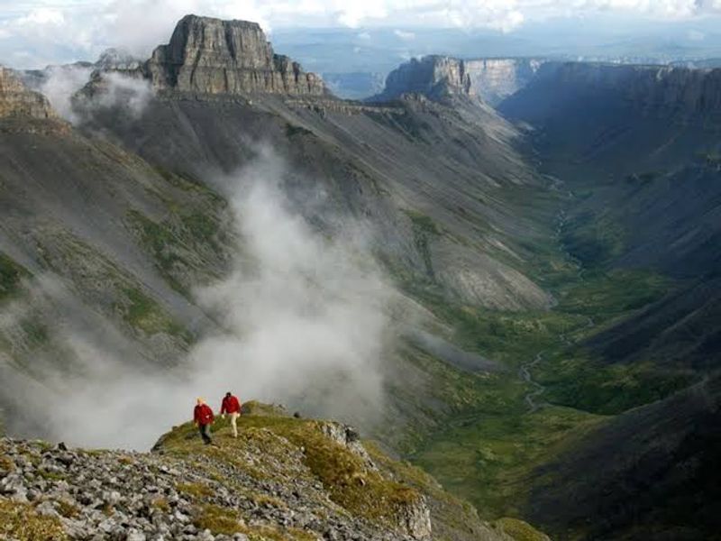
Nahanni is not a park you drive to. There are no public roads entering the reserve, and most visitors arrive by chartered floatplane, often departing from Fort Simpson.
That barrier alone keeps the crowds away and keeps the wilderness intact.
What waits inside is extraordinary. The South Nahanni River carves through deep canyons, Nailicho (Virginia Falls) drops nearly twice the height of Niagara Falls, and the backcountry stretches across mountains and remote valleys that very few people ever see up close.
Paddling the South Nahanni River is one of the most celebrated canoe routes in Canada.
Parks Canada confirmed in August 2026 that Nahanni National Park Reserve was open and operating normally following earlier wildfire disruptions near Fort Simpson. Guided activities at Nailicho had resumed, though a separate bear-related shoreline closure was issued for a specific river section later that same month.
Checking current conditions before departure remains essential.
Yellowknife, Northwest Territories
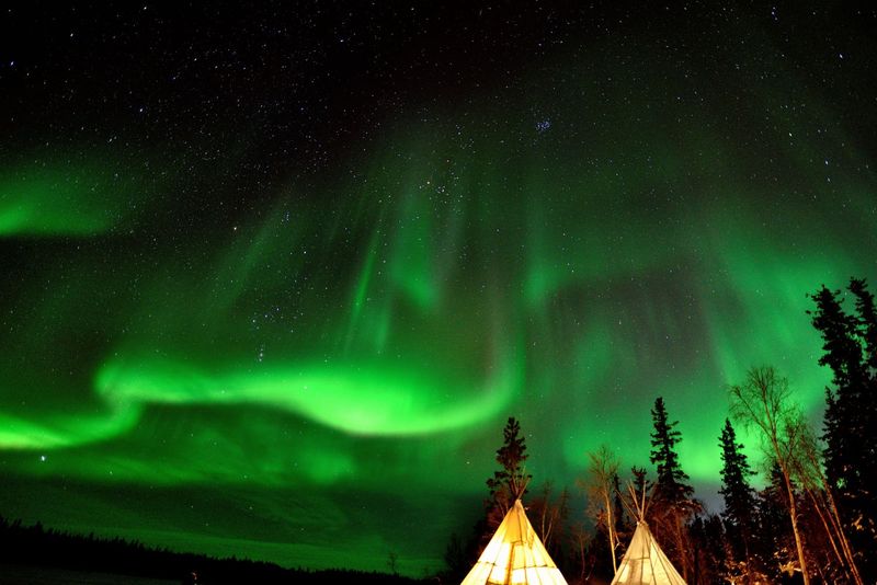
Yellowknife sits beside Great Slave Lake on a landscape of exposed Canadian Shield rock, boreal forest, and enormous open sky. As the capital of the Northwest Territories, it offers the infrastructure of a real city while sitting at the edge of some seriously wild country.
Aurora chasing is one of the biggest draws, and for good reason. The combination of northern latitude, relatively low light pollution, and a long aurora season from late August through spring gives Yellowknife a strong reputation among northern lights travelers from around the world.
Summer brings a different appeal entirely. Long evenings, lake access, hiking near town, and the distinctive character of Old Town make Yellowknife worth visiting across multiple seasons.
Northwest Territories Tourism continues to feature the city prominently in current trip-planning material, including Great Slave Lake scenery, aurora experiences, and road trips along the nearby Ingraham Trail into surrounding wilderness.
Inuvik, Northwest Territories
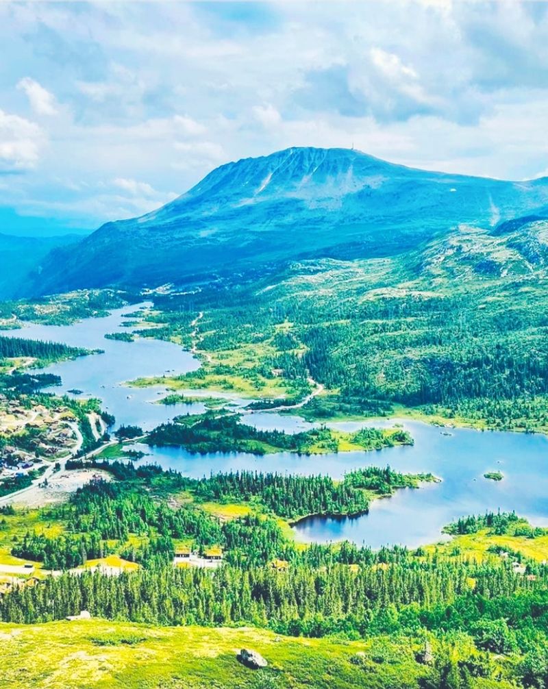
By the time you reach Inuvik, you have already crossed the Arctic Circle and driven through some of the most isolated road-accessible terrain in North America. That journey through the Dempster Highway alone is enough to make arrival feel like an accomplishment.
Inuvik sits in the Mackenzie Delta, surrounded by a landscape of rivers, channels, boreal forest, and open tundra. It serves as the main community of the Western Arctic and the essential stop between the Dempster Highway and the final drive north to Tuktoyaktuk on the Arctic Ocean coast.
The Western Arctic visitor center in Inuvik operates seasonally and provides current information about local attractions and travel conditions. The community reflects deeply rooted Inuvialuit and Gwich’in cultures, and long summer daylight makes outdoor exploration genuinely enjoyable.
Territorial campgrounds near Inuvik also serve travelers making the long journey north along this remarkable highway corridor.
Tuktoyaktuk, Northwest Territories
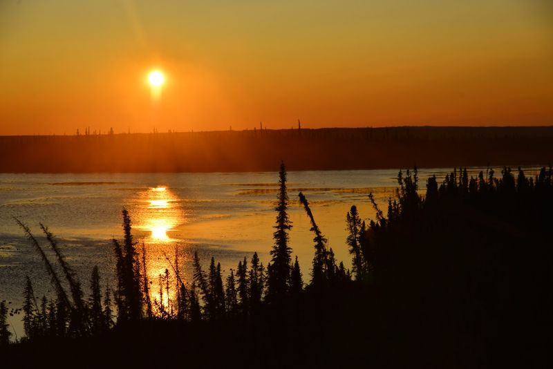
The highway from Inuvik ends at the Arctic Ocean. That simple fact is what makes Tuktoyaktuk one of the most memorable destinations on this entire list.
You can drive a public road from southern Canada all the way to an Inuvialuit community on the Arctic coast, which is something only a handful of places on Earth can offer.
The all-season highway opened in 2017, connecting Tuktoyaktuk to the North American road network for the first time. Before that, access required either a seasonal ice road in winter or a flight.
The change made one of Canada’s most remote communities genuinely reachable for ordinary road travelers.
Northwest Territories Tourism highlights the opportunity to visit the shoreline, meet local Inuvialuit artists, and see the area’s famous pingos, which are large ice-cored hills unique to permafrost landscapes. The drive from Inuvik takes roughly two and a half hours, but carrying emergency supplies and a spare tire is strongly advised.
Iqaluit, Nunavut
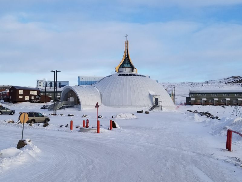
Flying into Iqaluit already tells you something is different. The tundra replaces forest well before you land, and Frobisher Bay stretches wide and cold below the aircraft.
Nunavut’s capital is the most accessible entry point into Canada’s newest territory, but accessible is a relative term up here.
Inuit culture is genuinely central to Iqaluit, not a backdrop. Visitors can explore local art, visit cultural institutions, walk through the nearby community of Apex, or arrange outdoor activities through licensed outfitters.
Depending on the season, options include kayaking, boating, fishing, snowmobiling, and dog sledding trips farther onto the land.
Sylvia Grinnell Territorial Park sits just outside town and offers a real taste of tundra wilderness without requiring a remote expedition. The City of Iqaluit maintains current visitor information and describes outdoor recreation as available year-round, making it a practical starting point for anyone new to Arctic travel in Nunavut.
Pangnirtung, Nunavut
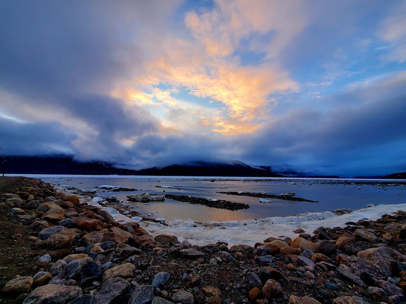
Few small communities in Canada have a setting as immediately striking as Pangnirtung. The fiord it sits in on Baffin Island is framed by steep, dark mountains that rise sharply from the water, and the scale of that landscape becomes obvious the moment you step outside.
Often called Pang by those familiar with the area, this community of roughly 1,500 people serves as the southern gateway to Auyuittuq National Park. But treating Pangnirtung as simply a transit stop would mean missing a lot.
The Uqqurmiut Centre for Arts and Crafts showcases Inuit art including printmaking, weaving, and carvings that reflect a rich cultural tradition specific to this part of Baffin Island.
Parks Canada offered scheduled guided day trips from Pangnirtung into Auyuittuq in 2026, including trips to Ulu Peak. That means visitors do not need a full multi-day backcountry expedition to get a genuine taste of the park’s remarkable terrain.
Auyuittuq National Park, Nunavut
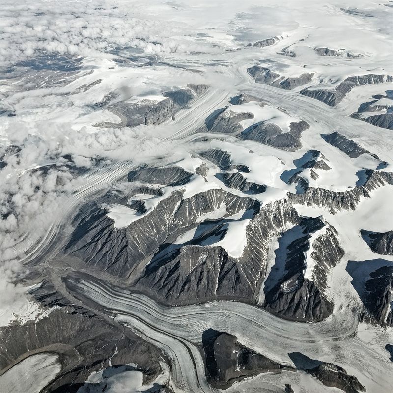
The name Auyuittuq means “the land that never melts” in Inuktitut, which gives you a reasonable sense of what to expect. Located on southeastern Baffin Island, this park is a landscape of massive granite walls, glaciers, braided rivers, and valleys that are almost entirely treeless.
Akshayuk Pass is the park’s best-known travel route, running through Arctic ecosystems from fiord coastline to tundra and glaciated highlands. Parks Canada describes it as an unmarked route, meaning travelers need solid navigation skills and proper backcountry experience.
Emergency shelters are spaced along portions of the route, but this is serious terrain.
Access to the park runs through Pangnirtung or Qikiqtarjuaq, with local outfitters providing required boat or snowmobile transportation into the park boundary. For 2026, spring skiing and summer hiking and climbing are identified as the principal visitor seasons.
This is not a beginner destination, but for experienced backcountry travelers, it is genuinely extraordinary.
Pond Inlet, Nunavut
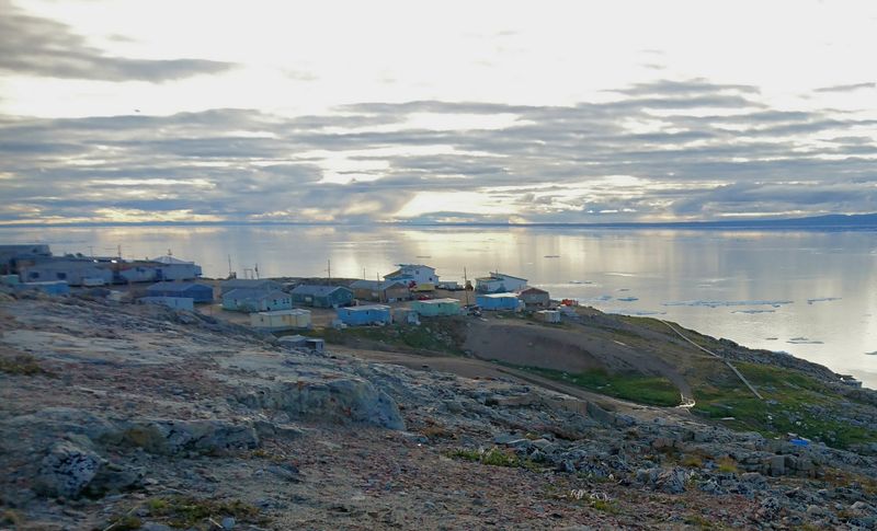
Pond Inlet, known in Inuktitut as Mittimatalik, occupies one of the most spectacular geographic positions in the Canadian Arctic. The community looks out across Eclipse Sound toward Bylot Island, with glaciers and mountains visible across the water on clear days.
The setting alone explains why travelers make the effort to get here.
This area is particularly well regarded for floe edge experiences in spring, when the meeting point of open water and sea ice attracts narwhal, beluga whales, seals, and large numbers of migratory seabirds. Licensed outfitters lead trips to the floe edge by snowmobile, and that experience is genuinely difficult to replicate anywhere else.
Nearby Sirmilik National Park adds another layer of wilderness for travelers wanting to explore beyond the community. Pond Inlet is accessible by scheduled air service, and cruise ships also stop during the navigable season.
The community maintains a visitor center, accommodations, and tourism information for arriving travelers.
Quttinirpaaq National Park, Nunavut
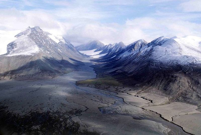
Quttinirpaaq sits near the top of the world in a way that most people will only ever see on a map. Located on Ellesmere Island roughly 800 kilometers north of Resolute Bay, this is one of the most remote national parks on the planet, and Parks Canada makes no effort to downplay what that means for visitors.
Getting here requires a commercial flight to Resolute Bay followed by a charter aircraft into the park. Facilities are extremely limited, self-reliance is mandatory, and Parks Canada states clearly that significant wilderness experience is required before attempting a visit.
The window for travel is narrow, generally between May and August.
What makes Quttinirpaaq worth including on any list of extraordinary northern places is precisely what makes it so hard to reach. Polar desert valleys, immense glaciers, mountains, and vast empty spaces that almost no one will ever see firsthand create a landscape unlike anything else in Canada.
The park is accepting visitors in 2026.
Share this story