Canada is home to some of the most remarkable places on Earth, and a handful of them have earned recognition from UNESCO as World Heritage Sites. These are locations where geology, history, culture, and nature combine in ways that are genuinely hard to find anywhere else.
From ancient fossil cliffs along the Atlantic coast to sacred rock art in Alberta’s river valleys, the range is striking. Whether you are planning a cross-country road trip or simply looking for inspiration for your next adventure, this list covers 14 Canadian UNESCO sites that deserve a spot on your radar.
Each one tells a different story, and each one gives you a reason to see Canada in a new way.
Gros Morne National Park, Newfoundland and Labrador
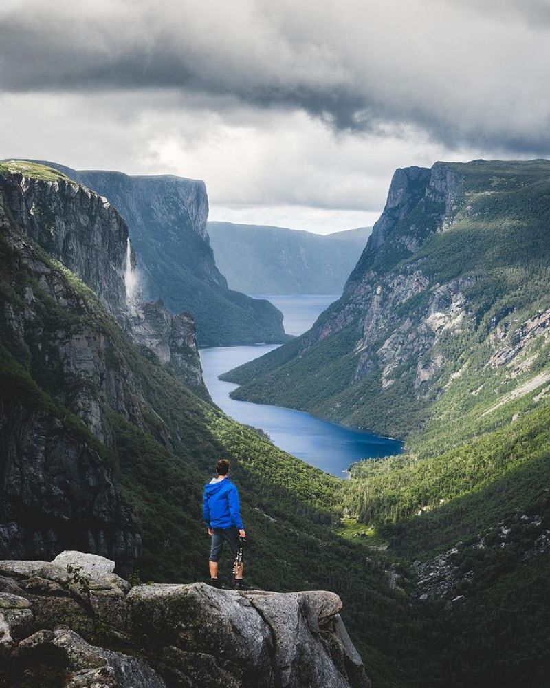
Gros Morne looks like a place where the planet forgot to hide its interior. Located on Newfoundland’s west coast, the park contains exposed rocks from Earth’s mantle and oceanic crust, making it one of the clearest places on the planet to see direct evidence of plate tectonics.
Geologists travel here specifically for that reason.
The orange-brown Tablelands are the most visually striking feature. Their barren, rust-colored surface looks almost alien beside the surrounding green mountains, and that contrast is exactly why so many visitors photograph them first.
Glaciers carved the rest of the landscape into fjords, cliffs, plateaus, and deep freshwater lakes over thousands of years.
Hiking, camping, kayaking, and boat excursions through the fjords are all available. Gros Morne remains open year-round, though most visitor services run primarily between spring and fall.
The park rewards slow travel more than a quick drive-through.
Historic District of Old Quebec, Quebec
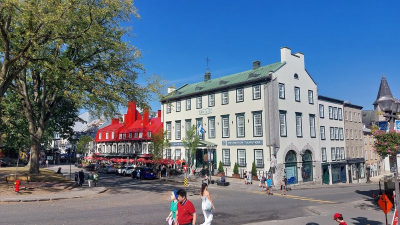
Standing inside the walls of Old Quebec, it genuinely feels like North America stepped aside and let a European city take over. Cobblestone streets, centuries-old stone buildings, narrow lanes, and the unmistakable silhouette of the Chateau Frontenac create an atmosphere unlike any other Canadian city.
Founded in the early 17th century, Quebec became the capital of New France.
UNESCO recognizes the historic district as the only city north of Mexico to have preserved such an extensive system of fortifications, including ramparts, gates, bastions, and defensive works. That is not a small distinction.
Most North American cities demolished their colonial defenses long ago.
Because this is a living neighborhood rather than a museum complex, the streets stay active throughout the year. Restaurants, shops, museums, and historic attractions operate within and around the district.
Visiting in winter, when snow settles on the stone walls, gives the whole place an entirely different character.
Dinosaur Provincial Park, Alberta
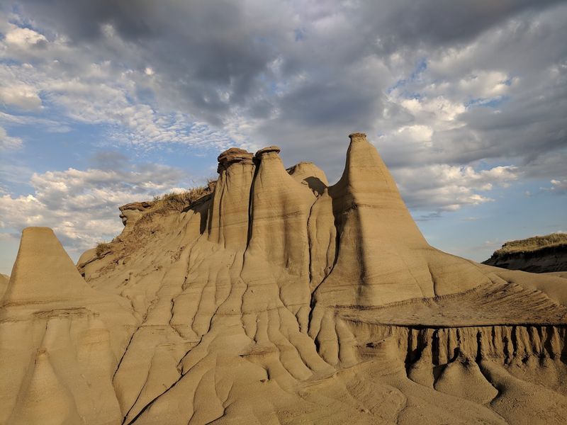
Alberta’s badlands would be worth visiting even if they had never produced a single fossil. The landscape of hoodoos, ridges, and deeply eroded valleys carved from ancient sediment is striking on its own terms.
Add one of the world’s richest collections of dinosaur fossils, and Dinosaur Provincial Park becomes something genuinely extraordinary.
UNESCO notes that fossils representing around 35 dinosaur species have been found within this park, with remains dating to roughly 75 million years ago. Interpretive programs give visitors access to protected areas where fossil discoveries have actually been made, which is a different experience from simply reading about them in a museum.
Designated trails and viewpoints are open for self-guided exploration as well. Sunrise and sunset bring out layers of gold, red, gray, and brown in the rock formations, giving the badlands an appearance that changes noticeably depending on the light.
Plan to spend more time here than you expect.
L’Anse aux Meadows National Historic Site, Newfoundland and Labrador
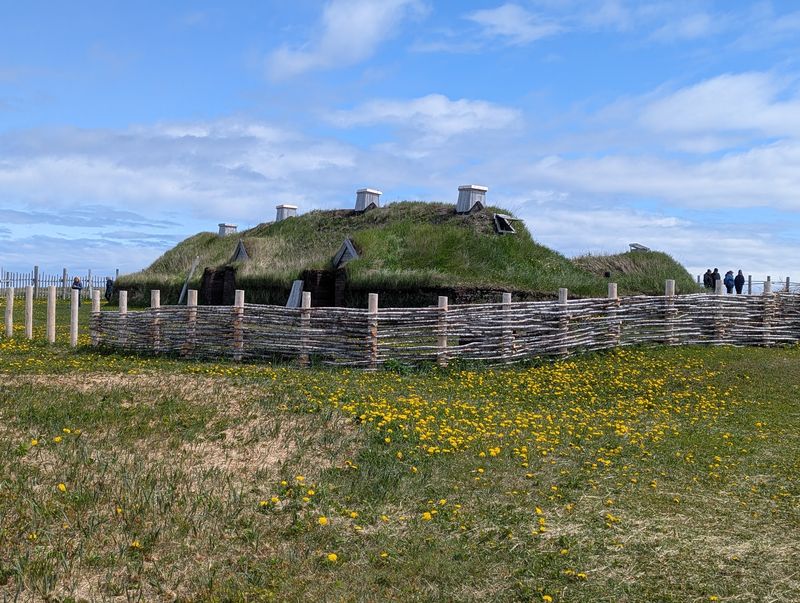
At the northern tip of Newfoundland, archaeological evidence confirms what historians spent years debating: Norse explorers reached North America roughly 1,000 years ago, centuries before the voyages traditionally credited with European arrival in the Americas. L’Anse aux Meadows is where that evidence sits in the ground.
Reconstructed sod buildings and living-history interpretation help visitors understand what daily life may have looked like for the people who crossed the North Atlantic and built a settlement on this remote coastline. The windswept setting adds something that no museum exhibit can replicate.
Surrounding sea, open grassland, and rocky shoreline provide almost no visual distractions from the history in front of you.
Parks Canada lists the visitor centre and Viking Encampment as open daily from June 1 through October 2, from 9 a.m. to 5 p.m. in 2026. Getting here requires some travel, but that remoteness is part of what makes the experience feel significant.
Head-Smashed-In Buffalo Jump, Alberta
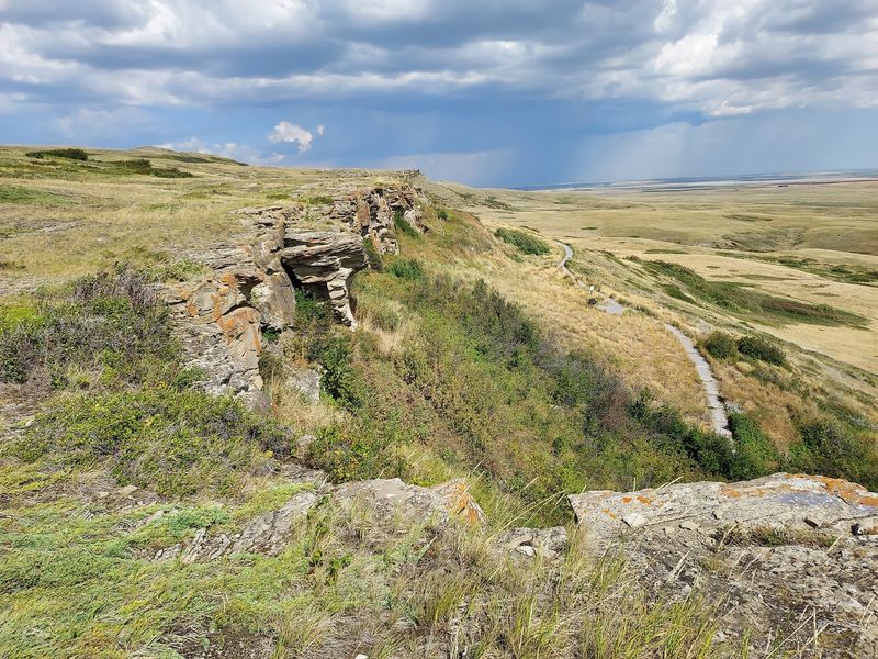
Few places on the Great Plains carry the kind of layered history that Head-Smashed-In Buffalo Jump holds. For thousands of years, Indigenous peoples of the Plains used detailed knowledge of bison behavior and local geography to drive herds toward and over a cliff.
The bison provided food, hides, bones, sinew, and other materials central to daily life.
Archaeological evidence at the site documents more than five millennia of this hunting tradition. Parks Canada describes it as one of the oldest, largest, and best-preserved buffalo jumps in North America, which gives the interpretive centre a lot of genuine material to work with.
The landscape itself remains an important place for understanding Blackfoot history and culture, not just as a historical curiosity but as a living part of that heritage. Visitors can explore the centre and stand on the same prairie terrain that shaped generations of Plains life.
The views across the open grassland are quietly powerful.
Old Town Lunenburg, Nova Scotia
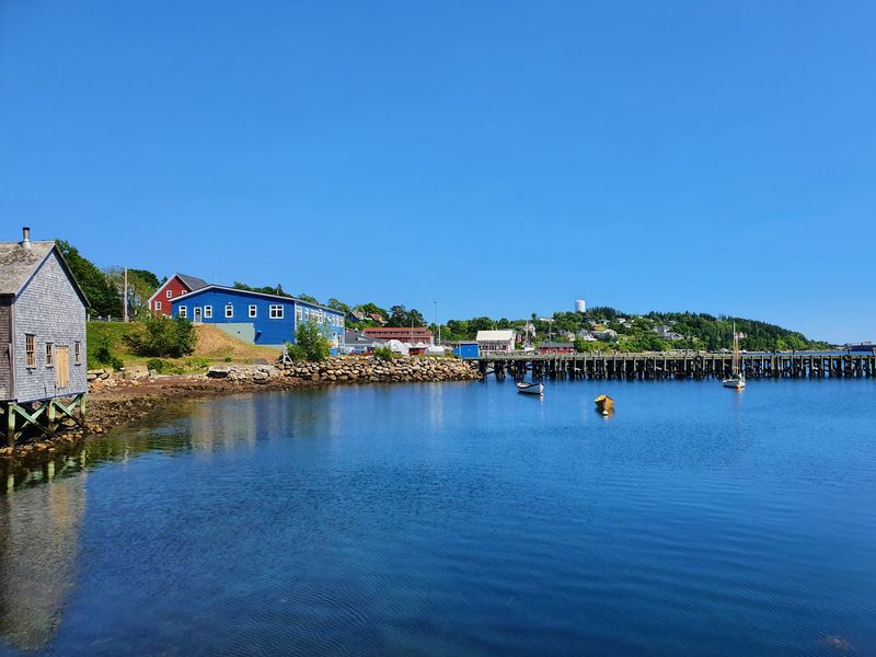
Lunenburg earns attention before you even start reading about its history. Bright wooden homes painted in deep reds, yellows, and blues line steep streets that lead down to a working waterfront.
Historic churches anchor the skyline. The whole town looks deliberately composed, though it has simply stayed true to the grid laid out when it was established in 1753.
UNESCO considers Lunenburg the best surviving example of British colonial settlement planning in North America. Its original street grid remains remarkably intact, and many wooden houses and public buildings preserve architectural traditions stretching back more than two centuries.
That kind of continuity is rare.
Importantly, Lunenburg is not a preserved historical display frozen in time. It functions as an active coastal community where visitors can walk the waterfront, explore maritime museums, dine at local restaurants, and wander residential streets filled with colorful architecture.
The combination of genuine history and everyday community life gives it a character that polished tourist towns rarely manage.
Mistaken Point, Newfoundland and Labrador
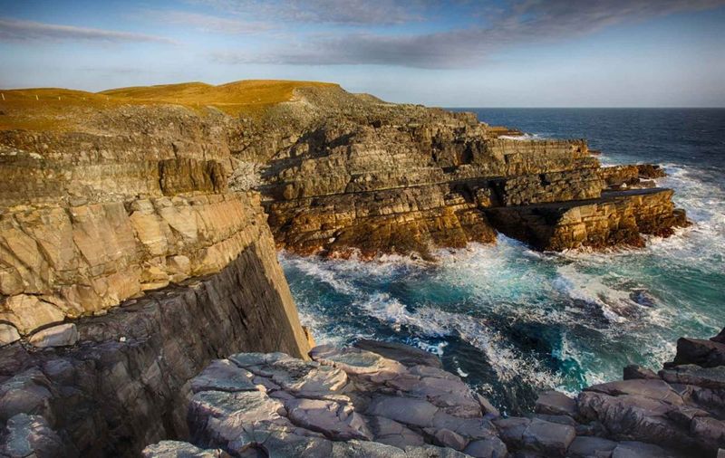
The fossils at Mistaken Point predate dinosaurs by hundreds of millions of years. Along roughly 17 kilometers of rugged Newfoundland coastline, exposed rock surfaces preserve fossils dating from approximately 580 to 560 million years ago.
UNESCO describes them as among the oldest known assemblages of large, complex organisms, documenting a stage in the evolution of life that most fossil sites cannot show.
Access to the fossil beds is carefully controlled, and for good reason. Visitors who want to see them must join an official guided tour, and reservations are strongly recommended.
In 2026, the reserve opened for its visitor season from May 11 through October 16.
The coastal setting itself is dramatic. Clifftops, open ocean, and the constant presence of wind give Mistaken Point a raw, elemental quality that fits the ancient subject matter well.
This is not a site that tries to entertain you. It simply shows you something genuinely old and lets that be enough.
Rideau Canal, Ontario
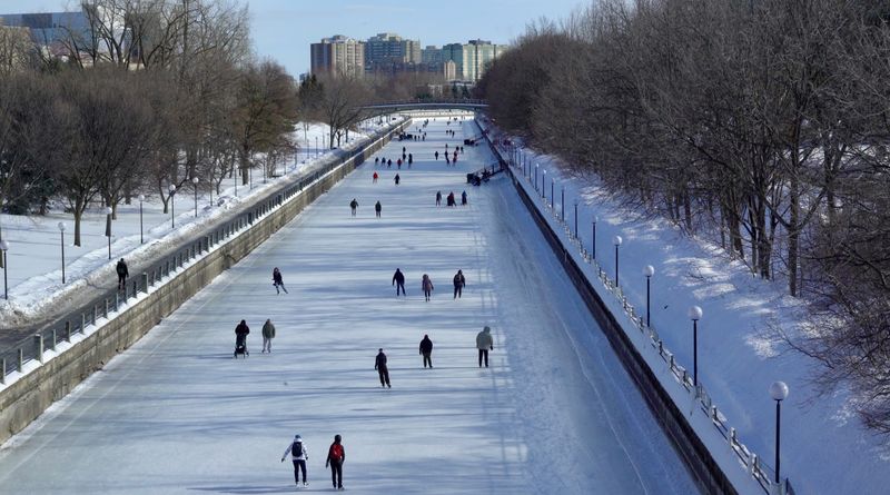
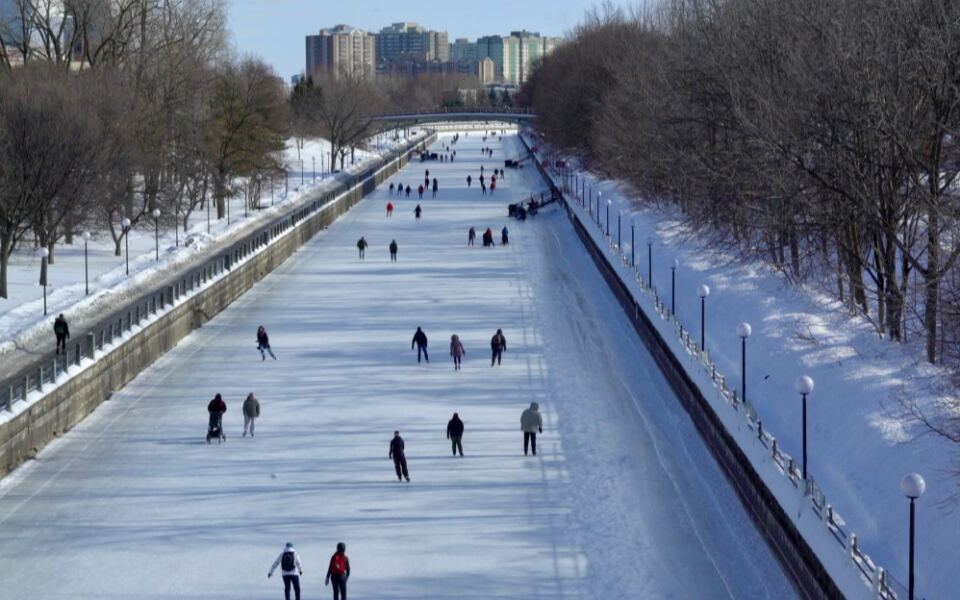
Stretching approximately 202 kilometers between Ottawa and Kingston, the Rideau Canal is both a functioning piece of 19th-century engineering and one of Ontario’s most enjoyable recreational waterways. Completed in the 1830s, the system connects rivers, lakes, and man-made sections through historic locks that Parks Canada still operates today across 22 lockstations.
Getting on the water is the best way to understand the canal’s scale. Visitors can explore it by boat, kayak, bicycle, or on foot, depending on the section and the season.
The experience shifts considerably between summer and winter, particularly in Ottawa, where sections of the waterway become associated with cold-weather recreation when conditions allow.
The 2026 navigation season runs from mid-May into October, with individual lockstation hours varying by date and location. Cycling the length of the canal is a popular multi-day option for those who want to experience the full route at a pace that lets the landscape actually register.
Joggins Fossil Cliffs, Nova Scotia
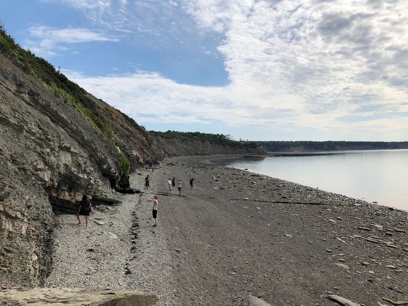
Every tide at Joggins reveals something the previous tide covered. The coastal cliffs along the Bay of Fundy preserve an extraordinary fossil record from the Carboniferous Period, when swampy forests covered large portions of the planet hundreds of millions of years ago.
UNESCO calls Joggins one of the world’s most complete records of terrestrial life from this era, including ancient plants, animal tracks, and early vertebrates.
Visitors can walk portions of the beach and examine the constantly eroding cliff face, ideally with knowledgeable guides who can identify what is appearing in the rock. The fossils here are not behind glass.
They are embedded in the cliffs and washing out onto the beach in real time.
Timing your visit around the tides is genuinely important. The Bay of Fundy has some of the highest tidal ranges on Earth, and beach access changes quickly.
Joggins publishes specific suggested beach-access windows based on the 2026 tide schedule, so check before you go.
Waterton-Glacier International Peace Park, Alberta
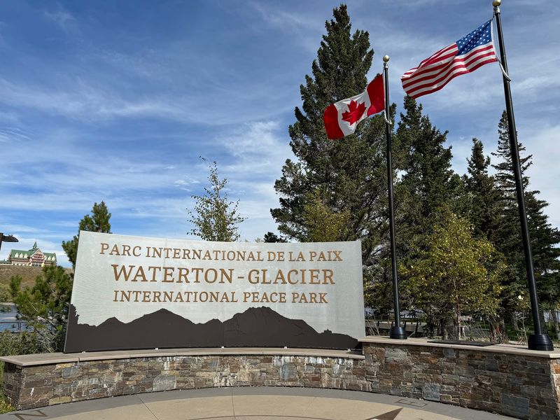
Waterton Lakes National Park sits at a geographic boundary that seems too dramatic to be real. Prairie grasslands run almost directly into the Rocky Mountains here, with almost no transition zone between them.
The visual effect, especially arriving from the east, is genuinely arresting.
Together with Glacier National Park in the United States, Waterton forms the Waterton-Glacier International Peace Park, created to celebrate cross-border conservation cooperation. The UNESCO designation covers the shared ecosystem, which protects mountain terrain, wildlife corridors, lakes, waterfalls, and colorful geological formations on both sides of the border.
On the Canadian side, Waterton is considerably smaller than neighboring Banff, which gives many parts of the park a compact and accessible feel. Wildlife sightings are common throughout the area.
Trails range from short walks near the townsite to demanding mountain routes for experienced hikers. Waterton Lakes National Park stays open year-round, though many townsite facilities close during the colder months.
Landscape of Grand Pre, Nova Scotia
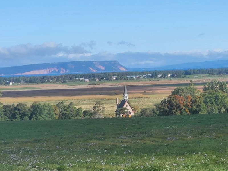
Grand Pre is the kind of place that looks peaceful until you learn what happened here. The UNESCO property encompasses more than 1,300 hectares of farmland, archaeological sites, and marshland along Nova Scotia’s Minas Basin.
Beginning in the 17th century, Acadian settlers created productive agricultural land by constructing dykes and wooden sluices called aboiteaux to manage seawater in an area with some of the world’s highest tidal ranges.
The engineering was clever and effective. The cultural history is more difficult.
Grand Pre is also deeply connected to the deportation of the Acadians beginning in 1755, an event that scattered a population across the Atlantic world and left a permanent mark on Maritime identity.
The exterior grounds and Victorian garden at Grand-Pre National Historic Site are open year-round. The visitor centre operates seasonally, with 2026 hours running from May 15 through October 12.
The site holds both agricultural history and a story of displacement that still resonates across generations.
Red Bay Basque Whaling Station, Newfoundland and Labrador
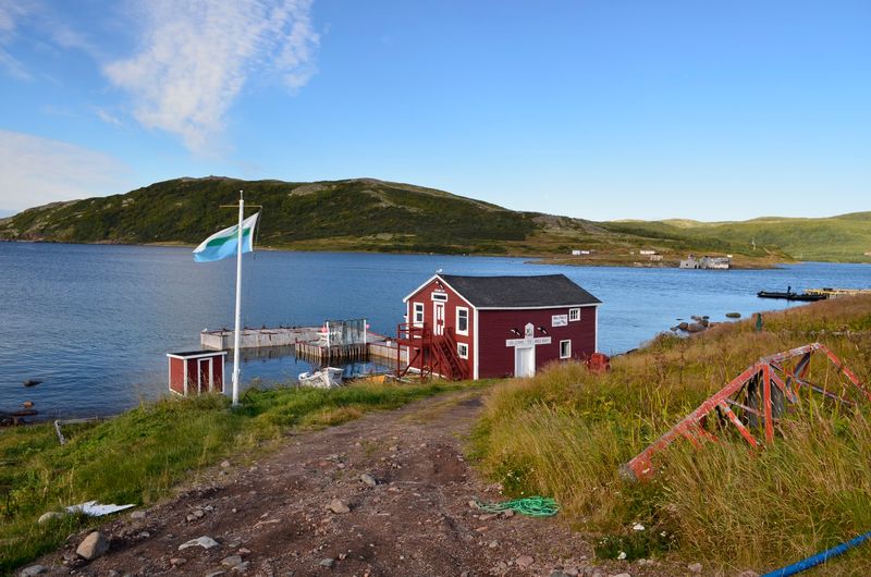
During the 16th century, Red Bay was one of the busiest whaling operations in the world, which is remarkable to consider when you see how remote this stretch of Labrador coastline actually is. Basque whalers crossed the Atlantic from areas that are now part of Spain and France to hunt right and bowhead whales in the Strait of Belle Isle, then processed the oil before shipping it back to Europe.
Archaeological discoveries have revealed structures, artifacts, and shipwreck evidence that document this once-significant industry in detail. Visitors can see original artifacts on display and examine a reconstructed chalupa, the small boat Basque crews used during hunts.
Parks Canada lists Red Bay as open from June 1 through October 2 in 2026. The remote setting makes the history feel even more striking when you consider what it took to cross the North Atlantic and operate a large-scale industrial enterprise here almost 500 years ago.
The distance itself becomes part of the story.
Miguasha National Park, Quebec
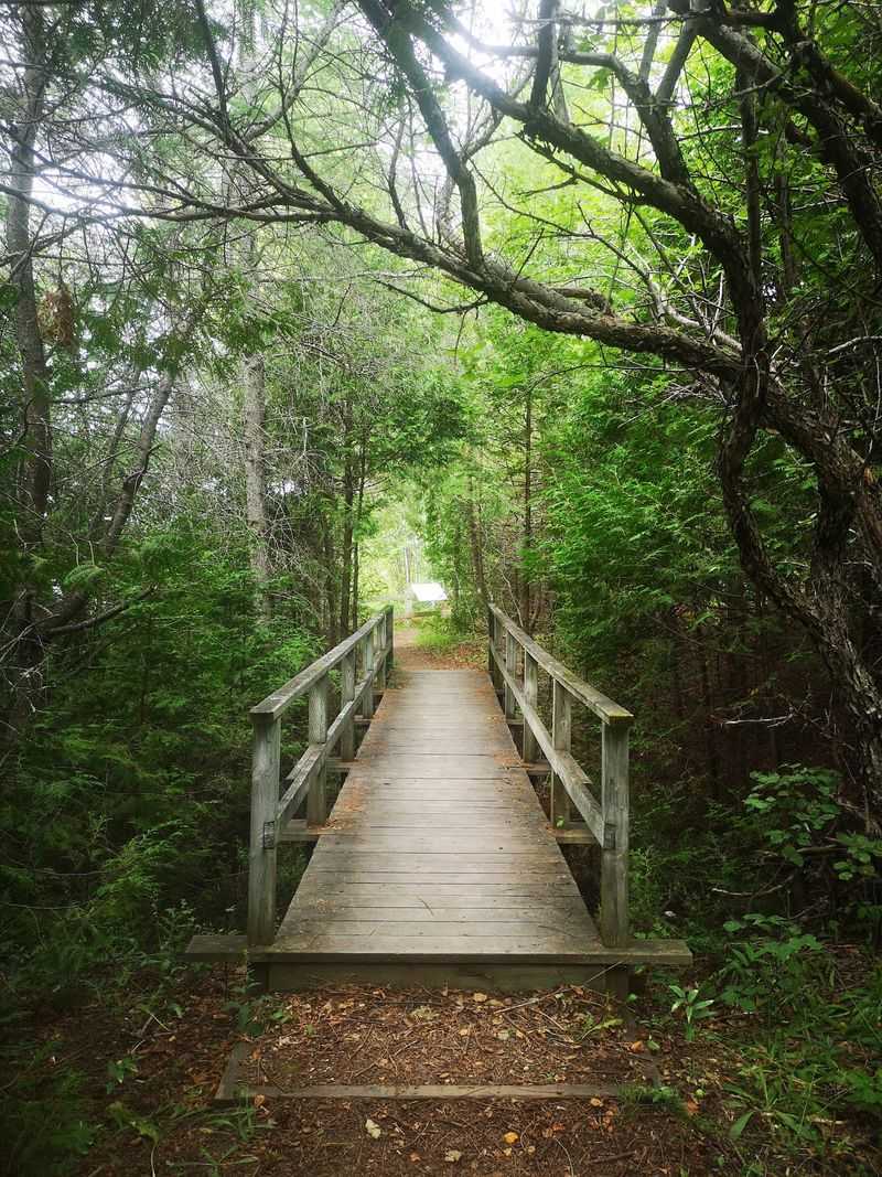
Miguasha looks like a quiet stretch of cliff along the Restigouche estuary on Quebec’s Gaspe Peninsula. What is preserved inside those cliffs is approximately 370 million years old.
UNESCO considers Miguasha one of the world’s finest fossil records from the Devonian Period, often called the Age of Fishes, because of the exceptional quality and variety of specimens found here.
The fossils include several major groups of prehistoric fish, including lobe-finned species connected to the evolutionary transition that eventually produced four-limbed vertebrates. That is a significant chapter in the history of life on land, documented in rock that visitors can see up close.
Exhibits inside the park help explain why these seemingly ordinary layers of sediment carry such scientific weight. Outdoor areas allow travelers to see the geological landscape in context.
The estuary setting is genuinely pleasant, which means the visit works on a purely scenic level even for travelers who arrive without much background in paleontology.
Writing-on-Stone / Aissinai’pi, Alberta
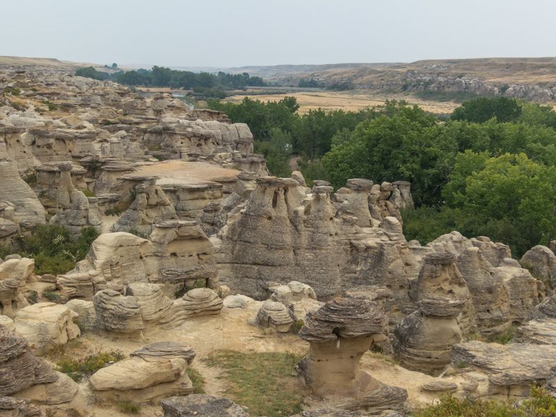
Southern Alberta’s Milk River Valley is full of sandstone hoodoos and eroded cliffs that took thousands of years to form, but the geology is not the main reason UNESCO recognized this place. Known as Aissinai’pi, meaning roughly “it is pictured, it is written,” this landscape is sacred to the Blackfoot people and contains one of the largest concentrations of rock art on the entire Great Plains.
More than 200 rock-art panels are found on cliff faces throughout the area, with engravings and paintings recording cultural traditions, spiritual connections, and experiences across a long span of time. The art is not decoration.
For the Blackfoot, this is a place where the physical and spiritual worlds meet.
Access to certain areas is managed to protect the rock art and respect the site’s cultural significance. Guided tours provide the most meaningful experience.
The combination of dramatic geology, ancient imagery, and living cultural importance makes Aissinai’pi one of the most layered UNESCO sites in Canada.
Share this story