Some of the planet’s greatest treasures never see a tour bus. They sit on far-off islands, deep in jungles, or in deserts so big that GPS gets nervous.
Here are 15 UNESCO sites where crowds are rare because of distance, strict rules, or tough conditions. A few are not safe for casual travel right now, so think of this as armchair adventure.
Heard and McDonald Islands
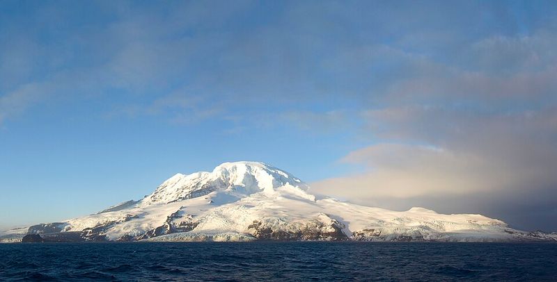
Picture a place where the welcome committee is a pile of elephant seals. Heard and McDonald Islands sit about 4,100 kilometers southwest of mainland Australia, and about 1,700 kilometers from Antarctica.
Nobody lives there.
Records show only around 240 shore visits to Heard Island since the first landing in 1855. Tourists have set foot there on just three commercial voyages, in 1992, 1997, and 2002.
McDonald Island has seen only two recorded landings.
The star of the show is Big Ben, an active volcano wrapped in glaciers that climbs to 2,745 meters. Around it, one of the least-disturbed subantarctic ecosystems carries on without much human interference.
Strict permits and quarantine rules keep it that way.
So how would a curious traveler experience it? Mostly through photos, documentaries, and the reports of scientists who make the rare trip.
Even they must follow tough biosecurity steps, such as cleaning boots and gear so no stray seeds sneak ashore.
It may be the ultimate lesson in staying away to keep something special.
Surtsey
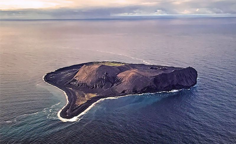
Born in fire in 1963, Surtsey is basically a teenager among islands, and it has a strict curfew on visitors. The volcanic island rose from the Atlantic south of Iceland during eruptions that lasted years.
Scientists were thrilled.
Why? They got a front-row seat to watch life move in.
Plants, birds, insects, and other organisms have colonized the fresh land, and researchers have tracked each step.
Iceland protected Surtsey while the eruption was still going. Tourist access has been banned since 1965 unless the Environment Agency gives special permission.
Even a single muddy boot could add seeds or bugs that spoil the experiment.
Curious travelers still have options. You can admire the island from a boat or an aircraft, and the view of dark rock dotted with green is worth the trip on its own.
Think of it as a living science lab with a very firm No Trespassing sign. Because people stay out, nature gets to write its story with almost no editing from us.
Henderson Island
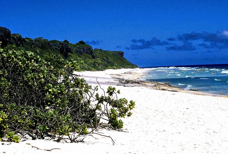
Imagine looking at a map and finding no land within 5,000 kilometers. That is Henderson Island, an uninhabited raised coral atoll in the South Pacific.
The nearest inhabited neighbor, Pitcairn Island, is about 200 kilometers away.
There is little fresh water here. There is no airport, no hotel, and no permanent settlement.
Those facts alone keep visitor numbers tiny.
All that isolation has turned Henderson into an evolutionary laboratory. It is home to ten endemic plant species and four endemic land birds, meaning they live nowhere else on Earth.
The raised limestone plateau and surrounding reefs show what a Pacific island looks like with little long-term human settlement.
Sadly, the modern world still finds a way in. Marine plastic pollution from distant places has washed up on its shores, which is a sobering sight on such a faraway beach.
Most people will never step on this sand, and that is part of its magic. Reading about it, and supporting ocean cleanup efforts at home, is the easiest way to help.
Gough and Inaccessible Islands
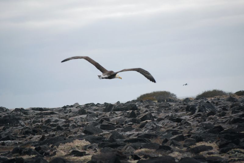
With a name like Inaccessible, you can guess how the sales pitch goes. Gough and Inaccessible Islands sit in the remote South Atlantic, surrounded by about 2,000 nautical miles of open ocean.
The weather there is famously rough.
Both islands are uninhabited. UNESCO describes them as some of the least-disturbed cool-temperate island ecosystems left on Earth.
Tall sea cliffs hold enormous colonies of albatrosses, petrels, and penguins.
Inaccessible Island has a special resident: the Inaccessible rail. It is the smallest flightless bird in the world, and it does just fine without wings for long trips.
The science value of these islands depends on keeping them isolated. Access is tightly managed, and landing can be tricky even when permits are in order.
Big waves and steep shores make sure of that.
The ocean itself acts like a giant bouncer. It keeps mass tourism away and lets the birds raise their chicks in peace.
For most of us, a good nature documentary is the best seat in the house.
Aldabra Atoll
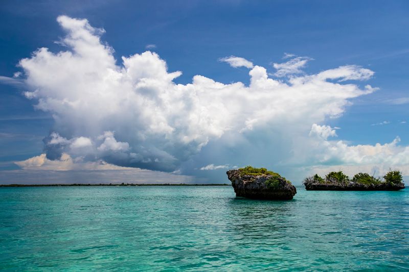
Forget the swim-up bars of the Seychelles. Aldabra has no airstrip, harbor, jetty, helipad, hotel, or guesthouse.
Visitors must arrive aboard live-aboard vessels with prior approval from the Seychelles Islands Foundation.
The numbers tell the story. Tourism averages only about 445 people per year, and just 41 visitors were recorded in 2010.
That is fewer people than fit on a single school bus trip a few times over.
The reward is a front-row view of one of the largest raised coral atolls in the world. Around 152,000 giant tortoises live here, the biggest population anywhere.
Imagine a traffic jam where every driver wears a shell.
Permitted guests stay in designated areas and walk with foundation staff. The rules protect a landscape UNESCO describes as largely untouched by people.
If you ever plan an expedition, book early and bring patience, because permits and sailing schedules do not bend easily. Slow travel suits a place ruled by tortoises anyway.
Macquarie Island
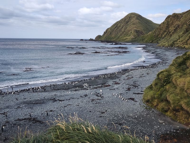
Halfway between Tasmania and Antarctica, rocks from deep under the ocean floor have popped up above the waves. That is Macquarie Island, a rare geological showpiece.
Its wildlife is just as dramatic.
Millions of seabirds nest here, and tens of thousands of elephant seals crowd the beaches. With that many animals, biosecurity matters a great deal.
One rat or weed seed could cause real trouble.
Tasmania’s Parks and Wildlife Service treats the area as a restricted reserve. Entry needs specific permission, and commercial educational tourism is held to quotas.
Only approved expedition operators can visit, and only in set seasons.
Then there is the weather. The Southern Ocean serves up wind, swell, and cold that can scramble any landing plan.
Add extreme distance from towns, and visitor numbers stay tiny compared with popular Australian attractions. Tourists who do make it often come away talking about the noise and smell of the seal colonies.
It is a wild, loud, wonderful place.
Nan Madol
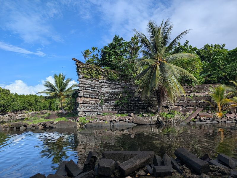
Nine foreign visitors a day. That was the average recorded by Pohnpei authorities between October 2018 and January 2020, with fewer locals on top.
For a place this amazing, that is a quiet afternoon.
Nan Madol is made of more than 100 artificial islets built from basalt and coral off Pohnpei. The remains of palaces, temples, tombs, and homes tell the story of the Saudeleur dynasty, which ruled roughly between 1200 and 1500.
The stone work is huge and hard to believe.
Getting around takes effort. Dense vegetation, tidal channels, and limited facilities mean you may be wading or hopping between walls.
Wear shoes that can get wet.
UNESCO’s 2026 conservation decision still called for the finished visitor center to become fully operational. So the welcome mat is not completely rolled out yet.
That suits fans of quiet ruins just fine. Pohnpei’s remote Pacific location keeps Nan Madol far from the crowded landmarks that fill travel brochures.
Go with a local guide to learn the stories behind the stones.
East Rennell
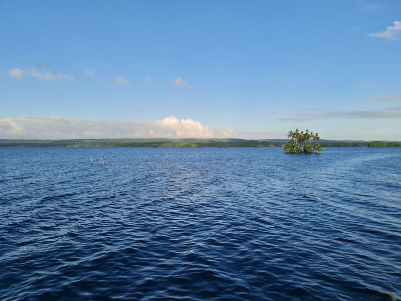
A flight that may or may not show up is a tough way to start a vacation. On East Rennell, that is a real challenge.
UNESCO notes that infrequent and unreliable air service and difficult overland travel limit access.
The property covers the southern third of Rennell Island, called the largest raised coral atoll in the world. At its heart lies Lake Tegano, a 15,000-hectare former lagoon.
It is the largest lake in the insular Pacific.
About 1,200 people live in four villages inside the World Heritage area. Their home is packed with dense forest, endemic birds, snails, and other wildlife found almost nowhere else.
Efforts to build ecotourism have been frustrated by that same isolation. Fewer visitors means fewer jobs, which is a tough trade for local families.
East Rennell has been on the World Heritage in Danger list since 2013 because of threats such as logging and invasive species. Its beauty is real, but so are its worries.
Supporting community-led conservation is the best way to care from afar.
Central Suriname Nature Reserve
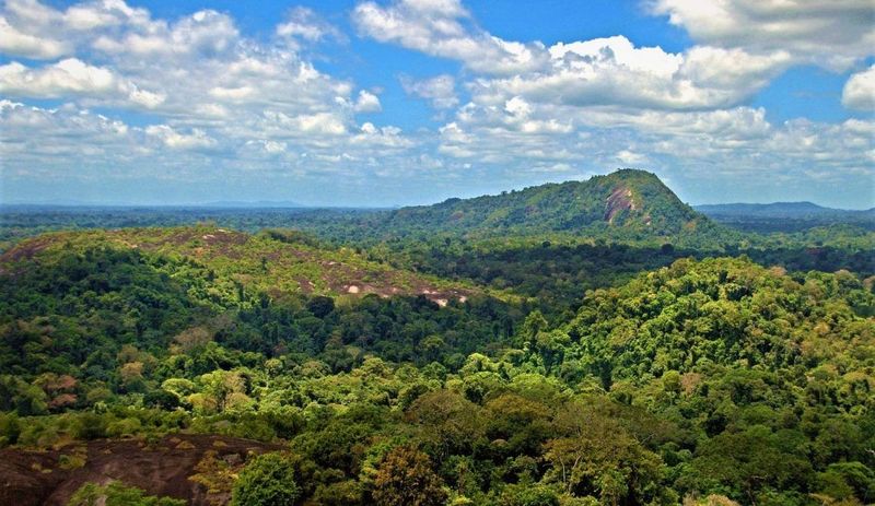
Jaguars, giant river otters, tapirs, and hundreds of bird species share a forest bigger than many small countries. The Central Suriname Nature Reserve covers about 1.6 million hectares of primary Amazonian forest.
Granite domes poke out of the green like giant bald heads.
UNESCO describes most of the reserve as inaccessible. Its remoteness gives it an unofficial buffer of nearly 100 miles in many directions.
That is a very long walk to the nearest crowd.
Tourism, UNESCO says, remains “in its infancy.” The few opportunities cluster near a handful of airstrips. Most of the interior has no roads, no visitor complexes, and no gift shops.
Compared with busy rainforest hot spots, this feels like another planet. The lack of development is a big reason the ecosystem has stayed so healthy.
Anyone dreaming of a visit should plan with licensed local operators and small aircraft, and be ready for heat, bugs, and rain. The payoff is wilderness that still feels like wilderness.
Ennedi Massif
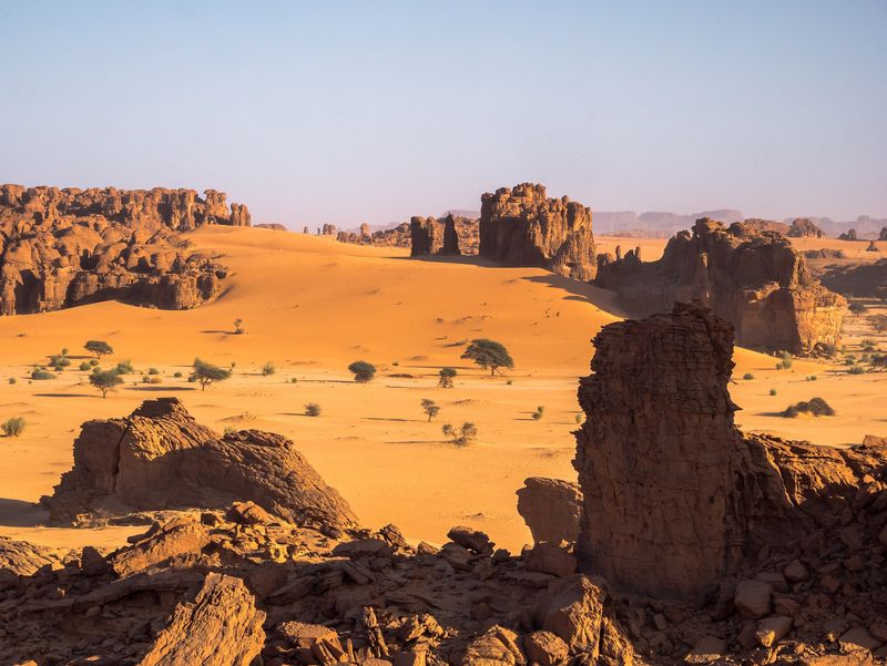
Wind has been sculpting the Ennedi Massif for ages, and the results look like a giant’s art project. Sandstone has been carved into arches, pinnacles, cliffs, and twisting canyons.
It is one of the Sahara’s most striking landscapes.
Hidden pools of permanent water survive in the desert. They support wildlife and the herding communities who depend on them.
Nearby rock walls hold thousands of paintings and engravings showing how climate and life changed over thousands of years.
UNESCO’s evaluation noted that tourism numbers were very small at the time of inscription. That is no shock.
Ennedi sits in northeastern Chad, and reaching it means long overland journeys.
There are no tour buses here. Travel is expedition style, with big distances, few services, and plenty of sand.
Anyone thinking about a trip should check current travel advice and go only with experienced local guides. Pack extra water, then pack more.
When the sun drops and the rocks glow orange, the effort starts to make sense.
Tubbataha Reefs Natural Park
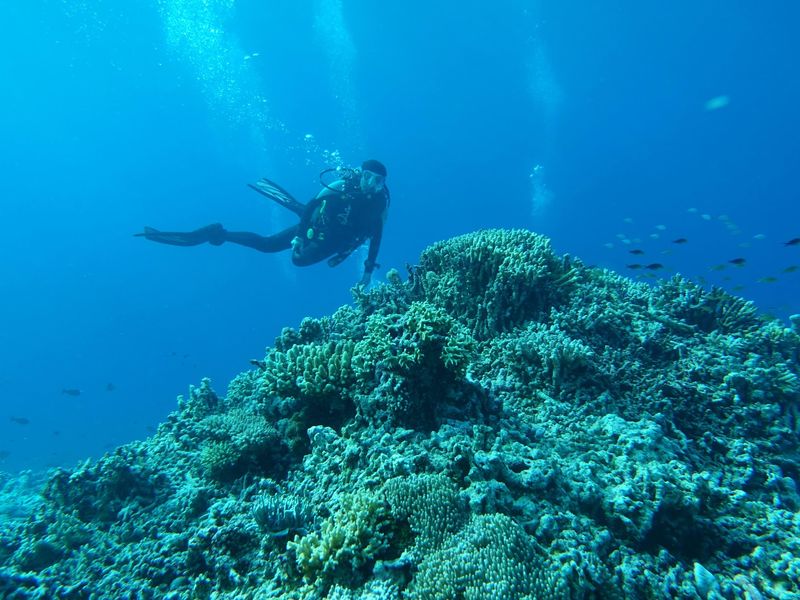
Bubbles, bunk beds, and a boat deck. That is the usual setup for a trip to Tubbataha.
The park lies isolated in the middle of the Sulu Sea, far from any permanent settlement.
The nearly 100,000-hectare marine park holds three atolls and dramatic reef walls. More than 360 coral species and almost 700 fish species call it home.
Sharks and turtles cruise past while seabirds nest on the sandy islets.
Visits are limited to a short diving season. Most travelers arrive on live-aboard vessels instead of day boats.
The park authority publishes separate annual tourism reports because access is closely monitored.
UNESCO stresses the remote and largely undisturbed character of the reefs. Park rules cap use so the wildlife has room to thrive.
Even among famous dive sites, Tubbataha takes extra planning. Book a berth well ahead and check the season dates.
Think of it as a reservation-only table at the best seafood spot, with fins instead of forks.
Aïr and Ténéré Natural Reserves
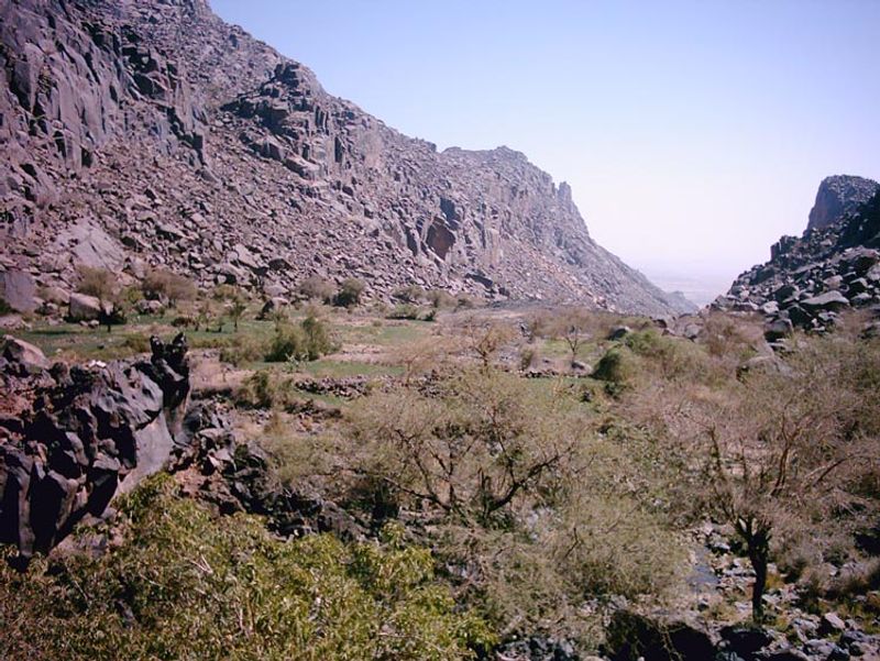
Size alone makes this place hard to picture: about 7.7 million hectares of volcanic mountains, desert plains, and drifting dunes. The Aïr and Ténéré reserves shelter one of the last major refuges for Saharo-Sahelian wildlife in Niger.
Few places in the Sahara are so large and so wild.
The property has been on UNESCO’s World Heritage in Danger list since 1992. It operates in a difficult security environment.
Some areas have strict access controls, and entry to the Addax Sanctuary is prohibited.
Low visitor numbers here are not a sign of a hidden bargain. They reflect geography, conservation needs, and safety concerns.
Travelers should read official advice before even thinking about a trip.
Still, the reserve matters to the world. Rare animals such as the addax depend on its quiet corners, and the landscapes tell a story of ancient climates.
For now, the best way to explore is through research, photography, and support for conservation groups. Sometimes a place earns respect by being left alone.
Manovo-Gounda St Floris National Park
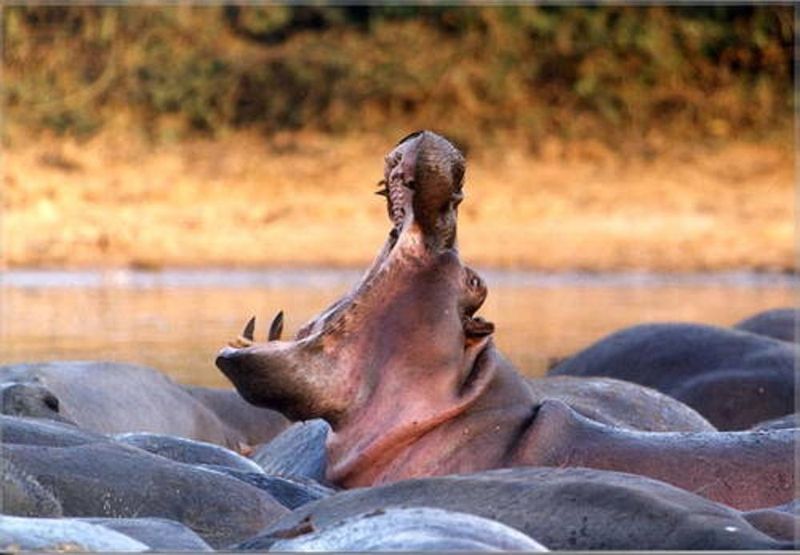
Some places are empty for sad reasons, and this is one of them. Manovo-Gounda St Floris covers 1.74 million hectares and is the largest national park in the Central African savannas.
It once supported elephants, cheetahs, wild dogs, buffalo, and gazelles.
Then trouble arrived. UNESCO placed the park on the World Heritage in Danger list in 1997 after armed poaching, heavy wildlife losses, staff deaths, and falling security.
Tourism and conservation projects came to a halt.
The park remained on the Danger list through the World Heritage Committee’s 2025 review. That tells you how slowly recovery can move.
This entry is about a documented lack of visitors, not a travel tip. Nobody should try an independent visit under current conditions.
Still, the story carries a lesson. Wildlife needs peace, funding, and trained rangers to survive.
Supporting reputable conservation groups is a safe way for readers to help. The savanna remains a symbol of what is at stake, and of what could return with time and care.
Mistaken Point
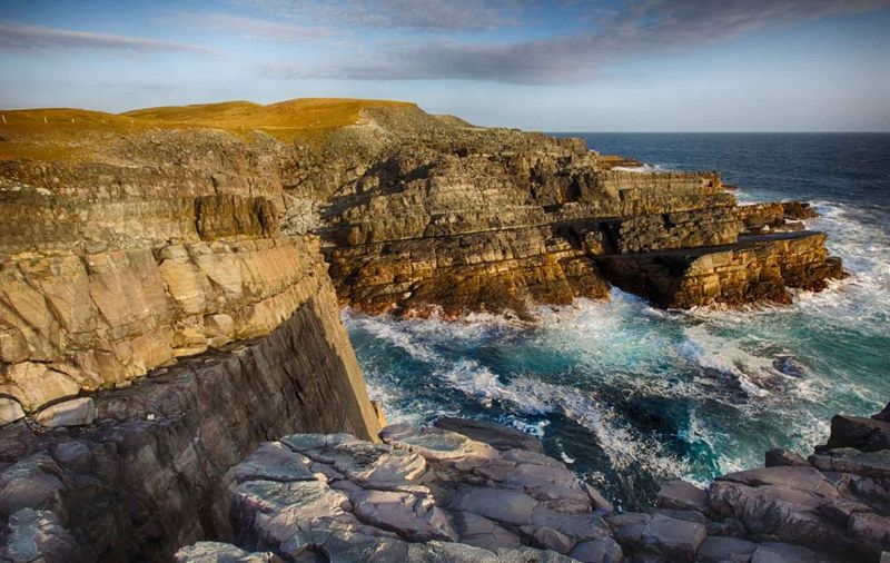
Castles are cool, but fossils older than half a billion years win the age contest. Mistaken Point on Newfoundland’s Avalon Peninsula guards exceptionally preserved remains of large, complex organisms from the Ediacaran Period.
They are among the earliest of their kind known on Earth.
UNESCO describes visitation as modest and strictly controlled. The fossil-bearing rock surfaces are delicate, and one careless step can cause damage.
So access is guided and rules decide where people may walk.
The coast itself adds drama. Wind, fog, and cold waves make the walk feel like a trip to the edge of the world.
Bring a rain jacket, even if the morning looks bright.
The fossils look like fern fronds and spindles pressed into stone. Guides help you spot shapes that untrained eyes would miss.
Compared with Canada’s famous national parks and historic cities, Mistaken Point stays almost unknown. That is fine with the scientists who study it.
A site can be hugely important without being busy.
Río Plátano Biosphere Reserve
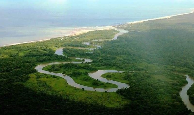
A river that runs free from mountain headwaters all the way to the sea is a rare thing. The Plátano River does exactly that in Honduras’ remote Mosquitia region.
Along the way it connects rainforest, wetlands, savanna, and Caribbean coastline.
The reserve protects roughly 350,000 hectares. UNESCO documentation describes the interior mountains as rarely visited and almost impenetrable.
Much of the wider area is hard to reach as well.
Indigenous and local communities live within the broader landscape. Their traditions are closely tied to the forest and waterways, and they travel by dugout canoe as their ancestors did.
Remoteness helps the wildlife, but it also makes protection tricky. Rangers cover huge distances with few resources, and the reserve has faced serious conservation pressures despite its isolation.
Anyone curious should look for community-led tours and check current safety information first. Travel here is slow, muddy, and humid, which is exactly why it still feels so wild.
Respect for local people is the best souvenir.
Share this story