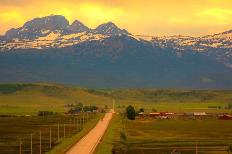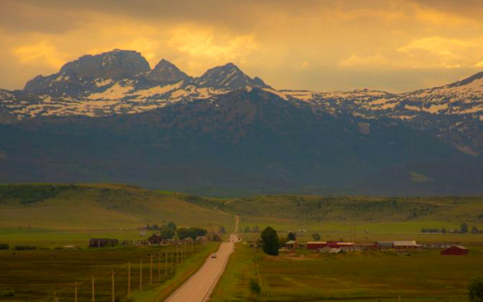
There is a road in eastern Idaho that most people have never heard of, and that is precisely what makes it so worth knowing about. It runs 69 miles through a valley where the Teton peaks rise so sharply on the horizon that they look almost unreal, like a painting someone propped up against the sky.
The farms roll out in every direction, small towns appear without warning, and the whole thing feels wonderfully unhurried. I drove every mile of this route and came back with a camera full of photos, a notebook full of observations, and a genuine desire to turn around and do it all again.
What surprised me most was not the mountain views, which are undeniably spectacular, but the quiet sense of discovery that builds with every passing mile. Keep reading and I will walk you through everything this remarkable drive has to offer, from the forested passes to the charming communities tucked between the fields.
Where the Drive Actually Begins and What to Expect
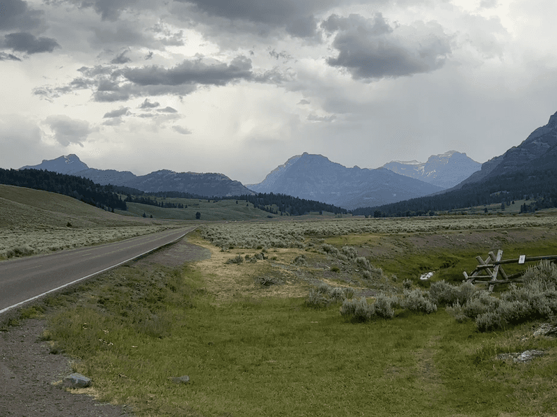
Most people picture the Tetons from the Wyoming side, but this drive flips that perspective entirely. The Teton Scenic Byway runs 69 miles through eastern Idaho, connecting Swan Valley to Ashton along Idaho Highways 31, 33, and 32, with its most iconic viewpoint centered around 6535 ID-33, Tetonia, ID 83452.
The route earns a 4.8-star rating from travelers who consistently describe it as jaw-dropping, tranquil, and far less crowded than the Wyoming counterpart. From Swan Valley, the road heads north and gradually reveals the western face of the Tetons, a perspective that feels more expansive and surprisingly more dramatic than many expect.
The byway is open 24 hours a day, every day of the year, and any street-legal vehicle can handle the fully paved route. Plan for at least two to three hours if you want to stop at pullouts, explore the towns, and actually absorb what you are seeing rather than just passing through it.
Pine Creek Pass and the Forest That Frames Everything
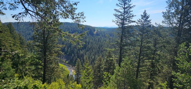
Before the valley opens up and the big mountain views arrive, the byway earns its place through sheer forest drama. Idaho Highway 31 climbs from Swan Valley into the Big Hole Mountains, reaching Pine Creek Pass at an elevation of 6,720 feet before descending into the Teton Valley below.
This stretch runs through the Caribou-Targhee National Forest, and the scent of pine is thick in the air on a warm morning. A wildlife viewing pullout near the pass gives you a reason to stop the car and scan the tree line, where moose and deer are known to appear, particularly in the early hours.
Fall Creek Falls, a roadside waterfall near Swan Valley, adds another reason to slow down on the southern approach. The cascading water appears almost without warning, tucked beside the road in a way that rewards attentive drivers.
This forested segment quietly builds anticipation, and the payoff waiting on the other side of the pass is well worth every uphill curve.
Victor, Idaho: Small Town with a Big Sweet Reputation
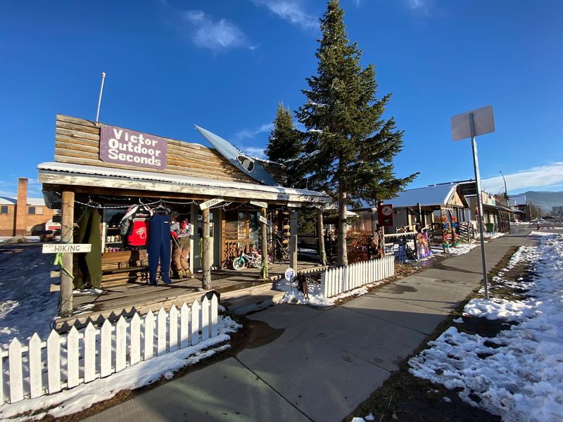
Victor greets you at the base of the pass with the kind of relaxed energy that makes you want to park the car and stay awhile. This small Idaho community sits at the southern end of the Teton Valley and serves as the first real town along the byway after the forested descent from Pine Creek Pass.
The Victor Emporium is a local institution that has been serving huckleberry milkshakes long enough to earn a devoted following. The huckleberry is Idaho’s unofficial fruit, and tasting one here feels like a proper introduction to the region’s identity.
Beyond the milkshakes, Victor connects directly to a network of hiking and mountain biking trails that push into the surrounding mountains. The town is small enough to feel personal but equipped enough to handle whatever a traveler needs before continuing north.
Spending even thirty minutes in Victor shifts the drive from a simple road trip into something that feels more like a genuine exploration of a living, breathing community.
Driggs and the Cultural Depth Hidden in Plain Sight
A few miles north of Victor, Driggs announces itself as the valley’s cultural anchor, and it delivers on that reputation with impressive variety. The Teton Valley Museum sits in town and covers everything from early homesteading to the valley’s ski history, offering a well-organized window into how this region developed over generations.
Corner Drug, reportedly Idaho’s oldest ice cream parlor, operates right in Driggs and draws visitors who are just as interested in the history as the frozen treats. There is also an outdoor movie theater, one of the last remaining in the state, that projects films under an open Idaho sky during the warmer months.
Hikers looking for a serious objective will find that Table Mountain is accessible from the Driggs area, offering one of the most celebrated views of the entire Teton Range from an elevated vantage point. The annual Rendezvous celebration each August commemorates the 1832 gathering of mountain men and Native American tribes near this very valley.
Driggs rewards curiosity, and the more time you spend here, the more layers it reveals.
Tetonia and the Art of Slowing Down
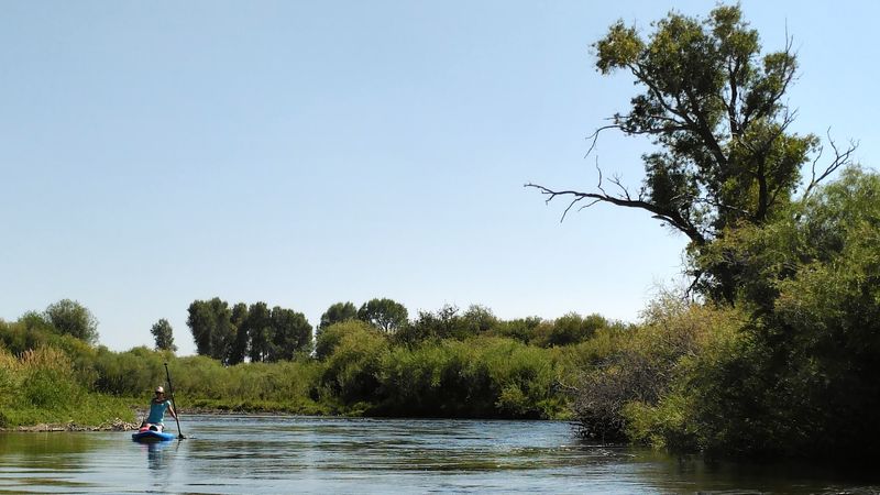
Tetonia sits along Idaho Highway 33 with a quietness that feels intentional, as if the town itself decided long ago that there was no rush. The agricultural fields surrounding it stretch wide and flat toward the Teton peaks, creating one of the most photographed compositions along the entire byway.
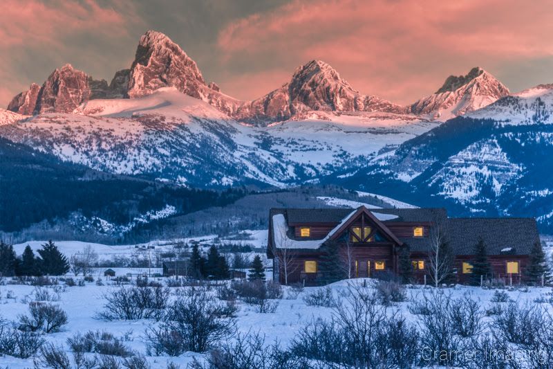
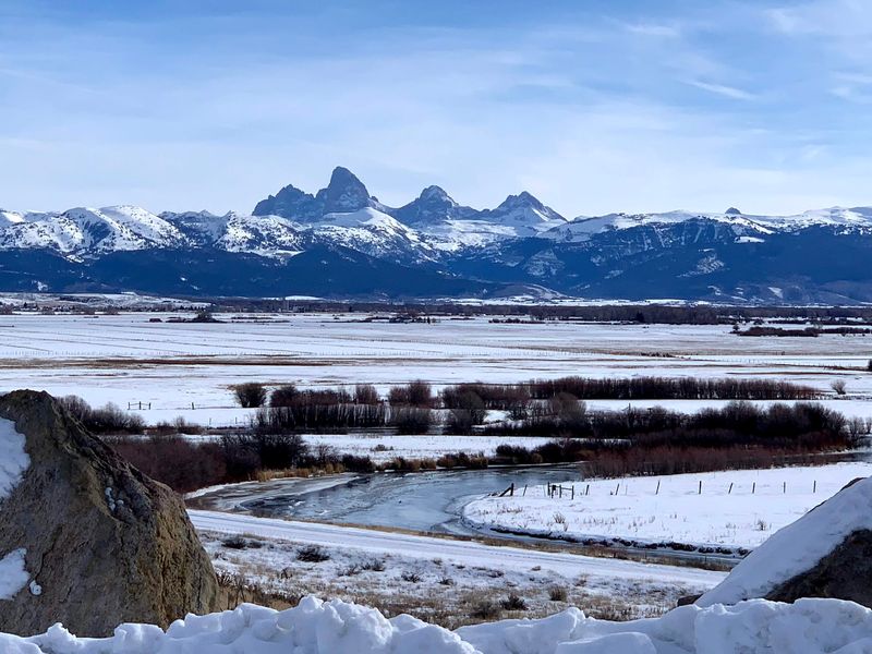
The pullout near the highway at 6535 ID-33 is exactly the kind of spot where you stop meaning to stay five minutes and end up staying forty. The western face of the Tetons fills the entire eastern horizon, snow-capped through most of the year, with jagged ridgelines that catch the light differently depending on the hour.
Local dining options in and around Tetonia offer hearty, unfussy meals that suit the pace of the surroundings. The Ashton-Tetonia Trail, a 30-mile rail-trail nearby, provides a non-motorized way to experience the valley’s beauty on foot or by bike, with consistent Teton views throughout its length.
Tetonia is not a destination that shouts for attention, but it holds its own as one of the byway’s most rewarding stops.
The Western Face of the Tetons: A View Most Tourists Never See
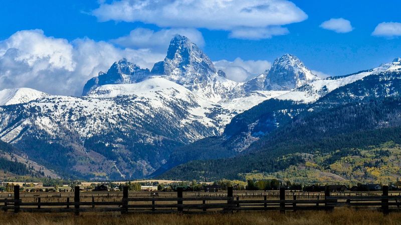
Most photographs of the Tetons are taken from the Wyoming side, inside Grand Teton National Park, where the peaks tower over Jackson Lake. The Idaho perspective is fundamentally different and, for many travelers, more satisfying because of how much space exists between the viewer and the mountains.
From the byway, particularly around Tetonia, the Tetons rise above a wide valley floor rather than appearing immediately overhead. That distance gives the entire range a sense of scale that is hard to achieve from the eastern side, where you are essentially standing at the base of the peaks.
The tops of the peaks do look like jagged teeth from this angle, with Grand Teton, Middle Teton, and South Teton all clearly visible on a clear day. Snow remains on the highest elevations year-round, giving every season its own version of the same dramatic view.
Photographers consistently note that morning light hits the western face with a warmth that makes the rocky surfaces glow, a detail that justifies an early start to the drive.
Rolling Farmland That Earns Its Place in the Scenery
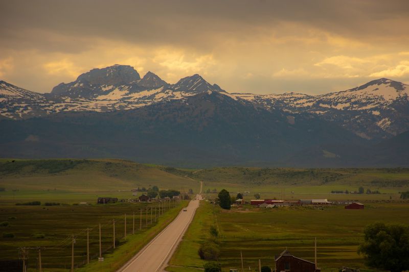
Between the mountain towns, the byway passes through an agricultural landscape that deserves more attention than it typically receives. The fields of the Teton Valley produce barley, wheat, and Idaho’s signature potatoes across a terrain that shifts from deep green in summer to amber and gold as fall arrives.
The contrast between the cultivated foreground and the wild peaks behind it is genuinely striking. One traveler put it simply: the agricultural scene in the foreground against the rugged Tetons in the background creates a visual that neither element could achieve alone.
Driving through these fields at golden hour, when the low sun catches the grain and the shadows stretch long across the furrows, produces a kind of quiet awe that is different from what the mountains inspire. It is softer, more grounded, more human in scale.
The farms also tell a story about the people who settled this valley, the Mormon homesteaders who arrived in the late 1800s and built communities that still define the region’s character today.
Wildlife Along the Route and Where to Watch for It
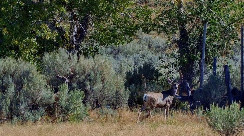
The Teton Valley and the surrounding mountains support a wildlife population that makes every drive feel like a potential nature documentary. Moose, elk, and deer are the most commonly spotted animals, and the Big Hole foothills along the early section of the byway are particularly productive at dawn and dusk.
The wildlife viewing pullout near Pine Creek Pass is a deliberate pause point built into the route for exactly this reason. Pulling over there with binoculars and a bit of patience can reward you with sightings that no zoo or nature center could replicate.
Driving at night or very early in the morning increases the chances of encountering animals on or near the road, so maintaining a careful speed through forested sections is genuinely important rather than just a suggestion. The valley floor around Tetonia and Driggs also sees regular elk movement during migration seasons.
Birdwatchers will find the open farmland productive as well, with raptors hunting the fields and waterfowl gathering near any low-lying water.
The History Buried in Pierre’s Hole
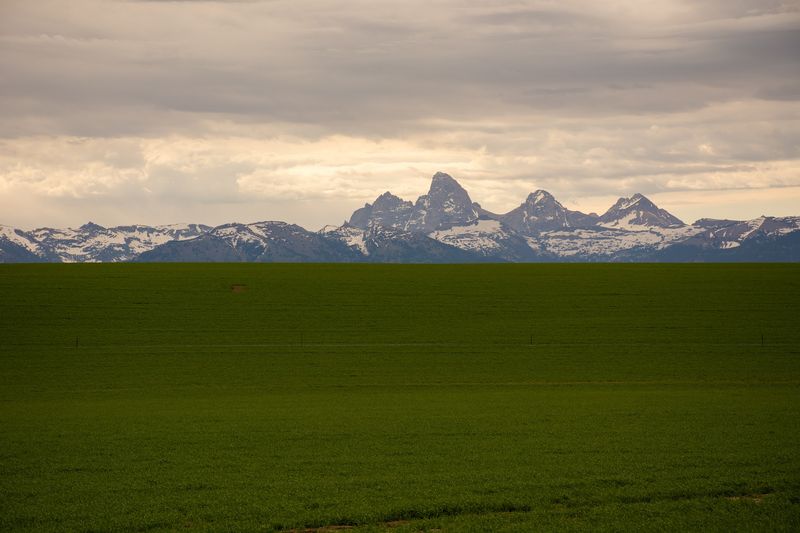
The Teton Valley carries a historical weight that most casual visitors never fully appreciate. Long before it became a scenic byway, this valley was known as Pierre’s Hole, a name given by French fur trappers who were among the first non-native people to navigate the region in the early 1800s.
John Colter, a veteran of the Lewis and Clark Expedition, is credited as the first documented non-native American to explore the area, venturing through in 1808 and reporting landscapes so extraordinary that his contemporaries largely dismissed his accounts as exaggeration. The French voyageurs who followed named the peaks “Les Trois Tetons,” a practical if colorful label that stuck.
The 1832 Rendezvous near Driggs brought together hundreds of fur trappers, mountain men, Nez Perce, and Shoshone people in one of the largest such gatherings ever held in the region. Mormon settlers arrived later in the century, establishing the agricultural communities that still define the valley today.
Even the old coal mining town of Sam, between Tetonia and Driggs, adds another layer to a history that runs deeper than the scenery suggests.
Seasonal Timing and What Each Month Brings to the Drive
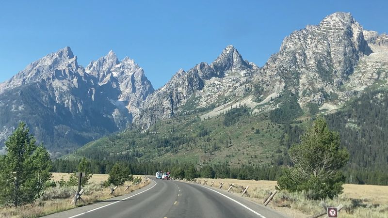
Summer and early fall represent the sweet spot for driving the Teton Scenic Byway, and the reasons are easy to understand once you see the valley in either season. Summer brings wildflowers across the meadows, long daylight hours, and comfortable temperatures that make stopping at every pullout feel effortless rather than rushed.
Early fall transforms the valley into something even more photogenic, as the deciduous trees shift to reds, oranges, and golds against a backdrop of already-snow-dusted peaks. Drivers who time their visit for late September or early October consistently report that the fall color display exceeds their expectations.
Winter is drivable but requires awareness, particularly on Pine Creek Pass along Highway 31, where heavy snowfall from December through March can necessitate tire chains. Checking road conditions before setting out during winter months is a practical step that takes two minutes and prevents significant inconvenience.
Spring offers its own quieter appeal, with rivers running full and the valley gradually greening up, though some higher elevation areas may still carry snow well into May.
Practical Tips for Getting the Most Out of the Drive
A few practical details can make the difference between a good drive and a genuinely great one. Cell service along the byway is reliable within the towns of Swan Valley, Victor, Driggs, Tetonia, and Ashton, but the stretches between those communities can be spotty, so downloading offline maps before departure is a sensible precaution.
Fuel up in Driggs before heading north toward Tetonia and Ashton, as the 35-mile stretch between those communities has limited services. Food and lodging are available in all five towns, with Driggs offering the broadest range of options given its role as the valley’s commercial hub.
Morning hours offer the best light for photography, particularly on the western face of the Tetons, and afternoon thunderstorms can develop over the peaks during summer, so planning high-elevation activities for earlier in the day is a smart habit. Wildlife is most active at dawn and dusk, making those bookend hours worth prioritizing if animal sightings are on your list.
The byway is open around the clock, every day of the year, which means there is genuinely no wrong time to show up and start driving.
Share this story