Iceland packs an unusual amount into an island you can drive around in about a week. Volcanoes, glaciers, black beaches, steaming geysers, and towering waterfalls all sit within a few hours of each other.
This list covers fifteen places that keep landing on traveler wish lists, from famous spa waters near the airport to quiet fjords in the far northwest. Some are easy day trips from Reykjavik, while others reward people who plan a longer road trip.
Each stop comes with practical details like seasonal notes, safety tips, and nearby sights, so you can sort out what fits your schedule. Whether you are dreaming big or just curious, these places show why so many visitors come home talking about Iceland.
Blue Lagoon, Reykjanes Peninsula
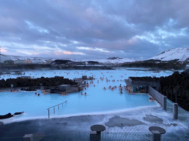
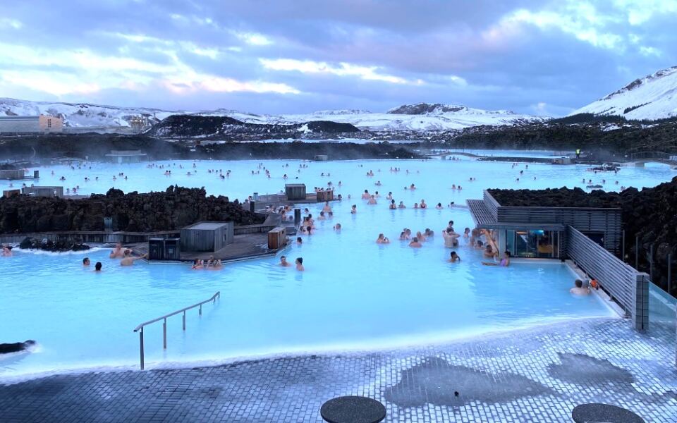
Few places say Iceland as loudly as this milky-blue spa set in a black lava field. The water is rich in silica, minerals, and algae, and it usually stays between 37 and 40 degrees Celsius.
That warmth is a big draw when the air outside is cold or windy.
Booking ahead is essential, because the lagoon is open every day of the year and time slots fill up. The complex also includes sauna and steam facilities, restaurants, hotels, and several spa experiences, so you can pick a simple soak or a longer visit.
The location is a major plus for trip planning. It sits between Keflavik International Airport and Reykjavik, which makes it easy to add at the start or end of a trip.
Many travelers like to arrive after a long flight and unwind before heading to the city, or stop on the way back to the airport as a relaxing last memory.
Pack a swimsuit and plan your time slot carefully so your day stays smooth.
Thingvellir National Park
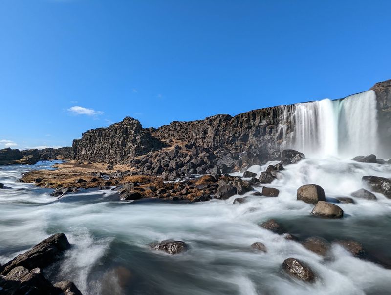
History and geology share the same ground at Thingvellir. Iceland’s Althing parliament began meeting here in AD 930, and the country’s independence from Denmark was proclaimed on this spot in 1944.
UNESCO named the park a World Heritage Site in 2004.
The landscape is just as interesting as the history. Visitors can walk through the Almannagja gorge, see the Oxararfoss waterfall, and stand in an area where the North American and Eurasian tectonic plates are slowly pulling apart.
Thingvellir is one of three classic stops on the Golden Circle, so it pairs easily with Geysir and Gullfoss in one long day from Reykjavik. The visitor center stays open year-round and shares details about trails, geology, and history.
Start there if you want a quick overview before choosing a path. Comfortable walking shoes are smart, since the trails can be uneven and weather changes fast.
Even a short walk gives you a clear sense of why this place matters to Icelanders.
Geysir Geothermal Area, Haukadalur
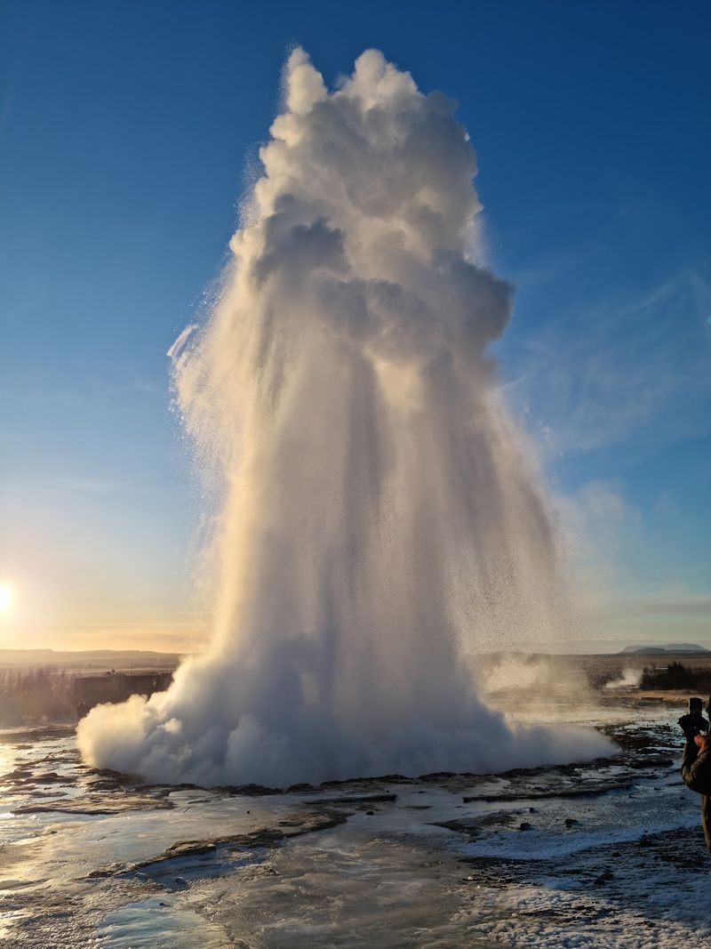
The English word geyser comes from this very valley. The historic Great Geysir gave the language its name, though it erupts only rarely these days.
Strokkur is the showpiece now. It goes off every several minutes, sending columns of steaming water into the air, so you rarely wait long.
Keep your camera ready, because the eruption is quick.
Marked paths lead past bubbling hot springs, steaming vents, and geothermal pools throughout the Haukadalur area. Staying on the paths matters, since the ground and water here can be extremely hot.
This stop is another piece of the Golden Circle, and it is one of the easiest places in Iceland to watch powerful geothermal activity up close. It also helps explain why the island is called the Land of Fire and Ice.
Plan for a relaxed hour or so, which is enough to see several eruptions and walk the loop.
Gullfoss Waterfall, Golden Circle
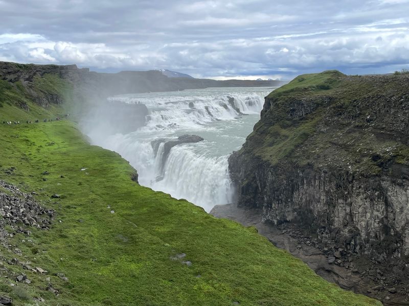
Rainbows are a regular bonus at Gullfoss when the sun hits the spray just right. The Hvita River drops in two stages into a rugged canyon, throwing up clouds of mist that catch the light.
Several viewing areas let you see the falls from different angles, so it is worth walking beyond the first overlook. Waterproof layers help on windy days when the spray travels far.
Gullfoss completes the traditional trio of Golden Circle attractions, joining Thingvellir and Geysir. The full loop is roughly 250 kilometers round trip from Reykjavik, which makes it a manageable day for most travelers.
The route can be driven throughout the year, though road conditions change by season. Winter visitors should check forecasts and allow extra time.
In summer, the long daylight hours give you plenty of room to enjoy all three stops without rushing.
Seljalandsfoss, South Coast
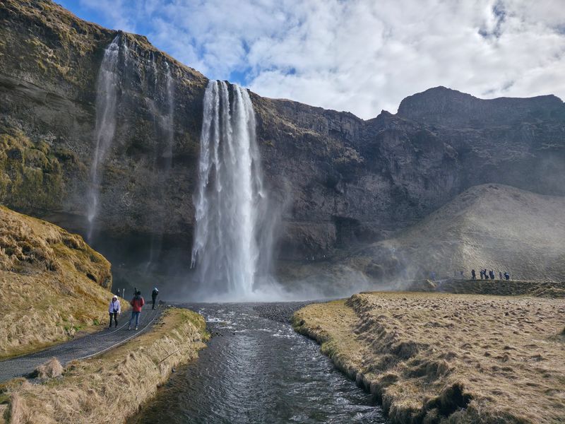
Walking behind a waterfall sounds like a movie scene, yet it is a real option here. Seljalandsfoss drops from former sea cliffs above a broad, open landscape, and a path leads right behind the falling water.
When conditions allow, you can follow the trail and look outward through the curtain of water. The spray can be intense, so waterproof clothing is a smart move.
Wet rocks can be slippery, so take your time on the path.
The waterfall sits close to the Ring Road, which keeps it convenient for anyone driving the South Coast. It makes a natural first stop on a route that also includes Skogafoss, Reynisfjara, and the glacier landscapes farther east.
Many travelers pair it with Skogafoss for an easy pair of waterfalls in a single morning. Bring a dry bag or cover for your phone and camera.
Skogafoss, South Coast
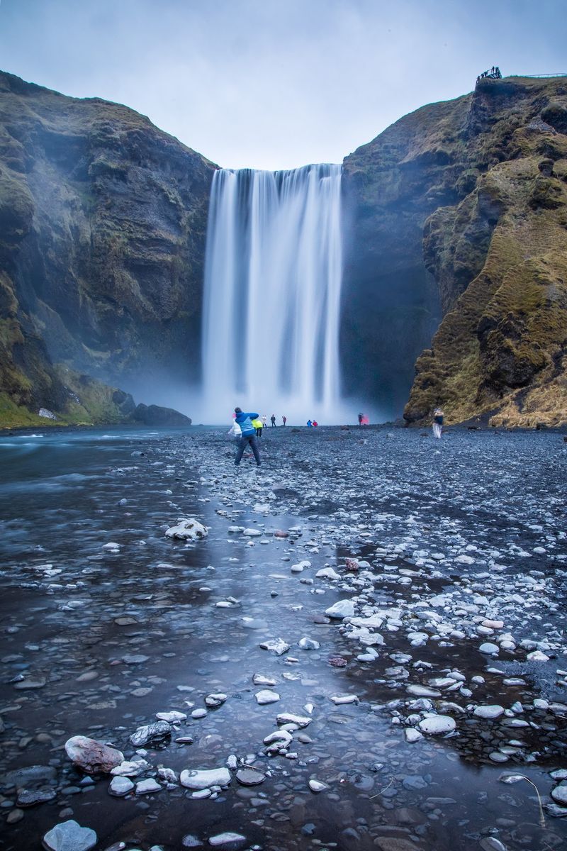
A wall of water, a long staircase, and a good chance of rainbows make Skogafoss easy to remember. The wide waterfall drops from former sea cliffs, and visitors can walk right up to the base to feel how big it really is.
A staircase climbs beside the falls to a viewing area above, while hiking routes continue farther inland for those who want more time outdoors. Sunny days often bring rainbows in the spray, which helps explain why it is one of the country’s most photographed natural sights.
The site sits immediately off the Ring Road, so stopping takes little planning. It is a handy break for drivers heading toward Vik, Skaftafell, or Jokulsarlon.
Expect a damp visit near the base, and wear shoes with grip. Arriving earlier in the day can mean fewer people in your photos and a calmer walk up the stairs.
Reynisfjara Black Sand Beach, Vik
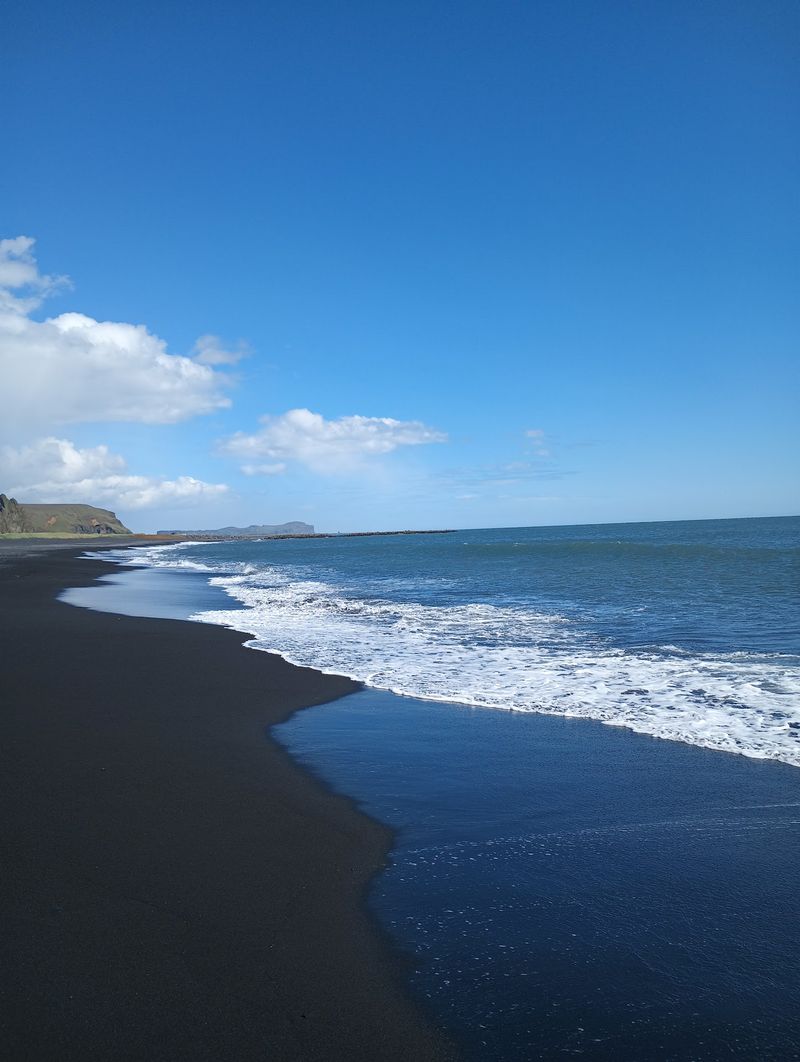
Black sand, basalt columns, and rock towers rising from the sea give this beach a look found almost nowhere else. Near Vik, Reynisfjara turns volcanic geology into one of Iceland’s most dramatic coastlines, with the Reynisdrangar sea stacks standing offshore.
The beach is open, but the ocean demands respect. Reynisfjara is known for powerful sneaker waves that can surge much farther up the sand than ordinary waves, often with little warning.
Official tourism guidance tells visitors to keep a safe distance from the water.
Staying well back from the surf still leaves plenty to enjoy. The basalt columns, cliffs, sea stacks, and dark sand all make for striking views from higher, safer ground.
Watch the waves for a few minutes before walking along the shoreline, and never turn your back on the sea. Treat this stop with care, and it becomes one of the most memorable on the South Coast.
Jokulsarlon Glacier Lagoon, Vatnajokull National Park
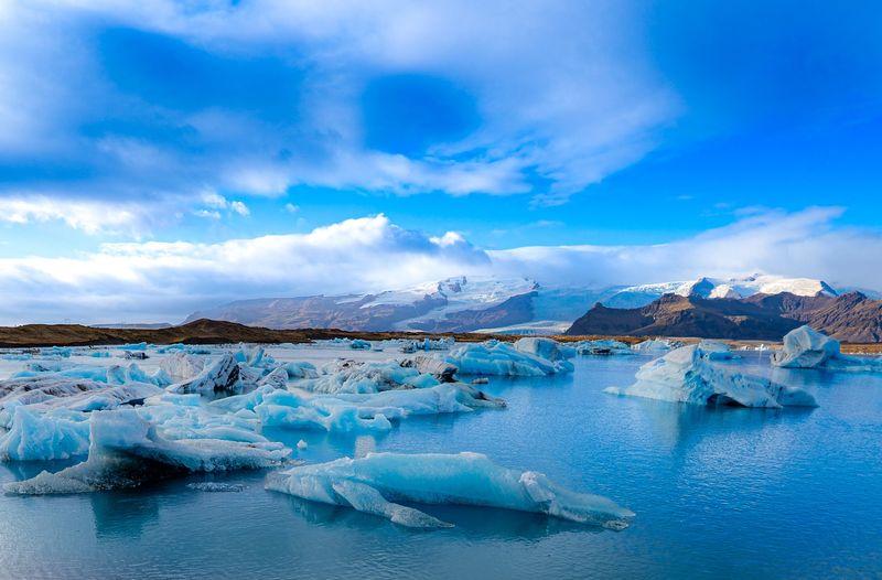
Icebergs drift past here on their slow way to the sea. They break away from Breidamerkurjokull, an outlet glacier of Vatnajokull, then float through the lagoon toward the Atlantic Ocean.
The lagoon lies directly beside Route 1 inside Vatnajokull National Park, which makes it surprisingly easy to reach for such a huge landscape. You do not need a tour to enjoy it, since the shoreline offers excellent views on its own.
Seasonal boat excursions take travelers out among the icebergs for a closer look. Check operating dates before you go, because boat tours depend on the time of year.
The area remains an active visitor site, and the national park continues to provide services and maintain it. Bring warm layers even in summer, because the air near the water can be chilly.
Give yourself time to walk the shore and watch the ice change shape.
Diamond Beach, Breidamerkursandur
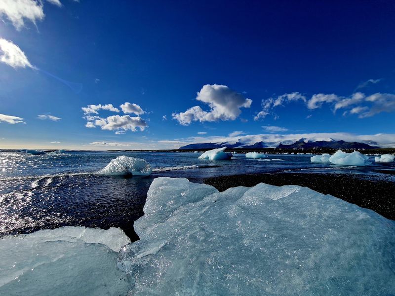
Right across the road from the lagoon, chunks of glacial ice wash up on black volcanic sand. The contrast between clear or blue-tinted ice and dark shoreline earned the stretch of Breidamerkursandur its nickname, Diamond Beach.
No two visits look alike. Tides, waves, and moving ice keep reshaping the scene, so the pieces you see today may be gone tomorrow.
Because Diamond Beach sits next to Jokulsarlon, the two are simple to combine in one stop. You can watch icebergs in the lagoon, cross the road, and see where some of that ice ends up.
Official Iceland tourism material still lists both among the major attractions on the South Coast. Wear sturdy boots, since the sand and ice can be slippery.
As with any shoreline here, keep an eye on the waves and stay a safe distance from the water.
Skaftafell, Vatnajokull National Park
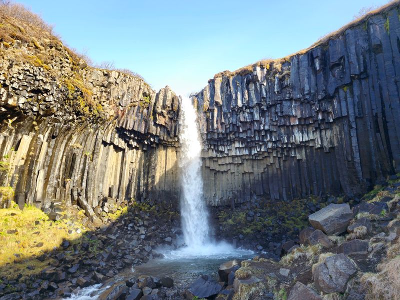
Skaftafell was once a national park of its own and now forms part of the much larger Vatnajokull National Park. That history shows in the range of scenery, from glacier tongues to mountain slopes.
Popular hikes lead toward the Skaftafellsjokull glacier and to Svartifoss, a waterfall framed by dark basalt columns. More demanding routes stretch into the surrounding highlands for those with experience and time.
The area can be reached throughout the year when weather and roads allow. The Skaftafellsstofa Visitor Centre stays open year-round, and it is a good first stop for maps and advice.
Trails can close briefly for maintenance or weather, so check conditions before you set out. Pack layers, water, and snacks, because services are limited once you leave the center.
Even a short walk delivers big views for travelers short on time.
Lake Myvatn, North Iceland
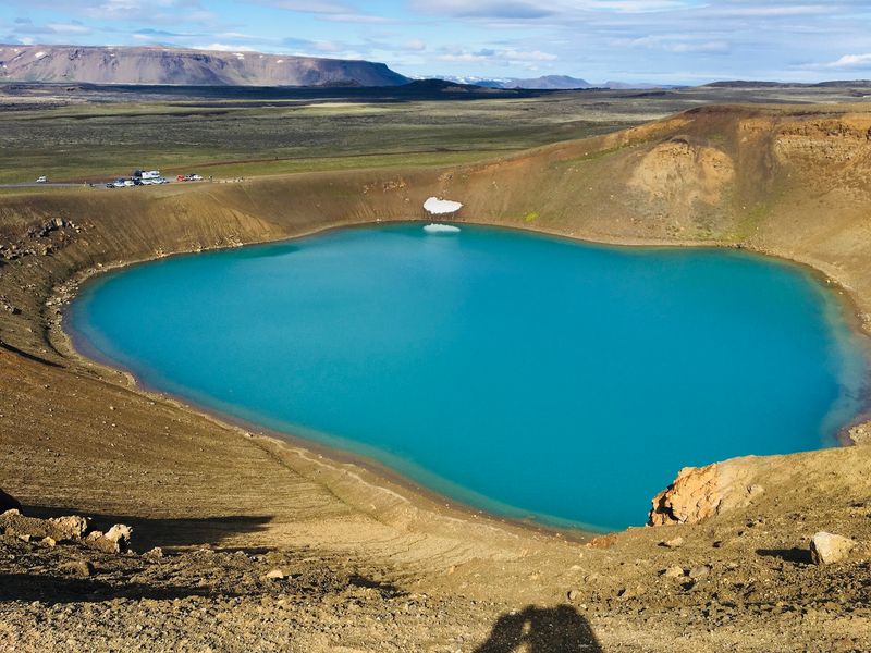
Looking for a break from the busy South Coast? Northern Iceland has its own volcanic playground, and Lake Myvatn sits right in the middle of it.
The surrounding land includes lava formations, geothermal areas, volcanic craters, wetlands, and unusual features shaped by centuries of volcanic activity. Birdlife is plentiful too, which adds another reason to bring binoculars.
Myvatn is one of five principal stops on North Iceland’s Diamond Circle route. It combines easily with Dettifoss, Godafoss, Asbyrgi Canyon, and Husavik, so a few days here can fill a full itinerary.
The mix of geology and wildlife appeals to travelers who want something beyond the better-known southern sights. Plan to explore by car, stopping at several areas around the lake rather than trying to see everything in one go.
Slow down and enjoy the variety.
Dettifoss, Vatnajokull National Park
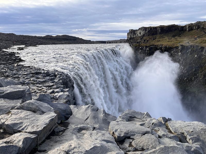
About 44 meters of drop and a huge volume of water give Dettifoss a sense of force that is hard to ignore. The waterfall carries the sediment-filled water of the Jokulsa a Fjollum river through a stark volcanic canyon.
It lies within Vatnajokull National Park and is a key piece of the popular Diamond Circle route. That makes it an easy partner for Lake Myvatn and the other northern stops.
Access depends on the season. Road and weather conditions can change things, especially outside summer, so check current driving information before heading out.
Stay behind the marked viewpoints, since the spray and rocks near the edge can be slippery. Bring a warm jacket, as the area is open and exposed.
For travelers who enjoy raw power over postcard prettiness, this is a standout.
Kirkjufell, Snaefellsnes Peninsula
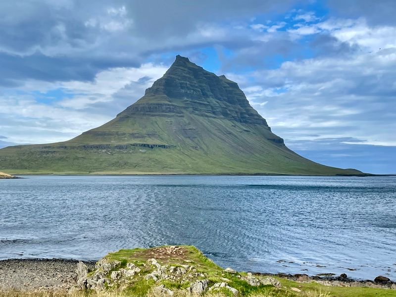
Few mountains in Iceland are as easy to recognize as Kirkjufell. It rises above the town of Grundarfjordur with a steep, symmetrical shape that looks especially striking beside the small Kirkjufellsfoss waterfall.
The Snaefellsnes Peninsula is sometimes called Iceland in miniature. Within a compact region, travelers can see glaciers, lava fields, mountains, beaches, caves, and coastal formations.
Kirkjufell stands as one of the peninsula’s centerpiece attractions. It can be visited throughout the year when local weather and road conditions permit, so winter trips are possible with careful planning.
Photographers often choose the waterfall viewpoint for classic shots of the peak. Grundarfjordur makes a handy base for meals and rest.
Allow extra time for the drive, because the peninsula has plenty of roadside stops worth a pause.
Hallgrimskirkja, Reykjavik
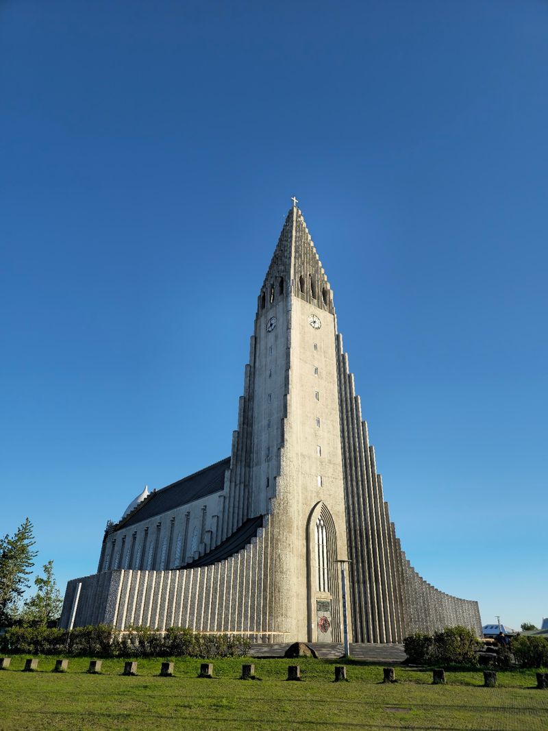
Most Iceland plans focus on nature, yet the capital has a landmark worth seeing too. Hallgrimskirkja is a monumental Lutheran church that towers over central Reykjavik and has become one of the city’s defining sights.
Its stepped design draws inspiration from the shapes and formations found across Iceland’s volcanic landscape. That connection to the land makes the building feel rooted in its setting.
Entering the church is free. Tickets are sold separately for the tower, which gives panoramic views over Reykjavik’s rooftops.
Hallgrimskirkja is still an active parish church as well as one of the country’s most visited tourist sites, so be respectful during services and quiet hours. It is easy to include on a walking tour of downtown, and the tower is a good choice on a clear day.
Dynjandi Waterfall, Westfjords
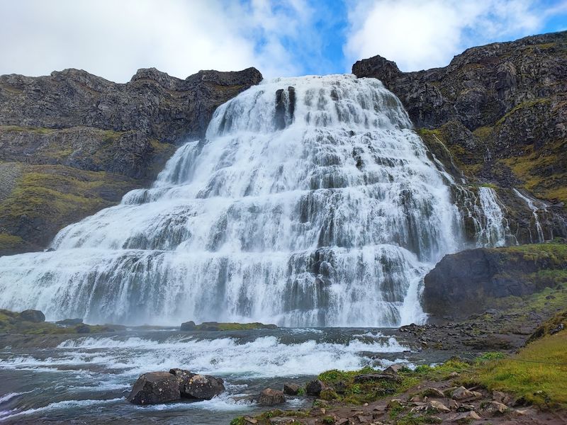
Roads in the Westfjords are quieter, and Dynjandi is the reward for taking them. This is the region’s signature waterfall, and its main cascade drops roughly 100 meters.
The water widens as it falls, forming a broad shape often compared to a bridal veil. A walking trail climbs toward the falls and passes several smaller cascades on the way up.
Dynjandi is one of the major attractions along the Westfjords Way, and it remains a popular summer road-trip destination. The climb is short enough for most visitors, with views improving at each step.
The Westfjords are far more remote than southern Iceland, so check road conditions and seasonal access before traveling. Fuel up and carry snacks, because services can be spread out.
For travelers who want space and silence, this corner of Iceland delivers.
Share this story